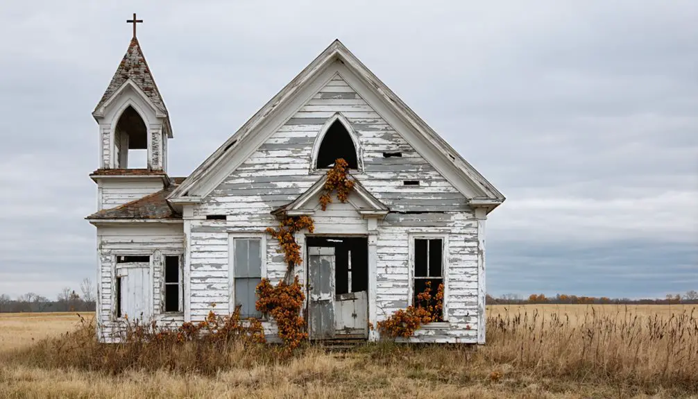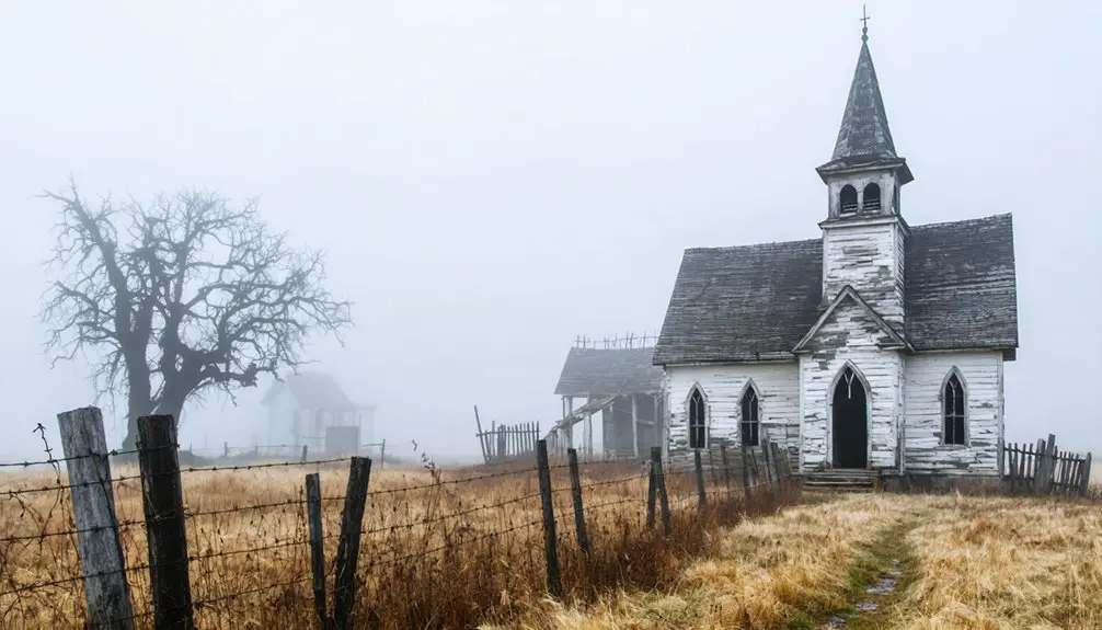
You’ll find Bloodland’s haunting remains at coordinates 37.687°N, 92.152°W in southern Pulaski County, Missouri. This once-thriving German-American farming community, established in the late 1800s, featured three churches, multiple cemeteries, and a tomato canning factory before the U.S. Army’s 1940 takeover for Fort Leonard Wood. The military’s arrival forced about 100 residents to abandon their homes, leaving behind whispered tales of supernatural encounters and mysterious cider ghosts that still intrigue visitors today.
Key Takeaways
- Bloodland was a thriving German-American farming community in southern Pulaski County, Missouri, established in the late 1800s with about 100 residents.
- The U.S. Army forcibly evacuated Bloodland’s residents in 1940 to construct Fort Leonard Wood, demolishing homes, businesses, and community buildings.
- Archaeological excavations in 2005 revealed structural remains, domestic artifacts, and evidence of the town’s layout through school and church foundations.
- The ghost town is known for supernatural encounters, with reports of “cider ghosts” and unexplained phenomena targeting military personnel since WWII.
- Bloodland Cemetery remains as a physical reminder of the displaced community and their German-American heritage dating back to the 1800s.
The Birth of a Rural Community
When Mr. Blood established his namesake town in southern Pulaski County, Missouri, he laid the foundation for what would become a tight-knit rural community. The settlement’s origins can be traced to the late 1800s, with the post office’s establishment in 1898 marking Bloodland’s official recognition. The town was one of several historic communities in Pulaski County.
You’ll find the community’s early settlement patterns reflected the hardy spirit of its pioneers, primarily of German descent, who built their lives at coordinates 37.687°N and 92.152°W. They transformed this Ozark region into a self-sustaining hub, complete with mills, churches, and a cemetery.
The town grew steadily, expanding from scattered farmsteads into an organized community of about 100 residents living in 40 buildings, all connected by their shared postal district and determination to carve out their piece of Missouri’s frontier. Their peaceful existence would be disrupted when the U.S. government used eminent domain to acquire the land for military purposes.
Life in Early 20th Century Bloodland
Though geographically isolated in Missouri’s Ozarks, early 20th century Bloodland thrived as a self-sufficient farming community anchored by its churches, schools, and robust social institutions.
You’d find families, mostly descended from Tennessee and Kentucky settlers, working their farmsteads while participating in vibrant community gatherings. The town’s agricultural practices centered around sustenance farming, with tomato canning and grain milling supporting the local economy.
Ozark families worked their land with timeless practices, building a resilient community through farming, canning and shared gatherings.
The Jaspar family’s hardware store and the local bank served as commercial pillars, while churches and the IOOF lodge fostered strong social bonds. Aerial photographs from the Agriculture Stabilization and Conservation Service documented the region’s patchwork of small family farms and agricultural development.
- Annual 4th of July picnics brought everyone together at the main store intersection
- Churches and schools doubled as community centers for social events
- Local tomato factories and mills provided employment beyond farming
- Family farmsteads practiced traditional Ozark agricultural methods
- Intergenerational ties kept the community closely connected through 1941
The Town’s Notable Infrastructure
Before its absorption into Fort Leonard Wood in 1941, Bloodland boasted an infrastructure that reflected its status as a self-sustaining Ozark community. You’d have found three churches and multiple cemeteries serving the spiritual needs of roughly 100 residents across 40 buildings.
The industrial impact of mills and a tomato canning factory strengthened the local economy, while two general stores provided essential goods. The town’s community resilience showed in its expanded educational system, which grew to include a high school. Multiple garages and filling stations served travelers and locals alike. The town’s fate was sealed when Fort Leonard Wood was constructed in 1940.
Despite the military’s eventual takeover, excavations have revealed lasting evidence of this once-thriving town through concrete steps, cellars, and various domestic artifacts that tell the story of daily life.
Military Takeover and Displacement
When the U.S. Army established Fort Leonard Wood in 1940, you’d find Bloodland’s residents facing mandatory evacuation as the military acquired their lands and properties for a new training installation.
You’ll note the stark transformation of this once-vibrant community as military construction crews demolished homes, businesses, and community buildings, fundamentally altering the rural landscape. The rapid development saw 1,600 buildings completed in just six months across the installation grounds.
If you’d visited during this period, you’d have witnessed the dispersal of Bloodland’s population, as families who’d farmed these lands for generations were forced to relocate with limited documentation of their compensation or assistance. This displacement echoed the earlier forced exodus of 15,000 Mormon settlers who were driven from Missouri under similar circumstances of mandatory relocation.
Land Acquisition Process
During the rapid military expansion of 1940, the U.S. Army’s land acquisition strategies targeted approximately 71,000 acres for what would become Fort Leonard Wood.
You’ll find that the government’s use of eminent domain implications dramatically affected local communities, particularly the town of Bloodland, where roughly 100 residents were forced to surrender their properties for military purposes.
The area’s transformation included WWII POW labor facilities that were constructed using prisoner workforce.
- Your property rights were subordinated to national defense priorities as World War II loomed
- You’d have received official notices demanding your departure, with limited time for negotiation
- Your home, along with about 40 other buildings, would’ve been seized through forced sales
- You would’ve witnessed the swift transformation of private property into restricted military grounds
- Your community’s infrastructure – mills, churches, schools, and businesses – fell under government control
Community Relocation Impact
The forced relocation of Bloodland’s tight-knit community in 1940 shattered generations of German-American heritage and agricultural tradition.
You’ll find that roughly 100 residents from 40 buildings had to abandon their homes, farms, and livelihoods as the military seized their land through eminent domain.
The displacement severed deep community bonds that had defined Bloodland’s cultural legacy.
You’d have witnessed families who’d farmed the land for generations loading their belongings onto wagons, heading to places like Big Piney and Camden County.
Their cherished Halloween gatherings and post office services ended abruptly.
While the government provided compensation through appraisals, it couldn’t replace the lost social networks, traditions, and sense of belonging that had united these hardworking German-American families for decades. The situation echoed the devastating impact seen in Times Beach, where unlocked homes and communal child-rearing practices symbolized the close bonds that were ultimately destroyed.
Military Base Construction
As World War II loomed on the horizon, military planners in 1940 selected south-central Missouri’s rugged terrain for what would become Fort Leonard Wood, forever altering Bloodland’s fate.
The military construction began on December 3, 1940, with crews racing against time to transform 60,000 acres of civilian land into a massive training facility. The urban planning was aggressive and uncompromising, designed to serve wartime needs rather than preserve local heritage. The base would later become a central hub for U.S. Army Engineer Schools and specialized military training. The development required extensive archaeological assessments to guide construction while preserving historical sites.
- Bulldozers carved through mud and harsh Ozark terrain to move critical supplies
- Workers constructed 1,600 buildings totaling over 5 million square feet
- The $37 million project demanded completion within six months
- Entire communities were demolished to make way for military infrastructure
- The base was designed to support more than 35,000 military personnel
Archaeological Findings and Hidden History
You’ll find evidence of Bloodland’s history preserved beneath the soil through archaeological investigations at Fort Leonard Wood, where structural remains and domestic artifacts like stove parts and bottles reveal concentrated areas of former residences.
The 2005 excavations proved particularly significant when Fort Leonard Wood archaeologists uncovered more extensive remains than initially anticipated during their cultural resource management surveys.
Through systematic archaeological documentation spanning 3,511 acres, researchers identified multiple historic sites connected to Bloodland’s past, though many artifacts were found disturbed from their original context due to previous earth-moving activities.
Uncovering Lost Town Remains
Recent archaeological discoveries have challenged long-held assumptions about Bloodland’s physical remains, revealing a treasure trove of preserved structural remnants beneath Fort Leonard Wood’s modern landscape.
You’ll find archaeological significance in the 2005 excavations near Highway 17, where concrete steps and cellar remains paint a vivid picture of the once-thriving community.
While military construction threatened preservation, it paradoxically protected some artifacts through restricted access.
- Excavated cellar foundations reveal original downtown building locations
- Whole and broken bottles indicate both residential and commercial activity
- Concrete steps mark entrances to long-forgotten structures
- Military utility trenches exposed previously unknown structural remains
- Community folklore and ghost stories led investigators to key archaeological sites
2005 Excavation Breakthrough Findings
The extensive archaeological investigations at Bloodland have yielded five breakthrough discoveries that reshape our understanding of this vanished Missouri town.
Through advanced excavation techniques, you’ll find evidence of daily life through iron stove parts and bottle fragments, though many were displaced by earlier earth-moving.
You’ll discover the sacred Lohraff Cairn burial mound and mysterious petroglyphs depicting birds and priest figures.
The artifact significance extends across 3,511 acres, where surveyors identified 21 prehistoric and 2 historic sites.
You can still trace the community’s layout through old school foundations and the Methodist church remnants documented in the 1970s.
The Bloodland Cemetery near Range #11 stands as a poignant reminder of the town’s forced displacement during military expansion.
Tales of Supernatural Encounters
Since World War II, mysterious supernatural encounters at Missouri’s Bloodland ghost town have captivated both locals and paranormal investigators alike, centering around peculiar incidents known as the “cider ghost” hauntings.
recently, interest has surged in exploring red oak ghost town history, as visitors seek to uncover the secrets of its past. The town’s abandoned buildings and eerie atmosphere provide a perfect backdrop for both history buffs and ghost hunters. As stories of spectral sightings emerge, the convergence of local lore and paranormal activity continues to attract thrill-seekers year-round.
In addition to Bloodland, there are several ghost town attractions in blue ball that draw curious adventurers eager to experience the paranormal. Each site offers tantalizing tales of its haunted past, inviting visitors to explore the crumbling remnants of once-thriving communities. As word spreads, these locations become increasingly popular among those looking to connect with history and the otherworldly.
Bloodland’s infamous cider ghosts have haunted this Missouri town since WWII, terrorizing locals with unexplained supernatural activity.
You’ll find these restless spirits, believed to be displaced former residents, have targeted military personnel with forced cider consumption through inexplicable supernatural sightings and ghostly encounters.
- Soldier Klown and Randall Ellsworth fell victim to ghostly forces in early 1940s
- Three more soldiers reported similar supernatural abductions in 1974
- Paranormal teams document whispers, cold spots, and shadowy figures
- Environmental anomalies include suppressed vegetation and unusual wildlife behavior
- Mysterious sounds of clinking glasses and footsteps echo through empty zones, especially at night
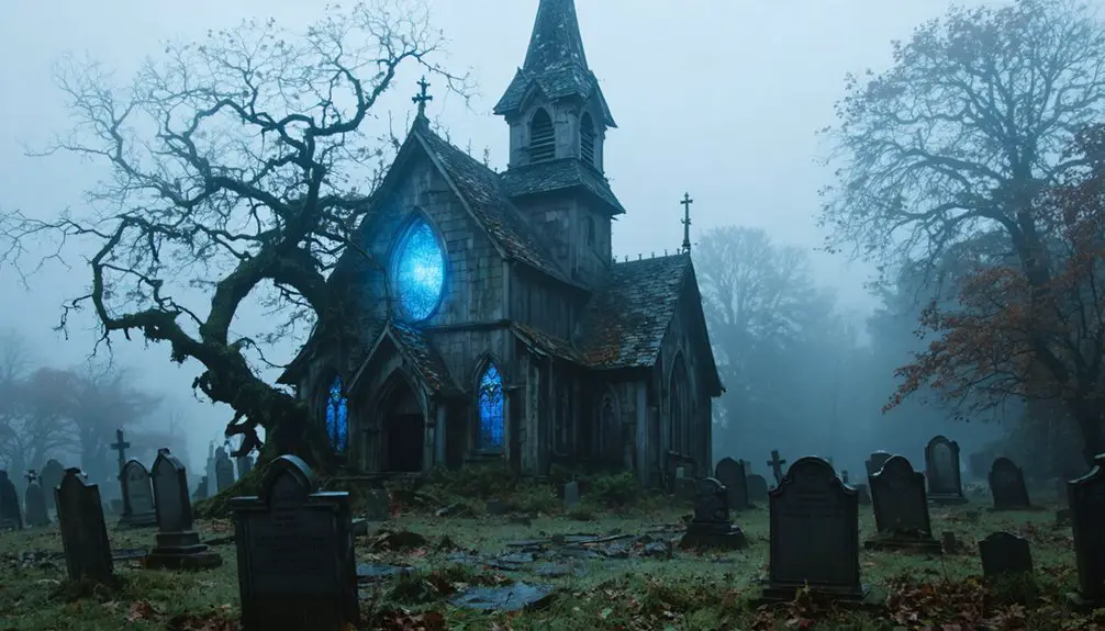
The Cemetery’s Silent Watch
Nestled within Fort Leonard Wood’s expansive military grounds, Bloodland Cemetery stands as a solemn sentinel to the displaced community it once served, housing approximately 40 unidentified graves alongside the marked remains of Civil War veterans, German settlers, and local prohibitionists.
You’ll find this sacred ground hasn’t surrendered to time, despite the challenges of military construction and training activities that surround it.
While cemetery preservation efforts continue under military jurisdiction, the site serves as more than just a burial ground – it’s the last physical remnant of a once-thriving town.
The ghostly legends that emerged after the 1941 displacement have only deepened the cemetery’s mystique, as it keeps its silent watch over the memories of those who called Bloodland home.
Preserving Bloodland’s Memory
Under federal mandates established by the National Historic Preservation Act, Fort Leonard Wood’s archaeological investigations have systematically documented Bloodland’s physical and cultural legacy through meticulous two-phase excavations.
You’ll find the Army’s heritage conservation efforts have preserved vital artifacts and historical records that tell the story of this lost Ozark community, ensuring its archaeological significance endures for future generations.
- Excavated pottery fragments and iron stove parts reveal daily life in the former settlement
- Historical land patents and community records trace Bloodland’s roots to the 1800s
- Cultural resource managers integrate both fieldwork and archival research
- Public education initiatives share Bloodland’s story through displays and publications
- The site serves as a model for preserving displaced community histories on military lands
Impact on Missouri’s Rural Heritage
Beyond preserving artifacts and records, Bloodland’s disappearance fundamentally altered Missouri’s rural landscape and cultural fabric.
You’ll find that this once-thriving community, with its tomato canning factory, mills, and high school, represented the heart of rural life in Pulaski County. The town’s destruction in 1941 didn’t just displace families – it severed generations of rural traditions and community bonds.
While rural nostalgia often romanticizes such lost towns, Bloodland’s story carries real weight in heritage preservation discussions.
Heritage preservation must confront not just lost buildings, but vanished communities that shaped our rural cultural identity.
You’re looking at more than just abandoned buildings; you’re witnessing the erasure of a crucial hub that supported surrounding farms and maintained regional commerce. When Fort Leonard Wood absorbed Bloodland, it marked a turning point in Missouri’s rural development, forever changing how local communities interacted and survived.
Frequently Asked Questions
How Much Were Residents Compensated When Forced to Leave Their Homes?
You won’t find specific compensation amounts documented, but you’ll discover that displaced residents received government payments through eminent domain, though historical accounts suggest many felt the settlements were inadequate.
Did Any Original Bloodland Families Remain in the Surrounding Pulaski County Area?
You’ll find no definitive records confirming if family legacies continued nearby, though it’s possible some local descendants integrated into surrounding Pulaski County communities after the 1941 displacement from their homes.
What Happened to the Businesses and Equipment From the Tomato Factory?
You’ll find most businesses tied to the tomato factory faced decline and closure, while the factory’s equipment was likely scrapped or abandoned, though no definitive records confirm its final disposition.
Were There Any Resistance Movements Against the Military Takeover of Bloodland?
You won’t find documented resistance strategies or local leaders opposing the 1940 military takeover, as wartime authority and federal powers effectively prevented organized opposition during this rapid displacement.
How Many People Lived in Bloodland at Its Peak Population?
You won’t find exact peak population records, but given the town’s historical significance with its school, churches, and businesses, estimates suggest several hundred residents lived there before 1941’s military takeover.
References
- https://www.militaryghosts.com/fort-leonard-wood-ghosts-of-bloodland/
- https://www.oldstagecoachstop.org/webgeezer/Gazette09/Bloodland.pdf
- https://en.wikipedia.org/wiki/Bloodland
- https://www.onlyinyourstate.com/trip-ideas/missouri/road-trip-through-mo-ghost-towns
- https://ozarks-history.blogspot.com/2008/10/bloodland.html
- https://en.wikipedia.org/wiki/List_of_ghost_towns_in_Missouri
- https://apps.dtic.mil/sti/pdfs/ADA273705.pdf
- https://collections.shsmo.org/manuscripts/counties/pulaski
- https://en.wikipedia.org/wiki/Missouri_Executive_Order_44
- https://home.army.mil/wood/about/history