You’ll find Buchanan’s ghost town remnants along the junction of the East and West Nodaway Rivers, where settler George Wesley Farrens first arrived by oxen team in 1843. The town thrived as a railroad hub after three major lines, including the Chicago, Rock Island and Pacific Railroad, transformed it into a bustling commerce center. Though it peaked at just 61 residents in 1925, Buchanan’s forgotten foundations, cemetery, and agricultural traces reveal a deeper pioneer story.
Key Takeaways
- Buchanan transformed from a bustling railroad hub to a ghost town following the Rock Island Railroad’s bankruptcy in 1975.
- The town reached its peak population of 61 residents in 1925 before declining due to the Great Depression and local industry closures.
- Today, only minimal traces remain of Buchanan’s original buildings, with most of the town site converted to agricultural farmland.
- The Shady Grove Cemetery serves as one of the few remaining physical links to Buchanan’s past.
- Three major railroads initially drove Buchanan’s development, but changing transportation patterns led to its eventual abandonment.
Origins and Early Settlement
While the Ioway people had inhabited the region for generations before European contact, Buchanan Township’s recorded settlement history began in 1843 when George Wesley Farrens arrived with his oxen team.
You’ll find that settler experiences quickly expanded as the Brock brothers, George and David, had already established themselves nearby by 1841, followed by Robert Wilson’s camp near present-day Braddyville in 1842.
The settlement grew around the junction of the East and West Nodaway Rivers, where cultural interactions between pioneers and remaining Ioway people briefly overlapped, though the tribe had already begun ceding their lands through various treaties starting in 1824.
Early families forged strong community bonds through intermarriage, as seen when Charles Gastou married into the Brown family.
Despite harsh conditions that claimed lives like Pleasant Wilson’s in 1844, the township’s agricultural promise and river access drew more settlers. The township’s first general store and post office, run by William Hardee’s store, became a crucial supply point for the growing community.
Railroad Era Development
Three major railroads transformed Buchanan’s development in the late 19th century, with the Chicago, Rock Island and Pacific Railroad leading the charge.
Railroad consolidation impacts were swift and far-reaching as the Rock Island acquired the Burlington, Cedar Rapids and Northern railroad in 1910, bringing four daily passenger trains through the region. You’d have found yourself well-connected, with regular service to Cedar Rapids and Clinton. The early railroad development fueled massive immigration influx into Iowa, transforming the region’s population and economic landscape.
The Illinois Central Railroad’s distinctive depot in Independence, built in 1891-1892, showcased unique Scandinavian-influenced architecture and served both freight and passenger needs.
The historic Independence depot stands as an elegant testament to Scandinavian design, welcoming freight and travelers since the Victorian era.
When steam service first arrived in 1859, it opened essential shipping routes to eastern markets. The passenger service frequency peaked during this golden age, though it eventually declined after Rock Island’s 1975 bankruptcy.
Educational Foundations
As the railroad era brought physical connections to Buchanan County, the region’s educational landscape took shape through a unique blend of traditional and cultural influences.
Similar to other U.S. county names, Buchanan’s educational institutions developed distinct characteristics based on local needs and demographics.
You’ll find a rich tapestry of educational initiatives shaped by the presence of Amish settlements, which operated their own special school districts until 1966, and modern community partnerships that continue to influence local learning.
The Buchanan County Community Foundation has become a cornerstone of educational support, offering grants and funding that keep local schools thriving.
Through their work, you’ll see sustainable childcare solutions and skill-building programs that prepare students for future careers.
Recent career-connected learning kits have enhanced the educational experience for local youth through foundation support.
While some rural schools have been abandoned, community engagement remains strong, with local organizations working together to overcome funding constraints and maintain quality education in both traditional and Amish communities.
Economic Rise and Fall
When the railroad expansion reached Buchanan in the mid-19th century, the town’s destiny became intertwined with the promise of economic prosperity.
You’ll find that Buchanan’s economic resilience initially grew from its strategic position along the Rock Island railroad line, transforming it from a farming settlement into a bustling hub of commerce and trade.
The railroad brought warehouses, bridges, and new businesses that flourished alongside traditional agriculture.
Early settlers like Jacob Kress paid just $1.25 per acre for their farmland, reflecting the area’s untapped potential.
Yet the town’s fortunes shifted dramatically when rail routes changed and automobile transportation gained prominence.
You can trace the demographic shifts that followed, as residents sought opportunities elsewhere. Just as modern websites require user interaction to verify human visitors, the town required active participation from its citizens to maintain its vitality.
The Great Depression, combined with dwindling rail traffic and closure of local industries, accelerated Buchanan’s decline.
What was once a thriving commercial center gradually transformed into a ghost town.
Transportation Hub Legacy
Buchanan’s railroad legacy stands as a tribute to Iowa’s golden age of rail transportation. At its height, the town served as an essential link in the region’s intricate network of rail lines, showcasing remarkable transportation innovation through the Burlington, Cedar Rapids and Northern Railroad, and the Chicago, Rock Island and Pacific Railroad operations. Like the historic St. Louis and Minneapolis that served Angus, these railways were vital lifelines for the community. Today’s visitors must enable JavaScript to access digital archives of the town’s rich railway history.
- You’ll find remnants of a time when Buchanan’s strategic location made it a significant player in regional collaboration between major economic centers.
- You can trace the town’s economic pulse through its former rail depots, where agricultural products and industrial goods once flowed freely.
- You’re walking the same paths where passengers once enthusiastically awaited trains to distant destinations.
- You’re witnessing the lasting impact of an era when rail transportation transformed small Iowa communities into vibrant commercial hubs.
Community Life and Social Structure
Though small in population, the social fabric of Buchanan revealed a tight-knit pioneer community built around key institutions and family units.
You’d find social roles clearly defined among early settlers like George Wesley Farrens and the Brock brothers, who established themselves by 1841-42. The Methodist Church and general store served as anchors for community cohesion, while the Presbyterian mission school fostered relationships between settlers and Indigenous peoples for over two decades.
Despite never growing beyond 61 residents at its peak in 1925, Buchanan maintained a surprisingly resilient social structure.
Today’s township demographics paint an interesting picture – with a young median age of 31.5 years and relatively high household incomes around $80,156, you’re seeing a community that’s defied typical ghost town decline.
Located within Jefferson County, the township continues to maintain its rural character across its modest landscape.
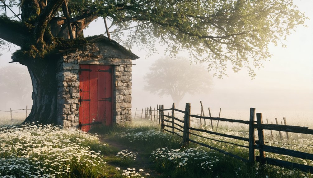
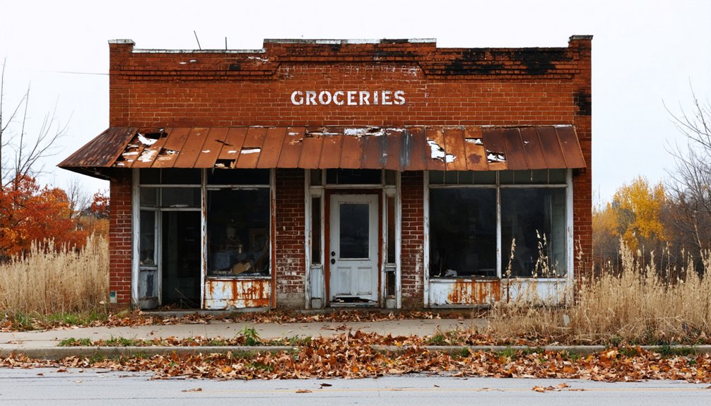
Physical Remnants and Transformation

If you explore the former town site of Buchanan today, you’ll find almost no trace of the once-thriving buildings that included a post office, general store, and creamery, as their foundations have largely vanished beneath agricultural fields.
You can still visit the well-maintained Shady Grove Cemetery, which serves as the most significant remaining physical link to the town’s past.
While the original town plat has been transformed into farmland, recent years have seen the addition of seasonal homes near the historic site, marking a new chapter in the area’s evolution.
Former Buildings and Sites
While most buildings have vanished from Buchanan County’s ghost towns, physical remnants offer glimpses into these former communities.
You’ll find whitewashed churches and weathered cemeteries standing as silent sentinels of the past, while concrete foundations map out where bustling streets once existed. Agricultural fields have reclaimed many sites, though careful observation reveals subtle traces of architectural styles in remaining structures.
- Abandoned churches in places like Buckhorn retain their distinctive features, though they’re now privately owned.
- Historic cemeteries hide among wooded areas, creating atmospheric connections to past residents.
- Industrial remnants like grain elevators and creameries tell stories of local commerce.
- Site preservation efforts focus on protecting remaining landmarks from further decay, particularly cemetery grounds and company buildings.
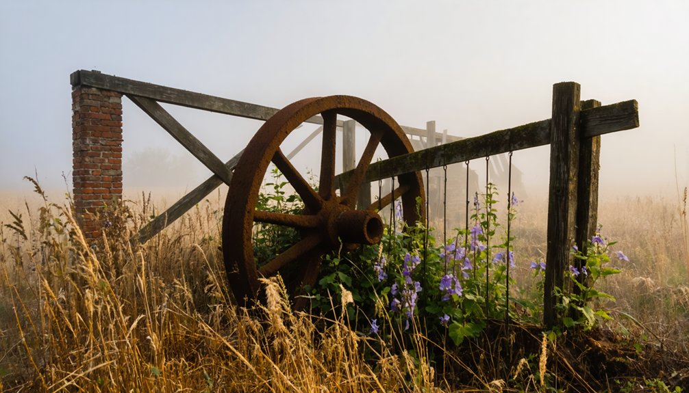
Railroad Infrastructure Remains
Two historic railroads once intersected the western edge of Buchanan Township, leaving behind a rich tapestry of physical remnants.
You’ll find railroad artifacts scattered throughout the landscape – from the relocated Morseman depot that stood until 1975 to concrete bridge piers crossing the region’s waterways.
The Burlington and Quincy‘s old route reveals itself through track preservation in the form of visible right-of-ways, while the Wabash’s path can be traced by remaining infrastructure near Crooks and the Nodaway River crossing.
Many former trackways have transformed into rural roads or farm paths, though you can still spot old railroad beds as subtle depressions or raised embankments crossing the fields.
Victorian-era wooden depots, though mostly gone, left their mark through repurposed materials in local structures.
Agricultural Land Conversion
Beyond the railroad remnants, Buchanan’s landscape bears witness to generations of agricultural transformation. The evolution of farming practices has dramatically altered the land use patterns you’ll see today, with abandoned structures and field layouts telling stories of earlier times.
Where small family farms once dotted the countryside, larger industrial operations now dominate the terrain.
- You’ll find weathered barns and forgotten homesteads scattered across the landscape, silent testimonies to the shift from manual farming to mechanized agriculture.
- The geometric patterns of old field boundaries remain visible, showing how farmers once divided their land for crop rotation.
- Remnants of historic water management systems reveal how earlier generations worked with the land.
- Former orchards and garden plots, now overtaken by row crops, hint at the area’s more diverse agricultural past.
Neighboring Ghost Towns
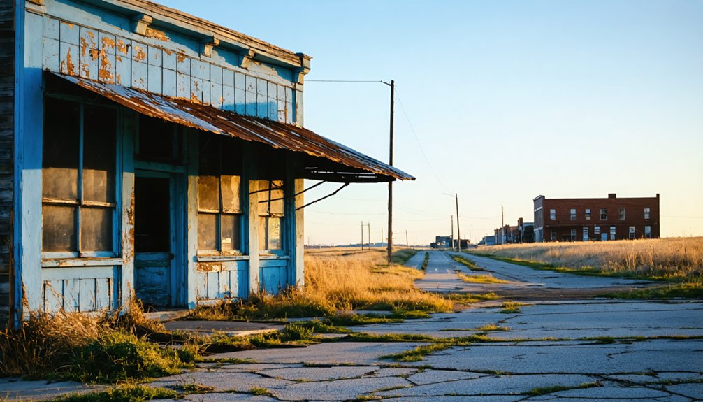
Throughout Buchanan County and its surrounding regions, a network of abandoned settlements tells the story of Iowa’s evolving transportation and economic landscape.
exploring the history of ivanhoe offers insights into the challenges faced by early settlers who sought to establish a community amidst the wilderness. These abandoned sites, now mere echoes of the past, reveal the intricate connections between transportation development and the settlement patterns across the region. Through careful examination, we can uncover the narratives of resilience and adaptation that shaped the area’s growth.
You’ll find the ghost towns of Doris and Bethel, once-bustling whistle-stops along the Chicago and North Western Railway, now silent reminders of the area’s railroad heritage.
Buffalo Grove joins them among Buchanan County’s lost communities, while Webster County features its own abandoned town named Buchanan.
Both Buffalo Grove and Buchanan now stand silent, ghost towns scattered across Iowa’s changing rural landscape.
The settlement patterns reveal how these towns often emerged as twins along rail lines, like Doris and Bethel, only to fade when transportation routes changed.
You’ll notice many towns peaked during the mid-1800s but couldn’t survive the shift in economic conditions.
Railroad rerouting, flooding, and the consolidation of farming communities into larger towns sealed their fate.
Historical Significance in Iowa’s Development
When settlers first arrived in Buchanan Township around 1840, they established one of Page County’s earliest non-indigenous communities at the confluence of the East and West Nodaway creeks.
You’ll find that this strategic location near waterways shaped Buchanan’s significant role in Iowa’s pioneer development, serving as a vital trading point and agricultural hub.
- Pioneer struggles defined early life, as evidenced by Pleasant Wilson’s death in 1844, one of the area’s first recorded white settler deaths.
- Cultural integration emerged as Native American wigwams gave way to European-descended settlers.
- The Farrens, Brock, and Wilson families carved out homesteads that transformed frontier wilderness into organized township lands.
- Water-powered industries flourished until railroad development shifted economic patterns, forever changing Buchanan’s destiny.
This early settlement period would shape Page County’s political and social organization for generations to come.
Frequently Asked Questions
What Natural Disasters or Epidemics Affected Buchanan’s Population During Its Existence?
You won’t find any documented natural disasters directly affecting the population decline. While Iowa faced common rural hazards and disease outbreaks, no specific catastrophic events are linked to Buchanan’s history.
Were There Any Notable Crimes or Lawlessness Incidents in Buchanan?
While shadows of crime history loom, you’ll find the most significant incident was Assistant Marshal Pitt Doxsie’s 1897 murder in Independence, reflecting the law enforcement challenges that plagued Buchanan County’s early days.
What Indigenous Peoples Inhabited the Buchanan Area Before European Settlement?
You’ll find the Ioway (Baxoje) people were the primary Indigenous tribes in this area, with the Sauk and Meskwaki also sharing the cultural heritage through hunting grounds and settlements nearby.
Did Any Famous Historical Figures Visit or Have Connections to Buchanan?
You won’t find any documented famous visitors or historical connections to nationally known figures in this area – historical records show only regional pioneer teachers and local settlers shaped its story.
What Specific Crops or Agricultural Products Were Primarily Grown in Buchanan?
You’ll find that corn production dominated the agricultural landscape, alongside significant wheat cultivation, while potatoes rounded out the main crops from the 1840s through early settlement years.
References
- https://sites.rootsweb.com/~iapage/history/buchanan/BUCH-HST.HTM
- https://kids.kiddle.co/List_of_ghost_towns_in_Iowa
- https://www.geotab.com/ghost-towns/
- http://genealogytrails.com/iowa/buchanan/abandoned_towns_01.htm
- https://en.wikipedia.org/wiki/Buchanan_County
- https://ia601407.us.archive.org/4/items/historyofbuchana00will/historyofbuchana00will.pdf
- https://pubs.lib.uiowa.edu/annals-of-iowa/article/id/13466/download/pdf/
- https://en.wikipedia.org/wiki/List_of_ghost_towns_in_Iowa
- https://pubs.lib.uiowa.edu/annals-of-iowa/article/7045/galley/115796/view/
- https://ioway.nativeweb.org/iowaylibrary/ioways_buchanan_county_history.htm