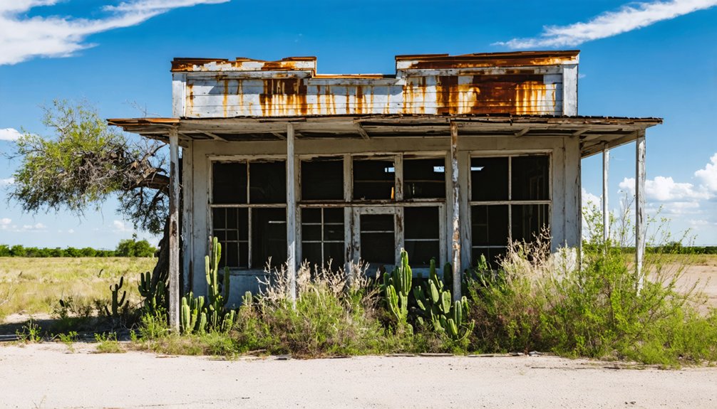
You’ll find Calliham’s remains beneath the waters of Texas’ Choke Canyon Reservoir. This former oil boom town began in 1918 as “Guffeyola,” a tent city around McGuffey’s general store, before officially becoming Calliham in 1923. The town grew to 400 residents during its peak in the 1930s but met its fate in 1982 when dam construction submerged it. Today, a relocated community exists three miles south, while the original site holds countless untold stories underwater.
Key Takeaways
- Calliham was established in 1918 as Guffeyola, a tent city around McGuffey’s store, before becoming an oil boom town.
- The town reached its peak population of 400 residents in the 1930s, supported primarily by oil extraction and related services.
- Original Calliham was submerged beneath Choke Canyon Reservoir after dam construction began in 1978.
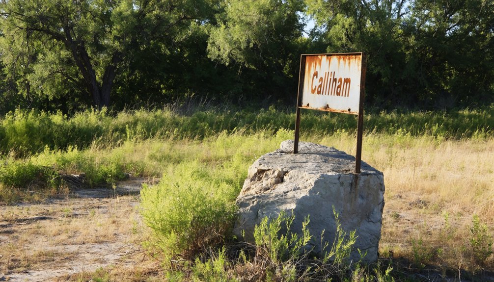
- A relocated community exists three miles south of the original site, preserving the town’s memory through historical markers.
- Archaeological evidence, including Apache artifacts and paleontological findings, was discovered before the town’s submersion.
The Birth of Guffeyola
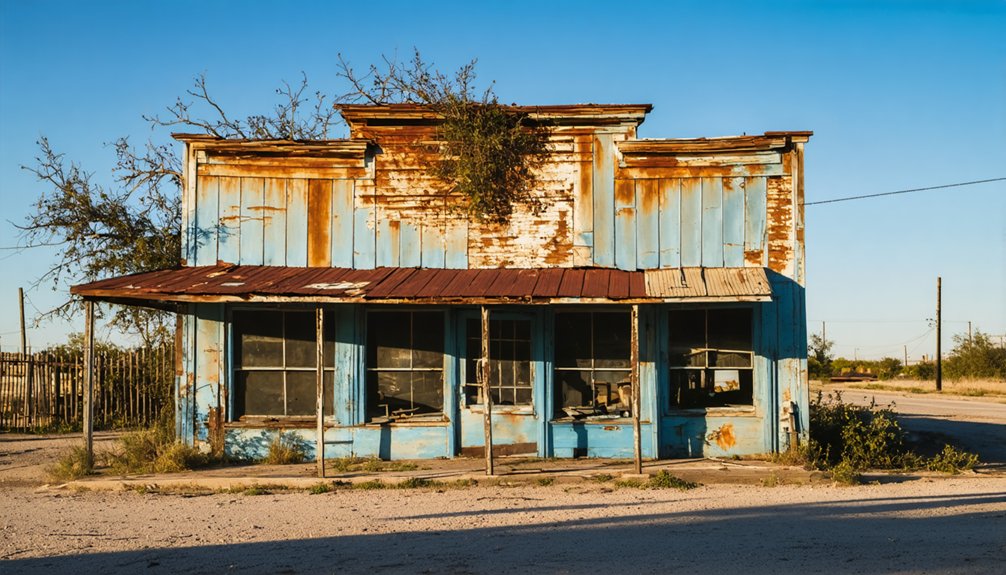
While many Texas towns sprang up organically over time, Guffeyola emerged specifically in 1918 as a tent city centered around Hiram McGuffey’s general store.
Unlike most Texas settlements, Guffeyola’s birth in 1918 was precisely marked by tent dwellers gathering around McGuffey’s store.
You’ll find the Guffeyola origins deeply rooted in the oil industry’s promise, as discoveries between 1917 and 1922 transformed this simple settlement into a bustling hub for workers and services.
The settlement evolution quickly progressed from temporary canvas dwellings to shotgun-style houses as more people arrived. The town’s first major road improvement came when workers installed a bituminous surface in 1951.
McGuffey’s store, which housed the community’s post office, became the heart of early civic life. The discovery of natural gas in the area led to the construction of the first pipeline that supplied San Antonio.
While some historical accounts incorrectly date the town’s founding to 1878, that reference actually pertains to Calliham, the name this community would later adopt following the 1923 oil boom and formal town planning.
Life in Early Calliham
As the discovery of oil transformed Guffeyola into early Calliham between 1917 and 1922, you’d find a bustling community emerging from its tent city origins.
The oil boom quickly drew workers and their families, who traded canvas shelters for wooden shotgun houses as they put down roots. You’d see the heart of the community at McGuffey’s store, where folks gathered to collect mail, share news, and purchase supplies. Just as early Spanish explorers had observed oil springs and pits in Texas, the area’s oil resources would shape its destiny. Following the massive Spindletop discovery in 1901, Texas towns like Calliham became part of the state’s remarkable oil boom.
Life centered around the oilfields, with most residents working in extraction or support services.
While some ranching and farming continued on the outskirts, the community dynamics revolved around the rhythms of the oil industry.
You’d navigate dirt roads to reach neighboring towns, relying on the post office established in 1918 to stay connected to the outside world.
From Tent City to Township
You’ll find Calliham’s origins in 1917 as “Guffeyola,” a humble trading post established by H.H. McGuffey that quickly transformed into a bustling tent city after the discovery of oil and gas deposits.
Between 1917 and 1922, workers flooded the area, setting up temporary dwellings and makeshift structures around McGuffey’s store and post office.
The settlement’s formal transformation came in 1923 when J.T. Calliham’s ranchland was surveyed and plotted into an official township, complete with permanent structures replacing the earlier tents and earning its new name, Calliham. McMullen County’s early ranching heritage was evident in the Boot Hill Cemetery nearby, which held the remains of local settlers and cowboys.
This development led to rapid growth, with the town eventually reaching four hundred residents during its peak in the 1930s.
Early Settlement Patterns
Before Calliham emerged as an oil boomtown in 1918, the earliest settlements in McMullen County took root around 1858 near where Leoncita Creek met the Frio River.
Early settlement dynamics centered on scattered communities like Rio Frio and Yarbrough Bend, where about 100 settlers had established themselves by 1860.
You’d have found these pioneers building crude dwellings and carving out basic roads to connect with the San Antonio-Laredo route. Their ranching practices focused on wild cattle and mustang hunting across the region’s rich grasslands. Like the early settlers in Coryell County, they relied on stock raising as their primary economic activity.
Life was challenging for these early settlers who had to maintain subsistence farming while defending against frequent raids.
Trading Post Origins
Three major oil and gas discoveries between 1917 and 1922 transformed Calliham from empty rangeland into a bustling tent city.
The tent city evolution began with H.H. McGuffey’s store, which housed the “Guffeyola” post office in 1918. You’ll find this trading post significance reflected in how it served as the community’s commercial backbone during the boom years. Similar to the early American frontier posts, McGuffey’s establishment provided absolute authority over the surrounding commercial activities. Like many historical trading posts, thorough primary source research was essential to document its authentic history and development.
The settlement’s growth followed a pattern typical of frontier trading posts:
- Initial tent settlements by oil field workers
- Development of essential commerce through McGuffey’s store
- Shift to permanent shotgun houses
- Establishment of civic infrastructure
Population Growth Timeline
Although Calliham began as a sparse tent settlement in the early 1900s, its population surged dramatically during the oil boom years of 1917-1922.
You’d have seen constant population fluctuations as the transient workforce moved with the railroad expansion and oil discoveries.
The Choke Canyon Dam Project
When the U.S. Bureau of Reclamation began the Choke Canyon dam construction in 1978, you would’ve witnessed one of their first major projects using metric units. The construction kicked off on August 10, with the Holloway Companies breaking ground on earthworks by October 2.
Four key aspects defined this massive undertaking:
- Sourced earth materials directly from the reservoir area
- Transported limestone riprap from quarries 135 miles away
- Completed substantial construction by May 18, 1982
- Weathered Hurricane Allen’s impact in August 1980
The dam’s completion marked a significant development for water security in South Texas, primarily serving Corpus Christi and Three Rivers.
The Choke Canyon Dam strengthened South Texas water security, ensuring stable supply for communities like Corpus Christi and Three Rivers.
While the project headquarters opened in 1976, you wouldn’t see the official dedication until June 8, 1982, when 1,300 people gathered to commemorate this engineering achievement.
A Community Underwater
The construction of Choke Canyon Dam brought dramatic changes to the region, none more profound than the submersion of original Calliham beneath its waters.
If you’d visited the site before flooding, you’d have found a thriving community of 22 families who called this northwestern McMullen County town home until the 1970s.
Today, you’ll find the town’s remains accessible only through underwater archaeology.
Before the waters rose, researchers discovered significant Native American Apache artifacts and paleontological evidence at the site.
The original buildings, homes, and local landmarks now rest silently beneath Choke Canyon Reservoir, while the relocated community exists three miles south.
Though submerged artifacts lie hidden from view, historical markers and documentation preserve the memory of this once-vibrant Texas town.
Preserving the Memory
Preservation efforts to safeguard Calliham’s legacy have united local historians, community groups, and descendants in a shared mission.
Through committed community involvement, you’ll find historical documentation efforts that keep the town’s memory alive through various initiatives.
You can explore Calliham’s history through:
- Digital archives and online repositories containing maps, census records, and newspaper clippings
- Photographic collections documenting cemeteries and remaining structures
- Oral histories from former residents and their descendants
- Annual heritage celebrations and educational programs
Local historical societies and museums lead preservation projects, organizing events that raise funds for ongoing maintenance.
They work alongside county institutions to protect key sites, while volunteer programs guarantee the careful documentation of artifacts and stories for future generations.
Legacy in Maps and Records
You’ll find detailed survey maps and construction plans from Calliham’s pre-flood period preserved in McMullen County archives, offering precise documentation of the town’s layout before Choke Canyon Reservoir submerged it.
Government agencies meticulously mapped the underwater site locations during reservoir planning, creating valuable records of Calliham’s original footprint and structural positions.
These historical documents, combined with early-1900s town planning records, provide researchers with thorough geographical data spanning Calliham’s evolution from oil boomtown through its final days above water.
Historical Survey Documents
Several key historical surveys and documents preserve Calliham’s legacy, with notable contributions from researchers Dianna Everett, Philip A. Bandy, and T. Lindsay Baker.
These records demonstrate both historical significance and community resilience through detailed documentation of the town’s evolution from 1917 to its submersion in the 1970s.
You’ll find extensive records in multiple formats:
- Texas Historical Commission marker files containing official recognition data
- Archaeological surveys detailing the original town site’s layout and structures
- Photographic archives showcasing the high school gymnasium and town landmarks
- T. Lindsay Baker’s “Ghost Towns of Texas” (1986) featuring mapped documentation
These surveys capture Calliham’s transformation from a thriving oil boom town to its eventual fate beneath Choke Canyon Reservoir‘s waters.
Underwater Site Mapping
Through advanced underwater mapping technologies, modern researchers have documented Calliham’s submerged remnants beneath Choke Canyon Reservoir with remarkable precision.
Using sophisticated sonar technology, they’ve created detailed bathymetric maps revealing the town’s underwater topography and hidden structures. You’ll find that remotely operated vehicles equipped with cameras provide visual documentation of surviving features, while GIS applications help overlay historical maps with current data.
The mapping process combines GPS positioning, acoustic systems, and underwater photogrammetry to generate accurate 3D models of submerged buildings and artifacts.
Pre-Flood Town Planning
Originally established as Guffeyola after store owner Hiram Harvey McGuffey, the town was formally planned and renamed Calliham in 1923 on J.T. Calliham’s ranch land.
J.W. Stephenson spearheaded the town layout, offering fifty-dollar incentives for lot purchases to attract settlers.
The town’s civic amenities reflected ambitious planning, with key features including:
- Commercial zones hosting multiple cafes, hotels, and stores
- Educational district with high school and elementary facilities
- Cultural spaces including a dance pavilion and gymnasium
- Essential infrastructure like the post office and deep water well
You’ll find that Calliham’s careful planning supported a peak population of 400 residents in the 1930s, though the original site now lies beneath Choke Canyon Reservoir‘s waters, preserving only maps and memories of this once-thriving community.
Metal Detecting Adventures
Metal detecting enthusiasts exploring Calliham face unique challenges and opportunities, as this former oil boomtown now lies beneath Choke Canyon Reservoir.
You’ll find accessible terrain around the reservoir’s edges where treasure hunting tips and metal detecting techniques can yield artifacts from the 1917-1922 oil boom era. Using historical maps, you can pinpoint promising locations of old homesites, trails, and oilfield equipment.
Your search might uncover early 20th-century relics like derrick hardware, tools, and personal items left behind when residents were evicted.
Before heading out, you’ll need to check current regulations and obtain necessary permits from Choke Canyon State Park authorities. Reference the twelve available historic maps to identify prime detecting spots, and plan your visits around seasonal water levels for ideal access.
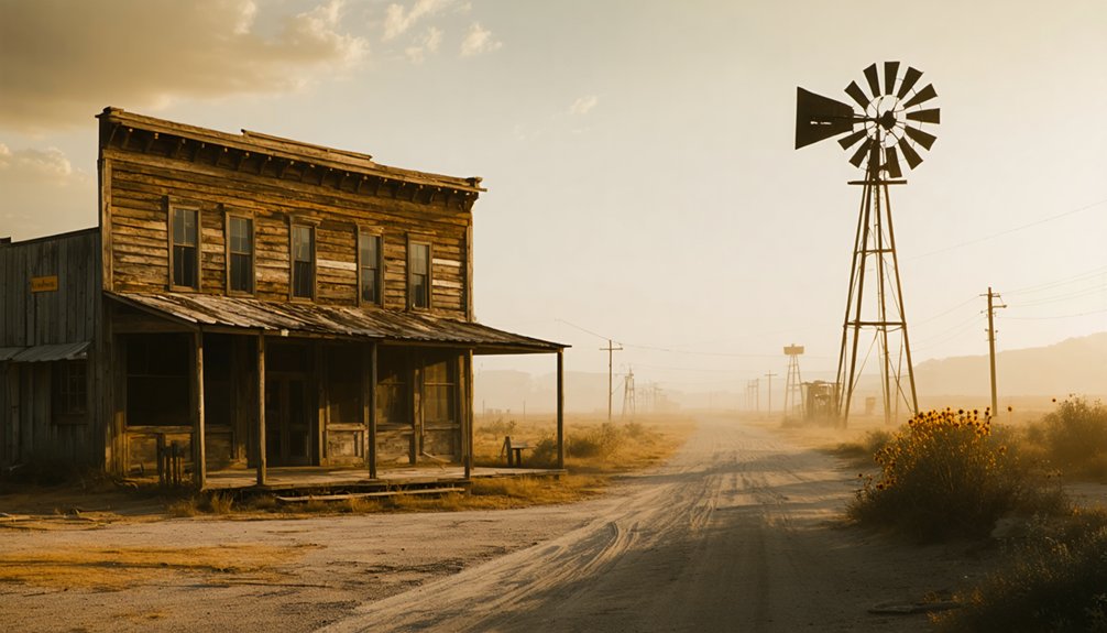
South Texas Ghost Town Heritage
While South Texas boasts over 500 ghost towns across its vast landscape, these abandoned settlements tell a rich story of 19th-century frontier expansion and industrialization.
The region’s ghost town preservation efforts highlight significant cultural heritage sites, from riverboat towns along the Rio Grande to mining communities that once thrived on natural resources.
You’ll discover these common factors led to their abandonment:
- Railroad bypasses that shifted trade routes
- Depletion of valuable mining resources
- Natural disasters, particularly devastating hurricanes
- Economic shifts in agriculture and cattle industries
Today, you can explore stone buildings, historic cemeteries, and abandoned commercial structures that showcase the architectural legacy of these frontier communities.
Some towns maintain small populations, keeping cultural traditions alive while serving as living museums of Texas’s pioneering spirit.
Frequently Asked Questions
What Wildlife Now Inhabits the Waters Above the Former Calliham Site?
You’ll find rich wildlife diversity including largemouth bass, catfish, turtles, waterfowl, and semi-aquatic mammals. These aquatic species thrive alongside herons, frogs, and water snakes in the reservoir waters.
Are There Any Descendants of Original Calliham Residents Still Living Nearby?
You’ll find it fascinating that dozens of original Calliham families’ descendants still call the area home, though local history records aren’t crystal clear. Family genealogy suggests many remain near the relocated town site.
What Items Have Metal Detector Enthusiasts Found at Accessible Shore Areas?
You’ll find old bullet casings, mining tags numbered 1-11, brass tool fragments, and Storm King lighters through metal detecting. Treasure hunting near shores reveals coins beneath sediment and glass debris.
Did Residents Receive Compensation When Forced to Relocate for Dam Construction?
You’d receive just compensation and relocation assistance under federal law, though exact compensation details from Calliham’s case aren’t recorded. Relocation impact included moving expenses, rent differences, and utility costs.
Are There Any Annual Events Commemorating the History of Calliham?
You won’t find dedicated annual celebrations or historical reenactments of Calliham’s past. The closest event is Trail of the Dead at Choke Canyon State Park, which includes some ghost town elements.
References
- https://www.ghosttowns.com/states/tx/calliham.html
- https://texashighways.com/travel-news/four-texas-ghost-towns/
- https://www.youtube.com/watch?v=phjUE19A8HM
- https://pastmaps.com/explore/us/texas/mcmullen-county/calliham/metal-detecting
- https://www.texasescapes.com/SouthTexasTowns/Calliham-Texas.htm
- https://en.wikipedia.org/wiki/List_of_ghost_towns_in_Texas
- https://www.texasescapes.com/TOWNS/Texas-Ghost-Towns-8-South-Texas.htm
- https://en.wikipedia.org/wiki/Texas_Recreational_Road_8
- https://www.hmdb.org/m.asp?m=161040
- https://justapedia.org/wiki/Texas_Recreational_Road_8


