You’ll find Carnegie’s ghostly remains in Rock County, Minnesota, near the Iowa border. This failed pioneer settlement emerged as a rival to nearby Jasper in the late 1800s but couldn’t match its competitor’s railroad connections and quarry industry. Carnegie’s merchants and farmers struggled with plummeting crop prices and lack of infrastructure, leading to their exodus. Today, nature reclaims the crumbling structures while photographers explore its haunting legacy – a story of fierce competition and economic survival.
Key Takeaways
- Carnegie was a failed settlement in Rock County, Minnesota that lost its economic battle with nearby Jasper in the early 20th century.
- Located near the Iowa border, Carnegie’s remains feature crumbling structures and foundations reclaimed by prairie vegetation.
- The town’s decline was accelerated by severe agricultural market pressures, with crop prices plummeting during the Great Depression.
- Carnegie’s inability to secure railroad connections and essential infrastructure investments led to its abandonment in favor of Jasper.
- The ghost town now serves as an unofficial wildlife sanctuary, though its privately owned grounds are difficult to access.
Location and Geographic Details
Located in Rose Dell Township of Rock County, Minnesota, the ghost town of Carnegie sits near the Iowa border at coordinates 43°47′26″N, 96°18′42″W.
You’ll find this abandoned settlement nestled in the southwestern corner of the state, where the landscape showcases the region’s distinctive geographic features of gently rolling prairie and scattered wetlands.
Much like the iron ore mining that drove the economy of its Pennsylvania namesake, this Carnegie also had industrial beginnings.
At an elevation between 1,300 and 1,500 feet above sea level, Carnegie’s terrain reflects the agricultural character that dominates the area today.
While the ghost town’s original rural infrastructure has largely vanished, you can still access the general vicinity through county roads that serve the surrounding farmland.
The site’s placement in the Prairie Pothole Region means you’re likely to spot characteristic depressions and small lakes that dot the otherwise open landscape.
Like many entries on Carnegie disambiguation pages, this location represents one of several historically significant places sharing the Carnegie name.
The Rise and Fall of Carnegie
You’ll find Carnegie’s origins rooted in fierce competition with nearby Jasper, as town founders sought to establish a rival commercial center in Rock County, Minnesota.
Similar to how transportation changes affected many Minnesota settlements, Carnegie’s isolated location made it difficult for businesses and residents to thrive.
Though Carnegie’s planners laid out an ambitious vision for growth and development, they struggled to secure the essential investment needed to build infrastructure and attract settlers. Like many ghost towns that were only on paper, Carnegie was created by speculators who ultimately failed to sell enough plots to sustain development.
The town’s inability to match Jasper’s economic opportunities ultimately led early residents to abandon their settlement dreams, marking the beginning of Carnegie’s decline.
Early Town Competition Days
In the late 19th century, Carnegie emerged as an ambitious settlement determined to rival the nearby town of Jasper in Rock County, Minnesota’s Rose Dell Township.
If you’d studied the settlement patterns of that era, you’d recognize how Carnegie’s establishment followed a familiar trajectory of frontier development, with new communities sprouting up in close competition for resources and settlers. Similar to how Dakota and Ojibwe tribes competed over territory in the 1830s, these frontier towns fought for dominance and survival.
The community dynamics between Carnegie and Jasper reflected the high-stakes nature of town building in Minnesota’s expanding frontier. Like many frontier settlements that faced competition, Carnegie’s situation mirrored that of early Maine Prairie, which struggled against neighboring towns in the 1860s.
You can imagine the tension as both settlements vied for the same pool of potential residents, businesses, and essential infrastructure investments.
Carnegie’s founders had envisioned creating a thriving hub that would match or surpass Jasper’s growth, but they’d soon face the harsh realities of frontier competition.
Failed Economic Growth Strategy
While Carnegie’s ambitious vertical integration strategy aimed to dominate the steel industry from Minnesota’s iron ore to finished products, this approach ultimately contributed to the town’s downfall.
Failed investments in transportation infrastructure and economic mismanagement left the community vulnerable to market fluctuations and financial panics.
The area’s extensive waterway networks had previously supported thriving Indigenous trade routes long before industrialization.
You can still see evidence of this failed strategy through:
- Abandoned mining equipment scattered across the Mesabi Range
- Empty storefronts where company stores once controlled workers’ spending
- Crumbling railroad beds that once carried iron ore to distant mills
- Remnants of immigrant housing that housed 43 different ethnic groups
The town’s dependence on Carnegie’s single-industry focus proved fatal.
When steel demand dropped and Rockefeller’s railroad monopoly squeezed transport costs, Carnegie’s vertical integration dream became the community’s economic nightmare. The eventual sale of Carnegie Steel to J.P. Morgan in 1901 sealed the town’s fate.
Competition With Jasper
The fierce competition between Carnegie and Jasper ultimately shaped the destiny of both Minnesota settlements, though Jasper emerged as the clear victor.
You’ll find the Carnegie rivalry was doomed from the start, as Jasper’s strategic advantages proved insurmountable. While Carnegie struggled, Jasper’s Improvement Company poured $100,000 into development, attracting significant businesses and the important Willmar & Sioux Falls railroad connection.
Jasper’s dominance grew through its thriving quarry industry, which employed 200 men under the Rae brothers’ leadership. The town officially incorporated in 1889 after uniting both town areas. The town’s superior location along Split Rock Creek, combined with its robust financial institutions and immigrant-friendly churches, sealed Carnegie’s fate.
Economic Challenges and Population Loss
Carnegie’s location put it in direct economic competition with the more established Jasper Township, which had already secured many of the region’s agricultural trade relationships.
You’ll find that Carnegie’s merchants struggled to attract sufficient business from local farmers, who’d grown accustomed to bringing their grain and livestock to Jasper’s markets.
The town’s inability to carve out its own agricultural market niche, combined with its dependence on the volatile mining industry, left Carnegie particularly vulnerable to economic instability.
Like many settlements during the Panic of 1857, Carnegie’s economy suffered a devastating blow that accelerated its decline.
Competition With Jasper Township
During the late 1800s, intense economic rivalry between Jasper Township and Carnegie revealed stark disparities in development potential, ultimately sealing Carnegie’s fate as a ghost town.
Jasper’s strategic advantages and successful development efforts led directly to Carnegie’s decline, creating a tale of two drastically different destinies.
Key factors in Jasper’s dominance included:
- Direct railroad access that transported quartzite and agricultural goods
- Four thriving churches serving diverse immigrant communities
- Multiple established banks supporting local business growth
- Successful quarrying operations providing skilled labor jobs
You’ll find that Jasper’s prosperity wasn’t merely luck – it stemmed from superior transportation links, stronger financial institutions, and industrial development.
While Carnegie struggled to attract investment and maintain its population, Jasper’s growing commercial sector and strategic location guaranteed its survival and eventual absorption of its failing neighbor.
Agricultural Market Limitations
While Jasper Township flourished through diversified commerce, Carnegie’s agricultural foundation crumbled under severe market pressures in the early 20th century.
You’d have witnessed dramatic market fluctuations as crop prices plummeted – corn fell to 28 cents per bushel and wheat to 44 cents by 1932, devastating local farm incomes.
Despite farmers’ attempts to join agricultural cooperatives like the Minnesota State Grange, they couldn’t overcome the perfect storm of economic challenges.
The Fordney-McCumber and Hawley-Smoot tariffs crushed export opportunities, while rising property taxes and freight rates squeezed profits further.
Carnegie’s small family farms, lacking access to mechanization that larger operations enjoyed, simply couldn’t compete.
With land values dropping to $35 per acre, many farmers abandoned their dreams, leaving Carnegie’s population to dwindle steadily.
Historical Significance in Rock County
The historical significance of Carnegie within Rock County exemplifies the fierce competition among pioneer settlements in 19th-century Minnesota. You’ll find Carnegie’s legacy as a ghost town particularly fascinating, as it represents the high-stakes gamble early settlers made when establishing new communities in the American frontier.
- Picture Carnegie’s ambitious beginnings in Rose Dell Township, where settlers dreamed of creating a thriving railroad hub.
- Envision the fierce rivalry with nearby Jasper for railroad connections and commercial supremacy.
- Witness the gradual exodus as Carnegie’s hopes faded while Jasper prospered.
- Imagine the empty prairie where Carnegie once stood, now returned to farmland.
This vanished settlement tells a compelling story of the broader economic forces that shaped Rock County’s development, where railroad companies and land speculators wielded enormous influence over a community’s fate.
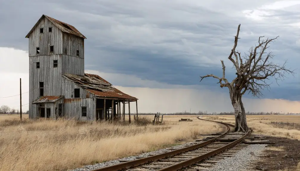
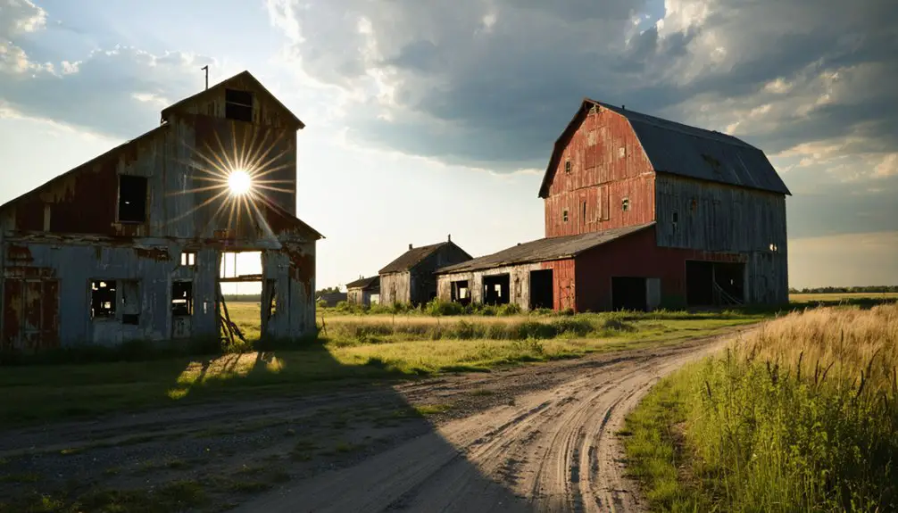
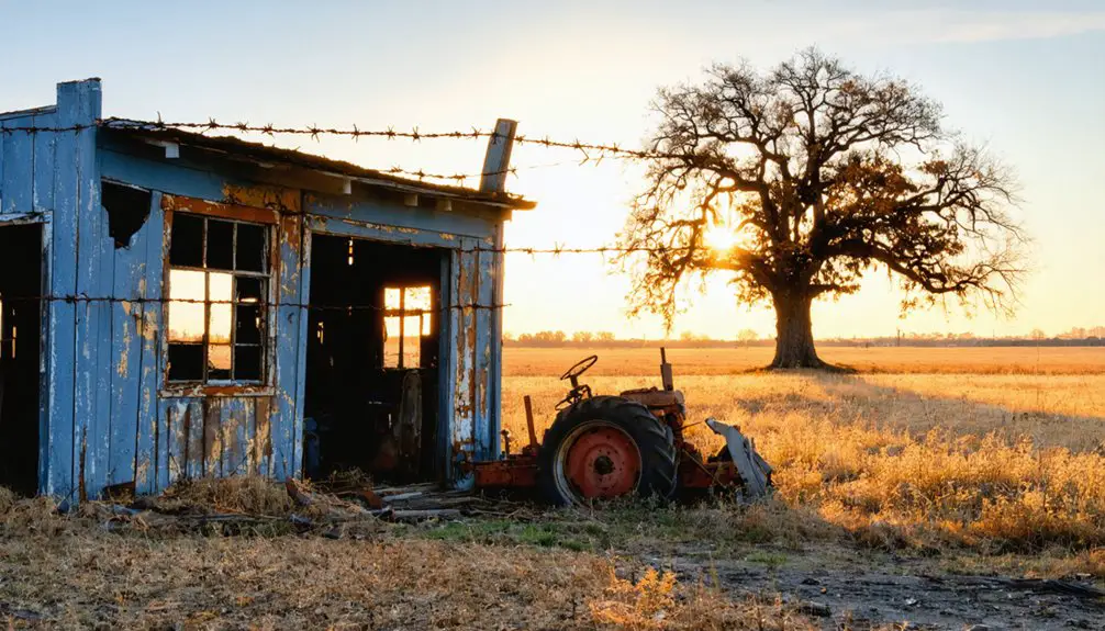
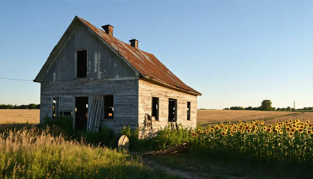
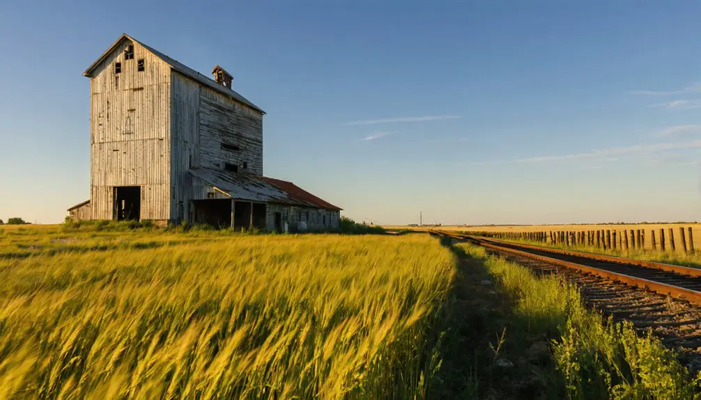
Modern Site Conditions and Legacy
Modern visitors to Carnegie will find nature steadily reclaiming what remains of this once-hopeful settlement.
You’ll encounter crumbling structures and weather-worn buildings showcasing classic signs of urban decay, while native vegetation pushes through forgotten foundations and along former streets. The site’s deterioration continues unchecked, with no preservation efforts in place.
Yet Carnegie’s cultural memory endures through local historical societies and family narratives passed down through generations.
While the ghost town now serves as an unintended wildlife sanctuary, its abandoned structures stand as silent witnesses to rural Minnesota’s changing landscape.
You might spot photographers or history enthusiasts exploring the privately owned grounds, though access remains challenging due to overgrown paths.
The town’s legacy persists as a poignant reminder of the region’s evolving economic fortunes.
Frequently Asked Questions
Were There Any Notable Crimes or Incidents in Carnegie’s Brief History?
You won’t find any documented crimes or unsolved mysteries in the records. Unlike other ghost towns with spooky tales and ghost sightings, Carnegie’s story revolves purely around economic failure.
What Was the Peak Population of Carnegie Before Its Decline?
While you’d expect population records for most towns, Carnegie’s exact peak remains unknown. Based on similar Minnesota ghost towns and the struggling Carnegie economy, it likely never exceeded 200 residents.
Did Carnegie Have a School, Church, or Post Office?
You won’t find records of a schoolhouse, church, or post office in Carnegie’s history. Available evidence suggests the town’s brief existence and small population couldn’t sustain these essential community institutions.
Who Were the Original Founders or Prominent Residents of Carnegie?
Like footprints washed away by time, founder backgrounds and resident stories of this failed settlement remain a mystery. You won’t find documented names of who established or lived there.
When Was the Last Building Torn Down or Removed From Carnegie?
You’ll find town history records don’t specify the exact date of the final building removal, but comparable Minnesota ghost towns suggest Carnegie’s last structure likely disappeared during the mid-1900s, following regional patterns.
References
- https://en.wikipedia.org/wiki/Carnegie
- https://www.youtube.com/watch?v=5bCG6B2rzZY
- https://pabucketlist.com/exploring-the-ghost-town-of-scotia-near-state-college-pa/
- https://www.wikiwand.com/en/map/Carnegie
- https://www.colerainemn.gov/historical-walking-tour/
- https://opendata.renenyffenegger.ch/Wikimedia/Wikidata/entity/Q5043868
- https://en-academic.com/dic.nsf/enwiki/1535026http:/en.academic.ru/dic.nsf/enwiki/3714014
- https://www.leg.mn.gov/docs/pre2003/mandated/000021.pdf
- https://www3.mnhs.org/mnopedia/search/index/place/ghost-towns-carver-county
- https://minnesotasnewcountry.com/this-story-of-a-central-minnesota-ghost-town-is-pretty-incredible/