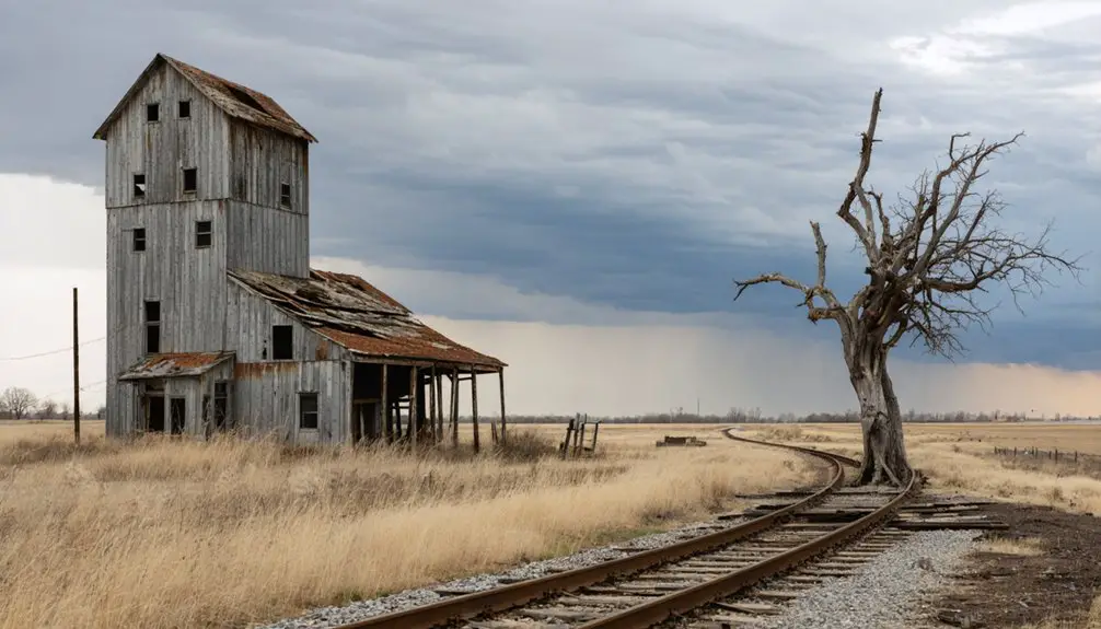
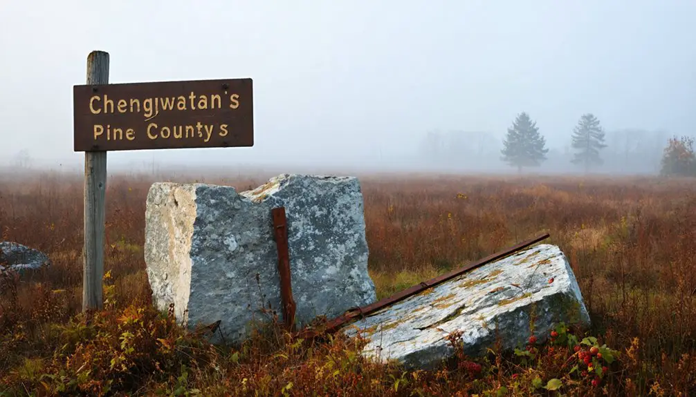
You’ll find Chengwatana’s remains in Pine County, Minnesota, where it once thrived as an Ojibwe settlement turned logging boomtown. Named from the Ojibwe term “Zhingwaadena” (White-Pine Town), it served as the county seat from 1856-1872 and peaked at 92 settlers in 1860. When landowners’ demands drove the railroad to bypass the town, Chengwatana’s fate was sealed, leading to its abandonment by 1873. The surrounding 33,000-acre state forest now guards its fascinating frontier story.
Key Takeaways
- Chengwatana was Pine County’s first county seat in 1856, named after the Ojibwe term meaning “White-Pine Town.”
- The town peaked at 92 settlers in 1860 but declined after railroad companies bypassed the settlement due to excessive landowner demands.
- By 1873, Chengwatana lost its post office and became nearly extinct, marking its transition into a ghost town.
- The town’s economic decline followed the relocation of the county seat to Pine City in 1872.
- Today, Chengwatana’s legacy lives on through the 33,000-acre Chengwatana State Forest and preserved archaeological sites.
Origins of the Ojibwe Settlement
During the 17th century, the Ojibwe people commenced a westward migration from the northern Great Lakes into present-day Minnesota, driven by lucrative fur trade opportunities and the search for resource-rich territories. Their warriors led the advance, establishing strategic settlements near Duluth and around Lake Superior before bringing their families to settle permanently.
You’ll find that this Ojibwe migration followed a carefully planned pattern, with early settlements taking root at Fond du Lac, Sandy Lake, and Red Lake between 1650 and 1750. The Ojibwe established villages in Grand Portage and Pembina, expanding their presence across Northern Minnesota. The prophecies of the Seven Fires instructed them to move west until they found wild rice growing on water.
As they expanded their territory, they encountered the Dakota people, initially establishing peaceful arrangements near Fond du Lac. The Ojibwe’s territorial expansion continued westward from their strongholds on Madeline Island and inland Wisconsin, guided by both economic interests and spiritual prophecies that led them to areas rich in wild rice.
The Name and Its Meanings
You’ll find the name “Chengwatana” originates from the Ojibwe term *Zhingwaadena*, which itself is a shortened form of *Zhingwaak-oodena*, meaning “White-Pine Town.”
The English version came through French transcription, reflecting the area’s rich multilingual heritage as European settlers interacted with the indigenous Ojibwe people. The region was historically dominated by Eastern White Pine until extensive logging operations transformed the landscape.
When local businessmen briefly renamed the settlement “Alhambra” in 1856, the community rejected this change and restored “Chengwatana” in 1857, preserving its connection to the region’s white pine forests and Native American roots. Today, the name lives on through the Chengwatana State Forest which spans across Pine and Chisago counties.
Origins Of Zhingwaadena
The Ojibwe word Zhingwaadena, a contraction of *Zhingwaak-oodena*, directly translates to “white-pine town” and reflects the deep connection between indigenous naming practices and the natural environment.
The village became a permanent settlement after Wisconsin’s statehood in 1848, marking a significant transition in the region’s development.
You’ll find this name’s roots deeply embedded in the Ojibwe language, describing a village that once thrived along the Snake River where Eastern White Pine dominated the landscape.
The name carries cultural significance beyond its literal meaning, embodying the Ojibwe people’s relationship with the land.
While the original settlement became a ghost town, the name endured through oral tradition and historical records.
You can still see its influence today in the anglicized form “Chengwatana,” which preserves the indigenous heritage in modern place names like the Chengwatana State Forest.
English Translation Evolution
As settlers began documenting the Snake River settlement in English, they first translated “Chengwatana” simply as “Pine Town,” capturing the area’s defining characteristic of abundant white pine trees.
You’ll find a fascinating language evolution in the name’s journey from the Ojibwe “Zhingwaadena” through French influence to its anglicized form.
In 1856, officials briefly attempted to rename the village “Alhambra,” but they quickly restored Chengwatana, preserving its cultural significance.
Located in Minnesota’s Pine County at an elevation of 928 feet, the settlement held an advantageous position along the Snake River.
While the core meaning remained tied to white pines, the name’s connotations shifted as the settlement declined.
Today, you’ll see Chengwatana’s legacy living on in the State Forest and township names, though its meaning has evolved from representing a vibrant community to marking an ecological preserve.
Local Names Through Time
Deep within Minnesota’s indigenous heritage, Chengwatana emerged from the Ojibwe word “Zhingwaadena,” a contraction of “Zhingwaak-oodena” meaning “White-Pine Town.” This name, along with its alternative form “Ne-zhingwaakokaag” (meaning “on a land-point full of white pines”), reflected the area’s abundant eastern white pine forests and served as more than just a label – it represented an established Ojibwe village before European settlement.
The place name evolution took several turns through history. French traders adapted it during early exploration, while “Chang-wa-do-nang” appeared as another variant.
In 1848, settlers briefly renamed it Alhambra, but local resistance led to restoring Chengwatana in 1857. When the settlement later declined, its legacy lived on through Pine City, an English translation honoring the location’s indigenous significance.
Early Settlement and Development
Located along Minnesota’s Snake River, Chengwatana emerged from an Ojibwa village whose name “Zhingwaadena” meant “White-Pine Town.”
Settlement began in earnest when it became Pine County’s seat in 1856, initially under the poorly-received name Alhambra before adopting Chengwatana in 1857.
Pine County’s first seat underwent a swift name change, swapping the unpopular Alhambra for Chengwatana within a year.
Settlement patterns centered around the abundant white pine forests and the Snake River Dam, where Elam Greeley’s toll dam facilitated timber transport. Local loggers directed timber through Snake River waterways to reach the St. Croix River and ultimately Stillwater. Evidence from the area suggests that early French traders had established Fort St. Croix between 1700 and 1703.
By 1860, you’d have found 92 settlers in Pike County, making Chengwatana the largest settlement north of Taylors Falls.
Community growth brought essential services: a post office, school, courthouse, blacksmith shop, general store, and hotel.
The village’s strategic location at Cross Lake’s outlet and its proximity to stagecoach lines made it a hub for lumber operations and regional commerce.
Military Post and Frontier Life
During the tumultuous years of 1862-1863, Chengwatana transformed into a frontier military post aimed at maintaining order amid growing tensions with Native Americans.
You’d find volunteer militias patrolling the region, supported by a network of infrastructure including the essential Military Road (Douglas Highway) and a horse-changing station. Local leader Emil Munch served in the First Minnesota Artillery Battery during this period, helping coordinate regional defense efforts.
While there weren’t any large hostile forces nearby, military presence intensified due to widespread fears of potential native attacks. The post primarily monitored the local Ojibwe population, who’d previously inhabited the area before being forced to relocate to White Earth Reservation.
The military’s role wasn’t permanent though – by the late 1860s, frontier tensions had eased considerably. The post’s operations wound down, leaving only a post office that continued serving the area until 1873.
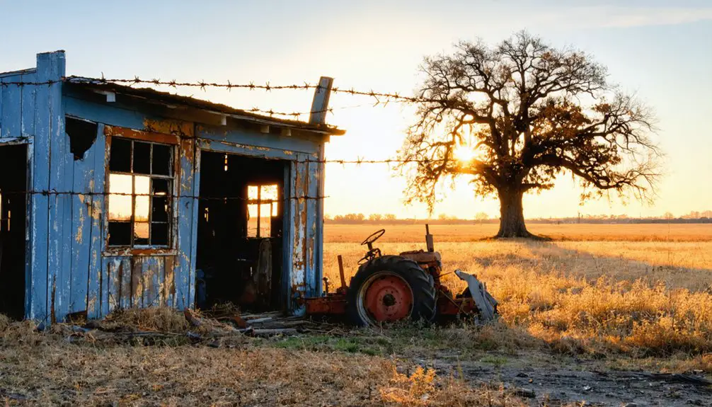
Logging Industry and River Transport
As military operations waned in Chengwatana, the logging industry emerged as the area’s economic backbone in the mid-19th century.
You’d find loggers employing traditional logging techniques during winter months, using axes and crosscut saws to fell mighty pines before hauling them by horse-drawn sleds to the Snake River‘s banks. Steam-powered sawmills introduced in the 1870s revolutionized lumber production in the region.
The St. Croix River system, including Chengwatana’s Snake River, became essential for river transportation of logs.
You could spot wanigans – floating cook shacks and bunkhouses – supporting the crews who guided massive log rafts downstream.
The controversial logging dam at Chengwatana helped control water flow, though local Ojibwe often opposed these structures for threatening their wild rice and fish.
County Seat Era and Governance
When Chengwatana became Pine County’s first county seat in 1856, you’d find the courthouse at what’s now Nichols Café, along with a jail and essential administrative offices.
For sixteen years, the town served as the hub of Pine County’s governance, managing court proceedings, land records, and civic functions during a period when the county’s borders stretched across territories that would later become Buchanan and parts of other counties.
You’ll understand the town’s decline in administrative power when, in 1872, Pine County voters chose to relocate the county seat to Pine City, marking the end of Chengwatana’s role as a governmental center.
Early Administrative Functions
Following its establishment as Pine County’s first county seat in 1856, Chengwatana quickly emerged as the region’s administrative hub, housing the county’s inaugural courthouse and jail facilities.
You’ll find that the town’s administrative strategies were shaped by its strategic location near Cross Lake and the Snake River, making it ideal for overseeing the area’s rich white pine resources and early settlement activities.
The town tackled significant governance challenges during the 1860s, particularly when managing the dissolution and reintegration of Buchanan County territory in 1861.
As the focal point for legal proceedings, record keeping, and election activities, Chengwatana’s courthouse served as the center of local authority, coordinating with state officials while balancing the interests of both new settlers and established residents.
County Records and Operations
The establishment of Chengwatana as Pine County’s seat in 1856 brought formal governance structures to Minnesota’s northeastern frontier.
You’ll find that during this period, the county’s legal operations centered around a courthouse and jail, where officials maintained essential records and conducted preliminary court proceedings near the present-day site of Nichols Café in Pine City.
As you explore the area’s history, you’ll discover how county governance adapted to significant territorial changes.
When Buchanan County formed in 1857 and later dissolved in 1861, Chengwatana’s administration had to adjust its jurisdiction.
The county seat managed public services including land surveying and township development until 1872, when officials relocated operations to Pine City amidst the county’s changing boundaries and economic landscape.
Seat Relocation and Impact
Chengwatana’s status as county seat began to unravel in the 1870s due to a series of pivotal events. The town’s seat significance diminished when local landowners demanded excessive prices from the railroad company, causing the rail line to bypass Chengwatana entirely. Instead, the tracks were laid through what would become Pine City, setting the stage for a dramatic governance shift.
- A courthouse fire in Chengwatana catalyzed discussions about relocating county operations
- Residents voted in 1872 to move the county seat to Pine City
- Pine City’s railway access made it more economically viable for government functions
- The transfer led to Chengwatana’s rapid decline, with many residents abandoning the town
Following the relocation, Pine City flourished as the new administrative hub, while Chengwatana faded into obscurity, marking the end of its brief but notable era in Pine County’s history.
Railroad Impact and Town Decline

While initial plans designated Chengwatana as a future railroad depot site, local landowners’ excessive property demands prompted railway officials to establish their junction on Cross Lake’s west side instead – a decision that proved disastrous for the town’s future.
Greed among Chengwatana’s landowners forced the railroad elsewhere, sealing the town’s doom in a single misguided decision.
The railroad bypass triggered a swift economic decline as businesses and residents migrated to the newly established Pine City.
You’ll find that Chengwatana’s once-bustling community, which boasted a post office, courthouse, hotel, and various merchants, quickly lost its liveliness.
The town’s population, which had reached 92 settlers in 1860, dwindled dramatically as Pine City flourished with its railway connection.
By 1873, Chengwatana had lost its post office, and most commercial activities had ceased.
The town’s fate was sealed when the county seat relocated to Pine City, cementing its transformation into a ghost town.
Natural Surroundings and Forest Legacy
Situated within Pine and Chisago counties, Chengwatana State Forest spans approximately 33,000 acres of diverse ecological landscapes that tell a story of environmental transformation.
This land’s cultural heritage is preserved in its very name – “Zhingwaadena” in Ojibwe means “white-pine town,” reflecting the towering pines that once dominated the forest ecology before extensive logging changed its character.
- You’ll find three major rivers – the St. Croix, Kettle, and Snake – weaving through the forest’s varied terrain.
- The landscape features a rich mosaic of marshes, brushlands, and forested uplands.
- Today’s forest supports diverse wildlife, from white-tailed deer to waterfowl.
- You can explore 20 miles of equestrian trails, 16 miles of ATV paths, and numerous other recreational opportunities.
Historical Preservation and Modern Legacy
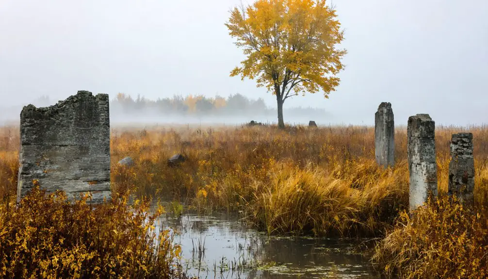
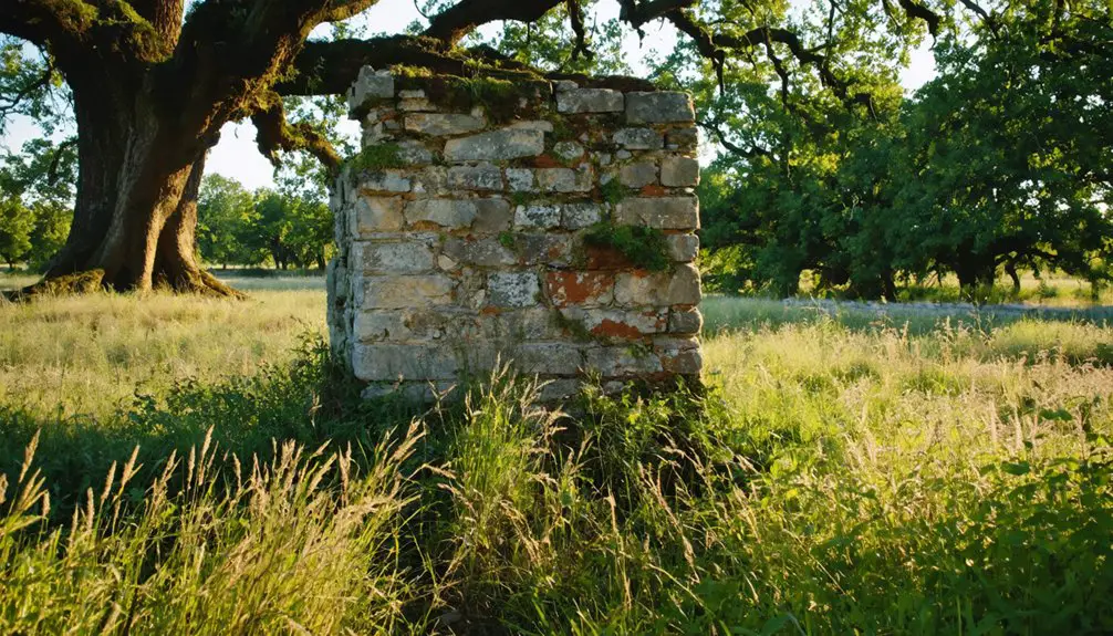
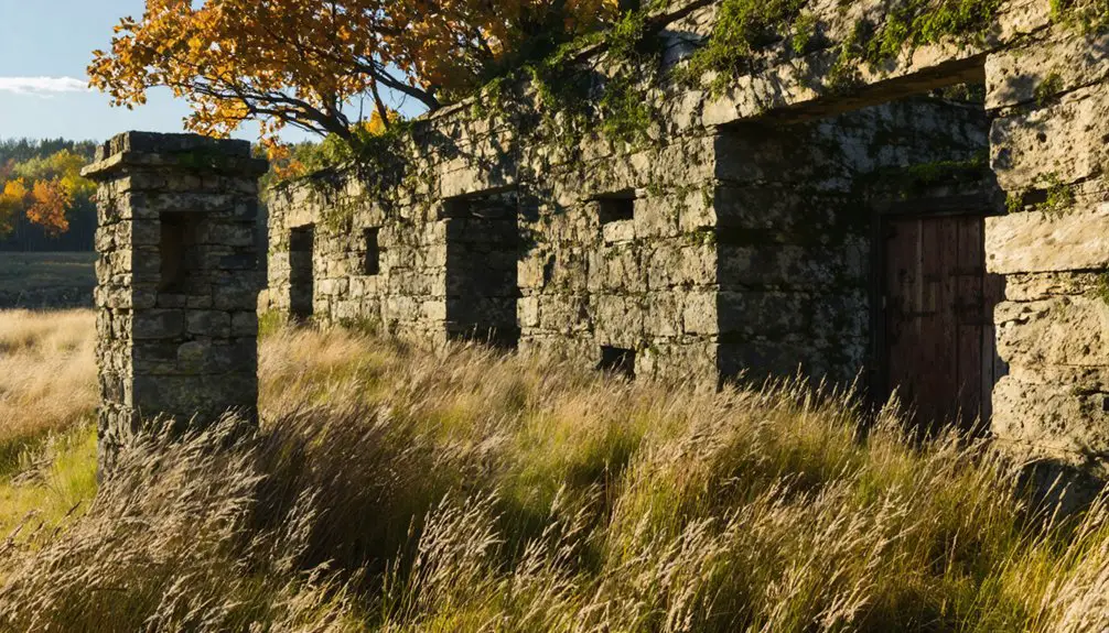
Although the physical remnants of Chengwatana have largely disappeared, its legacy endures through multiple forms of historical preservation.
You’ll find its cultural heritage preserved in the name of Chengwatana State Forest, which protects the white pine landscapes that gave the original Ojibwe village its name. The area’s rich multicultural past lives on through historical documentation and archaeological sites that reveal layers of indigenous, French, and settler history.
Today, you can explore this heritage through community engagement activities like geocaching and historical trails.
The preserved lands along the St. Croix River corridor offer you glimpses of the pre-settlement environment, while nearby protected areas help tell the story of the region’s logging heritage and military history through interpretive programs.
Frequently Asked Questions
Are There Any Remaining Structures or Ruins Visible at the Chengwatana Site?
You’re barking up the wrong tree if you’re seeking remaining buildings – there aren’t any visible structures or historical artifacts at the site, just cleared land with a few building pads showing past settlement.
What Was the Peak Population of Chengwatana During Its Heyday?
You won’t find exact population figures for this ghost town’s peak, as historical records don’t document specific numbers. Population trends suggest it remained a small frontier settlement during its brief county seat period.
Did Any Notable Conflicts Occur Between Settlers and Native Americans?
While no major battles occurred directly in Chengwatana, you’ll find its Ojibwa village location saw rising settler conflicts nearby, including the 1898 Battle of Sugar Point where Native forces defeated U.S. troops.
How Far Was Chengwatana From the Nearest Major Trading Centers?
You’d find the nearest major trading centers about 60-70 miles away in the Twin Cities, with transportation routes along rivers initially supporting trade. Economic factors shifted when railroads bypassed the settlement.
What Happened to the Residents After the Town Was Abandoned?
Like hitting “delete” on their hometown, you’ll find most residents’ migration patterns led them to Pine City and railroad towns, though ghost town folklore suggests some scattered across Minnesota seeking opportunities.
Exploring the history of Cazenovia reveals a rich tapestry of stories and traditions that have shaped the community over the years. This small town, nestled in Upstate New York, was once a hub for commerce and social gatherings, illustrating the resilience and spirit of its residents. As newcomers arrive, they often discover the blend of heritage and modernity that makes Cazenovia a unique place to call home.
References
- https://www.geocaching.com/geocache/GC1G4QF
- https://www.snakeriveroutfittersmn.com/snake river info.pdf
- https://en.wikipedia.org/wiki/Chengwatana_State_Forest
- https://en.wikipedia.org/wiki/Chengwatana
- http://wikimapia.org/13645506/Chengwatana-MN-Ghost-Town
- https://www.redlakenation.org/tribal-history-historical-photos/
- https://www3.mnhs.org/mnopedia/search/index/ojibwe-our-historical-role-influencing-contemporary-minnesota
- https://mlpp.pressbooks.pub/mnhist/chapter/3-early-minnesotans-the-dakota-and-ojibwe/
- https://www.mpm.edu/index.php/content/wirp/ICW-151
- https://en.wikipedia.org/wiki/Ojibwe