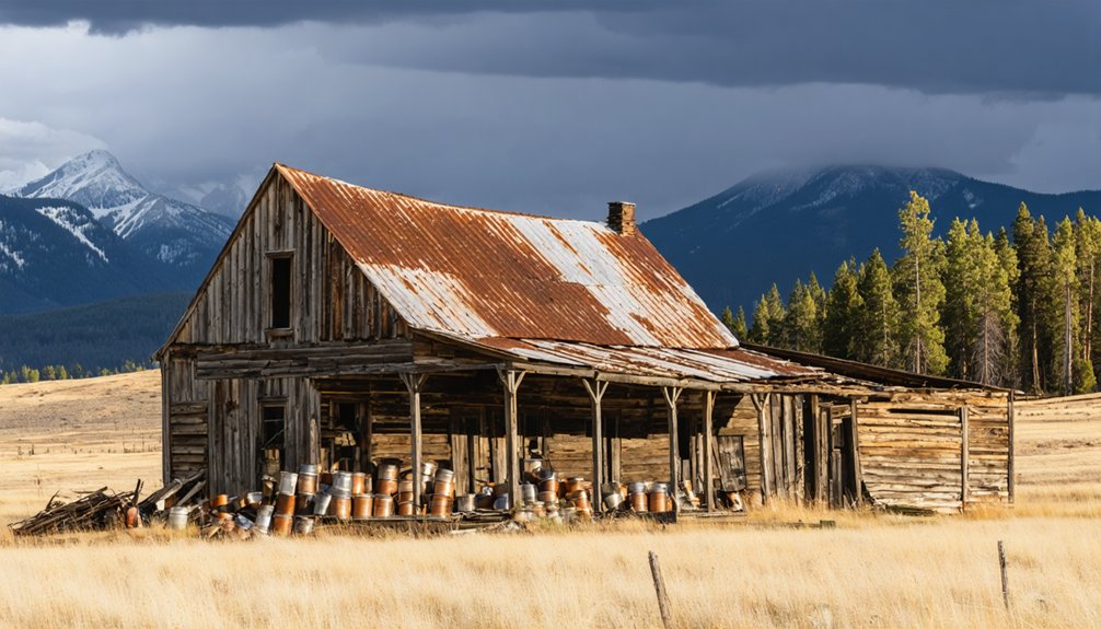
Howbert, Colorado isn’t your typical ghost town—it’s completely underwater. Founded in 1887 as a Colorado Midland Railroad stop, this once-bustling community of about 100 residents now rests beneath Eleven Mile Reservoir, submerged since 1934. You can’t explore its streets, but you’ll find Howbert Point campground overlooking the water where the town once stood. Below the surface lies a perfectly preserved piece of Colorado’s railroad heritage, waiting to share its story.
Key Takeaways
- Howbert was established in 1887 by the Colorado Midland Railroad and peaked at approximately 100 residents engaged in logging and ranching.
- Named after Irving Howbert, a prominent railroad promoter and State Senator who authored historical accounts of the Pike’s Peak region.
- The town served as a strategic transit hub connecting Colorado Springs to mining regions before its submersion.
- Howbert was completely submerged in 1934 during the creation of Eleven Mile Reservoir, preserving buildings and artifacts underwater.
- The submerged town remains unexplored archaeologically, while the area now offers recreational opportunities including camping, fishing, and boating.
From Railroad Stop to Underwater Legend: The Founding of Howbert
As the Colorado Midland Railroad carved its ambitious path through the rugged terrain of Ute Pass in 1887, it breathed life into what was once a modest settlement known as Dell’s Camp.
This frontier outpost, soon renamed Howbert to honor Irving Howbert—a significant railroad figure—quickly transformed under the railroad’s influence.
By December 1887, Howbert boasted its own post office, and within months, James Petty’s land was officially platted into 125 lots.
Streets named Dell, Midland, and Petty defined this ambitious community as it grew alongside the essential transportation artery.
The railroad’s presence spurred remarkable community growth, turning a simple way station into a structured town designed to serve travelers, settlers, and the mining industry. Irving Howbert’s substantial investments in railroads helped establish the transportation infrastructure that made towns like his namesake possible. The town’s population peaked at approximately 100 residents who primarily engaged in logging and ranching activities in the surrounding area.
Decades later, in 1934, Howbert met a dramatic end when reservoir waters claimed the site forever.
Irving Howbert: The Colorado Pioneer Behind the Name
You’ll recognize Irving Howbert not just as the namesake of a submerged Colorado town but as a dedicated railroad promoter who helped extend essential transportation links throughout the Pike’s Peak region.
His lasting imprint on regional education emerged through generous support of Colorado College and advocacy for educational institutions during his tenure as State Senator.
Howbert’s historical writings, including his 1925 memoir “Memories of a Lifetime in the Pike’s Peak Region,” preserve firsthand accounts of Colorado’s territorial days and early statehood that historians still treasure. In 2007, his grandson worked with the Old Colorado City Historical Society to republish this significant autobiography after decades of limited availability. Before his political career, he was elected El Paso County Clerk in 1869, establishing his first office in a log cabin that remains standing in Colorado City today.
Railroad and Education Legacy
Irving Howbert’s indelible legacy can be traced through his pioneering work in railroad development and educational advancement, two pillars that transformed Colorado Springs from frontier settlement to thriving municipality.
You’ll appreciate how his instrumental role in the Cripple Creek Short Line construction—later becoming Gold Camp Road—revolutionized regional transportation, connecting the mining district to Colorado Springs and revealing unprecedented economic potential. His election as railroad company president further cemented his influence over regional transportation development.
This railroad impact rippled through commerce, population growth, and resource extraction throughout the Pikes Peak region.
His educational initiatives proved equally visionary. Before his remarkable achievements, Howbert and his family had moved to the Colorado Territory in 1860, establishing early roots in the region. By supporting Colorado College during its significant formative years, Howbert helped establish an intellectual foundation that would nurture generations of free thinkers.
These complementary achievements—connecting physical landscapes through rails while cultivating minds through education—cemented Howbert’s status as a transformative figure who shaped Colorado’s development with remarkable foresight.
Regional Historical Writings
While many pioneers left their mark on Colorado’s physical landscape, Howbert’s enduring literary contributions have preserved firsthand accounts of the territory’s most formative and controversial periods. His 1914 work “The Indians of the Pike’s Peak Region” stands as a controversial yet significant window into pioneer narratives of early Colorado settlement.
You’ll find Howbert’s writings particularly notable for their depiction of indigenous relations during western expansion. Though he staunchly defended Colonel Chivington and the militia’s actions at Sand Creek—a position that conflicts with modern historical consensus—his accounts provide valuable primary source material from a settler’s perspective.
These writings reflect the complex tensions between westward migration and native populations, offering you raw insights into the mindset of those who shaped Colorado’s territorial development.
Life in a Mountain Railroad Town (1887-1934)
As the Colorado Midland Railway carved its path through the Rocky Mountains in 1887, Howbert emerged as more than just another dot on the map—it became a lifeline of civilization amid the rugged wilderness of southeastern Park County.
The railroad community dynamics revolved around the strategic transit hub that connected Colorado Springs to western mining regions. You’d have found a tight-knit population working primarily in railroad operations, ranching, and support services. Similar to Chattanooga’s experience, winter transportation often relied on sleds for supplies when snow made other methods impossible.
A railway outpost where steel met spirit, binding mountain folk to the iron pulse of progress
Local businesses catered to travelers and workers traversing the challenging rail line with its 4% grades and nearby tunnels.
Mountain life challenges were ever-present as residents endured harsh seasonal weather that disrupted transportation schedules and complicated daily existence.
Yet this resilient community persisted, their livelihoods intrinsically bound to the rhythmic arrivals and departures of the trains.
The Tragic 1915 Train Collision at Idlewild
You can trace the 1915 Colorado Midland Railway disaster to a deadly chain of communication failures among crews who couldn’t see each other through Idlewild’s imposing canyon walls.
When the eastbound passenger train missed its siding stop, it collided with the westbound service, leaving over thirty excursionists with injuries ranging from shattered limbs to severe lacerations.
This tragedy pales in comparison to Britain’s worst rail disaster at Quintinshill in Scotland, where over 200 people died in a multi-train collision with devastating fires.
The catastrophe involved multiple railways with complex track arrangements contributing to confusion among signalmen who failed to properly coordinate train movements.
Local physicians from Colorado Springs mounted a remarkable mountain rescue effort, carefully extracting the wounded from the twisted wreckage and transporting them down treacherous canyon roads for treatment.
Communication Failure Analysis
The catastrophic train collision of 1915 near Idlewild stands as a haunting monument to the fragility of early railroad communication systems.
You can trace the disaster to a perfect storm of challenges: the canyon’s high rock walls prevented vital visibility while telegraph instructions failed to guarantee the eastbound train remained at the siding.
The mishap exposed critical flaws in communication protocols of the era. Engineers received orders without adequate confirmation systems, leaving safety standards vulnerable to human error.
When the eastbound train “blew through” Idlewild, the narrow geography offered no escape. Similar to the Quintinshill disaster, inadequate signaling procedures and human error led to devastating consequences when trains occupied the same track.
This tragedy, injuring over 30 passengers, ultimately highlighted the dangerous gap between mountain railroad realities and the communication systems meant to protect them.
Passenger Injuries Described
When medical personnel arrived at the chaotic scene near Idlewild in 1915, they encountered a tableau of human suffering that would remain etched in local memory for generations.
Over 30 passengers bore wounds ranging from minor cuts to severe trauma—broken bones, head injuries, and lacerations testifying to the collision’s violent force.
You’d have witnessed survivors’ bewildered expressions as they recounted their passenger experiences: being violently thrown from seats, tumbling through overturned carriages, and emerging dazed into canyon air.
Injury accounts describe men and women in shock, some bleeding, others comforting the wounded until help arrived.
The community rallied immediately. Locals transported the injured to nearby facilities, where doctors worked tirelessly.
Despite the canyon’s rock walls amplifying the crash’s devastation, remarkably, not a single soul perished that fateful day.
Emergency Response Efforts
Despite the formidable challenges posed by steep canyon walls and limited communication infrastructure, emergency responders sprang into action with remarkable efficiency following the 1915 Idlewild collision.
You’d have witnessed local Howbert residents—a community of barely 100 souls—rushing to aid the more than 30 injured passengers, their instincts for neighborly duty overcoming the shock of the disaster.
The Colorado Midland’s telegraph office in Howbert quickly became the coordination center, dispatching calls for medical assistance while railroad workers organized the complex emergency logistics of evacuating the wounded through difficult mountain terrain.
Train safety protocols were immediately scrutinized as engineers who’d jumped to safety helped direct rescue efforts.
The accident’s remote location complicated rescue operations, yet the absence of fatalities testified to the swift, determined response of ordinary citizens facing extraordinary circumstances.
The Flooding and Submersion: When Howbert Disappeared
In what might be considered one of Colorado’s most poignant sacrifices for progress, Howbert’s final chapter began with a deliberate decision to submerge the once-thriving community beneath water.
The flooding impact was absolute. In 1934, dam breaks were opened, and you would’ve witnessed the gradual drowning of your heritage as waters deliberately consumed every structure.
This wasn’t nature’s wrath but calculated infrastructure development—reservoir creation deemed more valuable than preserving a community’s physical existence.
Beneath the Waves: What Remains of the Original Settlement
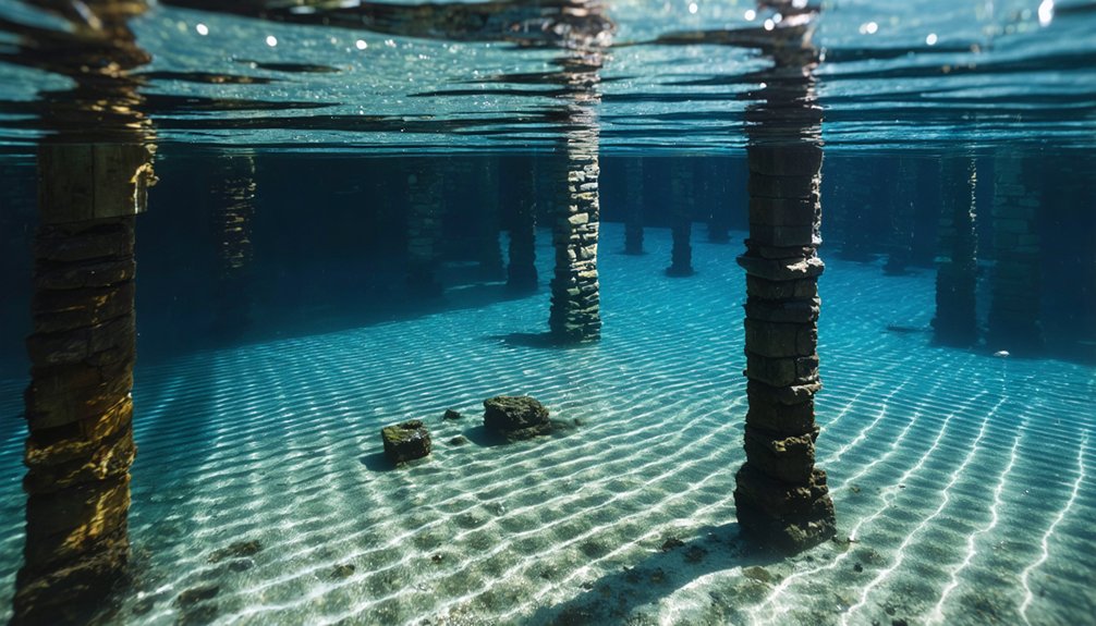
You’ll find no ghostly silhouettes of Howbert’s buildings beneath Eleven Mile Reservoir’s surface, as the town’s physical remnants have vanished entirely into their watery grave.
The original settlement’s foundations, streets, and structures now exist only in historical records, with no archaeological projects attempting to map or recover artifacts from the submerged townsite.
What remains instead is a transformed landscape where campers at Howbert Point unknowingly vacation above a forgotten pioneer community, its material legacy claimed completely by the waters that serve Colorado’s modern population.
Underwater Archaeological Potential
Beneath the tranquil waters of Eleven Mile Reservoir lies a time capsule of Colorado’s railroad era, preserved yet inaccessible since 1934 when the reservoir gates closed over Howbert’s remaining structures.
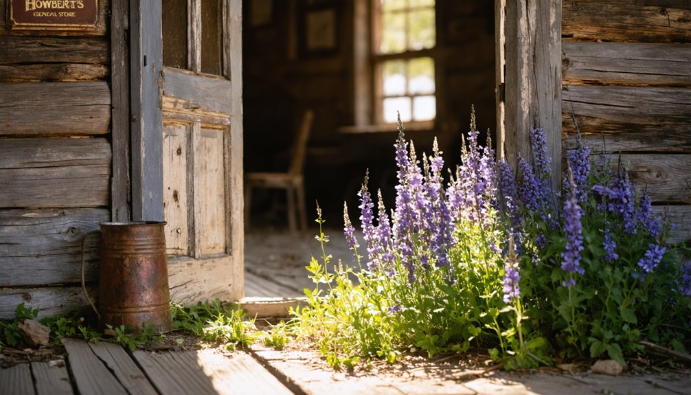
No underwater archaeology has been conducted at the submerged town site, leaving a pristine frontier settlement frozen in time. The mercantile, post office, telegraph office, and approximately 20 other buildings remain untouched by modern hands.
You’re looking at a potential treasure trove for historical preservation—though the water’s depth and conditions present significant challenges for exploration.
The unresolved question of a cemetery adds mystery to what might be discovered below. With twelve ranches and an entire community’s infrastructure beneath the surface, Howbert represents one of Colorado’s most complete—yet least documented—ghost towns, waiting for technology to reveal its secrets.
Mapping Forgotten Foundations
The waters of Lake George now veil what was once a bustling frontier settlement, yet modern mapping technologies offer glimpses into Howbert’s submerged foundations. Through underwater exploration, you can discover the ghostly outlines of the three-story mercantile, railroad station, and lumber mill that once served 100 residents.
Today’s historical mapping efforts combine sonar technology, photogrammetry, and satellite imaging with archival records to reconstruct this railroad town’s layout.
When you examine these digital recreations, you’re witnessing the preservation of Colorado’s frontier heritage—wooden structures and stone foundations that supported railroad workers, loggers, and merchants in the late 1800s.
These submerged remnants tell a greater story of western expansion, connecting you to the pioneers who established crucial links between Leadville, Colorado City, and beyond.
Relics After Flooding
When Lake George was created in 1891, it transformed Howbert’s physical legacy into a submerged archaeological site where the original settlement now rests in silent preservation.
Unlike Trinidad Lake’s visible foundations during drought periods, Howbert’s underwater discoveries remain largely undocumented.
You’ll find similarities to Stout’s fate beneath Horsetooth Reservoir—historical significance preserved only in records rather than tangible remains.
The submerged artifacts of Howbert tell a story you can’t easily access, much like Gillett’s lost post office records.
During rare instances of low water levels, you might glimpse foundations and structural remnants breaking the surface—fleeting windows into the past.
While no formal preservation efforts exist, these underwater relics endure as quiet witnesses to Colorado’s pioneer heritage, waiting for those determined enough to document their existence.
Eleven Mile Reservoir: Birth of a New Landmark

During the challenging years of the Great Depression, a monumental engineering feat began to transform the South Platte River Valley into what would become Eleven Mile Reservoir.
In 1930, eighty determined men initiated dam engineering that would forever alter Colorado’s landscape. You can still marvel at their achievement: a 151-foot high concrete arch masterfully anchored into stair-step cuts in the canyon’s granite walls.
By 1932, what was once Howbert’s valley became Colorado’s largest artificial body of water, with the South Platte River impounded behind this architectural triumph.
The reservoir ecology evolved as its capacity expanded to today’s impressive 128,000 acre-feet, creating a 3,500-acre mountain oasis at 8,567 feet elevation.
When you visit now, you’re witnessing not just water storage, but a proof of human ingenuity amid nature’s grandeur.
Howbert Point: Camping Where a Town Once Stood
Today’s peaceful campsites at Howbert Point hold a poignant secret beneath the rippling waters that lap against its shores.
You’re resting atop what was once a thriving mining community, now slumbering beneath Eleven Mile Reservoir‘s surface since the 1930s.
The campground’s 9-10 sites offer a rare blend of historical preservation and outdoor freedom at 8,576 feet elevation.
As you set up your tent or RV (accommodating lengths up to 110 feet), you’re participating in a tradition of respectful camping etiquette on hallowed ground.
While enjoying fishing, boating, or wildlife viewing, remember you’re experiencing more than just recreation—you’re connecting with Colorado’s mining heritage.
Though amenities are basic with no potable water, the panoramic reservoir views and whispers of the past make Howbert Point an unforgettable destination.
Preserving the Legacy: How Howbert Lives On Today
Though submerged beneath Eleven Mile Reservoir’s waters for nearly a century, Howbert’s legacy endures through thoughtful preservation efforts and deliberate naming traditions that honor its historical significance.
Hidden beneath the reservoir’s surface, Howbert whispers its history through carefully preserved names and traditions.
You’ll find Howbert Elementary School in Colorado Springs serving as a living memorial to Irving Howbert, bridging the gap between past and present.
The Ghost Town Club of Colorado, established in 1971, works tirelessly to document and preserve sites like Howbert, despite challenges faced by Colorado’s 1,500+ ghost towns.
Among these sites is the intriguing husted ghost town history in Colorado, which offers a glimpse into the state’s mining past and the stories of those who once called it home. Visitors to the area can walk the remnants of old buildings and imagine life during the gold rush era. Preservation efforts by local enthusiasts ensure that these forgotten places continue to inspire awe and curiosity.
Their Preservation Fund directs resources to qualified projects, counteracting the threats of development, vandalism, and decay.
While the townsite remains underwater—its cemetery location still undocumented—Howbert’s story continues through educational institutions that foster community awareness of this pioneer’s contributions to Colorado’s development.
Exploring the Underwater Ghost Town: Recreation and History Combined
Beneath the tranquil waters of Eleven Mile Reservoir lies the ghostly remnants of Howbert, Colorado, a once-thriving railway town now transformed into an underwater historical site that you can experience through recreation.
Today, you’ll find Howbert Point offering prime camping for nine vehicles, connecting you to this submerged history while enjoying modern recreational opportunities.
As you cast your line for rainbow trout or navigate your boat across the reservoir, you’re literally floating above Colorado’s pioneer past.
The clear waters that provide excellent fishing and boating conceal the streets and buildings of a community sacrificed for Denver’s water needs in 1934.
Seasonal park events sometimes illuminate this hidden heritage, allowing you to commune with both nature and history in this unique freedom-filled landscape.
Frequently Asked Questions
Were Any Artifacts Recovered From Howbert Before the Flooding?
No artifacts were recovered before Howbert’s flooding. You’d find no recorded recovery efforts or items of historical significance preserved from this submerged piece of your Western heritage.
What Happened to the Residents When the Town Was Submerged?
Remember those who called Howbert home? Most residents relocated before waters rose in 1932, dispersing to nearby communities. You’ll find their town relocation experiences varied, but nobody was forcibly evicted during this poignant chapter of heritage.
Can Divers Explore the Submerged Ruins of Howbert Today?
You can’t explore Howbert’s ruins underwater today. Diving regulations don’t permit underwater exploration of the site, and after nearly a century submerged, little of our heritage remains beneath those waters.
Did Any Buildings From Howbert Survive the Flooding?
All good things must end. You won’t find any survivor stories of buildings from Howbert—historical records confirm none escaped the deliberate flooding. Their historical significance lives only in memory now, not physical remnants.
Were There Any Supernatural Legends Associated With Howbert?
You’ll find no documented supernatural sightings connected to Howbert’s heritage. Local folklore hasn’t preserved ghost stories about this submerged settlement, unlike many of Colorado’s other liberty-loving mountain communities that vanished with time.
References
- https://janmackellcollins.wordpress.com/2024/12/29/a-fleeting-glimpse-howbert-colorado-and-a-watery-grave/
- https://www.youtube.com/watch?v=IAS6ag2HwRo
- https://en.wikipedia.org/wiki/List_of_ghost_towns_in_Colorado
- https://usrepresented.com/2023/03/19/pioneer-profiles-irving-howbert/
- https://95rockfm.com/colorados-ghost-towns-demise/
- https://en.wikipedia.org/wiki/Irving_Howbert
- https://janmackellcollins.wordpress.com/tag/cripple-creek-district/
- https://www.westsidepioneer.com/Articles/012714/HowbertObit.html
- https://history.denverlibrary.org/sites/history/files/RealPioneersColorado.pdf
- https://www.findagrave.com/memorial/16414989/irving-howbert


