You’ll find Cuervo, New Mexico alongside Interstate 40, where it began as a bustling railroad stop in 1901. During its peak in the 1930s, the town flourished with 300 residents, two churches, schools, and hotels serving Route 66 travelers. The construction of I-40 in the late 1960s split the town and led to its decline. Today, abandoned adobe structures and the historic Santo Niño de Atocha Catholic Church stand as silent witnesses to fascinating tales of southwestern ambition.
Key Takeaways
- Cuervo, New Mexico became a ghost town after Interstate 40’s construction in the 1960s split the town and diverted traffic from Route 66.
- The town peaked at 300 residents in the 1930s during Route 66’s heyday but declined dramatically after highway changes.
- Santo Niño de Atocha Catholic Church remains standing as the best-preserved structure from Cuervo’s early 1900s architecture.
- Abandoned adobe homes and buildings line dirt roads, showcasing the remnants of this once-thriving railroad and Route 66 community.
- The town’s last operational establishment, the post office, closed in September 2011, marking the final stage of Cuervo’s transformation into a ghost town.
The Rise of a Railroad Town
When the Chicago, Rock Island & Gulf Railroad expanded westward from Texas in 1901, they established Cuervo as a strategic water and supply point along their route.
You’ll find the town was named after nearby Cuervo Hill or Cuervito Peak, marking the beginning of this railroad settlement’s story.
The railroad expansion brought immediate economic growth to the area. With the opening of a post office in 1902, Cuervo quickly transformed from a simple siding into a bustling transportation hub in New Mexico Territory. By the 1910s, ranchers began settling in the area, further expanding the town’s population and economic base. The arrival of Route 66 brought new businesses like hotels and gas stations to serve travelers.
Spanish Heritage and Early Origins
Although the railroad brought Cuervo to life in 1901, the area’s Spanish heritage traces back to Francisco Cuervo y Valdes, a nobleman from Asturias, Spain who became New Mexico’s governor in 1696. His Spanish nobility credentials granted him authority to shape the region’s colonial governance through strategic settlement planning and indigenous diplomacy.
You’ll find Cuervo’s influence reflected in the area’s early economic framework, where Spanish settlers traded with Pueblo Indians using a complex barter system of horses, mules, and blankets. Life was challenging as settlers faced periods when population varied with rainfall, making agriculture and settlement growth unpredictable.
Under his leadership, settlements were designed with central plazas surrounded by churches and government buildings – a defensive layout mandated by Spanish colonial decree. His most notable achievement was founding Albuquerque in 1706, establishing a fortified villa to protect essential trade routes along the Camino Real.
Life During Cuervo’s Golden Age
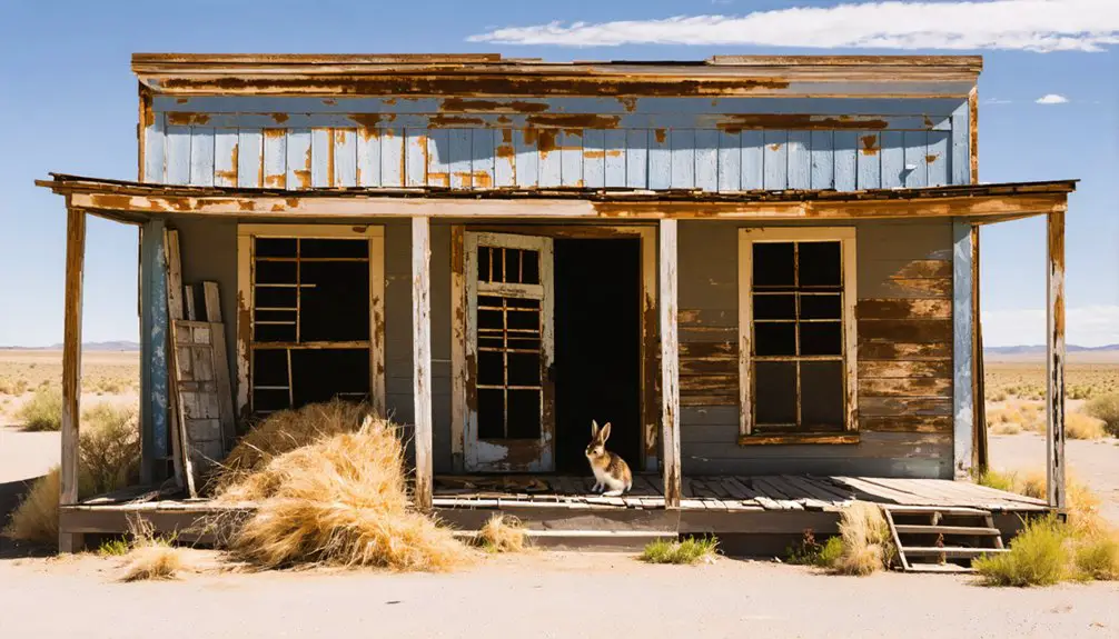
During its peak in the 1930s, Cuervo thrived as a bustling community of 300 residents, anchored by the Southern Pacific Railroad and Route 66 traffic. Daily routines centered around ranching activities, while two churches and schools served as hubs for community gatherings and education. The construction of Interstate 40 later bypassed the town completely, initiating its slow decline.
You’d find these crucial features of Cuervo’s golden age:
- Two hotels and a gas station catering to Route 66 travelers, creating a vibrant commercial atmosphere
- Adobe houses intermingled with businesses, showcasing traditional New Mexican architecture
- A post office functioning as the crucial communication link for residents and ranchers
The town’s social fabric wove together through church services, school events, and the constant flow of travelers stopping at local establishments. The local post office remained a vital part of the community until its final closure in September 2011.
Ranching formed the backbone of the economy, while the railroad and highway brought steady commerce to this desert community.
Historic Route 66 Impact and Changes
The arrival of Route 66 in 1926 marked a defining chapter in Cuervo’s history, transforming the former railroad water stop into a highway service hub.
You’d have found new gas stations, hotels, and stores catering to the steady stream of motorists, sparking a wave of economic transformation that pushed the population to nearly 300 by the early 1940s.
The town was uniquely equipped with two of everything, including schools, doctors, and churches to serve its growing population.
Yet this Route 66 nostalgia masks a more complex reality. Despite the highway’s presence, Cuervo struggled to maintain substantial tourist accommodations, and by 1946, the population had dwindled to just 128 residents.
The construction of Interstate 40 in the late 1960s dealt the final blow, physically splitting the town and diverting the crucial flow of travelers that once sustained it.
The historic Texaco gas station from the 1940s-50s still stands as a silent reminder of Cuervo’s vibrant past.
Today, you’ll find around 57 residents amid the preserved adobe buildings of this historic corridor.
Architecture and Notable Buildings
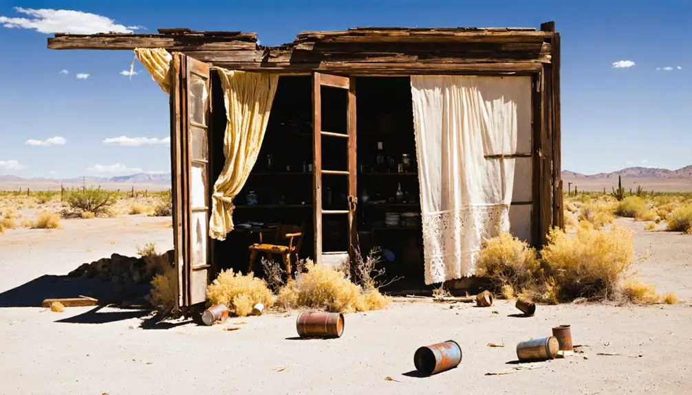
Standing as a proof of early 20th-century architectural ingenuity, Cuervo’s buildings showcase diverse construction styles ranging from red sandstone religious structures to adobe residences.
The architectural styles reflect the town’s evolution, with the Santo Niño de Atocha Catholic Church remaining the best-preserved example of early 1900s craftsmanship. An old schoolhouse with new metal roof exemplifies ongoing preservation efforts in the area. Remnants of two vintage hotels still stand as testament to the town’s bustling past.
You’ll discover three distinct building categories that define Cuervo’s landscape:
- Religious structures featuring durable building materials like red sandstone
- Residential adobe houses with distinctive features such as bead board interiors and porches
- Commercial buildings including the metal-clad Hawkins Building and various business ruins
The town’s architecture now stands divided by I-40, with most houses and schools south of the highway, while commercial structures remain scattered to the north, telling the story of infrastructure’s impact on this historic settlement.
Tales of the Supernatural
Mysterious tales and unexplained phenomena have transformed Cuervo from a simple ghost town into a hotbed of supernatural intrigue.
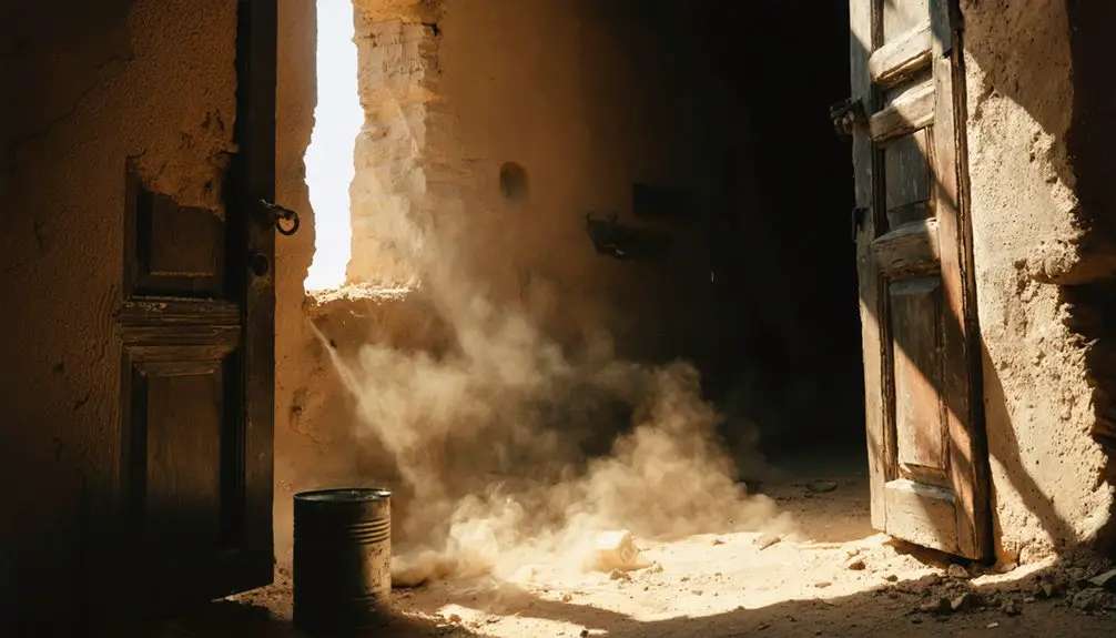
You’ll hear accounts of ghostly encounters along the dirt streets, where spectral figures roam after nightfall. Former residents’ spirits allegedly linger, leaving unexplained fingerprints on visitors’ vehicles and creating unsettling sounds throughout abandoned buildings.
The Catholic stone church, which remains standing but closed to worshippers, serves as a silent sentinel watching over the paranormal activities. The town’s supernatural legends are intensified by its physical environment. The haunting isolation is amplified by decaying adobe structures, while Interstate 40’s bisection of Cuervo in the 1960s left a perpetual sense of division.
Wind whistles through empty streets, creating ethereal voices, while sudden temperature drops add to the otherworldly atmosphere. The contrast between passing trains and the town’s deathly stillness further enhances its reputation for paranormal activity.
Interstate 40’s Role in Decline
When Interstate 40 sliced through Cuervo’s heart in the late 1960s, it dealt a devastating blow to this once-thriving New Mexico town. The highway’s construction physically split the community in two, triggering dramatic economic shifts that would forever alter its destiny.
Interstate 40’s arrival in 1960s Cuervo tore apart a thriving community, leaving a town forever divided by concrete and change.
You’ll find the impact of I-40’s arrival manifested in three distinct ways:
- Mass demolition of adobe structures and businesses to accommodate the highway’s broad corridor.
- Rapid economic decline as Route 66 traffic disappeared, forcing local establishments to shutter.
- Community disintegration as families relocated, schools closed, and social bonds unraveled.
Today, you can witness the stark reality of this transportation project’s legacy. Where a compact, vibrant town once stood, you’ll now see abandoned buildings straddling a massive interstate divide – a sobering reminder of mid-20th century highway planning’s destructive power.
The Remnants Today
Scattered across both sides of Interstate 40, Cuervo’s haunting remnants tell the story of a once-vibrant New Mexico community.
As travelers journey through the desolate landscape, they can encounter several ghost towns in New Mexico that echo the past. Each of these forgotten places offers a glimpse into the lives of those who once called them home, accompanied by poignant stories and intriguing remnants of their existence. Exploring these towns can be a haunting yet captivating experience, revealing the beauty found in their eerie silence.
The history of Chloride, New Mexico, reflects the ups and downs of mining fortunes in the region, where silver once drew hopeful prospectors. Today, remnants of its bustling past, including dilapidated structures and abandoned mine shafts, serve as silent reminders of the dreams that once flourished here. Although largely forgotten, Chloride stands as a testament to the resilience of those who sought prosperity in this unforgiving landscape.
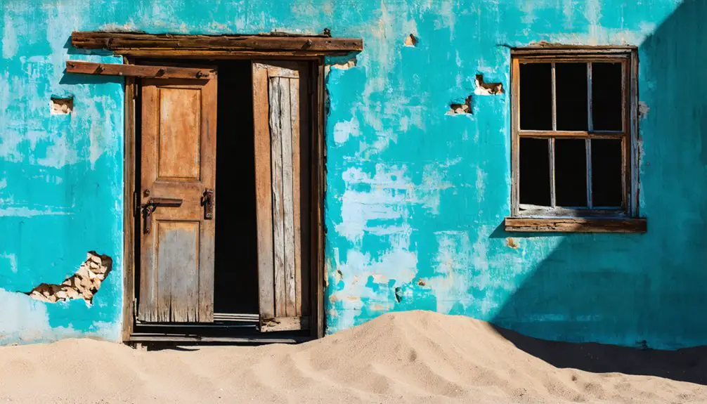
You’ll find adobe homes in various states of decay along dirt roads, with the red sandstone Santo Niño de Atocha Catholic Church standing as the town’s resilient centerpiece. For ruin exploration enthusiasts, the vintage gas station and early 20th-century buildings offer glimpses into the past, though local folklore warns of protective residents near certain structures.
While about 50 people still call this unincorporated area home, most buildings stand empty, their glassless windows and crumbling walls exposed to the elements.
The church, benefiting from recent preservation efforts, continues to host occasional services, while active railroad tracks remind visitors of Cuervo’s historic role in Southwest transportation and commerce.
Preserving a Piece of Southwest History
You’ll find the Santo Niño de Atocha Catholic Church, built in 1915 from local red sandstone, still standing as Cuervo’s most enduring landmark.
The church’s roof replacement in 2018 demonstrates ongoing preservation efforts by community members who maintain this essential piece of New Mexico’s architectural heritage.
Through photography and documentation, visitors continue to chronicle Cuervo’s remaining structures, ensuring these tangible links to Route 66 and railroad history aren’t lost to time.
Historical Buildings Stand Strong
Despite decades of abandonment, Cuervo’s historic buildings remain remarkably intact, offering visitors a well-preserved glimpse into early 20th-century Southwest architecture.
The town’s architectural styles reflect both its railroad heritage and ranching roots, with the red sandstone Santo Niño de Atocha Catholic Church standing as a symbol of community resilience since 1915.
You’ll discover three notable preservation highlights:
- Adobe houses with original beadboard interiors and shingled roofs
- The 1930s schoolhouse undergoing active renovation efforts
- The Hawkins Building with its authentic early 20th-century commercial facade and historic signage
While weathering continues to challenge these structures, their endurance showcases the durability of traditional building methods.
The town’s layout still clearly demonstrates its dual purpose as both a railroad stop and ranching community hub.
Communities Keep Stories Alive
The enduring spirit of Cuervo lives on through its small but dedicated community of residents and descendants who actively preserve the town’s rich cultural heritage.
You’ll find cultural preservation efforts centered around the Santo Niño de Atocha Catholic Church, where occasional services unite the community in spiritual gatherings.
Community storytelling thrives as locals share tales of haunting apparitions and memories of the town’s transformation after Interstate 40 split its heart.
Through oral histories, photographs, and guided tours, you’re connecting with a legacy that spans from the railroad boom of 1901 to today’s Route 66 folklore.
Local contractors maintain historic structures like the old stone schoolhouse, while residents serve as custodians of Cuervo’s narrative, ensuring these stories won’t fade into the desert winds.
Frequently Asked Questions
Are There Any Safety Concerns When Visiting the Abandoned Buildings?
Like walking through the ruins of Pompeii, you’ll face serious risks in abandoned structures – unstable floors and roofs could collapse, while wildlife encounters, sharp debris, and questionable human activity threaten your safety.
What Is the Best Time of Year to Visit Cuervo?
You’ll find the best season to explore is late September through early October, when weather conditions are moderate. Spring offers similar comfort, while you’ll want to avoid summer’s intense heat and winter’s cold.
Do You Need Special Permission to Explore the Ghost Town?
You don’t need special permission for public areas accessed from frontage roads, but respect “No Trespassing” signs and private property boundaries. Many structures require explicit owner permission for close exploration.
How Long Does a Typical Visit to Cuervo Last?
You’ll typically spend 30-60 minutes exploring this ghost town’s history and visitor experiences, with photographers taking longer. Brief roadside stops last 15 minutes, while detailed structure exploration can extend beyond an hour.
In addition to these engaging explorations, there are several historic ghost towns near Medford that offer unique insights into the region’s past. Visitors can immerse themselves in the tales of the mining era and the early settlements that defined the landscape. Each town presents a different story, making them perfect destinations for history buffs and adventurers alike.
What Photography Equipment Is Recommended for Capturing the Ghost Town Ruins?
You’ll need a DSLR or mirrorless camera with manual settings, wide-angle and prime lenses, tripod, and protective filters. Pack lens cleaning supplies and extra batteries for capturing architectural details effectively.
References
- https://www.outdoorssw.com/haunting-apparitions-of-cuervo-new-mexico
- https://pebblepirouette.com/a-ghost-town-called-cuervo/
- https://www.onlyinyourstate.com/experiences/new-mexico/ghost-town-of-cuervo-nm
- https://www.historynet.com/ghost-towns-cuervo-new-mexico/
- https://patternenergynewmexico.com/ghost-town-cuervo-new-mexico/
- https://en.wikipedia.org/wiki/Cuervo
- https://former-students.imperial.edu/16-news/pdf?dataid=ShZ70-3330&title=cuervo-new-mexico-history.pdf
- https://elchuqueno.com/city-of-dust-cuervo-new-mexico/
- https://digitalrepository.unm.edu/cgi/viewcontent.cgi?article=3220&context=nmhr
- https://www.nps.gov/parkhistory/online_books/blm/ut/29/chap3.htm