You’ll find Doseido Colony in western Wilson County, Texas at the intersection of County Roads 321 and 361, about a mile north of FM 775. This former agricultural settlement emerged in the late 1800s, with its cemetery established in 1881 serving as an essential landmark. The community thrived on cotton farming until the 1930s, supported by the San Antonio and Aransas Pass Railway. While only deteriorating structures remain today, the cemetery’s markers tell a deeper story of pioneer life.
Key Takeaways
- Doseido Colony is a former agricultural settlement in western Wilson County, Texas, located at the intersection of County Roads 321 and 361.
- The Doseido Colony Cemetery, established in 1881, serves as a key landmark and contains over 100 graves from the African American community.
- The settlement declined due to agricultural challenges, including drought, pest problems, and economic difficulties in cotton farming.
- Early settlers practiced diversified farming, with cotton dominating until the 1930s when agricultural diversification became necessary.
- The ghost town’s legacy is preserved through cemetery records, oral histories, and local preservation efforts by the Wilson County Historical Society.
The Rise and Fall of a Rural Settlement
Situated along key local roads in western Wilson County, Texas, Doseido Colony emerged as a small but promising agricultural settlement.
You’ll find its early success stemmed from family homesteads and local commerce that served the farming community along FM 775. The settlement’s community dynamics centered around tight-knit farming families who built a self-sustaining local economy. Similar to nearby Fairview, the settlement maintained a modest population of under 100 residents throughout most of its existence.
However, you’d have witnessed the town’s decline as agricultural challenges mounted. Drought, changing markets, and farm mechanization decreased profitability, while newer transportation routes bypassed the colony. Today, it stands as one of Wilson County’s 31 ghost towns.
As younger residents sought opportunities in larger cities, the remaining population dwindled. Without reinvestment or economic diversification, Doseido Colony couldn’t sustain itself.
The once-thriving settlement joined over 30 other ghost towns in Wilson County, marking the end of its brief but significant chapter in Texas rural history.
The history of Drumright, Texas ghost towns is a testament to the challenges faced by many small communities in the region. As the economy shifted and populations dwindled, these towns became mere memories, often overshadowed by larger, more prosperous cities nearby. Today, remnants of their past can still be found, inviting exploration and reflection on the lives that once thrived there.
Mapping Doseido’s Historical Location
You’ll find Doseido Colony at the intersection of County Roads 321 and 361 in western Wilson County, Texas, approximately one mile north of FM 775.
Historical records and cemetery markers along Dunn Road help pinpoint the ghost town’s exact coordinates, with the Doseido Colony Cemetery (established 1881) serving as a key reference point about 1.5 miles west of La Vernia.
The colony’s boundaries were defined by these local road networks and landmarks, creating a clear geographical footprint in this rural stretch of south-central Texas. Located at 29°20′06″N 98°09′32″W, the site remains an important marker of early settlement patterns in the region.
Local Road Intersections
At the convergence of County Roads 321 and 361, one mile north of Farm to Market Road 775, lies the most precise geographical marker for the historic Doseido Colony in western Wilson County, Texas.
You’ll find these rural roads forming a typical grid pattern characteristic of the region’s agricultural landscape. The intersection dynamics reflect the area’s farming heritage, with unpaved or lightly maintained surfaces that primarily serve local traffic. Early colonists focused on establishing sustainable agriculture practices to support the growing settlement.
While FM 775 provides the main regional access, it’s the quieter junction of CR 321 and CR 361 that serves as your gateway to Doseido’s past.
This rural access point sits amid sprawling farmland, where the roads connect scattered homesteads that once formed this pioneering community.
Historical Boundary Markers
Beyond the simple road intersections, the historical boundaries of Doseido Colony can be mapped through several key markers in western Wilson County.
You’ll find the settlement’s footprint anchored by the Doseido Colony Cemetery on Dunn Road, about 1.5 miles west of La Vernia, which serves as an essential boundary marker for understanding the ghost town’s historical extent.
- Cemetery markers dating from 1910 to the 1980s reveal the temporal boundaries of community life.
- Over 100 graves, including many unmarked sites, establish the boundary significance of this cultural landmark.
- While no official Texas Historical Commission markers exist, the cemetery’s location helps define Doseido’s original parameters through its relationship to nearby ranch lands and county roads 321 and 361.
Like other burial grounds such as the de la Zerda Cemetery that served early trading communities, the Doseido site provides crucial historical context.
The cemetery was established in 1881 as a final resting place for the African American community that once thrived in this area.
Life in Early Wilson County
In early Wilson County, you’d find settlers practicing diversified farming on small plots, with families growing both subsistence crops and limited cash crops suited to the region’s soil conditions.
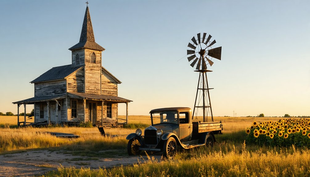
Your social connections would have centered around places like Doseido Colony’s churches and general stores, where settlers gathered not just for trade but to maintain essential community bonds. Much like the residents of semi-abandoned sites across Texas, the population gradually declined as economic opportunities shifted elsewhere.
As a farmer in these pioneer communities, you’d have relied heavily on your neighbors for everything from equipment sharing to harvest assistance, creating tightly woven social networks that helped guarantee survival in the challenging Texas frontier.
Early Farming Practices
Manual labor techniques dominated, with workers using pitchforks for peanut harvesting and threshing. Farmers relied heavily on mules and wagons for their daily operations. Cotton remained the dominant crop until pest problems and price drops in the 1930s forced diversification.
The San Antonio and Aransas Pass Railway’s arrival in 1886 opened new markets for local produce.
Family-run operations were the backbone of farming, especially in dairy enterprises like the I.B. Ray Dairy established in 1917.
Pioneer Social Networks
While early settlements in Wilson County began as isolated homesteads, they quickly developed into vibrant social networks centered around key institutions and gathering places.
You’d find pioneer gatherings taking place at churches, which served as the heart of community bonds, while schools like Lodi’s – with its 154 pupils in 1896 – fostered educational connections.
The county’s post offices, including Lodi’s established in 1858, kept you connected to the outside world. You could travel between communities by horseback or wagon along the San Antonio and La Bahia Road, stopping at camp sites to exchange news with fellow travelers.
Churches, courthouses, and ranches like Chapoya and Las Mulas became essential hubs where you’d forge lasting relationships with neighbors through shared activities and mutual support. The region’s gently undulating terrain made travel between these community gathering spots relatively easy for early settlers.
Agricultural Heritage and Economic Foundations
Located along Farm to Market Road 775 in western Wilson County, Doseido Colony emerged as a small farming and ranching settlement where families cultivated modest plots of South Texas staples like corn and cotton.
Relying on agricultural sustainability through crop rotation and livestock integration, settlers worked to maintain soil fertility despite the region’s challenging climate.
You’ll find evidence of the colony’s economic resilience in its:
- Network of family farms that shared equipment, seeds, and labor
- Strategic location near crossroads for market access and trade
- Integration of livestock breeding with crop production
The settlement’s rudimentary farming techniques and limited infrastructure ultimately proved insufficient to overcome periodic droughts and soil depletion, contributing to the community’s eventual decline into a ghost town.
The Legacy of Texas Ghost Towns
Texas ghost towns represent the nation’s richest collection of abandoned settlements, with over 500 documented sites scattered across the state’s vast landscape.
You’ll find these places serve as powerful reminders of the state’s frontier spirit, where communities once thrived before falling victim to changing economic fortunes and political decisions.
The cultural significance of these ghost towns extends beyond their physical remains. Towns like Jefferson and Shafter draw visitors with their haunting tales and reported supernatural experiences, while places like Helena maintain small populations that proudly embrace their ghost town status.
You’ll discover how these sites now function as open-air museums, hosting heritage events and reenactments that keep local history alive. Historical societies and community-led initiatives continue preserving these valuable windows into Texas’s past, ensuring their legacy endures for future generations.
Preservation Efforts and Historical Records
Despite limited physical remains, preservation efforts for Doseido Colony focus primarily on its historic Pleasant Grove Cemetery, established in 1881.
You’ll find Wilson County Historical Society and local activists like Maurine Liles working diligently to protect this essential piece of African American heritage near Floresville.
While direct founding documents are scarce, you can explore the colony’s past through various historical records:
- Wilson County Clerk’s genealogical archives containing birth, death, and marriage records
- Land documentation and property titles that trace ownership changes
- Regional histories and school projects from nearby La Vernia that provide contextual background
The preservation’s historical significance depends heavily on community involvement, as oral histories and cemetery records remain critical for understanding this former settlement’s story before memories fade into obscurity.
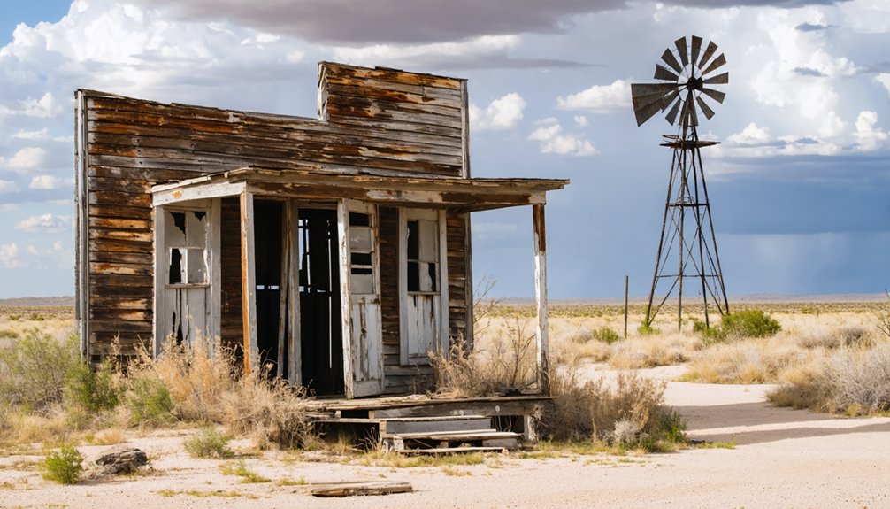
Notable Landmarks and Remnants
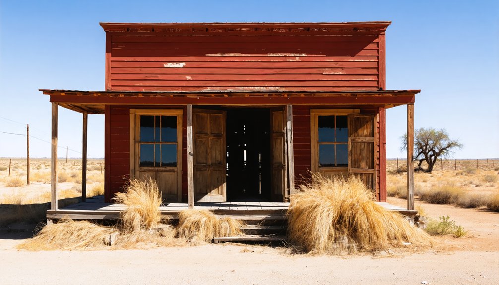
Standing at the junction of county roads 321 and 361, about a mile north of FM 775 in western Wilson County, Doseido Colony‘s remaining structures offer a glimpse into rural Texas’s past.
You’ll find deteriorating buildings scattered across the landscape, silent witnesses to the settlement’s former significance. While no detailed inventory exists of the historical artifacts that remain, you can explore what’s left of traditional farm buildings and community structures typical of early Texas settlements.
The crossroads serve as the primary landmark, marking where this once-bustling colony stood. Unlike some preserved ghost towns, Doseido’s remnants continue their slow return to the earth, unprotected by museums or caretakers, allowing you to experience an authentic piece of Wilson County’s agricultural heritage.
Frequently Asked Questions
What Indigenous Tribes Originally Inhabited the Doseido Colony Area?
You’ll find that Coahuiltecan-speaking Native Tribes primarily inhabited your region, with possible Tonkawa presence. These groups held historical significance as hunter-gatherers before European settlement displaced them from Wilson County’s lands.
Were There Any Natural Disasters That Contributed to Doseido’s Abandonment?
Like a whisper lost to time, you won’t find evidence of natural disasters causing Doseido’s demise. Historical records show no floods, tornadoes, or land depletion that directly led to abandonment.
What Was the Peak Population of Doseido Colony?
You’ll find no exact peak population records, but based on typical community dynamics and population growth patterns of similar African American farming settlements, estimates suggest several dozen to possibly a few hundred residents.
Did Doseido Colony Have Its Own School or Church?
While church gatherings were central to community life, you won’t find clear records of specific buildings. The colony likely had informal education, but there’s no documented evidence of a permanent school structure.
What Happened to the Last Family That Lived in Doseido?
You won’t find definitive records of the last family’s fate, though haunting stories persist. Like many rural Black families of that era, they likely moved to nearby towns seeking better opportunities.
References
- https://kids.kiddle.co/Doseido_Colony
- https://www.ksat.com/holidays/2018/10/30/texas-has-more-ghost-towns-than-any-other-state/
- https://en.wikipedia.org/wiki/List_of_ghost_towns_in_Texas
- https://www.wikiwand.com/en/articles/List_of_ghost_towns_in_Texas
- https://en.wikipedia.org/wiki/Doseido_Colony
- https://www.familysearch.org/en/wiki/Wilson_County
- https://www.texasescapes.com/TOWNS/Texas-Ghost-Towns-2-Central-Texas.htm
- https://www.texasescapes.com/TexasGhostTowns/DidoTexas/DidoTexas.htm
- http://genealogytrails.com/tex/southtexas/wilson/
- https://kids.kiddle.co/Wilson_County


