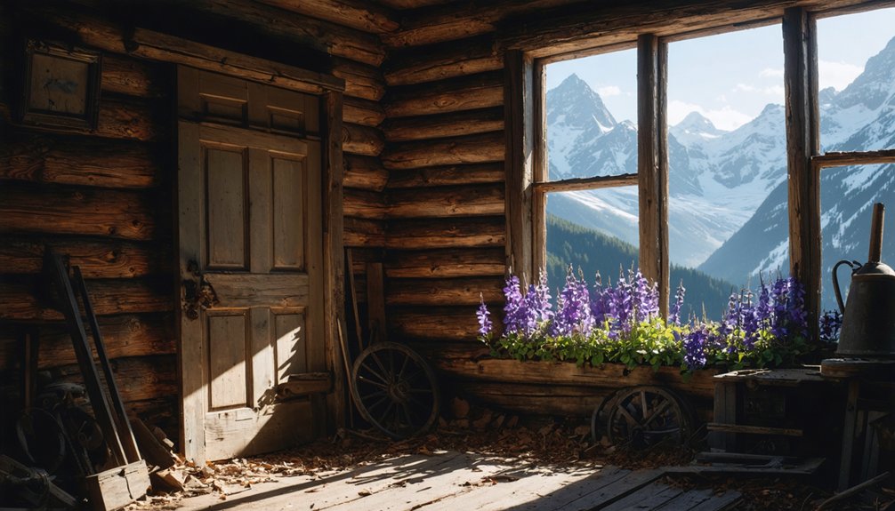
You’ll discover a haunting landscape of abandoned mining towns scattered throughout Durango’s rugged mountains, where remnants of Colorado’s silver and uranium booms still cling to windswept peaks at elevations reaching 11,500 feet above sea level. From Animas Forks’ revolutionary aerial tramway to Capitol City’s political dreams and Graysill’s radioactive uranium legacy, these ghost towns tell stories of ambition, fortune, and inevitable decline that shaped the American West’s mining heritage.
Key Takeaways
- Durango, Colorado features several historic ghost towns that showcase the region’s rich mining heritage from the late 1800s.
- Animas Forks, located at 11,500 feet elevation, was a silver mining town established in 1873 with 450 residents.
- Capitol City was founded in 1877 with dreams of becoming Colorado’s capital, peaking at 800 residents before decline.
- The Red Mountain District and Graysill Mines represent major mining operations, including Cold War-era uranium extraction through 1963.
- Visitors should exercise extreme caution due to radioactive contamination, unstable structures, and high-altitude weather conditions.
Animas Forks: High-Altitude Silver Mining Legacy
Perched at an oxygen-thin 11,500 feet above sea level, Animas Forks stands as a monument to human determination in one of Colorado’s most unforgiving landscapes.
You’ll discover a town where prospectors struck gold and silver in 1873, transforming three converging streams into a bustling camp of 450 souls by 1876.
The mining techniques here were revolutionary—the Gold Prince Mill’s 100 stamps could process 500 tons daily, while a 12,600-foot aerial tramway defied gravity itself.
Revolutionary engineering soared through mountain air—100 thundering stamps crushing ore while an impossible tramway conquered the peaks themselves.
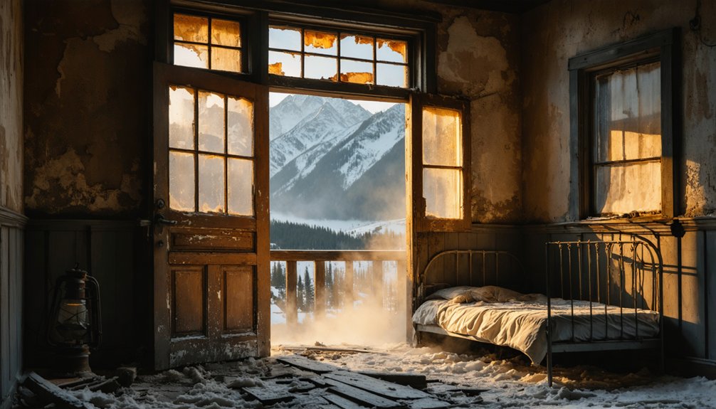
The historical significance runs deeper than the mines; this was America’s pursuit of freedom embodied in pickaxe and dynamite. The town’s resilience was tested when a devastating blizzard in 1884 buried buildings under 25 feet of snow, forcing most residents to flee to lower elevations. Today, visitors can reach this well-preserved ghost town through jeep tours from nearby Silverton, making the challenging journey accessible to those seeking to explore Colorado’s mining heritage.
Though avalanches, fires, and market crashes ultimately claimed victory, the skeletal remains whisper tales of those who dared chase dreams above the clouds.
Capitol City: The Boomtown That Dreamed of Being Colorado’s Capital
While most mining camps dreamed of striking it rich, George Lee had grander visions when he founded Capitol City in 1877—he wanted to relocate Colorado’s entire government to his high-altitude settlement at 9,480 feet.
Lee’s Capitol ambitions seemed achievable during the town’s peak year when 800 residents populated his 200-acre townsite. He built a two-story mansion, established smelters, and created the infrastructure befitting a future state capital. The town originally operated under the name Galena City before Lee renamed it to reflect his political aspirations.
However, his dreams crumbled when silver prices plummeted after 1877, triggering the town’s mining decline. The post office discontinued in October 1920, marking the end of the town’s official services.
You’ll find Capitol City’s remnants nine miles west of Lake City today:
- Two surviving structures: the restored U.S. Post Office and Lee’s Smelter Stack
- Accessible via Engineer Pass Road during warmer months
- Located along the scenic Alpine Loop Byway
- Nature has reclaimed most of the ambitious townsite
Eureka and Red Mountain District: Railroad-Era Mining Corridor
Unlike the grand political aspirations that drove Capitol City’s founder, the Red Mountain District emerged from more practical concerns—getting precious metals out of some of Colorado’s most treacherous terrain.
You’ll find this wasn’t some overnight success story. John Robinson’s 1882 discovery of the Yankee Girl Mine triggered the real boom, but gold had been sitting there since the 1870s, waiting for someone brave enough to tackle those brutal winters.
The game-changer came with railroad expansion. When that first train chugged into Red Mountain Town on September 17, 1888, everything shifted. Otto Mears established the Silverton Railroad, nicknamed The Rainbow Route, to facilitate transport through this challenging mountain terrain.
Suddenly, you could ship medium and low-grade ore to distant smelters. Mining innovations followed, with the Sunnyside Mine eventually becoming Colorado’s largest gold operation, extracting over seven million tons across 118 years. The town of Eureka established itself along the Animas River, becoming one of the few mining communities that remained operational through the harsh winter months.
Graysill Mines: Uranium Rush Remnants From the Atomic Age
You’ll find Graysill’s haunting remnants tucked three-quarters up Bolam Pass, where uranium fever gripped 450 desperate prospectors during the Cold War’s frantic race for atomic materials.
When operations abruptly ceased in 1963, they left behind more than crumbling buildings and rusted equipment—radioactive contamination from radon gas exposure forced miners to abandon their claims overnight.
Before you explore this ghostly memorial to the Atomic Age, understand that lingering radiation hazards demand serious safety precautions around the abandoned mine shafts and processing areas. The uranium rush that began in 1945 transformed this remote location into a bustling mining operation as prospectors armed with Jeeps and Geiger counters scoured the Four Corners region for radioactive riches.
Today, Graysill makes a convenient stop for adventurous travelers journeying between Durango and Silverton who seek to witness this chilling chapter of atomic-era history.
Cold War Mining Boom
As the dust settled from World War II, a new kind of gold rush swept across the Four Corners region—but this time, prospectors weren’t searching for precious metals with pickaxes and pans.
Instead, they carried Geiger counters and drove Jeeps through rugged terrain, hunting uranium to fuel America’s atomic power ambitions. The uranium rush transformed sleepy mining camps like Graysill into bustling operations almost overnight.
You’ll find this Cold War-era boom fascinating when you consider how rapidly it reshaped the landscape. Scientists had revealed atomic energy’s potential, and the nation desperately needed uranium ore to maintain its nuclear edge during an increasingly tense geopolitical climate.
The mines extracted valuable ore that was processed at facilities in Durango, where workers separated yellow cake uranium from red cake vanadium in specialized mills. A forgotten tank car from the earlier Vanadium Mill operations was repurposed to supply water for the Graysill Mine during this uranium boom period.
- 450 working claims sprouted around Graysill during peak uranium fever
- Prospectors abandoned traditional mining for high-tech Geiger counter exploration
- Operations shipped 3,000 tons of uranium ore annually at their height
- Mining ceased abruptly between 1953-1963 as demand shifted
Radioactive Legacy Concerns
When you explore the abandoned Graysill mines today, you’re walking through one of America’s most dangerous radioactive legacies—a silent monument to the atomic age that continues threatening visitors decades after the last uranium cart rolled out in 1963.
The invisible menace here isn’t just historical—it’s actively poisoning the air you breathe through odorless, tasteless radon gas seeping from fractured rock.
This uranium mining operation helped fuel WWII’s Manhattan Project, extracting the raw materials that became atomic bombs.
But the government’s secrecy left miners and communities unaware of radioactive contamination’s true dangers.
Today, you’ll find crumbling infrastructure where 450 claims once operated, producing over 200 tons of uranium ore.
The radioactive waste remains, making these ghost towns genuinely haunted by atomic-age consequences.
Visiting Safety Precautions
Protecting yourself at Graysill requires more than just acknowledging the radioactive dangers—it demands careful planning and the right equipment before you even start your engine.
Your safety gear should include a radiation detector, first aid kit, emergency beacon, and extra water for the 10,879-foot elevation.
Wildlife awareness becomes essential in this backcountry location where bears and mountain lions roam freely. Those mysterious metal clinking sounds from abandoned mine shafts aren’t just eerie—they signal unstable structures ready to collapse.
Important precautions include:
- Never enter abandoned mine entrances or approach deteriorating buildings
- Travel with multiple vehicles and inform others of your route
- Pack emergency supplies for sudden weather changes at high altitude
- Maintain safe distances from ore processing remnants and tailings piles
Mesa Verde Region: Ancient Puebloan Ghost Landscapes
Nearly 5,000 archaeological sites scatter across Mesa Verde National Park’s mesas and canyons, creating what’s perhaps the most haunting ghost landscape in the American Southwest.
You’ll witness the archaeological significance of these abandoned Ancestral Puebloan settlements, where entire communities vanished around 1300 CE after seven centuries of occupation.
Walking among the 600 cliff dwellings feels like stepping through time itself. You’ll discover sophisticated masonry structures built into natural alcoves, from single storage rooms to Cliff Palace’s sprawling 115-room complex.
The silence here carries weight—these weren’t gradual departures but rapid abandonments that left behind grinding stones, pottery shards, and perfectly preserved timber beams.
Unlike frontier boom towns that collapsed from economic shifts, these ancient ghost settlements represent something far more mysterious: an entire civilization’s exodus into the unknown.
Planning Your Ghost Town Adventure: Access, Safety, and Preservation
Before you set out to explore Durango’s ghost towns, you’ll need to understand that these adventures aren’t your typical weekend drives—they’re expeditions into Colorado’s most remote and challenging terrain.
As you explore ghost towns in Colorado, be prepared for unexpected weather changes and rugged paths that may require a high-clearance vehicle. Each site offers a glimpse into the past, where the remnants of mining operations and abandoned structures tell the stories of those who once called these towns home. Don’t forget to bring your camera; the breathtaking landscapes surrounding these ghost towns are just as captivating as the history they hold.
Ghost town access requires serious preparation. Animas Forks sits at 11,200 feet elevation, demanding four-wheel drive vehicles and high-altitude readiness. The Alpine Loop Back Country Byway isn’t forgiving—pack thermoses, supplies, and budget two hours each way from Durango-area resorts.
These aren’t casual Sunday drives—reaching Animas Forks demands serious four-wheel drive preparation and high-altitude expedition mindset.
Preservation efforts have protected these historical treasures for adventurous souls like yourself:
- Animas Forks earned National Register of Historic Places status with remarkable ruins intact
- Capitol City’s 1920 post office structure still stands as evidence of frontier determination
- Alta’s original cabins survived decades of harsh mountain winters
- Ghost Walk Durango actively maintains Southwest Colorado’s mining heritage
Freedom seekers respect these fragile remnants while exploring responsibly.
Frequently Asked Questions
Can I Camp Overnight Near the Ghost Towns or Are There Restrictions?
You’ll face a maze of camping regulations! Public lands allow dispersed camping with restrictions, but private ghost-town sites absolutely prohibit overnight stays. Check overnight permits and land ownership boundaries before setting up camp.
What’s the Best Time of Year to Photograph These Historic Sites?
You’ll capture stunning shots during October’s fall foliage peak when aspens dance around Ironton, or brave winter snow at high-elevation Alta for dramatic contrast against mining ruins and Wilson Peak’s majestic backdrop.
Are Ghost Tours or Paranormal Investigations Allowed at These Locations?
Like shadows dancing through abandoned doorframes, you won’t find organized ghost tours or paranormal investigations at Durango’s ghost towns. Their historical significance remains preserved through self-guided exploration, keeping ghostly encounters personal and unstructured.
How Much Does It Cost to Visit Each Ghost Town Site?
Most sites have no entrance fees, but you’ll spend $90-200 for guided tours reaching remote locations like Animas Forks. I’ve found 4WD rentals and ghost tours cost extra beyond free site access.
Can I Bring My Dog to Explore the Ghost Town Ruins?
You’ll likely find no explicit dog friendly policies posted at these remote sites, though pet safety becomes essential at 11,500-foot elevations where terrain challenges both you and your adventurous companion exploring crumbling structures.
References
- https://www.durango.com/colorado-ghost-towns/
- https://vacationdurango.com/blog/ghost-towns-near-durango-co/
- https://lizzie-borden.com/ghost-tours/durango/
- https://www.durango.org/blog/post/mysteries-in-history-understanding-southwestern-ghost-stories/
- https://www.uncovercolorado.com/ghost-towns/
- https://durangotourbase.com/travel-tips/durangos-historical-sites-a-step-back-in-time
- https://www.durangoco.gov/274/History
- https://www.colorado.com/articles/colorado-ghost-towns
- https://www.durangorivertrippers.com/blog/exploring-colorado-ghost-towns/
- https://www.durango.com/animas-forks/


