When exploring America’s flooded ghost towns, you’ll discover communities submerged between the 1920s-1970s for hydroelectric dams and water management projects. Notable examples include St. Thomas, Nevada and numerous Tennessee Valley Authority sites like Loyston. During droughts, receding waters reveal foundations, roads, and architectural remnants. Bring underwater cameras during low water periods, as these submerged landscapes offer glimpses into a disappeared chapter of American history waiting beneath the surface.
Key Takeaways
- Towns like St. Thomas, Nevada, and Loyston, Tennessee were submerged during infrastructure projects from the 1920s-1970s.
- Drought conditions occasionally reveal submerged structures, allowing for temporary exploration of foundations and architectural remains.
- Historical documentation efforts include photographs, surveys, and grave relocation records that help preserve these lost communities.
- Former residents and their descendants maintain connections through reunions and historical societies dedicated to submerged towns.
- Underwater archaeological sites offer unique glimpses into early 20th-century American town planning and construction techniques.
The History and Legacy of America’s Submerged Towns
While America’s ghost towns often evoke images of abandoned mining settlements or frontier outposts lost to economic decline, a more haunting category exists beneath the rippling surfaces of America’s lakes and reservoirs.
These submerged communities, sacrificed primarily between the 1920s and 1970s, were deliberately flooded for hydroelectric power, irrigation, and flood control projects. Towns like St. Thomas, Nevada (submerged in the 1930s) and Andersonville at the fork of the Seneca and Tugaloo rivers represent profound cultural significance lost to national infrastructure priorities. The people of Proctor, NC lost not only their homes but also access to family cemeteries when Fontana Dam was completed in 1944.
Native American communities bore disproportionate impacts, with settlements like Elbowoods and crucial fishing grounds at Celilo Falls vanishing underwater. The relocation of 325 families from Elbowoods devastated the Hidatsa, Mandan, and Arikara tribes when the Garrison Dam flooded their land in 1953.
The environmental impact extends beyond displaced populations—during droughts, these underwater ghost towns occasionally reveal themselves, offering glimpses into America’s drowned history.
Explorations of these submerged ghost towns in Texas transport visitors to a time when bustling communities thrived above the water’s surface. Artifacts from a bygone era emerge, telling stories of resilience and loss, as nature reclaims what was once vibrant life. Each visit becomes a haunting reminder of the delicate balance between human progress and environmental preservation.
Forgotten Communities of the Tennessee Valley Authority Projects
In the shadow of TVA’s ambitious hydroelectric development, you’ll find Norris Dam‘s controversial legacy of displacement, with communities like Loyston completely submerged beneath its waters.
The relocation efforts often involved moving not only living residents but also the deceased, as evidenced by the transfer of nearly 1,300 graves from Butler before Watauga Lake’s creation in 1948.
Despite physical erasure, these communities maintain their cultural identity through museums and annual commemorations like Butler Day, demonstrating how displaced populations adapt to preserve their heritage even after their original towns vanish from the landscape.
Many communities were originally established near rivers for their fertile farmland and resources, which ironically made them targets for TVA’s dam construction projects.
Douglas Dam construction on the French Broad River during World War II was a particularly controversial project that contributed to the displacement of additional families in East Tennessee.
Norris Dam’s Sunken Legacy
Beneath the placid waters of Norris Lake lies a submerged legacy of communities sacrificed for progress during America’s Great Depression.
When the TVA completed Norris Dam in the 1930s, it didn’t just control floods and generate power—it erased entire towns from the map. Over 3,000 families were displaced as the government exercised eminent domain across more than a million acres.
Towns like Loyston and Big Barren disappeared completely, their churches, schools, and businesses ceased to exist. The cultural erosion was profound, with over 2,000 graves relocated from ancestral resting places. Psychological impacts were severe, with some displaced residents experiencing mental health crises after losing generational connections to their land. The forced relocation resulted in the formation of New Lyston on higher ground as residents maintained their community spirit despite displacement.
You’d find resistance in stories like William Henry Hawkins, who fought against surrendering his homestead. While the dam created new opportunities through improved navigation and tourism, it permanently altered both landscapes and lives in the Tennessee Valley.
Relocated Communities Endure
Despite the physical erasure of their homes and land, communities displaced by the Tennessee Valley Authority have persevered through collective memory and documentation.
You’ll find evidence of this community resilience in the numerous reunions formed by descendants of the 2,890 displaced families, particularly those from Loyston where 991 families were uprooted.
The scale of displacement—1,262 land tracts across multiple states and 5,226 reinterred graves—represents one of America’s largest peacetime relocations.
Cultural preservation continues through meticulous archives including grave removal files, population relocation records, and virtual cemeteries.
Several families like the Andrews had their deceased loved ones moved to cemeteries that wouldn’t be affected by the flooding, ensuring continuity of their family history despite displacement.
While entire towns now lie submerged beneath reservoirs, their legacies endure through historical societies and digital repositories.
The “Great Exodus” may have dispersed generations-long rural networks, but the communities’ stories remain alive—underwater yet unforgotten.
The TVA project required the acquisition of 152,000 acres for the creation of lake basins, forever altering the landscape and communities that once thrived there.
Last Days: How Residents Faced Inevitable Displacement

When government officials arrived to announce the imminent flooding of towns for reservoir creation, you’d find families facing an impossible choice between accepting compensation or fighting a losing battle against federal agencies.
Your ancestral home, perhaps established generations ago like those in Massachusetts’ Swift River Valley, would soon vanish beneath rising waters regardless of your protest or acceptance.
You might respond like Hugh Lord of Saint Thomas who, rather than surrender his property intact, stayed until the last possible moment before burning his house down—a final act of defiance against forces that prioritized regional energy needs over community preservation.
In Georgia, residents of Etowah witnessed the complete transformation of their once thriving industrial town into a submerged landscape beneath the Allatoona Dam project in 1949.
In the case of the Garrison Dam, over 325 families were reluctantly relocated by the Corps of Engineers, forever changing their connection to ancestral lands and cultural heritage.
Government Versus Citizens
As federal projects transformed America’s landscape throughout the 20th century, numerous communities faced the grim reality of government-mandated displacement, creating a contentious power dynamic between state authority and citizen rights.
Federal agencies like the Army Corps of Engineers and TVA often prioritized infrastructure goals over citizen welfare, leaving unfulfilled promises in their wake.
The patterns of conflict between government and displaced citizens revealed:
- Chronic inadequacy of buyout programs that left residents stranded in flood-prone areas
- Destruction of cultural heritage sites with minimal compensation, especially for Native American tribes
- Broken promises regarding cemetery access and infrastructure replacement
This systemic failure of government accountability stands in stark contrast to citizen resilience, as communities fought to maintain their identities despite the erasure of their physical towns from both landscapes and official records.
Abandoning Ancestral Roots
The final days of condemned towns revealed the profound human cost of government displacement policies through intensely personal struggles of those facing imminent erasure. You’d have witnessed residents like Hugh Lord defiantly setting fire to their homes before departing by boat—a final act of agency amid forced cultural dislocation.
The emotional grief manifested differently across generations, with elderly citizens bearing the heaviest burden after losing ancestral connections spanning over a century.
You’d have observed entire communities fractured as tight-knit settlements like Robinson Bend scattered permanently, their social fabric irreparably torn. Family cemeteries were either relocated or abandoned beneath rising waters, severing spiritual connections to place.
The certainty of impending loss created a collective trauma as residents watched their identities, histories, and cultural heritage disappear beneath manufactured lakes.
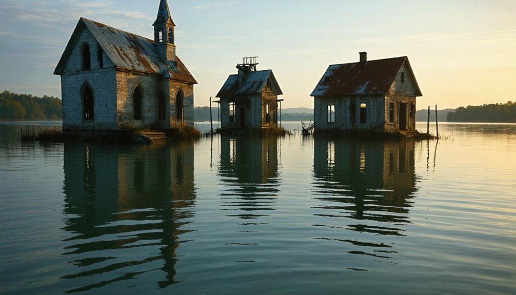
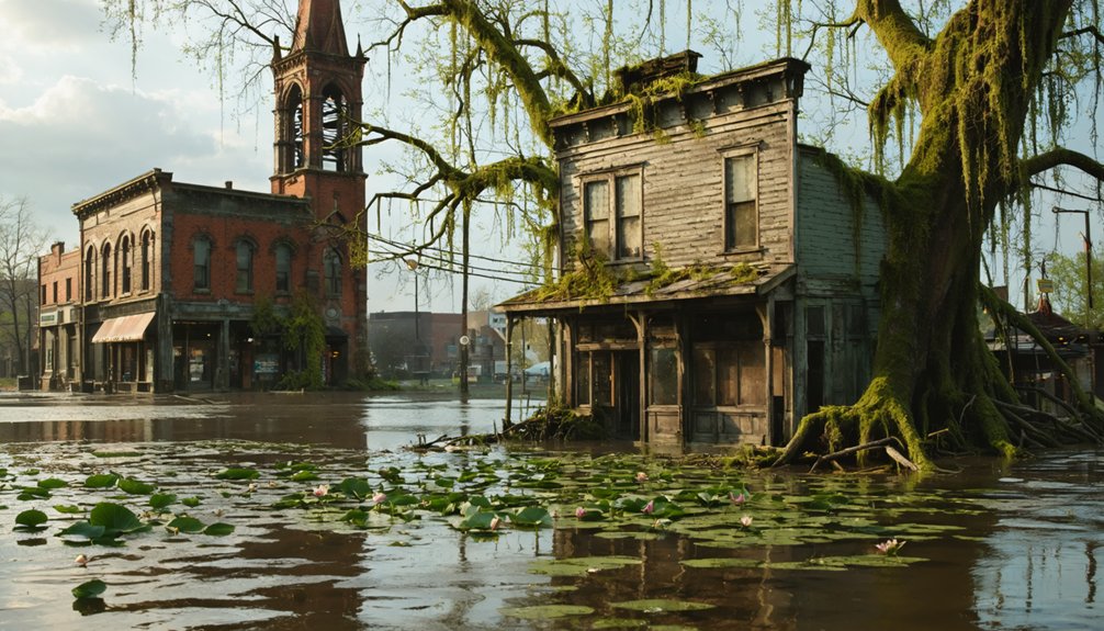
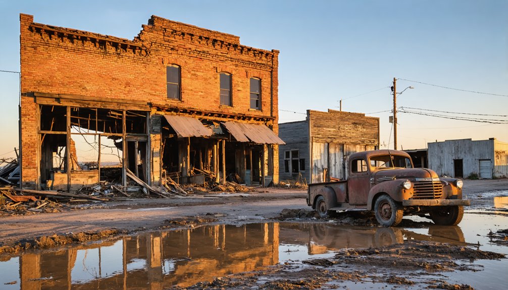
Beneath the Surface: What Remains When Waters Recede
Many submerged towns lie hidden beneath America’s reservoirs and artificial lakes, preserving a unique underwater archaeological record of communities sacrificed for water management infrastructure.
When drought conditions cause water levels to recede, you’ll witness the ghostly reemergence of these settlements, revealing their historical significance through underwater artifacts suddenly exposed to air again.
Saint Thomas offers a striking example, where structures submerged under 70 feet of Lake Mead water since 1938 became visible again in 2002.
The receding waters reveal:
These underwater ghosts emerge from the depths, telling forgotten stories through their silent ruins.
- Foundations of homes, schools, and businesses once bustling with life
- Architectural remnants of churches, hardware stores, and other community structures
- Settlement patterns that showcase early 20th-century American town planning
These glimpses into the past remind us of the communities displaced by massive infrastructure projects decades ago.
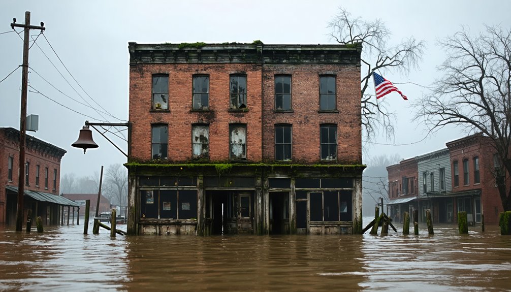
The Price of Progress: Weighing Water Management Against Heritage

Water management infrastructure projects throughout America’s history have repeatedly presented communities with an impossible choice: sacrifice their homes and heritage for the greater good of resource security and economic development.
These decisions disproportionately affected low-income and minority populations, who bore the burden of displacement without adequate compensation or preservation efforts. The systematic erasure of towns like Loyston and Noeton reflects a prioritization of progress over cultural reclamation.
This imbalance continues today through “ghost streams” and buried wetlands that increase flood vulnerability in historically redlined neighborhoods.
True community resilience requires acknowledging these inequities and incorporating hidden hydrology into modern planning. The loss extends beyond physical structures—it erases collective memory and cultural continuity, challenging us to question whether such trade-offs were ever truly necessary.
Preserving Memory: Documentation of Lost River Communities
While physical structures of river communities succumbed to rising waters, their memory persists through systematic documentation efforts spanning multiple generations and evolving technologies. Government agencies preserved official records through thorough photographic archives, boundary documentation, and engineering surveys that precisely mapped these settlements before their inundation.
Visual documentation efforts like Lewis Hine’s photography of pre-flooded Loyston and the collaborative Atlas of Drowned Towns project serve as critical historical testimonies of these lost places.
Community storytelling continues through:
- Social media groups like “What Went Under” where descendants identify relatives in historical photographs
- Crowdsourced genealogical information from local commenters
- Digital archives connecting displaced families with visual records of ancestral homes
Archaeological expeditions and mudlarking in ghost town riverbeds further reveal material culture, recovering artifacts that enrich our understanding of these submerged histories.
When Drought Reveals the Past: Modern Glimpses of Underwater Towns
As climate change intensifies drought patterns across America’s reservoir systems, receding waters have offered archaeologists and historians unprecedented access to submerged towns that vanished beneath dam projects of the early-to-mid 20th century.
You can witness this submerged heritage firsthand when visiting St. Thomas, Nevada, where drought effects have exposed school foundations and the Gentry Hotel since 2002.
Similar discoveries occurred at Old Bluffton, Texas, when Lake Buchanan’s levels dropped 26 feet in 2009, prompting formal archaeological excavation. The Texas Historical Commission documented structures normally hidden under 30 feet of water.
At Lake Mead, receding waters have disclosed approximately forty buildings from the Mormon settlement purposefully flooded in 1938, while Lake Texoma’s drought-exposed shorelines have revealed gravestones and foundations from multiple communities sacrificed for reservoir creation in 1944.
Frequently Asked Questions
Can Divers Legally Explore and Photograph Submerged Town Structures?
Over 40% of submerged towns require permits. You’ll need authorization from managing agencies to legally dive, with diver safety regulations protecting both you and submerged structure preservation from environmental or historical damage.
Were Residents Fairly Compensated for Their Properties Before Flooding?
You’ll find compensation varied widely, with many residents receiving below-market property valuations. Compensation disputes frequently arose as government buyouts often failed to enable relocation to comparable housing elsewhere.
How Has Fish Habitat Been Affected by Underwater Structures?
Would you believe the paradox? Underwater structures have greatly increased fish species abundance while creating complex ecosystems. You’ll find these structures enable habitat restoration by providing shelter and enhancing food availability across trophic levels.
What Psychological Impacts Did Displacement Have on Former Residents?
You’ll experience elevated rates of depression, PTSD, and anxiety when displaced. Your identity crisis stems from lost community connections, while memory loss emerges from trauma. Housing instability further exacerbates your psychological distress.
Are There Annual Commemorative Events for Submerged Communities?
You’ll find local annual festivals for drowned towns like St. Thomas, where reunions occurred during droughts. Community remembrance activities also include jamborees in Oregon and visits to memorial cemeteries where graves were relocated.
References
- https://www.tnmagazine.org/tennessees-underwater-ghost-towns/
- https://www.thewanderingappalachian.com/post/the-underwater-towns-of-appalachia
- https://www.traceyourpast.com/newsletters/ghost-towns
- https://clui.org/newsletter/spring-2005/immersed-remains-towns-submerged-america
- https://cedarbayoumarina.com/four-ghost-towns-under-lake-texoma/
- https://www.geotab.com/ghost-towns/
- https://www.youtube.com/watch?v=E0mfoxW3XIs
- https://en.wikipedia.org/wiki/List_of_flooded_towns_in_the_United_States
- https://www.neh.gov/article/atlas-drowned-towns
- https://www.youtube.com/watch?v=JnIIQymTY3w