You’ll discover Virginia’s most famous ghost towns span from colonial settlements to industrial failures. Jamestown, established in 1607, declined after losing capital status in 1699. Henricus, founded in 1611, was abandoned following the 1622 Indian Massacre. George Washington’s Matildaville represented failed canal ambitions from the 1780s. Union Level lost its railroad hub status after the Civil War. Wash Woods thrived until harsh weather reclaimed it in the 1930s. These sites reveal centuries of Virginia’s evolving story.
Key Takeaways
- Jamestown, America’s first English settlement established in 1607, declined after 1699 when Williamsburg became Virginia’s capital.
- Henricus, founded in 1611 as England’s second Virginia settlement, was permanently abandoned following the devastating 1622 Indian Massacre.
- Matildaville was George Washington’s failed industrial town built around his ambitious Potomac-Ohio river canal project that collapsed by 1828.
- Wash Woods thrived as a coastal community of shipwreck survivors until harsh weather reclaimed the settlement in the 1930s.
- Colchester served as a prosperous colonial tobacco port established in 1753 before becoming an archaeological site along the Occoquan River.
Jamestown: America’s First English Settlement
On May 4, 1607, three English ships—the Susan Constant, Godspeed, and Discovery—delivered 104 settlers to the northeast bank of the James River, establishing what would become America’s first permanent English settlement.
You’ll find Jamestown’s location strategically chosen for deep water anchorage and defense against Spanish threats, situated 2.5 miles southwest of present-day Williamsburg.
Colonial governance began immediately with a seven-member council electing Captain Edward Maria Wingfield as president.
The newly arrived English colonists wasted no time establishing formal leadership, immediately forming their governing council and selecting their first president.
However, you’d discover the settlement faced devastating challenges. Indigenous relations turned hostile within days as Powhatan warriors attacked, forcing rapid fort construction. The 1622 uprising killed over 300 colonists, destroying one-third of the English population. The brutal winter of 1609-10, known as the starving time, reduced the population from 300 settlers to merely 60 survivors.
Despite introducing representative government in 1619 and establishing tobacco cultivation, Jamestown declined after 1699 when Williamsburg became Virginia’s new capital. Today, the name Jamestown encompasses various locations and historical sites across different geographical contexts, reflecting its enduring significance in American colonial history.
Henricus: The Lost River Settlement
You’ll find that Sir Thomas Dale‘s ambitious vision for Henricus in 1611 represented a calculated military and colonial strategy to establish England’s second permanent foothold in Virginia’s interior.
Dale positioned this fortified settlement twelve miles southeast of modern Richmond as both a defensive bulwark against Spanish threats and a launching point for further expansion into Powhatan territory. The colony featured Mount Malady, America’s first colonial hospital, built across the river to treat settlers suffering from the harsh conditions of frontier life.
The settlement gained additional prominence when Pocahontas underwent Christian conversion at Henricus before her marriage to John Rolfe in 1614. However, you’ll discover that this carefully planned river settlement met its violent end during the 1622 Indian Massacre, when Opchanacanough’s coordinated assault destroyed the colony and forced its permanent abandonment.
Dale’s Vision and Planning
Ambition drove Sir Thomas Dale to envision a safer alternative to Jamestown’s precarious swampy location when he established Henricus in 1611.
You’ll discover that Dale’s strategies focused on positioning the settlement inland where Spanish warships couldn’t penetrate through Virginia’s dense forests. He selected former Arrohateck tribal land along the James River’s curl, deliberately placing it beyond enemy cannon range while maintaining river access for supplies.
Dale’s thorough planning included constructing a seven-acre fort under martial law and digging the Dutch Gap channel to improve navigation. The settlement featured defensive structures including palisades, watchtowers, a church, and storehouses to protect the colonists. Dale instituted martial law to establish order and ensure the swift construction of essential infrastructure within the settlement.
His colonial expansion blueprint encompassed four strategic settlements: Jamestown, Kecoughtan, Henrico, and Charles City. This network would establish English control throughout the Virginia interior, creating refuge from Spanish patrols while opening pathways for future private plantations and independent governance.
Massacre and Abandonment
While Dale’s ambitious vision took shape along the James River, the foundation of Henricus came at a devastating cost to the Arrohateck tribe who’d inhabited these fertile lands for generations.
Sir Thomas Dale attacked and slaughtered many Arrohateck to secure the strategic location, establishing Henricus directly opposite their village during the First Powhatan War (1610-1614).
The settlement faced constant threats from Arrohateck resistance and broader Powhatan conflict:
- Continuous harassment during the initial march and early settlement phases
- Temporary peace following Pocahontas’s marriage to John Rolfe in 1614
- Complete destruction during the 1622 Indian Massacre led by Opchanacanough
The Second Powhatan War proved devastating.
Twenty-two colonists died, including seventeen at the college lands.
Governor Sir Francis Wyatt ordered survivors to Jamestown, permanently abandoning Henricus.
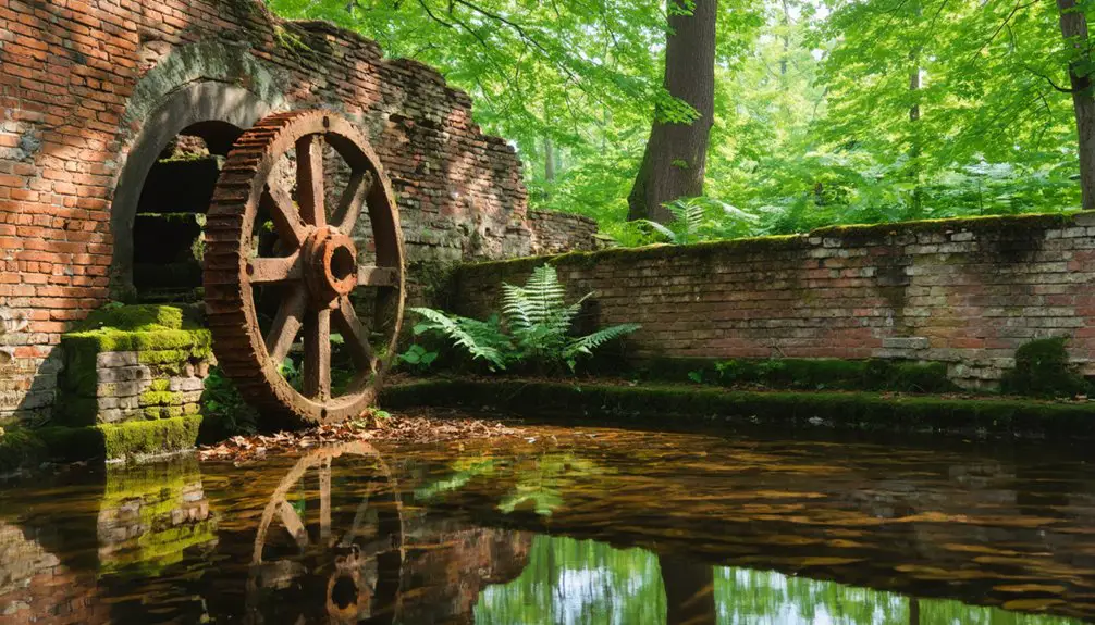
Matildaville: Washington’s Failed Industrial Dream
You’ll find George Washington’s most ambitious infrastructure project transformed from grand canal vision to abandoned ruins in just fifty years.
Washington himself served as the Patowmack Company’s first president, dreaming of connecting the Potomac and Ohio rivers through an elaborate lock system that would make Great Falls navigable.
What began as an engineering marvel in 1785 became a financial disaster by 1828, leaving behind the ghost town of Matildaville as a monument to early America’s industrial overreach. The town once featured a thriving market and foundry before construction costs spiraled beyond control.
Named after Light Horse Harry Lee’s wife, Matildaville served as the company’s headquarters during its brief operational period.
Washington’s Ambitious Canal Vision
Before the American presidency consumed his attention, George Washington championed one of the young nation’s most ambitious infrastructure projects—a canal system connecting the Potomac and Ohio rivers that would transform American commerce.
Washington served as president of the Patowmack Canal Company, chartered in 1785, until his 1789 election pulled him toward greater responsibilities.
You can envision the scope of Washington’s canal engineering ambitions through these impressive specifications:
- A 3/4-mile canal carved around Great Falls featuring five locks and holding basin
- A massive 1,200-foot wing dam extending into the Potomac to channel water flow
- Two protective guard gates controlling water levels and navigation access
Though Washington died in 1799—two years before the canal’s 1802 completion—his vision pioneered American waterway development. The project established Matildaville as a thriving industrial town that served as headquarters for canal operations and housed workers alongside essential facilities like markets, gristmills, and foundries.
Unfortunately, economic challenges including extreme water fluctuations and crushing construction costs doomed the project. The Potomac Canal faced such severe financial issues that it was sold to the Chesapeake & Ohio Canal Company in 1826.
Industrial Dreams Meet Reality
As Washington’s canal project neared completion in 1790, entrepreneurial investors founded Matildaville as America’s first planned industrial community designed to capitalize on the Patowmack Company’s operations at Great Falls.
You’d have witnessed industrial ambition at its peak by August 1800, when boats filled the Great Falls basin and workers moved cargo continuously day and night. The town boasted a forge, gristmill, store, and supporting facilities that bustled with regional trade activity.
However, canal challenges doomed this entrepreneurial dream. Navigation issues crippled operations after 1800, leading to the Patowmack Company’s dissolution.
Even Thomas Jones, William Bradley, and Hall Nielson’s 1830s revival attempt through the Great Falls Manufacturing Company couldn’t sustain viability. Their textile mill ambitions, modeled after Lowell, Massachusetts, ultimately failed, culminating in the land’s auction by 1838.
Ruins Within Great Falls
Today’s visitors can explore Matildaville’s haunting remains within Great Falls Park, where “Light Horse” Harry Lee’s ambitious industrial community once thrived along the Potomac.
The 1.7-mile Matildaville Trail leads you through wooded paths where Washington’s canal engineering vision took shape, though financial reality ultimately crushed these industrial dreams.
You’ll discover fragile foundations marking where a complete town once bustled:
- Inn and market foundations – remnants of the commercial heart that served canal workers
- Sawmill ruins – evidence of the lumber operations supporting construction efforts
- Company superintendent’s house site – traces of administrative headquarters
The old main road now serves as your hiking trail, offering glimpses into Matildaville history.
These preserved ruins tell the story of pioneering canal engineering that connected Washington’s vision to link eastern waterways with western expansion routes.
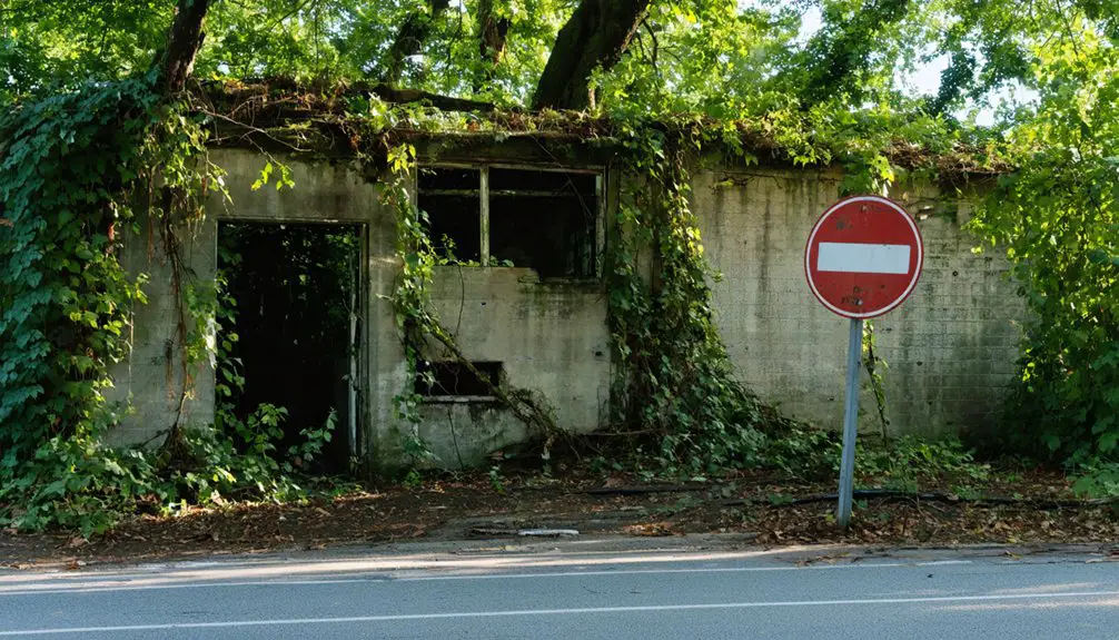
Union Level: Abandoned Railroad Hub
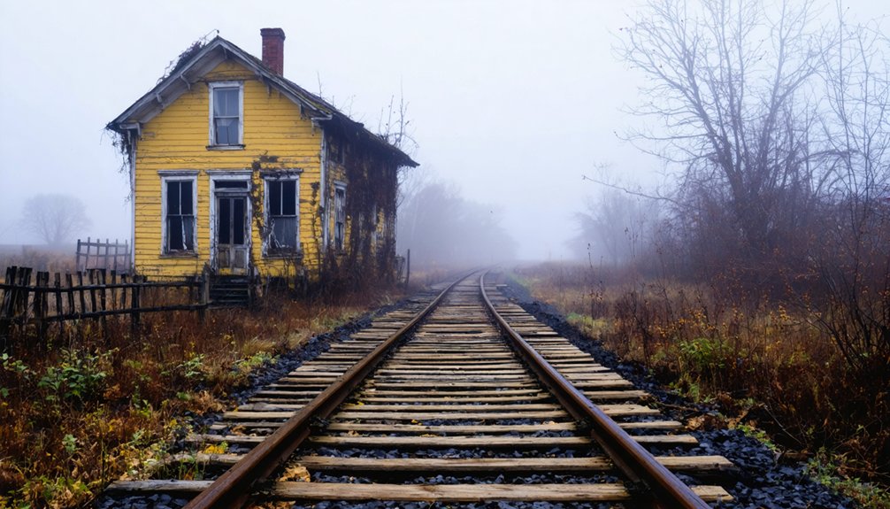
However, Economic Decline struck after the Civil War damaged the tobacco industry, followed by the Great Depression closing businesses in the 1930s.
Train service ended by the mid-1980s, and the post office closed in 1990.
Today, you’ll find abandoned storefronts with decaying furniture and broken glass.
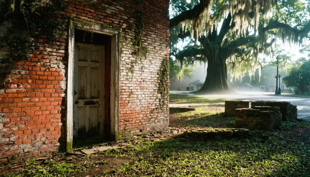
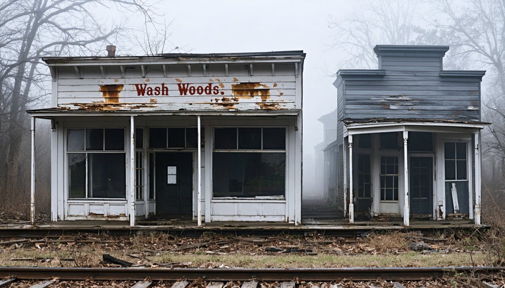
Wash Woods: Coastal Community Lost to Time
Shipwreck survivors founded Wash Woods on Virginia’s treacherous coast in what’s now False Cape State Park, creating a unique settlement from the remnants of maritime disasters.
These resilient pioneers built their community entirely through shipwreck salvaging, transforming maritime tragedy into opportunity.
The settlement thrived by the early 1900s with 300 residents who’d carved out freedom from civilization’s constraints.
Their ingenuity created:
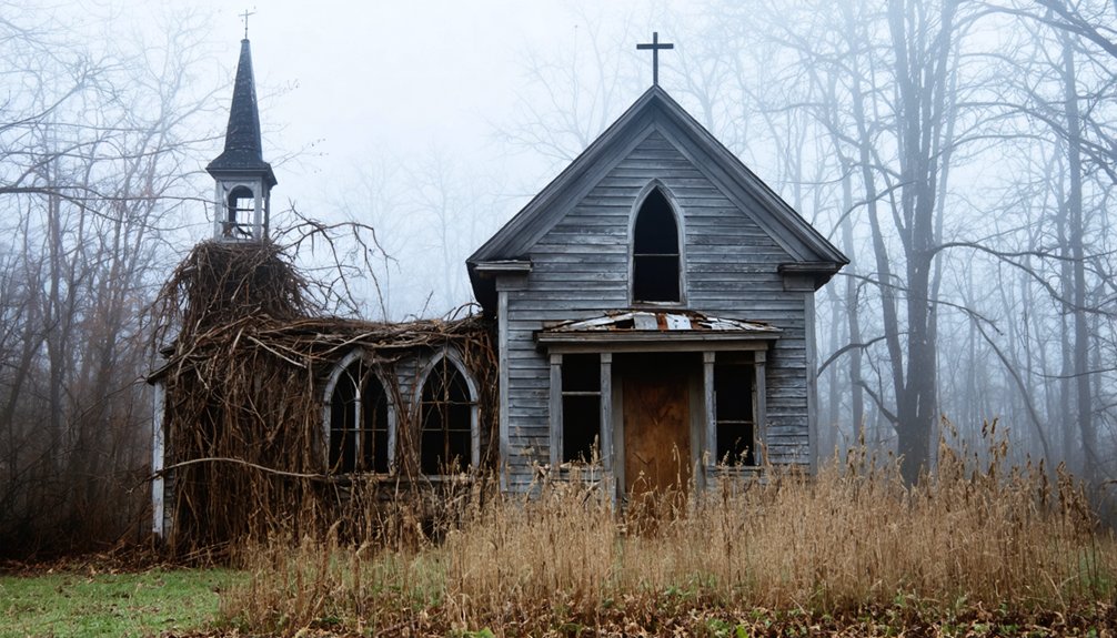
- Wash Woods Methodist Church – Constructed from cypress lumber salvaged from a winter storm wreck
- Community infrastructure – Including schoolhouse, grocery store, and two churches built from shipwreck materials
- Self-sufficient economy – Based on salvaging goods from the “Graveyard of the Atlantic“
Harsh weather ultimately reclaimed Wash Woods by the 1930s.
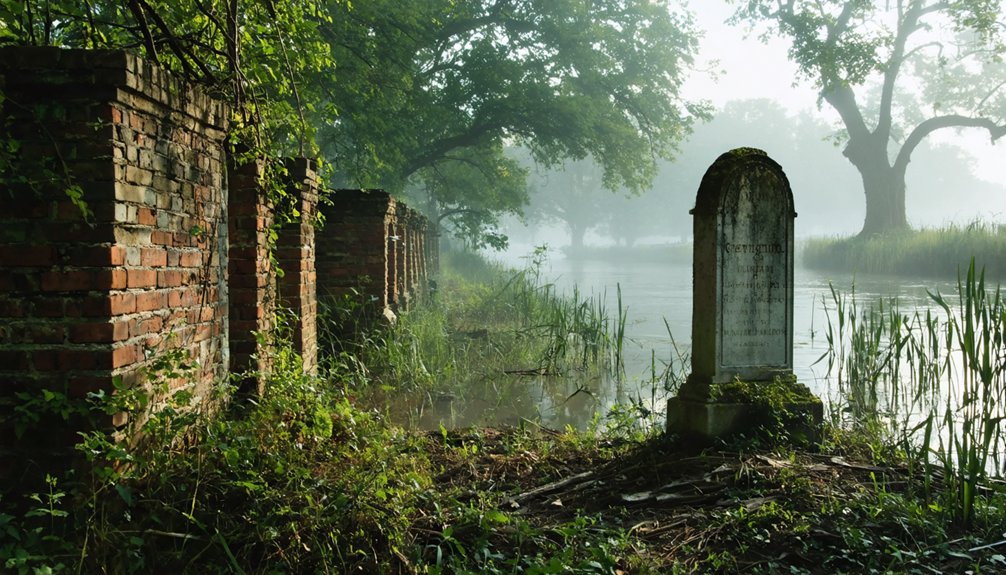
Today, you’ll find only foundations, the glass-encased church steeple, and moss-covered headstones marking where freedom-seekers once prospered.
Colchester: The Forgotten Colonial Port
Along the muddy banks of the Occoquan River, where Dogue Indians once fished and traded, Captain John Smith explored Virginia’s waterways in 1608, unknowingly charting the future site of one of colonial America’s most ambitious commercial ventures.
You’ll find Colchester’s archaeological remains near Lorton, where Peter Wagener established Virginia’s boldest experiment in colonial commerce in 1753.
This triangular port town featured 41 lots, warehouses, and a thriving tobacco trade that connected local plantations to global markets.
The historical significance becomes clear when you consider George Washington himself crossed Colchester’s ferry en route to Yorktown.
Exploring Virginia’s Ghost Town Heritage
Virginia’s scattered ghost towns tell the story of a state that repeatedly reinvented itself through four centuries of change.
You’ll discover communities shaped by tobacco agriculture, wartime necessity, and industrial ambitions that couldn’t sustain themselves when circumstances shifted.
The ghost town significance becomes clear when you explore these diverse origins:
- Agricultural decline – Union Level thrived in tobacco country until post-Civil War economic slumps forced abandonment.
- Military deception – Elko Tract transformed from farming community to fake WWII airfield, then vanished after 1945.
- Failed infrastructure – Matildaville represented George Washington’s canal vision but couldn’t survive engineering challenges.
Today’s preservation efforts vary dramatically.
You can visit Rosewell Plantation’s towering ruins Monday through Sunday, while other sites like Brown Cove and Buzzard’s Roost remain documented only in historical archives.
Visiting These Historic Abandoned Sites
When should you plan your ghost town expedition across Virginia? Year-round access makes these sites perfect for any season, though spring and fall offer ideal photography techniques with natural lighting.
Start at Union Level near Mecklenburg County’s border, where you’ll find preserved storefronts including a general store and bank. However, take safety precautions—these structures emit dangerous odors and require careful navigation.
Pamplin in Appomattox County offers safer exploration along High Bridge Trail, attracting cyclists and history buffs to its endangered railroad architecture.
Mouth of Wilson presents the most remote experience, featuring Fields Manufacturing Company’s woolen mill remains.
Stick to public paths, respect private property boundaries, and combine visits with nearby landmarks like Boydton Plank Road for thorough historical exploration.
Frequently Asked Questions
Are There Any Ghost Towns in Virginia That Allow Overnight Camping?
You won’t find overnight camping allowed in Virginia’s ghost towns, as they lack designated ghost town amenities and camping regulations. Instead, you’ll need to explore primitive camping options at nearby WMAs or state parks for legal overnight stays.
What Safety Precautions Should Visitors Take When Exploring These Abandoned Sites?
You’ll need safety gear including sturdy boots, heavy-duty gloves, respirators, and flashlights when exploring. Maintain wildlife awareness for snakes or aggressive animals. Travel in groups, obtain proper permissions, and always guarantee clear exit routes.
Can Artifacts Be Legally Collected From Virginia’s Ghost Town Locations?
No, you can’t legally collect artifacts from Virginia’s ghost towns. Legal regulations prohibit removing items from private properties and historic sites. Artifact preservation laws protect these locations, with penalties enforced by local authorities.
Which Ghost Towns Offer Guided Tours Versus Self-Exploration Only?
You’ll find Virginia’s haunted destinations are diamonds in the rough—guided tours dominate Williamsburg and Alexandria’s historic districts, while true self-exploration ghost towns remain elusive, with most paranormal sites requiring structured experiences.
The haunting beauty of Virginia ghost towns offers an atmosphere rich with tales of the past, inviting adventurous souls to wander through their forgotten streets. As dusk settles, the remnants of history come alive, revealing secrets that have lingered for generations. Exploring these forgotten locales provides an unparalleled experience, giving visitors a taste of both the eerie and the enchanting.
Are There Entrance Fees Required to Visit These Historic Sites?
You’ll find entrance fees vary considerably across Virginia’s historic sites. Thurmond Ghost Town offers free access through National Park Service, while Historic Jamestowne charges $15-30 depending on historic preservation areas you visit.
References
- https://kids.kiddle.co/List_of_ghost_towns_in_Virginia
- https://everafterinthewoods.com/deserted-ghost-towns-in-virginia-that-history-buffs-cant-resist-exploring/
- https://www.blueridgeoutdoors.com/go-outside/southern-ghost-towns/
- https://northernvirginiamag.com/67-advantures-ghost-towns-of-virginia/
- https://www.tripadvisor.com/Attractions-g28967-Activities-c47-t14-Virginia.html
- https://sites.rootsweb.com/~vatttp/ghosttowns/ghosttowns.htm
- https://en.wikipedia.org/wiki/Jamestown
- https://historicjamestowne.org/history/history-of-jamestown/
- https://en.wikipedia.org/wiki/History_of_Jamestown
- https://www.loc.gov/classroom-materials/united-states-history-primary-source-timeline/colonial-settlement-1600-1763/english-at-jamestown-1606-1610/