You’ll discover over 600 abandoned mining towns scattered throughout the Black Hills of South Dakota, remnants of the massive gold rush that began when George Armstrong Custer’s expedition found gold in French Creek on August 2, 1874. Notable ghost towns include Galena with its restored buildings, submerged Camp Crook beneath Pactola Lake, and Mystic in the Castle Creek district. These sites feature mine shafts, tailings piles, and structural foundations accessible via Highway 44 and off-road trails, offering adventurous exploration opportunities that reveal fascinating stories of frontier life.
Key Takeaways
- Over 600 abandoned mining towns exist throughout the Black Hills from the 1875 gold rush era to mid-20th century operations.
- Notable ghost towns include Galena, Mystic, Rochford, and submerged Camp Crook beneath Pactola Lake with restored buildings and cemeteries.
- Access routes include Interstate 90, US 385, Highway 44 from Rapid City, and the Mickelson Trail for hiking exploration.
- Physical remnants feature mine shafts, tailings piles, foundations, shaft houses, and ore bins creating dramatic atmospheric landscapes.
- Respect private property boundaries, research locations beforehand, and prioritize safety when exploring these historical mining sites.
The Black Hills Gold Rush Legacy
When Lieutenant Colonel George Armstrong Custer led over 1,000 men from Fort Abraham Lincoln into the Black Hills in 1874, his expedition wasn’t supposed to launch one of America’s most significant gold rushes.
You’ll discover that when prospectors found gold in French Creek on August 2, 1874, they triggered a mass migration rivaling California’s 1849 rush.
Despite the 1868 Treaty of Fort Laramie granting these lands to the Sioux Nation, thousands of miners flooded in illegally.
The 1868 Fort Laramie Treaty meant nothing to gold-hungry miners who illegally swarmed Sioux lands by the thousands.
You can trace how this violation sparked the Great Sioux War, ultimately leading to Custer’s defeat at Little Bighorn in 1876.
The Black Hills Gold Mining boom created legendary boomtowns like Deadwood and produced over 40 million ounces through the Homestake Mine‘s 125-year operation. By April 1876, Deadwood’s population had swelled to 7,000 residents as it became the bustling center of the Black Hills goldfields. Most prospectors found that the region’s gold was chemically bound, making it far more difficult and expensive to extract than the rare free-milling gold found at Homestake.
Over 600 Abandoned Mining Towns
You’ll discover that the Black Hills hard rock mining industry left behind over 600 abandoned mining towns scattered throughout the region.
These ghost towns represent different mining eras, from the initial 1875 gold rush settlements like Camp Crook to later operations that continued into the mid-20th century. Most of these communities were abandoned by 1940, following the decline of mining operations and economic shifts that made smaller settlements unsustainable.
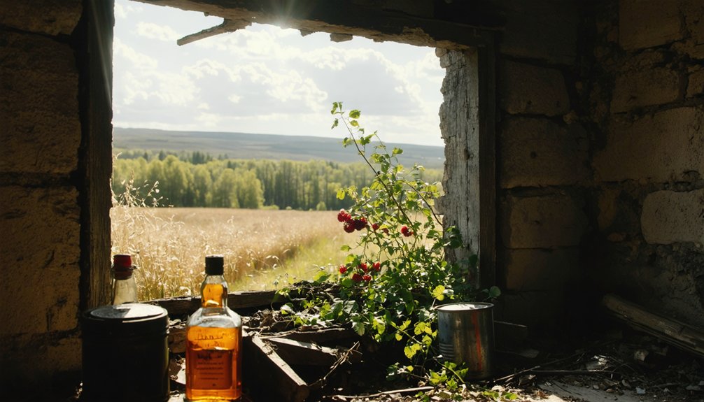
The remnants you’ll encounter today range from completely deserted sites with only foundation stones to partially occupied towns like Galena, where modern homes sit alongside historic mining ruins. Many communities now exist only as ruins and foundations, barely visible traces that require patient searching by ghost town hunters to uncover their hidden histories.
Gold Rush Mining Legacy
The Black Hills Gold Rush erupted in 1874 when prospectors discovered precious metal deposits throughout the region, triggering a massive influx of miners from across the United States who were desperate for opportunities during the economic turmoil of the Panic of 1873.
You’ll find that this rush created over 600 mining towns within a few short years, established by diverse groups including Black and Chinese miners seeking their fortunes through placer and lode mining operations.
The boom’s intensity brought chaos—over 100 murders occurred in the first year alone.
As mines played out and economic challenges mounted, urban migration accelerated, drawing populations away from remote camps.
This mining diversity initially flourished but ultimately couldn’t sustain the scattered communities when automotive transportation and improved infrastructure shifted settlement patterns toward established cities.
Hard Rock Industry Remnants
Today’s explorers can discover physical evidence of hard rock mining operations scattered across more than 600 abandoned town sites throughout the Black Hills region.
You’ll find gaping shafts, mine waste piles, and eroded tailings marking locations at Hornblend, Blue Lead, Bald Mountain, Flatiron, and Galena.
Shaft houses, ore bins, and foundations remain at Maitland, Two Bit, Golden West, and Myersville, while enormous cyanide process vats stand visible across valleys from Trojan and Astoria’s Golden Reward Mine.
These mining techniques left lasting marks on communities like Harney, which operated from 1876-1900 with its own school and post office until gold depletion by 1878.
Carbonate was deserted by 1891, and Trojan was abandoned in 1959 after mine closure, with foundations now hidden in woods.
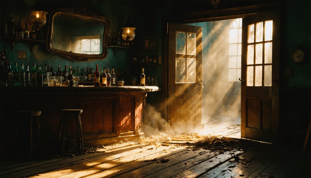
Galena: Vanocker Canyon’s Best-Preserved Settlement
Discovery of lead-silver deposits near Bear Butte Creek in 1875 sparked the creation of Galena, the Black Hills’ first major non-gold mining settlement.
You’ll find this preserved ghost town in Vanocker Canyon, where illegal prospectors established themselves on Lakota land despite the 1851 Treaty of Fort Laramie.
Galena history reveals a boom-and-bust cycle driven by Colonel John H. Davey’s ambitious mining operations from 1878-1886. The town’s population dramatically expanded from 75 to 400 residents in the late 1870s before eventually reaching 2,000 at its peak.
By 1877, commercial growth included 75 homes, two smelters, and a post office establishment that served the thriving mining community.
Today’s Galena offers you:
- Restored 1882 schoolhouse and preserved buildings showcasing frontier architecture
- Vinegar Hill Cemetery containing notable figures like Sarah Campbell, first Black woman filing a Black Hills claim
- Annual historic walks hosted by the Galena Society with photo displays and interpreters
This unincorporated Lawrence County community remains accessible to respectful visitors seeking authentic Wild West heritage in Vanocker Canyon’s scenic gulch setting.
Camp Crook Beneath Pactola Lake Waters
You’ll find Camp Crook’s remains submerged beneath Pactola Lake’s waters, where General George Crook established this military post in 1875 to expel miners violating the Laramie Treaty with the Sioux.
The transient camp preceded permanent Black Hills settlements during the 1870s conflicts, serving as a strategic point during Crook’s operations against Northern Cheyenne and Teton Sioux forces. The area later hosted a Civilian Conservation Corps camp from 1934 to 1937, where over 200 men constructed reservoirs and developed springs for water conservation efforts.
Today’s lake exploration reveals no visible traces since Pactola Dam’s construction permanently flooded the original military foundations. Due to the shared name with other locations, Camp Crook appears on disambiguation pages to help researchers distinguish between different historical sites bearing the same designation.
Submerged Town History
When General George Crook established his military post in 1875, he couldn’t have foreseen that Camp Crook would eventually rest beneath the waters of Pactola Lake.
You’re looking at one of the Black Hills’ most intriguing submerged settlements, where military history lies hidden under modern recreation waters.
The camp’s historical significance extends beyond its brief existence. Crook’s 1,260 men endured the grueling “Horsemeat March,” covering 25-35 miles daily with dwindling provisions during their campaign against Northern Cheyenne and Teton Sioux tribes.
Key details about this underwater ghost town:
- Founded to expel miners violating the Laramie Treaty with Sioux nations
- Served as temporary headquarters during 1876 Indian hostilities
- Connected other military posts like Camp Collier and Camp Success
Today’s reservoir conceals this piece of frontier military heritage completely.
Lake Exploration Today
Underwater exploration reveals little of Camp Crook’s remains due to lake depth and accumulated sediment since the dam’s 1952-1956 construction.
Water clarity varies seasonally, limiting visibility for divers.
You won’t see exposed artifacts above the surface, as flood control operations buried potential remnants under reservoir silt. Only foundations and bunkers from the original settlement rest beneath the lake waters.
Educational signage explains the ghost town’s history without visible on-site relics. The town once served as a crossing point for cattle drives and military movements along the Little Missouri River.
Mystic and the Castle Creek Mining District
The echoes of Custer’s 1874 Black Hills Expedition still resonate through Castle Creek valley, where his men first named the winding stream that would later spark one of the region’s most significant gold rushes.
When geologists Walter Jenney and Henry Newton discovered gold along Castle Creek in 1875, they ignited a mining frenzy that transformed this wilderness into a bustling district.
You’ll find Mystic’s fascinating evolution reveals the boom-and-bust cycle that defined Black Hills settlements:
- Originally called Sitting Bull in 1876, the mining camp renamed itself Mystic when railroads arrived in 1889
- Two railroad lines served the town, including the remarkable Crouch Line with its 14 circles and 100 bridges
- Advanced mining operations featured gold dredges, cyanide mills, and cutting-edge extraction technology
Today, you can explore these crumbling ruins along the Mickelson Trail, where Mystic history and Castle Creek’s legacy await discovery.
Rochford and Silver City Along Historic Routes
Fortune smiled upon M.D. Rochford when he built his first cabin in February 1877.
You’ll find that prospectors discovered gold along Castle Creek just one month later, establishing the Rochford Mining District.
By May 1878, Rochford and Richard B. Hughes laid out the town in a gulch along Little Rapid Creek, selling lots for $10 to $60.
Town lots sold for mere $10 to $60 when Rochford and Hughes platted their mining settlement along Little Rapid Creek.
You can trace Rochford history through its rapid growth—500 residents by December 1878, plus another 500 in temporary shelters.
The town boasted three saloons, six stores, and over 100 homes.
However, decline came swiftly. By 1900, only 48 residents remained.
Today, you’ll discover Silver City nearby along Route 385, part of the Black Hills’ 600 ghost towns that echo this region’s mining heritage.
Notable Mining Characters and Frontier Justice
Behind these ghost towns stood remarkable individuals whose discoveries and deeds shaped the Black Hills forever.
You’ll discover mining legends whose fortunes created an empire from wilderness claims.
The Manuel brothers, Moses and Fred, struck gold in 1876 near present-day Lead. They sold their Homestake claim to George Hearst’s group in 1877, with Fred receiving $150,000 and Moses getting $70,000.
Hearst transformed their discovery into America’s most productive gold mine, expanding operations to 500 employees.
Frontier justice ruled these boomtowns differently than civilized society:
- Wild Bill Hickok arrived seeking fortune but met his end weeks later holding aces and eights
- Gunfighters and gamblers operated by their own codes
- Lawless camps like Deadwood played by survival rules
These characters built the foundation for today’s ghost town remnants you’ll explore.
Visible Mine Remnants and Structural Features
When you explore Black Hills ghost towns today, you’ll encounter tangible remnants that tell the story of intensive mining operations spanning decades.
Mine infrastructure persists across these abandoned sites, from shaft houses and ore bins at Maitland to enormous cyanide vats near Trojan. You’ll discover structural decay varies dramatically – while foundations at Myersville lacked salvage value and remain intact, Golden West shows advanced deterioration from age.
Gaping shafts and waste piles mark former operations at Hornblend, while eroded tailings create badlands at Blue Lead and Flatiron.
Mill ruins dominate several locations, including visible tourist attractions at Golden Reward Mine near Astoria. At Spokane, you’ll find the mine manager’s house remarkably preserved alongside building frameworks, while Etta displays both cassiterite mill remnants and lithium mining structures.
Directions and Access Routes to Ghost Towns
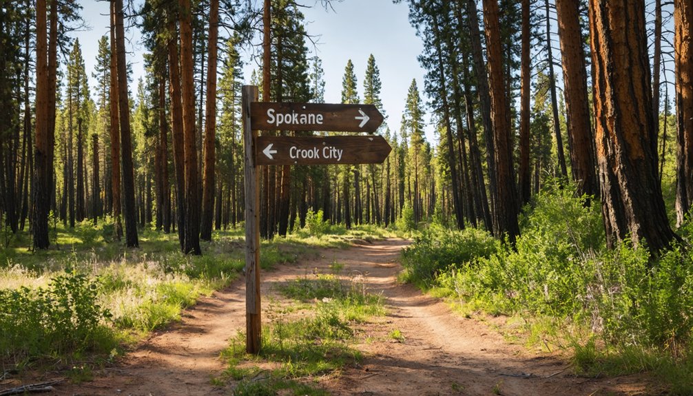
You’ll access most Black Hills ghost towns through major highways like Interstate 90 from the east and US 385 running north-south through the central hills.
Highway 44 connects west from Rapid City to reach Rochford and Mystic, while US 16 provides direct access to Rockerville.
The Mickelson Trail system offers walking routes to several sites, including Englewood and Mystic ghost towns along the historic railroad corridor.
Primary Highway Routes
US Highway 385 serves as the primary north-south corridor, linking Deadwood, Hill City, and Custer while accessing multiple mining settlements.
From Rapid City, you’ll follow Highway 44 west to US-385 north, then Rochford Road for ghost town exploration.
Key route benefits include:
- US Highway 16 passes directly through revived Rockerville
- State Highway 44 connects to Mystic and Rochford via scenic pine drives
- Local roads like Crook City Road offer roadside ghost town viewing
Trail Access Methods
Four distinct trail access methods provide specialized routes to Black Hills ghost towns beyond conventional highway driving.
You’ll find off-road trail systems offering the most extensive coverage, with MAD Peak Rentals providing direct access to 3,500 miles of trails from their Deadwood location. UTV rentals operate daily from 8am MDT, eliminating road travel to reach remote mining sites.
The Mickelson Trail delivers hiking routes to Englewood and Mystic ghost towns via historic railroad corridors. You can access Mystic’s National Register site through the Mystic Trailhead along former Chicago, Burlington and Quincy tracks.
Forest gravel roads like the 350-mile Black Hills BDR-X route connect challenging two-track sections reaching hidden towns including Spokane and Galena, where preserved structures await discovery through specialized trail access methods.
Exploration Guidelines and Current Conditions
When exploring the Black Hills’ ghost towns, you’ll find that access varies considerably depending on your destination and chosen transportation method. Current conditions range from well-preserved sites like Galena’s intact schoolhouse to completely submerged locations such as Camp Crook, now resting 150 feet beneath Pactola Lake since the early 1950s.
Ghost town accessibility spans from Galena’s preserved schoolhouse to Camp Crook’s watery grave 150 feet below Pactola Lake.
Your ghost town exploration will reveal diverse preservation states:
- Intact structures – Mystic’s old chapel and Galena’s schoolhouse offer excellent photography opportunities
- Foundation remnants – Over 600 sites display ruined houses, ash heaps, and gaping mine shafts
- Complete disappearance – Some locations show no visible evidence of former settlements
Mining relics including waste piles and eroded tailings mark these hard rock mining failures, creating atmospheric landscapes for freedom-seeking adventurers willing to respect private property boundaries.
Frequently Asked Questions
Are There Any Entrance Fees Required to Visit Black Hills Ghost Towns?
Most Black Hills ghost towns don’t require entrance fees for basic access. However, you’ll encounter varying fee structures at specific sites: Four Mile charges $7.50 per person, while Mount Moriah Cemetery requires $2 for entrance requirements.
What Is the Best Time of Year to Explore These Abandoned Settlements?
Like Goldilocks seeking perfection, you’ll find late spring through early fall offers the best seasons for ghost town exploration. Weather conditions remain favorable, roads stay accessible, and you’ll avoid winter’s limiting snowfall while enjoying ideal visibility.
Can Visitors Camp Overnight Near the Ghost Town Sites?
You can’t camp overnight at ghost town sites themselves, but you’ll find dispersed camping options nearby following Black Hills National Forest camping regulations. You’ll need overnight permits for dispersed sites and must respect private property boundaries.
Are Guided Tours Available for Multiple Ghost Towns in One Trip?
Yes, you’ll find multiple guided exploration options covering several ghost towns in single trips. GeoFunTrek offers customizable multi-day adventures, while ToursByLocals provides private tours emphasizing the historical significance of abandoned mining settlements.
What Safety Equipment Should Explorers Bring When Visiting Remote Mining Areas?
You’ll need hard hats, sturdy boots, leather gloves, and high-visibility vests as essential safety gear. Pack GPS devices, first aid supplies, and bear spray following these exploration tips for remote Black Hills mining areas.
References
- https://www.blackhillsbadlands.com/blog/post/old-west-legends-mines-ghost-towns-route-reimagined/
- https://www.trailhoundcabins.com/ghost-towns-of-the-black-hills/
- https://www.sdhspress.com/journal/south-dakota-history-2-2/some-black-hills-ghost-towns-and-their-origins/vol-02-no-2-some-black-hills-ghost-towns-and-their-origins.pdf
- https://en.wikipedia.org/wiki/List_of_ghost_towns_in_South_Dakota
- https://blackhillsatvdestinations.com/ghost-towns/
- https://www.sdpb.org/rural-life-and-history/2023-08-21/some-black-hills-ghost-towns-and-their-origins
- https://www.blackhillshikingbikingandmore.com/old-mining-ghost-towns
- https://www.youtube.com/watch?v=_0WNYsFLSLA
- https://www.tripadvisor.com/Attractions-g4007682-Activities-c47-t14-The_Black_Hills_South_Dakota.html
- https://www.americanhistorycentral.com/entries/black-hills-gold-rush/


