You’ll find Sixes’ remains hidden beneath Cherokee County‘s modern suburbs – a ghost town that started as an 18th-century Cherokee settlement along the Etowah River Valley. The area transformed during Georgia’s gold rush after discoveries in 1819, producing over 300 ounces daily by 1830. The Trail of Tears forcibly removed its Cherokee residents in 1838, though mining operations continued. The site’s rich layers of Native American and gold mining history await deeper exploration.
Key Takeaways
- Sixes was a thriving Cherokee settlement in Georgia’s Etowah River Valley until the forced removal during the Trail of Tears in 1838.
- Gold discovery in 1834 along Sixes Creek transformed the area into a bustling mining town producing over 300 ounces daily.
- The community originally housed 200 Cherokee residents and served as a vital trading hub connecting inland routes to coastal markets.
- After Cherokee removal, mining operations reshaped the landscape but eventually declined, leading to the area’s abandonment.
- Today, the historic settlement lacks preservation efforts, protected status, or interpretive markers documenting its significant Cherokee heritage.
Origins of a Cherokee Village
While Cherokee communities had long inhabited north Georgia, the village of Sixes emerged in the late 18th century as refugees from the Carolinas sought new settlement areas. The refugee movement brought displaced Cherokee families to the fertile Etowah River Valley around 1799, where they established a thriving community at the confluence with Little River. The area was historically known as Toonigh Creek before becoming Sixes.
Their settlement demonstrated Cherokee resilience in the face of colonial expansion, as they rebuilt their lives along the river’s rich bottomlands. By 1835, the village had grown into a substantial community with nearly 200 Cherokee residents.
You’ll find Sixes was strategically positioned within the Cherokee Nation’s Hightower District, approximately 38 miles above where the Coosa and Oostanauli rivers meet. The location proved ideal for agriculture and trade, connecting to other Cherokee settlements like Turkey Town through established river routes and traditional pathways.
The Gold Rush Era Emerges
Although Cherokee miners had long known about gold deposits near Sixes, the discovery of significant gold reserves in 1819 marked a turning point for the region.
White settlers began establishing mining operations near the Cherokee town of Sixes, implementing both placer and hard-rock mining techniques to extract the precious metal.
By 1830, the area was producing over 300 ounces of gold each day from its various mining operations.
This mining activity ultimately led to the Georgia Land Lottery, which distributed 40-acre plots to settlers in 1832.
Life at the Crossroads of Trade
You’ll find that Sixes stood at a significant junction where Cherokee trading networks connected the mountain settlements to coastal markets through a series of well-worn paths.
The site’s position near waterways meant traders could efficiently move deerskins and other goods via periagua boats, which regularly plied these river routes to reach larger markets in Charleston and Savannah. Much like the Silk Road merchants who sought new profitable routes through the Caucasus, local traders adapted their paths based on economic opportunities. The control of rivers was crucial for commerce, as river navigation enabled the transportation of various agricultural products and goods between trading centers.
From your vantage point at Sixes, you’d have witnessed a steady flow of Cherokee traders exchanging wildlife products and crafts with European settlers, making this crossroads a essential link in the regional economy that connected the mountain valleys to colonial ports.
Cherokee Trading Networks
During the late 17th century, Sixes emerged as a critical hub within the expansive Cherokee trading networks that connected British colonial centers like Augusta and Charleston to the Cherokee heartland.
You’ll find that Cherokee trade centered primarily on deerskins, which they’d exchange for coveted European goods like firearms, iron tools, and textiles. These economic exchanges transformed Cherokee society, as English traders established permanent residences in villages to facilitate commerce. The establishment of Carolina in 1670 dramatically shifted trade dynamics for the Cherokee people. By 1773, mounting debts of two hundred thousand dollars accumulated between traders and the Cherokee and Creek tribes.
The trade routes through Sixes weren’t just paths for goods – they were lifelines of cultural and political influence.
You’d have seen Cherokee traders leveraging their position as intermediaries, building alliances while maintaining their independence through careful economic partnerships. Their sophisticated trading system incorporated both the centralized Cherokee governance structure and their traditional clan-based social organization, creating a resilient commercial network.
River Commerce Routes
Located at a significant confluence where the Etowah and Little Rivers meet, Sixes emerged as an essential commercial crossroads that shaped river trade throughout the Cherokee Nation.
You’ll find evidence of its economic influence in the strategic placement of Moses Fields’ ferry operation and Gresham Mill, which facilitated the movement of agricultural goods, furs, and minerals along these critical waterways.
Similar to how the Santee Cypress Company transported lumber via river rafts, these rivers served as natural highways, connecting Sixes to broader trading networks spanning from the Coosa to the Chattahoochee River.
Much like the transportation lines that once sustained Fort Motte, these water routes became even more important as prospectors and traders navigated the region.
During the Georgia gold rush of the 1820s, these water routes became even more important as prospectors and traders navigated the region.
The presence of wealthy Cherokee families and white settlers at river crossings reflects the town’s significance in controlling these valuable commercial arteries.
Mountain-Valley Market Exchanges
While mountain communities often struggled with market access, agricultural exchanges emerged as crucial economic lifelines across Northeast Georgia’s challenging terrain.
You’d find cooperative exchanges like White County Farmers Exchange serving as significant hubs since 1928, helping remote farmers access supplies at competitive prices. Through resourceful local markets and community-driven commerce, these mountain-valley networks sustained regional independence.
- County extension agents facilitated produce sales and equipment trading through the Market Bulletin
- Farm stores evolved from simple lean-tos to full-service community hubs offering local meats, dairy, and supplies
- WPA projects in Pine Mountain Valley strengthened agricultural self-sufficiency through food production education and market development
The resilience of these market exchanges proved essential in preserving the region’s agricultural heritage while adapting to changing economic needs.
Trail of Tears and Community Displacement
You’ll find that Sixes’ Cherokee community of 194 residents fiercely opposed the federal removal policies, with documented threats of armed resistance emerging by 1834.
When General Winfield Scott’s troops arrived in May 1838, they encountered active resistance from Sixes residents, ultimately forcing nearly 400 Cherokee from the area into detention camps before their westward deportation.
The brutal journey to Indian Territory stretched 2,200 miles across nine states, claiming approximately 4,000 Cherokee lives and shattering the social fabric of communities like Sixes, which never recovered its indigenous population.
Cherokee Removal Timeline 1830s
During the 1830s, the Cherokee people faced systematic displacement from their ancestral lands through a series of devastating government policies and forced relocations. Despite their adoption of U.S. customs and legal challenges to Georgia’s laws, the Cherokee treaties were systematically violated, culminating in the tragic Treaty of New Echota in 1835.
Key events of Cherokee removal resistance include:
- The Indian Removal Act of 1830, which President Jackson used to force indigenous peoples west.
- The Supreme Court’s favorable ruling in Cherokee Nation v. Georgia, which Jackson refused to enforce.
- The forced relocation of over 16,000 Cherokees from May 1838 to March 1839, resulting in thousands of deaths.
Those who managed to escape found refuge in North Carolina’s mountains, where their descendants remain today, preserving their cultural heritage.
Impact On Local Culture
The Cherokee removal‘s devastating ripple effects transformed the cultural fabric of Sixes, Georgia, and surrounding communities in ways that would permanently alter the region’s identity.
You’ll find that the forced displacement of over 60,000 Native Americans shattered centuries-old social networks and severed deep connections to sacred lands.
The area’s cultural resilience was tested as Cherokee languages, customs, and traditional practices were suppressed or lost.
Community memory of Native settlements began fading as white settlers claimed the abandoned territories, replacing communal land practices with private ownership and resource extraction.
While some Cherokee cultural elements survived through adaptation and resistance, the Trail of Tears created lasting wounds that echo through generations, fundamentally changing how the land was understood, used, and remembered.
Forced Migration Routes Documented
When federal troops began enforcing the Indian Removal Act in 1838, they established a complex network of forced migration routes that would become known as the Trail of Tears, stretching over 1,000 miles across nine states from Georgia to Oklahoma.
Historical routes through Sixes and surrounding areas reveal the systematic displacement of Cherokee families, who were first confined in military-controlled stockades and camps.
Primary sources document three key aspects of the forced migration through this region:
- Multiple roundup points operated near Fort Newnan and Fort Cumming
- Local detachments merged with larger groups at Fort Cass in Tennessee
- Cherokee families faced harsh conditions in overcrowded holding camps before beginning their westward journey
Many who attempted to evade capture fled into the Great Smoky Mountains, while others endured the deadly march west under armed escort.
Mining Operations and Economic Growth
Gold mining operations transformed Sixes into a thriving industrial center after prospectors discovered substantial deposits along Sixes Creek in 1834.
The discovery of gold in 1834 along Sixes Creek sparked an industrial revolution, turning Sixes into a booming mining town.
You’d find miners using various mining techniques, from simple long-toms and rockers yielding 15-20 pennyweights daily to advanced stamp mills and cyanide plants processing low-grade ore. The 22-acre operation spanned multiple lots, showcasing the region’s economic sustainability through extensive infrastructure development.
The industry’s growth reshaped Cherokee County‘s landscape after the Cherokee removal, attracting diverse investors and creating jobs that supported local businesses.
Mining operations drove the development of support services, mills, and transportation networks. Even with Civil War interruptions and later economic shifts, Sixes’ mining legacy left lasting evidence through visible tailings, structural ruins, and the industrial foundation that transformed this once-frontier territory.
Archaeological Discoveries and Heritage
Archaeological excavations at Sixes Gold Mine from 1997 to 1998 revealed a treasure trove of cultural artifacts that paint a vivid picture of nineteenth-century mining life.
The site’s archaeological significance extends beyond mere artifact analysis, offering vital insights into the daily lives of early mining communities in Cherokee County.
You’ll find three key discoveries that transformed our understanding of Sixes:
- Kitchen and subsistence items dominated the artifact collection, revealing details about miners’ daily lives.
- Architectural remains helped map the settlement’s layout and construction methods.
- Industrial artifacts documented the evolution of mining techniques and technology.
The Georgia State Historic Preservation Office continues protecting this eligible National Register site, while fighting against looting threats that endanger these irreplaceable pieces of your heritage.
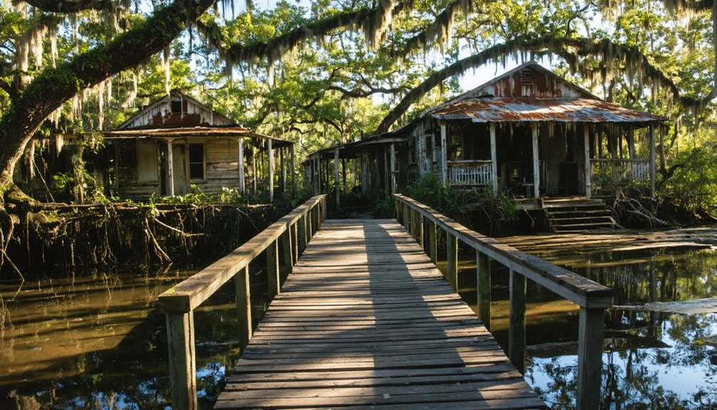
From Bustling Town to Abandoned Settlement
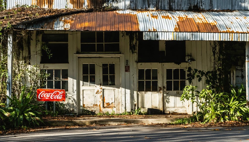
The rise and fall of Sixes, Georgia mirrors the boom-and-bust cycle that defined many Southern mining settlements in the 19th century.
You’ll find that this once-thriving community near Toonigh Creek built its economic resilience through diverse ventures – from Gresham’s Mill to gold mining operations, supported by a network of taverns, hotels, and shops.
The town’s decline began with Civil War destruction and accelerated through the Great Depression.
While neighboring communities adapted to changing transportation routes and industrial needs, Sixes couldn’t maintain its commercial significance.
You can trace how the loss of railroad connections and isolation from major thoroughfares gradually emptied the settlement, despite early attempts at community revival.
The rugged terrain and deteriorating infrastructure sealed its fate, transforming a bustling economic hub into today’s ghost town.
Preserving a Hidden Historical Treasure
Modern preservation efforts have overlooked one of Georgia’s most significant Cherokee settlements, leaving Sixes’ rich historical legacy at risk of being lost forever.
Time is running out to protect Sixes, a crucial piece of Cherokee history that Georgia’s preservation community continues to neglect.
Despite extensive historical documentation from the 1835 census and archaeological surveys, you’ll find no protected status or interpretive markers at this indicator of community resilience.
To save this essential piece of Cherokee heritage, preservationists recommend:
- Initiating ground-penetrating radar surveys to identify subsurface features
- Establishing partnerships with the Cherokee Nation and local historical societies for site protection
- Creating digital exhibits and educational programs to share Sixes’ story
You can support these preservation efforts through advocacy for conservation easements and historic preservation grants, ensuring this irreplaceable piece of Georgia’s past doesn’t vanish into obscurity.
Frequently Asked Questions
What Dangerous Wildlife Inhabits the Abandoned Sixes Mine Shafts Today?
Like miners’ headlamps piercing darkness, you’ll spot bat colonies numbering in hundreds, potentially rabies-carrying. Watch for venomous snake encounters near entrances, while raccoons and skunks might aggressively defend their underground homes.
Are There Any Reported Paranormal Activities or Ghost Sightings in Sixes?
You won’t find official ghost sightings or documented paranormal activity here. While ghost hunters occasionally explore the old mine areas, there aren’t any verified local legends about supernatural encounters worth chasing.
How Much Gold Remains Unmined in the Sixes Area?
Like a secret buried treasure, you won’t find exact figures for remaining gold. Despite the area’s rich mining history, there’s no reliable data on unmined deposits from past gold prospecting operations.
Can Visitors Legally Explore and Metal Detect Around Sixes?
You’ll need explicit permission and permits for metal detecting due to strict regulations. Most areas are private property or protected historical sites, with visitor safety guidelines requiring authorized access only.
Which Original Structures From the Mining Era Still Stand Today?
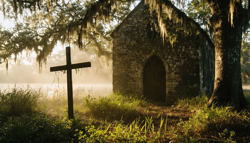
You’ll find only the Old Sixes Mill still standing as an original mining-era structure, though historic preservation efforts have documented foundations and ruins of other mining architecture throughout the site.
References
- https://vogtvisions.wordpress.com/tag/the-hidden-history-of-lake-allatoona-the-sixes-cherokee-mills-little-river-area/
- https://archaeology.uga.edu/gasf/report/6955
- https://dlg.usg.edu/record/g-hi_g-hiia_collectionsofgeo04jone
- https://www.geotab.com/ghost-towns/
- https://www.youtube.com/watch?v=kytx1_8jxdw
- https://vanishinggeorgia.com/category/cherokee-county-ga/
- https://freepages.rootsweb.com/~gtusa/history/usa/ga.htm
- https://nationaltota.com/sarah-hill-removal-of-the-cherokees-from-sixes-town-may-june-1838-2/
- https://historycherokee.org/gresham-mill/
- https://accessgenealogy.com/georgia/native-american-history-of-cherokee-county-georgia.htm