Your ghost town road trip to Comiskey, Kansas puts you face-to-face with a community that thrived along the Missouri Pacific Railroad from 1887 until the trains stopped running in 1929. Once home to 28 residents, a post office, and mercantile businesses, Comiskey quietly faded into history. Today, a few original structures still stand on private property, waiting to tell their stories. Stick around to uncover everything you need to explore this forgotten Kansas landmark.
Key Takeaways
- Comiskey sits on 100 Rd, straddling Morris and Lyon counties, about 6 miles east of Council Grove via U.S. Highway 56.
- Turn south onto 100 Rd and drive approximately 1.5 miles to reach the former townsite.
- The entire site is on private property, so securing landowner permission before exploring is mandatory.
- Remaining structures include an original schoolhouse, historic church, and civic pavilion amid overgrown foundations.
- Consult county historical societies beforehand for maps, photographs, and oral histories to enrich your visit.
The Missouri Pacific Railroad Town That Became Comiskey, Kansas
Tucked along the Missouri Pacific Railroad line, Comiskey, Kansas, operated as an active railroad station from 1887 to 1929, serving the rural communities straddling the Morris and Lyon county line.
At its peak, the town supported mercantile businesses, telegraph services, and roughly 28 residents recorded during the 1910 census. You’d have found a functioning post office listed under Lyon County and a community with genuine economic purpose.
At its peak, Comiskey supported merchants, telegraph lines, and a post office — 28 residents with genuine purpose.
When the railroad abandoned its route, Comiskey’s reason for existing vanished alongside it.
Today, you can still find historical landmarks like the original schoolhouse, a church, and a civic pavilion standing on private property.
While formal preservation efforts remain limited, these surviving structures silently tell the story of a community that thrived, then quietly faded into Kansas history.
What Still Stands at Comiskey Today?
Although Comiskey vanished from the map nearly a century ago, three structures still stand on the private property where the town once hummed with activity. The original schoolhouse, a historic church, and a civic pavilion have all survived the decades, quietly holding their ground against time and weather.
You’ll also spot building foundations pushing through the overgrown vegetation — silent proof that real lives unfolded here. Local legends have grown around these remnants, and ghost stories circulate among those who’ve managed to glimpse the site up close.
Keep in mind that you can’t simply wander in — the entire site sits on private property, so you’ll need landowner permission before exploring. These standing structures make that effort absolutely worth pursuing.
Why Comiskey Disappeared When the Railroad Left
When you look at Comiskey’s timeline, you’ll notice the town’s fate was tied directly to the Missouri Pacific Railroad, which operated there from 1887 until 1929.
Once the railroad pulled out, it stripped away the commerce that kept the mercantile businesses, telegraph services, and post office alive.
You’re seeing a pattern that erased dozens of Kansas towns — when the trains stopped coming, the economic pulse flatlined and people simply left.
Railroad Departure Killed Commerce
The Missouri Pacific Railroad breathed life into Comiskey in 1887, and when it pulled out in 1929, it took everything with it. For 42 years, the railroad made Comiskey relevant — connecting its mercantile businesses, telegraph services, and residents to the wider world.
Once those tracks went silent, commerce collapsed almost immediately.
The economic collapse followed a brutal pattern you’ll recognize across Kansas:
- Merchants lost their shipping lifeline overnight
- Telegraph services became obsolete without railroad traffic
- A population of 28 dropped to zero with nothing holding people there
- Local legends of bustling trade faded into forgotten history
Today, historic landmarks like the standing schoolhouse and church are all that remain. The railroad didn’t just leave — it erased Comiskey’s reason to exist.
Economic Shifts Erased Towns
Comiskey’s story wasn’t unique — it was Kansas playing out the same script dozens of times across the plains. When railroads rerouted or shut down, towns didn’t slowly fade — they collapsed practically overnight.
Commerce evaporated, residents relocated, and structures quietly surrendered to weather and time.
You’ll encounter ghost town myths suggesting these places died from violence or disaster, but the reality is far more mundane: economic irrelevance killed them. No railroad meant no grain shipments, no travelers, no reason to stay.
Comiskey followed that exact pattern after 1929. Preservation efforts have kept a few structures standing — the schoolhouse, church, and civic pavilion still exist — but they’re frozen reminders of a community that simply lost its economic reason for being.
Freedom once meant opportunity here. The railroad’s departure erased both.
What Makes Comiskey Different From Other Morris County Ghost Towns?
Among the many ghost towns scattered across Morris County, Comiskey stands out for a surprisingly quirky reason: it’s named after a St. Louis Browns baseball player. That’s not something you’ll find tied to most forgotten settlements.
Beyond local legends and ghost stories that haunt similar sites, Comiskey offers something tangible — surviving structures you can actually see.
What sets it apart:
- The schoolhouse, church, and civic pavilion still stand
- It operated as a Missouri Pacific Railroad station from 1887 to 1929
- It straddles the Morris and Lyon county line on 100 Rd
- Its 1910 population of 28 reflects an unusually small, tight-knit community
You’re not just visiting an empty field — you’re stepping into a layered history that most Morris County ghost towns simply can’t match.
How to Reach Comiskey From Council Grove

From Council Grove, you’ll head east on U.S. Highway 56 for roughly 6 miles until you spot 100 Rd, the county line boundary between Morris and Lyon counties.
Turn south onto 100 Rd and drive approximately 1.5 miles to reach the Comiskey site.
Keep in mind that the entire town sits on private property, so you’ll need to secure landowner permission before setting foot beyond your vehicle.
Driving Route From Council Grove
Reaching Comiskey from Council Grove takes you on a short but scenic 6-mile drive east through the rolling Kansas countryside. Head east on U.S. Highway 56, then turn south onto 100 Rd for about 1.5 miles.
You’ll cross into the Morris-Lyon county line, where local legends say the town once thrived with railroad life and historical architecture still visible today.
- Start at Council Grove’s downtown square and head east on U.S. Highway 56
- Drive approximately 6 miles until you spot 100 Rd on your right
- Turn south and travel 1.5 miles toward the county boundary
Remember the entire site is private property — secure landowner permission before exploring.
Keep your map handy, as rural Kansas roads aren’t always clearly marked.
Final Road Access Details
Once you’ve got your bearings in Council Grove, the drive to Comiskey is straightforward — head east on U.S. Highway 56 for approximately 6 miles until you spot 100 Rd.
Turn south and travel about 1.5 miles. You’ll cross the Morris-Lyon county line right at the site.
Keep your eyes open for local wildlife along this rural stretch — deer and hawks frequent these open Kansas plains.
Don’t rush past any historical markers you encounter near Council Grove before departing, as they’ll deepen your appreciation for what Comiskey once represented.
How to Get Permission From the Private Landowners
Since Comiskey sits entirely on private property, you’ll need to secure landowner permission before setting foot on the site. Respecting boundaries keeps this access open for future explorers chasing historical landmarks and local legends alike.
Comiskey sits on private property — always secure landowner permission before visiting to keep access open for future explorers.
Here’s how to approach the process effectively:
- Research ownership records through Morris or Lyon County property databases to identify current landowners
- Contact locals in Council Grove, roughly 6 miles west, who may know the property owners personally
- Write a respectful inquiry explaining your historical interest in the surviving schoolhouse, church, and civic pavilion
- Visit during reasonable hours and never assume silence means consent
Landowners generally respond better to genuine curiosity than casual trespassing. A polite, informed request dramatically increases your chances of walking those overgrown foundations yourself.
Other Abandoned Railroad Towns Along the Missouri Pacific Route
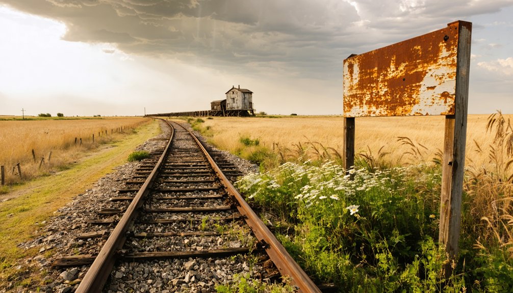
Comiskey isn’t the only Missouri Pacific ghost town worth tracking down once you’ve secured your landowner permissions. Kansas’s railroad corridor harbored dozens of forgotten settlements, each carrying its own historical anecdotes and local legends waiting to resurface.
As you map your route along the old Missouri Pacific line, you’ll discover similar patterns everywhere — thriving communities that railroad rerouting quietly erased. Towns like Bushong nearby hint at what survival looked like when economic shifts favored certain stops over others.
Research each location before you go. County historical societies often preserve oral histories, old photographs, and documented legends tied specifically to these vanished communities.
You’re not just driving through empty countryside — you’re retracing an economic backbone that once connected people, commerce, and culture across the Kansas plains.
Frequently Asked Questions
What Was Comiskey’s Population Recorded During the 1910 Census?
Like a flickering flame nearly extinguished, Comiskey’s historic population trends show you’d have found just 28 souls in 1910. Ghost town preservation lets you trace these fading footprints of freedom’s forgotten frontier.
Is “Comiskey, Ks” Still a Valid Mailing Address Today?
You can’t use “Comiskey, KS” as a valid mailing address today. This ghost town preservation site, rich with historical landmarks, exists purely on private property, making it an unforgettable destination rather than a functioning community you’d ever receive mail from.
Which County Listed Comiskey’s Post Office in 1912?
Like a faded map marking forgotten trails, Lyon County listed Comiskey’s post office in 1912. You’ll find this historical postal service detail fascinating for ghost town preservation research, revealing Comiskey’s surprising administrative ties beyond Morris County’s borders.
What Baseball Player Was the Town of Comiskey Named After?
You’ll discover Comiskey’s named after a St. Louis Browns historic baseball player — a fascinating nod to classic team names that adds a uniquely spirited, freedom-loving American character to this intriguing, forgotten Kansas ghost town you’re exploring.
How Far Southeast Is Emporia From the Comiskey Ghost Town Site?
Like a compass guiding restless souls, Emporia sits 25 miles southeast of Comiskey — your ghost town history anchor. Weave it into your travel planning tips as you chase Kansas’s forgotten echoes of freedom.
References
- https://en.wikipedia.org/wiki/Comiskey
- https://www.mlb.com/cut4/kansas-ghost-towns-named-after-st-louis-browns-players-c161501530
- https://legendsofkansas.com/morris-county-extinct-towns/
- https://www.youtube.com/watch?v=dy7nLwjHkbY
- https://www.wikiwand.com/en/map/Comiskey
- https://en.wikipedia.org/wiki/List_of_ghost_towns_in_Kansas
- http://www.ksgenweb.org/archives/1912/c/comiskey.html