Planning a ghost town road trip to Irving, Kansas means trading paved roads for gravel paths and modern noise for quiet prairie. You’ll find Irving about six miles southeast of Blue Rapids, tucked into the Big Blue River valley. Stone foundations, a visible road grid, and a visitor notebook are all that remain of this tornado-battered, flood-weary, dam-displaced community. Stick around — there’s far more layered history here than first meets the eye.
Key Takeaways
- Irving, Kansas sits southeast of Blue Rapids, about six miles away, accessible via the Big Blue River valley at Zenith and 12th Roads.
- The site features a stone marker, scattered foundations, and a visible road grid reclaimed by prairie grass, free to explore at your own pace.
- A small makeshift park includes a mailbox and visitor notebook containing personal stories, legends, and impressions from previous visitors.
- Pack water, snacks, sturdy shoes, and a camera, as no nearby services exist along this rural, gravel-road route.
- Pair Irving with Blue Rapids, following the river corridor to discover scenic bluffs, wetlands, historic sites, and frontier landmarks for a full-day adventure.
What Makes Irving, Kansas Worth the Drive?
Although Irving, Kansas is little more than a few stone foundations and a road grid reclaimed by prairie grass, it carries a history dramatic enough to justify the drive. You’re stepping into a place shaped by frontier ambition, devastating tornadoes, catastrophic flooding, and ultimately a government dam project that sealed its fate.
Local legends surround every layer of that story, from the 1879 twister that killed 19 residents to the federal reservoir plans that forced the last holdouts out in 1960. Preservation efforts have left you a stone marker, visible foundations, and even a notebook where past visitors have recorded their impressions.
Irving isn’t polished or promoted — and that’s exactly what makes it worth finding on your own terms.
How Tornadoes, Floods, and a Federal Dam Erased Irving
Irving’s story isn’t one single disaster — it’s a slow accumulation of them, each blow leaving the town a little weaker than before. Drought hit hard in 1860, barely a year after settlers arrived. Then 1879 brought tornadoes that killed 19 residents and leveled much of what they’d built. Irving rebuilt anyway — a testament to stubborn frontier resilience.
But abandonment stories rarely end with one chapter. The 1903 floods drowned the town’s momentum all over again. Decades later, federal plans for Tuttle Creek Dam delivered the final blow. Even though the reservoir never directly swallowed Irving, the government forced residents out by 1960 and shut down the post office.
These historical disasters didn’t erase Irving all at once — they wore it down until nothing was left worth staying for.
How to Find the Irving, Kansas Townsite
Finding Irving takes a little navigation, but the rural roads leading there are straightforward once you know what to look for. Head southeast from Blue Rapids about six miles, following the Big Blue River valley until you reach the intersection of Zenith and 12th Roads in Marshall County. That crossroads marks the old townsite.
Preservation efforts have kept the location accessible, so you’ll find a stone marker, visible building foundations, and a small makeshift park where visitors can wander freely.
Local legend lives in that notebook tucked near the mailbox — previous visitors have left their thoughts, and you’re welcome to add yours. There are no crowds, no fees, just open Kansas land and the quiet outline of a community that time and federal planning erased.
What Survives at the Irving Townsite Today?
When you arrive at the Irving townsite, you’ll find a stone marker standing as the town’s most visible tribute to its frontier past.
Scattered across the grounds, building foundations break through the earth, giving you a tangible sense of the community that once thrived here.
Before you leave, check the makeshift visitor area for a notebook where past explorers have left their impressions — and add your own.
Stone Marker Still Stands
What’s left of Irving, Kansas isn’t much — but it’s enough to make the stop worthwhile. A stone marker stands at the old townsite, serving as the anchor of historical preservation for everything this community once represented. It’s a quiet but powerful reminder that nearly 400 people once built their lives here.
Beyond the marker, you’ll find a makeshift park area that offers basic visitor amenities — a mailbox and a notebook where travelers like you can leave messages. It’s a surprisingly personal touch for such a remote location.
Building foundations still peek through the landscape, and the road network remains visible. You’re not just reading history here — you’re standing in it, free to explore at your own pace.
Foundations Dot The Grounds
How much can a ghost town really show you after more than six decades of abandonment? At Irving, the answer is more than you’d expect.
Scattered across the grounds, building foundations break through the earth like quiet confessions of what once stood here. These stone outlines trace where homes, businesses, and community life actually existed, giving you a tangible connection to a town that once held over 400 residents.
You won’t find standing abandoned buildings, but the foundations speak clearly enough. Paired with the historical markers nearby, they form a rough map of Irving’s former layout.
Walk the grounds slowly and you’ll start reading the land itself. Each foundation represents a story — a family, a structure, a life interrupted by forces bigger than any single community could withstand.
Visitor Notebook Awaits
Beyond the foundations, Irving holds one more quiet surprise that shifts your visit from observation to participation. Tucked within the makeshift park area, you’ll find a mailbox sheltering a notebook where past visitors have left their thoughts, stories, and reflections. It’s a living record that connects strangers through a shared curiosity about vanished communities.
Flip through the pages and you’ll encounter local legends passed down through generations, personal connections to Irving’s history, and impressions from those drawn to its historical architecture and forgotten streets.
Add your own entry before you leave. That small act makes you part of Irving’s continuing story rather than just a passing observer.
The notebook transforms a quiet rural stop into something unexpectedly human, proving that even abandoned places still hold space for connection.
What to Bring for a Day Trip to Irving, Kansas
Since Irving’s old townsite sits along rural roads with no services nearby, you’ll want to pack everything before you leave home. Roam freely and make the most of your visit by preparing ahead.
- Camera or smartphone – Exceptional photo opportunities await among the stone marker, visible foundations, and open Kansas landscape.
- Notebook and pen – Sign the visitor notebook and jot down your own reflections on Irving’s layered history.
- Water and snacks – No stores exist nearby, so bring enough to stay comfortable during your exploration.
- Sturdy shoes – Uneven ground surrounds the historic artifacts and foundation remnants scattered across the site.
Pack smart, and Irving will reward your curiosity completely.
Which Big Blue River Valley Stops Pair Well With Irving?
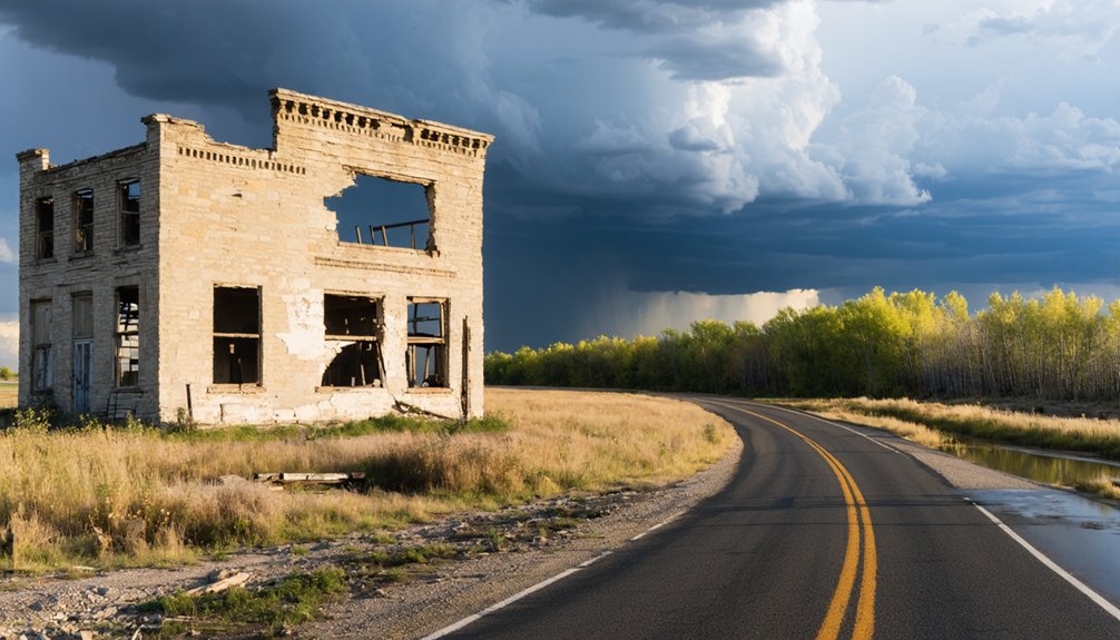
Since Irving sits just six miles southeast of Blue Rapids, you can easily add a stop in that small town to round out your understanding of Marshall County’s frontier history.
The Big Blue River valley offers additional landmarks tied to the region’s agricultural past and early settlement, giving your road trip a broader sense of place.
You’ll find that pairing Irving’s haunting foundations with the living history along the river creates a fuller, more rewarding day of exploration.
Nearby Blue Rapids History
Just six miles northwest of Irving, Blue Rapids makes a natural anchor for your Big Blue River valley road trip. This small Marshall County town holds deep community stories and historical preservation efforts worth your time.
While you’re there, explore these four highlights:
- Downtown Blue Rapids – Walk the historic commercial district and soak in its 19th-century character.
- Blue Rapids City Museum – Discover local artifacts that connect the region’s agricultural and frontier past.
- Big Blue River access points – Follow the same waterway that shaped Irving’s rise and hardship.
- Marshall County landmarks – Spot early settlement sites that echo Irving’s founding-era history.
Combining Blue Rapids with Irving gives your road trip real context, turning scattered stops into a connected, freedom-driven journey through Kansas frontier heritage.
Big Blue River Landmarks
The Big Blue River valley stretches well beyond Irving, threading together ghost towns, historic crossings, and frontier landmarks that reward curious road trippers. Follow the river corridor and you’ll find rich river ecosystems supporting wildlife, wetlands, and scenic bluffs worth photographing between stops.
Blue Rapids anchors your route with its limestone architecture and intact downtown, offering context for what Irving once aspired to become. Historical preservation efforts along the valley have documented old ferry crossings, Native American trails, and early settler campsites that deepen your understanding of the frontier experience.
Pairing Irving with these surrounding landmarks transforms a single ghost town visit into a full-day immersion in Marshall County’s layered past. Bring a map, pack water, and plan for gravel roads between sites.
Frequently Asked Questions
Is There an Admission Fee to Visit the Irving Ghost Town?
🪨💸 *Tumbleweeds laughing at your wallet!* No admission fee awaits you at Irving’s ghost town — it’s free! Historical preservation here welcomes all. Follow visitor guidelines, explore foundations, and enjoy your unrestricted, open-road freedom!
Are Pets Allowed When Visiting the Irving Townsite?
The available knowledge doesn’t specify pet policies or leash requirements for Irving’s townsite. Since it’s a rural, open area, you’ll likely enjoy bringing your furry companion along as you explore the foundations and historic marker!
What Is the Best Season to Visit Irving, Kansas?
Spring and fall offer you crisp, golden skies perfect for exploring Irving’s historical preservation. You’ll walk stone foundations comfortably, enjoy visitor amenities like the notebook mailbox, and soak in the open, free-spirited atmosphere of Kansas’s fascinating ghost town.
Is the Irving Townsite Accessible to Visitors With Mobility Limitations?
The Irving townsite’s accessibility features are limited — you’ll navigate unpaved rural roads with uneven terrain. Wheelchair access isn’t guaranteed, but you can still explore visible foundations and the stone marker from your vehicle.
Can Visitors Legally Take Artifacts or Stones From the Irving Townsite?
Before you pocket that stone… don’t. Artifact removal and stone collection aren’t legally yours to take from Irving’s townsite. You’d risk federal violations, so explore freely, but leave every relic exactly where you find it.
References
- https://en.wikipedia.org/wiki/Irving
- https://legendsofkansas.com/irving-kansas/
- https://www.romeoriders.com/forums/viewtopic.php?t=156
- https://www.kancoll.org/books/cutler/marshall/marshall-co-p9.html
- http://wikimapia.org/4009643/Irving-Kansas
- https://lostkansas.ccrsdigitalprojects.com/sites/lostkansas/files/private_static/2023-06/LT_MS_Irving_Allen.pdf
- https://www.wikiwand.com/en/map/Irving
- http://www.lovewellhistory.com/blog/theres-no-place-like-irving.html
- http://www.ksgenweb.org/archives/1912/i/irving.html
- https://lostkansas.ccrsdigitalprojects.com/irving-marshall-county