Planning a ghost town road trip to Mission Creek, Nebraska means chasing a place that’s vanished from the ground but survives in archives, plat maps, and local legend. You won’t find signs or visitor amenities here — just quiet Pawnee County roads and subtle landscape clues like faint foundations and overgrown lots. Pack historic railroad maps, aerial photographs, and county records before you go. Knowing what to look for makes all the difference, and there’s much more to uncover.
Key Takeaways
- Mission Creek is a ghost town in Pawnee County, Nebraska, with no visible remnants, signage, or visitor amenities at the site.
- Locate the site using historic maps, aerial imagery, Nebraska State Historical Society archives, county records, and cross-referenced plat maps.
- Look for subtle landscape clues like depressions, limestone fragments, isolated tree clusters, and faint crop patterns marking former structures.
- Plan a longer Southeast Nebraska loop including ghost town stops at Melrose, Meridian, and Minersville alongside Mission Creek.
- Pack railroad maps, aerial photographs, county histories, and archived newspapers to navigate and enrich your ghost town road trip.
What Was Mission Creek, Nebraska?
Though its name survives only on ghost-town lists today, Mission Creek was once a platted community in Nebraska’s Pawnee County — a small settlement that, like dozens of others across the state, rose quietly from the prairie and faded just as quietly when the forces that built it moved on.
Early settlers arrived with ambitions shaped by land development patterns and rail-era optimism, staking claims on ground that once felt full of promise.
Local legends tied to places like this often outlast the towns themselves, carried forward in county histories and old newspapers.
You won’t find a welcome sign or a main street here. What you’ll find instead is open landscape holding the memory of people who once called this corner of Nebraska home.
Where Mission Creek Sits in Pawnee County Today
You’ll find Mission Creek listed among Pawnee County’s ghost towns in Nebraska’s historical records, though no active community greets you there today. The site leaves little visible trace, so you’re fundamentally reading a landscape rather than touring a preserved place.
To locate it with any confidence, you’ll need to cross-reference historic maps, aerial imagery, and county records rather than rely on roadside markers.
Ghost Town County Placement
Nestled within Pawnee County in southeast Nebraska, Mission Creek once occupied a stretch of land that today offers few visible clues to its former existence. You won’t find a welcome sign or a preserved main street waiting for you.
What remains lives mostly in community history — recorded in archival documents, ghost-town lists, and county records that serious travelers know to seek out before hitting the road.
Southeast Nebraska carries deep cultural heritage beneath its quiet surface, and Mission Creek represents exactly the kind of vanished settlement that rewards research-driven exploration. Its county placement grounds your road trip in a specific, traceable geography.
Pawnee County becomes more than a map coordinate — it becomes a destination shaped by forgotten ambition, railroad-era growth, and the slow unraveling of what people once built here.
Current Site Conditions
What you’ll find at Mission Creek today isn’t a town — it’s a landscape that holds its history beneath the surface. No modern infrastructure marks the site. No visitor amenities guide you toward what once stood here. Pawnee County’s fields and quiet roads have absorbed the settlement completely, leaving only subtle traces for those who know where to look.
That’s exactly what makes the stop worthwhile. Aerial imagery sometimes reveals old roadbeds or foundation outlines invisible at ground level. The land itself becomes your primary document.
You’re not reading a historical marker — you’re reading the earth.
Come prepared with historic maps and county records. Mission Creek rewards the curious traveler who does the research beforehand and arrives ready to see absence as its own kind of story.
Locating Mission Creek Today
Because Mission Creek left no permanent markers behind, pinning it to a modern map takes some digging. You’ll rely on historic railroad maps, aerial imagery, and local folklore to triangulate where the settlement once stood in Pawnee County.
Preservation challenges mean the landscape holds clues rather than signage.
- Faint roadbeds cutting through open grassland where wagon traffic once wore deep ruts
- Subtle depressions in fields marking building foundations swallowed by decades of soil shift
- Abandoned rail corridors threading through countryside that once carried commerce and settlers
- Overgrown lots where local folklore quietly remembers a cluster of homes and storefronts
- Aerial photographs revealing geometric land divisions invisible from ground level
Cross-reference Nebraska State Historical Society maps with county records, and Mission Creek’s ghost begins taking shape beneath the modern landscape.
Why Mission Creek Nebraska Leaves Almost No Visible Trace
Most ghost towns leave behind at least a weathered facade or a crumbling foundation you can photograph, but Mission Creek, Nebraska offers you something far quieter than that. There’s no modern signage marking where settlers once built their lives, and urban development never swept through to accidentally preserve the old street grid beneath a parking lot.
Instead, the land simply reclaimed what people left behind. Transportation shifts and economic decline didn’t just empty Mission Creek — they erased it. What remains lives inside archival records, historic maps, and county histories rather than on the landscape itself.
When you stand where Mission Creek likely existed, you’re reading absence as evidence. That’s a different kind of discovery, but for the historically curious traveler, it’s a deeply honest one.
Historic Maps That Show Mission Creek’s Original Layout
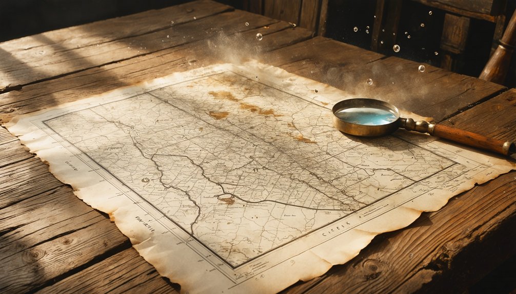
To reconstruct Mission Creek’s original layout, you’ll want to start by locating plat maps held through the Nebraska State Historical Society or Pawnee County records. These maps show where early surveyors once drew out streets, lots, and boundaries that no longer exist on the ground.
Railroad maps from the same era can reveal how rail lines shaped the town’s placement and commercial logic. This information can give you a clearer picture of why settlers chose that particular stretch of land.
Locating Original Plat Maps
When a town vanishes from the landscape, its clearest surviving record often lives inside a plat map. For Mission Creek, you’ll find those records through the Nebraska State Historical Society’s archives, county courthouse filings, and digitized land records.
Local folklore may hint at where buildings once stood, but plat maps confirm it. Preservation challenges mean some documents are fragile or incomplete, so request copies early.
Search these sources to reconstruct Mission Creek’s original layout:
- Hand-drawn survey grids marking individual lots and block numbers
- Surveyor notations identifying streets, alleys, and public squares
- Landowner names inked beside each parcel boundary
- Township and range coordinates anchoring the site to exact ground
- Filing dates revealing when settlers first staked their claims
Railroad Maps Reveal Layouts
Railroad maps cut straight to the bones of a forgotten town in ways that plat maps sometimes can’t. When you pull up historic Nebraska railroad surveys, you’re seeing Mission Creek through the eyes of engineers who once believed this place had a future. Lines, stops, sidings — each marking tells a story about economic ambition and cultural heritage that shaped southeastern Nebraska.
Compare those old railroad routes against current road grids and you’ll spot the ghostly outline of what once existed. Preservation efforts have kept some of these maps digitized and accessible through the Nebraska State Historical Society, so you won’t need to dig through dusty archives alone.
Follow the old rail corridor on your drive out. The landscape still echoes the route, if you know what you’re looking for.
Comparing Historic And Current Maps
Layering a historic map over a current one is where Mission Creek stops being an abstraction and starts feeling like a real place. Local lore only carries you so far—maps show you exactly where streets were platted, where buildings stood, and what preservation efforts, if any, left anything behind.
Look for these details when comparing maps:
- Street grids that no longer match modern roads
- Labeled town lots where open fields now exist
- Railroad spurs that vanished from current route lines
- Creek alignments that once defined the settlement’s edge
- Neighboring landmarks that confirm you’re standing in the right county section
You’re not just reading paper—you’re reconstructing a world. That’s the freedom ghost-town research gives you: no guided tour required, just your curiosity and the evidence.
How Nebraska’s Archives Confirm Ghost Town Locations

Because so many Nebraska ghost towns left behind little more than a faint outline on the land, the state’s archives become your most reliable guide. The Nebraska State Historical Society holds county histories, old newspapers, and railroad records that transform ghost town legends into verifiable coordinates.
You won’t find a welcome sign at Mission Creek, but you’ll find pioneer stories preserved in faded print and catalogued documents.
Cross-referencing those archival sources with the historic maps you’ve already studied sharpens your research considerably. Aerial photographs then confirm what the documents suggest, revealing buried foundations and vanished roadbeds invisible from a car window.
Trust the archive first, then trust your eyes on the ground. That combination turns a speculative drive into a historically grounded journey worth every mile.
How to Research a Nebraska Ghost Town Before You Drive Out
Before you drive a single mile toward Pawnee County, you’ll want to pull up historic Nebraska maps and trace Mission Creek’s outline on paper first.
Railroad-era plat maps and land development records often reveal a town’s original footprint long after the buildings have vanished.
Once you’ve confirmed the site on a historic map, cross-reference it against county histories and deed records to sharpen your coordinates before heading out.
Consulting Historical Maps First
How do you find a town that no longer wants to be found? Start with historical maps — they’re your clearest path to Mission Creek’s ghost. Nebraska’s archival sources confirm that maps reveal what local legends only hint at and what preserved structures rarely survive to show.
Pull up historic railroad and land plat maps, then compare them against current layouts. You’ll begin seeing the bones beneath the landscape.
- Faded grid lines marking streets nobody walks
- Platted lots where storefronts once faced each other
- Railroad corridors that dictated where life gathered
- Property boundary shifts that signal a town’s collapse
- Blank spaces on modern maps where names once appeared
That contrast between then and now tells you exactly where to point your truck.
Verifying Through County Records
Maps get you close, but county records seal the deal. Once you’ve traced Mission Creek on a historic map, head into Pawnee County’s archived plat books, deed records, and old newspaper files. These documents reveal the cultural significance a place once carried — who filed claims, which families stayed, and why the town eventually faded.
You’ll sometimes uncover local legends that never made it into printed histories: a disputed boundary, a railroad promise that never came through, a community that simply scattered when opportunity moved on. County histories and Nebraska State Historical Society materials help you cross-reference what the maps suggest.
That layered research transforms your road trip from a casual drive into something deliberate. You’re not just visiting a location — you’re reconstructing a vanished world before you ever leave home.
How to Read the Pawnee County Landscape for Hidden Remnants
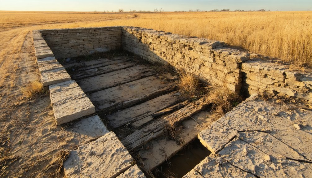
Once you’ve gathered your historic maps and aerial images, reading the Pawnee County landscape becomes less like sightseeing and more like archaeology. Local legends point you toward abandoned structures, but the land itself tells the deeper story.
Watch for these hidden remnants as you move through the terrain:
- Unusual depressions or raised earth where foundations once settled
- Isolated tree clusters marking former homestead yards
- Faint linear breaks in crop patterns revealing old roadbeds
- Scattered limestone fragments where a building once stood
- Abrupt changes in vegetation density following railroad rights-of-way
You’re not just driving through countryside — you’re tracing what was deliberately built and quietly lost. The freedom in this kind of travel is real: no guided tours, no visitor centers, just open land holding its own memory.
Plan Your Southeast Nebraska Ghost Town Route
Reading the land at Mission Creek is only the beginning — southeast Nebraska rewards the traveler who plans a longer loop through Pawnee County’s forgotten places. Add stops at Melrose, Meridian, and Minersville to build a route that traces the region’s rail-driven rise and quiet collapse.
Southeast Nebraska’s forgotten towns reward the curious traveler willing to trace a longer loop through Pawnee County’s quiet past.
Each site carries local legends worth tracking down through county histories and archived newspapers before you leave home. Don’t expect signage or developed facilities — you’re steering by historic maps and instinct.
Where preservation efforts exist, they’re modest, often community-led, and deeply meaningful. Pack your research alongside your road atlas.
The freedom of this trip lies in piecing together a landscape that official tourism never bothered to frame. Southeast Nebraska’s ghost towns won’t come to you — you have to go looking.
Other Pawnee County Ghost Towns Worth the Detour
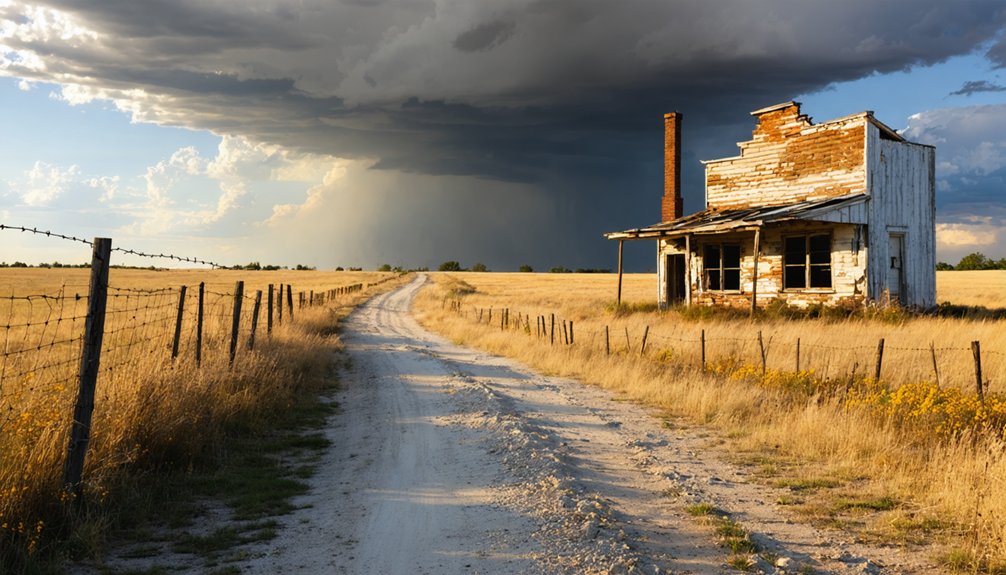
Pawnee County holds more than Mission Creek in its forgotten corners — Melrose, Meridian, and Minersville each earned a place on Nebraska’s ghost-town lists, and each rewards the traveler willing to dig through county histories before hitting the road. Urban legends and folklore stories cling to these vanished settlements like prairie dust, giving you richer context than any highway sign ever could.
Before you drive out, picture what you’re chasing:
- Collapsed foundations swallowed by tallgrass
- Overgrown rail corridors cutting through empty farmland
- Faded plat maps marking streets that never filled
- Cellars hinting at families who stayed and then disappeared
- Silence where a grain elevator once anchored a community
Each site deepens your understanding of southeast Nebraska’s fragile, freedom-built settlement history.
Field Tools and Resources for the Mission Creek Nebraska Visit
Before you load the car, gather the tools that’ll actually get you close to Mission Creek’s vanished footprint: historic railroad maps, aerial photographs, and Nebraska State Historical Society records form your core kit.
Cross-reference old plat maps against current aerial imagery to spot buried roadbeds or foundation outlines invisible at ground level.
County histories and local newspapers fill gaps where official records go quiet, revealing the cultural significance a forgotten settlement once carried.
Don’t underestimate oral histories either — they surface details no archive preserves.
Preservation challenges mean signage is practically nonexistent, so your preparation becomes the interpretation.
Download materials before leaving cell range.
Treat the landscape itself as your primary document.
What’s missing from the ground tells the story just as powerfully as what remains.
Frequently Asked Questions
What Is the Best Time of Year to Visit Mission Creek?
Spring and fall offer you the best seasonal weather for exploring Mission Creek’s quiet remnants. You’ll enjoy cooler temperatures, clearer skies, and rewarding wildlife viewing among the forgotten Nebraska landscape where settlers once built their dreams.
Are There Any Entrance Fees or Permits Required to Visit?
Like pioneers who roamed freely across open plains, you’ll find no entrance fees or permit requirements standing between you and Mission Creek. It’s a forgotten landscape welcoming your curious spirit without restriction.
Is the Mission Creek Site Accessible for Visitors With Mobility Limitations?
You’ll find no confirmed accessibility features or mobility assistance at Mission Creek’s ghost town remnants. The site likely offers only open land, so you’d navigate uneven terrain as free explorers tracing history’s quiet, fading footprints independently.
Can Children Participate Meaningfully in a Ghost Town Road Trip?
Yes, your kids can meaningfully explore ghost towns! Spark their curiosity through kid-friendly activities like map-reading and spotting old foundations. You’ll nurture their love of historical preservation while chasing Nebraska’s forgotten past together, creating lasting family memories.
Are There Lodging Options Near Pawnee County for Overnight Stays?
You’ll find nearby accommodations in surrounding southeast Nebraska towns. Seek out historic lodging that echoes the frontier spirit — small-town inns and motels keep your road-trip freedom alive while you chase Pawnee County’s forgotten past.
References
- https://en.wikipedia.org/wiki/List_of_ghost_towns_in_Nebraska
- https://visitnebraska.com/trip-idea/explore-7-authentic-ghost-towns-nebraska
- https://history.nebraska.gov/finding-nebraskas-ghost-towns/
- https://history.nebraska.gov/wp-content/uploads/2017/12/doc_publications_NH1937GhostTowns.pdf
- https://nebraskarules.tripod.com/id11.html
- https://en.wikipedia.org/wiki/Mira_Creek
- https://www.ghosttowns.com/states/ne/ne.html