Planning a ghost town road trip to Olney, Oklahoma means stepping into a place where Choctaw heritage, railroad ambition, and frontier commerce collided—then quietly disappeared. Located in Coal County, about 7 miles west of Lehigh, Olney was once called Parmicho, meaning “lighted place in the distance.” At its peak, it supported 11 merchants and 2 banks before the Rock Island Railroad‘s decline erased it all. Keep going, and you’ll uncover everything you need to explore it right.
Key Takeaways
- Olney, located in Coal County about 7 miles west of Lehigh, was founded in 1902 and has Choctaw roots.
- No standing structures remain, so focus on the landscape and regional geography rather than preserved architecture.
- Visit in spring or fall for mild temperatures, manageable roads, and ideal lighting conditions.
- Carry water, snacks, offline maps, and a full gas tank, as services are extremely limited in rural areas.
- Combine your visit with nearby Lehigh and Coalgate to explore connected railroad and mining ghost town histories.
What Made Olney, Oklahoma a Ghost Town?
Olney’s story follows a familiar Oklahoma pattern — a railroad arrives, a town blooms, and then the forces that built it slowly walk away. At its peak, Olney supported around 11 merchants and 2 banks, enough commercial life to feel like something lasting. It didn’t last.
When railroad economics shifted and nearby communities absorbed regional trade, Olney lost its footing. No single disaster erased it — just the quiet erosion that follows when a town’s purpose disappears.
You’re looking at a place whose cultural significance runs deeper than its current footprint suggests. The Choctaw roots, the renamed streets, the vanished storefronts — they all matter.
Historical preservation here isn’t about maintaining buildings. It’s about understanding why communities like Olney rise, shrink, and eventually fade into the landscape.
Where Olney, Oklahoma Sits in Coal County
Tucked into Coal County in southeastern Oklahoma, Olney sits about 7 miles west of Lehigh — close enough to feel connected to the region’s history, far enough to have developed its own identity. The Rock Island Railroad once tied this small settlement into a larger commercial network, giving it brief but real economic momentum.
Today, Coal County’s rural landscape defines what you’ll encounter when you visit. Open land, quiet roads, and scattered remnants frame the experience.
Olney’s cultural significance runs deeper than its physical footprint — its Choctaw-rooted name and railroad-era origins tell a story worth chasing.
Preservation challenges are real here. Without formal infrastructure, the historical record matters more than visible ruins.
Pair Olney with other southeastern Oklahoma stops to build a road trip that rewards curiosity over convenience.
Olney’s Choctaw Roots and the Name Parmicho
Before the town carried the name Olney, it went by something far more evocative: Parmicho, a Choctaw word meaning “lighted place in the distance.” The name referenced a lantern at the railway station — a small but striking detail that captures how Indigenous language and frontier infrastructure intertwined in early Oklahoma settlement.
That cultural significance runs deeper when you learn that Eliphalet Nott and James Brooks Wright, both sons of Choctaw leader Allen Wright, founded the community. Their heritage shaped how this place was named and understood.
On July 12, 1902, the name officially changed to Olney, and Parmicho faded from common use.
Heritage preservation efforts keep that original name alive in historical records. When you visit, you’re not just passing through a ghost town — you’re standing inside a layered story of Choctaw identity and early statehood.
The Railroad That Built and Then Abandoned Olney
When the Rock Island Railroad pushed into Coal County, it handed Olney its identity, pulling in merchants, banks, and the commercial energy that briefly made the town feel permanent.
You can trace that early momentum in the numbers — roughly 11 merchants and 2 banks operating during Olney’s active years, a striking count for such a small settlement.
But once the railroad’s priorities shifted and the tracks stopped driving traffic, the commerce dried up fast, leaving little behind but the outline of what the town once promised.
Rock Island Railroad Arrives
The Rock Island Railroad didn’t just pass through Olney — it *created* it. When the railroad arrived around 1901, it transformed raw Oklahoma land into a functioning community almost overnight.
Suddenly, you’d see 11 merchants setting up shop and two banks operating in a town that hadn’t existed years before. That’s the cultural significance of a single rail line — it didn’t just move freight, it moved entire economies into place.
The original station even inspired the town’s first name, Parmicho, a Choctaw phrase meaning “lighted place in the distance,” referencing a lantern burning at the depot. That detail alone carries enormous historical preservation value.
The railroad gave Olney its identity, its commerce, and its name — and understanding that arrival makes the town’s eventual decline all the more striking.
Commerce Fades Fast
Railroad towns lived and died by the same force that built them. When the Rock Island Railroad stopped prioritizing Olney’s route, the town’s eleven merchants and two banks couldn’t survive without steady rail traffic driving commerce. You can almost feel the silence that replaced the noise of an active depot once trains rerouted elsewhere.
What remains carries real cultural significance, even if the physical structures don’t. Olney represents a pattern repeated across Oklahoma’s roughly 2,000 ghost towns — boom, brief prosperity, then quiet erasure.
Historical preservation efforts here aren’t about maintaining buildings; they’re about remembering how quickly economic lifelines vanished.
When you drive through Coal County today, you’re passing through a landscape that once hummed with purpose — and now holds its history just beneath the surface.
Tracks Left Behind
How does a town rise from almost nothing and collapse just as fast? Follow the railroad. The Rock Island Railroad pulled Olney, then called Parmicho, into existence around 1901, drawing merchants, banking activity, and settlers enthusiastic for opportunity. That single rail connection made everything possible.
Then it made everything fragile.
When railroad priorities shifted, communities like Olney lost their economic lifeline almost overnight. No trains meant no trade corridors, no reason to stay. Urban decay crept in quietly, erasing what commerce had built.
Today, historic preservation efforts focus less on physical structures and more on keeping the memory documented.
You’re free to drive these backroads and piece together what the tracks once meant. That freedom to explore forgotten systems is exactly what ghost-town road trips offer.
What Historical Records Reveal About Olney’s Vanished Business District
When you look at the historical record, you find that Olney once supported around 11 merchants operating within its small but active commercial corridor.
Two banks even took root there, which tells you that early residents expected real economic staying power from this railroad-linked settlement.
That commercial confidence didn’t last, though, and once the railroad’s influence faded, Olney’s business district went quiet and eventually vanished from the landscape entirely.
Early Merchant Count Revealed
Though it lasted only a short time before fading into history, Olney’s early business district packed a surprising amount of commercial life into its railroad-era peak. When you dig into historical preservation records, you’ll find that roughly 11 merchants once operated here alongside 2 functioning banks. That’s a genuine economic footprint for a rural unincorporated settlement.
Community stories passed down through local accounts paint a picture of a place that briefly hummed with real commercial energy, driven almost entirely by its Rock Island Railroad connection. Once that railroad advantage disappeared, so did the businesses.
Understanding this merchant count helps you appreciate what you’re actually visiting — not just an empty field, but a place where everyday economic life once stood before quietly vanishing from the map.
Two Banks Operated Briefly
What stands out most in Olney’s historical record isn’t just the merchant count — it’s the fact that two fully operating banks once anchored this small railroad-era settlement. For a community this size, that detail carries real weight. Banks don’t appear without economic confidence, and their presence signals that residents genuinely believed Olney had a future worth investing in.
You won’t find surviving historical architecture here today, but the local legends surrounding Olney’s brief commercial peak paint a vivid picture. Money moved through this town. Loans were made, accounts were kept, and financial ambitions ran alongside the railroad tracks.
When both banks eventually closed, they took with them the clearest proof that Olney once functioned as a legitimate, thriving community rather than just a footnote on an old county map.
Railroad Commerce Then Silence
Historical records reveal that Olney once supported around 11 merchants operating alongside its two banks — a surprisingly dense commercial footprint for a small Coal County railroad stop. The Rock Island Railroad made that density possible, pulling commerce, residents, and ambition into a community that barely existed before 1901.
Then the silence came. Industrial decline reshaped countless Oklahoma railroad towns just like Olney, stripping away the economic engine that once justified their existence. When rail traffic shifted or reduced, merchants had little reason to stay.
What remains today isn’t rubble or ruin — it’s cultural heritage carried in records, names, and geography. You’re visiting a place where commerce once moved and then stopped, leaving only the land and the story behind. That story is worth the drive.
What’s Left to See in Olney, Oklahoma Today?
Like many of Oklahoma’s faded railroad towns, Olney doesn’t offer a dramatic skyline of crumbling buildings or a preserved main street frozen in time. What you’ll find instead is quieter but worth your attention if you value historical preservation and local legends tied to the land.
When you visit, focus your time on:
- The surrounding landscape, where Coal County’s open terrain still echoes the railroad corridor that once defined this community.
- The Lehigh connection, just seven miles east, which offers additional context for the region’s boom-and-bust history.
- The story itself, because Olney’s Choctaw-rooted name and vanished merchants carry more weight than any standing structure could.
You’re not chasing ruins here. You’re chasing history written in absence.
Other Ghost Towns Near Olney Worth the Detour
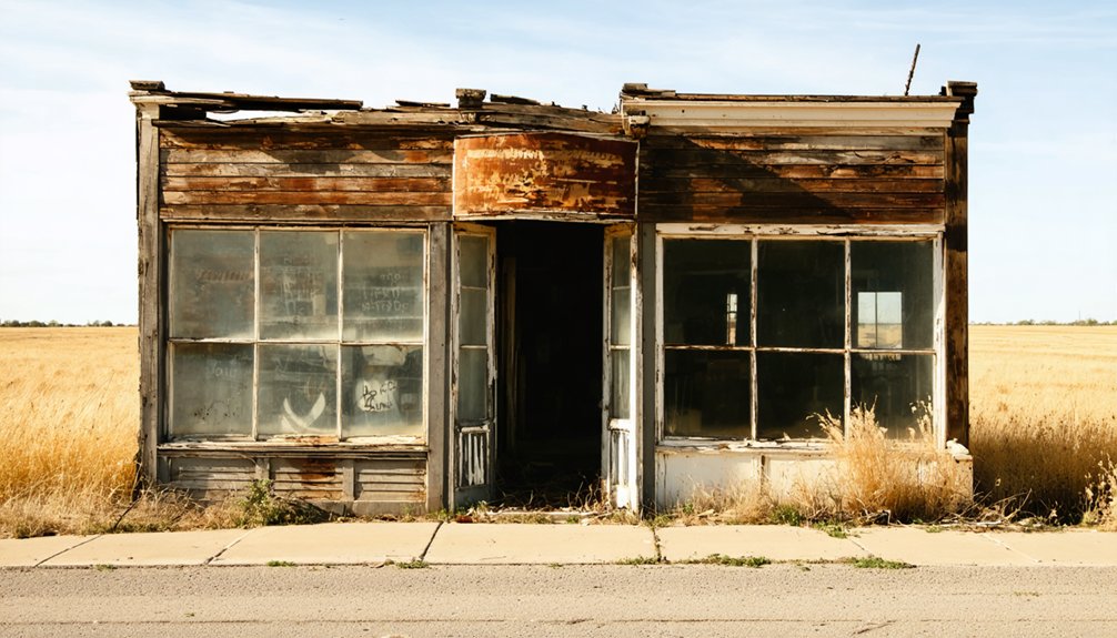
Olney sits in a region rich with forgotten communities, so if you’re already making the drive through Coal County, you’d be doing yourself a disservice by stopping at just one ghost town. Southeastern Oklahoma holds dozens of vanished settlements, each carrying its own cultural significance tied to railroad corridors, Choctaw heritage, and boom-and-bust economies.
Lehigh, just seven miles east, has its own mining history worth exploring. Towns like Coalgate nearby offer deeper context for understanding how the region developed and declined.
Historical preservation efforts vary across these stops, so go in with flexible expectations. String several sites together into a single day route, and you’ll leave with a much sharper picture of how Oklahoma’s rural southeast once thrived — and why so much of it eventually disappeared.
Best Time of Year to Drive Coal County’s Ghost Town Roads
Spring and fall offer the best conditions for driving Coal County’s back roads, when mild temperatures make long stretches behind the wheel genuinely comfortable.
You’ll want to avoid summer heat and winter mud, both of which can turn unpaved rural routes into frustrating detours.
If wildflowers are your thing, plan your visit for late March through April, when the roadsides bloom and the landscape adds a vivid backdrop to Olney’s quiet, faded history.
Ideal Visiting Seasons
When you’re planning a drive through Coal County’s forgotten landscapes, the season you choose shapes everything from road conditions to the quality of light falling across old town sites.
Three seasons stand out for this type of cultural heritage road trip:
- Spring (March–May): Mild temperatures and green surroundings frame historical preservation sites beautifully. Rural roads stay manageable after winter.
- Fall (September–November): Cooler air, golden light, and thin crowds make this the strongest season for unhurried exploration and photography.
- Winter (December–February): Stripped vegetation actually reveals old foundations and structural remnants more clearly. This rewards the prepared traveler.
Summer brings intense Oklahoma heat and humidity that drains your energy fast. Plan your visit when conditions work for you, not against you.
Weather And Road Conditions
Coal County’s weather can flip on you fast, so knowing what to expect before you load up the car makes a real difference on these rural roads.
Spring brings mud and flash flooding that can make unpaved county roads impassable, threatening your access to sites tied to cultural heritage worth seeing firsthand.
Summer heat is intense but roads stay dry and firm.
Fall offers the most reliable driving conditions, with cooler temps and stable ground, making it the smartest window for exploring preservation efforts and historical markers across the region.
Winter ice creates serious hazards on unlit rural stretches.
Always check Oklahoma Department of Transportation road condition updates before heading out, carry water, and keep your tank full since services thin out quickly once you leave Lehigh heading west.
Peak Wildflower Bloom Timing
Oklahoma’s wildflower season peaks between late March and mid-May, and if you’re timing a drive through Coal County’s ghost town corridor, that window gives you the most rewarding experience on the road west toward Olney. Wildflower peaks transform otherwise quiet rural stretches into vivid, open-road scenery worth slowing down for.
Plan your visit around these seasonal blooms:
- Late March brings Indian paintbrush and bluebonnets along roadsides near Lehigh.
- April delivers the fullest color, with prairie wildflowers framing abandoned lots and overgrown sites.
- Early May offers a final burst before summer heat strips the color back.
You’ll get richer photographs, better light, and a sense of the land reclaiming what the railroad once built.
Building a Southeastern Oklahoma Ghost Town Route Around Olney
Southeastern Oklahoma rewards ghost town hunters with a dense network of faded railroad stops, old mining camps, and vanished communities, and Olney fits naturally into a regional route through Coal County.
Pair it with nearby Lehigh, just seven miles east, where coal mining’s economic decline left its own visible marks on the landscape. You’ll find cultural heritage woven into nearly every stop, from Choctaw-era place names to railroad corridors that once drove commerce across the region.
Build your route heading west from McAlester, threading through Coal County’s quieter back roads before looping south toward Atoka County. Keep your expectations grounded since Olney offers historical atmosphere over dramatic ruins.
The real reward is understanding how interconnected these communities once were before the boom-and-bust cycle erased them from the map.
What to Pack for a Coal County Ghost Town Drive

Once you’ve mapped out your route through Coal County, packing smart will make the difference between a frustrating drive and a rewarding one. Rural southeastern Oklahoma offers limited services, so preparation matters.
- Navigation tools – Download offline maps before leaving. Cell service drops in remote areas, and you don’t want to miss Olney’s location about seven miles west of Lehigh.
- Research notes – Bring printed or saved background on Olney’s settlement origins, including its Choctaw-named past as Parmicho. Understanding cultural heritage deepens what you see.
- Water, snacks, and a full tank – Gas stations thin out fast once you leave main corridors. Stock up before heading into Coal County’s quieter backroads.
Pack light, but pack purposefully, and the drive rewards you.
Frequently Asked Questions
Is Olney, Oklahoma Officially Recognized as a Historic Landmark?
Based on available records, Olney doesn’t carry an official landmark designation. You won’t find formal historical preservation status here, but its rich railroad and Choctaw heritage still makes it a genuinely compelling, freedom-filled road trip discovery.
Can You Drive to Olney Without a Four-Wheel-Drive Vehicle?
You don’t need a four-wheel-drive vehicle to reach Olney. Road conditions are manageable for standard cars, and vehicle requirements stay minimal since it’s an unincorporated rural community accessible via typical Coal County roads.
Are There Any Guided Ghost Town Tours Available in Coal County?
You won’t find formal historical ghost town tours in Coal County, but you can independently explore Olney and surrounding areas. Bring your camera for ghost town photography and craft your own unforgettable, freedom-filled adventure.
Is There Cell Service Available Along Coal County Ghost Town Roads?
Cell service can be spotty along Coal County’s rural roads, so you’ll want to download offline maps before heading out. Road conditions vary, but that unpredictability is part of the freedom you’re chasing.
Are There Any Local Museums Near Olney That Cover Its History?
You won’t find dedicated local museum exhibits covering Olney directly, but Coal County’s historical site preservation efforts mean nearby Coalgate may offer regional displays capturing the railroad-era stories that shaped communities like Olney.
References
- https://en.wikipedia.org/wiki/Olney
- https://www.facebook.com/4StateNewsandWeather/posts/the-ghost-town-of-picher-oklahoma-who-has-been-here/1273791271553125/
- https://www.okhistory.org/publications/enc/entry?entry=GH002
- https://www.travelok.com/articles/oklahomaghosttowns
- https://www.reddit.com/r/AbandonedPorn/comments/1nvaobs/americas_most_toxic_ghost_town_picher_ok_usa/
- https://en.wikipedia.org/wiki/List_of_ghost_towns_in_Oklahoma
- https://okmag.com/blog/a-ghostly-site/
- https://www.youtube.com/watch?v=_T1s7uMtgJs
- https://okgenweb.net/~okcoal/place/olney.htm