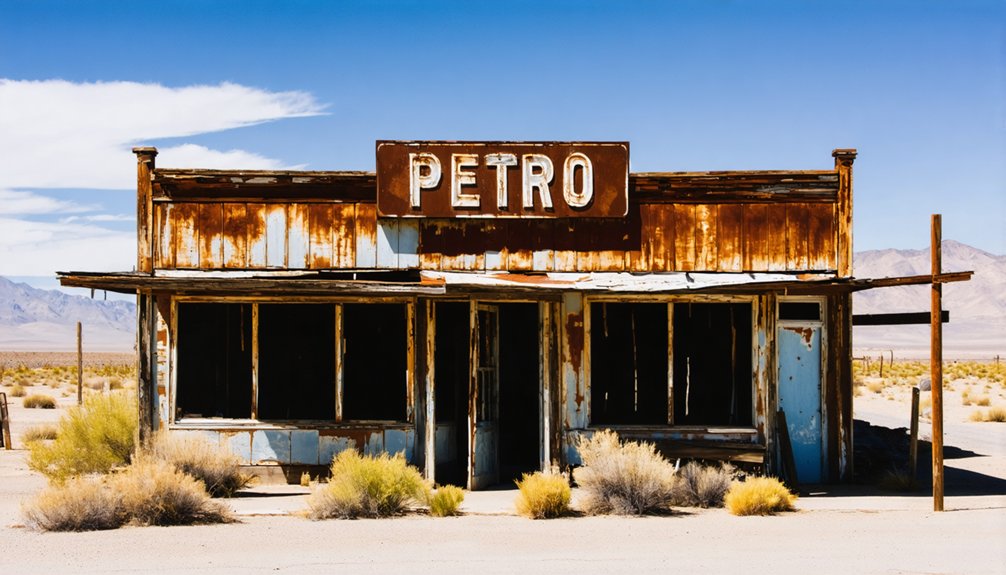
Petro, California sits roughly 7.25 miles north of Wasco in Kern County’s flat, sun-baked farmland — a railroad ghost town that last appeared on maps in 1947 before the earth quietly swallowed it whole. You won’t find signs, parking lots, or ranger stations here. You’ll need offline maps, curiosity, and a respect for forgotten places. It’s less a destination than a feeling — and there’s far more to this vanished town’s story worth uncovering.
Key Takeaways
- Petro, California, is located 7.25 miles north of Wasco in Kern County, making Wasco your closest modern starting landmark.
- No signs, parking, or visitor facilities exist, so bring offline maps, water, snacks, and essentials for self-guided exploration.
- Follow the old Santa Fe Railroad corridor from Wasco to navigate toward Petro’s historically mapped location.
- Visit during fall or spring for cooler temperatures, manageable dust levels, and better overall exploration conditions.
- Confirm land ownership before visiting, leave all artifacts undisturbed, and explore responsibly to preserve the site.
What Was Petro, California?
Though its name barely registers on modern maps, Petro was once a living settlement tucked into Kern County, California, roughly 7.25 miles north of Wasco at an elevation of about 292 feet. Its historical significance lies in its connection to the Atchison, Topeka and Santa Fe Railroad, the iron thread that likely called Petro into existence in the first place.
By 1947, it still appeared on maps. Then silence. Urban decay and abandonment erased it so completely that later records simply stopped acknowledging it.
That’s the pull for you as a road tripper chasing real California history. Petro isn’t a curated attraction or a county park. It’s a vanished world, a reminder that freedom once moved along railroad corridors through the Central Valley and left places like this behind.
Where Exactly Is Petro Located?
You’ll find Petro’s footprint in Kern County, California, roughly 7.25 miles north of Wasco — a flat, sun-baked stretch of the Central Valley where agriculture and railroad ambition once shaped the land.
The settlement grew up near the Atchison, Topeka and Santa Fe Railroad, which gave it both its reason to exist and, eventually, its reason to fade.
If you trace the old Santa Fe corridor today, you’re tracing the ghost of Petro itself.
Kern County General Location
Where exactly do you point on a map when a place has all but erased itself from modern records? Petro sits in Kern County, California, roughly 7.25 miles north of Wasco, resting quietly at 292 feet above sea level. Its cultural significance lives in what it once represented — a rail-linked settlement that thrived, then vanished.
- Kern County anchors California’s Central Valley interior
- Petro connected to the Atchison, Topeka and Santa Fe Railroad corridor
- Last confirmed mapping appearance dates to 1947
- Historical preservation remains minimal — nature reclaimed most evidence
- Wasco serves as your closest modern landmark for navigation
You’re chasing a coordinate more than a destination, and that freedom is exactly what makes this road trip worth planning.
Proximity To Wasco
Wasco gives you your clearest anchor point when you’re trying to locate Petro on a modern map. Head roughly 7.25 miles north, and you’re standing where Petro once breathed. That distance feels deceptively short — just enough road to carry you from a living town into something forgotten.
Petro sat at around 292 feet above sea level, flat Kern County land stretching in every direction, the Santa Fe Railroad threading nearby like a lifeline that eventually went quiet.
Its cultural significance lies in what it represents: a settlement born from rail expansion, then swallowed by time. Preservation challenges are real here — no markers greet you, no restored buildings anchor the memory.
You’re exploring by history alone, which makes the freedom of finding it entirely your own.
Santa Fe Railroad Connection
The Santa Fe Railroad didn’t just pass near Petro — it likely built it. Like countless Wild West settlements, Petro probably existed because the railroad needed it to. That’s railroad history in its rawest form: towns born from steel rails, then abandoned just as quickly.
Before you visit, consider what that connection means for your route:
- The Atchison, Topeka and Santa Fe Railroad shaped Kern County’s development.
- Railroad towns often vanished when lines rerouted or traffic declined.
- Petro’s location suggests it served a logistical purpose, not permanence.
- Following the old Santa Fe corridor adds thematic depth to your itinerary.
- Historic rail maps can help you trace Petro’s original footprint.
You’re not just chasing a ghost town — you’re chasing the ghost of an entire economy.
What’s Actually Left to See at Petro Today
Unlike Bodie’s preserved storefronts or Calico’s reconstructed streets, Petro offers you almost nothing in the physical sense—and that absence is the whole point. No visitor facilities wait for you here. No interpretive signs, no parking lots, no gift shops selling refrigerator magnets.
What you’ll find instead is open San Joaquin Valley farmland, flat horizon, and the quiet hum of a place that simply stopped existing sometime after 1947.
Historical artifacts won’t surface along a marked trail—they’ve long since scattered or disappeared beneath cultivated soil. You’re fundamentally reading a landscape that’s forgotten it ever had a name.
Bring your own water, your own maps, and your own sense of curiosity. Petro rewards the traveler who finds meaning in erasure rather than preservation.
Ghost Towns Near Petro Worth Visiting
Since Petro gives you almost nothing to see, you’ll want to build the rest of your route around ghost towns that still hold something tangible. The region rewards curious travelers who dig past tourist amenities and chase local folklore instead.
Consider adding these stops to your itinerary:
- Bodie State Historic Park – California’s most preserved ghost town, frozen in honest decay
- Calico Ghost Town – the most accessible option, converted into a county park with visible silver-mining history
- Cerro Gordo – remote, raw, and unfiltered for travelers who want solitude
- Mojave Desert ruins – scattered sites best explored fall through spring
- Kern County railroad corridors – echoing the same Santa Fe line that once gave Petro its brief purpose
How to Build a Kern County Ghost Town Route Around Petro
Building a route around Petro means accepting that the destination itself is more idea than place—a dot on a 1947 map that has since dissolved into Kern County farmland.
Start near Wasco, about 7.25 miles south, and let the Santa Fe Railroad corridor guide your heading. You’re chasing historical markers and echoes of urban decay rather than preserved storefronts.
Layer in neighboring Kern County stops where railroad expansion once promised permanence, then delivered silence instead.
Keep your maps current, check road conditions before you leave, and carry enough water to stay comfortable between stops.
The freedom here isn’t in arriving somewhere spectacular—it’s in reading a landscape that refuses to explain itself, piecing together what Petro once meant before the records simply stopped.
How Petro Compares to Bodie and Calico as Ghost Towns
When you stack Petro against Bodie and Calico, the differences hit fast and hard — Bodie’s frozen storefronts and Calico’s reconstructed saloons give you something to touch, photograph, and walk through, while Petro offers nothing but flat farmland and a faint outline on an old 1947 map.
Calico’s paved lot and ranger station make it the easiest stop you’ll ever make on a ghost-town circuit. Bodie rewards the drive with preserved decay that feels genuinely haunted, and Petro asks you to bring your own imagination because the land itself has moved on.
That gap between preservation and erasure is exactly what makes Petro worth including — you’re not visiting a curated past, you’re standing where history quietly dissolved.
Preservation Versus Vanished History
Not every ghost town leaves something behind for you to find. Petro didn’t preserve its urban decay behind a fence or dress it up for tourists. It simply vanished, making its cultural heritage feel more haunting than any restored building could.
Compare that to Bodie and Calico, where history stays frozen in place:
- Bodie holds arrested decay under state protection
- Calico offers walkable streets and preserved storefronts
- Petro exists only in railroad records and 1947 maps
- Bodie and Calico charge admission; Petro costs nothing but curiosity
- Preserved towns show you history; Petro makes you imagine it
That distinction matters when you’re planning your route. Sometimes the places that disappeared completely tell the truest story.
Accessibility Across Three Sites
Getting to these three ghost towns means three completely different experiences before you ever step out of your car. Calico wins on tourist accessibility — paved roads, parking lots, and county park infrastructure greet you immediately. It’s polished, almost too comfortable.
Bodie demands more effort: a long drive ending on a washboard dirt road, but the payoff is extraordinary historical preservation frozen mid-century, buildings still holding their original contents.
Then there’s Petro. No parking lot waits for you, no ranger station, no interpretive sign. You’re steering through Kern County farmland, cross-referencing old railroad maps against modern roads, searching for a place that’s fundamentally returned to earth.
That freedom cuts both ways — it’s raw, honest, and entirely yours to discover.
Remote Versus Developed Experiences
What you find at a ghost town depends almost entirely on how much the modern world has intervened. Bodie offers managed urban decay with ranger oversight. Calico built tourist infrastructure around its ruins. Petro gave you nothing — and that’s the point.
- Bodie: preserved mid-collapse, no restoration, state-monitored access
- Calico: county park with gift shops, trails, and guided tours
- Petro: unmarked, undeveloped, erased from most modern maps
- Bodie rewards patience; Calico rewards convenience; Petro rewards research
- Your experience scales directly with your willingness to seek rather than consume
That spectrum matters when you’re planning your route. Some travelers want guardrails. Others want the raw, nostalgic silence of a place the world forgot. Petro belongs firmly to the latter category.
Best Time to Visit Kern County Ghost Towns
Planning your visit around the right season can mean the difference between a memorable road trip and a miserable slog through triple-digit heat. Kern County’s ghost towns, including forgotten outposts like Petro, reward travelers who time things right.
Time your visit right, or let the desert punish you for it.
Fall and spring are your sweet spots. The air carries a cool, dusty clarity, the light hits abandoned landscapes with cinematic warmth, and you’re not fighting summer’s punishing desert sun. Without tourist amenities to cushion a bad-weather visit, preparation matters more here than at polished destinations.
Winter mornings can feel bracingly raw across the valley floor, but afternoons often turn golden and mild.
Local legends suggest old-timers scheduled their own travels this way instinctively. They understood the land’s rhythms. You should too before you go.
Ghost Town Access, Safety, and Site Rules
Arriving at a place like Petro means stepping into land that doesn’t owe you anything. No tourist infrastructure exists here — no signs, no rangers, no guardrails. Cultural preservation depends entirely on how you show up.
Before you leave pavement behind, know the rules:
- Confirm land ownership — some sites are private, and trespassing erases your freedom fast
- Pack water, snacks, and offline maps — services vanish with the blacktop
- Never remove artifacts — it’s illegal and strips history from everyone who follows
- Treat unstable structures as warnings, not invitations
- Visit during daylight — remote roads don’t forgive poor timing
Petro survived long enough to leave a mark on 1947 maps. The least you can do is leave it exactly as you found it.
Frequently Asked Questions
Can Children Safely Visit Ghost Town Sites Like Petro?
Yes, you can bring kids, but you’ll want to supervise them closely. Unstable structures pose real risks, so stick to kid-friendly activities like historical preservation storytelling, turning forgotten echoes of Petro’s past into unforgettable family adventures.
Are Photography Permits Required at California Ghost Town Locations?
Like a open road calling you forward, most sites don’t require permits. However, you’ll want to check each location’s photography guidelines and permit regulations, as private land and state parks sometimes have their own rules.
What Type of Vehicle Is Best for Ghost Town Road Trips?
You’ll want a capable off road vehicle to navigate rugged ghost town trails, though arriving in vintage cars carries a nostalgic charm that echoes the forgotten souls who once traveled these same weathered, freedom-calling roads.
How Long Should a Kern County Ghost Town Road Trip Take?
You’ll want three to four days to chase Kern County’s ghost towns properly. That’s enough time to honor historical preservation, absorb local legends, and let nostalgia breathe freely across every forgotten, sun-bleached mile you discover.
Are There Guided Ghost Town Tours Available Near Petro, California?
Dusty silence meets living history when you seek guided tour options near Petro. You won’t find formal tours here, but Bodie and Calico offer structured experiences supporting historical preservation, letting you roam freely yet meaningfully.
References
- https://www.calexplornia.com/california-ghost-towns/
- https://www.youtube.com/watch?v=feEm3HJ9_xo
- https://kids.kiddle.co/Petro
- https://en.wikipedia.org/wiki/Calico
- https://www.youtube.com/watch?v=oW66pgyhMYM



