You’ll find Northern Virginia’s most haunting ghost towns within an hour of Washington, D.C., each telling a distinct story of American ambition. Matildaville, founded in 1790 as George Washington’s canal headquarters, crumbles near Great Falls. Colchester, once Virginia’s third-largest port in the 1750s, was strangled by river sedimentation. The Elko Tract served as a WWII decoy airfield, complete with plywood planes and fake hangars. These forgotten settlements offer atmospheric ruins, archaeological sites, and historical markers that reveal the untamed chapters of Virginia’s past.
Key Takeaways
- Matildaville, founded in 1790 near Great Falls, served as Patowmack Company headquarters and became Virginia’s earliest ghost town by 1828.
- Colchester, established in 1753, was Virginia’s third-largest port until river sedimentation isolated it and ended commerce in the early 1800s.
- Elko Tract was a WWII decoy airfield created in 1942, requiring seizure of 40 farms to protect Richmond Army Air Base.
- Falling Creek Ironworks, America’s first iron production site from 1619, was destroyed in 1622 and never fully recovered operations.
- Historical markers and trails at Colchester allow visitors to explore archaeological sites and the original footprint of these vanished settlements.
Matildaville: Canal Company Headquarters Turned Ruins
When George Washington wasn’t founding a nation, he was pioneering infrastructure projects that would connect the fledgling country’s waterways—and one of his most ambitious ventures left behind a ghost town you can still visit today.
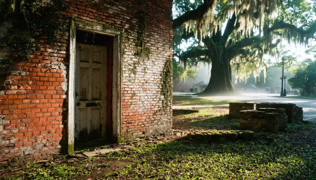
Named after Matilda Lee in 1790, Matildaville flourished as headquarters for the Patowmack Company’s canal operations. You’ll find its fragile stone foundations scattered throughout Great Falls Park, remnants of what was once a bustling hub complete with mills, foundries, and boarding houses. The ruins include the superintendent’s house and springhouse, accessible only via hiking trails within the park.
Despite groundbreaking canal engineering, economic challenges proved insurmountable. Construction costs spiraled, especially at Great Falls, while the canal operated merely one or two months yearly. The town had grown to include a market, grist mill, sawmill, and inn serving the canal workers and travelers.
When the company’s charter was revoked in 1828, Matildaville became Virginia’s earliest ghost town—a reflection of ambition outpacing reality.
Colchester: Colonial Port on the Occoquan
You’ll find Colchester’s story woven into the very landscape where the Occoquan River once bustled with tobacco-laden boats and colonial merchants.
Standing at the old ferry crossing today, it’s hard to imagine that these quiet woods were Virginia’s third-largest port in the 1750s, until relentless sedimentation choked the harbor and an 1815 fire sealed the town’s fate.
The town’s charter, granted in 1753 to Peter Wagener by the Virginia Assembly, established a layout of 42 lots and four streets governed by five trustees.
What remains—a handful of post-1820 structures and archaeological sites—whispers of the Revolutionary troops who crossed here on their march to Yorktown.
The site witnessed the passage of French and American armies in 1781 and 1782, with soldiers using Colchester’s ferry services and camping at a location one mile north near Giles Run.
Rise as Trading Hub
Long before Colchester’s official founding in 1753, the land along the north bank of the Occoquan River hummed with the promise of commerce. You’d find a tavern and blacksmith operating at the ferry crossing by 1729, serving travelers along the Potomac Path—later known as the King’s Highway.
This wasn’t just any crossroads; it connected the colonies’ major north-south route, making it essential colonial infrastructure.
When Peter Wagener surveyed his triangular 41-lot town in 1754, he built upon decades of established trade. The town’s primary function as a tobacco exportation and inspection port drew merchants, coopers, sailors, and vintners. Prospective buyers had to construct a house within two years of purchasing their lot, ensuring rapid development of the riverside settlement. The town likely took its name from Colchester, Essex in England, Wagener’s hometown.
Everyone—from gentry to enslaved workers—frequented this social and economic hub where Virginia’s cash crop flowed downriver to waiting markets.
Decline From Silting Issues
The Occoquan River betrayed Colchester’s ambitions through relentless sedimentation that choked its commercial lifeline.
You’d witness the silting impact transform this once-thriving port into an isolated backwater by the early 1800s. Tobacco ships that previously docked at Colchester’s wharves couldn’t navigate the increasingly shallow waters, forcing merchants to relocate their operations to deeper ports in Alexandria and Occoquan.
The navigation challenges weren’t just about depth.
Winter’s treacherous currents through the narrow rocky gorge, combined with spring flooding from the Bull Run Mountains, created impassable barriers for months. Your ferry crossing would’ve grown increasingly unreliable as competing routes upstream captured traffic. The alternate postal route established in 1805 diverted critical traffic away from the town’s commercial district.
When Thomas Mason’s wooden bridge washed away in 1807, it severed Colchester’s final hope of maintaining regional commerce. Like its English namesake in north-eastern Essex, the Virginia settlement shared a connection to water commerce, though the American port faced terminal decline where its colonial counterpart endured.
Visiting Colchester Today
Where tobacco ships once crowded the waterfront, today’s Old Colchester Park and Preserve offers you a hauntingly quiet window into Virginia’s colonial past.
You’ll find yourself wandering freely along trails that trace the ancient Potomac Path, now transformed into peaceful routes for archaeological exploration. Nine post-1820 houses still stand within the original town boundaries, marking lots once surveyed in 1754’s triangular marketplace design.
Historical interpretation comes alive through markers documenting Rochambeau’s allied armies crossing these grounds in 1781-1782.
You can explore Revolutionary War encampment remnants without barriers or fees—just park at Furnace Road’s intersection with Old Colchester Road. The undeveloped landscape preserves what development elsewhere destroyed: authentic evidence of an 18th-century tobacco port’s layout, waiting for your discovery along the Occoquan’s silent banks. The 150 acres of wooded area near the Occoquan and Potomac Rivers protect both natural and cultural resources that future walking trails and informational panels will help you interpret.
Union Level: Abandoned Railway Town
Hidden among the rolling hills of southern Virginia, Union Level stands as a haunting reminder of how quickly prosperity can fade when the engines of commerce fall silent.
Union Level reveals how swiftly prosperity vanishes when commerce dies, leaving only ghostly storefronts among Virginia’s quiet hills.
This railway town’s economic history tells a classic American story—from pre-1800s farming settlement to thriving 1920s hub with over 20 businesses, then complete abandonment.
You’ll find eight crumbling storefronts that once housed general stores, barbers, and garages. The Southern Railroad’s 1889 arrival sparked boom times, bringing the Bank of Union Level and even a motorcycle dealer.
But when landowners refused tobacco warehouses and textile mills, the Great Depression delivered the final blow.
Today, you’re free to photograph Virginia’s most famous ghost town, though structures teeter dangerously. The depot’s gone, trains ceased in the 1980s, and residents now claim South Hill addresses. James Bridgeforth served as the first postmaster starting in 1836, establishing early government services for the growing community.
Elko Tract: The Decoy Airfield Lost City
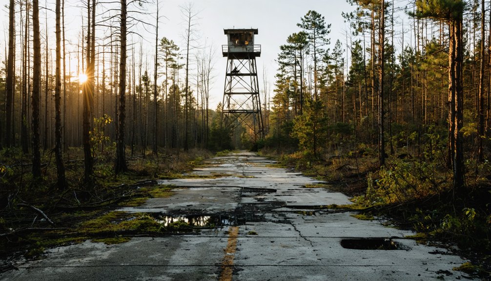
If you’ve ever flown into Richmond International Airport and glimpsed a strange water tower and phantom roads cutting through the woods below, you’ve spotted the remains of Elko Tract—a 2,400-acre WWII deception that locals still call the “Lost City.”
In 1942, the federal government seized over 40 farms here to build an elaborate decoy airfield complete with plywood planes and fake hangars, designed to trick Luftwaffe bombers into attacking empty forest instead of the real Richmond Army Air Base.
Today, crumbling streets that lead nowhere and rusted fire hydrants stand as eerie monuments to both wartime ingenuity and a failed 1947 plan to build a mental hospital on the abandoned military site.
World War II Origins
When federal authorities descended upon Henrico County farmland in October 1942, they gave forty families exactly thirty days to vacate 2,400 acres of property that had been home to generations of Virginia farmers.
You’d understand their shock—the government seized their land to build something that didn’t officially exist: a fake airfield designed to protect Richmond’s actual military installation from Luftwaffe bombers.
The 936th Camouflage Battalion employed decoy tactics borrowed from Hollywood set directors, creating an elaborate illusion five miles southeast of Byrd Field.
Their camouflage strategies required counterintuitive thinking—the fake base needed to look like it was unsuccessfully hidden to fool enemy reconnaissance.
They replicated Byrd Field’s triangular runway layout precisely, constructing plywood aircraft and canvas buildings that weighed practically nothing.
Abandoned Buildings and Ruins
The ghost of America’s most elaborate wartime illusion still haunts the woods of eastern Henrico County, where stretches of phantom runways cut triangular patterns through second-growth forest.
You’ll find few abandoned structures remain from the 1942 decoy airfield—the plywood aircraft and canvas buildings were designed to be moved and dismantled.
What endures are hidden histories: the infrastructure of a failed 1947 psychiatric hospital project, where $500,000 worth of utilities rusted unused. A water tower and drainage systems became monuments to bureaucratic abandonment.
Today’s White Oak Technology Park buries most traces beneath semiconductor plants, but aerial views still reveal the triangular runway scars.
Freedom-seeking families displaced from forty farms left no physical remnants, only the weight of condemnation.
Falling Creek Ironworks: America’s First Iron Production Site
Deep in Chesterfield County, where Falling Creek meets the James River, America’s industrial ambitions first took shape in 1619.
You’ll find where the Virginia Company invested £5,000 to establish the continent’s first iron production facility, combining blast furnace technology with refinery forges to serve colonial industry across Henricus, Williamsburg, and Jamestown.
The ironworks’ promising future ended violently:
The 1622 massacre destroyed America’s first ironworks, ending the Virginia Company’s industrial dreams and delaying colonial manufacturing for decades.
- Captain Benjamin Bluett led 80-150 men before the 1622 massacre destroyed everything
- The Virginia Company lost its charter in 1624, crushing revival hopes
- Forests reclaimed the site, hiding it for centuries
- Archibald Cary rebuilt operations in 1750, only to watch Benedict Arnold burn it during the Revolution
- No commercial iron manufacturing returned to Virginia until 1716
Today, archaeological evidence at Falling Creek Ironworks Park reveals the technology that launched American industry.
Rosewell Plantation: Fire-Ravaged Colonial Mansion
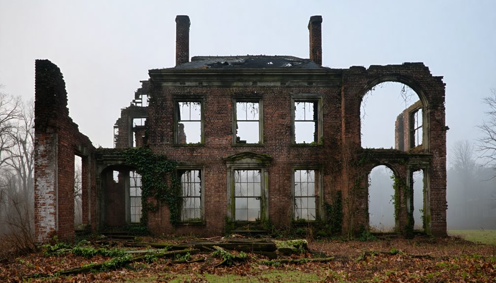
Rising from the banks of the York River in Gloucester County, Rosewell Plantation once stood as colonial Virginia‘s grandest mansion—a Flemish bond brick masterpiece that doubled the size of Williamsburg’s Governor’s Palace.
You’d have marveled at its three stories, twin octagonal cupolas, and 12,000 square feet of colonial architecture begun in 1725. The Page family’s estate hosted young Thomas Jefferson, who visited his friend John during college days—possibly where freedom’s blueprint first took shape.
That 1916 fire changed everything. You’ll find only haunting ruins now: four chimneys, a single wall, the wine cellar’s shadows.
The Rosewell Foundation‘s been fighting since 1995 to preserve what remains, seeking $3 million for restoration. Walk these grounds, and you’re touching Rosewell history itself—America’s grandest colonial dream, stubbornly refusing to disappear.
Exploring the Remnants: What You Can See Today
While Rosewell’s dramatic ruins command attention with their towering chimneys and vine-covered walls, Northern Virginia’s smaller ghost towns offer their own quiet revelations—if you know where to look.
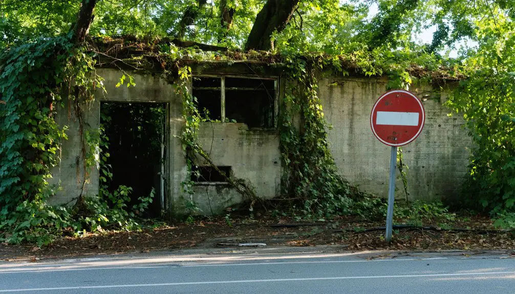
Exploring the abandoned towns of Virginia reveals stories of the past, often hidden among overgrown landscapes and crumbling facades. Each town carries echoes of former lives, with remnants of old schools and factories that invite curious visitors to imagine what once was. The haunting beauty of these sites serves as a reminder of both history and the passage of time, beckoning adventurers to uncover their mysteries.
Colchester stands as your best gateway into the region’s vanished settlements. Though fully reclaimed by development near the Potomac River, you’ll find:
Colchester offers unrestrained exploration of Northern Virginia’s colonial past, where development has erased physical traces but amplified historical intrigue.
- Historical markers documenting the colonial settlement’s complete erasure
- Ghostly legends whispered among locals about early settlers
- Archaeological sites occasionally revealing historical artifacts
- Nearby trails where you can trace the town’s original footprint
- Interpretive signs explaining how river commerce once sustained the community
The site represents freedom from preservation constraints—nothing remains to restrict your imagination.
You’re walking where colonists traded, built homes, and eventually abandoned everything to time’s relentless march.
Preservation Efforts and Historical Significance
Northern Virginia’s ghost towns exist in a preservation paradox—their very abandonment protects them from development while simultaneously ensuring their decay.
The charm of abandoned towns in Virginia often draws explorers and photographers eager to capture their haunting beauty. Amidst the crumbling structures and overgrown paths, one can sense the rich history that once thrived in these now-desolate spaces. Each visit serves as a poignant reminder of the passage of time and the stories that remain untold.
Exploring these abandoned towns in Virginia reveals not only their aesthetic allure but also the tales of resilience and loss that echo through their empty streets. Each building stands as a silent witness to the vibrant communities that once flourished, inviting reflection on what might have been. As nature reclaims its space, the juxtaposition of human creation and the relentless passage of time becomes increasingly evident.
You’ll find that preservation challenges mirror those cataloged statewide—erosion, neglect, and encroaching development threaten these silent witnesses to Virginia’s past.
Since 1889, organizations like Preservation Virginia have fought to protect landmarks, but ghost towns often lack the advocacy that saved Jamestown’s seawall or restored its brick church tower.
Their historical significance lies in architectural authenticity: buildings frozen in time without modern intrusion.
You’re witnessing structures that’ve weathered decades without interference—woolen mills, railroad depots, schoolhouses—each telling stories of communities that chose different paths.
While 90% of endangered sites find champions, abandoned settlements remain vulnerable, awaiting someone willing to preserve their liberty-loving spirit.
Visiting Virginia’s Forgotten Settlements
Beyond the well-trodden paths of Williamsburg and Mount Vernon, Northern Virginia’s forgotten settlements wait in varying states of accessible abandonment.
Hidden beneath Virginia’s manicured historical attractions lie decaying settlements that reveal stories the polished monuments prefer to forget.
You’ll find these historical significance markers scattered across private lands and preserved parks, each demanding respect for property boundaries while rewarding careful exploration.
Planning Your Visit:
- Rosewell Plantation’s ruins welcome visitors Monday-Thursday and Saturday 10 a.m.-4 p.m., Sunday 1-4 p.m.
- Jamestown’s archaeological park offers ranger-guided tours through America’s first permanent English settlement.
- Henricus Historical Park brings 1611 colonial life back through living history demonstrations.
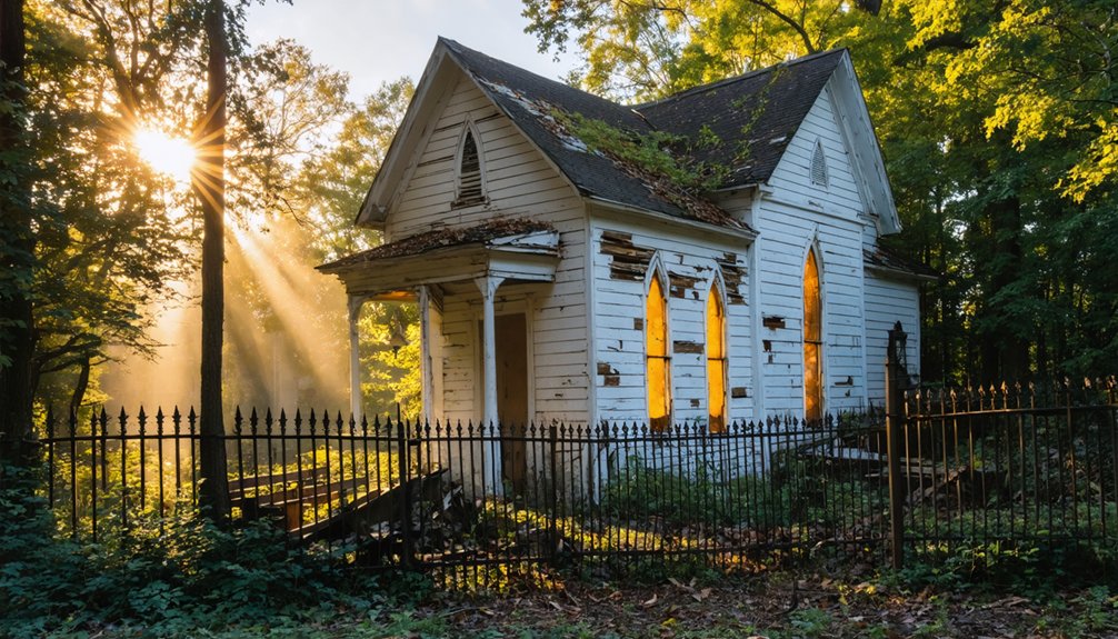
- Union Level’s churches and storefronts remain visible from roadways—observe no trespassing signs.
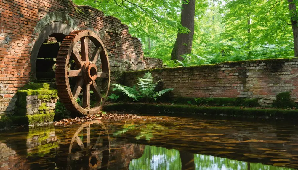
- Mouth of Wilson’s abandoned woolen mill and water tower stand along accessible Route 58.
These forgotten settlements tell Virginia’s untamed story beyond tourist brochures.
Frequently Asked Questions
Are There Any Ghost Towns in Northern Virginia Suitable for Family Visits?
You’ll find Matildaville and Rosewell Plantation offer family-friendly attractions with historical significance. I’ve wandered these sites myself—they’re perfect for exploring colonial heritage freely without trespassing concerns, unlike other restricted ghost towns nearby.
What Safety Precautions Should Visitors Take When Exploring Abandoned Sites?
Like explorers charting unknown territory, you’ll need proper safety gear for urban exploration: sturdy boots, flashlights, and first-aid supplies. I’ve learned to test floors before stepping, avoid rotted structures, and always tell someone your location.
Can You Camp Overnight Near Any of These Ghost Town Locations?
No, you can’t camp overnight at these ghost town locations due to strict camping regulations on private and park property. I’d recommend checking nearby accommodations instead—there are some charming options that’ll let you explore freely during daylight hours.
Which Ghost Town Is Closest to Washington D.C.?
Colchester’s your closest gateway to ghost town history, just 25 miles from D.C. You’ll find tobacco port ruins along the Occoquan River, where colonial foundations and nearby landmarks whisper tales of Virginia’s independent trading past.
Are Guided Tours Available for Any Northern Virginia Ghost Towns?
Guided exploration opportunities aren’t formally documented for Northern Virginia’s ghost town history sites. You’ll need to contact specific locations directly, as most require independent visits. Remember, respecting private property boundaries guarantees these historic places remain accessible for future exploration.
References
- https://theforgottensouth.com/union-level-virginia-ghost-town-history/
- https://everafterinthewoods.com/deserted-ghost-towns-in-virginia-that-history-buffs-cant-resist-exploring/
- https://en.wikipedia.org/wiki/List_of_ghost_towns_in_Virginia
- https://northernvirginiamag.com/67-advantures-ghost-towns-of-virginia/
- https://nvtami.com/2025/01/22/virginia-citys-forgotten-ghost-towns/
- https://www.peterlabau.com/blog/entry/virginia-ghost-town
- https://www.youtube.com/watch?v=P906DPA_czw
- https://www.virginia.org/listing/union-level-ghost-town/4358/
- https://www.islands.com/2035167/matildaville-virginia-historic-abandoned-town-nestled-great-falls-national-park-hauntingly-beautiful/
- https://www.onlyinyourstate.com/nature/virginia/matildaville-access-trail-va