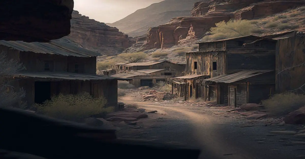
Cain City, KS
County:
Pratt
Zip Code:
Latitude / Longitude:
37°47′16″N 98°52′2″W / 37.78778°N 98.86722°W / 37.78778
Elevation:
Time Zone:
Central (CST) (UTC-6)
Established:
Disestablished:
Comments:
Remains:
Current Status:
Remarks:
Calhoun, KS
County:
Zip Code:
Latitude / Longitude:
Elevation:
Time Zone:
Central (CST) (UTC-6)
Established:
Disestablished:
Comments:
Remains:
Current Status:
Remarks:
California, KS
County:
Zip Code:
Latitude / Longitude:
Elevation:
Time Zone:
Central (CST) (UTC-6)
Established:
Disestablished:
Comments:
Remains:
Current Status:
Remarks:
Calista, KS
County:
Lane
Zip Code:
Latitude / Longitude:
Elevation:
Time Zone:
Central (CST) (UTC-6)
Established:
Disestablished:
Comments:
Calista is an unincorporated community in Kingman County, Kansas, United States. It was named from the Greek Callista, meaning “most beautiful”.
Remains:
Calista became a town in 1886 after the town of Maud (1881-1886) was moved there. This original town known as “Old Calista” lasted until 1896 when the town had to be moved to make way for the Atchison, Topeka and Santa Fe Railway. “New” Calista was founded about two miles west-southwest of “Old” Calista and was a town until 1955.
Current Status:
Now Calista is a ghost town with only a few buildings remaining and a small grain elevator open for about two weeks a year during the wheat harvest.
Remarks:
Camchester, KS
County:
Zip Code:
Latitude / Longitude:
Elevation:
Time Zone:
Central (CST) (UTC-6)
Established:
Disestablished:
Comments:
Remains:
Current Status:
Remarks:
Camp Whiteside, KS
County:
Geary
Zip Code:
Latitude / Longitude:
39°5’5″N 96°46’17″W
Elevation:
Time Zone:
Central (CST) (UTC-6)
Established:
Disestablished:
Comments:
Fort Riley-Camp Whiteside is a former census-designated place (CDP) that covers part of Fort Riley, a US Army installation in Geary County, Kansas, United States.
Remains:
Current Status:
The was 103 at the 2000 census. The was not recorded as a CDP for the 2010 census.
Remarks:
The CDP was part of the Manhattan, Kansas Metropolitan Statistical.
Canada, KS
County:
Marion
Zip Code:
1,362 ft (415 m)
Latitude / Longitude:
38°21’15″N 97°6’46″W
Elevation:
Time Zone:
Central (CST) (UTC-6)
Established:
1883
Disestablished:
Comments:
Canada is an unincorporated community in Marion County, Kansas, United States. It is named for many Canadian immigrants coming to the county.
Remains:
For many millennia, the Great Plains of North America was inhabited by nomadic Native Americans. From the 16th century to 18th century, the Kingdom of France claimed ownership of large parts of North America. In 1762, after the French and Indian War, France secretly ceded New France to Spain, per the Treaty of Fontainebleau.
Current Status:
A post office existed in Canada from February 20, 1884 to February 28, 1954. From 1964 to 1968, the Marion Reservoir was constructed north of Canada. In August 2015, a film crew for an advertising agency in Toronto, Ontario came to Canada to interview residents and give away New Balance shoes for a Canadian TV commercial.
Remarks:
As early as 1875, city leaders of Marion held a meeting to consider a branch railroad from Florence. In 1878, Atchison, Topeka and Santa Fe Railway and parties from Marion County and McPherson County chartered the Marion and McPherson Railway Company. In 1879, a branch line was built from Florence to McPherson, in 1880 it was extended to Lyons, in 1881 it was extended to Ellinwood. The line was leased and operated by the Atchison, Topeka and Santa Fe Railway. The line from Florence to Marion, was abandoned in 1968. In 1992, the line from Marion to McPherson was sold to Central Kansas Railway. In 1993, after heavy flood damage, the line from Marion through Canada to McPherson was abandoned and removed. The original branch line connected Florence, Marion, Canada, Hillsboro, Lehigh, Canton, Galva, McPherson, Conway, Windom, Little River, Mitchell, Lyons, Chase, Ellinwood.
Carneiro, KS
County:
Ellsworth
Zip Code:
Latitude / Longitude:
38°21′15″N 97°6′46″W / 38.35417°N 97.11278°W / 38.35417
Elevation:
1,578 ft (481 m)
Time Zone:
Central (CST) (UTC-6)
Established:
Disestablished:
Comments:
Carneiro is an unincorporated community in Ellsworth County, Kansas, United States. It is located approximately 10 miles (16 km) east of Ellsworth.
Remains:
The first post office in Carneiro was established as Alum Creek in 1872. The post office was renamed Carneiro in 1882, and remained in operation until it was discontinued in 1953.The obituary of Ernest Oakley Cunningham states that he served as Post Master in Carneiro, then later, Post Master in Langley, Kansas. Mr. Cunningham came to Ellsworth county in 1870, at the age of 15. At the time of his death, he was the oldest of the pioneers then living in Ellsworth County.
Current Status:
Remarks:
Carneiro was a station and shipping point on the Union Pacific Railroad.
Carthage, KS
County:
Ellsworth
Zip Code:
Latitude / Longitude:
38°44′20″N 98°01′51″W / 38.73889°N 98.03083°W / 38.73889
Elevation:
1,581 ft (482 m)
Time Zone:
Central (CST) (UTC-6)
Established:
Disestablished:
Comments:
Remains:
Current Status:
Remarks:
Cash City, KS
County:
Zip Code:
Latitude / Longitude:
Elevation:
Time Zone:
Central (CST) (UTC-6)
Established:
Disestablished:
Comments:
Remains:
Current Status:
Remarks:
Castleton, KS
County:
Reno
Zip Code:
Latitude / Longitude:
37°51’44″N 97°57’6″W
Elevation:
1,470 ft (448 m)
Time Zone:
Central (CST) (UTC-6)
Established:
Disestablished:
Comments:
Castleton is an unincorporated community in Reno County, Kansas, United States.
Remains:
Castleton was a station and shipping point on the Hutchinson & Blackwell division of the Atchison, Topeka and Santa Fe Railway.
Current Status:
The post office was established December 6, 1872, remained in operation until it was discontinued on June 28, 1957. In 1971, the post office building was moved to the Barton County Historical Society Museum and Village in Great Bend, Kansas.
Remarks:
Cato, KS
County:
Crawford
Zip Code:
Latitude / Longitude:
37°51′44″N 97°57′6″W / 37.86222°N 97.95167°W / 37.86222
Elevation:
1,470 ft (448 m)
Time Zone:
Central (CST) (UTC-6)
Established:
Disestablished:
Comments:
Cato is an unincorporated community in Crawford County, Kansas, in the United States.
Remains:
Cato was founded in 1854. By 1867, Cato contained a store, a blacksmith, and a sawmill.
Current Status:
Remarks:
Cave Springs, KS
County:
Elk
Zip Code:
Latitude / Longitude:
37° 32′ 0″ N, 96° 7′ 21″ W
Elevation:
Time Zone:
Central (CST) (UTC-6)
Established:
Disestablished:
Comments:
Cave Springs is an unincorporated community in Elk County, Kansas, in the United States.
Remains:
Cave Springs was founded in 1873.
Current Status:
The post office in Cave Springs closed in 1903.
Remarks:
Centerview, KS
County:
Edwards
Zip Code:
Latitude / Longitude:
37° 48′ 54″ N, 99° 16′ 8.4″ W
Elevation:
Time Zone:
Central (CST) (UTC-6)
Established:
Disestablished:
Comments:
Centerview is an unincorporated community in Edwards County, Kansas, in the United States.
Remains:
A post office was opened in Centerview in 1917, and remained in operation until it was discontinued in 1959.
Current Status:
Remarks:
Centropolis, KS
County:
Franklin
Zip Code:
Latitude / Longitude:
38° 42′ 58″ N, 95° 21′ 1″ W
Elevation:
971 ft (296 m)
Time Zone:
Central (CST) (UTC-6)
Established:
Disestablished:
Comments:
Centropolis is an unincorporated community in Franklin County, Kansas, in the United States. Centropolis has an elevation of 971 feet (296 m).
Remains:
The Centropolis post office closed in 1930.
Current Status:
Remarks:
Chantilly, KS
County:
Zip Code:
Latitude / Longitude:
Elevation:
Time Zone:
Central (CST) (UTC-6)
Established:
Disestablished:
Comments:
Remains:
Current Status:
Remarks:
Chetolah, KS
County:
Ellis
Zip Code:
Latitude / Longitude:
38° 45′ 11.3″ N, 99° 30′ 0.6″ W
Elevation:
Time Zone:
Central (CST) (UTC-6)
Established:
Disestablished:
Comments:
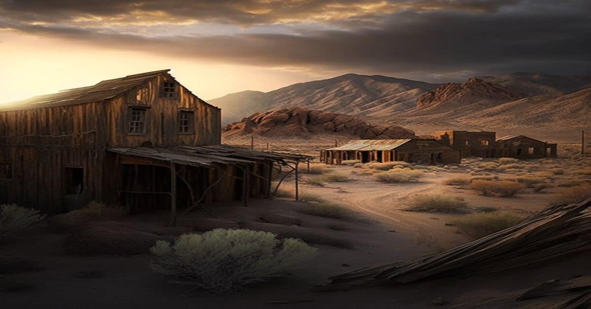
Chetolah was a late 19th-century settlement in Ellis County, Kansas, United States.
Remains:
Chetolah was founded in the 1880s when promoters laid out a town site and built a hotel, livery stable, and store. The Chetolah Town Site Company was incorporated in 1888 and then renamed the Chetolah Land and Town Company in 1889. The company had plans for a railroad connection, but no such connection was ever built. The initial settlement was unsuccessful, but the town revived in the 1890s with the purported discovery of gold in the surrounding hills. A three-year gold rush ensued, and the town grew as miners searched for gold along the Smoky Hill River. The hotel reopened and a bridge was built across the river into the settlement.
Current Status:
Following the gold rush, Chetolah was abandoned and became a ghost town. Today, very little remains of the settlement.
Remarks:
Cleburne, KS
County:
Zip Code:
Latitude / Longitude:
Elevation:
Time Zone:
Central (CST) (UTC-6)
Established:
Disestablished:
Comments:
Remains:
Current Status:
Remarks:
Cofachiqui, KS
County:
Allen
Zip Code:
Latitude / Longitude:
37° 55′ 59.88″ N, 95° 24′ 53.28″ W
Elevation:
Time Zone:
Central (CST) (UTC-6)
Established:
Disestablished:
Comments:
Cofachique (pronounced ko-fa-chee) was an unincorporated community situated along the Neosho River near the present-day city of Iola in the western part of Allen County, located in southeast Kansas, in the central United States of America. Being the first town established in Allen County in 1855, it was the original county seat. However, within five years the greater part of the town was moved to the new town of Iola, while the old site of Cofachique became farm land. The town was named in honor of an Osage chief known as Cofachique, who is said to have been particularly helpful to early settlers, bringing aid to the distressed and homeless. The name “Cofachique” appears to have origins with the Cofachiqui (or Cofitachiqui) tribe in South Carolina, who were Siouan speakers, and the Osage who settled this were closely affiliated with the Siouan.
Remains:
In the spring of 1855 a party of pro-slavery men from Fort Scott formed a town company and laid out a town on the high land east of the Neosho River, south of the mouth of Elm Creek, and about on the north line of Section 10, Township 25 south, Range 18 east. The first Territorial Legislature in July, 1855, passed an act incorporating the Cofachique Town Association. The legislature empowered the Association to locate and hold a tract of land not to exceed nine hundred acres, around the proposed town site, and passed an act making Cofachique the permanent county seat of Allen County. The incorporators were Daniel Woodson, Charles Passmore, James S. Barbee, Samuel A. Williams, and Joseph C. Anderson; Mr. Barbee was elected the first president of the company. During the summer of 1855 the town was located and staked out with Mr. Barbee as the first to settle on the new town site. He was appointed the County Clerk at the first meeting of the county commissioners on May 7, 1856.
Current Status:
In 1857 other towns were started and Cofachique began to decline. The founders of Humboldt numbered among them some influential men who, unknown to the citizens of the county, appeared before the free-state Territorial Legislature early in the year 1858, and secured the passage of an act locating the county seat at Humboldt. The following year the greater part of Cofachique was removed about two miles (3 km) north to Iola, that town having just been started. The principal cause of the failure of Cofachique was that, being in a hilly region it was difficult of access, besides which it was almost impossible to obtain good well water. Another reason for its failure was that it was settled by pro-slavery men, generally, and during the early political troubles an armed company of pro-slavery men was stationed there, which caused some anxiety and created a feeling of enmity toward the town. When the towns of Iola and Humboldt were started on either side it was not long until Cofachique became entirely depopulated.
Remarks:
Colokan, KS
County:
Zip Code:
Latitude / Longitude:
Elevation:
Time Zone:
Central (CST) (UTC-6)
Established:
Disestablished:
Comments:
Remains:
Current Status:
Remarks:
Columbia, KS
County:
Ellsworth
Zip Code:
Latitude / Longitude:
38°49’38″N 098°19’06″W
Elevation:
1,673 ft (510 m)
Time Zone:
Central (CST) (UTC-6)
Established:
Disestablished:
Comments:
Columbia Township is a township in Ellsworth County, Kansas, USA.
Remains:
Current Status:
As of the 2000 census, its was 60.
Remarks:
Comanche City, KS
County:
Zip Code:
Latitude / Longitude:
Elevation:
Time Zone:
Central (CST) (UTC-6)
Established:
Disestablished:
Comments:
Remains:
Current Status:
Remarks:
Comiskey, KS
County:
Zip Code:
Latitude / Longitude:
Elevation:
Time Zone:
Central (CST) (UTC-6)
Established:
Disestablished:
Comments:
Remains:
Current Status:
Remarks:
Coolidge, KS
County:
Hamilton
Zip Code:
67836
Latitude / Longitude:
38°2’32″N 102°0’37″W
Elevation:
3,356 ft (1,023 m)
Time Zone:
Central (CST) (UTC-6)
Established:
Disestablished:
Comments:
Coolidge is a city in Hamilton County, Kansas, United States.
Remains:
The city of Coolidge was named after Thomas Jefferson Coolidge, the former president of the Atchison, Topeka and Santa Fe Railway.
Current Status:
As of the 2010 census, the city population was 95.
Remarks:
The first post office in Coolidge was established in July 1881.
Coronado, KS
County:
Wichita
Zip Code:
Latitude / Longitude:
38°2′32″N 102°0′37″W / 38.04222°N 102.01028°W / 38.04222
Elevation:
3,356 ft (1 023 m)
Time Zone:
Central (CST) (UTC-6)
Established:
Disestablished:
Comments:
Coronado had a post office from 1886 until 1899.
Remains:
Current Status:
Remarks:
Coyote, KS
County:
Zip Code:
Latitude / Longitude:
38°29′9″N 101°18′17″W / 38.48583°N 101.30472°W / 38.48583
Elevation:
Time Zone:
Central (CST) (UTC-6)
Established:
Disestablished:
Comments:
Remains:
Current Status:
Remarks:
Croft, KS
County:
Pratt
Zip Code:
Latitude / Longitude:
37° 30′ 12″ N, 98° 59′ 41″ W
Elevation:
Time Zone:
Central (CST) (UTC-6)
Established:
Disestablished:
Comments:
Croft is an unincorporated community in Pratt County, Kansas, United States.
Remains:
Croft was a village with a post office of Springvale Township, Pratt County, Kansas. It was also a station on the Wichita & Englewood division of the Atchison, Topeka & Santa Fe railroad about 20 miles southwest of Pratt, the county seat.
Current Status:
It had telephone connections, local trade, did some shipping and in 1910, reported a of 30. A post office was opened in Croft in 1907, and remained in operation until it was discontinued in 1961.
Remarks:
Croweburg, KS
County:
Crawford
Zip Code:
Latitude / Longitude:
37° 33′ 25″ N, 94° 39′ 58″ W
Elevation:
Time Zone:
Central (CST) (UTC-6)
Established:
Disestablished:
Comments:
Croweburg is an unincorporated community in Crawford County, Kansas, USA.
Remains:
Croweburg was a station on the Joplin & Pittsburg electric line.
Current Status:
A post office was opened in Croweburg in 1908, and remained in operation until it was discontinued in 1972.
Remarks:
Defiance, KS
County:
Zip Code:
Latitude / Longitude:
Elevation:
Time Zone:
Central (CST) (UTC-6)
Established:
Disestablished:
Comments:
Defiance – located six miles east of Yates Center, its population moved to Yates Center after it was selected as the permanent county seat in 1876
Remains:
Current Status:
Remarks:
Delaware City, KS
County:
Leavenworth
Zip Code:
Latitude / Longitude:
39° 13′ 45″ N, 94° 51′ 1″ W
Elevation:
Time Zone:
Central (CST) (UTC-6)
Established:
Disestablished:
Comments:
Delaware City is a ghost town in Leavenworth County, in the U.S. state of Kansas.
Remains:
Delaware City was platted in 1854. A post office called Delaware City was established in 1856, and remained in operation until it was discontinued in 1878.
Current Status:
Remarks:
Delaware Springs, KS
County:
Zip Code:
Latitude / Longitude:
Elevation:
Time Zone:
Central (CST) (UTC-6)
Established:
Disestablished:
Comments:
Remains:
Current Status:
Remarks:
Dermot, KS
County:
Zip Code:
Latitude / Longitude:
Elevation:
Time Zone:
Central (CST) (UTC-6)
Established:
Disestablished:
Comments:
Remains:
Current Status:
Remarks:
Devizes, KS
County:
Zip Code:
Latitude / Longitude:
Elevation:
Time Zone:
Central (CST) (UTC-6)
Established:
Disestablished:
Comments:
Remains:
Current Status:
Remarks:
Diamond Springs, KS
County:
Morris
Zip Code:
Latitude / Longitude:
38° 33′ 27″ N, 96° 44′ 40″ W
Elevation:
Time Zone:
Central (CST) (UTC-6)
Established:
Disestablished:
Comments:
Diamond Springs is an unincorporated community in Morris County, Kansas, in the United States.
Remains:
Diamond Springs takes its name from a stream which was a landmark and watering place for travelers on the Santa Fe Trail.
Current Status:
The post office in Diamond Springs was discontinued in 1930.
Remarks:
Dispatch, KS
County:
Smith
Zip Code:
Latitude / Longitude:
39° 35′ 47″ N, 98° 30′ 18″ W
Elevation:
Time Zone:
Central (CST) (UTC-6)
Established:
Disestablished:
Comments:
Dispatch is an unincorporated community in Smith County, Kansas, in the United States.
Remains:
A post office was opened in Dispatch in 1891, and remained in operation until it was discontinued in 1904. Dispatch was named from its role in shipping the mail.
Current Status:
Remarks:
Doniphan, KS
County:
Doniphan
Zip Code:
Latitude / Longitude:
39°38’30″N 95°4’51″W
Elevation:
Time Zone:
Central (CST) (UTC-6)
Established:
Disestablished:
Comments:
Doniphan is a small unincorporated community in Doniphan County, Kansas, United States. Doniphan is part of the St. Joseph, MO–KS Metropolitan Statistical.
Remains:
The company that founded the town was organized on November 11, 1854. Doniphan was incorporated in 1869. The community was named for Alexander William Doniphan, a military leader in the Mexican–American War.
Current Status:
A post office was opened in Doniphan on March 3, 1855, and remained in operation until it was discontinued on August 15, 1943.
Remarks:
Drury, KS
County:
Sumner
Zip Code:
Latitude / Longitude:
39°38′30″N 95°4′51″W / 39.64167°N 95.08083°W / 39.64167
Elevation:
Time Zone:
Central (CST) (UTC-6)
Established:
Disestablished:
Comments:
Drury is an unincorporated community in Falls Township, Sumner County, Kansas, USA.
Remains:
Drury was a station and shipping point on the Kansas Southwestern Railway.
Current Status:
Drury had a post office from 1884 until 1921.
Remarks:
Dry Creek, KS
County:
Zip Code:
Latitude / Longitude:
Elevation:
Time Zone:
Central (CST) (UTC-6)
Established:
Disestablished:
Comments:
Remains:
Current Status:
Remarks:
Dubuque, KS
County:
Barton, Russell
Zip Code:
67634
Latitude / Longitude:
38°41’45″N 98°36’32″W
Elevation:
1,883 ft (574 m)
Time Zone:
Central (CST) (UTC-6)
Established:
Disestablished:
Comments:
Dubuque is an unincorporated community in Barton and Russell Counties in the U.S. state of Kansas. It is approximately 10 miles (18 km) south of Dorrance.
Remains:
Polish immigrants from Illinois, Indiana, and Wisconsin first settled the after the American Civil War. They were soon followed by Volga Germans from Minnesota, Wisconsin, and Dubuque, Iowa. A rural post office named Dubuque opened in 1879, and the village was formally established in 1887. Devout Catholics, the local townsfolk built their first church in the early 1870s. They replaced it in 1901 with St. Catherine Catholic Church which still stands. The post office closed in 1909. By the 1920s, Dubuque had begun to lose its and its business community.
Current Status:
Today, all that remains is the Catholic church and a cemetery.
Remarks:
Dunlap, KS
County: Morris
Zip Code: 66846
Latitude / Longitude: 38°41′45″N 98°36′32″W / 38.69583°N 98.60889°W / 38.69583
Elevation: 1,184 ft (361 m)
Time Zone: Central (CST) (UTC-6)
Established:
Disestablished:
Comments: Dunlap is a city in Morris County, Kansas, United States. A post office was established in Hillsborough on March 19, 1874 then renamed to Dunlap on April 20, 1874.
Remains: In 1878, Benjamin “Pap” Singleton chose Dunlap as the site for his second Singleton Colony, a community of freedmen who had migrated from Tennessee, because of land available under the Homestead Act. It was named Dunlap after its founder, Joseph Dunlap, an Indian agent for the Kaw tribe. Before its present name, the settlement was briefly known as Hillsboro. In the early 1880s, the Presbyterian Church in Dunlap founded the Freedmen’s Academy to provide an education to freedmen’s families in Kansas. The Academy closed in the mid-1890s.
Current Status: As of the 2010 census, the city population was 30.
Remarks: The post office in Dunlap closed on August 12, 1988.