Acme, PA
County:
Fayette
Zip Code:
15610
Latitude / Longitude:
40°7’38″N 79°26’5″W
Elevation:
Time Zone:
Eastern (EST) (UTC-5)
Established:
Disestablished:
Comments:
Acme is an unincorporated community in Donegal Township, Westmoreland County, Pennsylvania, Mount Pleasant Township, Westmoreland County, Pennsylvania, and Bullskin Township, Fayette County, Pennsylvania in the United States. The Acme ZIP code of 15610 extends well beyond the more densely populated part of the area, into rural parts of Donegal Township in Westmoreland County and Bullskin Township in Fayette County.
Remains:
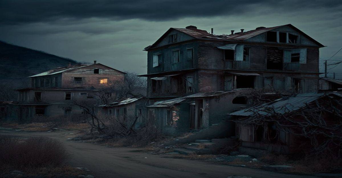
Acme has always been an agricultural community; however, three attempts to develop resorts in the area have likely been inspired by its gateway position along the edge of the Laurel Highlands. In 1962, architect Peter Berndtson developed a master plan for a 125-acre (0.51 km2) property named Treetops & Mountain Circles. Berndtson, an original apprentice of Frank Lloyd Wright, designed a network of twenty-four private houses, each within a 300-foot (91 m) diameter clearing in the woods. If completed, the clearings and their connecting roads would have depicted a bunch of grapes when viewed from the sky. Only two homes—those for developers Harry Blum and James Balter—were actually built.
Current Status:
Following in the footsteps of the very successful Bear Rocks, this much smaller resort featuring a recreational lake, a swimming pond, and wooded house lots, Forest Lake, was developed adjacent to the eastern edge of Bear Rocks along Bear Rocks road. As part of the sales promotion, a red caboose, now greatly decayed, was placed on one of the lots. Forest Lake never enjoyed the success of its larger neighbor and only 5 houses were built.
Remarks:
Acme is located in [Donegal Township, Westmoreland County, Pennsylvania], and [Mount Pleasant Township, Westmoreland County, Pennsylvania], in southern Westmoreland County, and in [Bullskin Township, Fayette County, Pennsylvania] in the northeastern corner of Fayette County at 40°7’38″N 79°26’5″W (40.12731, -79.434929). The name “Acme” refers to the area’s location atop Chestnut Ridge in the Allegheny Mountains.
Ardara, PA
County:
Westmoreland
Zip Code:
15615
Latitude / Longitude:
40°21’28″N 79°44’06″W
Elevation:
961 ft (293 m)
Time Zone:
Eastern (EST) (UTC-5)
Established:
Disestablished:
Comments:
Ardara is an unincorporated community in Westmoreland County, Pennsylvania, United States. The community is located along Pennsylvania Route 993 2.9 miles (4.7 km) northwest of Irwin. Ardara has a post office with ZIP code 15615, which opened on May 6, 1907.
Remains:
Current Status:
Remarks:
Aitch, PA
County:
Huntingdon
Zip Code:
Latitude / Longitude:
40° 22′ 27″ N, 78° 9′ 33″ W
Elevation:
Time Zone:
Eastern (EST) (UTC-5)
Established:
Disestablished:
Comments:
Aitch is an extinct town in Huntingdon County, Pennsylvania. The GNIS classifies it as a populated place. The town site was inundated by the creation of Raystown Lake. Aitch Boat Launch retains the name.
Remains:
A post office called Aitch was established in 1887, and remained in operation until 1973. The community’s name is an acronym of names of first settlers, namely Aumen, Isett, Trexler, Crexwell, and Harker.
Current Status:
Submerged to form Raystown Lake.
Remarks:
Alice, PA
County:
Westmoreland
Zip Code:
Latitude / Longitude:
Elevation:
Time Zone:
Eastern (EST) (UTC-5)
Established:
Disestablished:
Comments:
Remains:
Current Status:
Remarks:
Alvira, PA
County:
Union
Zip Code:
Latitude / Longitude:
Elevation:
Time Zone:
Eastern (EST) (UTC-5)
Established:
Disestablished:
Comments:
During the Second World War, the federal government built the $50 million Susquehanna Ordnance Depot to make TNT on 8,500 acres (3,400 ha), partially in the White Deer Hole Creek watershed.
Remains:
Current Status:
In the spring of 1942, residents were evicted by eminent domain from 163 farms and 47 other properties in Gregg Township in Union County and Brady, Clinton, and Washington Townships in Lycoming County. The village of Alvira in Gregg Township disappeared.[29] Alvira was founded in 1825 as “Wisetown” and had 100 inhabitants by 1900. Although the inhabitants were told they could return after the war, almost all the buildings seized were razed. Only some cemeteries and the nearby “Stone Church” remain.
Remarks:
Construction of the plant involved some 10,000 people, and it took 3,500 to 4,500 employees to run the plant with its more than 200 buildings and 149 storage bunkers for TNT and high explosives, as well as storage racks of bombs. However, the need for TNT was lower than originally estimated and the project was nearly abandoned. By 1945, the only workers left at the depot were guards.
Andrico, PA
County:
Westmoreland
Zip Code:
Latitude / Longitude:
Elevation:
Time Zone:
Eastern (EST) (UTC-5)
Established:
Disestablished:
Comments:
Remains:
Current Status:
Remarks:
Appalacha, PA
County:
Indiana
Zip Code:
Latitude / Longitude:
Elevation:
Time Zone:
Eastern (EST) (UTC-5)
Established:
Disestablished:
Comments:
Remains:
Current Status:
Remarks:
Aqueduct, PA
County:
Indiana
Zip Code:
Latitude / Longitude:
Elevation:
Time Zone:
Eastern (EST) (UTC-5)
Established:
Disestablished:
Comments:
Remains:
Current Status:
Remarks:
Armerford, PA
County:
Indiana
Zip Code:
Latitude / Longitude:
Elevation:
Time Zone:
Eastern (EST) (UTC-5)
Established:
Disestablished:
Comments:
Remains:
Current Status:
Remarks:
Bagdad, PA
County:
Westmoreland
Zip Code:
Latitude / Longitude:
Elevation:
Time Zone:
Eastern (EST) (UTC-5)
Established:
Disestablished:
Comments:
Remains:
Current Status:
Remarks:
Bairdstown, PA
County:
Westmoreland
Zip Code:
Latitude / Longitude:
Elevation:
Time Zone:
Eastern (EST) (UTC-5)
Established:
Disestablished:
Comments:
Remains:
Current Status:
Remarks:
Barclay, PA
County:
Bradford
Zip Code:
Latitude / Longitude:
41° 39′ 21″ N, 76° 37′ 35″ W
Elevation:
Time Zone:
Eastern (EST) (UTC-5)
Established:
Disestablished:
Comments:
The ghost town of Barclay, in Franklin Township, Bradford County, Pennsylvania, was a coal mining town. Coal was transported down the mountain by an incline plane rail system. The original location of the town was later obliterated by strip mining operations.
Remains:
The towns of Barclay and Laquin are in close proximity of each other. Barclay came into existence before Laquin, Pennsylvania, and both were served by the long defunct Susquehanna and New York Railroad. This operated between Monroe, Pennsylvania (Monroeton) and Williamsport, Pennsylvania. The railroad is quite an interesting story and most of the trackbed, and bridges are still very much in evidence throughout the valley of Schrader Creek.
Current Status:
The cemetery still exists and provides an interesting place to visit.
Remarks:
Bear Run, PA
County:
Indiana
Zip Code:
Latitude / Longitude:
Elevation:
Time Zone:
Eastern (EST) (UTC-5)
Established:
Disestablished:
Comments:
Remains:
Current Status:
Remarks:
Bells Mills, PA
County:
Indiana
Zip Code:
Latitude / Longitude:
Elevation:
Time Zone:
Eastern (EST) (UTC-5)
Established:
Disestablished:
Comments:
Remains:
Current Status:
Remarks:
Blacklick Furnace, PA
County:
Indiana
Zip Code:
Latitude / Longitude:
Elevation:
Time Zone:
Eastern (EST) (UTC-5)
Established:
Disestablished:
Comments:
Remains:
Current Status:
Remarks:
Blackwood, PA
County:
Zip Code:
Latitude / Longitude:
Elevation:
Time Zone:
Eastern (EST) (UTC-5)
Established:
Disestablished:
Comments:
Remains:
Current Status:
Remarks:
Blairsville Junction, PA
County:
Westmoreland
Zip Code:
Latitude / Longitude:
Elevation:
Time Zone:
Eastern (EST) (UTC-5)
Established:
Disestablished:
Comments:
Remains:
Current Status:
Remarks:
Breisons No. 3, PA
County:
Indiana
Zip Code:
Latitude / Longitude:
Elevation:
Time Zone:
Eastern (EST) (UTC-5)
Established:
Disestablished:
Comments:
Remains:
Current Status:
Remarks:
Broad Fording, PA
County:
Westmoreland
Zip Code:
Latitude / Longitude:
Elevation:
Time Zone:
Eastern (EST) (UTC-5)
Established:
Disestablished:
Comments:
Remains:
Current Status:
Remarks:
Buckeye, PA
County:
Westmoreland
Zip Code:
Latitude / Longitude:
Elevation:
Time Zone:
Eastern (EST) (UTC-5)
Established:
Disestablished:
Comments:
Remains:
Current Status:
Remarks:
Buena Vista, PA
County:
Indiana
Zip Code:
Latitude / Longitude:
Elevation:
Time Zone:
Eastern (EST) (UTC-5)
Established:
Disestablished:
Comments:
Remains:
Current Status:
Remarks:
Butler Junction, PA
County:
Alleheny
Zip Code:
Latitude / Longitude:
Elevation:
Time Zone:
Eastern (EST) (UTC-5)
Established:
Disestablished:
Comments:
Remains:
Current Status:
Remarks:
Byrnesville, PA
County:
Columbia
Zip Code:
Latitude / Longitude:
40° 47′ 45.24″ N, 76° 20′ 21.12″ W
Elevation:
Time Zone:
Eastern (EST) (UTC-5)
Established:
Disestablished:
Comments:
Byrnesville was a town located in Conyngham Township, Columbia County, Pennsylvania, United States. It was located about halfway between Centralia and Ashland. In 1985, the population of Byrnesville was approximately 75.
Remains:
Byrnesville was founded in 1856. Most of the residents were Irish Catholics who worked in the local anthracite coal mines. It was made up of Upper and Lower Byrnesville. The first homes were built in Lower Byrnesville around 1856 and in Upper Byrnesville around 1865. An elementary school was located in Byrnesville but was discontinued in the 1930s.
Current Status:
The present-day routing of Pennsylvania Route 61 follows what was an old logging road through Byrnesville, bypassing sections of the original route of the four-lane highway which has been heavily damaged with subsidence due to the underground Centralia mine fire.
Remarks:
Byrnesville was one of the casualties of the Centralia mine fire. The last home in Byrnesville was torn down in 1996, which spelled the end for this town. The only remaining structures there now are a religious shrine on a hillside, a storage trailer, and an unused garage.
Carney, PA
County:
Westmoreland
Zip Code:
Latitude / Longitude:
Elevation:
Time Zone:
Eastern (EST) (UTC-5)
Established:
Disestablished:
Comments:
Remains:
Current Status:
Remarks:
Carpentertown, PA
County:
Westmoreland
Zip Code:
Latitude / Longitude:
Elevation:
Time Zone:
Eastern (EST) (UTC-5)
Established:
Disestablished:
Comments:
Remains:
Current Status:
Remarks:
Celestia, PA
County:
Zip Code:
Latitude / Longitude:
Elevation:
Time Zone:
Eastern (EST) (UTC-5)
Established:
Disestablished:
Comments:
Remains:
Current Status:
Remarks:
Centralia, PA
County:
Columbia
Zip Code:
17927 (discontinued 2002) 17921 (Ashland 2002-present)
Latitude / Longitude:
40°48’12″N 76°20’30″W
Elevation:
1,467 ft (447 m)
Time Zone:
Eastern (EST) (UTC-5)
Established:
1866
Disestablished:
Comments:
Centralia is a borough and near-ghost town in Columbia County, Pennsylvania, United States. Its population has dwindled from more than 1,000 residents in 1980 to 63 by 1990, to only seven in 2013—a result of the coal mine fire which has been burning beneath the borough since 1962. Centralia, which is part of the Bloomsburg–Berwick metropolitan area, is the least-populated municipality in Pennsylvania. It is completely surrounded by Conyngham Township.
Remains:
Many of the Native American tribes in what is now Columbia County sold the land that makes up Centralia to colonial agents in 1749 for the sum of five hundred pounds. In 1770, during the construction of the Reading Road, which stretched from Reading to Fort Augusta (present-day Sunbury), settlers surveyed and explored the land. A large portion of the Reading Road was developed later as Route 61, the main highway east into and south out of Centralia.
Current Status:
In 1992, Pennsylvania governor Bob Casey invoked eminent domain on all property in the borough, condemning all the buildings within. A subsequent legal effort by residents to overturn the action failed. In 2002, the U.S. Postal Service discontinued Centralia’s ZIP code, 17927. In 2009, Governor Ed Rendell began the formal eviction of the remaining Centralia residents. All real estate in the borough was claimed under eminent domain in 1992 and therein condemned by the Commonwealth of Pennsylvania. Centralia’s ZIP code was discontinued by the Postal Service in 2002. State and local officials reached an agreement with the seven remaining residents on October 29, 2013, allowing them to live out their lives there, after which the rights to their houses will be taken through eminent domain.
Remarks:
Centralia has been used as a model for many different ghost towns and physical manifestations of Hell. Prominent examples include Dean Koontz’s Strange Highways and David Wellington’s Vampire Zero. Centralia was the inspiration for the Silent Hill film adaptation. The 1982 PBS documentary Centralia Mine Fire contains interviews with residents and relates the story of the mine fire. The 1987 film Made in U.S.A. opens in Centralia and the surrounding coal region of Pennsylvania. The 2007 documentary The Town That Was is about the history of the town and its current and former residents. Centralia had a segment entitled “City on Fire” on the Travel Channel television series America Declassified which aired in 2013. The Centralia story was explored in the documentary segment “Dying Embers” from public radio station WNYC’s RadioLab.
Cereal, PA
County:
Westmoreland
Zip Code:
Latitude / Longitude:
Elevation:
Time Zone:
Eastern (EST) (UTC-5)
Established:
Disestablished:
Comments:
Remains:
Current Status:
Remarks:
Claghorn, PA
County:
Indiana
Zip Code:
Latitude / Longitude:
Elevation:
Time Zone:
Eastern (EST) (UTC-5)
Established:
Disestablished:
Comments:
Remains:
Current Status:
Remarks:
Climax, PA
County:
Indiana
Zip Code:
Latitude / Longitude:
Elevation:
Time Zone:
Eastern (EST) (UTC-5)
Established:
Disestablished:
Comments:
Remains:
Current Status:
Remarks:
Cokeville, PA
County:
Westmoreland
Zip Code:
Latitude / Longitude:
Elevation:
Time Zone:
Eastern (EST) (UTC-5)
Established:
Disestablished:
Comments:
Remains:
Current Status:
Remarks:
Conemaugh, PA
County:
Indiana
Zip Code:
Latitude / Longitude:
Elevation:
Time Zone:
Eastern (EST) (UTC-5)
Established:
Disestablished:
Comments:
Remains:
Current Status:
Remarks:
Corydon, PA
County:
McKean
Zip Code:
Latitude / Longitude:
41° 55′ 0″ N, 78° 49′ 59″ W
Elevation:
Time Zone:
Eastern (EST) (UTC-5)
Established:
1829
Disestablished:
Comments:
Corydon Township is a township in McKean County, Pennsylvania, United States. The population was 301 at the 2000 census.
Remains:
Corydon was settled in 1810 and incorporated in 1829. On March 26, 1846, a small sliver of the westernmost portion of Corydon bordering the Allegheny River was transferred to Warren County; the new town also retained the name Corydon, resulting in there being two adjacent but separate townships with the same name.
Current Status:
The Warren County township of Corydon was flooded and dissolved in 1964.
Remarks:
Charles F. Freeman (1832-1915), Wisconsin politician and businessman, was born in the township.
Dias, PA
County: Indiana
Zip Code:
Latitude / Longitude:
Elevation:
Time Zone: Eastern (EST) (UTC-5)
Established:
Disestablished:
Comments:
Remains:
Current Status:
Remarks: