Alaska, WV
County:
Zip Code:
Latitude / Longitude:
Elevation:
Time Zone: Eastern (EST) (UTC-5)
Established:
Disestablished:
Comments:
Remains:
Current Status:
Remarks:
Ames, WV
County:
Zip Code:
Latitude / Longitude:
Elevation:
Time Zone: Eastern (EST) (UTC-5)
Established:
Disestablished:
Comments:
Remains:
Current Status:
Remarks:
Blue Sulphur Springs, WV
County: Greenbrier
Zip Code:
Latitude / Longitude: 37°49′30″N 80°38′10″W / 37.82500°N 80.63611°W / 37.82500
Elevation: 1,654 ft (504 m)
Time Zone: Eastern (EST) (UTC-5)
Established:
Disestablished:
Comments: Blue Sulphur Springs is an unincorporated community in Greenbrier County, West Virginia, United States. Blue Sulphur Springs is north of Alderson. It is named for a mineral springs near the original town site.
Remains:
Current Status:
Remarks:
Brink, WV
County: Marion & Wetzel
Zip Code:
Latitude / Longitude: 39°32′53″N 80°29′34″W / 39.54806°N 80.49278°W / 39.54806
Elevation: 1,411 ft (430 m)
Time Zone: Eastern (EST) (UTC-5)
Established:
Disestablished:
Comments: Brink is an unincorporated community in Marion and Wetzel counties, West Virginia, United States. Brink is 8 miles (13 km) west of Mannington.
Remains:
Current Status:
Remarks:
Caperton, WV
County: Fayette
Zip Code:
Latitude / Longitude: 38°1′16″N 81°1′35″W / 38.02111°N 81.02639°W / 38.02111 -81.02639
Elevation: 991 ft (302 m)
Time Zone: Eastern (EST) (UTC-5)
Established:
Disestablished:
Comments: Caperton is an unincorporated community and coal town in Fayette County, West Virginia. It was also known as Elen.
Remains:
Current Status:
Remarks: The community has the name of Austin Caperton, a businessman in the local mining industry.
Devon, WV
County:
Zip Code:
Latitude / Longitude:
Elevation:
Time Zone: Eastern (EST) (UTC-5)
Established:
Disestablished:
Comments:
Remains:
Current Status:
Remarks:
Eagle, WV
County: Fayette
Zip Code:
Latitude / Longitude: 38°9′30″N 81°18′16″W / 38.15833°N 81.30444°W / 38.15833 -81.30444
Elevation: 689 ft (210 m)
Time Zone: Eastern (EST) (UTC-5)
Established:
Disestablished:
Comments: Eagle is an unincorporated community in Fayette County, West Virginia.
Remains:
Current Status:
Remarks:
Fire Creek, WV
County: Fayette
Zip Code:
Latitude / Longitude: 37°57′30″N 81°1′44″W / 37.95833°N 81.02889°W / 37.95833 -81.02889
Elevation: 1,033 ft (315 m)
Time Zone: Eastern (EST) (UTC-5)
Established:
Disestablished:
Comments: Fire Creek is a ghost town in Fayette County, West Virginia, United States. It was located on the New River Gorge.
Remains:
Current Status:
Remarks:
Freed, WV
County: Calhoun
Zip Code:
Latitude / Longitude: 39°0′39″N 81°8′16″W / 39.01083°N 81.13778°W / 39.01083
Elevation: 761 ft (232 m)
Time Zone: Eastern (EST) (UTC-5)
Established:
Disestablished:
Comments: Freed is an unincorporated community in Calhoun County, West Virginia.
Remains:
Current Status:
Remarks: The community most likely was named after the local Freed family.
Gaymont, WV
County: Fayette
Zip Code:
Latitude / Longitude: 37°49′56″N 81°00′3″W / 37.83222°N 81.00083°W / 37.83222 -81.00083
Elevation: 1,243 ft (379 m)
Time Zone: Eastern (EST) (UTC-5)
Established:
Disestablished:
Comments: Glade is an unincorporated community in Fayette County, West Virginia. It was also known as Paw Paw.
Remains:
Current Status:
Remarks: The community takes its name from nearby Glade Creek.
Glade, WV
County: Fayette
Zip Code:
Latitude / Longitude: 37°49′56″N 81°00′3″W / 37.83222°N 81.00083°W / 37.83222 -81.00083
Elevation: 1,243 ft (379 m)
Time Zone: Eastern (EST) (UTC-5)
Established:
Disestablished:
Comments: Glade is an unincorporated community in Fayette County, West Virginia. It was also known as Paw Paw.
Remains:
Current Status:
Remarks: The community takes its name from nearby Glade Creek.
Goodwill, WV
County: Mercer
Zip Code:
Latitude / Longitude: 37°21′15″N 81°17′22″W / 37.35417°N 81.28944°W / 37.35417
Elevation: 2,280 ft (690 m)
Time Zone: Eastern (EST) (UTC-5)
Established:
Disestablished:
Comments: Goodwill is an unincorporated community in Mercer County, West Virginia, United States. Goodwill is 2 miles (3.2 km) west of Montcalm.
Remains:
Current Status:
Remarks: The community was named after one Mr. Goodwill, the proprietor of a local mine.
Jerryville, WV
County: Webster
Zip Code:
Latitude / Longitude: 38°25′32″N 80°18′40″W / 38.42556°N 80.31111°W / 38.42556 -80.31111
Elevation: 2,447 ft (746 m)
Time Zone: Eastern (EST) (UTC-5)
Established:
Disestablished:
Comments: Jerryville is an unincorporated community in Webster County, West Virginia.
Remains:
Current Status:
Remarks:
Kaymoor, WV
County:
Zip Code:
Latitude / Longitude:
Elevation:
Time Zone: Eastern (EST) (UTC-5)
Established:
Disestablished:
Comments:
Remains:
Current Status:
Remarks:
Layland, WV
County: Fayette
Zip Code: 25864
Latitude / Longitude: 37°53′21″N 80°58′16″W / 37.88917°N 80.97111°W / 37.88917
Elevation: 2,431 ft (741 m)
Time Zone: Eastern (EST) (UTC-5)
Established:
Disestablished:
Comments: Layland is an unincorporated community in Fayette County, West Virginia, United States. Layland is located on West Virginia Route 41 6.5 miles (10.5 km) west-northwest of Meadow Bridge.
Remains:
Current Status:
Remarks:
Lobelia, WV
County: Pocahontas
Zip Code:
Latitude / Longitude: 38°08′01″N 80°17′40″W / 38.13361°N 80.29444°W / 38.13361
Elevation: 2,503 ft (763 m)
Time Zone: Eastern (EST) (UTC-5)
Established:
Disestablished:
Comments: Lobelia is an unincorporated community in Pocahontas County, West Virginia, United States. Lobelia is 4.5 miles (7.2 km) west of Hillsboro.
Remains:
Current Status:
Remarks: The community was named after the Lobelia flowers near the original town site.
Pearlytown, WV
County: Randolph
Zip Code:
Latitude / Longitude: 38°58’58 N 79°33’16 W
Elevation: 2,106 ft (642 m)
Time Zone: Eastern (EST) (UTC-5)
Established:
Disestablished:
Comments: Perlytown was an unincorporated community in Randolph County, West Virginia.
Remains:
Current Status:
Remarks:
Putney, WV
County: Kanawha
Zip Code:
Latitude / Longitude: 38°17′47″N 81°22′22″W / 38.29639°N 81.37278°W / 38.29639 -81.37278
Elevation: 1,211 ft (369 m)
Time Zone: Eastern (EST) (UTC-5)
Established:
Disestablished:
Comments: Putney is an unincorporated community in Kanawha County, West Virginia, United States.
Remains:
Current Status: Its post office is closed
Remarks: The community was named after Mose Putney, a local merchant.
Royal, WV
County: Raleigh
Zip Code:
Latitude / Longitude: 37°51′10″N 81°4′4″W / 37.85278°N 81.06778°W / 37.85278 -81.06778
Elevation: 1,243 ft (379 m)
Time Zone: Eastern (EST) (UTC-5)
Established:
Disestablished:
Comments: Royal is an unincorporated community in Raleigh County, West Virginia, United States.
Remains:
Current Status:
Remarks:
Rutherford, WV
County: Fairfax
Zip Code: 22032
Latitude / Longitude: 38°49’44.74 N 77°15’47.82 W
Elevation:
Time Zone: Eastern (EST) (UTC-5)
Established: 1965
Disestablished:
Comments: Rutherford is an unincorporated community in Fairfax County, Virginia, United States. It lies South of Virginia State Highway 236 (a.k.a. Little River Turnpike), North of Virginia State Route 620 (Fairfax and Loudoun Counties) (a.k.a. Braddock Road), East of Olley Lane, and West of Guinea Road. This is west of Annandale, east of the independent city of Fairfax.
Remains: Rutherford Park, Rutherford Area Swim Club and Fairfax County Public Schools Little Run Elementary School are located in the community. Other parks are located nearby, including Long Branch Stream Valley Park to the south, Daniels Run Park to the west and Woodburn Road Park and Accotink Stream Valley Park to the northeast.
Current Status: The Rutherford community consists of approximately 700 homes.
Remarks: To the east lies Northern Virginia Community College Annandale Campus. To the northwest is Wilbert Tucker Woodson High School and Robert Frost Middle School. Churches of note include St Matthews United Methodist Church, Highview Christian Fellowship, Providence Presbyterian Church, Barcroft Bible Church, Fairfax Seventh-day Adventist Church and Bethlehem Lutheran Church. The Jewish Community Centre of Northern Virginia also lies to the north.
Sewell, WV
County: Fayette
Zip Code:
Latitude / Longitude: 37°59′50″N 81°01′15″W / 37.99722°N 81.02083°W / 37.99722
Elevation: 1,014 ft (309 m)
Time Zone: Eastern (EST) (UTC-5)
Established:
Disestablished:
Comments: Sewell is an unincorporated community in Fayette County, West Virginia, United States. Sewell is located on the New River 6 miles (9.7 km) southeast of Fayetteville.
Remains: Sewell was the sight of a major coking operation with 193 beehive coke ovens operating in the late nineteenth century and early to mid twentieth century.
Current Status: The operation was serviced by the Mann’s Creek Railroad between 1886 and 1955.
Remarks: The community was named after Stephen Sewell, a pioneer settler.
Stotesbury, WV
County: Raleigh
Zip Code: 25929
Latitude / Longitude: 37°40′54″N 81°17′19″W / 37.68167°N 81.28861°W / 37.68167 -81.28861
Elevation:
Time Zone: Eastern (EST) (UTC-5)
Established:
Disestablished:
Comments: Stotesbury is an unincorporated community and former coal town in Raleigh County in the U.S. state of West Virginia that flourished during the 1930s. The community was named for Edward T. Stotesbury, then the president of Beaver Coal Company.
Remains:
Current Status: Stotesbury’s St. John’s Baptist Church has fallen into total ruin and as of 2013, only the foundation stones remain. St. John’s Baptist Church was listed as an “Endangered Building” by the National Trust for Historic Preservation. The owners of the Stotesbury Coal Camp are still affiliated with Beaver Coal Company in 2006. The Stotesbury Community church is still active. The town itself does still have original residential housing.
Remarks: The Stotesbury mining camp is located in the Winding Gulf Coalfield. It was originally operated by the E.E. White Coal Co. and named for Edward T. Stotesbury, who was president of Beaver Coal Co. at the time. Mining was in the Beckley seam. In the late 1930s, the Koppers Coal Company took over coal mining operations in Stotesbury, which ended in 1958. In the mid-1960s, Eastern Associated Coal rebuilt the mine and operated in Stotesbury until the mid-1980s. White Mountain LLC rebuilt the mine in 2001, but closed it down one year later, in 2002.
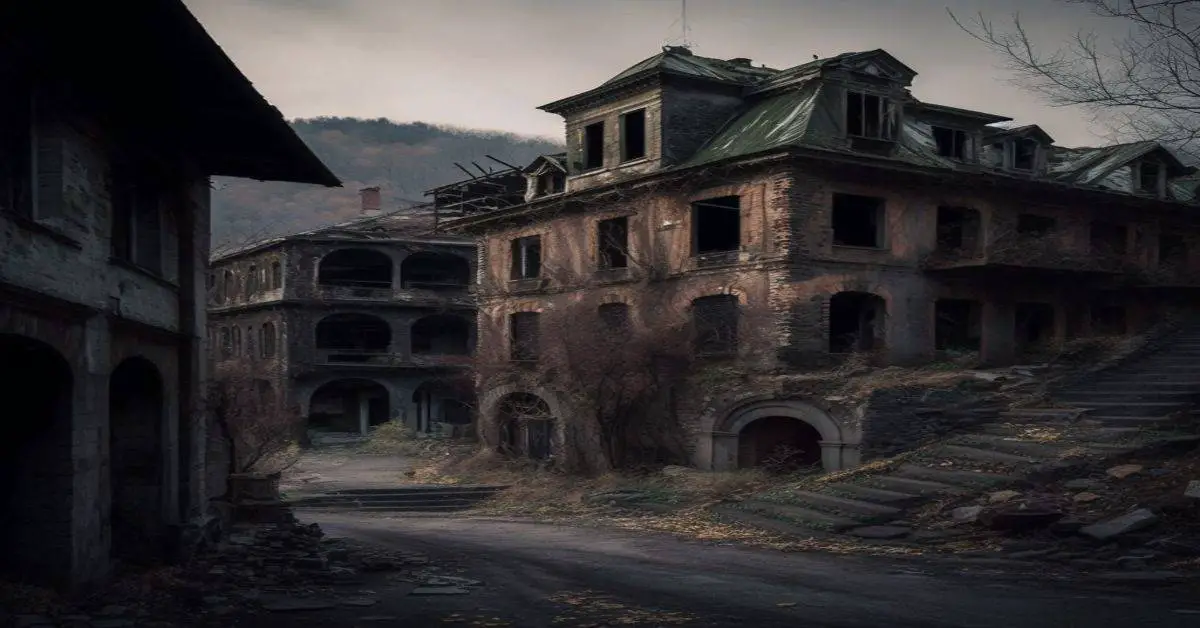
Thurmond, WV
County: Fayette
Zip Code: 25936
Latitude / Longitude: 37°57′40″N 81°4′54″W / 37.96111°N 81.08167°W / 37.96111
Elevation: 1,070 ft (326 m)
Time Zone: Eastern (EST) (UTC-5)
Established: 1900
Disestablished:
Comments: Thurmond is a town in Fayette County, West Virginia, United States, on the New River. The population was five at the 2010 census. During the heyday of coal mining in the New River Gorge, Thurmond was a prosperous town with a number of businesses and facilities for the Chesapeake and Ohio Railway. The town was the filming location for John Sayles’ 1987 movie Matewan since it still possesses many of the characteristics of a 1920s Appalachian coal town. Thurmond was incorporated in 1900 and was most likely named for Captain W. D. Thurmond, who settled here in 1844. He served in the Confederate Army and died in 1910 at age 90. Thurmond post office was established in 1888 and discontinued in 1995. The community remained small until Thomas G McKell of Glen Jean negotiated with the Chesapeake and Ohio Railroad for a crossing at Dunloup Creek in 1892.
Remains: The town once had a population of several hundred, which has dwindled to fewer than a dozen. The railroad depot is now a visitor center for New River Gorge National River.
Current Status: Today, much of Thurmond is owned by the National Park Service for the New River Gorge National River. The C&O passenger railway depot in town was renovated in 1995 and now functions as a Park Service visitor center. The entire town is a designated historic district on the National Register of Historic Places.
Remarks: In the residential portion of the town, housing types are standardized, with three or four basic types corresponding to different positions in the railroad hierarchy. The commercial district, while lacking a street for much of its history, boasted two hotels, two banks, and a number of other commercial buildings. The railroad station was built in 1888, while a railyard and shops served the extensive branch line network which carried coal out of the hills.
Virginius Island, WV
County:
Zip Code:
Latitude / Longitude: 39°19′17″N 77°44′21″W / 39.3214898°N 77.7391595°W / 39.3214898
Elevation:
Time Zone: Eastern (EST) (UTC-5)
Established:
Disestablished:
Comments: Virginius Island is an island on the Shenandoah River in Harpers Ferry, West Virginia. The island is formed by the Shenandoah Canal, constructed by the Patowmack Company between 1806 and 1807, which separates it from the town of Harpers Ferry.
Remains: Virginius Island was once its own thriving industrial town on the Shenandoah River in the nineteenth century. Today, its mills, foundries, factories, warehouses, and homes remain in ruins and are available for walking tours.
Current Status: Virginius Island is part of the Harpers Ferry National Historical Park.
Remarks:
Whitney, WV
County: Fayette
Zip Code:
Latitude / Longitude: 38°5′22″N 81°5′57″W / 38.08944°N 81.09917°W / 38.08944 -81.09917
Elevation: 932 ft (284 m)
Time Zone: Eastern (EST) (UTC-5)
Established:
Disestablished:
Comments: Whitney was an unincorporated community and coal town in Fayette County, West Virginia.
Remains:
Current Status:
Remarks: