You’ll find Iowa’s ghost towns primarily scattered across southeastern counties, where coal boom settlements like Buxton and Muchakinock—once home to thousands of workers—now lie beneath tallgrass prairie and farmland after mines closed in the early 1900s. Civil Bend disappeared under Missouri River floods, while Red Rock rests beneath Iowa’s largest lake, deliberately flooded in 1969. Today, systematic reclamation projects have restored over 13,000 acres of former mining land, creating wildlife habitat where prairie grasses stabilize soil and woodland corridors support returning biodiversity across landscapes that preserve these communities’ cultural heritage.
Key Takeaways
- Buxton, Iowa’s largest unincorporated town, peaked at 10,000 residents before abandonment in 1927, now marked only by prairie grass and cemetery.
- Muchakinock’s former mining operations from the 1870s-1900 are now completely reclaimed farmland after families relocated when coal seams were exhausted.
- Red Rock was deliberately flooded in 1969 to create Iowa’s largest lake, submerging the entire town beneath 38,000 acres of water.
- Restored prairies with deep root systems now stabilize soil on abandoned town sites, supporting grassland birds and filtering runoff effectively.
- The Pella Wildlife Area transformed a former coal mine into 70 acres of timber, 20 acres of wetlands, and extensive prairie habitat.
Buxton: Where Prairie Grass Covers a Once-Thriving Community
Around 1900, the Consolidation Coal Company—a division of the Chicago and Northwestern Railway—established Buxton in Monroe County, Iowa, naming it after J.E. Buxton, their agent.
You’ll find remarkable Buxton history in its rise as the largest unincorporated town west of the Mississippi, peaking at 10,000 residents during WWI’s coal boom.
Buxton demographics defied Jim Crow entirely—this mainly Black community thrived with integrated schools, businesses, and churches. The company recruited Southern Black workers and European immigrants, creating exceptional living standards where Black professionals owned stores and practices. Workers earned wages higher than many African-Americans elsewhere in the United States, making Buxton a rare economic success story.
By 1927, you’d witness complete abandonment as mines closed and railways ceased operations.
Today, prairie grass blankets the foundations where this once-prosperous settlement stood, with only the cemetery marking where thousands built lives free from racial constraints. The site now features security measures to protect the historical grounds from vandalism and unauthorized disturbances.
Muchakinock: Coal Mining Legacy Beneath the Farmland
In the 1870s, brothers H.W. and W.A. McNeill purchased coal fields that’d transform Mahaska County’s landscape. Their Consolidation Coal Company became the region’s largest mining operation by 1878, employing 400 workers across seven openings.
You’ll find Muchakinock’s mining heritage particularly significant—it housed Iowa’s largest African American settlement from 1874 to 1900, where Southern migrants built community resilience despite operating under an exhaustion-and-abandon plan. The company town thrived atop Muchakinock valley’s coal seams, supplying locomotive fuel to Chicago and Northwestern Railroad.
When mines closed in 1900, entire families relocated to Buxton, ending three decades of extraction. Houses were loaded onto railroad cars for the move to this new integrated coal-mining community in Monroe County. Today, you’d never know this coal camp existed. Nature’s reclaimed the site, burying its industrial past beneath farmland where prairie grass now grows. The transformation protects the area’s integrity while offering visitors a glimpse into Iowa’s forgotten industrial heritage.
Civil Bend: A Riverbank Settlement Lost to Flooding
Positioned where the Missouri River carved the boundary between slavery and freedom, Civil Bend emerged as a critical entry point for fugitive slaves crossing into Iowa’s southwestern corner.
During the 1850s, a sympathetic ferryman guided freedom seekers across dangerous nighttime waters, evading bounty hunters who prowled Missouri’s banks.
You’ll find Civil Bend’s significance peaked when John Brown‘s group crossed nearby in February 1859, routing through this abolitionist stronghold. The settlement’s residents coordinated with Tabor abolitionists, forming a network that stretched northward to Canada.
The community maintained its reputation as a safe haven through word of mouth among freedom seekers navigating northward.
Yet Civil Bend couldn’t withstand nature’s persistence. Repeated flooding impact from the Missouri River ultimately reclaimed this riverbank community, forcing abandonment. Just upstream, Mormon pioneers had established Winter Quarters in September 1846, creating a temporary settlement before their continued westward journey.
Today, farmland and overgrown vegetation mark where courage once defied injustice, leaving only archival records of its Underground Railroad legacy.
Red Rock: The Town That Sleeps Beneath the Lake
A trading post materialized along the Des Moines River in 1842, predating Iowa’s statehood by four years and establishing what would become Red Rock—a frontier settlement destined for an unusual fate.
Despite enduring major floods in 1851, 1859, and 1903, this community demonstrated remarkable flood resilience, operating its school from 1857 until the 1950s.
Red Rock’s submerged history includes:
Beneath the surface lie the scattered foundations of a frontier town deliberately sacrificed to tame the Des Moines River.
- Failed 1890s sandstone quarry operations, abandoned when the soft red rock proved commercially worthless
- A transformation from violent frontier outpost to respectable town with churches, stores, and professional services
- Deliberate flooding in 1969 when Red Rock Dam gates closed, creating Iowa’s largest lake at 15,250 acres
You’ll find only foundation remnants beneath these waters—silent testimony to autonomy surrendered for flood control. The lake now covers approximately 38,000 acres of public land, making it the largest contiguous public land base in Iowa. This man-made reservoir serves as an underwater graveyard for six towns that once dotted the valley.
How Boom-and-Bust Cycles Shaped Iowa’s Ghost Towns
When railroad companies mapped their routes through Iowa in the 1860s, they created winners and losers overnight—settlements that bet correctly on rail placement flourished, while those bypassed withered into obscurity.
You’ll find this pattern repeated across Iowa’s landscape: speculative towns like Conover built hotels and saloons on muddy streets, only to see their infrastructure abandoned within two decades when rails chose alternative routes.
Coal mining towns faced similar fates through resource exhaustion rather than geographic rejection.
Buxton in Monroe County emerged in the 1890s above coal seams, becoming a racially integrated company town before fires and mine closures emptied it by the 1920s.
The 1851 flood that destroyed Iowaville demonstrates how natural disasters compounded economic vulnerability. Without Economic Resilience through diversified industries, these single-resource communities couldn’t withstand market shifts.
Urban Migration followed opportunity elsewhere, leaving empty buildings where frontier ambitions once thrived. Modern ghost developments face similar challenges, as negative associations with economic collapse deter potential buyers from investing in these once-promising locations.
Archaeological Discoveries Revealing Iowa’s Lost Communities
You’ll find Iowa’s ghost towns preserved not in standing structures but in the artifacts archaeologists extract from undisturbed soil layers.
When surveyors recovered over 1,200 items from a single Woodland Period site near the Chariton River in 1986, the pottery shards and stone tools revealed occupation patterns spanning 500-900 A.D., documenting communities that thrived centuries before European settlement.
These material remnants—from hematite pigments at prehistoric villages to foundation stones beneath Buxton’s abandoned coal town—now rest in museum collections, transforming scattered fragments into coherent narratives of Iowa’s lost populations.
Pottery Shards Tell Stories
Beneath Iowa’s cultivated fields, pottery shards function as temporal markers that archaeologists use to reconstruct settlement timelines spanning millennia.
You’ll find ceramic chronology reveals distinct occupation periods: Woodland fragments dating to 500-900 A.D., Oneota shell-tempered vessels with strap handles, and 1830s pioneer ceramics layering over Indigenous sites. These fragments document cultural adaptation through vessel designs suited for processing squash, little barley, and marsh elder.
At undisturbed locations, pottery assemblages tell complete stories:
- The Wever Site yielded 72,000 fragments representing 379 distinct vessels
- A 1986 south-central Iowa survey recovered 1,200 artifacts from six-month habitations
- Edgewater Park’s 3,800-year-old ceramics mark Iowa’s oldest domesticated plant evidence
Each shard preserves evidence of daily routines, ceremonial practices, and technological knowledge—unregulated archives of self-sufficient communities.
Foundations Beneath Prairie Grass
While surface ceramics document cultural practices, the structural foundations hidden beneath Iowa’s remaining grasslands reveal complete community footprints.
At Muchakinock in Mahaska County, you’ll find foundational remnants poking through prairie grass where coal miners once built their lives in the late 1800s. When the seams depleted by the early 1900s, inhabitants abandoned the town to nature’s advance.
Today, archaeologists uncovering these sites discover pottery shards and foundations exposing both Indigenous and pioneer occupation layers. These ghostly echoes of vanished settlements persist beneath farmland that’s reclaimed the townsites.
A small cemetery stands as the sole guardian of memory, while the town’s physical skeleton lies buried where native grasses have reasserted their ancestral claim to Iowa’s landscape.
Museum Artifacts Preserve Heritage
When construction crews broke ground for highway expansions across south-central Iowa in 1986, they unearthed more than 1,200 artifacts from Woodland Period settlements dating between A.D. 300 and 1,000.
You’ll find these recovered treasures documenting lives that flourished independently across Iowa’s stream valleys:
- Arrow points and stone tool waste chips revealing self-sufficient hunting practices
- Pottery shards marking domestic traditions from 500-900 A.D.
- Hematite deposits indicating ceremonial knowledge and mineral extraction skills
The National Historic Preservation Act mandated full-scale archaeological excavations before highway construction proceeded.
Iowa’s State Archaeologist’s Office coordinated systematic artifact preservation, ensuring cultural heritage survived despite infrastructure development.
These settlements weren’t temporary camps—evidence suggests six-month occupations by multiple people who mastered their environment through strategic resource management and autonomous community building.
The Pella Abandoned Mines Transformation Project
The transformation of the 277-acre Pella Wildlife Area represents one of Iowa’s most ambitious mine reclamation efforts, targeting a former strip coal mine that operated until the 1950s and left behind a landscape scarred by acidic soils and hazardous water bodies.
You’ll find this $4 million Pella transformation reclaiming land that predates 1977 federal mining regulations, moving over 1.3 million cubic yards of earth and applying 7,000 tons of lime to neutralize toxic conditions.
The ecological restoration converts degraded terrain into 70 acres of timber, 20 acres of wetlands, and extensive prairie habitat.
Statewide Efforts to Reclaim Abandoned Mine Lands
Across southeastern Iowa’s coal-bearing counties, systematic reclamation of over 13,000 acres eligible under the federal Surface Mining Control and Reclamation Act addresses environmental damage from pre-1977 mining operations that left behind acidic soils, contaminated water bodies, and unstable terrain.
The Iowa Department of Agriculture and Land Stewardship’s Mines and Minerals Bureau implements reclamation strategies through federal funding mechanisms, allocating $15,000 to $20,000 per acre toward restoration projects.
Community involvement through partnerships like Pathfinders RC&D has secured $5.5 million since 2006, reclaiming 63 sites across:
- Mahaska County’s terraced hillsides replacing dangerous highwalls
- Marion County’s limestone-treated wetlands filtering acidic runoff
- Monroe County’s native grasslands supporting wildlife habitat
You’ll find these transformed landscapes demonstrate how coordinated reclamation efforts restore environmental freedom to communities burdened by historical industrial degradation.
Preserving Memory: Cemeteries and Markers of Vanished Towns
As vanished towns fade from living memory, their cemeteries remain tangible connections to Iowa’s earliest settlers—burial grounds that demand active preservation against neglect and time’s erosion.
Organizations like SAPIC provide financial assistance and technical guidance for restoring untended pioneer graves, while Iowa law designates sites with twelve or fewer burials in fifty years as pioneer cemeteries requiring township stewardship.
You’ll find volunteers like Wade Fowler employing conservation methods that halt deterioration without recreating original inscriptions.
Crawford County’s Historical Preservation Commission maps forgotten settlements through interactive cemetery preservation efforts, marking locations like Paradise, discontinued in 1863.
Mount Pisgah’s one-acre preserve honors over 160 Mormon migrants who perished crossing Iowa’s prairie in 1846—historical markers ensuring these vanished communities won’t disappear completely from collective memory.
Wildlife and Nature’s Return to Former Mining Communities
You’ll find prairie grass now covering the foundations of Buxton and Muchakinock, where coal mining communities once thrived before operations ceased in the 1920s.
Since Iowa’s reclamation efforts began in 1983, over 120 former mine sites have transformed from eroded wastelands into functional habitats, with the Pella Wildlife Area’s 280-acre restoration representing the state’s most ambitious project.
As vegetation stabilizes steep slopes and wetlands fill with frogs and aquatic life, these reclaimed landscapes demonstrate how systematically addressing soil toxicity and waterway degradation can reverse decades of ecological damage.
Prairie Ecosystems Reclaim Townsites
When invasive honeysuckle and autumn olive were cleared from hills overlooking Rock Creek Lake last November, the project revealed something remarkable: soil-stored native seeds that had waited years for their chance to germinate.
Where ghost towns once stood, prairie ecosystems now reclaim abandoned townsites through systematic restoration.
Prescribed fire maintains these recovered landscapes, triggering blooms of:
- Maximillian sunflower and butterfly milkweed painting hillsides gold and orange each July
- Rattlesnake master and wild bergamot creating purple-white meadows that attract field sparrows
- Cream gentian and pale spiked lobelia offering late-season color through August
These restored prairies stabilize soil with deep roots, filter runoff, and support grassland birds.
With less than 0.1% of Iowa’s original prairie remaining, each reclaimed townsite represents recovered freedom for plant and animal species once driven out.
Restored Habitats Support Biodiversity
Beyond prairie grasses pushing through forgotten main streets, Iowa’s abandoned industrial sites harbor returning wildlife populations that tell a different recovery story.
You’ll find wetland restorations transforming drained marshlands into biodiversity hotspots—26,000 acres by 1981 expanded through targeted conservation since 1985. These spaces now shelter wood turtles along Cedar River, muskrats engineering open water zones, and waterfowl reclaiming historic nesting grounds.
Converted railway corridors like the 63-mile Wabash Trace create habitat corridors threading through ghost towns—Silver City, Malvern—where crushed limestone paths support regenerating ecosystems.
Woodland expansion added 500,000 acres between 1974-1990, sheltering butterflies and hummingbirds.
You’re witnessing nature’s territorial reclamation: beavers damming streams, amphibians completing life cycles in restored potholes, chipmunks inhabiting shrub layers where commerce once thrived.
Frequently Asked Questions
Can Visitors Legally Explore Iowa’s Ghost Town Sites and Abandoned Mines?
You’ll find legal access to surface sites on public lands, but abandoned mines remain strictly off-limits due to visitor safety hazards. Always verify property ownership through county records before exploring Iowa’s historical remnants independently.
What Happened to Residents When These Towns Were Abandoned or Evacuated?
Residents scattered to neighboring communities when economic opportunities vanished, carrying resident memories that became ghost town folklore. You’ll find their descendants preserved displacement narratives through family histories, documenting how railroad decisions and disasters permanently fractured established settlements.
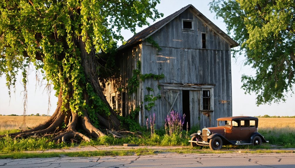
Are There Any Original Structures Still Standing in These Ghost Towns?
Yes, you’ll find original structures worth your urban exploration: Stiles’ 1852-era general store, Buckhorn’s whitewashed church and crumbling creamery, Terra Haute’s schoolhouse, and Rockville’s stone grist mill—all awaiting historic preservation or nature’s reclamation.
How Do Modern Property Owners Feel About Ghost Towns on Their Land?
Modern property owners’ perspectives aren’t well-documented in historical records. You’ll find property rights concerns and land value considerations likely influence attitudes, though individual responses vary between preserving heritage sites and maximizing economic development opportunities.
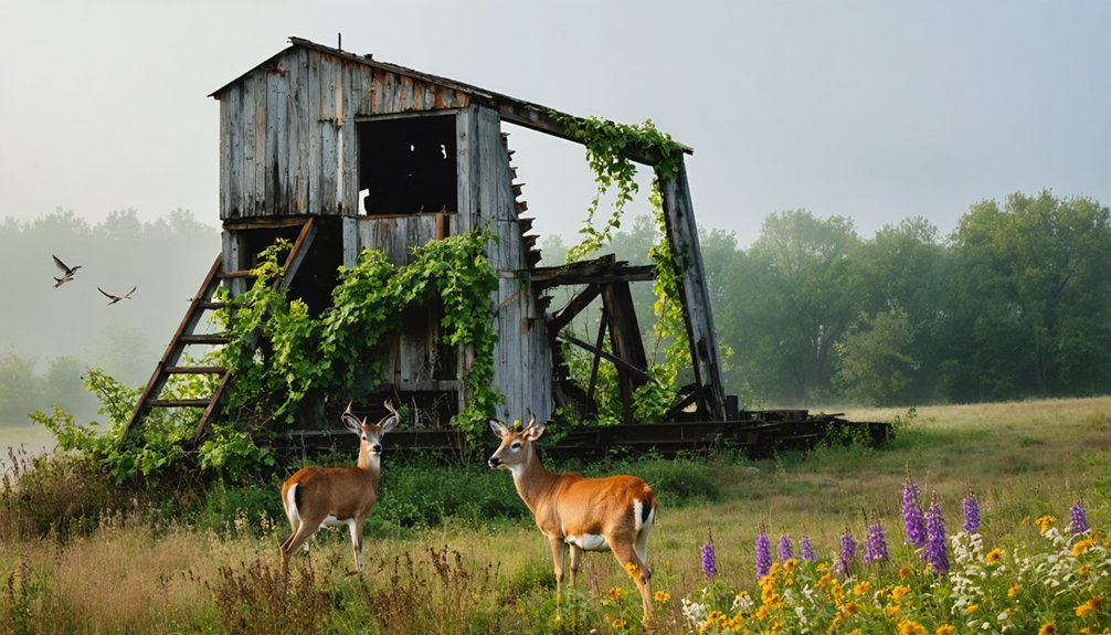
What Wildlife Species Have Returned to Reclaimed Mining Areas in Iowa?
You’ll witness countless wildlife species thriving in reclaimed mining areas across Iowa—deer, wild turkey, quail, pheasants, songbirds, waterfowl, rabbits, squirrels, and fur-bearing animals now roam these transformed landscapes freely.
References
- https://everafterinthewoods.com/these-deserted-ghost-towns-in-iowa-still-tell-the-story-of-the-heartland/
- https://www.thegazette.com/business/iowa-to-reclaim-abandoned-coal-mines-that-created-ecological-disaster/
- https://www.bbcearth.com/news/abandoned-places-reclaimed-by-nature
- https://www.shive-hattery.com/from-hazard-to-habitat-revitalizing-iowas-abandoned-mine-lands/
- https://pubs.lib.uiowa.edu/annals-of-iowa/article/id/6960/download/pdf/
- https://smalltowns.soc.iastate.edu/about/
- https://pubs.lib.uiowa.edu/annals-of-iowa/article/10852/galley/119423/view/
- https://reformedjournal.com/2019/07/05/ghost-town-legacy/
- https://aaregistry.org/story/buxton-iowa-founded/
- https://www.youtube.com/watch?v=ka8Ys_htFr8