You’ll find Virginia’s ghost towns in various states of natural reclamation, from Lignite’s stone foundations disappearing beneath dead vines to Mouth of Wilson’s 1980s-era storefronts standing eerily intact beside active highways. Pocahontas preserves remnants of its coal-mining past through St. Elizabeth Church and an exhibition mine, while Union Level’s abandoned buildings mark its transportation-era decline. These sites represent decades-long economic shifts rather than sudden abandonment, creating landscapes suspended between preservation and decay that reveal how infrastructure decisions determined which communities would thrive and which would fade into the undergrowth.
Key Takeaways
- Lignite’s stone foundations are hidden by dead vines and vegetation, with 19th-century home and church remnants completely reclaimed by nature.
- Mouth of Wilson features abandoned commercial buildings including a general store, post office, and gas station overtaken by rural decay.
- The 1884 Fields Manufacturing woolen mill stands silent along Route 16, surrounded by encroaching natural growth since its closure.
- Rosewell Plantation’s 1916 fire left only brick walls and chimneys, now weathered ruins amid archaeological discoveries and ongoing natural reclamation.
- Pocahontas industrial ghost town, founded in 1883, shows abandoned coal mining structures being slowly consumed by Virginia’s returning wilderness.
Lignite: Stone Foundations Among Dead Vines
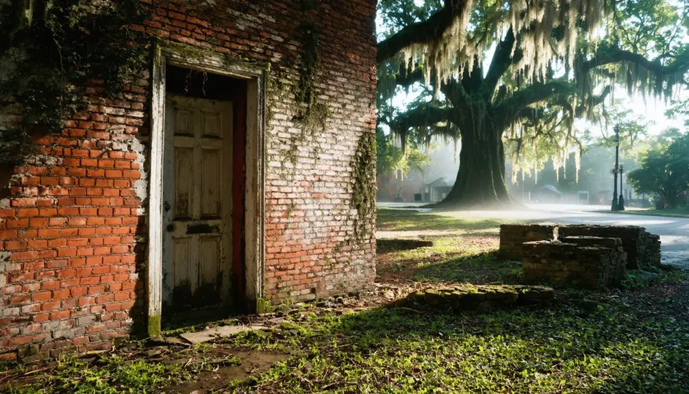
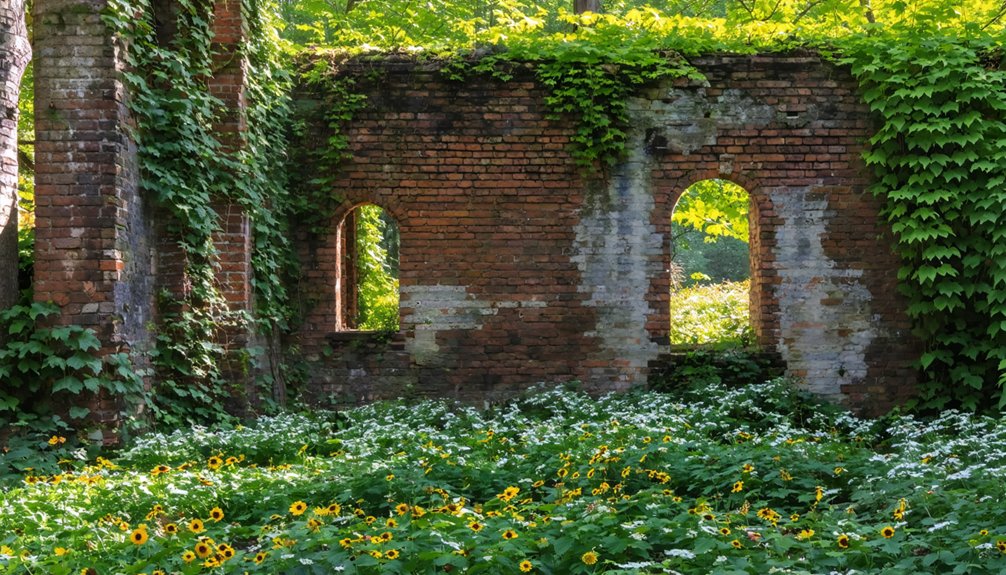
Among the scattered remnants of Virginia’s forgotten settlements, Lignite emerges from historical records as little more than a name attached to stone foundations slowly disappearing beneath decades of vegetation.
You’ll find no documented founding date or population records—just fragmentary mentions alongside other York County ghost towns like Bigler’s Mill and Ca Ira.
The lignite history that survives exists primarily through these crumbling bases of homes and churches, their 19th-century stonework peeking through moss and dead vines.
Natural reclamation has transformed the site into an overgrown symbol of abandonment, where wildflowers and creeping vegetation erase what economic shifts, isolation, or infrastructure failures once destroyed.
The foundations persist as silent markers of lives and communities that chose—or were forced—to move on. Unlike Wash Woods, which was founded by shipwreck survivors, Lignite left behind no origin story to explain its creation.
Ghost towns across the region often reflect economic decline and abandonment, with names that sometimes symbolize the fate of the settlements themselves.
Mouth of Wilson: Abandoned Junction at the Border
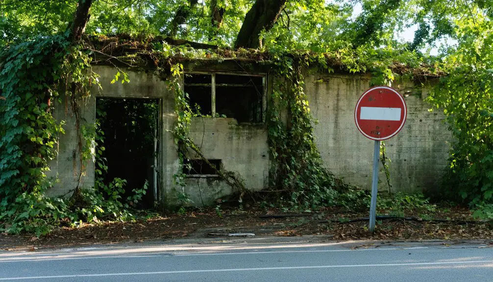
You’ll find Mouth of Wilson’s commercial abandonment particularly striking because it defies typical economic logic—despite steady traffic flowing through the junction of U.S. Route 58 and State Route 16, every building from the Halsey Farm Service Store to the woolen mill stands vacant.
Examining structures from the 19th and 20th centuries reveals a complete rural vernacular catalog: mill buildings, general store, post office, gas station, and auto repair shop, all deteriorating without preservation efforts over more than a decade. Like Union Level near the North Carolina line, the town attracted history enthusiasts drawn to explore these remnants of Virginia’s agricultural past.
This frozen decay creates an unsettling atmosphere where infrastructure persists but community has vanished, leaving only architectural remnants that document regional consumer patterns shifting toward distant retail centers. The contrast becomes stark just ten miles down the road, where a Walmart parking lot overflows with vehicles that once might have patronized Mouth of Wilson’s local merchants.
Commercial Center’s Complete Abandonment
At the junction where routes 58 and 16 meet Virginia’s North Carolina border, Mouth of Wilson’s commercial center stands frozen in economic decline.
You’ll find the former Halsey Farm Service Store, mill buildings, general store, post office, gas station, and auto repair shop—all completely deserted yet structurally sound.
These abandoned structures from the 19th and 20th centuries showcase rural decay without anyone’s intervention to preserve them.
The remnants of Fields Manufacturing Company’s woolen mill anchors the southern view, while an old water tower marks the western approach.
Despite their reasonable condition, these buildings deteriorate slowly, victims of economic migration toward big-box retailers like Walmart.
What’s most striking isn’t their dilapidation—it’s their potential wasting away, unclaimed by a community that’s chosen commerce elsewhere over preservation here.
Similar economic forces transformed Wilson Mall from its 1964 opening as Parkwood Shopping Center into a 50-acre dead zone, its decade of abandonment marked by collapsed skylights and water-damaged interiors that mirror the fate of rural commercial spaces across Virginia. The mall’s three anchor stores—Roses, JC Penney, and Sears—once drew shoppers from across the region before the complex closed in 2013.
Notable Abandoned Rural Buildings
The junction itself tells multiple stories through its layered abandonment.
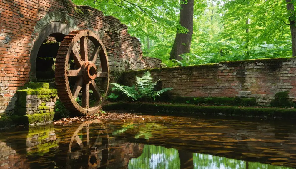
You’ll find Fields Manufacturing Company’s 1884 woolen mill standing sentinel along Route 16, its water-powered machinery silent since Col. Fields J. McMillan’s enterprise ceased operations.
The former Halsey Farm Service Store faces northeast on Route 58, while an old water tower punctuates the skyline depending on your vantage point.
These abandoned structures represent distinct eras of rural heritage—19th-century industrial ambition, mid-20th-century agricultural commerce, residential life now surrendered to decay.
Dan Idol’s 1874 Round House survived floods in 1916 and 1940 before Appalachian Power acquired it through eminent domain in 1961. The octagonal house represented a brief architectural trend popular in the late 19th Century across the USA.
North Carolina’s National Scenic River designation halted the dam project, leaving these buildings frozen between demolition and preservation—monuments to economic freedom lost. Along western Virginia’s US Highway 11, designated in 1926, similar abandoned structures stand as reminders of the region’s fading past.
Eerie Twilight Zone Atmosphere
How does a place achieve such complete stillness while straddling two active state highways? Mouth of Wilson exists in perpetual twilight ambiance, where functional roads slice through a frozen commercial landscape.
You’ll find abandoned structures creating haunting echoes of 1930s prosperity, preserved through neglect rather than intention. The junction’s eerie quality intensifies as vehicles pass defunct storefronts without stopping—motion without interaction.
Atmospheric Elements Creating the Time-Frozen Experience:
- Silent woolen mill buildings stand sentinel at active highway intersections
- Vacant post office and general stores face roads that no longer serve them
- Ten-year observation periods reveal zero intervention or demographic change
- Border location amplifies isolation despite continuous traffic flow
- Mid-1980s architecture remains untouched, creating authentic historical suspension
This intersection exemplifies Virginia’s ghost towns—accessible yet abandoned, visible yet invisible to passing travelers seeking destinations beyond. The settlement takes its name from Wilson Creek, a tributary that flows through this desolate landscape where nature slowly reclaims what commerce once claimed. The power dam built in 1930 once brought modernity to this outpost, but now stands as another relic of ambitions that ultimately faded into obscurity.
Pamplin: Endangered Railroad Hub Along High Bridge Trail
You’ll find Pamplin’s transformation from thriving railroad hub to endangered historic site mirrors the economic shifts that reshaped Virginia’s rail corridors throughout the twentieth century.
The town’s trajectory—from Nicholas Pamplin’s 1850s land donation through its post-1909 fire decline—demonstrates how infrastructure changes and industrial closures systematically emptied once-prosperous railway communities.
Its 2014 designation as one of Virginia’s most endangered historic sites reflects ongoing tensions between preservation and decay along the High Bridge Trail corridor.
Railroad Heritage and Decline
When Farmville citizens petitioned to reroute the Southside Railroad through their town in the 1850s, pledging up to $150,000 in bonds, they couldn’t have foreseen how profoundly their decision would reshape the region’s economic geography.
Though they ultimately paid just $12,000, this investment—equivalent to $3.5 million today—secured their prosperity while dooming rival river towns.
The railroad nostalgia you’ll find along this corridor masks a harder truth: infrastructure determines winners and losers.
Key Turning Points in the Rail Line’s Story:
- Original 1853-1854 High Bridge required nearly 4 million bricks and 20 massive piers
- Strategic military target during Civil War’s final Battle of High Bridge
- William Mahone rebuilt post-war infrastructure, eventually forming Norfolk and Western
- 1916 low-grade route bypassed Farmville, diminishing the line’s historical significance
- Norfolk Southern abandoned the increasingly costly route, donating 31 miles in 2006
Preservation Efforts and Visitors
Though Pamplin’s population hovers around 200 residents, the town’s twelve-year campaign for a trail extension demonstrates how infrastructure advocacy can reverse decades of decline.
The 2024 completion of High Bridge Trail’s 1.2-mile extension to Main Street employed preservation techniques that honored the original rail corridor while catalyzing economic transformation.
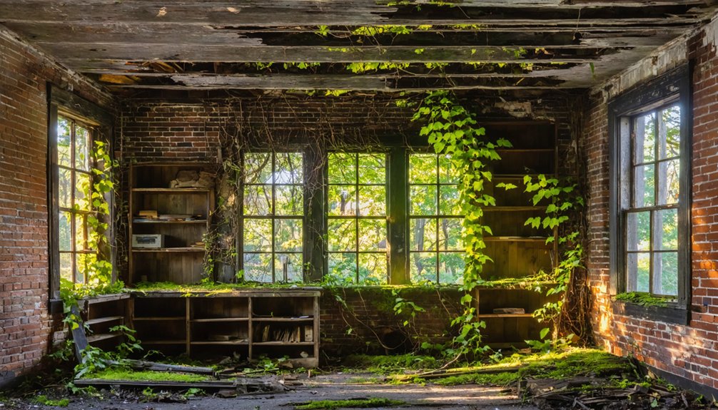
You’ll find abandoned brick storefronts now housing MiPa’s Table and a forthcoming bookstore, proving visitor impact extends beyond simple tourism.
The crushed gravel path creates foot traffic that’s revitalized a community once reduced to ten downtown buildings.
This strategic connection between recreational infrastructure and commercial revival shows you don’t need government mandates—just determined residents who understand that preservation means adaptation, not fossilization.
Rosewell Plantation: Colonial Ruins Open for Exploration
Rising from the banks of the York River in Gloucester County, the ruins of Rosewell Plantation stand as one of colonial Virginia‘s most ambitious architectural achievements—and its most haunting reminders of a society built on enslaved labor.
Built beginning in 1725, this 12,000-square-foot mansion once towered three stories high with twin octagonal cupolas. The 1916 fire left only magnificent brick walls and four chimneys, yet archaeologists continue uncovering stories within these grounds—particularly those of hundreds of enslaved lives who constructed this monument to colonial power.
Exploring Rosewell Today:
- Preserved ruins within Gloucester County State Nature Preserve
- Archaeological findings revealing colonial-era artifacts and architectural details
- 2025 remembrance structure honoring enslaved people’s contributions
- Finest colonial brickwork specimens in America
- Interpretive programs examining plantation’s complex history
Pocahontas: Faded Coal Town of the Early 1900s
While Virginia’s Tidewater region preserves the skeletal grandeur of plantation estates, the state’s southwestern coalfields tell a different story of extraction and exploitation—one written in immigrant labor, corporate ambition, and subterranean danger.
Pocahontas history began in 1883 when Norfolk and Western Railroad transformed Jordan Nelson’s property into an industrial outpost. Hungarian, Swedish, and German workers extracted coal from thirteen-foot seams, shipping 60,828 tons that first year.
The company town featured boardinghouses, stores, and coke ovens—a bustling settlement beyond typical coal mining camps.
Then disaster struck: an 1884 explosion killed 114 miners, their bodies recovered only after flooding extinguished the fire.
The 1884 explosion claimed 114 lives—bodies retrieved only after floodwaters drowned the flames that consumed them below.
The original mine closed in 1955, leaving behind St. Elizabeth Church, immigrant headstones, and an exhibition mine where you’ll find remnants of corporate dominance.
Union Level: Overgrown Remnants of a Bygone Transportation Hub
Unlike the coal-fueled settlements carved into Appalachia’s slopes, Union Level‘s transformation hinged on horizontal movement—the flow of goods and people across Southside Virginia’s tobacco belt.
You’ll find this Mecklenburg County ghost town‘s story woven through transportation history, from stagecoach routes of the 1840s to railroad tracks laid in 1890. The Atlantic & Danville Railway sparked economic revival, transforming a waystation into a commercial center that once outpaced neighboring South Hill.
What Remains at Union Level:
- Abandoned storefronts lining the main road, reclaimed by kudzu and undergrowth
- Bank of Union Level’s weathered facade, frozen since the 1930s Depression
- Vintage gas pump standing sentinel over vanished commerce
- Three historic buildings owned by local Jimmy Thompson
- Buckhorn Elementary School’s empty halls, once echoing with generations
Frequently Asked Questions
Is It Legal to Explore These Abandoned Virginia Ghost Towns?
You’ll find ghost town regulations permit exploring publicly accessible sites like Belle Isle and Swannanoa Palace, but you must secure exploration permissions for private property and avoid archaeologically protected zones requiring state permits to remain legal.
What Safety Precautions Should Visitors Take When Exploring Ruins?
Ironically, nature’s reclamation creates new dangers you’ll face. You must wear proper safety gear—sturdy boots, gloves, long sleeves—and maintain wildlife awareness. Test every surface, avoid structural centers, and preserve your autonomy through careful preparation.
Are There Guided Tours Available for Any of These Locations?
Most sites lack formal guided exploration programs, leaving you free to discover their historical significance independently. Pocahontas’s coal mine offers structured summer tours, while other locations permit self-directed wandering through decaying remnants.
Can I Photograph or Film Inside the Abandoned Buildings?
You’ll need permission first—no different than asking before sketching someone’s daguerreotype. Photography etiquette demands respecting property rights and building preservation laws. Research ownership thoroughly, obtain permits, and understand that trespassing charges override your creative freedom.
What Caused Most of These Virginia Towns to Become Abandoned?
Economic decline from the Great Depression and railroad closures triggered these abandonments, while population migration to modernized areas drained remaining residents. You’ll find government land seizures for parks also forcibly eliminated several communities, erasing them from Virginia’s landscape.
References
- https://www.blueridgeoutdoors.com/magazine/february-2012/lost-town-of-lignite/
- https://www.peterlabau.com/blog/entry/virginia-ghost-town
- https://abcnews4.com/amazing-america/discover-pamplin-virginia-a-nearly-forgotten-ghost-town-with-stories-still-standing
- https://northernvirginiamag.com/67-advantures-ghost-towns-of-virginia/
- https://www.youtube.com/watch?v=Z_9T_Ea5T7I
- https://www.youtube.com/watch?v=moYHlyQexj4
- https://en.wikipedia.org/wiki/List_of_ghost_towns_in_Virginia
- https://sites.rootsweb.com/~vatttp/ghosttowns/ghosttowns.htm
- https://icatchshadows.com/photographing-the-abandoned-ghost-town-of-pamplin-virginia/
- https://www.atlasobscura.com/places/wash-woods-settlement