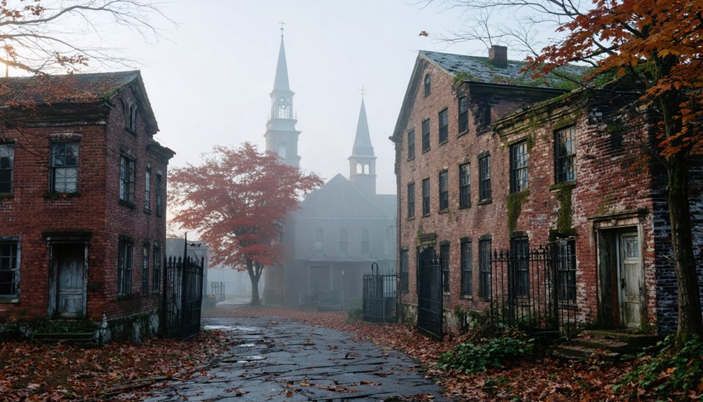
You’ll discover Massachusetts’ most haunting ghost towns at Dogtown’s boulder-strewn wilderness on Cape Ann, where cellar holes mark 80 vanished homesteads, and along Quabbin Reservoir’s shores, where Dana’s preserved foundations and paved paths tell stories of four towns sacrificed for Boston’s water supply. Long Point’s wind-scraped peninsula offers coastal ruins accessible only by hiking, while Prescott’s forested Questing Reservation hides crumbling farmsteads beneath the trees. Each site demands sturdy boots, careful preparation, and respect for these landscapes where nature has reclaimed what settlers once called home.
Key Takeaways
- Dogtown features cellar holes from 80 colonial families, glacier-carved boulders, and trails for hiking amid wild, mysterious woodlands.
- Dana’s preserved remains include paved paths, foundations, and historical markers above the Quabbin Reservoir’s waterline for easy exploration.
- Greenwich and Prescott offer submerged ruins and farmstead foundations from 1800s settlements displaced by the Quabbin Reservoir project.
- Long Point presents wind-swept coastal ruins with a historic lighthouse, Civil War fort, and wildlife including seal colonies.
- Bring sturdy boots, water, maps, and check tide charts; most sites are free but require preparation and navigation skills.
Dogtown: A Colonial Settlement Lost to Time
Hidden among the rocky woodlands of Cape Ann lies Dogtown, a haunting settlement that once thrived as the most prosperous community in the region before vanishing into history. You’ll discover cellar holes marking where 80 affluent families lived during the 1750s peak, when this agricultural hub connected Cape Ann’s coastal towns.
After the Revolution, residents abandoned their homes for opportunities elsewhere, leaving Revolutionary War widows and freed slaves as final inhabitants until 1830. The area earned its eerie name from packs of stray dogs roaming empty streets.
Long before colonial settlement, the Dogtown area served as hunting grounds and gathering sites for Indigenous peoples dating back over 12,000 years, who collected berries, medicinal plants, and game from these lands. Today you can explore glacier-carved boulders, inscribed stones, and dense woods within the protected watershed. The site features trails for hiking, biking, jogging, and cross-country skiing across the reclaimed landscape. Folklore and legends of witches and outcasts still permeate this wilderness, while preservation efforts maintain its wild, mysterious character for adventurous souls seeking forgotten American history.
Dana: Remnants Above the Waterline
When Massachusetts sacrificed four entire towns to quench Boston’s thirst, Dana alone escaped complete submersion beneath the Quabbin Reservoir’s waters. Though systematically razed in 1939, the Common sits high and dry above the waterline, its stone foundations defying erasure.
Dana’s stone ruins stand as monuments to a town deliberately erased, preserved above water where three sister settlements vanished beneath.
You’ll find preservation efforts evident throughout—paved paths wind through cellar holes while historical markers match vintage photographs to remnants. The 1996 central monument honors those who “sacrificed their homes and way of life.”
What You’ll Discover:
- Center School’s foundation, once teaching 33 students
- Stone fence posts marking the exhumed cemetery’s border
- Edgar Vaughn’s intact retaining wall built from stream stones
- Foundations lining the 1.5-mile walk from parking
- Placards identifying the church, general store, and blacksmith shop
Visitor experiences feel archaeological—you’re walking through deliberate destruction, not gradual abandonment. Dana established as a town in 1801 after separating from Hardwick and Petersham, giving it just 137 years of independent existence before its demolition. The town’s population had declined to 387 by 1935, down from its 1860 peak of 876 residents.
Enfield: Completely Submerged Beneath Quabbin Reservoir
Unlike Dana’s fortunate topography, Enfield lies entombed beneath hundreds of feet of water—the wealthiest and most populous of the Quabbin’s four sacrificed towns now exists only in photographs and memories.
You’ll find no cellar holes to explore here. Enfield’s fourteen mills, active railway, and thriving businesses were systematically razed before the valley burned for months. On April 27, 1938, residents held their farewell ball with free beer and dancing—midnight marked their town’s official dissolution.
By June 1946, water had swallowed everything.
The reservoir now holds over 400 billion gallons, making it one of the largest unfiltered water sources in the United States. The system relies entirely on gravity to flow water into Boston without requiring pumps, demonstrating remarkable engineering foresight.
Historical preservation took an underwater turn when 1990s divers discovered tombstones and mausoleums still resting on the reservoir floor. Though 7,600 bodies were exhumed and relocated, these submerged markers offer haunting archaeological research opportunities—forbidden reminders of Enfield’s complete erasure.
Greenwich: A Swift River Valley Community Sacrificed for Water
Established in 1737 as a land grant to descendants of King Philip’s War veterans, Greenwich became the first European settlement in the Swift River Valley and would ultimately serve as the eastern sentinel of Hampshire County for two centuries.
You’ll find that this agricultural community, straddling the East and Middle branches of the Swift River, thrived until progress demanded sacrifice.
Greenwich’s transformation included:
- Peak population exceeding 1,100 residents in the early nineteenth century
- Tourist trade flourishing alongside light manufacturing ventures
- Population decline of over one-third between 1850-1890
- Historical preservation through Swift River Valley Historical Society’s extensive records
- Environmental impact affecting over 2,000 displaced residents and 7,500 relocated graves
The town’s diverse economy supported woolen mills, scythe and rake manufacturers, match factories, and ice harvesting operations that provided winter employment for residents.
Before European settlement, the area was inhabited by Nipmuc peoples who called it Quabbin meaning “the meeting of many waters.”
The town’s corporate existence ended midnight, April 27, 1938—forever submerged beneath metropolitan Boston‘s thirst.
Prescott: Exploring the Questing Reservation Ruins
Just west of Greenwich’s watery grave, Prescott’s story unfolds differently—you can still walk its forgotten streets. This 1822 township escaped drowning when the Quabbin waters rose, leaving its peninsula as a haunting wildlife sanctuary you’re forbidden to enter. But there’s your loophole: Questing Reservation.
Dr. Robert Lehman’s donated farmstead opens 438 acres of Prescott’s past to unrestricted forested trail explorations. You’ll trace old woods roads past ancient farmsteads where cellar holes yawn beneath forest canopy. Stone walls crisscross the landscape—property lines marking dreams that ended in 1938. The Leffingwell brothers’ farm, established in the mid-1800s, met tragedy when both William and Jerome died in farming accidents.
The rubber factory foundation stands accessible from the visitor center, while throughout, scattered ruins whisper of 7,500 graves relocated, of Daniel Shays plotting rebellion at Conkey Tavern, of freedom lost and reclaimed. At the highest point, you’ll find where the first fort once stored gunpowder and sheltered the Brookins twins—the first non-Native American children born in New Marlborough.
Long Point: Cape Cod’s Isolated Peninsula Settlement
While Prescott’s ruins hide beneath the forest canopy, Long Point’s ghost village sprawls across wind-scraped sand where Cape Cod hooks into the Atlantic.
You’ll find historical preservation stripped to essentials here—a lighthouse, oil house, and earthen Civil War battery marking where 200 souls once thrived. In the 1850s, residents literally floated their homes across Provincetown Harbor rather than surrender to isolation’s grip.
What remains:
- 1875 brick lighthouse standing sentinel over coastal ecology rich with seal colonies and nesting birds
- Earthen Civil War fortification locals mockingly dubbed “Fort Useless”
- Pier pilings emerging at low tide like skeletal fingers
- Wooden cross memorializing WWII casualty Charles Darby
- Wind-scraped peninsula accessible only by determined hiking
This isolated spit attracts weekend wanderers seeking landscapes emptied of civilization’s constraints.
Planning Your Ghost Town Adventure in Massachusetts

Before you chase Massachusetts’ vanished settlements, understand that these aren’t theme parks with marked pathways and visitor centers—they’re landscapes reclaimed by nature where preparation separates adventure from misadventure.
abandoned towns to explore in Massachusetts offer a glimpse into the past, revealing stories etched in crumbling architecture and overgrown streets. Each location has its own unique history, often marked by the lives of those who once called these places home. As you wander through these forgotten sites, keep an eye out for remnants of their former glory, shrouded in mystery and the passage of time.
These ghost towns demand respect and preparation—nature doesn’t maintain visitor amenities where civilization surrendered its grip.
Visitor Safety demands sturdy boots for Dogtown’s treacherous cellar holes, tide charts for Monomoy’s shifting sands, and weather vigilance in Catamount’s remote mountains. Pack water, maps, flashlights, and insect repellent—cell service rarely reaches these forgotten places.
Respect Historical Preservation by staying on designated trails at Quabbin Reservoir and honoring private property boundaries. Spring through fall offers ideal exploration windows, though winter adventurers find solitude worth the challenge.
Massachusetts DCR and wildlife refuges maintain free access to most sites, requiring only your commitment to leave nothing but footprints among the ruins.
Frequently Asked Questions
Are Ghost Town Visits in Massachusetts Free or Do They Require Permits?
Like modern-day explorers seeking Atlantis, you’ll find most Massachusetts ghost towns free for urban exploration. You won’t need permits for historical preservation sites like Dogtown or Quabbin’s viewpoints—just respect dawn-to-dusk hours and marked boundaries.
As you explore abandoned towns in Massachusetts, you’ll come across fascinating remnants of the past, each telling a unique story. The eerie silence of these deserted streets can spark your imagination as you ponder the lives that once thrived there. Keep your camera ready, as the haunting beauty of these locations often attracts both history buffs and curious adventurers alike.
In addition to the abandoned architecture, you may also catch hints of annual festivals in Massachusetts ghost towns, where communities once gathered to celebrate their rich heritage. These events, although no longer held in some locations, evoke memories of vibrant traditions and the lively atmosphere that once filled the air. As you wander through these historical sites, imagine the joyous sounds of laughter and music that echoed off the weathered buildings.
What Safety Precautions Should Visitors Take When Exploring Abandoned Massachusetts Towns?
You’ll need sturdy boots, a first-aid kit, and a buddy when exploring ruins. Respect historical preservation by avoiding unstable structures, and while local legends tempt you deeper, always tell someone your plans before venturing into forgotten places.
Can You Camp Overnight Near Any of These Massachusetts Ghost Towns?
You’ll absolutely *love* camping at Winter Island Park near Salem’s haunted history—just 2.5 miles from ghost town vibes. Practice campfire safety, follow night exploration tips, and embrace freedom while the spirits whisper through harbor breezes.
What Is the Best Season to Visit Massachusetts Ghost Towns?
Fall’s your ultimate gateway to Massachusetts ghost towns, when October’s crisp air awakens local legends and historical preservation efforts shine brightest. You’ll experience peak atmosphere as autumn foliage frames abandoned sites, making eerie encounters feel authentically spine-tingling and unforgettable.
As you venture forth, consider some of the intriguing ghost towns to explore in Massachusetts that offer a glimpse into the past. Each location tells its own haunting story, inviting the adventurous spirit to unravel mysteries tucked away among the trees. Embrace the thrill of discovery as you wander through the remnants of history, where every step resonates with stories long forgotten.
Are Guided Tours Available for Any of These Abandoned Massachusetts Settlements?
You won’t find guided tours for actual abandoned settlements in Massachusetts. Urban exploration of ghost towns requires independent adventure, as historical preservation efforts focus on maintained sites. Salem’s ghost tours cover preserved historic districts, not true abandoned settlements.
Explorers drawn to the mystery of abandoned places in Massachusetts often need to do their research to find lesser-known sites. While some locations may be off the beaten path, others are well-trodden by fellow adventurers seeking the thrill of exploring history’s forgotten corners. These hidden gems offer a unique glimpse into the past, contrasting sharply with the bustling tourism found in more popular areas.
References
- https://en.wikipedia.org/wiki/List_of_ghost_towns_in_Massachusetts
- https://historyofmassachusetts.org/ghost-towns-massachusetts/
- https://www.atlasobscura.com/things-to-do/massachusetts/abandoned
- https://ghost-towns.close-to-me.com/states/massachusetts/
- https://wnaw.com/ma-ghost-towns-hiking/
- https://www.youtube.com/watch?v=RNd_mooK0Cs
- https://www.bostonhiddengems.com/blog/dogtown-ma
- https://babsonassoc.org/indegeneous-presence-dogtown/
- https://appsprod.northshore.edu/poetry/gloucester/dogtownhistory.html
- https://www.theothercape.com/blog/a-plan-to-keep-dogtown-wild-and-free


