Spring’s snowmelt reveals Maine’s haunting past at sites like Flagstaff, where receding lake waters expose the drowned town’s foundations for shoreline exploration. You’ll find Freeman’s crumbling stone walls from 1840s sheep farms emerging from winter’s grip, while Madrid’s weathered mine structures become accessible along mudding trails. The colonial ruins at Fort William Henry and Ligonia Village‘s industrial remnants shed their ice cover, creating ideal conditions for discovery. Below, you’ll find detailed directions to each location and essential spring exploration tips.
Key Takeaways
- Flagstaff’s submerged ruins become visible during spring water drawdowns, offering unique exploration opportunities including underwater diving near Eustis.
- Freeman features authentic cellar holes and stone walls from 1800s sheep farms, accessible via forgotten roads between Kingfield and Strong.
- Madrid, once a 3,000-resident mining town, now hosts artist studios alongside weathered mine structures and the historic Mine Shaft Tavern.
- Colonial Pemaquid State Historic Site displays reconstructed fort walls and original foundations from 1692-1759 military outposts defending frontier conflicts.
- Spring exploration requires checking road conditions after flooding, carrying DEET repellent for black flies, and using detailed offline maps.
Fort William Henry: Bristol’s Colonial Military Outpost
Standing on the windswept headlands of Bristol, you’ll find the remnants of one of colonial America’s most ambitious—and ill-fated—military projects. Fort William Henry‘s massive stone bastion once towered 29 feet high, bristling with cannon meant to assert English independence against French and Wabanaki forces.
Built in 1692 for £20,000—two-thirds of Massachusetts’s budget—this fortress represented colonial architecture at its most imposing, with walls six feet thick and accommodations for 60 soldiers. Construction required 2,000 cartloads of stone to build the formidable walls and defensive bastion.
Yet poor mortar and a water supply outside the walls doomed these military defenses. The fort fell in just four years. The site’s military significance continued when Fort Frederick was built from the ruins in 1729, successfully defending against attacks in 1747 before being decommissioned in 1759. Today, you can explore reconstructed walls and original foundations at Colonial Pemaquid State Historic Site, tracing the footsteps of Captain Pasco Chubb’s garrison and contemplating freedom’s price on this contested frontier.
Perkins on Swan Island: Kennebec River’s Forgotten Settlement
Drifting downriver through the Kennebec’s slate-gray waters, you’ll spot Swan Island’s wooded shores emerging like a ghost from Maine’s colonial past. Once called Perkins Township, this 1,500-acre refuge hosted thriving shipyards and ice houses before emptying in the 1940s.
Five weathered homes still stand—including Dr. Silvester Gardiner’s 1763 saltbox—testament to historical preservation that earned National Register status in 1995.
You’ll need ferry passage from Richmond between May and October, with camping reservations essential.
The Steve Powell Wildlife Management Area transforms abandonment into opportunity: wildlife observation here means tracking bald eagles overhead and deer threading through collapsed foundations. A wildlife tower provides elevated vantage points for spotting seasonal migrations and monitoring the island’s abundant fauna.
Walk the forgotten cemetery where settlers rest, then paddle the shoreline where Abenaki camps predated European contact by centuries. The island once welcomed notable historical figures including Aaron Burr and Benedict Arnold during their travels through Maine.
Freedom lives where civilization withdrew.
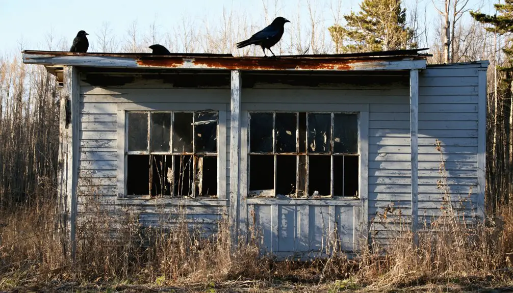
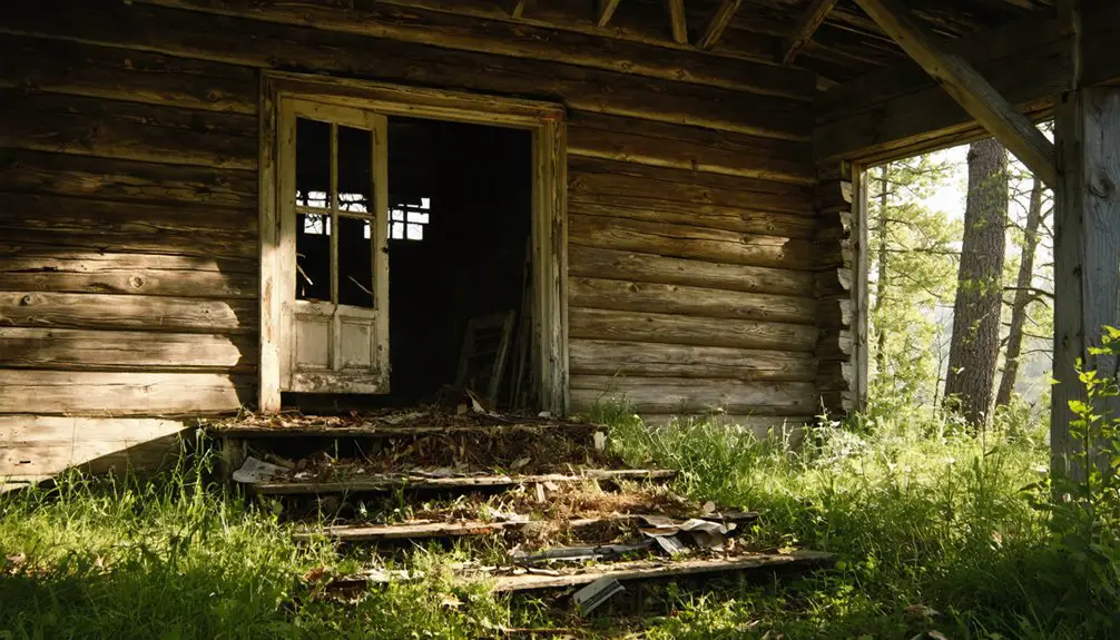
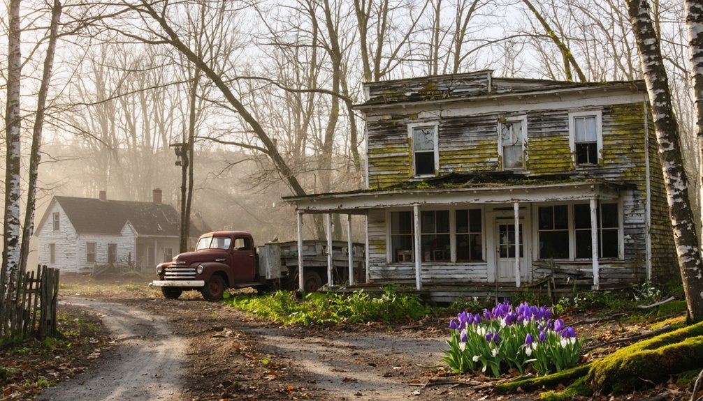
Freeman: Ghost Town Between Kingfield and Strong
While Swan Island’s preserved homes anchor you to a tangible past, Freeman offers something rawer—a settlement that dissolved so completely you’ll need imagination to resurrect it. Between Kingfield and Strong, this Franklin County ghost town peaked at 838 souls in 1840 before vanishing entirely by 1937.
Freeman dissolved so completely that only imagination can resurrect its 838 souls who vanished between 1840 and 1937.
You’ll wander among cellar holes and crumbling stone walls where Maine’s largest sheep farms once sprawled across thousands of cleared acres. Spring’s the perfect season—new growth softening the evidence of abandonment while highlighting what remains.
There’s no historical preservation effort here, no interpretive signs, just folklore legends whispered through empty valleys. Freeman’s origin traces back to land grants for Revolutionary War survivors around 1797, after Portland was burned during the conflict.
Freeman’s your canvas. Walk the forgotten roads where Revolutionary War survivors built dreams that couldn’t withstand industrialization’s pull. Nearby Strong, incorporated in 1801, grew with mills and commerce while Freeman faded into memory. It’s hauntingly serene, authentically abandoned, completely yours to explore.
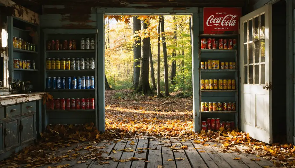
Madrid: Western Maine’s Abandoned Mining Community
Madrid’s coal-fueled past comes alive when you walk past weathered mine structures and crumbling worker housing that once supported 3,000 residents during the 1920s boom.
You’ll find the old Mine Shaft Tavern still operating among artist studios and galleries—a proof of how this ghost town transformed from abandoned mining camp to creative colony after families bought buildings for under $2,000 in 1975.
The coal gob piles and restored drainage channels tell stories of both environmental reclamation and preserved history, making spring visits ideal when snowmelt hasn’t yet turned the terrain muddy. Under superintendent Oscar Huber’s leadership in 1919, Madrid featured paved streets and even a hospital, establishing standards unusual for mining towns of that era.
Since 1980, remediation efforts have closed over 100 hazardous abandoned mine features, including open shafts and portals that once posed dangers to visitors exploring the historic site.
Mining History and Decline
Deep in the high desert of New Mexico—not Maine—this ghost town’s story begins with a glint of gold in 1822.
You’ll discover mining techniques evolved from simple pickaxes to sophisticated operations extracting both bituminous and anthracite coal. By the 1920s, Madrid thrived as Oscar Huber’s model company town, complete with the West’s first lighted baseball field and Christmas displays visible from airplanes overhead.
The decline came swiftly post-WWII when natural gas replaced coal. By 1954, operations ceased entirely, and residents vanished almost overnight.
Historic preservation efforts now maintain remnants of this once-bustling community where 3,000 souls lived. Artists and craftsmen began transforming the abandoned houses in the 1970s, purchasing properties from Joe Huber and establishing Madrid as a vibrant arts colony. The town sits in a rugged valley bounded by the Ortiz Mountains, formerly known as Coal Gulch. You can still explore the Mine Shaft Tavern and imagine the Madrid Miners—Brooklyn Dodgers’ affiliate—playing under those legendary lights before abandonment claimed this remarkable settlement.
Exploring Remnants Today
Though Madrid sits 1,600 miles west of Maine in New Mexico’s high desert, today’s visitor finds a thriving artists’ colony where coal dust once clouded the air.
You’ll discover abandoned architecture transformed into galleries and studios, where 204 free-spirited residents have breathed new life into identical company houses.
Your exploration reveals:
- Mine Shaft Tavern’s 40-foot pine bar – New Mexico’s longest, adorned with thousands of hand-decorated dollar bills
- Historic tunnel entrance and parked rail train – perfect for haunted folklore enthusiasts drawn by ghost stories
- Old Coal Town Museum – featuring mining-era buildings hauled here in 1880
- Repurposed miner’s shacks – now colorful studios showcasing local crafts
Coal piles still dot the hillsides, reminding you that freedom often rises from industrial ruins.
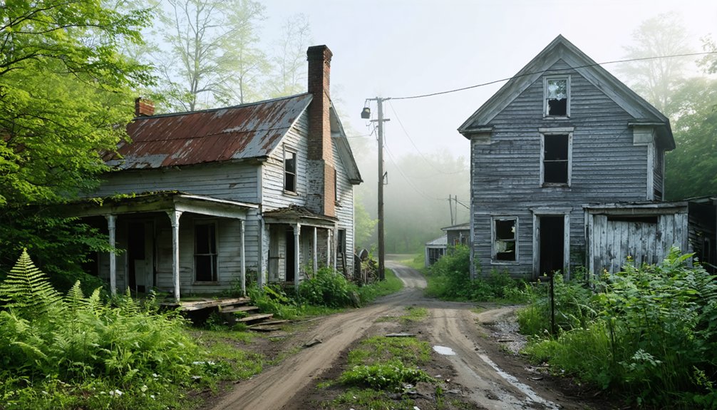
Flagstaff: The Town Beneath the Lake
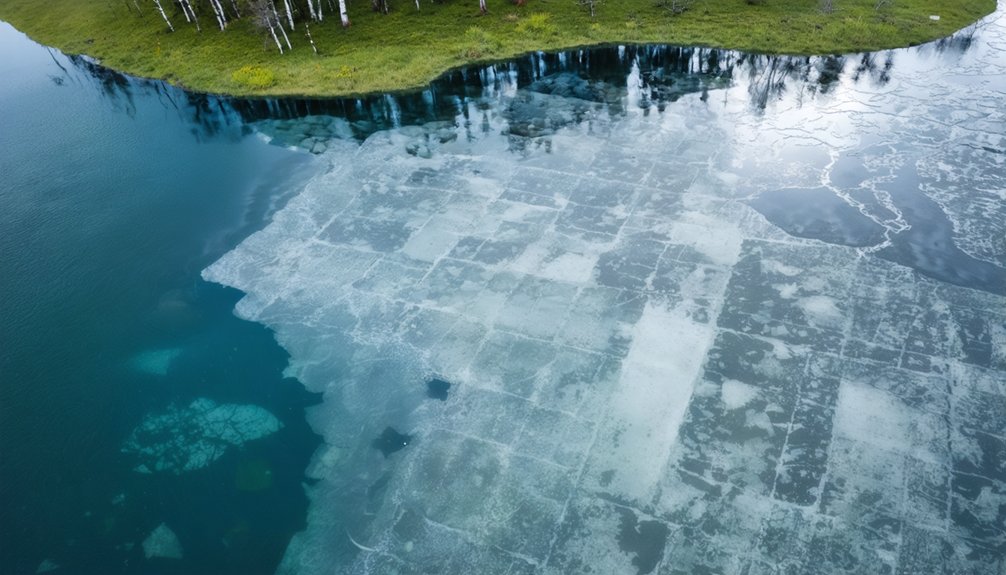
Beneath the rippling surface of Flagstaff Lake lies Maine’s most haunting ghost town, where an entire valley community was sacrificed to create the state’s largest man-made reservoir. Central Maine Power flooded this thriving settlement in 1950, submerging homes where families had lived since the 1800s.
You’ll find the historical significance most powerful during spring drawdowns, when foundations and streets emerge from receding waters. The town’s remnants serve as unexpected tourist attractions—you can explore crumbling structures along the shoreline or scuba dive through underwater ruins.
Before submersion, residents held a tearful two-day farewell celebration, watching smoke from burning debris cloud their valley home.
Visit near Eustis, twenty miles north of Rangeley, where you’ll discover fragments of Flagstaff’s buildings scattered throughout town—echoes of displacement.
Ligonia Village: South Portland’s Lost Industrial Hub
While most ghost towns vanish beneath lakes or crumble in remote forests, Ligonia Village disappeared in plain sight—swallowed by South Portland’s suburban sprawl.
This once-thriving industrial hub centered around Kerosene Corner, where the Portland Kerosene Oil Company began refining operations in 1859.
Today, you’ll find starter homes masking the area’s industrial heritage, though keen observers can spot remnants.
Explore what remains:
- Kerosene Corner (Main and Lincoln Streets)—where six brick buildings processed kerosene starting in 1859
- 95 Main Street—Henry Bodge’s 1867 building, now South Portland Wine Company
- Brown’s Hill—farmed since the 1700s, now residential Ridgeland Avenue
- Forest City Cemetery area—Ligonia’s historic heart
The residential transformation conceals a neighborhood where factories once defined daily life.
You’re walking through history disguised as suburbia.
Planning Your Spring Ghost Town Adventure in Maine
You’ll need more than enthusiasm to reach Maine’s ghost towns this spring—mud-caked roads and crumbling foundations demand careful planning. I learned this the hard way during my first trip to Freeman, when standard sedan tires spun uselessly in April’s clay-thick ruts, forcing a two-mile hike in borrowed boots.
Pack your vehicle with layered clothing, offline maps, and a healthy respect for the state’s unpredictable weather shifts that can turn a sunny morning into a rain-soaked afternoon.
Best Routes and Accessibility
Planning your spring exploration of Maine’s ghost towns requires understanding the seasonal accessibility of remote routes that lead to these forgotten settlements.
Essential Access Routes:
- Flagstaff Village remnants near Eustis offer wildlife observation opportunities along flooded areas where homes once stood before Dead River Plantation’s relocation.
- Freeman Ridge between Kingfield and Strong provides photography opportunities through historical T3 R2 NPC WKR designations via local roads.
- Temple’s Route 43 terminus delivers isolated western Maine access with seasonal conditions varying at moderate-rated trails like Potato Hill.
- Anson’s old railway pedestrian bridge connects the Millinocket-to-Wilton route, offering flat crushed stone paths perfect for spring conditions.
Before venturing out, check trail statuses—Tropical Storm Irene damaged several pathways in 2011.
You’ll find freedom exploring these forgotten places where Maine’s past whispers through abandoned foundations.
Essential Gear and Supplies
Before you venture into Maine’s abandoned settlements, assembling the right gear separates memorable spring exploration from miserable—or dangerous—experiences. Pack hiking boots with aggressive tread for muddy, uneven terrain around crumbling foundations.
Synthetic layers and a rain jacket handle Maine’s temperamental spring weather while you’re documenting wildflower foraging opportunities near old homesteads.
Bring at least two quarts of water per person and a Sawyer Squeeze filter—ghost towns rarely have reliable water sources.
Bug spray with 100% DEET becomes non-negotiable during black fly season from mid-May through June.
Binoculars transform birdwatching hotspots around abandoned structures into unexpected highlights.
Don’t forget your paper map, headlamp, first aid kit, and bear spray. Black bears emerge hungry in spring, especially near forgotten orchards where nature’s reclaiming civilization.
Safety and Legal Considerations
While Maine’s ghost towns beckon with historical intrigue, your adventure hinges on understanding access regulations that carry teeth.
Pivotal considerations for your spring exploration:
- Access fees matter – North Maine Woods charges $13-$18 per person daily, with $1,000 fines for unauthorized entry. Review Baxter State Park’s strict guidelines before venturing in.
- Spring timing is essential – Soft roads from thawing prohibit driving. Skip March and early April starts when flooding swallows trails and erosion reshapes paths.
- Water safety demands attention – Maine CDC warns against roadside springs harboring E. coli and parasites. Filter everything.
- Wildlife encounters require preparation – Extreme weather and emergency situations happen fast. You’re responsible for your own rescue, so pack accordingly and respect the 14-day camping limit without written permission.
Frequently Asked Questions
Are Paranormal Investigation Tools Allowed at Maine’s Ghost Town Sites?
Most sites don’t explicitly ban investigation tools, though you’ll face trespassing charges at restricted locations. Fort Knox welcomes ghost hunters with equipment, while historical preservation efforts and volunteer programs at accessible sites typically permit respectful paranormal research during authorized visits.
What Specific Safety Gear Is Recommended for Exploring Abandoned Mines in Madrid?
You’ll need protective helmets with headlamps, sturdy boots, and respiratory masks for toxic gases. Don’t forget gloves, high-visibility clothing, and multiple flashlights. I always pack a gas detector—it’s saved me from dangerous methane pockets in abandoned shafts.
Can Visitors Camp Overnight Near These Ghost Town Locations in Spring?
You’ll find overnight permissions vary widely—Swan Island offers ten managed campsites with reservations, while Freeman and Riceville lack designated sites. Check camping regulations for each location, as backcountry options exist nearby but aren’t directly at ruins.
Are Guided Tours Available for Any of Maine’s Ghost Towns?
While Maine’s abandoned settlements lack formal guided tours due to limited historical preservation efforts, you’ll find robust tourist amenities in coastal towns offering ghost-themed walks. You’re free to explore authentic ghost towns independently, armed with maps and adventurous spirit.
Exploring abandoned towns in Maine provides a unique glimpse into the region’s past, where stories of prosperity and desolation intertwine. Each derelict structure stands as a testament to the lives once lived there, inviting adventurers to uncover their mysteries. As you traverse the overgrown paths, the echoes of history whisper through the rustling leaves, creating an atmosphere both eerie and enchanting.
Do I Need Special Permits to Access Swan Island’s Abandoned Buildings?
Yes, you’ll need authorization to enter Swan Island’s abandoned buildings—they’re restricted areas under state regulations. While you can explore trails and foundations freely, historical preservation rules and private property designations protect these deteriorating structures from unauthorized entry.
References
- https://www.mooseriverlookout.com/post/ghost-towns-in-maine-9-fascinating-places-that-rose-fell
- https://www.hotels.com/go/usa/ghost-towns-maine
- https://greyhavens.com/haunted-places-in-maine/
- http://strangemaine.blogspot.com/2012/02/ghost-towns-of-maine.html
- https://b985.fm/6-maine-ghost-towns-you-never-knew-existed/
- https://www.geotab.com/ghost-towns/
- http://freepages.rootsweb.com/~gtusa/history/usa/me.htm
- https://www.youtube.com/watch?v=iX5zjixvUTo
- https://friendsofcolonialpemaquid.org/Fort-William-Henry
- https://www.maine.gov/dacf/parks/discover_history_explore_nature/history/colonialpemaquid/fortwh.shtml