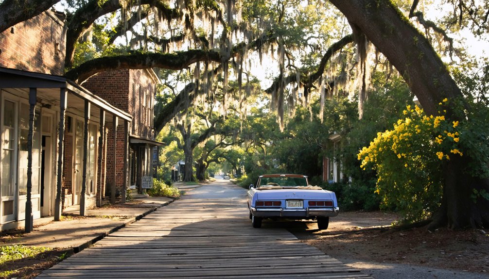
You’ll discover South Carolina’s most accessible ghost towns bloom to life each spring, when dogwoods frame Dorchester’s 1696 colonial ruins and kudzu-draped storefronts line Chappells’ abandoned Main Street. Visit Fort Dorchester’s crumbling bell tower, explore the weathered 1867 store at Ella’s Grove, or stand where Hamburg once moved 60,000 cotton bales annually before vanishing in 1848. Spring’s mild weather and extended daylight make the 290-mile route ideal, though Ellenton remains forever closed—a radioactive ghost beneath government warning signs that holds darker secrets than most.
Key Takeaways
- Dorchester offers colonial architecture and archaeological sites, with low tide exposing log wharves ideal for spring exploration near Charleston.
- Andersonville’s underwater ruins beneath Lake Hartwell provide best visibility during springtime for permitted divers exploring submerged textile history.
- Chappells features abandoned Main Street with kudzu-covered brick walls, depot ruins, and cemetery accessible along former Highway 39 route.
- Hamburg’s Savannah River location near North Augusta preserves remnants of the 1821 cotton trading hub linked to Charleston’s railroad.
- Ella’s Grove near Centenary showcases 1867 relocated store and historic Davis family cemetery with graves dating to 1841.
Dorchester: A Colonial Settlement Along the Ashley River
When you stand among the crumbling brick ruins of Dorchester today, it’s hard to imagine this quiet stretch along the Ashley River once buzzed with merchants, craftsmen, and families who’d sailed 700 miles from Massachusetts seeking their fortune.
Founded in 1696 by settlers aboard the sloop *Friendship*, this New England-style township thrived for nearly eight decades before the Revolutionary War scattered its residents. Reverend Joseph Lord of Massachusetts led this group of colonists, who were drawn by South Carolina’s promising economic prospects compared to the land shortages plaguing New England towns.
For eighty years, *Friendship’s* passengers and their descendants built prosperity along the Ashley until revolution swept them away.
You’ll find the bell tower of St. George’s Anglican Church still piercing the sky—a haunting reminder of colonial architecture that once defined this trading hub.
At low tide, exposed log wharves emerge from the water, while ongoing archaeological discoveries continue revealing fragments of pottery, tools, and foundations. The imposing Fort Dorchester structure, built between 1757 and 1760 from reinforced tabby and brick, stands as one of the best-preserved colonial military fortifications in the United States.
Walk these grounds in spring, and you’re treading where pioneers once carved freedom from wilderness.
Andersonville: The Flooded Textile Community
Unlike most ghost towns where you can wander among weathered foundations and crumbling walls, Andersonville rests beneath thirty feet of Lake Hartwell water—a sunken monument to ambition drowned twice by nature before the final submersion.
You’ll find nothing to photograph here, no Instagram-worthy ruins. The textile mills that Robert Anderson’s namesake town built were demolished by floods in 1840 and 1852. When Lake Hartwell’s dam gates closed in the late 1950s, the community had already surrendered to economic obsolescence.
Today, boaters drift unknowingly above flooded artifacts—mill foundations, trading post remnants, lives abandoned. This submerged history whispers a haunting truth: sometimes nature refuses to negotiate. The town’s fate echoes the Great Pacolet Flood of 1903, which destroyed six textile mills along the Pacolet River and claimed dozens of lives after waters rose twenty feet above normal.
Spring’s clarity offers the best underwater visibility for divers seeking Andersonville’s ghostly remains, though accessing this drowned settlement requires specialized equipment and permits. The only surviving remnant is Andersonville Island, reachable exclusively by watercraft for those willing to explore this forgotten chapter of South Carolina history.
Ellenton: The Town Seized for Nuclear Development
You can’t actually visit the original Ellenton—it vanished in 1952 when the government seized 300 square miles for the Savannah River Plant.
This action uprooted 6,000 residents and erased an entire community for Cold War nuclear production.
The site remains behind security fences at one of America’s most contaminated nuclear facilities, where radiation from decades of plutonium and tritium manufacturing has rendered the ground unsafe for public access.
What’s left isn’t a ghost town you can walk through but a radioactive memory, buried beneath restricted Department of Energy land where kudzu now blankets the spots where homes once stood.
Before its destruction, Ellenton was a thriving agricultural community incorporated in 1880, with an economy built on farming, trading, and sawmills that supported around 760 residents by the early 1950s.
The name Ellenton now refers to multiple locations in South Carolina, as displaced residents established a new town bearing the same name after being forced from their original homes.
Government Seizure in 1950
The quiet cotton fields of Ellenton held no strategic value until the morning in November 1950 when the U.S. Atomic Energy Commission announced its seizure. You’d find it hard to imagine how government espionage—Klaus Fuchs’s January confession—transformed sleepy farmland into America’s plutonium heartland within months.
The federal government swept through 200,000 acres, targeting properties where Black tenant farmers worked land they’d never own. You’ll notice the calculated efficiency: ten dollars per acre, condemnation notices for resisters, 19 million total spent while extracting 28 million in lumber alone.
Nuclear safety demanded a 300-square-mile perimeter, but documents reveal another truth—choosing Ellenton meant displacing sharecroppers who couldn’t fight back. The town’s destruction inspired the 1951 protest song “Death of Ellenton,” recorded by the Johnson Family Singers and later covered by folk artists for decades. By April 1952, 6,000 residents had vanished, leaving only sidewalks leading nowhere. New Ellenton emerged as a 200-acre development near the plant’s main entrance, hastily built to house the displaced community.
Radioactive Contamination and Access
Beneath where Ellenton’s church once stood, 34 million gallons of radioactive waste now sits in 51 underground tanks—enough plutonium to build 50 bombs. The radioactive contamination spreads across what became the Savannah River Site, a 300-square-mile zone you can’t freely enter.
Steel canisters holding this toxic legacy will last maybe 50 years, while the plutonium-239 inside remains deadly for 24,100 years. Site remediation continues under Department of Energy oversight, though the facility earned EPA Superfund status for its toxicity. DuPont managed the site for over 30 years, promoting a family-friendly image while producing nuclear weapons materials and suppressing environmental data. The facility produced roughly 40% of all Cold War plutonium, cementing its role in nuclear weapons development while displacing approximately 1,500 families.
You’ll find no spring wildflowers blooming over Ellenton’s graves—just restricted roads, monitoring stations, and warning signs. The government seized land for “national security,” then left a poison you can’t see, smell, or escape for 241 centuries.
Ella’s Grove and Palmer Cemetery: Commercial Remnants and Historic Burials
Near Centenary in lower Marion County, you’ll find the weathered brick store that B.F. Davis’s sons built after their father launched his mercantile business at Dog Bluff in 1867.
The original wooden structure once hummed with customers who arrived by barge on the Little Pee Dee River, back when muddy roads made water the only reliable highway for commerce.
Stand before this lonely sentinel now, and you’re looking at one of the few physical reminders that a thriving river trading post once anchored this quiet bend between the two Pee Dee Rivers.
B.F. Davis’s Original Store
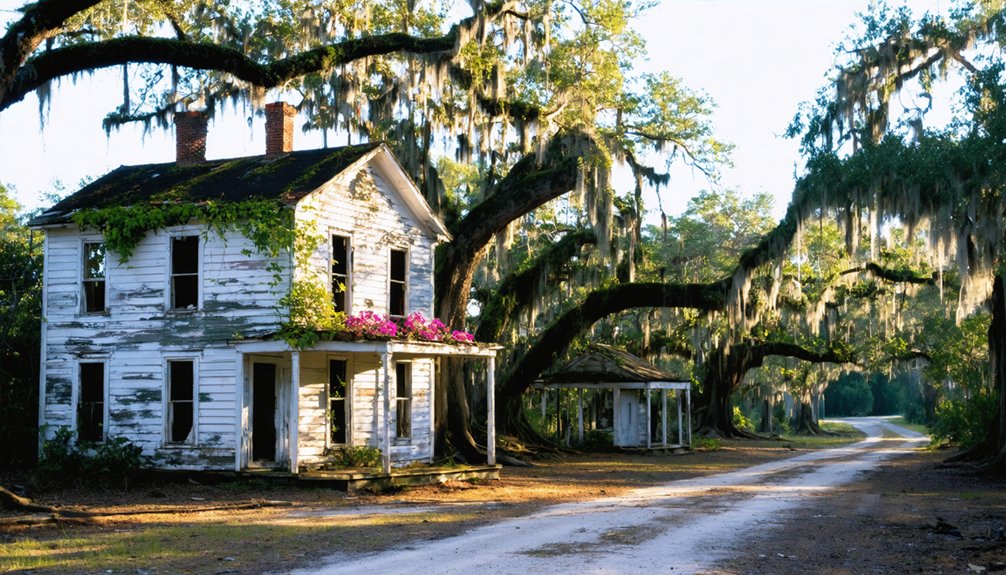
Hidden among the rural landscapes of Marion County, B.F. Davis’s original wooden store stands as a weathered monument to commerce’s evolution. You’ll discover this 1867 structure, relocated from Dog Bluff when river transport gave way to overland routes.
The Confederate veteran opened his first location on the Little Pee Dee, where barges delivered supplies. As roads improved, he moved the entire operation to Ella’s Grove, transforming it into the community’s beating heart.
Today, store preservation efforts have maintained this architectural relic, though it’s been relegated to warehouse duty since sons built the brick replacement in 1915.
The family legacy endures—B.F.’s grandson still owns the property, keeping alive this perfect ghost town remnant where worn floorboards and empty shelves whisper stories of frontier enterprise.
Davis Family Brick Vault
Just beyond the weathered gates of Palmer Cemetery, where granite markers have kept watch since 1841, you’ll encounter the most striking monument to the Davis dynasty’s endurance.
The brick vault architecture rises from red earth like a fortress—its unusual ziggurat-style concrete roof defying conventional tomb design. Built in 1932 for James Clement Davis, this structure speaks to ambition that wouldn’t fade quietly into Marion County clay.
Bird nests now crown the weathered roof, nature reclaiming what man constructed. Cemetery preservation here feels like a losing battle against time, yet that’s precisely what draws adventurers seeking authenticity.
Stand beneath towering pines and trace your fingers across century-old brick. The vault guards secrets of plantation-era prosperity while surrounding graves whisper tales of families who refused disappearing.
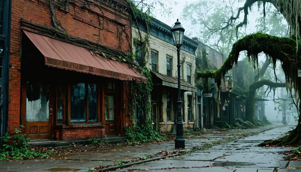
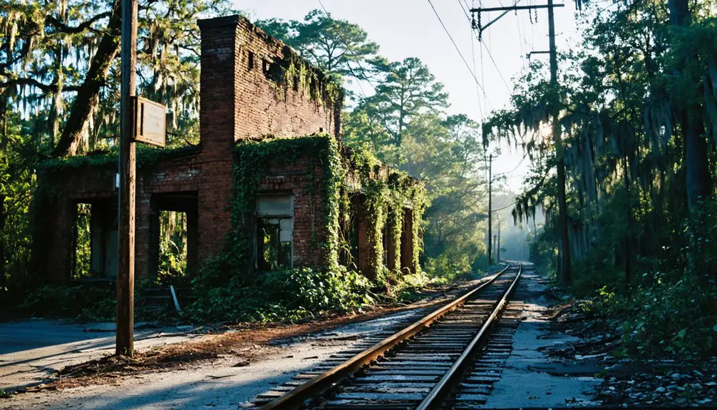
Chappells: Authentic Abandoned Main Street Experience

While most ghost towns fade into complete obscurity, Chappells preserves an eerily intact snapshot of small-town commerce frozen in time. You’ll discover authentic urban decay along the bypassed Main Street, where Highway 39‘s 1931 relocation sealed this community’s fate.
The abandoned architecture tells vivid stories—brick walls emerging through kudzu vines, railroad beds disappearing into forest, and the crumbling Farmer’s Bank standing as proof of 1929’s economic collapse.
Spring’s perfect for exploring:
- Chappells Depot ruins where trains once stopped before the 1884 tornado struck
- General store foundations buried beneath vegetation along the old commercial strip
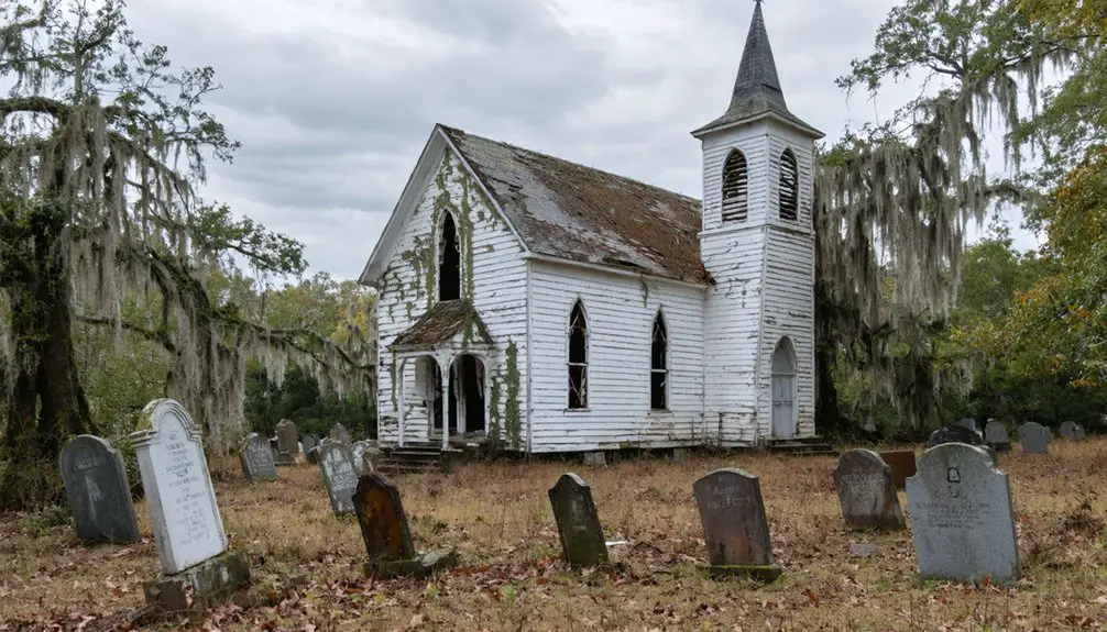
- Chestnut Baptist Church and cemetery revealing settlement patterns
You’re free to wander these uncurated remnants, experiencing history without barriers or guided tours restricting your discovery.
Hamburg: Former Cotton Trade Hub
The Savannah River’s banks near North Augusta conceal one of the South’s most ambitious commercial experiments—Hamburg, where Henry Shultz’s 1821 vision of a cotton empire briefly rivaled Augusta itself.
You’ll find little historical architecture remaining from when 60,000 cotton bales annually thundered through streets now swallowed by undergrowth. The 1833 railroad terminus that once connected this powerhouse to Charleston has vanished, but local legends whisper of Center Street’s darker commerce—slave markets exploiting Georgia’s trade laws.
Walk the floodplain where merchants abandoned their dreams after the 1848 Augusta Canal diverted prosperity across the river.
Spring’s green reclamation makes Hamburg hauntingly beautiful, its ghost town status achieved before the Civil War even began.
Freedom came too late for this already-extinct settlement.
Planning Your South Carolina Ghost Town Road Trip
Before you chase shadows across South Carolina’s haunted landscape, map your 290-mile pilgrimage from upstate rubble piles to lowcountry foundations with the precision of a Union cartographer. This five-hour urban exploration demands preparation—spring’s mild temperatures won’t excuse poor planning when you’re knee-deep in Hell Hole Swamp’s overgrown trails.
Abandoned streets demand respect—pack water, wear boots, and treat these ruins like the historical crime scenes they are.
Essential preparations:
- Charge cameras for capturing Pinckneyville’s crumbling stone and Colonial Dorchester’s preserved archaeology
- Fill fuel tanks before departing—ghost towns don’t stock gas
- Contact historical societies about access restrictions and preservation challenges at sites like Chappells
Barnwell County’s five clustered ghost towns offer efficient routing, while state-managed sites provide marked trails through unstable ruins. Google Maps links eliminate guesswork, but verify private land access near Ellenton.
Spring daylight extends your wandering hours—use them wisely before dusk swallows these forgotten streets.
Frequently Asked Questions
Are Ghost Town Visits in South Carolina Safe for Families With Children?
Ghost town visits can be safe with proper safety precautions—stick to daylight hours and maintained paths. While exploring crumbling structures sparks adventure, child-friendly activities are limited. You’ll find more remote isolation than amenities, so plan accordingly for your family’s comfort.
What Photography Equipment Works Best for Capturing Abandoned Building Interiors?
Light becomes your paintbrush in these forgotten spaces. You’ll need wide-angle camera lenses like a 16-35mm and sturdy tripods for long exposures. Master lighting techniques using flashlights and reflectors to reveal hidden stories within crumbling walls.
Do Any South Carolina Ghost Towns Offer Guided Tours or Interpretive Programs?
You’ll find guided ghost tours throughout South Carolina emphasizing historic preservation and tour safety, though they focus on haunted towns rather than abandoned ones. Charleston’s moonlit walks and Pendleton’s tragic tales offer spine-tingling freedom to explore dark histories safely.
In addition to ghost tours, there are many fascinating abandoned sites in South Carolina that tell stories of the past. Exploring these forgotten locations offers a glimpse into the state’s rich history and unique architecture. These sites are often shrouded in mystery and provide an entirely different type of adventure for those seeking the eerie and the unknown.
Are There Entrance Fees Required to Visit South Carolina’s Ghost Towns?
Most ghost towns you’ll explore don’t charge entrance fees—they’re open, wild spaces where freedom reigns. You’ll find parking availability varies, though access restrictions might exist on private property. Always respect posted boundaries while wandering these atmospheric ruins.
What Wildlife or Natural Hazards Should Visitors Watch for at These Sites?
You’ll need wildlife caution around alligators, venomous snakes, and black bears at these abandoned sites. Natural hazards include flooding rivers, mosquito swarms, poison ivy, and fire ants—spring awakens both beauty and danger in these forgotten places.
References
- https://kids.kiddle.co/List_of_ghost_towns_in_South_Carolina
- http://www.onlyinyourstate.com/trip-ideas/south-carolina/haunted-road-trip-sc-ghost-towns
- https://www.randomconnections.com/ghost-towns-of-the-pee-dee-part-1-ellas-grove-and-palmer/
- https://www.randomconnections.com/ghost-towns-of-south-carolina/
- https://sctravelguide.com/2018/06/11/south-carolina-ghost-towns/
- https://wnok.iheart.com/content/2023-10-11-abandoned-south-carolina-town-named-the-creepiest-ghost-town-in-the-state/
- https://www.youtube.com/watch?v=-kK74wq5NUQ
- https://www.discoveramericablog.com/post/colonial-dorchester
- https://www.libertyhistory.net/a-new-errant-massachusetts-puritans-and-the-founding-of-dorchester-south-carolina/
- https://www.carolana.com/SC/Towns/Dorchester_SC.html