You’ll find Minnesota’s ghost towns especially haunting in winter, when snow reveals what summer foliage conceals. Forestville State Historic Site preserves an 1899 merchant’s store still stocked with abandoned goods, while Taconite Harbor’s 1980s industrial ruins sit frozen along Lake Superior’s shore. Old Wadena’s trading post foundations emerge along the Crow Wing River, and Mineral Center’s homestead remains hide deep in the Ely wilderness. Each snow-dusted site tells stories of lumber camps, failed mining ventures, and vanished communities—tales that unfold across Minnesota’s frozen landscape.
Key Takeaways
- Forestville State Historic Site preserves an 1899 ghost town with abandoned homes, grist-mill ruins, and frost-covered riverbank gardens in southeastern Minnesota.
- Old Wadena Trading Post along Crow Wing River features fur trade remnants, fortifications, cellar holes, and snow-highlighted historic trail routes.
- Chippewa City near Grand Marais offers Lake Superior shoreline views, St. Francis Xavier Church, and a cemetery with Ojibwe graves from 1892.
- Taconite Harbor displays industrial ruins including cracked basketball courts, weathered streetlights, foundations, and breakwaters visible beneath snow since 1988 abandonment.
- Northwoods Settlement near Ely reveals winter-concealed school foundations, homestead ruins, and cemeteries from Malcolm Linnell’s 1909 mineral exploration town.
Forestville State Historic Site: A Preserved 1890s Village
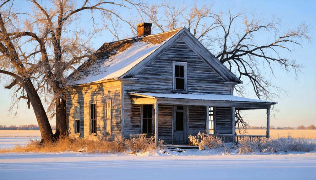
Tucked into the limestone bluffs of southeastern Minnesota’s Root River valley, Forestville stands frozen in 1899—not by winter’s grip, but by a merchant’s decision to simply board up his general store and walk away. You’ll cross the South Branch Root River on foot to reach this authentic ghost town where Thomas Meighen left $20,000 worth of inventory untouched for decades.
A merchant’s abrupt departure in 1899 left $20,000 of goods gathering dust in this riverside settlement that time forgot.
Winter transforms the preserved village into a stark tableau of settler ambition and failure—homes abandoned after the 1868 railroad bypass, dreams buried alongside 30+ pioneers in Zumbro Hill cemetery. The town once bustled with over 150 residents who formed a local township government and relied on the stagecoach route connecting them to St. Paul and Dubuque.
Wander snow-dusted trails past the grist-mill ruins and distillery sites. The riverside garden sleeps beneath frost, its chicory and ground cherries dormant. The village first thrived starting in 1852 when early settlers like Levi Waterman and the Fosters claimed land in this remote river valley.
This landscape holds deeper stories too: Native history from Dakota communities who thrived here before the 1851 treaties opened 24 million acres to winter preservation and eventual abandonment.
Old Wadena Trading Post Along the Crow Wing River
Where the Crow Wing River bends through what’s now Old Wadena County Park, winter silence blankets layers of commerce that once rang with French traders’ voices and the creak of Red River oxcarts. You’ll walk ground where four successive trading posts thrived between 1782 and 1856, each carved from wilderness by men seeking fortune beyond civilization’s reach.
The Cadotte post’s log fortifications once defended against Dakota raids while fur trade dealings unfolded inside palisade walls. Early settlements peaked with over 100 souls before vanishing entirely—only cellar holes and archaeological fragments remain. Jean-Baptiste Cadotte emphasized diplomatic gift-giving to maintain peaceful relations with both Ojibwe and Dakota nations during his winter trading operations.
Snow reveals the rope ferry’s crossing path more clearly than summer’s vegetation, letting you trace where Woods Trail pioneers forded the icy Crow Wing. When the railroad track was built 3.5 miles south in 1871, the original townsite was abandoned, and residents moved to what became the new Wadena. Winter strips away distractions, exposing this ghost town’s bones.
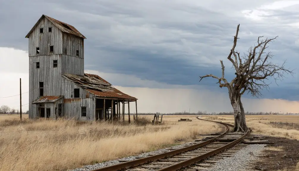
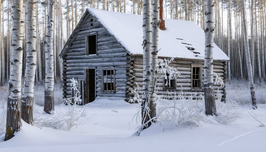
Clear Grit Logging Community: Echoes of the Timber Industry
You’ll find Clear Grit nestled in Carrolton Township, where Minnesota’s white pine empire once thundered with the crack of falling timber and the shouts of hundred-man logging crews.
Winter reveals this ghost town’s skeletal remains—a weathered barn standing sentinel over snow-covered ground where the Kaercher Mill processed endless streams of virgin pine.
The frozen landscape mirrors the conditions that shaped this place, when ice roads bore twenty-ton sleigh loads and men consumed five pounds of food daily to fuel their relentless harvest. Sprinkler systems irrigated the winter roads with water from storage tanks, creating the frozen highways that made hauling massive logs possible. Like Sawbill Landing’s logging camp, Clear Grit evolved from temporary timber operations into a small community before being abandoned as the industry moved on.
Logging Boom Era History
During Minnesota’s late 19th-century timber rush, Clear Grit sprang to life in Carrolton Township as loggers descended on Fillmore County’s pine-rich forests. You’ll discover how this settlement embodied the era’s relentless expansion, where hundred-man camps transformed wilderness into commerce.
Logging techniques evolved rapidly as operations scaled:
- Winter crews carved ice roads for 20-ton sleighs hauled by two dozen horses
- Blacksmiths and filers kept tools sharp in dedicated camp shacks
- Steam power eventually replaced animal muscle in progressive operations
- Loggers consumed five pounds of food daily to fuel grueling work
- River drivers greased their legs with lard before steering icy torrents
Timber transportation defined the rhythm of seasons—logs dragged to river landings awaited spring’s thaw, then floated downstream on swollen currents. Wanigans served as mobile headquarters, following the precious cargo to distant sawmills. Camps processed timber ranging from 5,000 to 25,000 board feet per acre, with white pine dominating at 80% of harvests alongside Norway pine, spruce, and balsam fir. Workers endured six-day work weeks from sunrise to sunset regardless of weather conditions, relying on wool clothing for protection against the elements.
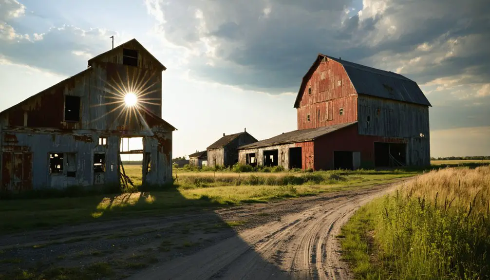
Industrial Decline and Remnants
By 1910, Clear Grit’s forests stood silent and stripped. You’ll find exhausted timber stands where twenty thousand lumberjacks once worked. The white pine vanished through relentless clear-cutting, forcing operations elsewhere. Economic collapse emptied the camps—river drivers, sawmill workers, and support crews all departed.
What remains? A solitary barn stands amid the quiet. You’re free to explore this ghost town’s skeletal remnants, touching authentic wilderness history without crowds or commercialization. Unlike modern tourism destinations with manufactured experiences, Clear Grit offers raw, unpolished truth. No urban revival has sanitized this place.
Catastrophic fires between 1894-1918 consumed what logging slash didn’t destroy. The transformed landscape now shelters deer and grouse across former cutovers. Winter logging operations once relied on two-man crosscut saws and axes to fell the towering pines. You’ll discover evocative traces of Minnesota’s timber legacy—scarred riverbanks, altered forests, and profound silence where industry once thundered.
Winter Access and Exploration
When snow blankets the remnants of Clear Grit between December and March, you’re retracing the very conditions that once made this isolation profitable. The frozen landscape reveals what summer vegetation conceals, though precious little remains.
Your winter exploration uncovers:
- Subtle depressions where bunkhouses once sheltered 100+ workers from subzero temperatures
- Frozen tributaries that served as log-transport corridors during spring thaws
- Winter wildlife tracks crossing abandoned ice roads where 20-ton sleighs once traveled
- Occasional rusted artifacts emerging through snowpack—remnants of blacksmith operations
- Forest regrowth patterns marking clear-cut boundaries from the 1890s
Urban exploration here demands self-reliance. You’ll find no guided tours or interpretive signs—just silent testimony to Minnesota’s timber heritage. The solitude mirrors what loggers experienced during their seasonal camps, making winter the most authentic season for discovery.
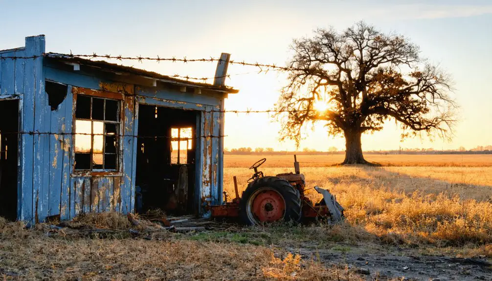
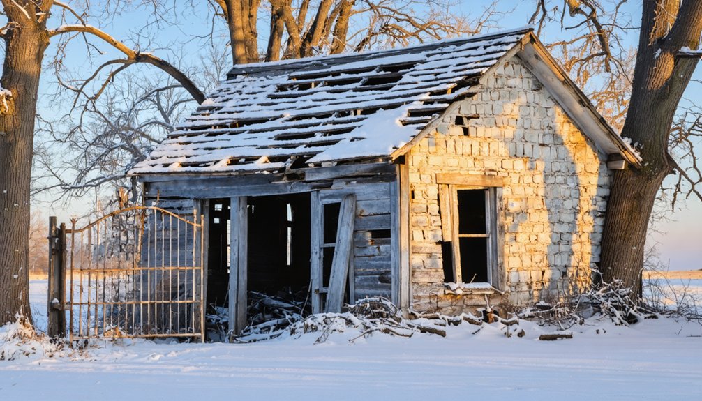
Pomme De Terre: an Early Settlement Frozen in Time
Where the windswept prairie meets Grant County’s snowy horizon, the remnants of Pomme de Terre whisper stories of frontier soldiers and westbound dreamers. You’ll find this 1860s settlement named for wild turnip roots the Dakota called Tipsinah—a homage to Native American legends that shaped the land before Fort Pomme de Terre rose in 1863.
The Civil War impact reached even these remote hills, where Captain McLarity’s troops built a 500-man garrison amid the Sioux Uprising’s chaos. Winter reveals the fort’s vanished footprint most clearly, with snow outlining where blockhouses and barracks once stood. Before military occupation, this site served as a stagecoach relay station in the 1850s, bustling with land traders and fur trappers.
You can visit the granite marker placed over two soldiers’ graves—men ambushed hunting goose eggs in 1863. Only the converted schoolhouse remains, preserving freedom’s price on this frozen frontier.
Taconite Harbor on Lake Superior’s North Shore
Along Lake Superior’s rugged North Shore, the ghost town of Taconite Harbor stands as a monument to mid-century industrial ambition and the promise of quick-built American dreams.
Founded in 1957, this prefabricated community housed taconite workers and their families until economic decline forced its abandonment by 1988.
For three decades, prefabricated homes sheltered mining families before economic forces turned their industrial community into an abandoned relic.
Today, you’ll discover haunting remnants of industrial history scattered across the frozen landscape:
- Cracked basketball courts where 74 children once played
- Weather-beaten street lights illuminating empty roads
- Concrete foundations marking where 22 bungalows stood
- Sections of original pavement beneath winter snow
- Breakwalls protecting islands near abandoned loading docks
Cross River Heritage Center maintains exhibits celebrating ghost town preservation efforts.
You’ll find this accessible site along Highway 61, offering unobstructed Lake Superior views and tangible connections to Minnesota’s mining heritage without requiring permission or trespassing.
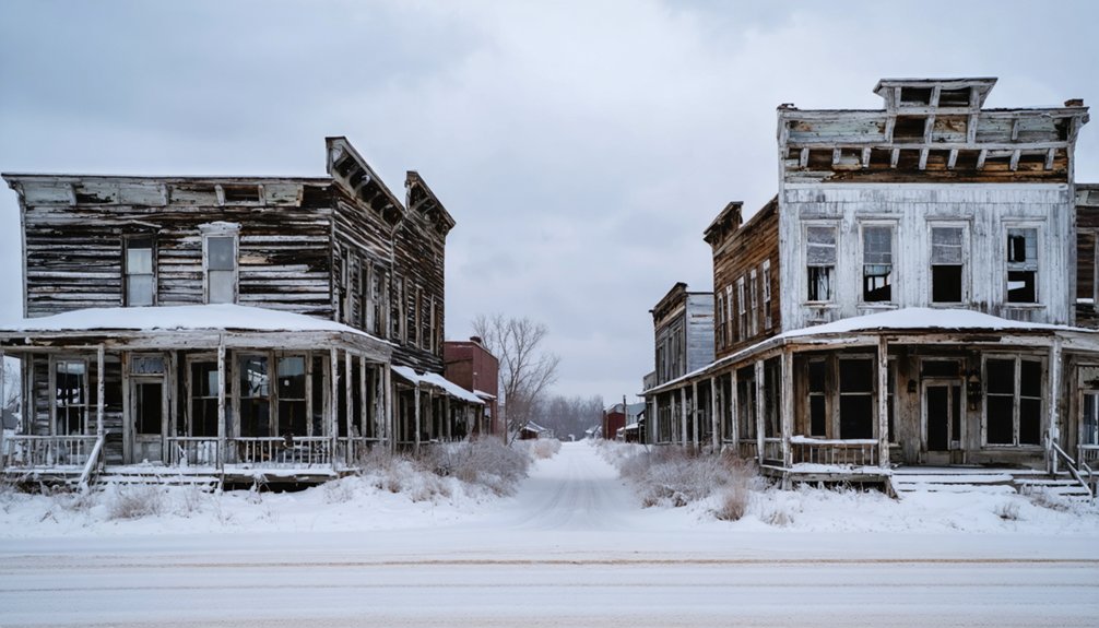
Chippewa City: a Cook County Settlement From the 1880S
Just beyond Grand Marais, where Lake Superior’s waves once lapped against a thriving Ojibwe settlement, the ghost town of Chippewa City tells a quieter story than its industrial counterparts.
Unlike abandoned mines scarring Minnesota’s landscape, this 1880s village simply faded away—claimed by fire, flu, and the Great Depression’s grip.
You’ll find St. Francis Xavier Church standing sentinel since 1895, its weathered walls holding Native legends and memories of 200 families who once called this home.
The cemetery waits one-eighth mile north on a snow-dusted dirt road, where white crosses mark Ojibwe graves dating to 1892.
Most headstones vanished during a 1958 cleanup, but what remains speaks volumes.
Winter transforms this lakeside ghost into something ethereal—a place where you can trace freedom’s cost in every forgotten marker.
Mineral Center Deep in the Northwoods Near Ely
Fifteen miles inland from Hovland, the Northwoods swallowed Mineral Center whole after the federal government reclaimed it in 1940. You’ll discover a settlement born from mineral history dreams—gold, silver, copper—that never materialized into viable operations. The Malcolm Linnell family staked their claim in 1909, and 54 families followed, building a community of 350 souls.
Winter reveals what wilderness surviving truly meant here:
- Snowshoe past three abandoned schoolhouse foundations
- Trace homestead ruins beneath deep snowpack
- Explore the cemetery where settlers rest
- Navigate forests that claimed back their territory
- Experience isolation matching 1910s homesteaders’ reality
The Grand Portage Tribe’s reclaimed lands offer you unfiltered access to authentic frontier remains, where February’s bone-cold temperatures echo the determination required to carve existence from unforgiving terrain.
Reyataotonwe: Hennepin County’s First Ghost Town
You’ll discover a profound chapter of Minnesota history at Bde Maka Ska’s southeast shore, where Chief Cloud Man led 125 Dakota people to establish an agricultural settlement between 1828 and 1829. Walking these grounds today, you’re tracing the footsteps of Hennepin County’s first ghost town—a place where traditional Dakota life intersected with Euro-American farming methods under the guidance of Fort Snelling’s Indian Agent Lawrence Taliaferro.
The village thrived briefly before regional violence and persistent Dakota-Ojibwe conflicts forced Cloud Man to relocate his community south to Oak Grove by 1840.
Chief Cloud Man’s Vision
Long before Minneapolis’s glittering lakes became surrounded by joggers and luxury condos, Chief Cloud Man envisioned something revolutionary along the southeastern shore of Bde Maka Ska.
In 1829, he established Reyataotonwe—a bold experiment blending agricultural innovation with cultural preservation.
His vision for this community of 125-150 Mdewakanton Dakota included:
- Securing stable food sources through experimental farming while maintaining traditional ceremonies
- Partnering with Fort Snelling’s agent for plowing technology and missionary assistance
- Creating a strategic settlement between two lakes rich with game and fertile soil
- Adopting carpentry skills and cultivation methods without abandoning Dakota identity
- Establishing summer headquarters for his semi-nomadic people
You’ll discover Cloud Man carefully selected even where missionaries built their cabins—ensuring visibility of the lake’s loons, creatures sacred to his people’s traditions.
Life at Bde Maka Ska
Chief Cloud Man’s vision materialized into something tangible around 1829, when Reyataotonwe took root along Bde Maka Ska‘s southeastern shore. You’d have witnessed 125 Dakota souls merging ancestral lifeways with agriculture, their plows turning earth where traditions met innovation. The community thrived through bountiful vegetable harvests and fish from the lake’s abundant waters, proving self-sufficiency wasn’t just survival—it was cultural preservation in action.
The Pond brothers arrived in the 1830s, systematically recording Dakota language and creating the first dictionary. Today, only their marker remains; the village itself vanished by 1839 when Ojibwe-Dakota hostilities forced abandonment.
Community stories now surface through archival research, revealing how this groundbreaking settlement disappeared beneath manicured parkland, leaving Hennepin County’s first ghost town buried in Minneapolis’s urban transformation.
Settlement’s Historical Legacy
Between 1828 and 1829, Reyataotonwe emerged as Hennepin County’s pioneering settlement—a bold agricultural experiment where Chief Cloud Man and 125 to 150 Mdewakanton Dakota transformed Bde Maka Ska’s southeastern shore into cultivated fields.
Yet Indigenous resilience couldn’t withstand escalating Dakota-Ojibwe conflicts. When Ojibwe Chief Hole-in-the-Day attacked nearby Wahpeton bands in 1838, Cloud Man recognized the writing on the wall.
By 1840, your ancestors’ footprints faded as the tribe relocated ten miles south to Oak Grove.
The village’s legacy endures through:
- Lawrence Taliaferro’s agricultural partnership introducing plow cultivation
- Missionary Gideon Pond’s 1843 home construction near Oak Grove
- Charles Mosseaux’s 1849 land reclamation of the abandoned site
- Evidence of Dakota adaptation and survival strategies
- Hennepin County’s first documented settlement transformation
Today, winter snow blankets where fields once flourished—a haunting _testament_ to displacement.
Tazaska: The Failed Territorial Settlement at Lake Minnetonka
On the northwest shores of Crystal Bay, where the Lafayette Club now stands, an ambitious dreamer once envisioned Minnesota’s territorial capital rising from the wilderness. In 1857, Civil War sharpshooter William F. Russell proposed Tazaska as Minnesota’s governmental heart, writing to Colonel Stevens seeking support for a public vote. His vision never materialized.
The cultural significance of this failure echoes through Lake Minnetonka’s transformation from Dakota hunting grounds to tourist destination. Following the 1851 Treaty of Mendota, European settlers disrupted the Mdewakanton’s centuries-old relationship with these sacred waters.
The environmental impact became stark as hotels replaced wild rice beds and maple groves by the 1890s.
Today, you’ll find no trace of Russell’s territorial dream—just winter-silent shores where ambition once burned bright.
Frequently Asked Questions
What Winter Clothing and Gear Should I Bring When Visiting Minnesota Ghost Towns?
You’ll need moisture-wicking thermal layers as your foundation, insulated winter boots with solid traction for icy terrain, waterproof outer shells, warm mittens, and wool socks. Don’t forget a face covering—Minnesota’s windchill bites hard in abandoned places.
Are Minnesota Ghost Towns Accessible During Heavy Snowfall and Winter Storms?
No, you shouldn’t visit during severe weather. Minnesota receives over 70 inches of annual snowfall, making winter road conditions treacherous. You’ll find backroads impassable, cell service vanishes, and even snowmobile access becomes dangerous near unstable structures.
Do I Need Permits to Explore Abandoned Buildings at Ghost Town Sites?
You’ll need property owner permission before entering abandoned buildings, as trespassing laws protect these structures regardless of condition. Historical preservation sites offer permitted access, but most ghost town ruins remain privately owned, requiring you to respect boundary lines.
Which Ghost Towns Offer Heated Facilities or Indoor Areas for Warming Up?
You’ll find heated visitor centers at Banning State Park, Forestville, and Crow Wing State Park—perfect warming stations between exploring historical preservation sites. These facilities offer incredible photography opportunities while you thaw out before venturing back into Minnesota’s frozen, forgotten landscapes.
Can I Camp Overnight Near These Ghost Towns During Winter Months?
You can’t camp at most Minnesota ghost towns since historic architecture and preservation efforts protect these sites. However, you’ll find dispersed camping freedom on nearby state forest lands, respecting the structures while experiencing authentic wilderness solitude.
References
- https://en.wikipedia.org/wiki/List_of_ghost_towns_in_Minnesota
- https://thievesriver.com/blogs/articles/ghost-towns-in-minnesota
- https://quickcountry.com/minnesotas-abandoned-ghost-towns/
- https://www.minnesotahistory.org/post/a-complete-guide-to-the-ghost-towns-of-hennepin-county
- https://minnesotasnewcountry.com/minnesota-ghost-towns-within-90-minutes-of-st-cloud/
- https://exploringnorthshore.com/north-shore-ghost-towns/
- https://www.youtube.com/watch?v=btvFiKT3Quw
- http://www.onlyinyourstate.com/minnesota/ghost-towns-mn
- https://www.mngoodage.com/voices/mn-history/2019/07/a-ghost-town-turned-history-site/
- https://fillmorecountyjournal.com/historic-forestville-ending-interpretive-tours/