You’ll find Rhode Island’s most significant underwater ghost towns beneath the Scituate Reservoir, where six complete villages—Ashland, Kent, Ponaganset, Richmond, Rockland, and South Scituate—were deliberately flooded between 1915-1926. The reservoir submerged 1,195 structures including homes, churches, schools, and mills across 5.3 square miles to supply Providence’s water demands. Approximately 700 graves remain beneath 80 feet of water, while during drought conditions, foundations, stone walls, and infrastructure remnants emerge as tangible evidence of these displaced communities and the archaeological landscape that documents their existence.
Key Takeaways
- Six villages—Ashland, Kent, Ponaganset, Richmond, Rockland, and South Scituate—were submerged beneath Scituate Reservoir after construction from 1915-1925.
- Construction required demolishing 1,195 structures including homes, schools, churches, and mills, displacing approximately 1,600 residents through eminent domain.
- During droughts, remnants like foundations, stone walls, roads, and bridges emerge from up to 80 feet underwater.
- Approximately 728 graves remain submerged, with over 1,400 individuals unaccounted for beneath the reservoir waters.
- The reservoir holds 37-39 billion gallons, covering 5.3 square miles where entire communities once thrived before 1926.
The Creation of Scituate Reservoir: Rhode Island’s Largest Water Supply Project
When Providence’s water demands exceeded the Pawtucket River’s capacity in the early twentieth century, the Rhode Island General Assembly authorized what would become the state’s most ambitious infrastructure project on April 9, 1915.
Rhode Island’s General Assembly launched the state’s largest infrastructure endeavor when Providence outgrew its original water source in 1915.
You’ll find this legislative act empowered the Providence Water Supply Board to condemn 14,800 acres in Scituate through eminent domain, despite residents’ legal challenges.
Construction teams built Kent Dam—3,200 feet long, 640 feet wide—entirely by hand using earthen materials between 1915 and 1925.
The reservoir capacity reached 39 billion gallons when filling was completed in September 1926.
Engineers achieved superior water quality through the Philip J. Holton Water Purification Works, which began operations September 30, 1926.
This infrastructure eliminated reliance on the insufficient Pawtucket supply, though it required demolishing 1,195 structures across 23 square miles.
The project displaced approximately 1,600 residents, forcing lifelong community members to abandon homes their families had occupied for generations.
The reservoir now supplies water to Providence and surrounding cities, serving communities far beyond Providence’s borders alone.
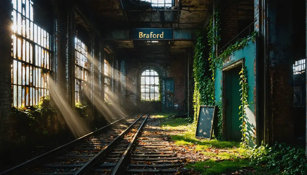
Six Villages Swallowed by the Reservoir Waters
The reservoir’s construction necessitated the complete abandonment and demolition of six distinct villages—Ashland, Kent, Ponaganset, Richmond, Rockland, and an additional settlement—resulting in the removal of 1,195 structures across the valley floor.
You’ll find that systematic clearing operations eliminated 36 miles of roadway infrastructure before controlled flooding submerged these communities beneath what would become 80 feet of water at maximum depth.
During drought conditions when reservoir levels drop considerably, archaeological remnants including fieldstone walls, building foundations, and the Andrews iron bridge foundation emerge as tangible evidence of the submerged settlements.
The region’s industrial heritage includes water-powered structures with old water wheel foundations dating to the 1700s, discovered near historic dam sites that once supported agricultural and milling operations throughout the valley.
The 3,200-foot earthen dam was completed on November 10, 1925, with the reservoir reaching its capacity of nearly 39 billion gallons by September 1926.
Villages Lost to Progress
Between 1915 and 1925, six established villages disappeared beneath the Scituate Reservoir as Rhode Island’s most ambitious water infrastructure project displaced entire communities. The Providence Water Supply Board‘s historical engineering initiative condemned 14,800 acres through legislative seizure on April 9, 1915.
You’ll find that community displacement was total: Ashland, Kent, Ponaganset, Richmond, Rockland, and South Scituate vanished permanently. The demolition inventory documents 1,195 structures eliminated—375 homes, 233 barns, 7 schools, and 6 churches razed.
Infrastructure losses included 36 miles of roadway and the complete Providence and Danielson Electric Railway system. Authorities disinterred 4,000-5,000 bodies, relocating them to consolidated burial sites.
The 3,200-foot earthen dam‘s completion on November 10, 1925, initiated reservoir filling, permanently submerging these population centers under government-mandated waters. During periods of drought or fluctuating water levels, remnants of these submerged communities occasionally re-emerge from beneath the reservoir’s surface.
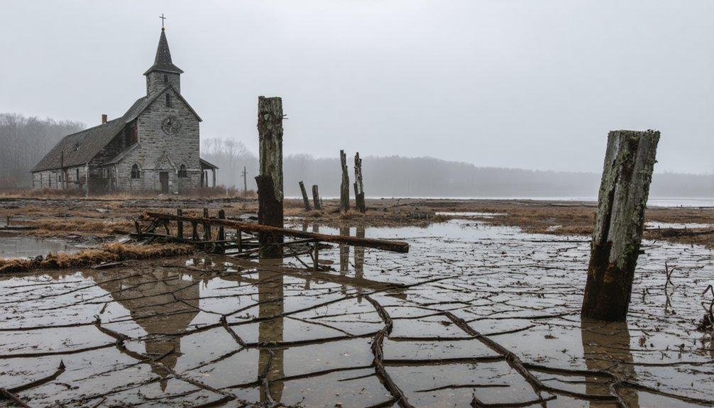
Remains Visible During Droughts
During extreme hydrological deficit periods, archaeological remnants of the six submerged villages breach the reservoir’s surface, offering quantifiable evidence of pre-inundation settlement patterns. You’ll observe ancient artifacts emerging as water levels decline, revealing the river ecology’s transformation since 1926.
The exposed infrastructure includes:
- Fieldstone walls delineating 36 miles of abandoned roadways
- Building foundations from 1,195 demolished structures across Ashland, Richmond, Rockland, South Scituate, and Kent villages
- Old Andrews iron bridge spanning former watercourses
These drought-exposed remnants document settlement hierarchies predating reservoir construction. Foundation traces persist at depths reaching 80 feet during normal conditions.
You’re witnessing tangible connections to displaced communities—quantifiable proof that governmental infrastructure projects permanently altered both human settlement and river ecology patterns across 5.3 square miles.
The Scale of Destruction: Homes, Churches, and Community Buildings Lost
When Rhode Island authorities initiated the Scituate Reservoir project in 1915, they triggered the systematic dismantling of an entire community’s physical infrastructure.
You’ll find documented evidence of hundreds of residential structures deliberately flooded—homes containing generations of family history submerged beneath engineered water levels. The community impact extended beyond housing: churches that anchored spiritual life vanished underwater, schools and meeting halls disappeared, and commercial establishments ceased to exist.
Cultural relics manifested in the permanent inundation of town commons, bridges, and civic centers that once formed the nucleus of collective identity.
During drought conditions, foundations emerge as archaeological evidence of state-sanctioned displacement. The reservoir prioritized metropolitan water requirements over preservation rights, transforming occupied settlements into subaqueous ruins that remain visible testaments to governmental overreach. Similar patterns of depopulation creating disruptions in transit, clean water, electricity, and internet access now threaten Rhode Island areas near East Providence, Newport, Warwick, Pawtucket, and Middletown by 2100.
The Heartbreak of Displacement: Stories of Protest and Tragedy
Psychological consequences included:
The human toll extended far beyond physical displacement, leaving deep emotional scars that would persist for generations.
- Seven documented suicides during demolition phases
- Permanent severance of generational family networks
- Complete eradication of cultural heritage sites
The 23-square-mile acquisition obliterated six villages, simultaneously destroying wildlife habitats and community infrastructure—transforming occupied territory into submerged archaeological sites beneath 60 feet of water. Rhode Island’s ghost towns include Hanton City in Smithfield, where stone wall remains and the Alfred Smith Cemetery mark what was once an extremely isolated settlement, possibly founded by Loyalist families during the Revolutionary era.
abandoned towns submerged in New Jersey share a similar fate, with entire communities lost to the waters of man-made reservoirs. These towns serve as haunting reminders of the past, their remnants occasionally visible during droughts or low water levels. As divers explore these forgotten places, they uncover stories woven into the fabric of the state’s history, revealing the lives of those who once called them home.
Moving the Dead: Thousands of Graves Relocated for the Reservoir

The systematic exhumation and relocation of human remains represented one of the most extensive cemetery displacement operations documented in New England history.
You’ll find that over 1,485 bodies were relocated from condemned land, while approximately 728 graves were never removed and remain submerged. An additional 700 graves lie buried beneath 6 feet of earth under 80 feet of water.
Thirty-two cemeteries required relocation, with most remains reinterred at Rocklin Cemetery in Clayville. Burial records proved incomplete, preventing accurate genealogical reconstruction. Each relocated grave received uniform marble gravestones inscribed with alphanumeric codes referencing their original cemetery locations.
Family descendants now face barriers locating ancestral sites due to inadequate documentation. The hand-excavation process created anonymous burials, and more than 1,400 individuals remain unaccounted for beneath reservoir waters—permanently severing your access to historic burial grounds. Limited funding makes it challenging to implement comprehensive documentation systems that could have preserved more detailed records of these displaced graves.
Engineering Marvel: Building the Dam That Changed Scituate Forever
You’re examining one of the early 20th century’s most ambitious hydraulic engineering projects: the Gainer Memorial Dam, a 3,200-foot earthen structure constructed entirely through manual excavation and fill placement between 1915 and 1925.
This $21 million undertaking required thousands of laborers and 200 mules to move sufficient soil mass to create a barrier 640 feet wide, ultimately impounding 37-39 billion gallons across 5.3 square miles.
The dam’s construction methodology and scale represented the largest civil engineering project ever attempted in Rhode Island, necessitating the systematic demolition of over 1,195 structures before the reservoir’s initial filling on November 10, 1925.
Massive Earthen Dam Construction
After acquiring over 23 square miles of land through eminent domain powers granted by the 1915 Rhode Island General Assembly legislation, construction crews initiated excavation work that would transform the Pawtuxet River valley into New England’s largest municipal water reservoir.
The earth-filled structure deployed sophisticated engineering methodologies to guarantee structural integrity and water quality:
- Core trench excavation extended through bedrock, creating impermeable barriers preventing erosion patterns that compromise dam stability.
- Cut-off trench construction utilized river diversion channels, allowing engineers to work in dry conditions.
- 200 mules transported excavated material to build the 3,200-foot-long, 100-foot-high barrier.
The dam’s 640-foot width and strategic spillway design managed hydraulic pressure from 37 billion gallons while preventing catastrophic overflow scenarios.
Construction equipment and systematic diversion approaches enabled completion by November 1925.
Engineering Scale and Impact
Spanning approximately 2,300 feet across the Pawtuxet River valley, Scituate Dam’s engineering specifications establish it as a monumental feat of early 20th-century hydraulic infrastructure. You’ll find its maximum height reaches 70 feet, creating a 3,400-acre impoundment that fundamentally altered the region’s hydrological dynamics.
The dam’s structural integrity relies on an impermeable slurry wall extending to bedrock, complemented by ogee and stair-step spillway designs that manage water flow efficiently.
Recent rehabilitation efforts demonstrate the evolution of hydraulic engineering standards. You’re witnessing modifications including internal drainage systems, slope flattening, and an emergency draw-down pipeline—critical upgrades ensuring continued operational safety.
The reservoir’s 89.3 million gallon daily safe yield serves Providence’s water demands, though it permanently impaired groundwater movement throughout the Big River watershed, reducing discharge into the Pawtuxet River system.
Infrastructure Before the Flooding
When Providence’s City Council convened in January 1913 to address the city’s escalating water demands, they initiated a decade-long engineering campaign that would fundamentally restructure Scituate’s geographic and social landscape. The Water Supply Board identified North Branch Pawtuxet River as ideal source, subsequently acquiring 23 square miles through eminent domain powers granted by Rhode Island’s General Assembly in 1915.
Infrastructure dismantled between 1915-1925 included:
- Residential structures: 375 homes, 233 barns systematically demolished
- Community facilities: 7 schools, 6 churches, 10 general stores eliminated
- Industrial operations: 6 mills, 30 dairy farms, Providence and Danielson Railroad removed
This environmental legacy displaced entire villages—Kent, Richmond, Ashland—representing 35% of Scituate’s territory.
The societal impacts manifested tragically: seven residents committed suicide during displacement, while Providence’s counterproposal for reduced watershed acquisition faced systematic rejection.
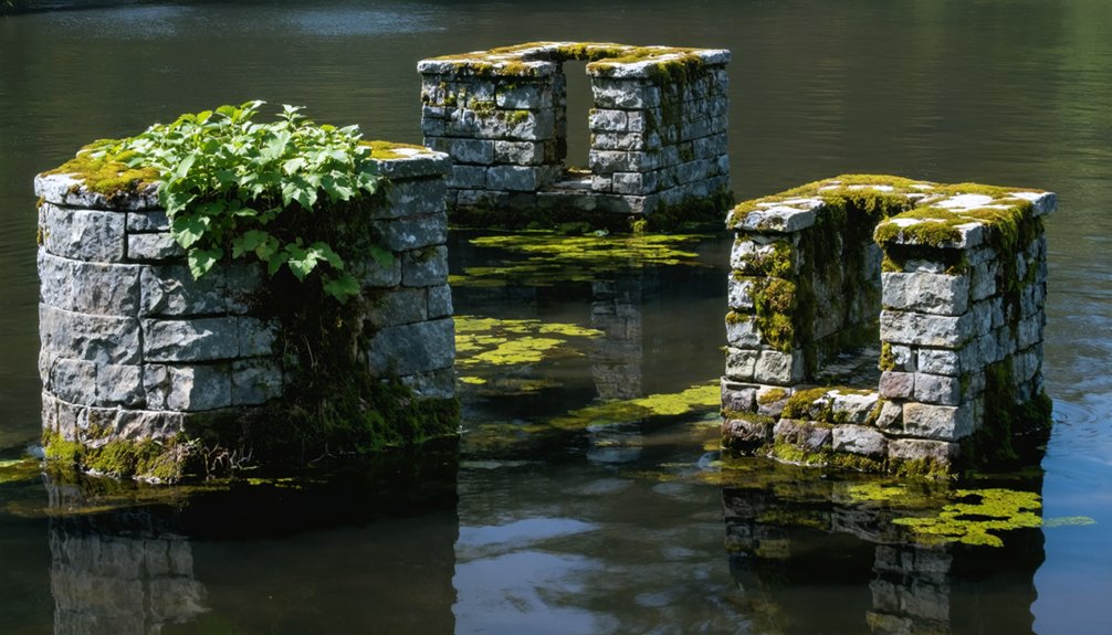
What Lies Beneath: Structures Still Hidden Under 80 Feet of Water
Beneath 80 feet of water and 6 feet of protective earth sediment, approximately 700 structural foundations remain preserved in their original positions on the Scituate Reservoir floor. These underwater artifacts include 233 barn foundations, 375 residential structures, and six mill complexes that escaped demolition before flooding.
You’ll find fieldstone construction methods from the 18th and early 19th centuries remain intact beneath the surface, as concrete wasn’t used in original building techniques.
The submerged landscapes contain sacred Native American sites like Council Throne, alongside colonial infrastructure including schoolhouses, churches, and commercial buildings.
Transportation networks—the Providence and Danielson railroad and trolley systems—rest undisturbed on the reservoir bottom.
Fieldstone property walls delineating original boundaries create an underwater archaeological record accessible only through documented evidence and drought-period observations.
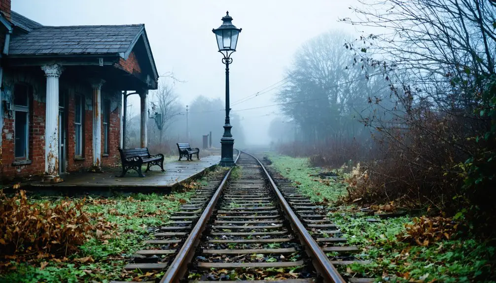
When Droughts Reveal the Past: Visible Remnants of Lost Communities
During periodic drought conditions, the Scituate Reservoir’s water level recedes sufficiently to expose structural remnants that typically remain submerged beneath 80 feet of water. You’ll observe distinct archaeological features emerging along the shoreline, revealing the environmental impact of this engineering project on cultural heritage sites.
Primary visible structures include:
- Fieldstone walls and home foundations marking former property boundaries
- Mill foundation remnants indicating historical industrial activity
- Andrews iron bridge foundation appearing during extreme low-water events
These exposed artifacts provide tangible evidence of the five villages—Ashland, South Scituate, Richmond, North Scituate, and Kent—that were systematically cleared between 1913 and 1926.
The 375 demolished homes, 233 razed barns, and dismantled infrastructure represent irreversible alterations to Rhode Island’s settlement patterns, documented by Providence Journal photographer John R. Hess before inundation.
Exploring the Surrounding Woods: Foundations and Roads That Remain
Beyond the reservoir’s fluctuating waterline, you’ll discover an extensive archaeological landscape where systematic documentation reveals the spatial organization of pre-1913 settlement patterns.
John R. Hess’s pre-flood surveys identified 375 house foundations, 233 barn structures, and civic buildings including 7 schools and 6 churches throughout the watershed forests.
You’ll encounter fieldstone walls functioning as historic boundary markers along forested pathways, defining property divisions that preceded reservoir construction.
The terrain preserves colonial-era mill foundations and iron bridge remnants like Andrews bridge.
Former trolley and railroad corridors remain traceable through wooded areas surrounding North Scituate’s submerged villages.
These structural remnants, combined with the 3200-foot aqueduct system, create a navigable network where you can independently explore Rhode Island’s displaced settlement infrastructure without restriction.
Other Forgotten Places: Hanton City and Big River Management Area
Rhode Island’s terrestrial ghost settlements present comparable archaeological complexity to the Scituate Reservoir’s submerged villages. You’ll find Hanton City near Smithfield’s Hanton City Trail, where three English families established operations around 1676-1677.
This settlement peaked during the 1730s before industrial mechanization eliminated its leather-tanning economy.
The site demonstrates limited historic preservation efforts, though you can document:
- Stone foundations and deteriorated burial grounds
- Defunct irrigation dam infrastructure
- Quarry remnants from pre-industrial operations
Community resilience failed when highway construction diverted commerce and Blackstone River mills attracted residents by the 1850s. You’ll access remaining cellar holes 3/4 mile along the designated hiking trail from 70 W. Reservoir Rd.
The Big River Management Area encompasses additional abandoned settlements, offering comparative data for understanding New England’s economic displacement patterns during industrialization.
Frequently Asked Questions
Can You Swim or Boat in Scituate Reservoir Today?
No, you can’t swim or boat in Scituate Reservoir today. While historical wrecks and underwater archaeology from submerged villages lie beneath, strict watershed protection protocols prohibit recreational access to safeguard drinking water quality for Rhode Island’s population.
Is the Water From Scituate Reservoir Safe to Drink?
Yes, Scituate Reservoir water’s safe to drink. Rigorous water testing in 2023 showed zero exceedances of federal standards. Though water contamination risks exist from road salt and aging septics, you’ll find the supply meets all regulatory requirements.
Were Families Compensated When Their Land Was Seized by Eminent Domain?
You’ll be thrilled to know families received “fair market value”—though compensation disputes dragged through courts for years. The state’s land acquisition process technically followed legal protocols, but residents’ freedom to refuse was merely theoretical under eminent domain law.
Can You Visit or Explore the Submerged Village Ruins Underwater?
You can’t explore submerged ruins underwater due to watershed protection laws prohibiting entry. Underwater archaeology and submerged ruins exploration aren’t permitted here—no diving, boating, or direct access. You’ll only see exposed foundations during severe droughts from shore.
How Often Does the Reservoir Water Level Drop Enough to See Ruins?
During extreme drought events, water levels drop irregularly—no quantified frequency exists. You’ll find ruins surface infrequently when precipitation deficits create exposure conditions, enabling urban exploration opportunities while challenging historical preservation efforts of these submerged archaeological sites.
References
- https://www.youtube.com/watch?v=urcXKCFkjDA
- https://www.youtube.com/watch?v=hAVOfTGz1Lc
- https://www.youtube.com/watch?v=ngZKyrn3Sxw
- https://weird-island.simplecast.com/episodes/57-ghost-town-hanton-city-ky53imy0
- https://www.youtube.com/watch?v=MfR6RRFsNqg
- https://en.wikipedia.org/wiki/List_of_flooded_towns_in_the_United_States
- https://brownpoliticalreview.org/dark-history-of-pvd-water/
- http://www.scituateri.net/qrtour/Reservoir.htm
- https://www.bvhsri.org/2015/02/28/ray-wolf-brings-the-scituate-reservoir-to-life-at-north-gate/
- https://preservation.ri.gov/sites/g/files/xkgbur406/files/pdfs_zips_downloads/survey_pdfs/scituate.pdf