You’ll find several submerged communities beneath South Carolina’s reservoirs, created when 20th-century dam projects flooded entire settlements. Ferguson, a lumber town established in 1881, lies beneath Lake Marion since 1939. Andersonville rests under Lake Hartwell, while Lake Murray conceals 1920s-30s communities with visible foundations during droughts. These sites preserve industrial remnants—mill machinery, kiln foundations, and cypress lumber—accessible when water levels drop. Archaeological evidence reveals settlement patterns and economic evolutions from river-dependent industries. The article below explores specific locations, causes of submersion, and preservation efforts surrounding these historical landscapes.
Key Takeaways
- South Carolina has several submerged towns beneath lakes like Marion, Hartwell, and Murray, flooded by dam construction projects.
- Ferguson, a lumber town established in 1881, lies beneath Lake Marion after the 1939 dam flooded the area.
- Andersonville and mountain settlements submerged under Lake Hartwell include relocated cemeteries and former river commerce sites.
- Water level fluctuations from droughts reveal submerged foundations, mill machinery, bridges, and industrial artifacts for exploration.
- These underwater sites attract divers and researchers studying 19th-century settlement patterns, industries, and South Carolina’s historical landscape.
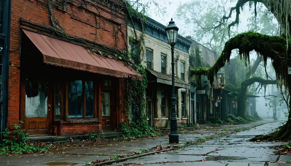
Ferguson: The Lumber Town Claimed by Lake Marion
When Chicago lumbermen Francis Beidler and Benjamin Franklin Ferguson established the Santee River Cypress Lumber Company in 1881, they acquired 165,000 acres of prime wetlands along South Carolina’s Congaree, Wateree, and Santee Rivers at approximately $2.00 per acre.
After Ferguson’s death, Beidler constructed a fully operational lumber mill by 1910, creating a self-contained company town housing 350 workers and their families. The community featured advanced infrastructure—paved streets, indoor plumbing, and coal gas lighting—uncommon for remote mill towns. The town also included a church, hotel, and school to serve the residents. Workers were paid in scrip, which could only be spent at company stores within Ferguson.
Operations ceased in 1915 when Beidler lost his eyesight, and the town was abandoned by the 1930s. Today, Ferguson lies beneath Lake Marion, submerged following the 1939 Santee Dam construction.
You’ll find submerged artifacts including kiln remnants accessible by kayak, though local legends surpass official historical markers commemorating this lost community.
The Santee Cooper Project and Its Human Cost
The Santee Cooper Project’s construction displaced approximately 3,000 residents from 177,000 acres of land. This displacement represents one of the largest forced relocations in southeastern United States history.
Families who had owned property for over two centuries lost their homes, farms, and communities when the Santee and Cooper Rivers were dammed between 1939 and 1942. Workers relocated over 160,000 acres, clearing the land before the flooding began.
This massive land acquisition created Lake Marion and Lake Moultrie, permanently submerging established settlements and irrevocably altering the region’s cultural landscape. The project was funded entirely through federal loans and grants as part of President Franklin D. Roosevelt’s New Deal initiative.
Displacement of 3,000 Residents
Before construction crews could begin building the dams and powerhouses that would transform rural South Carolina’s electrical infrastructure, the Santee Cooper Project required an unprecedented human sacrifice: the forced relocation of approximately 3,000 residents from their ancestral lands.
You’ll find that 160,000 acres submerged entire communities between 1939-1942, eliminating farms, churches, and cemeteries that families had maintained for generations.
The economic impacts devastated displaced populations who lost property rights and livelihoods without adequate compensation.
Environmental consequences extended beyond habitat destruction—cultural heritage sites disappeared permanently beneath what became Lakes Marion and Moultrie.
While the project delivered hydroelectric power through facilities like Jefferies Generating Station‘s 143 MW capacity, this infrastructure development came at the cost of individual liberty and community sovereignty that you can’t quantify in megawatts.
Modern regulatory frameworks now require facilities to manage coal combustion residuals through closure by removal methods, eliminating the need for post-closure care at ash storage sites.
Creation of Lake Marion
Between 1939 and 1941, over 12,500 workers transformed 177,000 acres of South Carolina’s swamp and timberland into what became Lake Marion—a reservoir operation that permanently altered the region’s cultural and physical geography.
You’ll find this 110,000-acre reservoir spans five counties, with a shoreline measuring 315 miles.
The Santee Dam and Pinopolis Dam created an artificial ecosystem where water quality management became essential for the region’s sustainability.
While submerged cypress forests and flooded structures created unique underwater topography, they also established diverse wildlife habitats that replaced the original terrestrial environment.
This engineering intervention sacrificed established communities and natural landscapes for hydroelectric power generation, demonstrating how centralized infrastructure projects prioritize industrial development over individual property rights and existing ecological systems.
The flooding drowned Ferguson, a former mill town that had housed around 2,500 residents during its peak in the 1890s-1900s, leaving its infrastructure and community submerged beneath the lake.
The project included constructing a 20-mile canal linking the Santee and Cooper Rivers to facilitate the broader hydroelectric and navigation goals.
What Remains Above and Below the Waterline
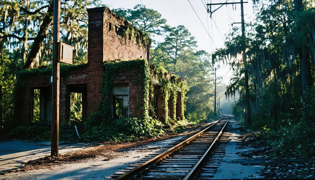
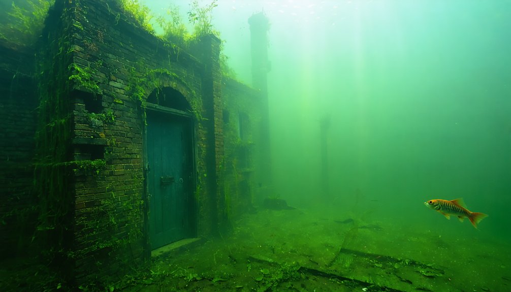
Ferguson’s industrial infrastructure is divided between exposed and submerged zones. The kiln’s skeletal remains are visible on the north island, while mill machinery rests just beneath the surface.
Lake Marion’s shallow depths preserve structural evidence—machine beds, foundation outlines, and cypress logging remnants—creating both archaeological resources and navigation hazards as metal anchoring wires corrode. The Santee River Cypress Lumber Company began operations in 1910, establishing the industrial foundation that would support Ferguson’s growth as a lumber town.
The 2010 drought revealed the full extent of these ghost town sites, temporarily exposing walkable paths to brick memorials and building foundations that document the 1941 displacement of 2,500-3,000 residents. Modern visitors can explore these sites by watercraft, following Leave No Trace principles to ensure both environmental and historical preservation.
These explorations also highlight ghost towns celebrating New Hampshire traditions, where local history and culture are intertwined with the landscapes. Festivals and events often take place in these areas, allowing visitors to engage with the remnants of the past while honoring the legacies of those who once lived there. As community efforts continue, there is hope for revitalization, drawing attention to the rich heritage that these abandoned sites embody.
Visible Mill and Kiln Structures
Water level fluctuations dramatically affect what you can observe. During drought conditions, exposed brick foundations and wall segments reveal the settlement’s former footprint.
Normal lake levels submerge most remnants, leaving the kiln as your primary visual marker. The deteriorated structure serves archaeological documentation purposes, representing the industrial operations that once processed timber from 165,000 acres of cypress forest. Waves crash against the ruins on Ferguson Island during high water conditions, making open-water crossings more challenging for explorers visiting the site.
Submerged Foundations and Machinery
When lake levels drop considerably, Ferguson Island’s submerged foundations emerge from Lake Marion’s waters, revealing the precise footprint of the Santee River Cypress Lumber Company’s industrial complex.
Google Earth imagery documents multiple structure outlines where church, hotel, and school once stood.
You’ll find underwater artifacts including machine beds and processing equipment abandoned during the 1930s flooding, preserved beneath the surface like ancient boatwrecks in maritime archaeology sites.
Documentation shows:
- Mill machinery beds visible just below waterline
- Kiln foundations extending from exposed skeletal remains
- Railroad bed traces leading to former landing
- Thousands of board feet cypress lumber wired underwater
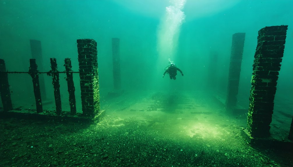
Divers and boaters with keen observation skills can identify these industrial remnants during low-water periods, accessing physical evidence of Ferguson’s displaced community.
Drought-Exposed Town Sites
Lake Marion’s water level fluctuations directly determine which portions of Ferguson’s industrial archaeology become accessible for documentation and study. During South Carolina’s severe drought around 2007-2016, you could walk several hundred yards from Ferguson Landing Way to exposed foundations and machine beds. These exceptional low-water conditions revealed brick fragments, mill equipment, and structural remains typically hidden beneath underwater ecosystems.
The 2012 drawdown allowed closer inspection of the submerged steel bridge and kiln structures before water levels recovered. Climate change increasingly influences these fluctuation patterns, affecting long-term preservation of archaeological resources.
You’ll find that canoe or kayak access remains essential during normal conditions, though submerged hazards require careful navigation. Seasonal variations continue determining what portions of Ferguson’s industrial heritage become temporarily visible for historical documentation.
Andersonville: A River Town Lost to Progress
Beneath the placid waters of Lake Hartwell lies Andersonville, a once-prosperous river port established in 1801 through an Act of the South Carolina General Assembly on land owned by Colonel Elias Earle. Named after Revolutionary War General Robert Anderson, the settlement thrived on river commerce at the confluence where the Tugaloo and Seneca Rivers form the Savannah River.
Where three rivers converge, a forgotten port town rests beneath Lake Hartwell’s surface, lost to time and rising waters.
The town’s economic foundation crumbled through repeated flood destruction:
- 1840 freshnet destroyed cotton mills, wool factories, and the cotton gin
- Rebuilt mills faced destruction again in 1850
- 1852 flooding delivered the final blow to industrial infrastructure
- Railroad expansion bypassed the settlement, rendering river transport obsolete
Lake Hartwell’s Submersion of Mountain Settlements
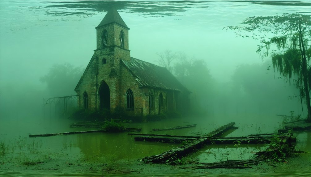
By 1962, the U.S. Army Corps of Engineers completed Lake Hartwell’s dam, permanently flooding mountain settlements across 56,000 acres. You’ll find Cemetery Island’s Harris family plot standing as critical evidence—59 marked graves with fewer than 20 stone markers documenting enslaved peoples’ burial sites from the 1700s. This site exemplifies underwater archaeology’s challenge in reservoir environments where submerged vegetation obscures historical remnants.
The lake’s formation destroyed entire communities, farms, and infrastructure networks that represented pre-industrial settlement patterns. You can access Cemetery Island only by watercraft, where fluctuating water levels expose or conceal grave markers. These submerged landscapes preserve transitional economic systems between river-dependent commerce and modern development.
The site’s partial visibility demonstrates preservation’s ongoing struggle against engineered flooding that erased centuries of Appalachian foothill history.
The Forgotten Communities of Lake Murray
When South Carolina Electric & Gas purchased land throughout the Saluda River Valley during the 1920s, they initiated the erasure of settlements that German, Swiss, and Dutch immigrants had established since the 1750s. The resulting 50,000-acre Lake Murray submerged nine towns housing nearly 5,000 residents, preserving their remnants beneath underwater flora.
Today’s divers document these submerged artifacts across multiple sites:
- Wyse Ferry Bridge – Intact concrete structure bearing 1911 construction workers’ inscriptions
- Job F. Wingard Homesite – Two wells, hundreds of chimney bricks, 1850s foundation remains
- Stone House – Four walls and roof preserved underwater
- Cemetery – 2,300+ graves with headstones from the 1800s
These cold, immersive exploration sites require specialized training but offer unrestricted access to authentic valley history that official records failed to preserve.
Cypress Logging’s Legacy Beneath the Surface
During the late nineteenth century, Chicago lumbermen Francis Beidler and Benjamin F. Ferguson established the Santee River Cypress Lumber Company, controlling 165,000 acres of South Carolina wetlands. Their 1881 operation harvested old-growth bald cypress until 1915, when Beidler’s failing eyesight forced closure.
The 1939 Santee Cooper project submerged Ferguson’s mill town beneath Lake Marion, creating unique marine archaeology opportunities. You’ll find skeletal mill structures and foundations partially exposed in shallow waters, accessible via Ferguson Landing Way.
The 2016 drought revealed extensive remnants for documentation. Underwater conservation efforts now focus on recovering sunken cypress logs and cataloging industrial artifacts.
Heavy wire anchors, once securing timber, present ongoing boating hazards. These submerged remnants represent South Carolina’s lumber industry heritage, offering researchers freedom to explore pre-industrial wetland exploitation patterns.
Visiting South Carolina’s Sunken Ghost Towns
The submerged industrial landscapes documented by archaeologists require careful site assessment before exploration. Marine archaeology protocols protect these heritage sites while ensuring waterway ecosystems remain undisturbed.
You’ll find three primary locations accessible for responsible visitation:
- Andersonville Island in Lake Hartwell’s center offers boat-accessible remnants of the 1801 settlement destroyed by nineteenth-century floods.
- Ferguson Island in Lake Marion displays Santee River Cypress Lumber Company foundations and kiln structures, with ideal viewing at lower water levels.
- Lake Murray’s submerged settlements require specialized diving certification due to depth, darkness, and cold temperatures.
Historical structures lie beneath normal waterlines, with exposed foundations appearing during drawdowns.
Church Island’s Rocks Cemetery connects to Ferguson’s logging operations.
Navigate carefully—submerged machinery poses hazards to watercraft.
Documentation through photography preserves these vanishing landscapes without disturbing archaeological integrity.
Preserving the Stories of Displaced Communities
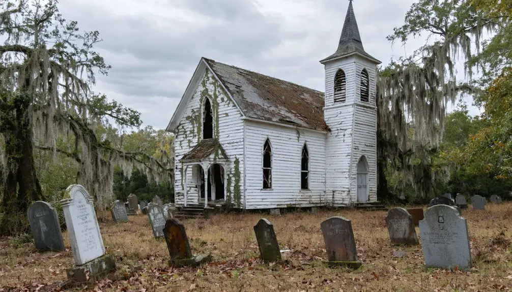
Thorough documentation becomes critical as firsthand accounts from displaced communities diminish with each passing generation. You’ll find cultural preservation efforts like the Loftis project, which transcribes Ferguson residents’ memories and archives them at South Caroliniana Library, creating permanent records of erased communities.
Church records from the deconsecrated Church of the Epiphany document pre-displacement life before Lake Marion’s rise. The 2018 settlement—$52 million paid to Swain County for the unfinished Road to Nowhere—acknowledges broken governmental promises to displaced families.
Documented remnants beneath Lake Marion, including Santee Cypress Lumber Company foundations, provide tangible evidence of lost towns. These preservation methods enable renewal tourism while honoring ancestral lands.
You’re witnessing history rescued from bureaucratic erasure, ensuring displaced voices aren’t silenced by floodwaters.
Frequently Asked Questions
Are There Other Submerged Ghost Towns in South Carolina Besides These Three?
The provided documentation doesn’t identify additional submerged ghost towns beyond these three primary sites. You’ll find underwater archaeology and historical preservation efforts focused on Andersonville, Ferguson, and Lake Murray settlements, with related features like Francis Marion’s homesite requiring further exploration.
Can Scuba Divers Legally Explore the Underwater Ruins of These Towns?
You’re in the clear—no legal restrictions explicitly prohibit scuba diving these submerged ruins. However, you’ll need standard diving permits and should follow U.S. Army Corps of Engineers regulations while prioritizing artifact preservation and respecting posted restricted zones.
Were Any Cemeteries Relocated Before the Lakes Flooded These Communities?
No documented evidence confirms cemetery relocations occurred before flooding these famous ghost towns. You’ll find preservation records lack specific grave relocation accounts for Andersonville, Ferguson, or Dutch Fork communities, suggesting abandonment preceded impoundment without formal cemetery transfers.
Do Any Descendants of Displaced Residents Still Live Near the Lakes Today?
No documented evidence confirms descendants live near ancestral homelands today. You’ll find displaced families scattered beyond lake vicinities through economic relocations. However, community reunions and oral history projects preserve connections, though physical proximity to submerged sites remains unverified.
Has Anyone Attempted to Create Underwater Maps of the Submerged Structures?
Like cartographers charting unknown territory, you’ll find divers have undertaken underwater archaeology expeditions, creating historical mapping documentation of Lake Murray’s Dutch Fork and Saxe Gotha sites using specialized equipment, while boaters chart Ferguson Island ruins and submerged railroad coordinates for preservation.
References
- https://sc.edu/uofsc/posts/2020/05/memories_of_a_drowned_town.php
- https://www.thewanderingappalachian.com/post/the-underwater-towns-of-appalachia
- https://www.youtube.com/watch?v=T6gy0y6XFAo
- https://www.twocraftycats.com/post/ferguson-an-underwater-ghost-town
- https://en.wikipedia.org/wiki/Ferguson
- https://www.randomconnections.com/the-ghost-towns-of-lake-marion/
- https://www.onlyinyourstate.com/state-pride/south-carolina/ferguson-underwater-ghost-town-sc
- https://www.randomconnections.com/the-ghost-towns-of-lake-marion-part-2-ferguson/
- https://crimeandcask.com/city-of-ferguson-submerged-lake-marion/
- https://www.scencyclopedia.org/sce/entries/santee-cooper/