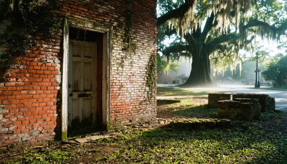
You’ll find Virginia’s underwater ghost towns exist more in legend than documented fact. Smith Mountain Lake’s rumored settlement of “Monroe” near Vista Point remains unverified after decades of exploration, with no census records, property deeds, or confirmed artifacts despite depths reaching 150 feet. In contrast, Philpott Lake represents Virginia’s only documented community inundation—the 1952 damming displaced residents, relocated 1,135+ graves from 19 cemeteries, and submerged A.B. Philpott’s general store and the Virginia Ore & Lumber Company’s railroad infrastructure. The technical challenges and verified evidence reveal why these sites differ dramatically from neighboring states’ accessible underwater ruins.
Key Takeaways
- Smith Mountain Lake formed in 1963 by damming rivers, submerging scattered roads, bridges, houses, and barns beneath 60-150 feet of water.
- Monroe’s existence as an underwater town remains unverified; no census records, property deeds, or confirmed archaeological evidence support the legend.
- Philpott Lake submerged Town’s Creek settlement in 1952, including A.B. Philpott’s store, railroad infrastructure, and relocating 19 cemeteries with 1,135-1,354 graves.
- Underwater exploration faces challenges from murky water, three-foot visibility, submerged timber, and depths reaching 320 feet limiting systematic surveys.
- No verified artifacts or mapped foundations confirm organized ghost towns; only rural infrastructure like roads and potential homestead remains are documented.
The Mystery of Monroe: Virginia’s Unconfirmed Submerged Settlement
Where exactly does Monroe lie beneath Smith Mountain Lake’s surface? You’ll find rumors pointing to the Vista Point area within the lake’s main body, where structures reportedly rest 60 to 150 feet down.
Structures allegedly rest 60 to 150 feet below Vista Point, though Monroe’s existence as an actual town remains unproven by historical records.
Yet local officials confirm no actual town existed—only scattered roads, bridges, houses, and barns dotted the landscape before Appalachian Power’s damming project began in 1963.
Despite persistent legends and folklore, no hard evidence validates Monroe’s existence as a proper settlement. The supposed records remain archived in Danville, Virginia, though researchers haven’t uncovered definitive proof.
Modern exploration efforts include aerial photo superimpositions revealing possible submerged roadways, while Sunken City Brewery displays alleged historical artifacts. Murky waters and submerged timber make underwater exploration particularly challenging for divers attempting to verify the settlement’s existence.
You’re left examining contradictory accounts: old-timers’ testimonies versus documentary gaps, creating Virginia’s most enigmatic submerged mystery. The lake was formed by damming the Roanoke and Blackwater Rivers approximately 50 years ago, forever altering the landscape and fueling speculation about what lies beneath.
Philpott Lake: A Documented Community Lost to Flood Control
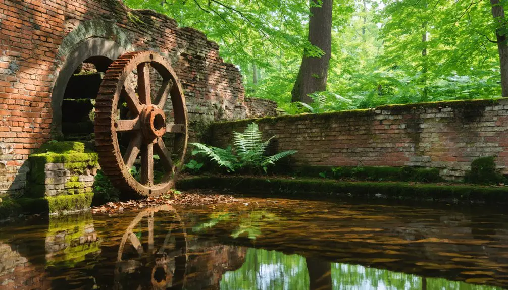
Before Philpott Dam’s 1952 completion, you’ll find documented evidence of an active settlement at Town’s Creek where A.B. Philpott operated a store by 1905.
The Virginia Ore & Lumber Company maintained a railroad junction connecting iron ore operations in Fayerdale to the Norfolk and Western Railway’s “Pumpkin Vine” line.
The U.S. Army Corps of Engineers’ flood control project submerged 3,000 acres across three counties, permanently relocating residents and eliminating the transportation infrastructure that had served timber and mining operations along the Smith River. Construction started in 1948 and transformed the communities of Bassett and Fieldale, which had experienced frequent flash flooding and property loss.
The dam project was authorized in 1944 following devastating floods in 1940 that brought 14-16 inches of rainfall to the Roanoke River basin.
Archaeological excavations conducted between 1965-1985 at the Philpott site (44Hr4) recovered late prehistoric Dan River phase artifacts and contact-period materials, now curated at RLA.
YouTube documentation confirms visible cemetery remnants including tombstones pushed underwater during the flooding process.
Community Before the Flood
The settlement at Town’s Creek and Smith River had established itself as a functioning community by 1905, when A.B. Philpott opened his store at this strategic junction.
You’ll find no flood myths here—documented evidence proves this area’s vulnerability through decades of catastrophic inundation. Congress authorized the dam’s construction in 1944 following severe flooding events that repeatedly devastated the region.
Archaeological mysteries surround the deeper history: excavations revealed a substantial Dan River phase village dating to the mid-1600s contact period, with artifact concentrations indicating prolonged occupation.
The community’s infrastructure included:
- Virginia Ore & Lumber Company’s standard gauge railroad snaking up Smith River to extract iron and timber
- Iron ore transport route connecting Fayerdale mines through Philpott to Norfolk and Western’s “Pumpkin Vine” line
- Ancient pathways following the Tutelo-Saura and Saura-Saponi trails used by Native Americans for centuries
Relocation and Infrastructure Loss
Following Congressional authorization under the 1944 Flood Control Act, the U.S. Army Corps of Engineers initiated construction in 1948, forcing systematic clearance below 967 feet elevation.
You’ll find all structures—homes, businesses—were removed by March 1952 during an eight-month operation.
The Virginia Ore & Lumber Company’s railroad, critical for pig iron transport from Fayerdale to Norfolk and Western Railway, now lies submerged.
A.B. Philpott’s store at Town’s Creek vanished beneath rising waters.
Historic routes—Colonist’s Great Road, Tutelo-Saura Path, and Saura-Saponi Trail crossings—became subjects for maritime archaeology study.
Trees between 935-967 feet were cut flush, creating navigational hazards for underwater navigation.
Henry County’s Philpott family donated hundreds of acres, their sacrifice enabling flood protection for downstream communities across Henry, Patrick, and Franklin counties.
The 1937 flood had prompted this flood control infrastructure development, demonstrating the catastrophic event that ultimately led to the dam’s construction.
The old Union Church was rebuilt on higher ground, one of the few structures to escape permanent loss.
What Lies Beneath Smith Mountain Lake Near Vista Point
You’ll find no census records, property deeds, or municipal documents confirming Monroe’s existence beneath Smith Mountain Lake.
Scuba divers have explored the depths near Vista Point and reported finding structural remnants.
Yet murky conditions and 3-foot visibility prevent photographic verification.
Despite decades of local testimony and ongoing underwater expeditions, investigators haven’t recovered artifacts or mapped foundations that would definitively prove a town occupied this submerged terrain.
The lake itself formed in September 1963 when Appalachian Power completed dam construction for hydroelectric development.
Before the flooding, workers relocated 1,135 graves from numerous cemeteries across the 20,000-acre basin, some dating back to the 1750s.
Monroe’s Elusive Historical Record
Near Vista Point on Smith Mountain Lake, Monroe exists as Virginia’s most enigmatic ghost town—a settlement whose historical record remains frustratingly incomplete. You’ll find no census records, no verified maps, no documented evidence proving its existence before the 1963 flooding.
This absence transforms Monroe into one of Virginia’s most debated maritime legends, with archaeological debates hindered by 795 feet of water concealing potential proof.
The historical vacuum reveals three distinct challenges:
- Pre-1963 Documentation Gap: No surveyors’ records or county registries confirm Monroe’s exact location or population.
- Submerged Evidence: Lake depth prevents systematic underwater archaeological surveys of the Vista Point vicinity.
- Relocation Records: While Herbert Taylor documented 1,135-1,354 grave relocations, no Monroe-specific cemetery data survived.
You’re left examining shadows rather than substance—a ghost town that may never surrender its secrets. The lake’s rapid filling mirrors Smith Lake’s experience, where flooding occurred within 11 months rather than the anticipated five years, leaving residents little time to document what would be lost forever.
These submerged remnants tell stories of lives interrupted and dreams submerged, like the abandoned towns beneath South Carolina lakes that lie hidden from view. As the waters rise, history itself fades into silence, leaving only whispers of the past echoing through the depths. Each visit to these lakes becomes a haunting reminder of what once was, challenging visitors to reflect on the impact of nature’s might against human settlement.
Scuba Diver Reports Emerge
When scuba divers from the Bolt Fin-Atics team descended 114 feet to the Halesford Bridge ruins on Labor Day 2019, they encountered conditions that fundamentally limit underwater archaeology at Smith Mountain Lake.
You’ll find visibility restricted to three feet—complete darkness requiring nitrox equipment and compass navigation. The bridge structure, measuring 10 feet thick with its top at 65 feet, remains preserved since the 1960s flooding.
Marine archaeology efforts here face depths reaching 320 feet and holiday boat traffic hazards. Despite rumors of Monroe’s ghost town remnants, divers report only verified bridge ruins near Vista Point.
Underwater flora obscures potential artifacts, while relocated gravesites from 20,000 acres complicate historical documentation. The spooky preservation continues drawing exploration teams, though hard evidence remains elusive.
No Physical Evidence Found
Despite persistent local folklore about the submerged town of Monroe, systematic investigation has yielded no verifiable physical evidence of an organized settlement beneath Smith Mountain Lake’s waters near Vista Point.
Digital mapping technologies and extensive archival research have failed to locate town records, census data, or property deeds documenting Monroe’s existence as an incorporated settlement.
Oral histories circulate, but corroborating documentation remains absent.
What researchers *have* documented:
- 1,135 to 1,354 relocated graves from 50,000 acres, dating to the 1750s, with no accompanying town infrastructure
- Submerged roads, small bridges, and scattered homestead foundations indicating rural settlement patterns rather than urban development
- 150 feet of water depth at the alleged site, with underwater forests and hazardous conditions preventing systematic archaeological surveys
You’re left questioning whether Monroe ever existed beyond storytelling.
Relocating the Dead: The 19 Cemeteries of Philpott
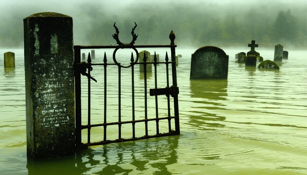
The flooding of Philpott Lake in March 1952 required the relocation of 19 documented cemeteries, though the USACE Master Plan later identified 29 known burial grounds within project lands. During summer 1950, you’ll find bodies were exhumed and reinterred before waters reached elevation 967 feet. Affected families included Jarrett, Ingram, Turner, Foster, Clark, Mullins, Spencer, Bryant, Menefee, Brooks, Stone, Martin, Shelton, Bowling, Crawford, Mize, and Philpott.
Virginia DHR mandates archaeologists handle historic relocations—essential for collapsed coffins and unmarked burials. Remains were temporarily stored at funeral homes like Fisher & Watkins until final placement. This process supports genealogical research through DNA sampling and family consultation.
Modern cemetery preservation efforts continue when droughts expose submerged stones, requiring probing and diving to recover physical evidence.
How Virginia’s Underwater Sites Compare to Appalachian Neighbors
Across Appalachia’s flooded valleys, documented displacement histories reveal stark contrasts with Virginia’s underwater folklore.
While Smith Mountain Lake’s alleged Monroe submergence persists in local folklore—immortalized on Sunken City Brewery walls—no physical evidence confirms these legendary myths. You’ll find verified sites elsewhere:
- West Virginia’s Summersville Lake: Drained every decade, exposing Gad’s roadways, foundations, and rock carvings beneath 3,000 acres.
- Tennessee’s Norris Dam: Lewis Hine photographed Loyston before TVA’s 1935 submergence, preserving displacement records.
- South Carolina’s Lake Jocassee: Divers navigate standing forests around Attakulla Lodge, which resisted bulldozing until 1973 flooding.
Virginia lacks the U.S. Army Corps documentation, relocated graveyards, and periodic drainage exposures that authenticate neighboring states’ underwater communities. Your freedom to investigate meets archival silence.
Exploring Access and Visibility at Virginia’s Flooded Locations

Virginia’s flooded locations offer minimal investigative infrastructure compared to neighboring states’ documented underwater sites.
You won’t find guided scuba tours or established dive shops serving Smith Mountain Lake’s rumored Monroe settlement.
Boat access remains your primary exploration method, though visibility conditions and underwater archaeology evidence haven’t been systematically documented like Summersville Lake’s 327-foot clarity or Jocassee’s 50-foot sightlines.
Without verified remnants or equipment rental services, you’re limited to surface speculation from pontoon vessels.
No drawdown schedules expose foundations for inspection, and no technical instruction exists for deep-dive confirmation.
While West Virginia’s Sarge’s Dive Shop provides structured access to submerged bridges and roadways, Virginia’s hydroelectric sites lack comparable verification infrastructure.
The absence of documented artifacts means you’ll navigate uncharted waters without the methodical documentation available at neighboring Appalachian reservoirs.
Frequently Asked Questions
Can Recreational Divers Legally Explore the Alleged Monroe Site at Smith Mountain Lake?
You’ll find no explicit legal restrictions prohibiting Monroe site dives, but you must follow standard boating regulations and Appalachian Power’s hydroelectric operations guidelines. Exploration guidelines aren’t specifically documented, so you’re responsible for verifying current county ordinances before diving.
What Artifacts Have Been Recovered From Philpott Lake’s Submerged Community Areas?
You’ll find documented recoveries include a circular brass gorget from drainage exposure, plus glass beads and rolled-brass tinklers. These artifact origins trace to European trade, though excavation techniques lacked systematic soil zone documentation, limiting your ability to reconstruct precise archaeological contexts.
Are There Any Survivor Accounts From Families Displaced by Philpott Lake’s Creation?
You’ll find limited documented survivor accounts from displaced families in official records. The Bassett Historical Center likely holds oral histories from the Jarrett, Ingram, Turner, and other families who lost their homes when construction began in 1948.
How Deep Is the Water Covering the Former Monroe Town Location?
Ironically, you’ll find conflicting reports about Monroe’s watery grave. The flooded settlement rests under approximately 150-155 feet of water in the main lake body, though underwater archaeology faces challenges with depths varying between 60-175 feet across different town areas.
Which Specific Cemeteries Were Relocated During the Philpott Lake Flood Control Project?
You’ll find that specific cemetery names weren’t documented in available records, though cemetery relocation affected 19 sites within the flood zone preservation area. The Corps completed exhumations during summer 1950, protecting your ancestors’ remains before flooding.
References
- https://wvtourism.com/did-you-know-there-is-an-underwater-ghost-town-in-west-virginia/
- https://www.thewanderingappalachian.com/post/the-underwater-towns-of-appalachia
- https://www.blueridgeoutdoors.com/go-outside/sunken-secrets-the-underwater-ghost-towns-of-the-blue-ridge/
- http://www.onlyinyourstate.com/virginia/underwater-ghost-town-hiding-in-va
- https://www.youtube.com/watch?v=IABhuspHxuU
- https://www.visitfranklincountyva.com/215/The-Unique-History-of-Philpott-Lake-A-Hi
- https://en.wikipedia.org/wiki/List_of_flooded_towns_in_the_United_States
- https://www.treasurenet.com/threads/ghost-town-of-monroe-va.564717/
- https://www.smithmountainhomes.com/underwater-city/
- https://appetite4history.com/2016/06/14/moving-people-dead-and-alive-a-story-of-smith-mountain-lake/