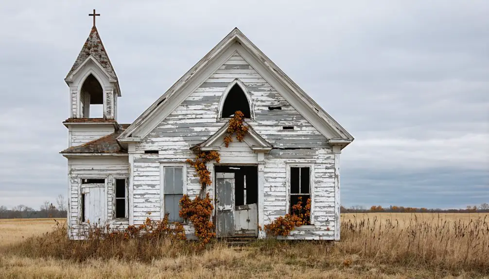
You’ll find Hopewell nestled in northwest Missouri’s Daviess County, where Robert P. Piniston established this pioneer settlement in 1836. Early settlers from Virginia, Kentucky, and Tennessee favored the area’s timbered landscape and fertile soil, building a thriving agricultural community near natural water sources. The town’s fortunes changed dramatically when new transportation routes bypassed it in the late 1800s, leading to its abandonment. The ghost town’s ruins hold stories of frontier life, Mormon influences, and shifting economic tides.
Key Takeaways
- Hopewell was established in 1836 by Robert P. Piniston in northwest Missouri’s Daviess County among gently rolling agricultural plains.
- Early settlers from Virginia, Kentucky, and Tennessee developed the area through farming, relying on corn crops and wild game.
- The community grew around primitive trails and dirt roads, with local trade centered around Millport’s horse-powered mill in the 1830s.
- The Rock Island Railroad‘s arrival in 1871 initially boosted trade but eventually contributed to decline as new routes bypassed the settlement.
- Economic decline, population shifts to urban areas, and lack of formal governance led to Hopewell’s eventual abandonment and ghost town status.
Pioneer Settlement and Native American Heritage
While much of Missouri was still untamed frontier, the first pioneers began settling in what would become Hopewell around 1836, when Robert P. Piniston established a horse mill and laid plans for a new town.
You’ll find that these early settlers, mainly from Virginia, Kentucky, and Tennessee, chose the timbered areas over prairie lands to build their homes. Like many other settlers in Daviess County in 1830, families were drawn to the region’s abundant natural resources. Similar to nearby regions where Indian trails ran east of Kingston, the area had a rich Native American heritage.
The pioneer lifestyle demanded resilience, with settlers relying on corn crops and wild game for sustenance. They’d travel long distances to Richmond or Liberty just to grind grain until local mills emerged.
Though native interactions weren’t extensively documented in Hopewell specifically, you’ll understand that this settlement was part of a larger shift as indigenous peoples, including Shawnee and Osage, were displaced from their traditional lands during Missouri’s frontier expansion of the 1830s.
Geographic Features and Location Details
Deep in northwest Missouri’s Daviess County, Hopewell’s ghost town site rests among gently rolling plains characteristic of the Midwest’s natural landscape.
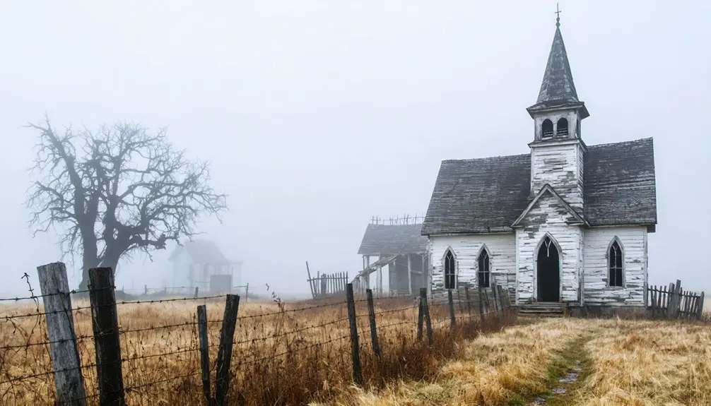
This site is a poignant reminder of ghost towns in Missouri history, where once-thriving communities have faded into memory. Many of these abandoned locations tell stories of hardship and resilience, reflecting the changing landscape of the region. As you explore, you can almost hear the echoes of the past, breathing life into the remnants of what used to be.
These ghost towns of Missouri’s history offer a glimpse into the lives of those who once called them home, their dreams and aspirations vividly captured in the lingering structures. Each broken wall and overgrown path serves as a testament to the relentless march of time, inviting visitors to ponder the stories hidden within. As you wander through these sites, consider the vibrant communities that once flourished, now replaced by whispers of nostalgia and a quiet longing for what was lost.
You’ll find the settlement’s former location nestled within the agricultural heartland, where natural water sources once supported pioneer life and farming activities.
The geographic characteristics that drew early settlers included fertile soil and accessible terrain, though these weren’t enough to sustain long-term settlement dynamics.
Today, while you won’t find active infrastructure, the area’s documented coordinates remain in geographic databases and historic registries.
The surrounding region features a network of rural roads connecting to surviving communities, while Hopewell itself has returned to its agricultural roots.
The ghost town’s location tells a story of changing rural landscapes and the ebb and flow of frontier settlement patterns.
Like many locations bearing the name Hopewell across America, this Missouri settlement’s geographic placement made it one of numerous similarly-named pioneer communities.
As a basic geographic entity, Hopewell’s existence is preserved in structured databases that help researchers track historical settlements.
Early Community Development
You’ll find Hopewell’s pioneer origins deeply connected to the Mormon settlements that emerged in Daviess County during 1837, when agricultural plots were first distributed among early residents.
The community’s growth followed typical settlement patterns of rural Missouri, with homesteads spreading outward from a central cluster of buildings and communal spaces. Like many of Missouri’s ghost towns today, Hopewell once featured thriving homes, businesses, and community gathering places.
Local transportation initially consisted of dirt trails connecting to neighboring communities and the Grand River, which served as an essential waterway for early commerce and travel.
Pioneer Settlement Patterns
As Missouri’s earliest communities took shape, settlement patterns primarily followed the meandering paths of the Mississippi and Missouri Rivers, where French and Spanish colonists established their first strongholds. Early settlers faced significant challenges, including Indian conflicts that required building fortifications for protection.
You’ll find that pioneer demographics shifted dramatically as American settlers from Kentucky and Tennessee joined the existing French-speaking Catholic communities, creating a diverse cultural landscape despite settlement challenges. Merchants and traders prospered as steamboat trade began in 1811, revolutionizing transportation and commerce along the waterways.
- You’d discover most early homesteads clustered near navigable waterways, where Spanish land grants of 136-204 acres attracted settlers looking for prime farming opportunities.
- Your ancestors might’ve received additional land based on family size and number of enslaved persons, up to 800 arpents.
- You’d notice how religious tolerance shaped community development, as Catholic and Protestant settlers learned to coexist while building new lives along Missouri’s riverbanks.
Agricultural Land Distribution
While early settlers in Hopewell sought prime farmland during the 1830s, the agricultural landscape quickly evolved into a diverse patchwork of holdings, ranging from small 10-acre plots to expansive 328-acre farms.
You’d have found early land ownership concentrated among Virginians, Kentuckians, and Tennesseans who favored timbered areas over plains for their homesteads.
The region’s farming techniques adapted to the local terrain, with cropland dominating at 229,000 acres.
You’ll notice how settlers strategically positioned their farms near water sources and mills, essential for grain processing.
Today’s farmers continue this legacy of agricultural innovation, with 22% practicing no-till farming and 11% using reduced tillage methods.
The mix of cropland, pasture, and woodland reflects the community’s enduring commitment to diverse agricultural practices.
Early Transportation Networks
During the early 1800s, settlers in Hopewell relied on a network of primitive trails and dirt roads that connected their isolated community to indispensable trading posts and neighboring settlements. Steamboat transportation arrived in Missouri by 1817, though Hopewell’s inland location meant continued reliance on overland routes.
You’d find these early transport routes shaped local settlement patterns, as pioneers established homesteads near accessible pathways.
- You could travel by foot, horseback, or wagon along routes like Boone’s Lick Trail, which provided essential links to St. Charles and Howard County.
- Your freight wagons would’ve hauled supplies between scattered farms and distant mills in Richmond or Liberty.
- You’d need to navigate these challenging roads for indispensable community activities, from attending church to trading agricultural goods.
These transportation networks proved critical in knitting together Hopewell’s early social and economic fabric, though travel remained slow and difficult until railroad development. Today, many of these historical transportation records have been digitally preserved through specialized collection management systems.
Religious and Cultural Impact

The Hopewell Baptist Church emerged as a groundbreaking religious institution that served both enslaved and free African Americans, establishing itself as the community’s cultural cornerstone. Under white minister James Ely Welch’s initial leadership, followed by Rev. Isam Morton‘s forty-year tenure as African American pastor, the church fostered remarkable cultural resilience among its congregation. Their practices reflected elements of the broader Native American trade networks that historically connected communities from the Great Lakes to the Southeast.
You’ll find the church’s influence extended far beyond spiritual matters. With support from Edward Bates, who donated land and later freed his enslaved workers, the church complex included a schoolhouse and cemetery.
Located along Boone’s Lick Road, it became a crucial hub for religious services, education, and community gatherings. Members participated in significant religious ceremonies, including baptisms in the Dardenne stream, while the church’s connection to the St. Louis Baptist Association strengthened regional religious ties.
Agricultural Life and Local Economy
You’ll find that early Hopewell farmers relied heavily on traditional farming methods and animal-powered equipment, much like their counterparts across Daviess County who used horse mills for grain processing.
When local mills were scarce in the early 1800s, farmers had to travel considerable distances to neighboring counties to process their grain harvests.
The establishment of water-powered and horse-operated mills in the region, including the Lyons brothers’ mill in 1833, transformed Hopewell’s agricultural economy by reducing travel time and creating a local market hub.
Early Farming Practices
Early settlers in Hopewell faced significant agricultural challenges as they established their first farms in the 1830s.
You’d find these pioneers implementing crop rotation and livestock management techniques they’d brought from Kentucky, Tennessee, and Virginia, adapting them to Missouri’s unique environment.
To maintain a successful farm in Hopewell, you needed to:
- Clear timber for farmland while balancing resource needs
- Practice mixed farming with both crops and livestock for sustainability
- Travel long distances to mill your grain until local facilities were established
Your survival depended on raising diverse livestock including cattle, hogs, and sheep, which provided both food and vital manure for fertilizing fields.
Working with draft animals, you’d plow the soil and plant staple crops like corn and wheat, both for your family’s needs and potential trade.
Trading and Market Access
While primitive trade initially centered around Millport’s horse-powered mill in the 1830s, Hopewell’s market access transformed dramatically with the arrival of the Rock Island Railroad in 1871.
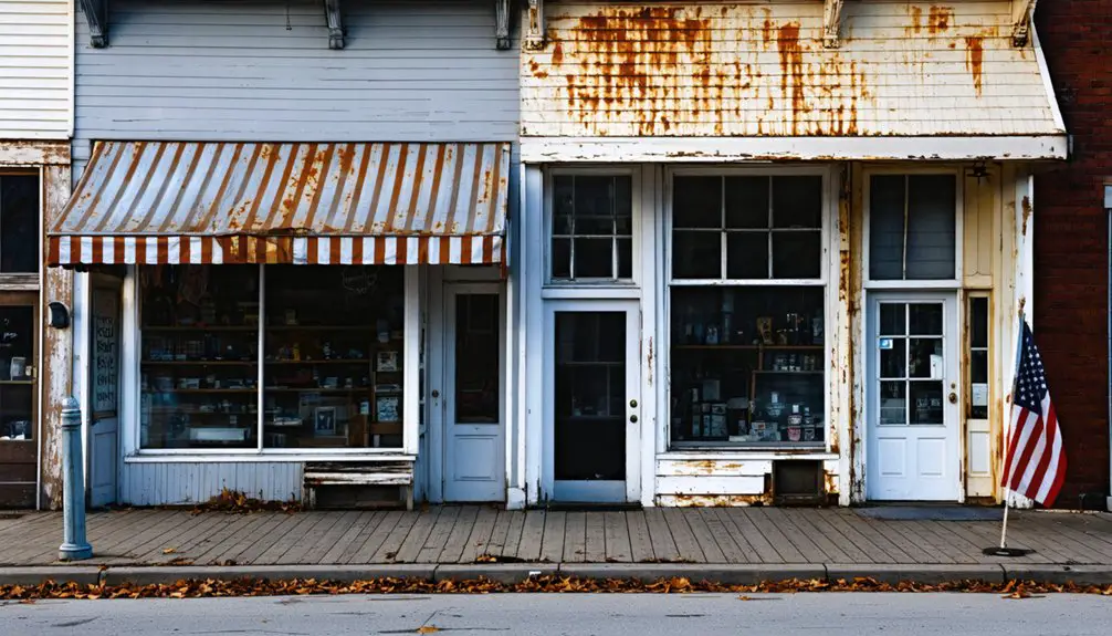
You’d find bustling trading hubs emerging as Hopewell established essential businesses – groceries, hardware stores, and blacksmith shops that served local farmers’ needs.
The town’s market fluctuations reflected broader regional turmoil. Earlier, the Mormon War’s destruction of Millport and other trading centers had disrupted established commerce patterns.
But Hopewell adapted, with the Jameson House hotel accommodating merchants and travelers, while livery stables supported the transport of agricultural goods.
The railroad’s arrival proved vital, finally connecting you to broader markets beyond Missouri’s borders, making it easier to sell your crops and acquire necessary farming supplies.
Mormon Settlement Influence
Mormon settlement patterns dramatically shaped northwest Missouri’s development in the mid-1830s, particularly after the creation of Caldwell County in 1836. The wave of Mormon migration transformed local landscapes as settlers expanded from Far West into surrounding areas, including parts of Daviess County.
- You’ll find evidence of Mormon community architecture in the planned layouts of settlements, which reflected their organized approach to town development.
- You’ll see how they converted thousands of acres of federal land into productive farmland, fundamentally changing the region’s agricultural character.
- You’ll discover how their presence sparked infrastructure growth and new governance structures, though tensions with non-Mormon neighbors ultimately led to conflict.
These settlement influences came to an abrupt end with the 1838 Mormon War and subsequent forced exodus from Missouri.
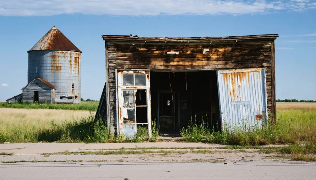
Decline and Abandonment
Once thriving with local industry and farming, Hopewell fell into steep decline during the late 19th century as economic factors and transportation changes reshaped the region.
When new roads and railways bypassed the settlement, local businesses lost their customer base, triggering a downward spiral. The lack of economic diversification left the community vulnerable to these changes.
Population dynamics shifted dramatically as younger residents moved to urban areas seeking better opportunities. Family networks dispersed, and school enrollment dropped, accelerating the town’s decline.
Without a formal local government structure as an unincorporated community, Hopewell couldn’t enact preservation measures. Environmental challenges and changes in land ownership further weakened community bonds.
The settlement’s ultimate abandonment led to its official designation as a “former populated place” in Daviess County.
Historical Records and Preservation
Despite Hopewell’s physical decline, the town’s legacy endures through various historical records and documentation efforts. You’ll find references to this forgotten settlement in the United States Geological Survey’s Geographic Names Information System and the State Historical Society of Missouri’s archives.
The town’s historical significance is preserved through:
- County surveys dating back to 1838, which include early maps of the Daviess County region
- Collections maintained by the Daviess County Historical Society, featuring stories and archival data about early settlements
- Digital preservation projects that have made historical maps and manuscripts more accessible
While archival accessibility remains limited, you can explore Hopewell’s past through state archives, local historical society collections, and genealogical research platforms.
The town’s story continues to be woven into broader narratives of Missouri’s ghost towns and 19th-century settlement patterns.
Frequently Asked Questions
What Was the Population of Hopewell at Its Peak?
Like a whisper lost to time, you won’t find concrete population numbers for Hopewell’s peak. Ghost town demographics suggest it likely held dozens to low hundreds before declining into history.
Were There Any Notable Crimes or Incidents in Hopewell’s History?
You won’t find much criminal activity recorded in the area, though there’s the unsolved 1887 murder of John Gagan in northern Daviess County that stands as the region’s most notable documented crime.
Did Any Famous Pioneers or Historical Figures Visit Hopewell?
While millions passed through Missouri’s frontier, you won’t find records of famous pioneers visiting Hopewell specifically. The area’s historical significance mainly comes from nearby Mormon settlements and Joseph Smith’s regional activities.
What Natural Disasters Affected the Hopewell Community?
While you’d expect flood damage and tornado destruction in Missouri’s tornado alley, there’s no specific record of major natural disasters directly impacting Hopewell, though regional storms likely affected the community.
What Businesses or Industries Operated in Hopewell Besides Agriculture?
You’d find small merchants, local masons, and traveling amusement shows, but no mining operations or textile manufacturing. The Cole Brothers Amusement Company and general stores served the community’s basic needs.
References
- https://upload.wikimedia.org/wikipedia/commons/7/77/History_of_Daviess_and_Gentry_counties
- https://archive.org/stream/historyofdaviess00leop/historyofdaviess00leop_djvu.txt
- https://collections.shsmo.org/manuscripts/columbia/C2366/daviess-county
- https://www.henry.mogenweb.org/Cemeteries/1072.html
- http://genealogytrails.com/mo/daviess/hist_ministers.html
- https://archive.dev-bookofmormoncentral.org/sites/default/files/archive-files/pdf/jenson/2022-07-26/hr_8.1_daviess_county_missouri_january_1889_724-732.pdf
- https://sites.rootsweb.com/~mocaldwe/history2.htm
- http://genealogytrails.com/mo/worth/county-history.htm
- https://en.wikipedia.org/wiki/Hopewell
- https://en.wikipedia.org/wiki/List_of_ghost_towns_in_Missouri