You’ll find estimates ranging from 32 to over 100 ghost towns in Alaska, though the true count remains elusive due to inconsistent classification standards and documentation gaps. The variation depends on whether you’re counting only sites with standing structures or including submerged settlements, abandoned military bases, and Native villages lost to incomplete census records from the 1880s through post-World War II periods. Alaska’s vast 665,000-square-mile territory conceals numerous undocumented communities beneath wilderness and water, making exhaustive cataloging nearly impossible. The stories behind these abandoned settlements reveal much about Alaska’s turbulent history.
Key Takeaways
- Alaska has between 32 and over 100 ghost towns, depending on classification standards and whether sites include standing structures or barren locations.
- National indices document over 50,000 U.S. ghost town sites, with scattered Alaskan locations included but often undercounted due to remoteness.
- Documentation gaps from missing census records, inconsistent categories, and limited historical mapping lead to incomplete counts across Alaska’s vast territory.
- Ghost towns emerged from mining, fishing, canneries, railroads, and military operations, with many abandoned after economic boom-and-bust cycles ended.
- Natural disasters like the 1964 earthquake, 1918 influenza pandemic, and volcanic eruptions destroyed or permanently relocated numerous Alaskan settlements.
Counting Alaska’s Abandoned Settlements: The Numbers Behind the Mystery
Because Alaska’s remote geography and boom-and-bust settlement patterns complicate documentation efforts, estimates of the state’s ghost towns vary dramatically across sources. You’ll find national rankings listing just 32 abandoned communities, while Alaska’s labor statistics confirm over 100 sites—ranging from small encampments to towns that once housed thousands.
This discrepancy reflects different classification standards for urban development and population decline. Some tallies count only complete abandonments with standing structures, while state records include barren sites destroyed or reclaimed by wilderness.
The broader national ghost town index documents over 50,000 faded U.S. sites, with Alaska’s contributions scattered among mining camps, cannery operations, and military installations. Many of these settlements were strategically positioned along railway routes, connecting vital economic corridors between locations like Seward and Fairbanks during the early 20th century. Among these abandoned settlements, Kennecott copper mining town stands as one of the most well-preserved examples, having been abandoned in the late 1930s after its mining operations ceased. Each methodology reveals different aspects of Alaska’s settlement history, where isolation and economic volatility repeatedly transformed thriving communities into empty ruins.
Why Alaska Has So Many Deserted Communities
Alaska’s abundance of ghost towns stems from three interconnected forces that repeatedly displaced communities throughout the territory’s modern history.
You’ll find that boom-and-bust economic cycles—particularly in mining and fishing—created settlements that thrived briefly before collapsing when resources depleted or markets shifted. Kennicott extracted over $200 million in copper before its decline, exemplifying how even the most prosperous mining operations eventually exhausted their resources.
Natural disasters and Alaska’s extreme remoteness compounded these vulnerabilities, making it economically unfeasible to rebuild communities after earthquakes, floods, or epidemics struck areas already struggling with isolation from supply networks and transportation infrastructure.
Government-forced relocations, including the internment of Attu villagers during World War II, added another layer of disruption that permanently emptied entire communities.
Boom-and-Bust Economic Cycles
Remote Alaskan settlements rose and fell with stunning speed as extractive industries exhausted local resources between the 1880s and mid-20th century. You’ll find copper mining drove Kennecott’s 30-year prosperity until ore depletion forced abandonment by 1938, while gold operations similarly emptied Chatanika near Fairbanks.
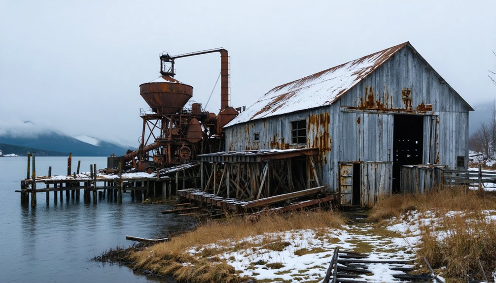
Salmon canneries created temporary population spikes—Portlock housed 58 residents in the 1930s before collapsing to zero by 1949 when processing operations failed.
Railroad stops like Curry dropped from 183 inhabitants to complete desertion after fires and economic decline.
This boom-bust pattern disrupted Indigenous history as cash economies from outsiders accelerated relocations from traditional seasonal camps. Military installations followed similar trajectories, with Adak Island’s Naval Base transforming from a strategic Cold War outpost to an abandoned facility supporting just 177 residents today. Over 100 abandoned communities mark Alaska’s landscape, evidence of resource exhaustion cycles that demanded constant climate adaptation and migration toward stable trading centers offering schools and year-round employment.
Natural Disasters Force Relocation
Catastrophic natural events decimated Alaska’s settlements with particular brutality during the territory’s early development period. The 1912 Mount Katmai eruption obliterated its namesake town, while the 1898 Palm Sunday Avalanche killed 70 in Dyea, triggering permanent abandonment. The 1964 earthquake’s tsunami forced Afognak’s complete relocation.
Today’s climate migration patterns mirror historical displacement, with over 200 villages facing flooding and erosion threats. Shishmaref loses 3-5 feet of shoreline annually—up to 50 feet during severe storms.
Thawing permafrost and vanishing sea ice accelerate destruction, leaving 31 communities requiring immediate relocation. Newtok, Kivalina, and Shishmaref exemplify modern disaster resilience failures, where 87% of rural settlements face environmental displacement. The warming in Alaska occurs at over twice the global average, intensifying these environmental threats and accelerating community displacement. Since 1980, Alaska has experienced 92 disaster declarations, with fires and severe storms representing the majority of these catastrophic events.
You’ll find Alaska’s ghost towns aren’t merely economic casualties—they’re nature’s uncompromising erasure of human permanence.
Remote Location Challenges
Geographic isolation proved the silent executioner of dozens of Alaskan settlements where economic promise couldn’t overcome accessibility barriers.
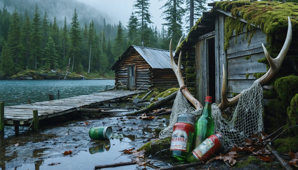
You’ll find Portlock buried deep in southern Alaska’s rugged wilderness, reachable only through challenging routes that ultimately strangled its fishing economy.
McCarthy’s unpaved road and bush plane requirements exemplified year-round worker isolation that accelerated urban decay.
Tin City demanded flights to Wales village followed by treacherous overland journeys across windswept capes—logistics that killed mining prospects before they started.
Environmental hazards compounded these challenges: Makushin sits near an active volcano, while Dome City requires hiking through grizzly country.
Even Ukivok’s cliffside King Island location offered no practical overland access.
When single cable baskets became your only river crossing, community sustainability became impossible regardless of resource wealth.
Portlock’s dependence on boat or floatplane access meant the cannery town on the Kenai Peninsula’s southern tip could never establish the reliable supply lines necessary for long-term survival.
Unga’s remoteness required boat or floatplane travel from the mainland, constraining the fishing hub’s ability to maintain populations after cod processing declined.
Natural Disasters That Emptied Entire Towns
You’ll find that Alaska’s ghost towns often trace their origins to catastrophic events that struck without warning. The March 27, 1964 earthquake—the second largest ever recorded—devastated Portage when the ground sank 6-10 feet below the high water mark during 4 minutes and 38 seconds of shaking. This rendered the entire settlement irretrievable beneath floodwaters. The 1792 earthquake and tidal wave that struck Three Saints Bay on Kodiak Island destroyed Russia’s first American colony, forcing residents to relocate to Kodiak.
Earlier, the 1918 influenza epidemic proved equally destructive, wiping out York‘s entire population so completely that the village never reappeared in subsequent census records.
The 1964 Earthquake Impact
The March 27, 1964 earthquake, registering 9.2 on the Richter scale, fundamentally altered Alaska’s coastal geography and displaced entire communities through a combination of ground subsidence and subsequent tidal flooding.
Portage sank six feet below high tide, forcing complete evacuation as saltwater repeatedly inundated the town. Girdwood’s bedrock dropped nine feet, submerging ancient settlement patterns beneath mudflats. Archaeological site preservation became impossible in Afognak Village after 3.5-5.5 feet of subsidence brought relentless tidal action.
Chenega lost 23 of 75 residents when tsunamis destroyed the Prince William Sound community. Kodiak Island experienced catastrophic impacts: 5.6 feet of subsidence combined with ten seismic waves demolished 215 structures, causing $45 million in damages.
You’ll find ghost forests marking these abandoned sites—saltwater-killed trees standing as natural monuments to communities that couldn’t resist the ocean’s advance.
1918 Influenza Epidemic Devastation
When the S.S. Victoria docked in Nome during October 1918, it delivered more than mail—it brought death. The influenza history of Alaska reveals catastrophic pandemic effects that erased entire communities from the map.
You’ll find York completely wiped out, every resident perished. Brevig Mission lost 72 of 80 people. Eight Dena’ina villages disappeared between 1880-1920, while Kalifornsky’s 16 unmarked graves mark its abandonment.
The virus claimed up to 3,000 Alaskans, including 8% of the Native population. Dog sleds and missionaries inadvertently spread the contagion inland along river routes.
Some communities survived through armed quarantines—Shishmaref posted guards eight miles out. Remote islands escaped through isolation.
Today, you’ll discover these ghost towns stand as silent testimony to nature’s devastating power over human settlements.
Economic Boom and Bust: Mining’s Legacy of Abandonment
Alaska’s mining frontier created explosive population surges followed by equally dramatic abandonments, establishing a boom-and-bust pattern that left dozens of ghost towns scattered across the territory. You’ll find Hyder’s silver lode discovery swelled its population beyond 250, yet mining decline eliminated most operations by 1929.
The Riverside Mine extracted significant precious metals before economic cycles forced closure. Chicken demonstrates this pattern differently—founded in the late 1800s with 400 residents, it now shelters just six winter inhabitants.
Sulzer on Prince of Wales Island exemplifies complete abandonment when copper mining economics collapsed. These communities weren’t destroyed by disaster but by market forces and ore depletion.
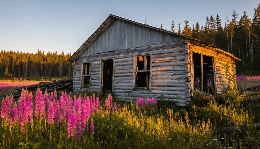
Freedom-seeking prospectors built thriving settlements that couldn’t sustain themselves once the valuable minerals ran out, leaving skeletal remains throughout Alaska’s wilderness.
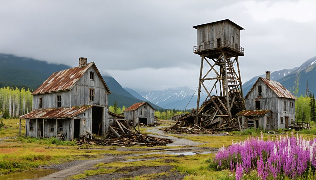
Kennicott: Alaska’s Most Famous Ghost Town
You’ll find Kennicott stands as Alaska’s most documented ghost town. Its copper mining operations between 1911 and 1938 produced ore valued at $32.4 million during the 1916 peak year.
The corporation’s abrupt departure left an intact company town frozen in time—fourteen-story mill building, powerhouse, dormitories, and hospital—which earned National Historic Landmark designation in 1986.
Since the Park Service acquired the site in 1998, you can visit these preserved structures within Wrangell-St. Elias National Park.
Ongoing stabilization efforts maintain this exceptional example of early twentieth-century industrial mining architecture.
Copper Mining Boom Era
Deep in the Wrangell-St. Elias wilderness, you’ll find evidence of one of America’s richest mineral strikes. When prospectors discovered 70% pure copper chalcocite in 1900, they’d stumbled upon what would become the world’s most valuable copper deposit within two decades.
The Kennicott Copper Corporation transformed this remote glacier into an industrial powerhouse between 1911-1938. You’re looking at cultural heritage that generated nearly $200 million in copper ore—a fortune that required building a 196-mile railroad through unforgiving terrain.
The company town housed 300 mill workers processing 600,000 tons of high-grade copper, while ancient artifacts of this boom era still stand: a 14-story mill, hospital, and recreation facilities. By 1938, when copper prices collapsed, they’d extracted everything worth taking, leaving behind Alaska’s most significant mining ghost town.
Tourist Destination Since 1970s
For three decades after 1938, Kennicott stood silent—its 14-story mill, hospital, and workers’ quarters slowly weathering in the Alaskan wilderness.
The Trans-Alaska pipeline era of the 1970s changed everything.
You’ll find the town transformed from forgotten relic into Alaska’s premier ghost town destination, drawing wanderers who explore its faded red buildings and former red-light district.
Federal recognition secured its cultural heritage:
- Wrangell-St. Elias National Park incorporation (1980)
- National Historic Landmark designation (1986)
- National Park Service structural stabilization programs
- Protected access via Edgerton Highway (Route 10)
You can walk silent streets past the concentration mill on Bonanza Ridge, where environmental impact remains minimal despite decades of copper extraction.
Chitina’s population rebounded to 105 residents, supporting visitors seeking authentic encounters with Alaska’s richest mining history.
Historic Structures and Preservation
Since its 1986 National Historic Landmark designation, Kennicott’s 7,700-acre district has preserved the world’s finest example of early 20th-century copper mining operations.
You’ll find the iconic 14-story concentration mill dominating the landscape above Kennicott Glacier, standing exactly as workers left it in 1938.
The National Park Service’s “arrested decay” philosophy maintains historic architecture authentically while preventing collapse—you’re free to explore buildings frozen in time without excessive restoration.
Preservation challenges intensify in this remote wilderness.
The NPS acquired key structures in 1998, implementing selective vegetation thinning to reduce wildfire risks and stabilizing red-and-white painted wooden buildings constructed between 1907-1925.
Original equipment remains in situ throughout the ammonia leaching plant, machine shop, and powerhouse.
You can access these industrial ruins through guided tours that interpret Alaska’s mining heritage within its unforgiving environmental context.
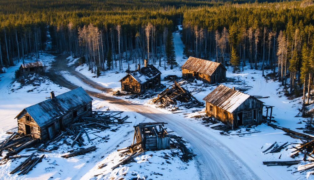
Remote and Forgotten: Towns Along the Yukon River
The Yukon River‘s thousand-mile course through Alaska’s interior reveals a scattered geography of abandonment, where settlements like Paradises and Purgatorys now exist only as deserted coordinates along the waterway. These abandoned river towns document the transient nature of frontier life, where military outposts, mining camps, and indigenous villages succumbed to economic collapse and environmental forces.
Key Yukon River sites include:
- Fort Egbert – Remote military installation from gold rush era at Eagle
- White Eye – Empty village site in Yukon Flats
- Old Bettles – Original community location in Yukon-Koyukuk Census Area
- Sulatna Crossing – Settlement dating to 1923 on Sulatna River’s north side
Flooding and erosion devastated communities like Old Minto, forcing relocations.
You’ll find conservative estimates exceed 100 such settlements statewide, their stamped-metal ceilings and log frameworks slowly returning to wilderness.
Cold War Relics: Military Bases Turned Ghost Towns
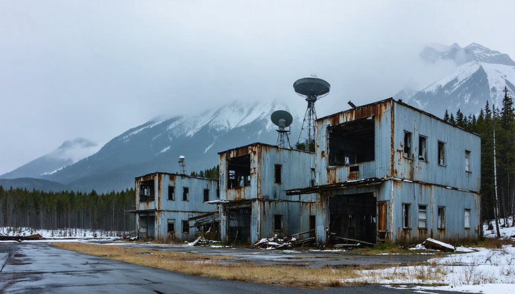
Abandoned bunkers tell the darkest story. Adak’s “Seven Doors of Doom” once secured nuclear warheads behind watchtowers and gun placements. After 1997’s withdrawal, these installations became genuine ghost towns.
Today, fewer than 300 residents occupy spaces built for thousands. They are surrounded by mold-infected structures reclaimed by Alaska’s unforgiving elements.
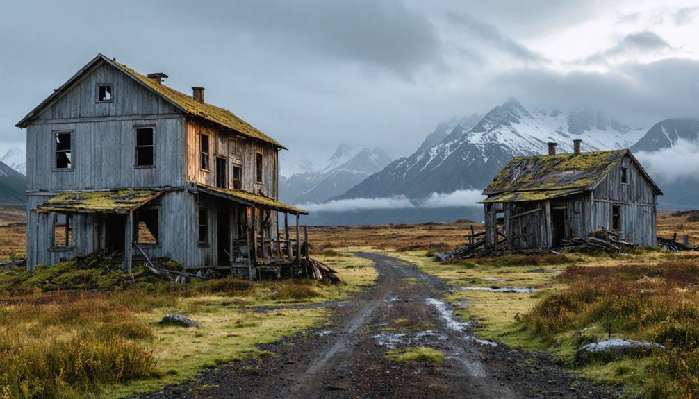
Where to Find Ghost Towns Across Alaska’s Vast Territory
Across Alaska’s 665,384 square miles, at least 100 documented ghost towns scatter from the Southeast panhandle to the remote Aleutian Islands, though Beth Mikow’s 2010 University of Alaska Fairbanks master’s thesis acknowledges this represents a conservative count.
You’ll discover abandoned infrastructure concentrated in four primary regions:
- Southeast Alaska: Mining operations like Treadwell (1883-1917) and Kennicott (1903-1938) near major waterways.
- Seward Peninsula: Gold rush settlements including York and Pilgrim Hot Springs in Nome Census Area.
- Aleutian Islands: Remote sites like Unga (established 1833, abandoned 1969) on isolated island chains.
- Interior Alaska wilderness: Settlements such as White Eye in Yukon Flats and relocated villages like Old Minto.
Documentation gaps from the 1880 U.S. Census suggest additional undiscovered sites remain throughout Alaska’s vast territory.
The Challenge of Documenting Alaska’s Lost Settlements
Pinpointing Alaska’s ghost towns proves far more difficult than locating them on a map. Official documentation from Alaska’s territorial era suffers from inconsistent categories, missing entries, and indecipherable codes that leave critical gaps in settlement histories. Federal records can’t account for towns that vanished after the Klondike Gold Rush or explain why Portlock’s 1949 abandonment involves conflicting narratives—one recorded death versus widespread desertion rumors.
You’ll find census data simply stops for abandoned communities without explanation.
Oral histories fill these voids when government sources fail. Family accounts and local lore preserve stories of places like Curry, razed after 1950s railroad decisions, though details vary wildly between sources. YouTube documentaries now supplement scarce records with firsthand testimonies.
Remote locations and complex Native corporation land claims further obstruct comprehensive documentation efforts across Alaska’s 100-plus deserted sites.
Visiting Alaska’s Ghost Towns: Tourism and Preservation Efforts
Several dozen of Alaska’s ghost towns now function as tourist destinations, though preservation efforts vary dramatically between federally managed sites and isolated ruins left to natural reclamation. You’ll find sophisticated cultural preservation at Kennicott, where National Park Service reconstruction enables self-guided tours through mill buildings (nps.gov, 907-554-1105).
Community revitalization manifests differently across regions:
- Kennicott: Active reconstruction since 1970s maintains structural integrity
- Dyea: Natural reclamation prevails, with Chilkoot Trail access from Skagway
- Treadwell: Accessible ruins near Juneau blend 1883-1917 gold mining history with urban proximity
- Portage: 1964 earthquake remnants serve seismic education near Whittier
You can explore Ukivok’s clifftop Inupiat village independently, though remote Nome Census Area access demands self-reliance. Each site reflects distinct preservation philosophies balancing historical authenticity against visitor accessibility.
Frequently Asked Questions
Are There Any Ghost Towns in Alaska That Are Still Legally Inhabited?
No legally inhabited ghost towns exist in Alaska—by definition, they’re abandoned. However, you’ll find sites like Kennecott operate as tourist attractions under historical preservation, offering guided experiences without permanent residents, maintaining their authentic ghost town status while welcoming visitors.
What Happens to Property Ownership When an Alaskan Town Becomes Abandoned?
Property ownership reverts to the state after abandonment periods expire, though historical preservation efforts and adverse possession laws protect your property rights. You’ll find Alaska’s framework balances individual liberty with managing unclaimed assets through documented legal processes.
Can You Camp Overnight in Alaska’s Ghost Towns Legally?
You can’t legally camp overnight in most Alaska ghost towns due to historic preservation regulations and wildlife encounters risks. Federal and state authorities restrict access to protect archaeological sites, though some dispersed camping exists on certain BLM lands.
Which Alaska Ghost Town Disappeared Most Recently?
Want to witness urban decay’s latest chapter? You’ll find Unga as Alaska’s most recently abandoned ghost town, evacuated in 1969. Historical preservation efforts there remain minimal, leaving you free to explore this Aleutian settlement’s authentic ruins.
Are Any of Alaska’s Ghost Towns Considered Dangerous to Visit?
Yes, you’ll find dangerous conditions at several Alaskan ghost towns. Despite haunted legends attracting ghost town tours, archival sources document structural collapses, earthquake damage, and restricted military sites. You’re risking injury exploring these deteriorating, isolated locations without proper precautions.
References
- https://www.loveexploring.com/gallerylist/188219/the-us-state-with-the-most-ghost-towns-revealed
- https://live.laborstats.alaska.gov/sites/default/files/trends/may24art2_0.pdf
- https://www.youtube.com/watch?v=xaNERTG53Oo
- https://getlostinamerica.com/alaska-ghost-towns/
- https://www.gi.alaska.edu/alaska-science-forum/ghost-towns-scattered-across-alaska-map
- https://www.youtube.com/watch?v=ONXvpPaTLXw
- https://en.wikipedia.org/wiki/List_of_ghost_towns_in_Alaska
- https://www.geotab.com/ghost-towns/
- https://freepages.history.rootsweb.com/~gtusa/usa.htm
- https://www.atlasobscura.com/places/kennicott-ghost-town