You’ll find between 1 and 8 ghost towns in Rhode Island, depending on how strictly you define “abandoned”—Geotab’s analysis identifies just one, while Close-to-Me catalogs eight sites including Hanton City and Rocky Point. This makes Rhode Island the state with America’s fewest ghost towns, a distinction reflecting its compact geography and continuous settlement rather than demographic failure. Classification hinges on whether you’re counting fully deserted locations or including semi-inhabited ruins with stone foundations and deteriorating structures that tell deeper stories about the Ocean State’s forgotten communities.
Key Takeaways
- Rhode Island has only 1 officially recognized ghost town according to Geotab’s analysis, the fewest of any U.S. state.
- Other sources identify 3 to 8 ghost sites depending on classification criteria, including semi-inhabited ruins and industrial sites.
- Hanton City is the most documented ghost town, fully abandoned since 1900 with visible stone foundations and cellar holes.
- Variability stems from differing definitions: some require full abandonment while others include depopulated or partially inhabited locations.
- Notable sites include Fort Wetherill, Rocky Point amusement park, Valley Falls Mill, and hurricane-damaged coastal military fortifications.
The Official Count: Sources Disagree on Rhode Island’s Ghost Town Numbers
When attempting to determine Rhode Island’s ghost town count, researchers encounter significant discrepancies across authoritative sources. Geotab’s 2018-2021 analysis documents just one ghost town, positioning Rhode Island among states with minimal abandonment.
Conversely, Close-to-Me identifies eight distinct sites, including Hanton City’s stone foundations and Rocky Point’s defunct amusement park. Wikipedia’s incomplete enumeration lists three locations, while RootsWeb catalogs numerous abandoned mills, taverns, and colonial settlements across Washington, Kent, and Providence counties.
These variations stem from definitional disputes: strict abandonment versus semi-inhabited ruins or operational sites with historical significance. Ghost towns are often linked to resource booms, transportation, and population shifts that left communities empty. Nationally, an estimated 50,000 ghost towns exist across the USA, making Rhode Island’s count relatively modest by comparison. For those seeking tourism potential, this ambiguity matters considerably—preservation efforts depend on official recognition.
Understanding whether Rhode Island contains one documented ghost town or multiple abandoned communities fundamentally shapes accessibility, historical interpretation, and your freedom to explore these remnants of past settlements without regulatory interference.
What Qualifies as a Ghost Town in the Ocean State
You’ll find that Rhode Island’s ghost town classification hinges on three contested criteria: whether a settlement qualifies as truly abandoned (Class C) or merely depopulated (Classes D-E), the sufficiency of archival evidence documenting former economic activity, and the precise population threshold distinguishing permanent abandonment from seasonal occupation.
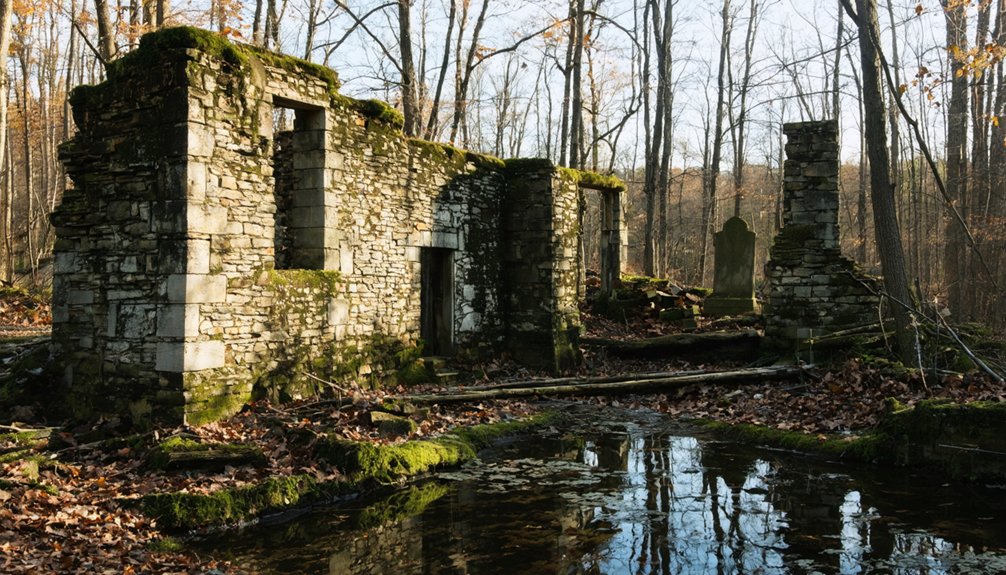
Historical societies typically require stone foundations, cemetery sites, or documented commercial centers as physical proof, yet many alleged Rhode Island ghost towns exist only in oral tradition without cartographic verification. Sites like Hanton City in Smithfield feature remains of stone walls and small cemeteries that provide tangible evidence of former habitation.
The state’s small geographic footprint and continuous settlement patterns since colonial times mean few locations meet the strict “barren site” standard, forcing researchers to accept semi-ghost classifications where partial populations persist alongside abandoned structures. Classification systems must remain continuously revised based on new archaeological findings or historical documentation that emerges from local archives.
Abandonment vs. Near-Ghost Status
Defining what qualifies as a ghost town in Rhode Island requires examining the spectrum between complete abandonment and near-ghost status. You’ll find Hanton City represents full abandonment—rotted buildings consumed by forest, zero residents since 1900.
Western Mining History’s classification accepts “mostly or all abandoned” sites, permitting skeleton populations. This distinction matters when cataloging Rhode Island’s ghost towns, as near-ghost communities like Nooseneck retain minimal populations while their original economic purposes have ceased.
RootsWeb documentation includes colonial-era ferries, mill-sites, and taverns where urban decay progresses despite occasional inhabitation.
You must recognize that preservation challenges intensify when distinguishing between temporarily vacant properties and genuinely abandoned settlements. Visitors can access Hanton City’s remains by walking approximately 3/4 mile into the Hanton City Hiking Trail from the designated starting point at 70 W. Reservoir Rd.
The standard demands tangible remains—foundations, cemeteries, walls—visible to researchers, separating authentic ghost towns from locations completely erased by time. Industrial sites like Ramtail Factory provide additional examples of abandonment contributing to Rhode Island’s ghost town landscape.
Historical Documentation Standards
Rhode Island’s historical documentation standards impose rigorous requirements that separate verifiable ghost towns from speculative folklore.
You’ll find the Rhode Island Historical Preservation and Heritage Commission demands specific eligibility criteria, confirmed above-ground features, and delineated site boundaries before recognizing abandoned settlements. Geographic classification requires tangible remains—stone foundations, cemeteries, or structural remnants—that visitors can physically observe, not merely oral traditions.
These preservation challenges become evident when examining sites like Hanton City, where complete overgrowth obscures colonial-era foundations. Documentation protocols mandate scope-of-work assessments and examination protocols for burial sites, with incomplete forms returned for revision.
This archival rigor explains why RootsWeb estimates up to 50,000 American ghost towns exist, yet Rhode Island’s official Wikipedia list contains merely three verified locations — most remain undocumented, awaiting proper archaeological validation.
Population Decline Thresholds
Unlike Western states where mining booms created clear-cut abandonment scenarios, ghost town classification in Rhode Island operates without fixed population thresholds.
Instead, it relies on economic collapse indicators and physical evidence of desertion. You’ll find sites ranging from completely uninhabited ruins to locations with skeleton populations maintaining part-time residence.
The state’s colonial-era settlements like Hanton City demonstrate total abandonment exceeding a century, while industrial-decline sites may retain occasional occupants. This flexible criterion prevents urban legends from obscuring legitimate documentation, allowing historians to catalog approximately three verified sites officially while identifying dozens more through archival research.
Tourism development interests have incentivized clearer classification standards, though Rhode Island maintains no statutory definition. Your identification depends on visible structural remains, isolation from active communities, and documented economic failure rather than arbitrary population counts.
Hanton City: Rhode Island’s Most Famous Abandoned Settlement
You’ll find Rhode Island’s most documented ghost town in Smithfield’s woods, where Hanton City stood from approximately 1676 until its abandonment in the 1850s.
The settlement began when three English yeoman families—the Paines, Hantons, and Shippees—established homesteads following King Philip’s War, creating a small community of tanners and bootmakers that peaked during the 1730s with stone quarrying and shoemaking operations. Residents worked in the quarries and crafted shoes by hand, which they sold at the Providence marketplace. The settlement’s decline accelerated when mills along rivers began offering wages in the early 1800s, drawing residents away from the isolated community.
Today, the site preserves tangible evidence of this vanished community through stone foundations, cellar holes, deteriorating walls, and a burial ground accessible via the Hanton City Hiking Trail off West Reservoir Road.
Settlement Origins and History
In the aftermath of King Philip’s War, three English yeoman families—the Paines, Hantons, and Shippees—settled what would become Hanton City between 1676 and 1677, likely receiving land grants as compensation for military service. Unlike Native settlements that preceded colonial expansion or coastal communities studied through maritime archaeology, this inland Smithfield location remained deliberately remote from contemporary towns.
The settlement’s rural character manifested through:
- Stone quarries carved into hillsides, providing raw materials for Providence construction
- Tanning yards processing leather alongside crude workshops for bootmaking
- Rutted trading routes connecting Providence to northern settlements
- Scattered homesteads housing poor craftsmen’s families
The Harrington family may have founded the settlement in the late 1600s, potentially providing the etymological basis for the “Hampton” name variation that appears in some historical references. The settlement developed in the 1730s as a community primarily composed of tanners and boot makers who earned their income by selling goods at Providence markets.
Ruins and Remnants Today
Today’s Hanton City exists as a scattered archaeological landscape where stone foundations, crumbling walls, and cellar holes punctuate the forest floor with evidence of its eighteenth-century occupation. You’ll find defunct irrigation dams, exposed wells, and visible cellar steps throughout the heavily wooded terrain, though thick vegetation obscures most remnants unless you’re guided to specific locations.
The Alfred Smith Cemetery integrates into these ruins, marking burial sites among residential remains. Modern preservation efforts remain minimal—you’re encouraged to observe without touching these fragile structures.
While not developed as formal tourist attractions, the site draws hikers via the Hanton City Trail from Smithfield’s reservoir road. Rocky soil, marshy wetlands, and granite outcroppings characterize this terrain, accessible through multiple trail connections including the Vernal Pool Loop.
Documented Ghost Towns and Near-Ghost Towns Across Rhode Island
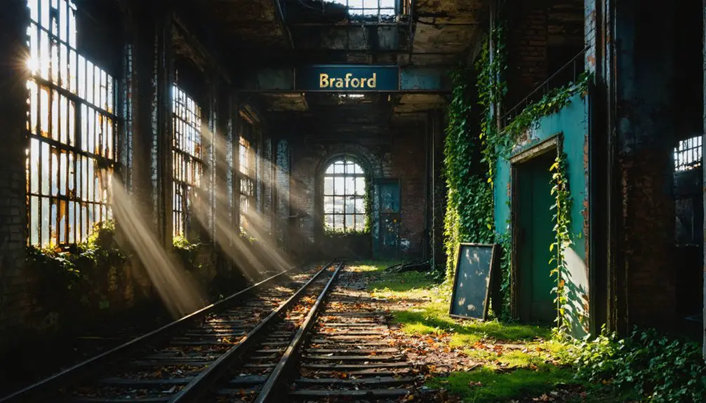
Rhode Island harbors between six and eight documented ghost towns, depending on whether military installations and partially redeveloped sites qualify under strict definitions of complete abandonment. These locations span civilian settlements, military fortifications, and industrial complexes, each exhibiting distinct stages of urban decay and natural reclamation.
Rhode Island’s six to eight ghost towns reveal varied definitions of abandonment across forgotten settlements, military sites, and industrial ruins.
The documented sites include:
- Hanton City – Stone foundations emerge through forest undergrowth where English settlers established homes in the late 1700s, accessible via marked trails from West Reservoir Road.
- Fort Wetherill – Granite walls and concrete bunkers deteriorate along Narragansett Bay’s defensive perimeter. These structures were abandoned after WWII demilitarization.
- Rocky Point – Amusement park structures rust amid partial redevelopment efforts following 1995 closure.
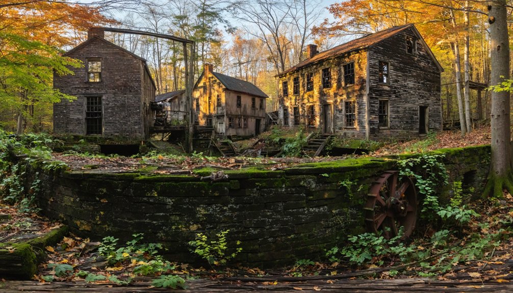
- Valley Falls Mill – Blackstone River textile ruins stand fire-scarred since 1999, brick shells persisting against reclamation.
Exploration demands awareness of structural instability and property boundaries.
Coastal Abandonment: Napatree Point and Fort Mansfield
Among Rhode Island’s coastal ghost sites, Napatree Point presents a unique case where natural disaster rather than economic decline created abandonment.
You’ll find Fort Mansfield’s ruins hidden beneath sea grass on this 1.5-mile peninsula, where 39 summer cottages once lined the dunes.
The 1898 military installation, designed to protect Long Island Sound, suffered a fatal design flaw discovered in 1907—a blind spot rendering its three batteries obsolete.
After decommissioning and 1928 demolition, developers built extensively, but the Great Hurricane of 1938 obliterated everything, killing fifteen residents and severing Sandy Point.
Unlike typical urban decay patterns, this abandonment enabled eco restoration.
Since 1945, the Watch Hill Fire District has preserved the site, where accelerating erosion continues shrinking the coastline 200 feet from its 1928 position.
Colonial Era Sites: Taverns, Mills, and Forgotten Communities
While coastal disasters created Rhode Island’s more dramatic ghost sites, the state’s inland landscape conceals dozens of colonial-era settlements that faded through gradual economic obsolescence rather than catastrophic events. These hidden histories reveal communities built around taverns, mills, and rural crossroads that simply ceased functioning as transportation patterns shifted.
Rhode Island’s forgotten villages didn’t vanish in flames—they simply emptied as commerce moved elsewhere, leaving only stones and silence.
You’ll discover these remnants throughout Providence and Washington Counties:
- White Horse Tavern (1673) in Newport—where revolutionaries gathered in rooms rumored to connect via underground tunnels.
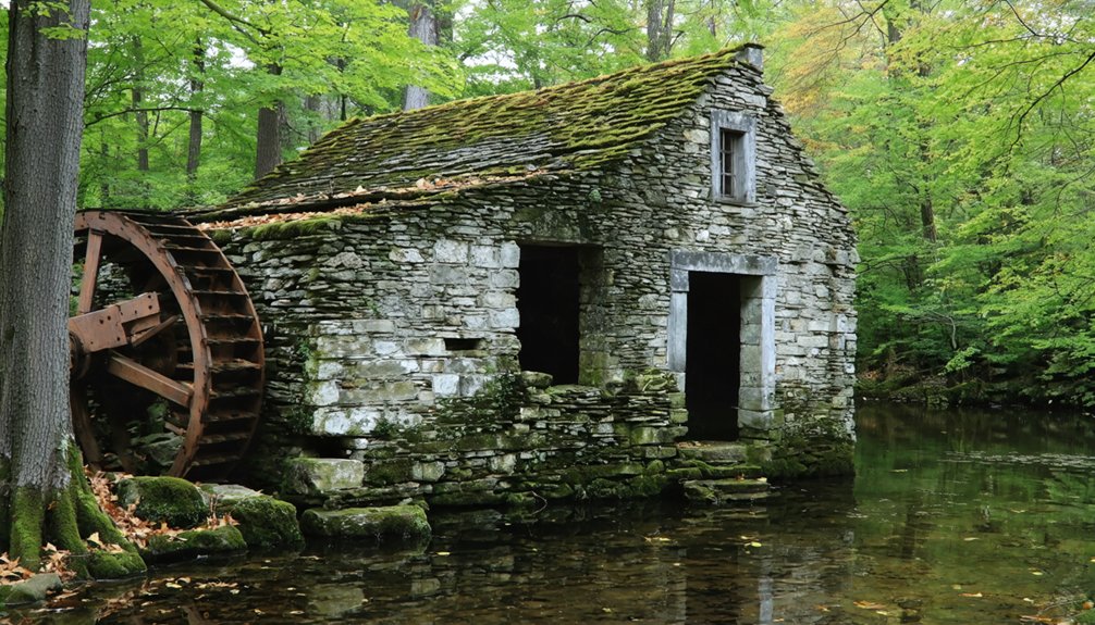
- Kenyon Grist Mill along SH 138, its wheel frozen beside Usquepaugh’s vanished industrial core.
- Hanton City’s stone foundations near Route 116, marking Alfred, Eliza, and Emor Smith’s abandoned settlement.
- Ramtail Factory in Foster, where mill workers’ cottages dissolved into forest.
These sites demonstrate how economic independence vanished when railroad routes bypassed established communities.
How Rhode Island Compares to Other States in Ghost Town Statistics
With just one officially recognized ghost town within its 1,214 square miles, Rhode Island claims the nation’s sparsest concentration of abandoned settlements—a statistical anomaly that reflects both geographic constraints and historical patterns fundamentally different from states shaped by extractive industries.
You’ll find neighboring Connecticut (4), Vermont (5), New Hampshire (8), Massachusetts (11), and New Jersey (11) all surpass Rhode Island’s minimal count.
Western states demonstrate staggering contrasts: Texas leads with 511-558 ghost towns, California follows with 346, Kansas holds 308. These disparities stem from mining booms and oil rushes that never materialized in Rhode Island’s stable manufacturing economy.
While states leverage ghost towns as tourist attractions generating economic impact, Rhode Island’s singular abandoned settlement prevents comparable heritage tourism development, limiting revenue opportunities from America’s 50,000+ documented ghost towns.
Frequently Asked Questions
Can You Legally Visit and Explore Rhode Island’s Ghost Town Sites?
You can legally explore several sites like Hanton City’s maintained trail and Napatree Point’s public waterfront. However, unauthorized exploration of private properties risks trespassing charges. Historic preservation laws protect these locations, requiring you to respect boundaries and artifacts.
What Caused Most Rhode Island Communities to Become Ghost Towns?
Like Hanton City’s last resident departing in 1889, you’ll find economic decline primarily caused Rhode Island’s ghost towns. Historical causes include resource depletion, mill failures, and agricultural downturns across Washington and Providence Counties, mirroring broader New England’s industrial shifts.
Are There Any Remaining Structures or Buildings at These Abandoned Sites?
You’ll find mostly foundations and cellar holes rather than intact buildings. Historic site management hasn’t prioritized abandoned building preservation at these locations, leaving stone remnants, sand-buried debris, and crumbling factory walls as primary evidence of former communities.
Which Rhode Island Ghost Town Is Easiest to Access for Tourists?
“The beaten path leads somewhere worthwhile”—you’ll find Hanton City most accessible, where conservation efforts preserve historical landmarks through maintained trails. You’re free to explore stone foundations, cemetery sites, and dam remnants without permits or restrictions.
Have Any Rhode Island Ghost Towns Been Restored or Preserved?
Rhode Island’s ghost towns haven’t undergone historic preservation; they remain in urban decay as accessible ruins. You’ll find Hanton City’s foundations, Ramtail Factory’s remnants, and Napatree Point’s buried structures left unrestored, offering authentic exploration without governmental interference.
References
- https://blog.batchgeo.com/ghost-towns/
- http://freepages.rootsweb.com/~gtusa/history/usa/ri.htm
- https://en.wikipedia.org/wiki/List_of_ghost_towns_in_Rhode_Island
- https://www.loveexploring.com/gallerylist/188219/the-us-state-with-the-most-ghost-towns-revealed
- https://www.youtube.com/watch?v=kpy7zlXYrAU
- https://www.geotab.com/ghost-towns/
- https://freepages.history.rootsweb.com/~gtusa/usa.htm
- https://www.geotab.com/press-release/american-ghost-towns/
- https://ghost-towns.close-to-me.com/states/rhode-island/
- https://podcasts.apple.com/us/podcast/57-ghost-town-hanton-city/id1554896421?i=1000563483124