You’ll find Randall’s ghost town remains in Helt Township, Vermillion County, at coordinates 39°46′30″N 87°31′21″W. This former postal community operated from 1858 to 1872, named after the influential Randall family who were early settlers. Located along W County Road 700 S at 617 feet elevation, it’s 1.6 miles northwest of extinct Toronto. Today, nature has reclaimed most structures, though agricultural fields and historic cemeteries hold clues to its past significance.
Key Takeaways
- Randall, Indiana became a ghost town after its post office closed in 1872, marking the beginning of the community’s decline.
- Located in Helt Township at 39°46′30″N 87°31′21″W, Randall’s abandoned structures are now surrounded by agricultural fields.
- The town’s economic collapse accelerated during late 20th-century industrial decline, leading to mass exodus of residents.
- Nature has reclaimed many abandoned buildings, while nearby Ross Cemetery and old railroad corridors serve as historical landmarks.
- Environmental restoration efforts have transformed former industrial sites into wetland habitats, attracting native wildlife to the ghost town.
A Lost Postal Town in Vermillion County
The small settlement of Randall, Indiana emerged as a postal community in Helt Township, Vermillion County during the mid-19th century.
You’ll find its roots traced back to the Randall family, who were among the area’s earliest settlers and gave the town its name. Similar to the fate of Baldwin which vanished after its railroad abandonment, Randall’s isolation contributed to its eventual decline.
The town’s post office history began in 1858, serving as an important communication hub for the rural community. For fourteen years, you could’ve found residents gathering at this central location to send and receive mail, connecting them to the wider world.
For fourteen years, Randall’s post office connected rural residents to the outside world, serving as both mail hub and community center.
However, the post office’s closure in 1872 marked a turning point in Randall’s story. Like many small rural communities facing similar challenges, the town gradually declined after losing this essential service. The name “Randall” appears in several places across America, making it a place name disambiguation requiring careful historical research.
Today, you’ll find Randall listed among Indiana’s ghost towns, a reminder of the rural challenges that shaped the region’s development.
The history of Heath, Indiana ghost town reveals the stories of its former residents and the economic struggles that led to its decline. Once a bustling community, it serves as a poignant example of the many towns lost to time in this part of the country. Exploring its remnants offers a glimpse into the past and the resilience of those who once called it home.
The history of Yatton, Iowa ghost town adds another layer to the tapestry of forgotten places that dot the American landscape. Once a thriving settlement, it has now succumbed to the relentless march of time, leaving behind echoes of its vibrant past. Each crumbling structure and overgrown path tells a story of hope and hardship, inviting exploration and reflection on the lives that were once intertwined there.
Mapping Randall’s Geographic Footprint
You’ll find Randall’s precise location in Helt Township at 39°46′30″N 87°31′21″W, situated along W County Road 700 S.
Like many small settlements of its era, Randall was established near a clean water source that sustained its early residents.
The ghost town‘s footprint lies 1.6 miles northwest of the extinct town of Toronto and maintains an elevation of 617 feet above sea level.
Today’s landmarks near the former settlement include agricultural fields and scattered farmland, with the nearest active community being the town of Dana to the northeast.
Township Grid Location
Located in western Indiana’s Vermillion County, Randall’s precise geographic footprint falls within Helt Township at coordinates 39°46′30″N, 87°31′21″W.
You’ll find this ghost town positioned 1.6 miles northwest of the extinct town of Toronto, along W County Road 700 S, at an elevation of 617 feet above sea level.
The township boundaries and land survey records place Randall within the Public Land Survey System (PLSS), which you can reference through:
- County plat books showing section and quarter-section subdivisions
- USGS topographic maps displaying the sparse development patterns
- Historical land allocation documents detailing property descriptions
- Township grid maps identifying Helt Township’s square boundaries
This systematic grid layout continues to serve as the foundation for modern mapping and geographic referencing of the former townsite.
Surrounding Landmarks Today
While exploring Randall’s geographic footprint today, you’ll find the ghost town surrounded by a mix of agricultural fields and remnants of its industrial past.
You can trace the area’s cultural heritage through nearby cemeteries and churches that still stand as historical landmarks connecting present-day visitors to former generations.
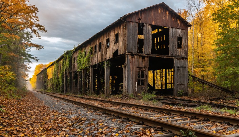
Old railroad corridors and defunct coal mining operations dot the landscape, offering glimpses into the region’s industrial roots.
Ross Cemetery features prominently in local folklore, drawing curious visitors to the area. The cemetery gained additional notoriety from the mysterious tale of a hitchhiking woman who vanished after asking to be driven there.
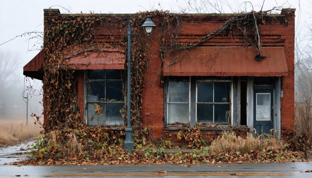
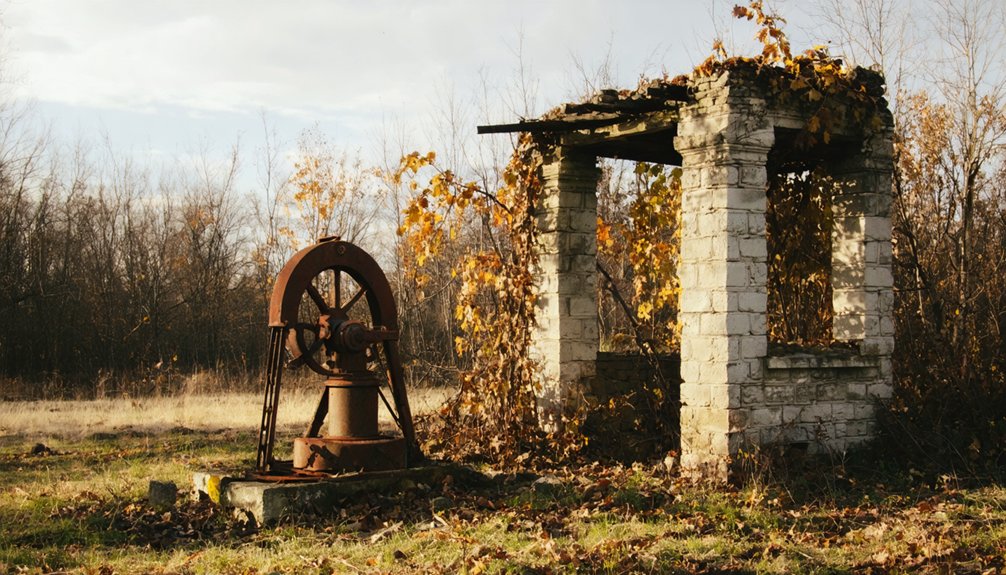
Nature has slowly taken over abandoned structures, with deteriorating buildings being gradually reclaimed by vegetation and wildlife.
Though major highways like State Road 63 and US Route 36 now bypass the settlement, you’ll discover a network of quiet county roads that follow original settlement patterns, primarily serving local farming operations.
The Randall Family Legacy
While you’ll find few physical traces of Randall today, the town’s pioneering family left an enduring mark on Indiana’s history when they first settled the area in the mid-1800s.
The Randalls’ early presence proved significant enough to inspire the naming of both the town and its post office, which operated from 1858 to 1872.
Their role as foundational settlers in Helt Township, Vermillion County exemplifies how pioneer families shaped the development of rural Indiana communities during the nineteenth century. Like many settlements of the era, the remaining property was eventually acquired by farmers when the town declined.
Early Settlement Activities
As pioneers of Vermillion County’s early development, the Randall family established their legacy through founding and shaping the small rural community that would bear their name.
The settlement’s early growth centered around essential settler activities that transformed the wilderness into a functioning community. Similar to early villages that appeared over 1000 years ago, the settlers built permanent housing structures to establish their community. Like the ghost town of Wehrum’s 230 houses, Randall’s buildings represented the ambitious vision of its founders.
Key developments in Randall’s early settlement included:
- Land clearing and agricultural expansion
- Establishment of basic housing and infrastructure
- Creation of local trade networks with nearby settlements
- Installation of a post office in 1858
You’ll find that community growth peaked during the 1858-1872 period when the post office operated, facilitating commerce and communication.
The settlement’s strategic location, approximately 1.6 miles northwest of Toronto, supported interconnected trade routes among neighboring communities, though this wouldn’t prevent its eventual decline into a ghost town.
Pioneer Names Live On
Though the physical town of Randall no longer exists, the Randall family name endures as a symbol of Indiana’s pioneer heritage.
When you explore Helt Township in Vermillion County today, you’ll find the Randall name preserved in historical records and local geography, despite the limited documentation of the family’s specific activities and influence.
The Randalls’ most tangible contribution was establishing a post office that served as a crucial hub for early settlers from 1858 to 1872.
While details about their personal lives and community roles remain scarce, their legacy lives on through local nostalgia and historical studies of Indiana ghost towns.
The practice of naming communities after pioneers mirrors earlier settlements like the one in Rhode Island, where William Randall’s grist mill became a cornerstone of early colonial development.
A comprehensive genealogical record spanning 596 pages helps document the broader Randall family history from 1666 to 1879.
You can trace their impact primarily through the naming conventions of the era, when communities often honored founding pioneer families by immortalizing their surnames in settlement names.
Post Office Years: 1858-1872
The Randall Post Office operated for fourteen essential years between 1858 and 1872, serving as a significant communication hub during America’s westward expansion.
From 1858 to 1872, the Randall Post Office connected frontier communities to America’s growing postal network during westward expansion.
You’ll find this post office was part of the federal government’s broader mission to connect frontier communities through reliable postal service, enabling your ancestors to participate in commerce and stay informed of national affairs.
During its operation, the post office likely functioned from a modest structure, possibly a general store or private residence, where you could:
- Collect newspapers from distant cities
- Send and receive personal correspondence
- Access official government documents
- Participate in regional commerce through mail orders
This critical communication hub operated through the Civil War and Reconstruction, connecting you and your fellow pioneers to the expanding American postal network until its closure in 1872, likely due to railroad development or demographic changes.
Agricultural Life in 19th Century Randall
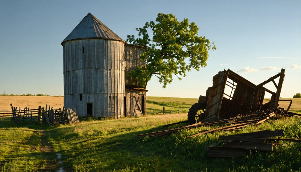
Beyond its role as a postal hub, Randall flourished as an agricultural settlement near the fertile banks of the Wabash River.
You’d have found farmers transforming challenging terrain into productive farmland through deep plowing and innovative drainage techniques. Agricultural innovations like reapers and seed drills revolutionized crop production in the 1870s, while strategic crop rotation and lime application enriched the soil.
Livestock management played a vital role in Randall’s farm economy. You could’ve witnessed thriving cattle and swine operations alongside extensive dairy production.
Women were integral to these agricultural pursuits, managing everything from garden cultivation to livestock care. The farm families’ combined efforts, coupled with mechanization and soil conservation practices, drove Randall’s shift from subsistence farming to market-oriented agriculture.
The Silent Decline
During the latter half of the 20th century, Randall’s economic foundation crumbled as industrial decline swept through Indiana’s manufacturing sector. The town’s lack of economic resilience became evident as its steel industry collapsed, following a pattern similar to Gary, Indiana, where U.S. Steel’s workforce plummeted from 30,000 to just 5,000 workers.
The devastating impact manifested in four key ways:
- Mass exodus of residents seeking employment elsewhere
- Rapid deterioration of infrastructure and abandoned buildings
- Sharp decline in local tax revenue and public services
- Loss of community identity and social cohesion
Despite attempts at community revitalization through development projects, Randall’s dependence on a single industry proved fatal.
Randall’s reliance on steel manufacturing sealed its fate, even as civic leaders tried desperately to breathe new life into the dying town.
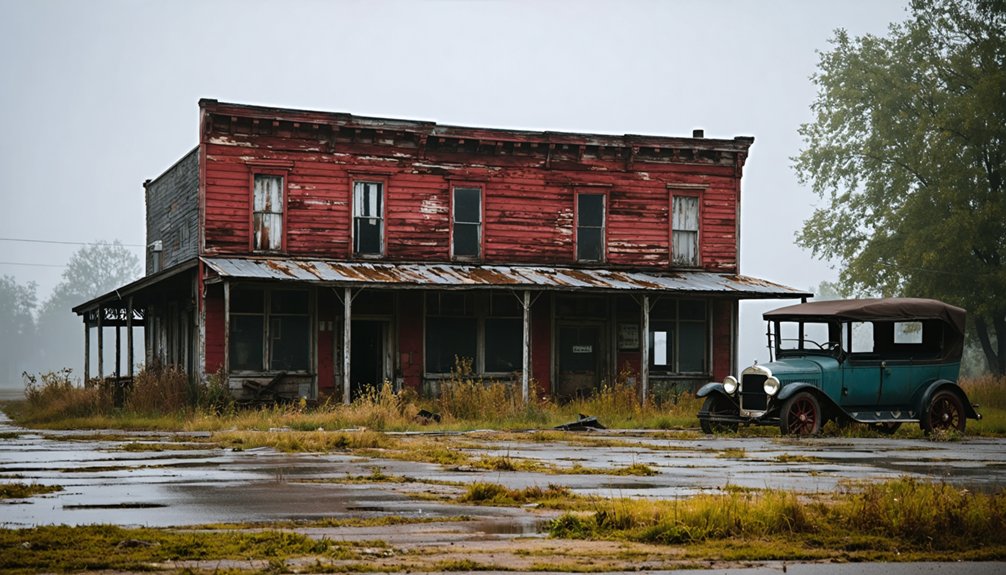
Within decades, empty storefronts and decaying homes became silent testimonies to the town’s economic collapse, while remaining residents witnessed their community transform into a ghost town.
Natural Reclamation of a Settlement

After decades of abandonment, nature began systematically reclaiming Randall’s industrial ruins through a complex process of ecological restoration.
You’ll find that the site’s natural recovery started with aggressive erosion control using straw bale terraces, coir rolls, and rock rundowns to stabilize the coal waste-scarred landscape.
The restoration created wetland habitats through flooded bioreactor cells and oxidation ponds, transforming polluted mining areas into thriving ecosystems.
Native plants gradually recolonized the reclaimed soil while wildlife returned to newly established riparian buffers.
Water quality improved as constructed wetlands filtered acid mine drainage, benefiting downstream users and aquatic life.
The once-barren industrial site has evolved into a biologically productive landscape where you can witness nature’s remarkable ability to heal itself when given the chance.
Preserving Randall’s Memory
While preserving Randall’s historical legacy presents significant challenges, local historical societies and community groups have launched coordinated efforts to document and protect what remains of this Indiana ghost town.
Community initiatives focus on engaging volunteers and securing crucial funding through targeted fundraising campaigns.
Local organizations rally support through volunteer recruitment and strategic fundraising to preserve our shared cultural heritage.
Historical preservation efforts face several key obstacles that you’ll need to understand:
- Limited historical documentation makes it difficult to authenticate the site’s past
- Private property restrictions often prevent access to significant locations
- Weather and environmental factors continue to degrade remaining structures
- Financial constraints hinder thorough restoration projects
Despite these challenges, you can support preservation through local historical societies, which are developing educational programs and organizing volunteer events to maintain what’s left of Randall’s heritage.
These collaborative partnerships prove essential in keeping the town’s memory alive for future generations.
Ghost Towns of Central Indiana
Throughout central Indiana, you’ll find at least 41 documented ghost towns that tell compelling stories of economic shifts and societal changes.
Exploring similar themes, ghost towns in Wisconsin’s lakes reveal fascinating insights into the lives of those who once inhabited these now-abandoned places. These towns, often submerged or partially hidden by the water, serve as a reminder of the changing landscape and the transient nature of communities. As you navigate the lakes, you can uncover remnants of the past that highlight the rich history and culture of Wisconsin.
These abandoned settlements offer unique opportunities for ghost town tourism, drawing visitors who seek to explore Indiana’s rich historical tapestry. While specific data about Central Indiana’s ghost towns remains limited, you can discover numerous former communities that succumbed to changing economic fortunes, natural disasters, and infrastructure developments.
Many of these sites reveal how shifts in agriculture, trade routes, and industrial practices reshaped the region’s landscape. The economic impact of these changes forced residents to relocate, leaving behind fascinating remnants of once-thriving communities.
Today, preservation efforts help maintain these historical sites, ensuring their stories continue to educate future generations about Indiana’s dynamic past.
Frequently Asked Questions
What Was the Peak Population of Randall During Its Inhabited Years?
Though history whispers of its humble past, you’ll find no documented peak population for this settlement of historical significance, though community activities suggest it remained small throughout its brief existence.
Were There Any Churches or Schools Established in Randall?
You won’t find documented church history or school establishment records for this location. Historical research doesn’t indicate any formal institutions were built during the town’s brief existence.
What Happened to the Last Residents of Randall?
You’ll find zero ghost stories about the last inhabitants – they quietly drifted away to nearby towns like Dana after the post office closed in 1872, seeking better economic opportunities.
Did Any Businesses Besides the Post Office Operate in Randall?
You won’t find clear evidence of other businesses in local history records. While there might’ve been informal economic activity, research only confirms the post office’s presence in this area.
Are There Any Photographs or Maps of Randall From Its Active Period?
While you’ll find modern maps empty and historical photos scarce, there aren’t any widely available photographs or maps from Randall’s active period, though local historical societies might house undiscovered archival resources.
References
- https://greatnews.life/article/northwest-indiana-a-hotbed-for-haunted-folklore/
- https://www.youtube.com/watch?v=45D4dbASJyE
- https://www.randydpearson.com/books/trac-brothers/walton-junction/
- https://kids.kiddle.co/Randall
- https://www.randydpearson.com/randys-writing/walton-junction/
- https://www.acgsi.org/genweb/county/maps/towns-of-allen-county-indiana.html
- https://en.wikipedia.org/wiki/Randall
- https://en.wikipedia.org/wiki/List_of_ghost_towns_in_Indiana
- https://www.wikiwand.com/en/articles/Randall
- http://ingenweb.org/injay/historyofjaycoun01mont.pdf