You’ll find Jud, Texas at the confluence of the Double Mountain Fork and Salt Fork Brazos River, about 7 miles west of Rochester along FM 617. This ghost town peaked around 1915 with 31 residents and two cotton gins serving local farmers. By 1940, the population dropped to 25 as mechanization and shifting commerce led to its decline. Today’s ruins and occasional heritage events like JUD FEST reveal a deeper story of Texas agricultural boom-and-bust cycles.
Key Takeaways
- Jud, Texas became a ghost town after peaking at 31 residents in 1915, declining to near-zero population by 2000.
- Located in western Haskell County at the Double Mountain Fork and Salt Fork Brazos River confluence, 7 miles west of Rochester.
- Two cotton gins powered the town’s economy during its prime, serving as vital processing centers for local farmers.
- Economic decline resulted from mechanization, falling cotton prices, and business shifting to larger towns after the 1940s.
- The town’s remnants now host occasional heritage events like JUD FEST, preserving the memory of this former agricultural community.
The Rise and Fall of a Texas Cotton Town
While many Texas towns rose and fell with the fortunes of cotton, Jud’s story exemplifies the boom-and-bust cycle of early 20th-century agricultural communities.
Like the first train arrival in Lubbock that transformed transportation in 1909, Jud’s cotton heritage reflected in its peak years around 1915, when two cotton gins served a population of 31 residents. The town thrived as a local market center, processing cotton from surrounding farms and supporting cattle trade in Haskell County.
Today, Texas Escapes magazine preserves the memories and stories of vanishing towns like Jud through historical documentation and community submissions.
But by 1940, you’d have found only 25 people remaining in what would become a ghost town. The decline mirrored broader changes sweeping across rural Texas – mechanization reduced labor needs, cotton prices fluctuated wildly, and larger railroad-connected towns drew commerce away.
Without industrial diversification, Jud couldn’t sustain its economic foundation, marking the end of its cotton-driven prosperity.
Geographic Location and Natural Surroundings
You’ll find Jud, Texas nestled in western Haskell County where the Double Mountain Fork and Salt Fork Brazos River merge to form the mighty Brazos River.
The ghost town‘s position in this river valley places it within sight of the Double Mountains, which stand as the region’s most prominent geological landmarks for over 160 miles. Located at precise coordinates 31.187°N, the site offers a clear view of the surrounding terrain.
From your vantage point on FM 617, about 7 miles west of Rochester, you’re surrounded by the characteristic West Texas prairie landscape that once supported thriving cotton farms. Like many sites requiring civil and church law, the town’s original settlement needed legal expertise to establish proper land ownership.
River Valley Setting
Nestled in extreme western Haskell County, Jud’s geographic location alongside Farm-to-Market Road 617 places it within a distinctive river valley setting.
You’ll find this ghost town just 7 miles west of Rochester, where the Double Mountain Fork and Salt Fork converge to form the mighty Brazos River, creating a rich river ecosystem that’s shaped the region’s history.
The surrounding landscape features gently rolling plains and fertile riparian zones that once supported Jud’s agricultural heritage.
While the terrain remains mainly flat, you’ll notice native grasslands perfect for farming and ranching, with mesquite trees scattered throughout.
The river valley’s natural features, including seasonal water flows and productive soil conditions, tell the story of why settlers chose this spot, though today it’s a quiet reminder of Texas’s pioneering past.
Like the town of Sierra Blanca, Jud maintains a small resident population despite its ghost town status.
Local communities often gather here for cultural celebrations that honor the area’s heritage.
Regional Landmarks Nearby
Beyond Jud’s immediate river valley, the surrounding region holds a rich tapestry of historic ruins and natural wonders.
You’ll find the remnants of Freo Town’s original courthouse and jail near the Frio River crossing, while stone chimneys and foundations mark early settler homesteads.
To the south, Big Bend National Park and Big Bend Ranch State Park offer dramatic desert landscapes and mountain vistas alongside the Rio Grande River.
The area’s mining heritage lives on through Terlingua’s Chisos Mining Company ruins, dating from the 1880s. Mercury mining operations sustained this once-bustling town until the mines closed in 1947.
Many local sites reflect the boom-and-bust cycle, like Silver where oil production decline in the mid-1960s left abandoned homes and businesses.
You’ll discover over 20 preserved old west buildings scattered among nearby ghost towns, with Shaer’s bullet-riddled structures standing as silent witnesses to the region’s untamed past.
These sites provide glimpses into the area’s rich history while surrounded by rugged terrain and natural open spaces.
West Texas Prairie Position
Situated along Farm to Market Road 617 in western Haskell County, the ghost town of Jud occupies a distinctive position within Texas’ Southern Great Plains at coordinates 33°16’56.35″ N, 99°57’30.35″ W.
You’ll find this spot where prairie ecosystems meet the convergence of the Double Mountain Fork and Salt Fork Brazos River, creating a unique environment that’s shaped the region’s history.
- The semi-arid climate adaptation of native grasses supports traditional dryland farming and ranching
- The terrain sits 1,400-1,600 feet above sea level with gently rolling plains
- The Brazos River basin influences local soil conditions and natural drainage patterns
- The location showcases classic West Texas prairie features with seasonal temperature extremes and moderate rainfall
Early Settlement and Economic Growth
As farmers sought fertile land in western Haskell County during the late 19th century, they established the small agricultural community of Jud near the confluence of the Double Mountain Fork and Salt Fork Brazos River.
You’ll find that early settlers capitalized on the area’s rich soil and abundant water resources, developing diverse agricultural practices that included both crop cultivation and livestock raising. Similar to Thurber’s economic history, Jud residents experienced the challenges of once-monthly pay for their agricultural labor.
The community’s dedication to farming shaped its growth, with residents building essential community structures like the Baptist church, which still stands today. Like many small towns of the era, Jud established a local post office that served as a vital communication hub for the growing settlement.
You can trace Jud’s economic development through its farming success, as the town’s prosperity relied heavily on seasonal harvests and animal husbandry.
The close-knit community fostered strong social bonds through shared agricultural interests, creating a self-sustaining settlement typical of rural Texas farming towns.
Cotton Gins and Agricultural Legacy
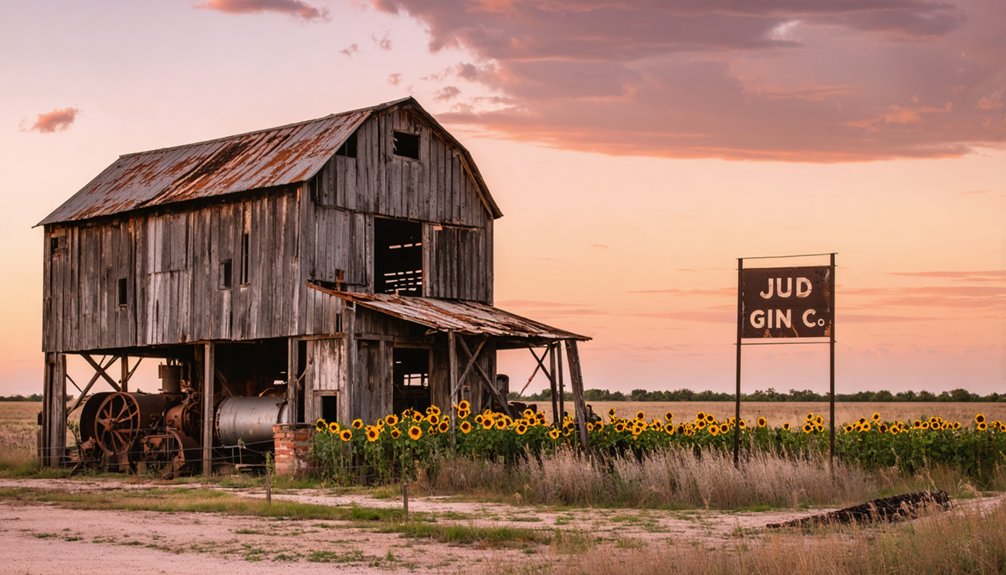
You’ll find the old cotton gins were pivotal in Jud’s early economic development, as they transformed raw cotton into marketable bales while serving as crucial community gathering spots.
The gins operated intensively during harvest season from August through December, processing wagonloads of cotton brought in by local farmers who depended on efficient processing to maximize their profits.
These agricultural processing centers followed the standard mechanical innovations of the time, using saw disks and continuous emptying mechanisms to separate cotton fibers from seeds, making them fundamental infrastructure in Jud’s cotton-based economy.
Cotton Processing Infrastructure
During the height of cotton production in East Texas, Jud’s agricultural infrastructure centered around cotton ginning operations that were essential to the region’s economy.
You’d find cotton gin innovations transforming raw cotton into marketable products, with agricultural machinery running nearly around the clock during harvest season.
- Local gins featured wooden cylinders with iron spikes and grooved breastworks, representing the era’s most advanced processing technology.
- You’d see continuous emptying systems that improved efficiency, allowing farmers to process more cotton in less time.
- Cotton buyers would grade samples right at the gin to establish prices.
- The facilities operated intensively for 18-24 hours daily during peak season.
These processing centers weren’t just buildings – they were the heartbeat of your community’s agricultural heritage, where farmers gathered to transform their harvest into prosperity.
Economic Impact Analysis
The economic influence of Jud’s cotton gins rippled far beyond their physical structures, establishing the town as an essential market center for both cotton and cattle by 1915.
You’ll find that the dual cotton gin operations were crucial to economic sustainability, allowing local farmers to process their harvests efficiently and maximize profits from their agricultural innovation.
The town’s strategic location near the Brazos River confluence strengthened its position in regional trade networks, while FM 617 provided crucial transportation links.
Yet, by 1940, you’d have seen the population drop to 25 as mechanization and market changes diminished labor demands.
While Jud’s agricultural economy eventually collapsed, its legacy lives on through JUD FEST, where you can still experience echoes of its cotton-trading past.
Population Changes Through the Decades
While exact early census figures remain undocumented, Jud’s population peaked in the early 20th century as a small farming community along the Double Mountain Fork.
You’ll find that the town’s population decline mirrored many rural Texas communities, gradually shifting from a vibrant farming settlement to a ghost town by the late 1900s.
- Mid-century marked significant population attrition as the town lost essential services
- The rural exodus accelerated through the 1950s-1970s as younger generations left for urban opportunities
- By 2000, the population had dwindled to near-zero, with only ruins remaining
- Today’s population consists of occasional visitors during heritage events like JUD FEST
The community’s transformation from an active settlement to a ghost town reflects broader demographic shifts that you’ll see throughout rural West Texas, where many small farming communities faced similar fates.
Life Along the Double Mountain Fork
Living alongside the Double Mountain Fork shaped Jud’s early identity as both a farming settlement and a contested frontier outpost.
You’ll find deep cultural heritage in this landscape where Comanche, Kiowa, and Tonkawa tribes once roamed before cattlemen like John Goff and One-Armed Jim Reed established the first ranches in the 1870s.
The historical significance of the area is evident in Reed’s stone house, which doubled as a fortress against raids, and in place names like Kiowa Peak and Tonk Creek.
The river valley’s fertile soil supported both crops and livestock, creating a mixed agricultural economy that sustained the community.
While Jud’s now a ghost town, you can still experience its enduring spirit at the annual Jud Fest, where music and food celebrate the area’s frontier legacy.
Transportation Routes and Rural Connections
Today you’ll find Jud tucked away in western Haskell County along Farm to Market Road 617, about 7 miles west of Rochester.
Transportation challenges and rural isolation played a significant role in the town’s decline, as Jud never secured the essential railroad connections that sustained many other Texas communities.
- The town’s primary access remains FM 617, a minor rural road that sees minimal traffic.
- Local gravel and dirt farm roads connect to surrounding agricultural properties.
- The nearby confluence of Double Mountain Fork and Salt Fork Brazos River once offered limited water transport options.
- Unlike thriving towns with rail or highway access, Jud’s transportation infrastructure never expanded beyond basic farm-to-market roads.
Despite limited accessibility, FM 617 still brings visitors to the annual Jud Fest, keeping this ghost town‘s spirit alive.
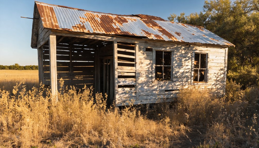
Present-Day Remnants and Ghost Town Status
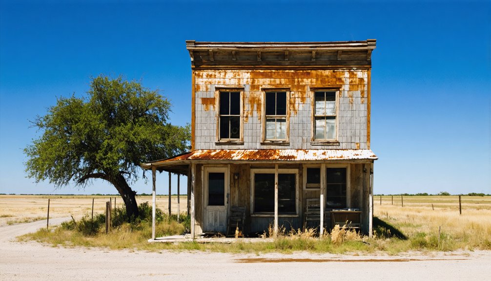
Standing alone against the western Haskell County landscape, a solitary Baptist church ruin marks what remains of Jud, Texas.
You’ll find no operational buildings, schools, or infrastructure in this genuine ghost town – just open farmland and ranch land stretching across the horizon.
Yet Jud refuses to fade completely into history. The annual JUD FEST draws visitors to this abandoned site, where Texas country artists perform and meat cookoffs create a lively atmosphere around the church ruins.
Through music and smoke from sizzling grills, Jud’s spirit lives on as its ruins host a celebration of Texas culture.
While no permanent residents remain, this cultural event maintains a strong community attachment to the location.
Unlike some Texas ghost towns that have developed preservation programs or tourism infrastructure, Jud’s only physical remnant serves as a stark reminder of its past while providing a meaningful backdrop for present-day gatherings.
Frequently Asked Questions
Were There Any Notable Crimes or Lawlessness in Jud’s History?
Picture peaceful farmland stretching to the horizon – you won’t find records of notable crime incidents in this community’s past. No significant law enforcement presence or documented lawlessness marked its quiet history.
What Happened to the Buildings and Structures After the Town’s Abandonment?
You’ll find most abandoned structures deteriorated or collapsed over time, with no historical preservation efforts saving them. Only one Baptist church still stands as a monument to Jud’s existence.
Did Any Famous or Notable People Come From Jud?
You won’t find any documented famous people from Jud. While there may have been notable families and local legends among early settlers, historical records don’t identify any widely recognized individuals from this community.
Were There Any Schools or Churches Established in Jud?
You’ll find limited education history in this locale, with no confirmed schools documented. The only religious significance was the Jud Baptist Church, though details about its establishment remain scarce.
What Natural Disasters or Extreme Weather Events Affected Jud’s Development?
While 3 major rivers converged nearby, you’ll find drought effects were likely the biggest natural threat, though specific flood damage records aren’t confirmed. The region’s harsh climate challenged farming sustainability.
References
- https://kids.kiddle.co/Jud
- https://alchetron.com/Jud
- https://www.county.org/county-magazine-articles/summer-2025/ghost-towns
- https://www.loquis.com/en/loquis/6456512/Jud+Texas
- https://en.wikipedia.org/wiki/List_of_ghost_towns_in_Texas
- https://www.tshaonline.org/handbook/entries/jud-tx
- https://www.texasescapes.com/TexasTowns/Jud-Texas.htm
- https://authentictexas.com/the-cottonest-city-in-the-world/
- https://hillsboroheritage.org/glimpse-of-the-past-the-town-that-cotton-built
- https://www.youtube.com/watch?v=UE2HCv5y96s


