You’ll find Loma Vista ghost town in southeastern Zavala County, Texas, about 12 miles south of Batesville. This former ranching community flourished in the 1940s when W.D. established a successful 15,000-acre Santa Gertrudis breeding operation that made record-breaking cattle sales across North America. Today, you can explore the historic Presidio Road trail system, partially intact building foundations, and a cemetery featuring limestone monuments of early settlers. The site’s Spanish colonial heritage holds deeper secrets within its rolling terrain.
Key Takeaways
- Loma Vista was a ranching community in Zavala County, Texas, established by Spanish-speaking pioneers approximately 12 miles south of Batesville.
- The settlement centered around the successful Loma Vista Ranch, which expanded to 15,000 acres and achieved record-breaking cattle sales by 1974.
- Historical remnants include the Presidio Road trail system, early survey markers, and a cemetery featuring both simple and ornate limestone monuments.
- The community declined due to changing transportation patterns and urban migration, leaving partially intact building foundations and scattered farm equipment.
- Local historical societies have installed protective fencing and informational plaques to preserve the ghost town’s heritage and promote tourism.
Location and Geographic Setting
Nestled in southeastern Zavala County, Texas, Loma Vista sits approximately 12 miles south of Batesville along Farm Road 1867.
You’ll find this ghost town at roughly 28.9825° N latitude and -99.8383° W longitude, positioned near the borders of Uvalde County and Crystal City.
The geographic significance of Loma Vista stems from its strategic location within South Texas’s rural landscape. The area’s history can be traced through topographic maps available on specialized historical mapping websites. Eight historical maps of the region are preserved from various time periods.
At an elevation between 1,200 and 1,300 feet above sea level, you’ll discover why the settlement earned its name – “hill view” in Spanish – as rolling terrain characterizes the area.
The surrounding countryside features sparse forests and open farmland, while small creeks weave through the territory.
Despite its remote setting, you can access nearby communities via local roads, though you won’t find any major highways or rail lines in the immediate vicinity.
Spanish Colonial Heritage
Along the western edge of Loma Vista, you’ll find remnants of the historic Presidio Road trail system that once connected Spanish colonial outposts across Upper Texas.
You can trace the footsteps of 18th-century Franciscan missionaries who traveled this network between missions, leaving behind fragments of glazed pottery and religious artifacts near creek crossings.
These preserved trail segments reveal how Spanish colonial authorities strategically positioned their routes through Loma Vista to link the eastern Texas missions with San Antonio’s religious and military establishments. Spanish expeditions used these paths to seek out reported silver deposits in the region, though most ventures yielded little wealth.
The trail network was essential for protecting missions and settlements, as Spanish soldiers from nearby presidios regularly patrolled these routes.
Presidio Road Trail Legacy
During the Mexican Revolution period, Presidio gained prominence as a key location for journalists and military operations along the U.S.-Mexico border. The area’s strategic importance was established much earlier when Spanish colonial forces constructed the Presidio de San Saba in 1757.
Upper Texas Mission Routes
Spanish missionaries blazed significant pathways across Upper Texas during the late 17th century, establishing a network of missions that would shape the region’s cultural and religious landscape.
You’ll find missionary influence was strongest along routes connecting El Paso to San Angelo, and from East Texas toward Louisiana’s frontier. These pathways weren’t just for spreading Christianity – they were strategic corridors that helped Spain maintain control against French expansion.
- Franciscan friars from Querétaro and Zacatecas colleges trekked through wilderness to establish missions like San Francisco de los Tejas.
- Indigenous interactions shaped mission locations, with some tribes accepting Spanish presence while others forced relocations. The Spanish missions often sparked conflict as Apache raids became more frequent in response to European expansion.
- Mission routes became crucial lifelines for trade, military protection, and cultural exchange between Spanish settlements and native communities. Establishing new missions required official authorization from Spanish civil authorities before construction could begin.
Early Settlement and Development
You’ll find that Loma Vista’s early settlement emerged as a modest ranching community, established by Spanish-speaking pioneers who recognized the strategic value of its hilltop vantage point.
The name itself, meaning “hill view” in Spanish, reflects the settlers’ appreciation for the elevated terrain that provided natural advantages for livestock management and security.
The community developed gradually through the establishment of basic homesteads and communal facilities, with early residents primarily engaging in cattle ranching and small-scale farming typical of South Texas colonias. Similar to neighboring Thurber, the town maintained armed guards to regulate access and maintain order.
Like other South Texas settlements of the era, the area faced challenges maintaining order and occasionally experienced the type of lawless frontier violence that made towns like Oakville notorious.
Spanish Settlement Origins
Following Spain’s claim to Texas territory in 1519, the settlement patterns of Loma Vista emerged from New Spain’s expanding northern frontier. The region’s development was shaped by Spanish exploration and indigenous influence, as missions and presidios became focal points for future civilian settlements.
You’ll find these key elements that defined early Spanish presence in the area:
- Franciscan friars established missions to convert Native Americans while imposing Spanish cultural norms.
- Military presidios protected the settlements and secured essential trade routes.
- Civilian settlements grew around these religious and military outposts, creating permanent communities.
The Spanish settlement system faced ongoing challenges from indigenous raids and French territorial rivalry, which affected the location and security of settlements throughout Texas.
Ranching Community Development
During the late 1860s, ranching transformed Loma Vista’s landscape as pioneering settlers like Elijah Bates established vital irrigation systems to support extensive cattle operations.
You’ll find that ranching infrastructure quickly expanded as prominent families like Everett, Adams, Vivian, and Gates consolidated land and built wire fences in the 1880s, marking the shift from open range to managed grazing.
The community’s evolution centered around strategic land development, with ranchers like George C. Hatch acquiring over 3,800 acres to strengthen economic foundations.
You’ll notice how cattle culture shaped local trade through brick stores, small hotels, and post offices that served as commercial hubs.
Environmental adaptations became essential as ranchers faced challenges in the semi-arid terrain, relying heavily on water sources like the Bates Ditch to sustain their operations.
Ranch Life and Cattle Industry
The vast expanses of Loma Vista Ranch became a cornerstone of South Texas cattle ranching in the 1940s when W.D. established his ambitious Santa Gertrudis breeding operation on 9,000 acres in Zavala County.
Through strategic ranch management and selective cattle genetics, the operation expanded to 15,000 acres and 2,000 head by the 1960s.
You’ll find the legacy of this pioneering ranch in three distinctive features:
- Record-breaking cattle sales across 31 states and Canada by 1974
- Integration of King Ranch bloodlines for superior heat tolerance and beef quality
- Advanced conservation practices that supported both livestock and wildlife
The ranch’s influence stretched beyond Texas borders, setting American records for single-breed sales and establishing international market connections that would shape the industry for decades to come.
Historical Transportation Routes
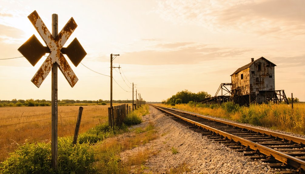
You’ll find the historic Presidio Road trading path passed near Loma Vista, serving as an essential early transportation artery that connected Spanish colonial settlements and frontier outposts.
Early survey markers from the 1840s still dot sections of this route, with limestone blocks and wooden posts indicating key crossroads and water sources that stage drivers relied upon.
These markers helped establish the path’s significance in Texas transportation history, as they guided travelers through the region’s challenging terrain before more formal road systems emerged.
Presidio Road Trading Path
Stretching hundreds of miles between San Antonio, Texas, and Chihuahua, Mexico, Presidio Road Trading Path emerged as an important commercial artery in the post-Texas Revolution era.
You’ll find this historic trade route crossing the Rio Grande at Presidio del Norte, where it fostered vibrant cultural exchange between frontier settlements.
Along this path, you’ll encounter:
- Fort Leaton, which grew from a humble trading post to a fortified landmark
- Remote presidios and missions that served as essential defensive outposts
- The challenging Chihuahuan Desert terrain that tested travelers’ resilience
The route played a significant role in regional commerce, despite facing intermittent challenges from tariff disputes and border tensions.
You can trace the path’s influence through the establishment of trading posts and settlements, which shaped the economic development of Texas’s frontier communities.
Early Survey Route Markers
During the early days of Texas settlement, critical survey route markers dotted the landscape near Loma Vista, ranging from wooden posts to stone cairns that helped travelers navigate the challenging terrain.
You’ll find that early surveying methods combined compass bearings and chain measurements, with surveyors strategically placing markers at visible points along natural fords and less obstructed paths.
The marker significance extended beyond mere navigation – these posts established legal right-of-way boundaries that would shape the region’s development.
They marked essential connections between water sources, hunting grounds, and trading posts, often following ancient Native American trails.
These carefully plotted routes later evolved into mail roads, stagecoach stops, and eventually formed the foundation for Texas state highways after 1917, demonstrating how early survey markers influenced modern transportation infrastructure.
Rise and Decline of the Community
While many Texas settlements flourished in the late 19th century, Loma Vista emerged as a modest but promising community in Zavala County, shaped by the region’s agricultural potential and strategic location along key transportation routes.
The community dynamics revolved around ranching and farming, with residents building a self-sufficient economy based on local resources.
You’ll find these key elements shaped Loma Vista’s economic shifts:
- Cattle operations and small farms sustained the initial growth
- Trade networks with neighboring towns created essential supply chains
- Basic infrastructure supported a stable, though limited, population
However, changing transportation patterns and the lure of urban opportunities led to the town’s gradual decline.
Like many rural communities, Loma Vista faded into memory as new roads and city lights beckoned its people away.
As younger generations sought prospects elsewhere, Loma Vista’s population dwindled until it joined the ranks of Texas ghost towns.
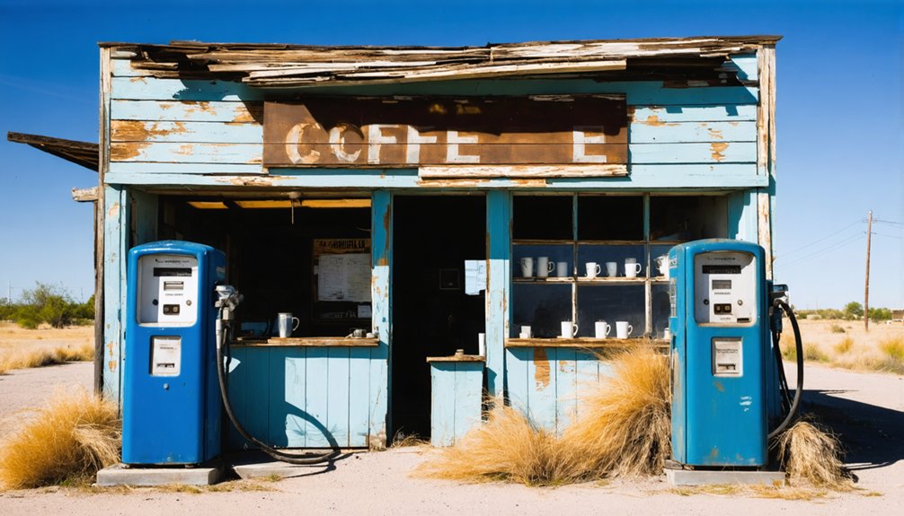
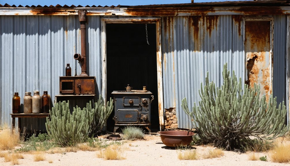
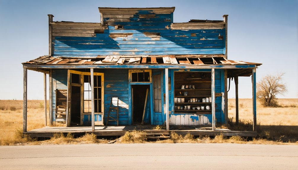
Remaining Structures and Artifacts
Today in Loma Vista, three distinct categories of structures and artifacts remain as silent witnesses to the town’s past: architectural ruins, scattered artifacts, and the old cemetery.
You’ll find several partially intact building foundations, with the old courthouse walls still standing despite their roofless condition. Throughout the site, rusted farm equipment and household items tell stories of daily life, while faded business signs hint at once-thriving commerce.
The town’s cemetery has weathered time better than most structures, featuring both simple markers and ornate limestone monuments that document the community’s earliest settlers.
While many remaining buildings have succumbed to Texas weather and vandalism, local historical societies have installed protective fencing around key structures and placed informational plaques to preserve Loma Vista’s legacy.
Archaeological Discoveries
Archaeological investigations near Loma Vista have revealed a remarkable prehistoric legacy spanning thousands of years. In 1977, excavators discovered a massive Coahuiltecan cemetery containing 205 adult burials, dating from 850 to 250 B.C. This find has transformed our understanding of prehistoric burial practices in South Texas.
- Stratified burial layers show concentrated mortuary use over time, with ancient cultural artifacts carefully arranged around the deceased.
- Stone tools, projectile points, and inscribed objects suggest sophisticated technology and artistic expression.
- Evidence indicates communities were more settled than previously thought, challenging beliefs about purely nomadic lifestyles.
The nearby Gault site has yielded over 2.6 million artifacts, with only 3% excavated, promising future discoveries that’ll continue reshaping Texas’s ancient history.
Exploring the Ghost Town Today
From the ancient burial grounds to the present-day ruins, Loma Vista stands as a tribute to the passage of time in the Texas hill country.
Your ghost town exploration will take you through weathered structures and overgrown paths where nature’s reclamation meets historical preservation. You’ll find dilapidated buildings, scattered foundations, and possible remnants of storefronts amid the limestone hills and scrub brush.
When visiting, you’ll need sturdy boots and supplies – there aren’t any modern amenities here.
Watch for wildlife and unstable structures as you navigate the site. While there’s no formal tourism infrastructure, you’re free to photograph the haunting scenes and contemplate Texas heritage.
Remember to verify access permissions beforehand, as local authorities or private landowners may restrict entry to certain areas.
Legacy in Texas History
While many Texas ghost towns have faded into obscurity, Loma Vista’s legacy endures as a tribute to South Texas’ rich cultural heritage and ranching traditions.
The town’s cultural resilience shines through in oral histories that document the unwavering spirit of Mexican-American families who shaped this borderland community.
You’ll find the impact of historical preservation efforts in:
- Maps and land records that chronicle Loma Vista’s role in South Texas settlement patterns
- Documented cultural practices that showcase traditional festivals and agricultural fairs
- Vernacular architecture that reflects the unique blend of regional building styles
As researchers continue studying Texas ghost towns, Loma Vista stands as a symbol of the determination of rural communities that adapted to changing times while maintaining their cultural identity.
Frequently Asked Questions
Are There Any Known Paranormal Activities Reported in Loma Vista?
You won’t find documented ghost sightings or haunted locations specifically in Loma Vista, though nearby Texas ghost towns share similar paranormal patterns of shadowy figures, unexplained lights, and mysterious sounds.
What Wildlife Species Currently Inhabit the Abandoned Town Site?
Over 20 documented wildlife species thrive there. You’ll spot white-tailed deer, coyotes, red-tailed hawks, western diamondback rattlesnakes, and tarantulas among the ruins, showing remarkable species diversity despite abandonment.
Is Special Permission Required to Visit or Metal Detect Here?
You’ll need landowner permission to visit or metal detect, as ghost town access is likely on private property. Local regulations protect historical sites, so check with county officials first.
Exploring these areas can lead to fascinating discoveries, including ghost stories of mineral springs that have captivated locals for generations. Many believe that these springs hold secrets of the past, sparking curiosity and intrigue among visitors. Engaging with the history of these sites can enhance your experience, making every trip an opportunity for ghostly tales and enchanting legends.
Were Any Famous Historical Figures Known to Have Visited Loma Vista?
You won’t find records of any famous visitors at this location. While it served as a reference point along the Spanish Upper Presidio Road, its limited historical significance hasn’t yielded evidence of notable figures.
What Natural Disasters or Events Contributed to the Town’s Abandonment?
While millions speculated about natural calamities, you won’t find any specific disasters causing Loma Vista’s abandonment. Instead, you’re looking at typical South Texas challenges like periodic flooding and drought alongside economic decline.
References
- https://www.youtube.com/watch?v=j1vcl01ulo8
- https://www.youtube.com/watch?v=Jkdn0Q6IS0c
- https://pastmaps.com/explore/us/texas/starr-county/loma-vista-colonia/hiking-exploration
- https://en.wikipedia.org/wiki/List_of_ghost_towns_in_Texas
- https://pastmaps.com/explore/us/texas/wilson-county/loma-vista/metal-detecting
- https://www.texasescapes.com/SouthTexasTowns/Loma-Vista-Texas.htm
- http://files.usgwarchives.net/tx/frio/history/friohistory.txt
- https://www.texasescapes.com/TOWNS/Texas-Ghost-Towns-8-South-Texas.htm
- https://www.mapquest.com/us/texas/loma-vista-tx-282913139
- https://www.anyplaceamerica.com/directory/tx/zavala-county-48507/locales/loma-vista-1361627/


