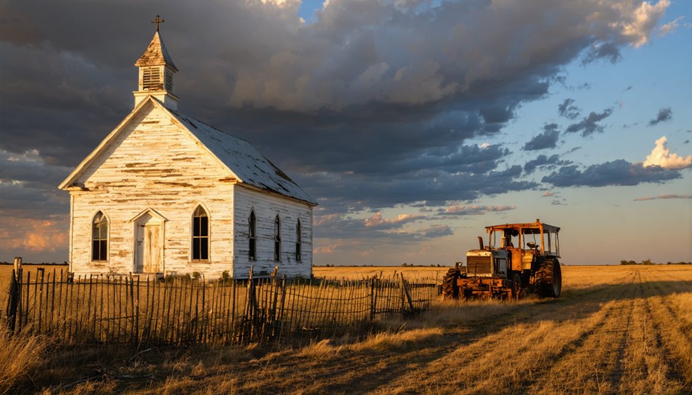
You’ll find Maverick Junction at the intersection of US Highways 18, 385, and State Highway 79 in South Dakota’s Black Hills. While primarily a transportation hub, this settlement emerged during the 1874 Black Hills gold rush sparked by Custer’s expedition. The town featured churches, saloons, and a one-room schoolhouse before declining as mining operations dwindled. Today, weathered foundations and a small cemetery mark where this once-bustling community stood – each crumbling stone holding untold stories of the American frontier.
Key Takeaways
- Maverick originated as a Black Hills mining settlement in 1872, following General Custer’s expedition and subsequent gold rush in the region.
- Located at the intersection of US Highways 18, 385, and State Highway 79, Maverick Junction primarily served as a transportation hub.
- The town experienced typical mining boom-and-bust cycles before transitioning to dairy farming and agriculture as mines closed.
- Community life centered around churches, saloons, and a one-room schoolhouse, with social events strengthening local bonds.
- Today, only weathered foundations, abandoned buildings, and a small cemetery remain as evidence of the former settlement.
The Rise and Fall of a Black Hills Settlement
While General Custer’s 1874 Black Hills expedition sparked the region’s legendary gold rush, the town of Maverick emerged as one of many hastily established settlements that dotted the contested Dakota Territory.
You’d have found prospectors using both placer and lode mining techniques to extract gold from the region’s rich deposits, quickly transforming the landscape from pristine wilderness to a bustling frontier outpost. The earliest mining operations concentrated on the Deadwood Formation, where the richest gold deposits were found.
The town’s rapid growth mirrored the cultural conflicts of its era, as settlers violated the Fort Laramie Treaty and encroached on Sioux lands. The sacred Ȟe Sápa territory was forcibly taken from its rightful inhabitants despite legal protections.
But like many mining towns, Maverick couldn’t sustain its prosperity. As gold deposits dwindled and extraction costs rose, miners and merchants abandoned their claims.
Geographic Location and Natural Features
You’ll find Maverick Junction nestled in the rugged terrain of South Dakota’s Black Hills region, where US Highways 18 and 385 intersect with State Highway 79.
The area’s natural landscape features rolling grasslands and scattered timber stands characteristic of the Great Plains, while nearby rivers like the Fall and Cheyenne have carved their paths through the region’s mixed geology. Several local points of interest include Spring Creek stream located approximately 3½ miles east. Like many South Dakota towns, the region experienced a severe water shortage crisis that affected development and sustainability.
The surrounding Black Hills harbor historic mineral deposits, though Maverick Junction itself primarily served as a transportation hub rather than a mining settlement.
Black Hills Terrain Features
Located in western South Dakota and northeastern Wyoming, the Black Hills encompass a dramatic landscape formed by ancient geological forces.
You’ll find these majestic peaks rising 3,000 to 4,000 feet above the surrounding plains, crowned by Black Elk Peak at 7,242 feet. The geological formations showcase a fascinating dome-shaped uplift exposing ancient Precambrian rocks at its core. The region’s dry continental climate creates distinct seasonal variations throughout the Black Hills. The area receives notably higher precipitation than surrounding regions, supporting its unique ecosystem.
- Distinctive hogback ridges form an outer rim 300-600 feet high, creating a natural boundary.
- The Red Valley encircles the uplift with its striking limestone composition.
- Deep canyons and gorges cut through the terrain, carved by outward-flowing streams.
- Dense ponderosa pine forests blanket the hills, giving them their characteristic dark appearance.
These dramatic topographic features create an oasis of diverse ecosystems amid the Great Plains’ semi-arid expanse.
Transportation Routes and Access
As an essential transportation hub in Fall River County, Maverick Junction stands at the strategic convergence of South Dakota Highway 79 and US Highways 18/385, roughly five miles southeast of Hot Springs.
You’ll find this historic crossroads has shaped regional transportation history since 1926, when SD-79 first intersected with today’s US-18. If you’re heading northwest, you’ll reach Hot Springs directly. The Mountain Time Zone governs all local travel schedules and business hours in the region.
Taking US 18/385 southeast leads you to Oelrichs before splitting – US-18 runs east to Pine Ridge while US-385 heads south to Chadron, Nebraska. For northbound travelers, Highway 79 connects to Buffalo Gap and Rapid City. Visitors should note that GPS navigation is highly recommended for locating specific historic sites in the area.
Modern highway alignments have addressed previous access challenges, replacing narrow bridges and outdated river crossings with improved infrastructure, including a four-lane bridge over the Cheyenne River completed in 2009.
Natural Resource Deposits
The rugged terrain of Maverick, South Dakota stretches across the northwestern Black Hills region of Pennington County, where elevations range from 3,000 to 7,000 feet.
You’ll find the town’s remnants along a northwest branch of Spring Creek, where mineral exploration once thrived amid the Precambrian granite formations and dense Ponderosa pine forests.
Like hundreds of other ghost town hunters who explore the Black Hills today, patient searching is required to locate remaining traces of the settlement.
While specific resource deposits aren’t documented for Maverick, the region’s rich mining heritage suggests:
- Carbonate silver-lead ores similar to nearby mining camps
- Valuable mineral veins within intrusive igneous rock formations
- Precious metals including gold and silver deposits
- Essential water resources from natural springs and creeks
The area’s resource management followed typical Black Hills patterns, with mining operations established around 1891 during the region’s peak extraction period.
Today, natural vegetation has reclaimed most evidence of these early mining ventures, much like the abandoned tin ore mine at Etta that closed in 1959.
Mining Operations and Economic Activities
Mining operations in Maverick began with a significant discovery in 1872, when prospectors first identified valuable mineral deposits in what became known as the Senator (later renamed Maverick) within the Rosita Hills district.
While specific mining techniques used at Maverick aren’t well-documented, the operation likely employed traditional methods common in the Black Hills region during that era.
Traditional mining methods typical of the Black Hills region shaped early operations at Maverick, though details remain sparse in historical records.
The economic impact of mining activities extended beyond mineral extraction. You’ll find that mining operations created jobs for locals and spurred infrastructure development, including roads and railways.
Like other mining towns in the region, Maverick experienced the industry’s characteristic boom-and-bust cycles. The area’s mining economy was influenced by larger operations nearby, particularly the Homestake Mine, which produced over 40 million ounces of gold throughout its history.
Daily Life in Maverick’s Peak Years
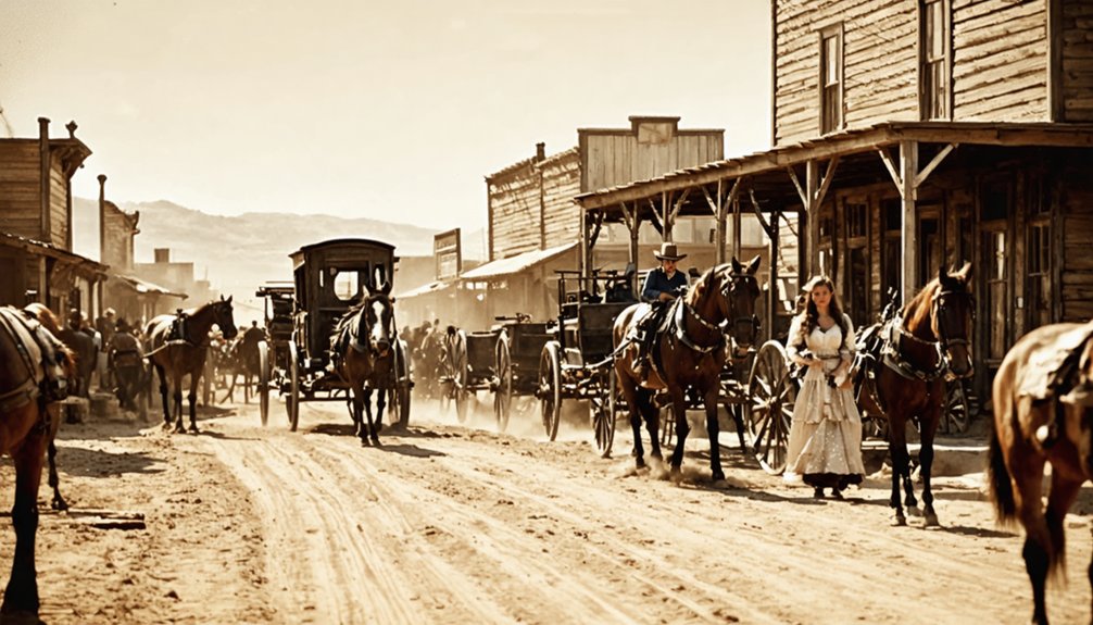
If you’d visited Maverick during its busiest years, you’d have found families living in modest wood-frame houses and simple cabins, with daily routines revolving around mining work or cattle operations.
Your children would have attended the local school, which doubled as a community meeting place, while churches served as centers for both worship and social gatherings.
After long workdays, you might’ve joined neighbors for dances, rodeos, or informal gatherings at the community hall, where news and stories were freely exchanged.
Living Quarters and Homes
During Maverick’s peak years, frontier homes dotted the Black Hills landscape as simple wooden structures built for function over form.
You’d find basic log cabins and frame houses with wooden or stone foundations, their roofs topped with local shingles or tar paper. Living conditions were sparse, with most homes featuring single-pane windows and minimal insulation against South Dakota’s harsh climate.
- Wood stoves served as the heart of each home, providing warmth and a cooking surface.
- Kerosene lamps and candles lit the small living spaces where families gathered.
- Most homes lacked indoor plumbing, requiring trips to wells or streams for water.
- Living quarters doubled as workspaces, with families sharing tight rooms that hosted everything from sleeping to social gatherings.
Work and Social Activities
As the Black Hills bustled with activity in the late 1800s, Maverick’s residents split their time between resource extraction and essential support roles that kept the town functioning. You’d find miners heading deep into the earth while blacksmiths forged tools and repaired equipment.
The work culture centered on cooperation, with families sharing daily responsibilities across mining, farming, and trading activities.
After long days of physical labor, you could join your neighbors at the local saloon or general store to swap stories and play cards. The town’s social fabric strengthened through community events like seasonal festivals, dances, and picnics.
When mines began closing, many folks shifted to dairy farming and agriculture, operating cooperatives to maintain their livelihoods in the face of changing economic times.
School and Church Routines
Once miners and their families settled in Maverick, they’d make daily journeys to the one-room schoolhouse that sat prominently on the town’s eastern edge.
School attendance varied with mining cycles, as children often helped their families during busy work periods. Inside the weathered walls, students shared scarce textbooks while practicing their arithmetic and recitations under a single teacher’s guidance.
The local church, serving as Maverick’s spiritual anchor, drew the mining community together for weekly Sunday services.
You’d find these essential gathering spots buzzing with activity:
- Morning Bible readings and spirited hymn singing
- Community potlucks after services to strengthen bonds
- Holiday celebrations that united the transient population
- School performances and religious ceremonies marking life’s milestones
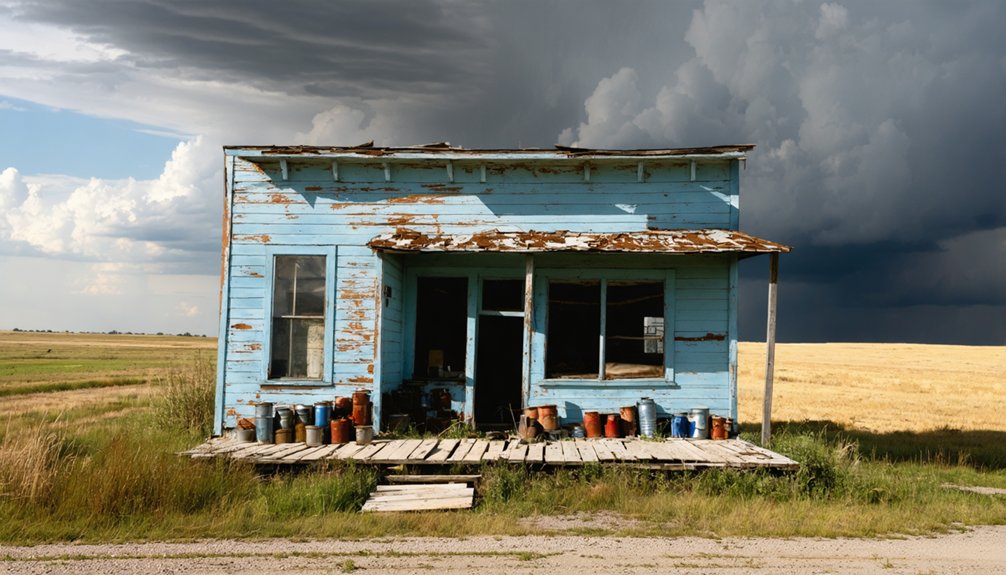
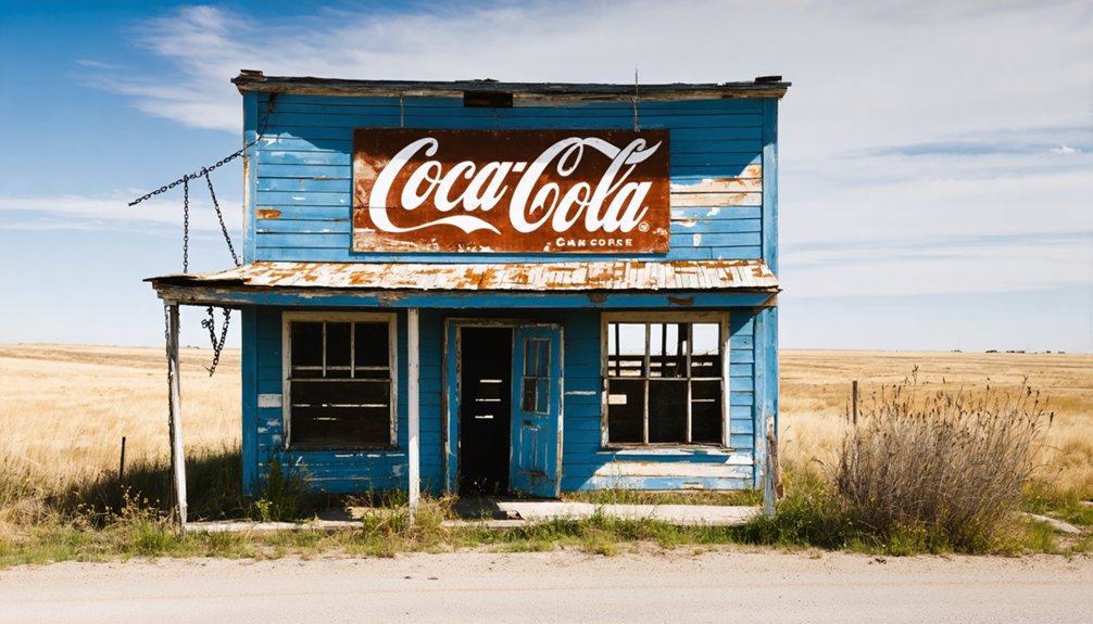
Notable Buildings and Infrastructure
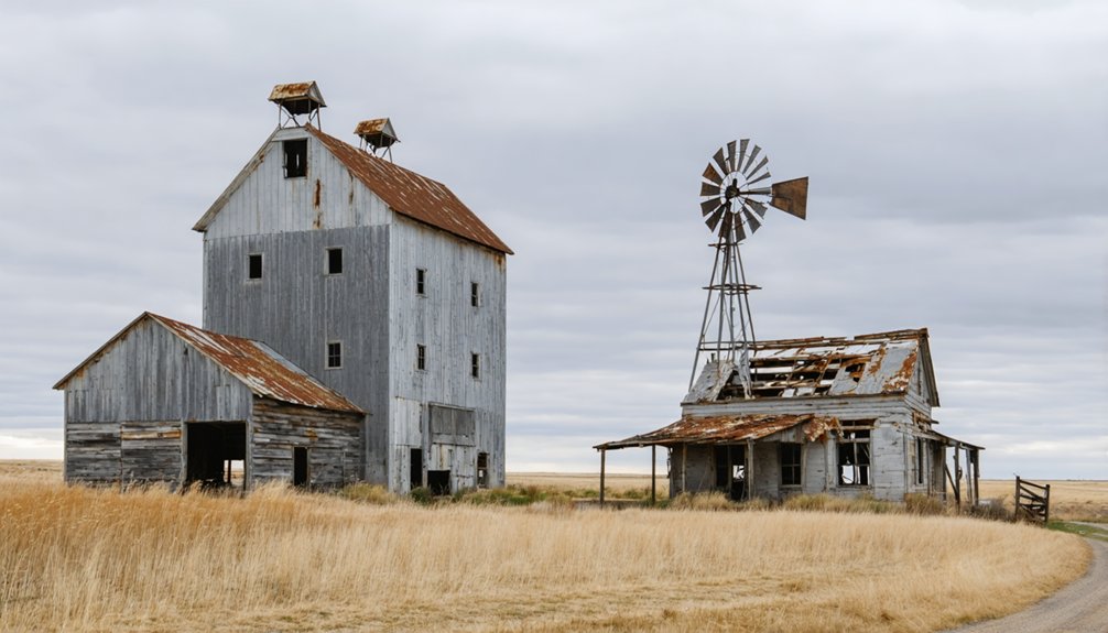
Little remains today of Maverick’s original buildings and infrastructure, with only scattered foundations marking where the town once stood.
Today’s scattered foundations are all that survive of Maverick, echoing its forgotten footprint on South Dakota’s frontier landscape.
As you explore the site, you’ll find weathered building materials that have largely deteriorated due to South Dakota’s harsh climate and the passage of time since the town’s 1891 founding. The infrastructure remnants tell a story of a modest frontier settlement that once served local needs.
Unlike some preserved ghost towns in South Dakota, such as 1880 Town, Maverick’s structures weren’t saved or relocated.
exploring the history of Lentz reveals the rich narratives of the people who once thrived there. The abandoned buildings stand as silent witnesses to a bygone era, offering a glimpse into a community that has long since faded away. While many towns have transformed into tourist attractions, Lentz serves as a poignant reminder of the past.
Time and nature have reclaimed most of what was built here. The few remaining foundation stones and worn pathways serve as silent witnesses to the town’s brief existence, offering you a glimpse into South Dakota’s boom-and-bust frontier era.
Transportation and Access Routes
Modern travelers can easily locate Maverick’s remains at the intersection of South Dakota Highway 79 and US Highways 18/385, known today as Maverick Junction.
You’ll find well-maintained highways connecting you to nearby destinations, though transportation challenges exist in this rural area where private vehicles remain essential.
- Take US 18/385 southeast to reach Oelrichs and Pine Ridge, or head northwest to explore Hot Springs.
- Follow SD-79 north to discover Buffalo Gap and Rapid City.
- Drive south on US-385 to connect with Chadron, Nebraska.
- Access the scenic Black Hills region via multiple routes.
The junction underwent significant improvements in the 1960s when highways were realigned, and further upgrades continued through 2009 with the expansion of a two-lane bridge to four lanes, ensuring safer travel through this historic location.
The Decline and Abandonment
While the exact founding date remains unclear, Maverick emerged during the late 19th-century settlement boom that swept across the northern plains.
You’ll find its story mirrors many Dakota settlements that rose and fell with changing fortunes. The town’s economic decline likely began as modernization reduced agricultural labor needs, while the harsh realities of drought and mechanization pushed families to seek opportunities elsewhere.
Community fragmentation accelerated as essential services disappeared. When schools closed and businesses shuttered, younger generations left for larger towns, leaving behind aging residents.
Without new economic drivers or successful preservation attempts, Maverick couldn’t sustain itself. Like many of its neighbors across the plains, the town gradually emptied until complete abandonment, joining the ranks of South Dakota’s ghost towns.
What Remains Today
Scattered across the remote southwestern corner of South Dakota, Maverick’s remaining structures tell a haunting story of abandonment and decay.
You’ll find ghost town remnants nestled among the Black Hills’ rugged terrain, where nature slowly reclaims what humans left behind. Historical artifacts dot the landscape, revealing glimpses of the town’s past through weathered foundations and crumbling walls.
- Abandoned wooden buildings stand in various states of collapse, their weathered boards telling tales of the old sawmill operations.
- Faint traces of original roadways wind through overgrown vegetation, marking the town’s former layout.
- Scattered debris from mining activities lies partially buried beneath years of soil and plant growth.
- A small, forgotten cemetery rests nearby, with worn markers bearing witness to Maverick’s former inhabitants.
You can access these remnants via forest service roads, though the terrain’s grown challenging over decades of disuse.
Historical Significance and Legacy
Beyond its physical remnants, Maverick stands as a symbol to the boom-and-bust cycles that shaped South Dakota’s Black Hills region during the late 19th century.
You’ll find in its story the familiar patterns of frontier development: the rush for natural resources, the crucial role of railroad connections, and the harsh realities of pioneer life.
As part of South Dakota’s cultural heritage, Maverick reflects the complex community dynamics of the American West.
You can trace how changing transportation methods, resource depletion, and economic shifts gradually eroded the town’s foundations.
Through Maverick’s rise and decline, you’ll understand how these small frontier settlements contributed to the region’s development, even as they struggled against the environmental and economic challenges that ultimately led to their abandonment.
Frequently Asked Questions
Were Any Famous Outlaws or Lawmen Known to Visit Maverick?
You won’t find documented outlaw sightings or lawman legends in Maverick. While famous figures like Wild Bill Hickok roamed the Black Hills region, there’s no evidence they visited this small settlement.
What Native American Tribes Inhabited the Area Before Maverick’s Establishment?
Powerful Plains people, including the Lakota, were your region’s primary inhabitants, followed by the Cheyenne. Before them, Paleo-Indians roamed freely, hunting massive game across these lands 7,000 years ago.
Did Any Major Fires or Natural Disasters Contribute to Maverick’s Abandonment?
You won’t find records of major fire incidents or natural disasters causing Maverick’s decline. While the area faced typical South Dakota weather challenges, these weren’t the primary reasons for its abandonment.
What Were the Most Common Causes of Death in Maverick?
You’d likely have faced disease outbreaks, mining accidents, winter exposure, and untreated injuries in Maverick’s harsh environment, though specific death records haven’t survived to confirm the exact causes.
Were Any Movies or Television Shows Ever Filmed at Maverick?
Like a faded photograph lost to time, you won’t find any documented film locations or ghost stories captured on camera here. There’s no record of movies or TV shows being filmed at this site.
References
- https://www.youtube.com/watch?v=Glucs_Rq8Xs
- https://www.sdpb.org/rural-life-and-history/2023-08-21/some-black-hills-ghost-towns-and-their-origins
- https://www.youtube.com/watch?v=_0WNYsFLSLA
- https://adventure.com/usa-americas-forgotten-ghost-towns/
- https://en.wikipedia.org/wiki/List_of_ghost_towns_in_South_Dakota
- https://www.legendsofamerica.com/south-dakota-ghost-towns/
- https://b1027.com/south-dakota-has-an-abundance-of-ghost-towns/
- https://en.wikipedia.org/wiki/Seizure_of_the_Black_Hills
- https://travelhummingbirds.wordpress.com/2019/08/16/a-brief-history-of-the-black-hills/
- https://en.wikipedia.org/wiki/Black_Hills


