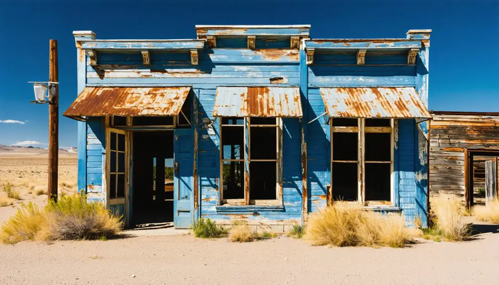
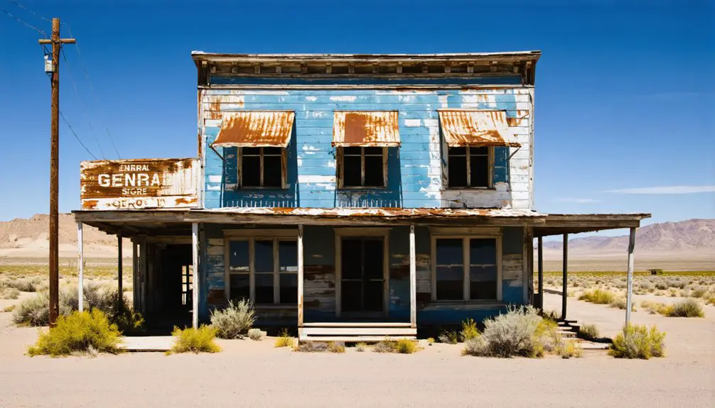
You’ll find Mitchell, Oregon standing resilient along Highway 26 as a living proof of frontier perseverance. Founded in 1873 as a supply hub on the Dalles-Canyon City Military Road, this historic town weathered devastating floods and fires between 1884-1960. While retaining its ghost town character through preserved historic structures, Mitchell has evolved into a gateway community for the Painted Hills. Its story of adaptation and survival holds deeper layers beneath its weathered facade.
Key Takeaways
- Mitchell is not a ghost town but a living community that has transformed from a mining-era settlement into a tourism gateway.
- Multiple fires and floods between 1881-1960 destroyed parts of the town, contributing to its weathered, historical appearance.
- The town preserves historic buildings and ghost town features as part of its heritage tourism strategy.
- Mitchell’s population declined after the 1950s lumber industry peak, but the town adapted through tourism development.
- The community’s resilience through disasters and economic changes prevented it from becoming an abandoned ghost town.
The Birth of a Frontier Town
When William Warren “Broadie” Johnson requested the establishment of Mitchell in 1873, he set in motion the birth of a distinctive frontier settlement that would serve as an essential waypoint along the Dalles-Canyon City Military Road.
You’ll find the roots of Mitchell’s frontier resilience in its first 50 settlers who carved out a life near Bridge Creek valley, following I.N. Sargent’s pioneering homestead built in 1867.
Early agriculture flourished as early as 1863, when Wheeler County’s first orchard and garden took root near Bridge Creek. The town’s first general store, built by R. E. Edmunson in 1875, helped establish a growing commercial center.
Pioneering farmers established Wheeler County’s agricultural legacy in 1863 by planting the area’s first orchard along Bridge Creek.
The town’s strategic location proved significant, with the military road route adjusted to pass through after the post office’s establishment.
Named after U.S. Senator John Hipple Mitchell, the settlement quickly developed into a bustling frontier outpost. The town’s naming required careful consideration to avoid confusion with other settlements, as place name disambiguation was a common challenge in frontier development.
Natural Forces Shape Mitchell’s Destiny
You’ll find Mitchell’s history deeply intertwined with nature’s devastating forces, as the town endured five major floods between 1884 and 1960 that reshaped its physical landscape.
The most severe flood occurred in 1904, when a thirty-foot wall of water crashed through the canyon, forcing residents to eventually rebuild on higher ground away from Bridge Creek’s vulnerable basin.
Three significant fires in the late 1800s compounded these challenges, demonstrating how natural disasters repeatedly tested Mitchell’s resilience and dictated its eventual location.
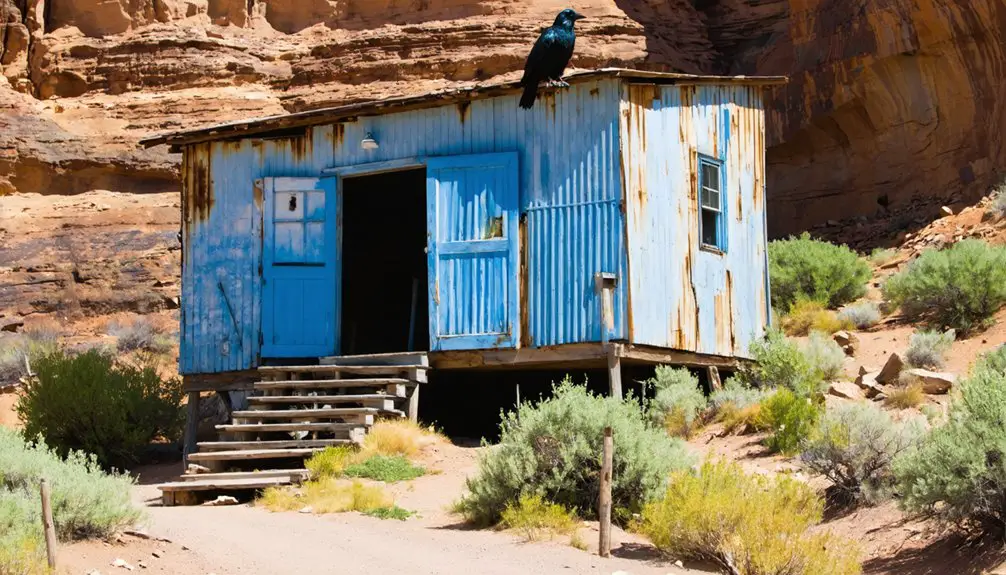
Despite these hardships, Mitchell maintains its charm as a small town community of just over 100 residents today.
Before these disasters, Mitchell served as a vital stop on the Dalles-Canyon City Military Road, which was essential for transporting gold and mail through the region.
Devastating Floods Strike Again
Throughout Mitchell’s history, devastating floods repeatedly threatened the town’s very existence, with five major events between 1884 and 1964 reshaping both its physical landscape and community resilience.
The most catastrophic flood struck in 1884, when a nine-foot wall of water claimed six lives and destroyed numerous buildings. You’ll find similar destruction in 1904, when two more lives were lost to rushing waters that nearly wiped out the town.
Despite these setbacks, Mitchell’s flood resilience emerged through determined community rebuilding. The town’s location in a narrow canyon along Bridge Creek made it particularly vulnerable to flash floods from mountain thunderstorms. The 1956 flood alone caused an estimated $709,000 in damage, destroying 20 buildings and several bridges.
Over time, residents adapted by gradually relocating buildings to higher ground, though they’d face more challenges with the destructive floods of 1954 and 1956.
Fire Reshapes Town Location
Fires proved just as merciless as floods in shaping Mitchell’s destiny, with a series of devastating blazes between 1881 and 1899 repeatedly testing the town’s resilience.
You’ll find that each time flames ravaged the community, residents stubbornly rebuilt in the same location along Bridge Creek, prioritizing existing infrastructure over safer alternatives.
The 1899 fire marked a significant turning point in Mitchell’s urban planning, as half the town burned to ash.
Despite this catastrophe, the community concentrated reconstruction efforts around the original site, implementing new fire mitigation measures.
This decision reflected both practical considerations about road connections and a deep-rooted determination to maintain the town’s historical core.
The repeated rebuilding efforts along the creek demonstrated how natural forces directly influenced Mitchell’s physical development and layout.
The town later became known as The Painted Hills gateway, attracting visitors to the stunning geological formations nearby.
Life Along The Dalles-Canyon City Military Road
While The Dalles-Canyon City Military Road began as little more than marked lanes through rugged terrain, it quickly became an essential lifeline connecting settlements across 357 miles of Oregon territory.
The route traced ancient Native American trails that had been used for generations before European settlers arrived. By 1863, the road saw intense traffic with 150 miners daily traveling between The Dalles and the goldfields.
You’ll find evidence of the region’s mining heritage at strategic stops that once served travelers making the arduous journey:
- Sherars Bridge – a vital crossing point where roadside attractions emerged to serve wagon trains
- Burnt Ranch – one of many 30-mile-spaced rest stops supporting military supply lines
- Mitchell – a key resupply point for freight wagons heading to mining camps
- Braggs Ranch – a welcome sight for weary travelers before reaching Canyon City
Rebuilding Through Adversity
Mitchell’s history stands as a demonstration to human perseverance against nature’s recurring fury.
When a nine-foot wall of water swept through in 1884, the community rebuilt. When fires destroyed most buildings in 1894, they relocated half a mile west and started anew. Through each disaster, Mitchell’s community resilience shone as residents reconstructed essential services and adapted their settlement patterns.
The town’s cultural continuity persisted through economic diversification, shifting from a mining supply stop to embrace logging, ranching, and tourism. The region’s sheep farming industry brought significant activity to the area during its peak years.
Despite nature’s challenges, residents kept moving to higher ground, rebuilding businesses, and maintaining their determination to preserve their town’s liveliness against all odds.
Today, the Mitchell School District continues to adapt by enrolling international students to maintain its educational services.
From Canyon Floor to Higher Ground
Situated at the base of a narrow canyon, the original town site of Mitchell faced persistent geographic challenges that would ultimately force its evolution.
You’ll find that the community’s flood mitigation strategy emerged through hard-learned lessons, as devastating floods with walls of water up to thirty feet high repeatedly swept through the canyon floor.
The town’s remarkable community resilience manifested in a strategic relocation effort:
- Moving residential structures up the canyon hillsides
- Establishing new business hubs on elevated terrain
- Developing access improvements along the canyon rim
- Creating supply centers above known flood levels
This upward migration wasn’t just about survival – it represented a fundamental shift in Mitchell’s relationship with its landscape, transforming from a vulnerable settlement to a more strategically positioned community adapted to its environmental challenges.
Economic Evolution and Adaptation
You’ll find Mitchell’s economic story traced through its early prominence as a stage stop and mail route hub in the 1880s, where the town established itself as an essential trade center serving gold mining operations and agricultural ventures.
The community’s financial backbone shifted dramatically through the 20th century, from a thriving lumber industry peak in the 1950s to subsequent declines in both timber and traditional ranching.
Today, Mitchell has reinvented itself as a gateway to the Painted Hills and John Day Fossil Beds National Monument, where tourism provides a new economic lifeline for this resilient rural community.
Early Trade and Commerce
As gold mining operations flourished east of town in the 1860s, Mitchell emerged as an essential stage stop along The Dalles-John Day Military Road, establishing its early economic foundation.
The town’s strategic location fostered significant trade networks that connected gold mines, supply routes, and mail services, shaping its commerce evolution.
You’ll find Mitchell’s early commercial development characterized by:
- Settlement growth driven by the Federal Homestead Act, introducing agricultural ventures near Bridge Creek
- Formal establishment of trade infrastructure with the town’s platting in 1885 and incorporation in 1893
- Development of orchards and gardens supporting local commerce and regional supply chains
- Strategic positioning as a hub for miners, supplies, and mail transportation along military roads
The town’s early economy thrived on its role as a pivotal link in the region’s gold mining and transportation infrastructure.
Mail Route Economic Impact
The discovery of gold in Canyon City during 1861 transformed Mitchell into an essential economic hub along The Dalles-Canyon City mail route, where the improved military road infrastructure facilitated secure transportation of mail, gold shipments, and necessary supplies.
You’ll find that Mitchell’s economic resilience was tested through severe floods in 1884, 1904, and 1960, forcing the town to relocate to higher ground while maintaining its critical role as a supply point.
The mail route’s influence extended beyond basic communication, creating a dynamic economy around traveler services and ranching supplies.
While Mitchell’s prominence as a mail hub eventually diminished with improved transportation methods, you can trace its adaptation from a mail-dependent center to a service node along Highway 26, preserving elements of its mail route legacy through tourism and ranching activities.
Modern Tourism Transition
While Mitchell’s historical economic foundation rested on mail routes and mining, the town has successfully transformed into a vibrant tourism gateway centered around the Painted Hills National Monument.
You’ll witness remarkable tourism growth as the community adapts to serve increasing visitor demands through strategic development of essential services and attractions.
- New lodging options and eateries continually emerge to accommodate extended stays
- Heritage preservation efforts maintain historic buildings and ghost town features
- Local businesses diversify offerings to capture broader tourist demographics
- Sustainable tourism practices protect delicate landscapes while promoting economic growth
This economic evolution demonstrates Mitchell’s resilience, as it leverages its natural and historical assets to create a sustainable future.
The town’s transformation from near-ghost town status to thriving tourist destination showcases successful community adaptation.
The history of Barr, Macoupin County is rich with stories of resilience and innovation. Local events and festivals draw visitors, showcasing the unique culture that has developed over the years. This vibrant heritage not only attracts tourists but also fosters a sense of pride among residents.
Gateway to the Painted Hills
Situated just 9 miles from Oregon’s colorful Painted Hills, Mitchell serves as the primary gateway to this natural wonder, providing essential amenities and access points for the thousands of visitors who explore the region each year.
You’ll find the most direct route by taking U.S. Highway 26 east from Mitchell, then following Bear Creek Road to reach the various trailheads and the popular Painted Hills Overlook.
As you venture from Mitchell toward the 3,132-acre painted landscape, you’ll traverse the scenic Bridge Creek Road, which leads to five distinct hiking trails.
Each trail offers unique perspectives of the stratified hills, from the accessible boardwalk at Painted Cove Trail to the panoramic views atop Carroll Rim Trail, making Mitchell your ideal base for experiencing this geological masterpiece.
Preserving a Pioneer Legacy
Beyond its role as a gateway to natural wonders, Mitchell stands as a symbol of Oregon’s pioneering spirit, with roots stretching back to the 1860s when it emerged as an essential stage stop along the Dalles-John Day Military Road.
Through heritage preservation and community storytelling, you’ll discover how this resilient town overcame multiple floods while maintaining its independent character.
- Local museums and archives safeguard pioneer artifacts, including items from early settlers like James C. Biffle.
- Oral histories preserve tales of Christian Meyer and “Alkali” Frank Hewot’s orchard-founding ventures.
- Historic structures, from I.N. Sargent’s original homestead to preserved ranch sites, tell stories of frontier determination.
- Educational initiatives at the John Day Fossil Beds National Monument connect Mitchell’s pioneer legacy to broader regional history.
Frequently Asked Questions
What Indigenous Tribes Originally Inhabited the Mitchell Area Before Settlement?
Like ancient guardians of untamed lands, you’ll find Indigenous history reveals the Warm Springs, Northern Paiute, Bannock, Cayuse, and Umatilla peoples held tribal significance as original inhabitants around Mitchell’s landscape before settlement.
Are There Any Haunted Buildings or Paranormal Stories in Mitchell?
You won’t find documented ghost sightings or formal paranormal investigations in Mitchell. While local cemeteries and abandoned buildings might spark speculation, there’s no verified evidence of supernatural activity in the town.
What Was Mitchell’s Peak Population Throughout Its History?
You’ll find Mitchell’s peak population hit 415 residents in 1950, marking the height of its historical growth during the post-WWII boom when logging and agriculture drove population trends upward.
How Many Original Structures From the 1800S Still Stand Today?
Due to historic preservation challenges, you won’t find a precise count of 1800s structures, but given severe floods and fires, architectural significance suggests very few, if any, original buildings remain intact today.
What Happened to Mitchell During the Great Depression Years?
You’ll find Mitchell faced severe economic decline during the Depression, with job losses from lumber mill closures, ranching struggles, and community hardships worsened by the region’s dust bowl conditions and reduced private investment.
References
- http://www.photographoregon.com/Mitchell-Oregon.html
- https://crookcountyhistorycenter.org/2022/07/richmond-thriving-community-that-became-a-ghost-town/
- https://www.mitchelloregon.us/about
- http://www.photographoregon.com/ghost-towns.html
- https://en.wikipedia.org/wiki/List_of_ghost_towns_in_Oregon
- https://en.wikipedia.org/wiki/Mitchell
- https://www.mitchelloregon.us/about/page/history
- https://heritagedata.prd.state.or.us/historic/index.cfm?do=v.dsp_siteSummary&resultDisplay=39345
- https://www.oregonencyclopedia.org/articles/mitchell/pdf/
- https://bendmagazine.com/easy-days-in-eastern-oregon/


