America’s submerged ghost towns resulted from massive dam projects between the 1930s-1950s when entire communities were sacrificed for flood control and hydroelectricity. Towns like Preston, Butler, and St. Thomas now lie beneath reservoir waters, their cultural heritage and histories largely forgotten. During severe droughts, these underwater settlements occasionally reveal themselves—foundations, gravestones, and artifacts briefly resurfacing to tell their stories. These hidden landscapes offer glimpses into communities that paid the ultimate price for progress.
Key Takeaways
- America’s dam construction era (1930s-1950s) submerged numerous towns for flood control, irrigation, and hydroelectric power generation.
- Notable underwater towns include Preston, Butler, St. Thomas, and Cherokee settlements like Chota and Tanasi.
- Severe droughts periodically reveal building foundations, gravestones, and artifacts from these once-thriving communities.
- Submerged towns created new aquatic ecosystems while erasing cultural landscapes and forcing community displacement.
- These underwater ghost towns attract historians, tourists, and recreational enthusiasts interested in America’s submerged cultural heritage.
The Great Dam Construction Era and Its Underwater Legacy
While the gleaming waters of America’s largest reservoirs now serve as recreational playgrounds and essential resources, they conceal a haunting underwater legacy—entire communities sacrificed during the Great Dam Construction Era of the mid-20th century.
Beneath tranquil reservoir surfaces lies America’s drowned history—communities erased for progress during the dam-building frenzy.
This transformative period, spanning roughly from the 1930s through the 1950s, emerged from Depression-era politics when massive federal initiatives like the New Deal funded infrastructure development.
The Bureau of Reclamation and Army Corps of Engineers spearheaded ambitious dam construction projects—Hoover Dam (1936) being the first major achievement—that would forever alter America’s waterways. President Franklin Roosevelt strongly advocated for these projects as part of his commitment to natural resources conservation.
As engineering consortiums like Six Companies, Inc. erected concrete monuments to progress, underwater towns disappeared beneath rising reservoirs. Originally called Boulder Dam by President Roosevelt’s administration, the massive structure later became permanently known as Hoover Dam through Congressional action in 1947.
These submerged communities were the price of modernization, sacrificed for flood control, irrigation, and hydroelectric power that would fundamentally reshape the American West’s development.
Notable Submerged Settlements Across American Waterways
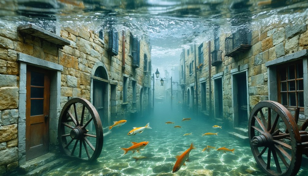
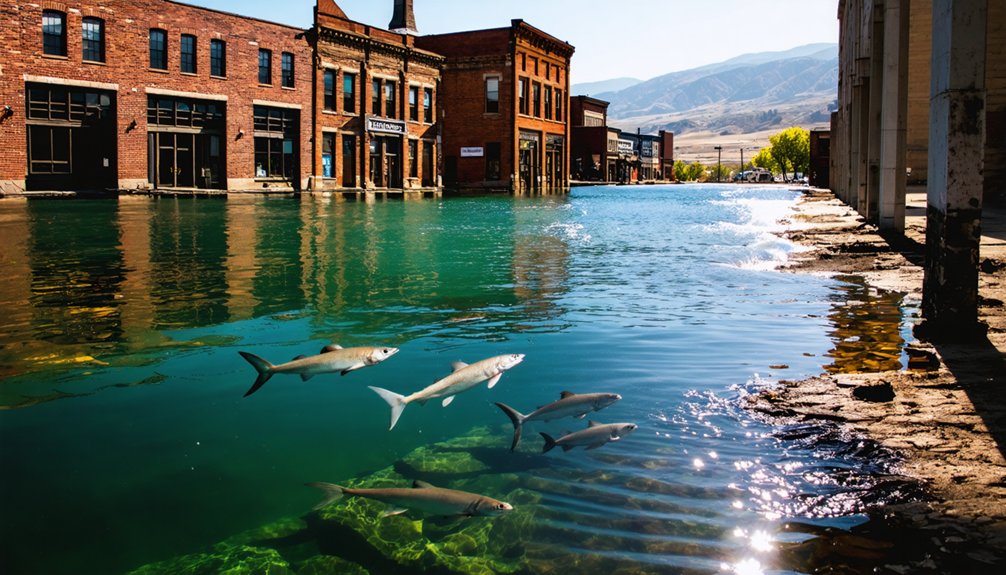
Beneath the tranquil surfaces of America’s vast reservoirs lie the skeletal remains of once-thriving communities, their streets and structures preserved in a perpetual underwater twilight.
These submerged settlements range from Preston, Texas—once a crucial Red River crossing—to Andersonville’s textile manufacturing hub at the fork of Seneca and Tugaloo Rivers.
You’ll find Lake Jocassee concealing multiple historic Cherokee townsites including Chota and Tanasi, while Fontana Lake harbors Proctor’s foundations and graves, visible during extreme low-water periods.
The historical significance of these underwater towns is profound.
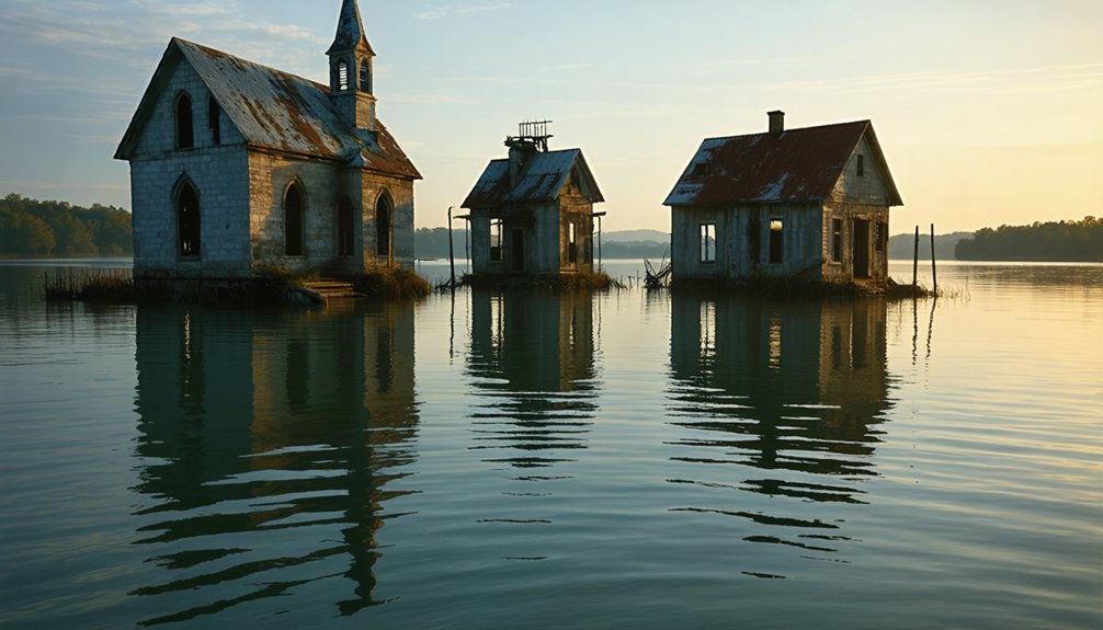
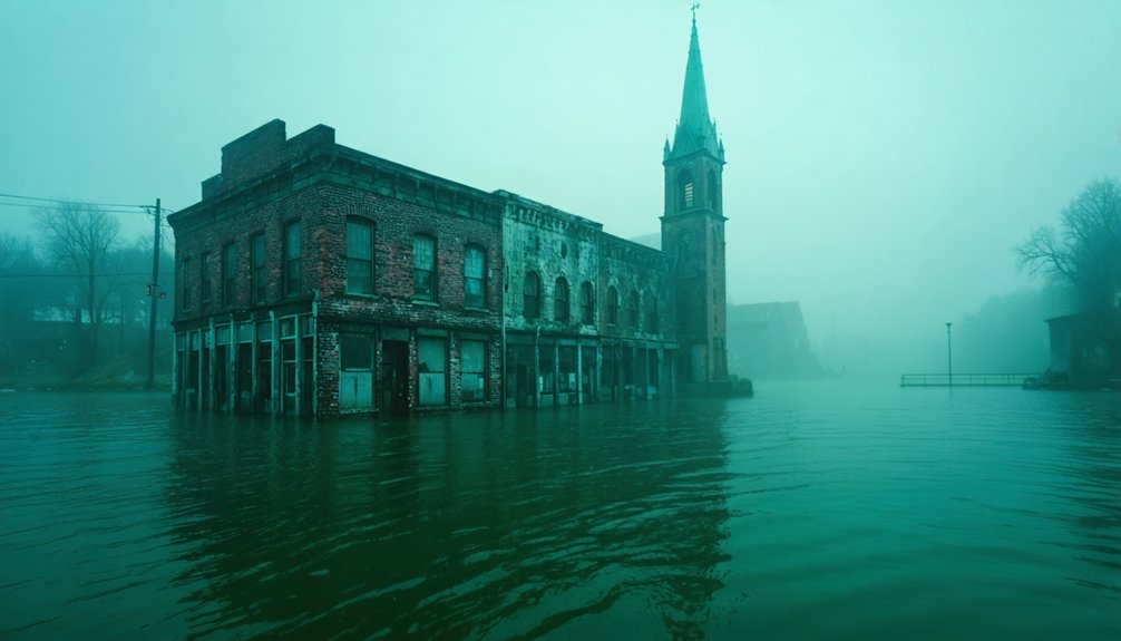
St. Thomas, Nevada reveals forty building foundations during droughts, including the former school and Hannig Ice Cream parlor.
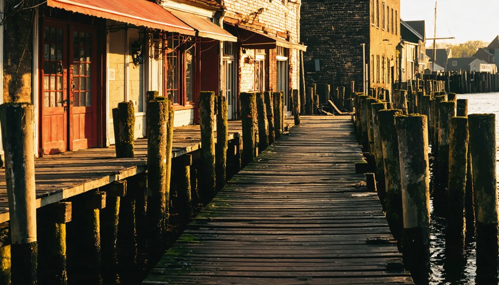
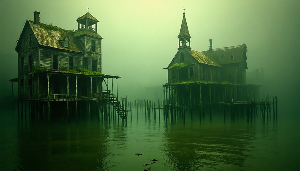
Communities like Butler, Tennessee—once the commercial heart of Eastern Tennessee’s Watauga Valley—now exist only in memory and beneath the rippling waters of America’s engineered landscapes.
The submerged town of Judson, once home to approximately 600 residents, disappeared in the 1930s when the area was flooded to create Fontana Lake and establish Great Smoky Mountains National Park.
Elbowoods, North Dakota was established in 1891 as a headquarters for the Three Affiliated Tribes before being sacrificed to the waters of Lake Sakakawea in 1953.
Cultural Heritage Lost Beneath the Waves
As dam waters rose over America’s valleys throughout the twentieth century, they swallowed more than just physical structures—they submerged entire cultural identities and heritage landscapes.
You can witness this cultural memory preserved in places like the Lost Villages Museum, where relocated buildings house artifacts from disparate families, creating physical anchors to vanished communities.
The disruption of ancestral connections is particularly evident in the exhumation of family cemeteries, with some burial grounds at Toledo Bend remaining permanently underwater.
Descendants maintain spiritual relationships with these submerged lands, gathering at reunions to reconnect with their heritage.
The reported paranormal phenomena—dancing lights beneath water surfaces and faint voices near former settlements—suggest these drowned landscapes continue to resonate in our collective consciousness despite their physical absence, revealing how deeply place shapes identity.
In southeastern Ontario, approximately 7,000 residents were forced to relocate during the inundation day that permanently altered their connection to ancestral homes.
The flooding of Saint Thomas and Calville during the creation of Lake Mead demonstrated how infrastructure progress often came at the expense of established communities.
Drought Revelations: When Forgotten Towns Resurface
When severe droughts grip America’s reservoir-laden landscape, they paradoxically reveal hidden chapters of our submerged past.
You’ll witness the North Alabama steamboat‘s skeletal hull near Vermillion emerging cyclically since 1906, most recently in 2025’s drought conditions.
These drought impacts extend beyond vessels to entire communities.
Preston’s hotel foundations and Elbowoods’ tribal headquarters resurface as waters recede, offering fleeting windows into places sacrificed for infrastructure.
Lake McConaughy in Nebraska has revealed the remnants of old Lemoyne town that was flooded in the late 1930s.
The once thriving Whiskey Flats town in California’s Gold Country becomes visible as Lake Isabella’s water levels drop to just 5-7% capacity.
Even more poignant are the gravestone exposures at Lake Texoma, silent testimonies to displaced burial grounds.
Each town rediscovery presents both opportunity and ethical challenge.
While you’re encouraged to photograph sites like St. Thomas’s forty building foundations, preservation demands respectful distance.
These drought-exposed relics aren’t just curiosities—they’re tangible connections to communities whose stories persisted beneath the waves.
Ecological Transformations and Recreational Afterlives
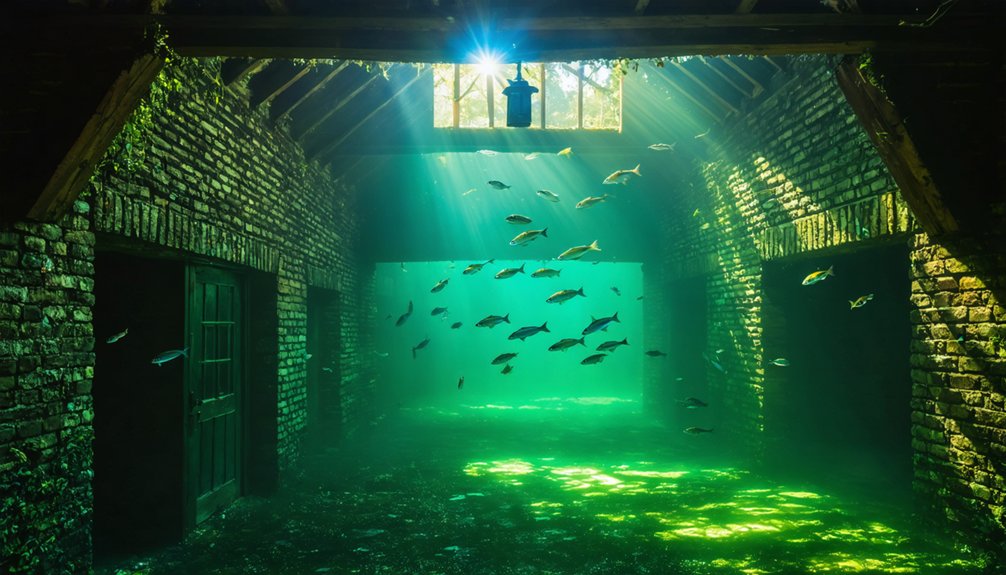
The ecological metamorphosis triggered by reservoir construction represents more than just the physical inundation of towns—it’s a complete transformation of living systems.
When rivers became lakes, terrestrial ecosystems vanished, yielding to new habitat creation that supports diverse aquatic species and migratory birds. You’ll find these manufactured environments now serve dual purposes: ecological niches and recreational playgrounds.
Clear waters in places like Fontana Lake have birthed thriving tourism impacts, with scuba divers exploring submerged ruins and anglers casting lines where streets once stood. Communities like Valmeyer relocated to higher ground after experiencing catastrophic flooding along the Mississippi River in the early 1990s. Fontana Dam was urgently built to generate electricity for Oak Ridge during World War II, forever changing the landscape of Proctor, NC.
As water levels fluctuate seasonally, glimpses of the past emerge—foundations, cemeteries, artifacts—drawing history enthusiasts and outdoor recreationists alike.
This convergence of ecology and leisure exemplifies how these drowned communities continue their legacy, not as ghost towns but as living monuments to environmental adaptation.
Exploring ghost towns along American waterways reveals the intricate relationship between human history and nature’s reclaiming power. As visitors navigate through these abandoned but hauntingly beautiful landscapes, they encounter stories etched in the remnants of once-thriving communities. Each site serves as a reminder of resilience, showcasing how life adapts and transforms even in the face of environmental challenges.
Frequently Asked Questions
Can Divers Legally Explore and Remove Artifacts From Submerged Towns?
With 95% of underwater artifacts undocumented, you can’t legally remove items from submerged towns. Diving regulations permit exploration but mandate artifact preservation through special permits for historical or scientific purposes only.
Were Residents Fairly Compensated for Their Flooded Properties?
You’d find compensation disputes common, as residents often received below-market property valuation. Government buyout programs existed but frequently underpaid, especially in ghost towns where markets collapsed following abandonment and infrastructure loss.
Do Original Landowners Retain Any Rights to Submerged Properties?
While you might assume all rights vanish underwater, you’ll often retain limited land rights through property claims. However, these submerged property interests typically yield to public trust doctrine and governmental authority.
How Do Tribes Commemorate Ancestral Lands Now Underwater?
You’ll find tribes honoring submerged ancestral lands through traditional ceremonies that connect past and present, documenting cultural artifacts, creating underwater memorials, and weaving oral histories that preserve their enduring connection to these sacred spaces.
What Modern Technologies Help Document Underwater Ghost Town Layouts?
You’ll discover ghost towns through side-scan sonar creating detailed layouts while remotely operated vehicles capture imagery. Underwater mapping technologies like photogrammetry and magnetometers reveal forgotten structures with unprecedented precision beneath the waves.
References
- https://clui.org/newsletter/spring-2005/immersed-remains-towns-submerged-america
- http://www.stagecoachtrailsranch.com/2017/10/01/alamo-lake-lost-submerged-ghost-town/
- https://cedarbayoumarina.com/four-ghost-towns-under-lake-texoma/
- https://www.thewanderingappalachian.com/post/the-underwater-towns-of-appalachia
- https://texashighways.com/culture/history/the-lost-underwater-towns-of-texas/
- https://en.wikipedia.org/wiki/List_of_flooded_towns_in_the_United_States
- https://www.wef.org/publications/news/wef-news/ghost-town-emerges-from-the-depths-of-lake-mead/
- https://www.nps.gov/articles/-the-greatest-dam-in-the-world-building-hoover-dam-teaching-with-historic-places.htm
- https://en.wikipedia.org/wiki/Hoover_Dam
- https://www.nwcouncil.org/history/DamsHistory/