You’ll find Pine Springs, Texas—once a frontier outpost and stage station along the Butterfield Trail—in northwestern Culberson County. The settlement emerged around reliable artesian springs in 1858, serving as a crucial horse-changing station and military base for Buffalo Soldiers. Though the historic Pine Springs Cafe closed after Bertha Glover’s death in 1982, the area’s rich history of Apache conflicts, ranching legacy, and natural wonders continues to draw visitors to this windswept ghost town.
Key Takeaways
- Pine Springs began as a stage station in 1858 and later became a ghost town after its cafe closed following Bertha Glover’s death in 1982.
- The Pinery stage station served the Butterfield Overland Mail route from 1858 to 1861, facilitating horse changes and mail delivery.
- Walter and Bertha Glover established the Pine Springs Cafe in 1928, which became a local landmark until its eventual closure.
- The site’s decline from active settlement to ghost town status occurred despite preservation efforts by the National Park Service.
- Archaeological excavations revealed 40,000 artifacts from the settlement’s active period, documenting daily life at the stage station.
The Birth of a Desert Settlement
While indigenous peoples had long made use of the area’s essential water sources, Pine Springs emerged as a significant settlement in northwestern Culberson County, Texas, positioned strategically near Guadalupe Pass.
You’ll find this historical landmark situated 59 miles north of Van Horn, where U.S. Highway 62/180 now runs through what was once a critical desert waypoint.
The settlement’s cultural significance stems from its reliable artesian springs, which attracted both Native Americans and early explorers.
In 1858, the Butterfield Overland Mail recognized the location’s strategic value, establishing The Pinery stage station for horse changes and mail delivery.
The site’s proximity to McKittrick Canyon and Guadalupe Peak made it an ideal base for military operations, including Buffalo Soldiers’ campaigns and Lt. Francis Theodore Bryan’s 1849 expedition. The area now contains several historic structures that have been carefully documented through archaeological surveys.
During peak months from February to April, the area experiences intense winds up to 105 miles per hour, earning it the reputation as Texas’s windiest town.
Winds and Wild West Stories
Once settled by pioneers seeking refuge in the Guadalupe Mountains, Pine Springs earned its reputation as Texas’ windiest town, with average gusts reaching between 50 and 80 mph annually.
The relentless winds have shaped more than just the landscape – they’ve woven themselves into the fabric of local folklore and wind legends. The mild winter highs around 60 degrees make this a popular rest stop for modern travelers exploring the ghost town. Real-time wind monitoring helps visitors safely plan their excursions to this historic site.
Like threads through time, Pine Springs’ eternal winds stitch together myths and memories, forever shaping the stories of this untamed land.
You’ll discover three haunting elements that define Pine Springs’ wild heritage:
- Ghostly whispers carried on gusts up to 105 mph through narrow mountain passes
- Tales of lost travelers and outlaws, scattered like tumbleweeds across the desolate terrain
- Stories of stagecoach robberies amplified by howling winds that reach their peak from February to April
The harsh conditions you’ll encounter mirror those faced by frontier settlers, with modern-day activities still dictated by these powerful desert winds.
Life Along the Butterfield Trail
As you explore Pine Spring’s role along the Butterfield Trail, you’ll discover how stage station operators managed horse exchanges and mail transfers while constantly watching for Apache raids in this remote stretch of West Texas.
You’d have found the station’s daily operations revolving around maintaining fresh horse teams, storing water from nearby springs, and coordinating with military escorts from Fort Davis and Fort Quitman. Operating with 250 coaches at peak, the station played a vital role in keeping mail and passengers moving across the challenging terrain.
The challenging terrain and isolation meant station workers faced not just the practical demands of the mail route but also the realities of operating in contested Apache territory, where attacks on stages and stations occurred with alarming frequency. The route’s 3,292-mile span made it one of the most ambitious transportation projects of the 1800s.
Stage Station Operations
Life along the Butterfield Trail centered on strategically placed stage stations that served as vital hubs for the stagecoach service from 1858 to 1861.
You’d find these stations operating with clockwork stage station efficiency, managing both westbound and eastbound traffic on alternating days. The discovery of forty thousand artifacts during archeological excavations revealed the rich history of daily station life. Travelers paid a dime per mile for their passage, though this price could double during difficult conditions.
Key features of passenger experiences included:
- Four-room stations with dedicated spaces for dining, repairs, and lodging
- Regular twice-weekly stops in each direction
- Essential services like blacksmithing, horse care, and coach maintenance
Inside, you’d discover the station keeper’s quarters with a cook stove, while large service areas housed tools and wagon parts.
The proximity to Fort Chadbourne provided enhanced security that you wouldn’t find at more isolated stops, making this station particularly valuable for weary travelers along the arduous route.
Mail Route Challenges
Despite the ambitious goal of covering 100 miles daily across Texas’s 740-mile segment, the Butterfield Overland Mail service faced formidable challenges that threatened its twice-weekly schedule.
You’d have found mail delivery disrupted by Apache attacks, with over 50 employees killed and stations repeatedly sacked for horses and mules.
Route planning proved especially challenging around treacherous areas like Quitman Canyon, where entire stagecoaches fell victim to deadly ambushes. Today, the National Historic Trail designation helps preserve these historically significant locations.
Natural obstacles complicated matters further – you’d need to navigate the rugged Guadalupe Mountains, ford dangerous river crossings like Horsehead Crossing, and contend with floods that forced time-consuming detours.
The company’s 1859 route adjustment brought stages closer to the Rio Grande for reliable water, but the harsh climate and remote terrain continued testing the endurance of crews, animals, and equipment. The Concord spring design of their stagecoaches proved essential for withstanding the punishing desert conditions.
Apache Territory Crossings
Through strategically positioned passage points in present-day Texas, New Mexico, and Arizona, the Butterfield Trail‘s Apache Territory crossings formed critical lifelines for stagecoaches traversing the hostile southern frontier.
You’d encounter constant tension from Apache resistance while maneuvering through these essential passages, which connected crucial stage stations and settlements.
At these crossings, you’ll find:
- Armed escorts and defensive positions protecting travelers from raids
- Fundamental services including fresh horses, food, and shelter at isolated stations
- Complex cultural exchanges between Native Americans, settlers, and stage drivers
Life at these crossings wasn’t easy – you’d face extreme desert conditions and scarce water.
The stations required continuous maintenance and cooperation between indigenous groups, settlers, and mail companies to maintain operations.
These crossings eventually became economic hubs, spurring settlement growth and forever changing the southwestern frontier’s landscape.
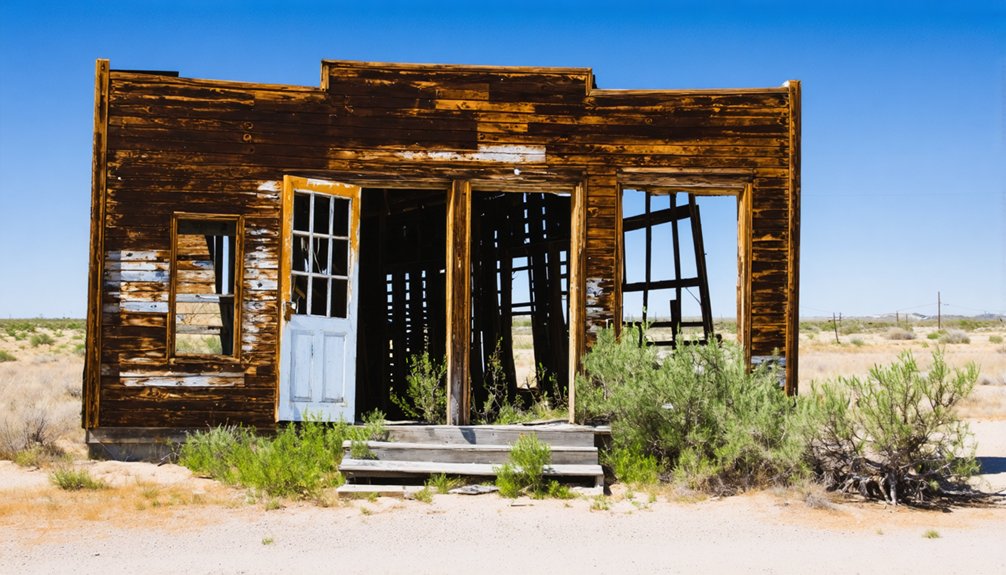
The Pine Springs Cafe Legacy
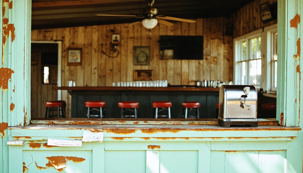
When Walter and Bertha Glover established the Pine Springs Cafe in 1928, they couldn’t have known their roadside establishment would become a significant waypoint for generations of travelers between El Paso and Carlsbad.
The cafe, built on land Walter purchased in 1907, quickly evolved into more than just a rest stop – it became an essential cultural heritage site and general store serving both locals and highway travelers.
For over 50 years, Bertha maintained this family legacy until her death in 1982.
Despite preservation efforts by the National Park Service in the 1970s and local advocacy in the 1980s, economic challenges ultimately led to the cafe’s closure.
Today, the structure stands as a symbol of early Far West Texas hospitality and the region’s transportation history.
Military Outpost and Apache Conflicts
You’ll find evidence of intense military activity at Pine Springs during the late 1860s and early 1870s, when troops from the 9th Cavalry established operations against Mescalero Apache raiders in the area.
The site’s strategic location near Guadalupe Pass made it an ideal base for soldiers from Fort Stockton and Fort Davis, who used the existing infrastructure of The Pinery as their military outpost.
The thick limestone walls of The Pinery provided critical protection for troops during their campaigns, while the area’s natural resources, including water and grasslands, sustained their extended operations against Apache forces.
Soldiers Against Apache Raiders
As conflicts between settlers and Native Americans intensified in the late 1860s, Pine Springs emerged as an indispensable military outpost in the U.S. The 9th Cavalry troops utilized this strategic location for its crucial resources and proximity to Apache territory, launching campaigns against Mescalero raiders.
Key military tactics employed at Pine Springs included:
- Rapid 65-mile marches to intercept Apache warriors
- Night patrols and surprise attacks to counter raid patterns
- Coordinated campaigns with Mexican forces across the Rio Grande
You’ll find that Apache strategies often involved quick raids followed by tactical retreats into the harsh Guadalupe Mountains.
The Buffalo Soldiers endured extreme conditions, including rugged terrain, limited supplies, and constant threat of ambush while maintaining their presence at Pine Springs through the early 1870s.
The Pinery Military Base
The Pinery Military Base stood as a tribute to frontier ingenuity and survival, featuring distinctive limestone walls measuring 30 inches thick and 11 feet high.
The Pinery architecture incorporated a fortress-like rectangular design with a single entrance protected by heavy pine stockade posts. You’d find three mud-roofed rooms attached inside the walls, providing essential shelter and storage.
Defense strategies centered on readiness for Apache attacks. When scouts spotted Indians, you’d see soldiers and civilians spring into action – herding livestock into the stone-walled corral, barring the entrance, and positioning Sharp’s rifles.
Water security came from Pine Spring via an open ditch to an interior tank. Though not a formal fort, the outpost’s wagon repair shop, smithy, and occasional military presence made it a vital frontier stronghold.
Ranching Days and Pioneer Families
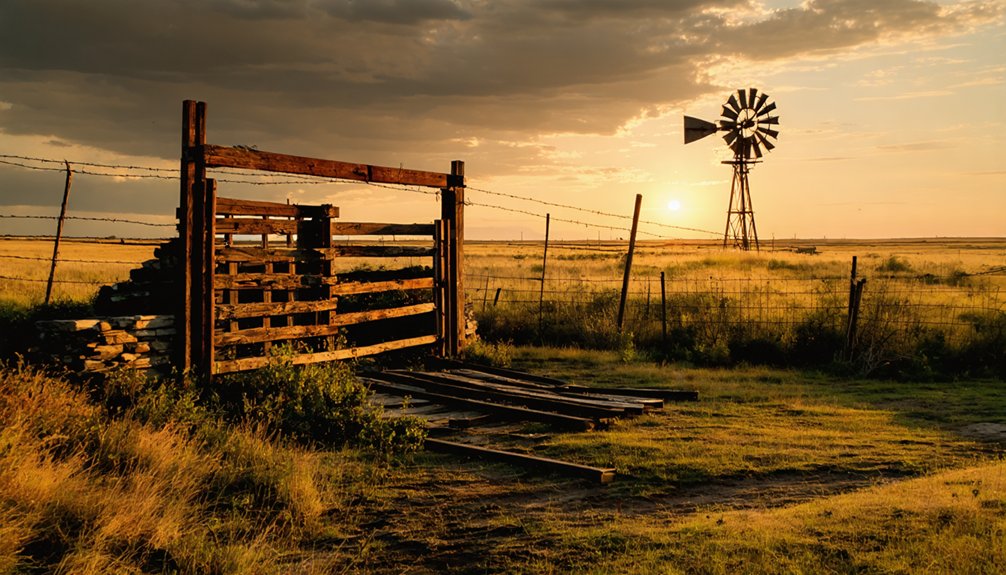
Dating back to Spanish missionary influence, ranching emerged as a cornerstone of Pine Springs’ development, with cattle first introduced by conquistadors in the 16th century.
Pine Springs’ ranching roots trace back to Spanish missionaries and conquistadors who brought the first cattle in the 1500s.
You’ll find this ranching heritage deeply rooted in the region, where vaqueros became the first cowhands managing thousands of cattle by 1680.
The pioneer struggles shaped the landscape through significant developments:
- Walter Glover’s 1913 land purchase near Pine Springs launched a new era of ranching.
- James Adolphus Williams partnered with Geronimo to run longhorn cattle operations.
- The Glovers expanded their influence by developing tourist facilities and a guesthouse.
Environmental challenges tested ranchers’ resilience as overgrazing led to depleted grasslands and dwindling animal populations.
The transformation from longhorn cattle to sheep and goats reflected the adaptability needed to survive in this harsh terrain.
Natural Wonders and Park Development
Beyond Pine Springs’ ranching heritage lies a geological marvel that stands among North America’s most remarkable natural wonders.
You’ll discover the Capitan Reef complex, a 260-million-year-old fossil preservation site that ranks among the world’s best-preserved ancient reef systems.
The area’s dramatic geological formations include El Capitan’s towering 1,000-foot limestone cliff and Guadalupe Peak, Texas’s highest point at 8,751 feet.
Since becoming a national park in 1972, the protected area has expanded to 86,416 acres, safeguarding these unique features.
You’ll find 80 miles of trails winding through diverse ecosystems, from Chihuahuan Desert landscapes to high-country wilderness.
The park’s distinctive position between desert and mountain habitats creates a sanctuary for migrating birds and native wildlife, making it an illustration of nature’s resilience.
Modern Life in Texas’ Windiest Town
Life in Pine Springs presents unique challenges as residents navigate some of North America’s most extreme wind conditions, with gusts regularly reaching 50 to 80 mph between February and April.
Modern challenges include adapting to peak gusts of 105 mph, which can disrupt daily activities and create hazardous conditions.
Despite these obstacles, community resilience shines through as you’ll find:
Through fierce winds and isolation, Pine Springs residents demonstrate unwavering resilience, forging a tight-knit community that thrives against the odds.
- Locals who’ve adapted by working primarily for the national park or highway department
- A small but determined population that’s weathered economic shifts since the 1940s
- Residents who’ve learned to schedule outdoor activities during calmer summer months, especially August
The town’s remote location and limited infrastructure continue to shape daily life, yet the remaining inhabitants maintain their independence in this uniquely challenging environment.
Frequently Asked Questions
Are There Any Hotels or Lodging Options Near Pine Springs Today?
You’ll need to stay in nearby towns, as there’s no direct lodging at Pine Springs. Your closest hotel options are 25-48 miles away in Whites City and Carlsbad, where you’ll find reviewed accommodations.
What Native American Artifacts Have Been Discovered in the Pine Springs Area?
You’ll find extensive Native American artifacts including over 550 arrow points, stone beveled knives, lithic workshop debris, and evidence of archaeological significance through projectile points dating back to the Late Archaic period.
How Did Residents Get Water in This Arid Desert Community?
You’d get your water directly from Pine Spring through open ditches and tanks, using basic irrigation methods to channel the spring’s reliable flow of 1.2 gallons per minute for drinking and livestock.
What Happened to the Original Buildings From the 1840S Settlement?
You won’t find much left of those 1840s log buildings today – they’ve vanished due to neglect, deterioration, and zero historical preservation. Most were replaced by frame houses or simply crumbled into forgotten architectural remains.
Does Pine Springs Hold Any Annual Festivals or Community Gatherings?
You won’t find any documented annual celebrations or community events in Pine Springs. While nearby Texas towns host various festivals, there’s no evidence of organized gatherings specific to this location.
References
- https://kclegacypress.com/opinion/2021/11/03/ancient-curse-arises-after-dark-ghost-tours-in-old-town-spring/
- https://southwritlarge.com/articles/the-curse-of-old-town-spring/
- https://www.texasalmanac.com/places/pine-springs
- https://en.wikipedia.org/wiki/Pine_Springs
- https://www.texasescapes.com/EastTexasTowns/Pine-Springs-Smith-County.htm
- https://en.wikipedia.org/wiki/List_of_ghost_towns_in_Texas
- https://allacrosstexas.com/texas-ghost-town.php?city=Pine+Town
- https://www.texasescapes.com/CentralTexasTownsSouth/Oso-Texas.htm
- https://freakuency.org/blog/f/oso-ghost-town-site-and-pine-springs-cemetery-fayette-county-tx
- https://www.tshaonline.org/handbook/entries/pine-springs-tx-smith-county


