Planning a road trip to Abram, Kansas means chasing a town that vanished almost as fast as it appeared. You’ll find the ghost town site about 3 miles southeast of Lincoln Center, marked by a weathered 1936 historical plaque on private land. Abram won the county seat in 1870, built a stone courthouse and 36-block grid, then collapsed within a year. There’s far more to this fascinating frontier story than you’d expect.
Key Takeaways
- Abram is located about 3 miles southeast of Lincoln Center, Kansas, on a ridge with rolling prairie landscape.
- Confirm land ownership with Lincoln County courthouse before visiting, as the site sits on private property requiring permission.
- The 1936 historical marker is the primary guide to the site’s precise location and serves as its main tangible remnant.
- Visit during spring, early summer, or fall for ideal weather; avoid winter due to harsh conditions and limited accessibility.
- No standing structures remain, so expect only foundations, archaeological traces, and open grassland marking this ghost town site.
What Was Abram, Kansas?
Tucked into the rolling plains of Lincoln County, Kansas, Abram was a short-lived frontier town that once served as the county’s first seat of government. If you dig into historical maps from the early 1870s, you’ll find its carefully planned layout — 36 blocks, a public square, and lots reserved for four churches.
The Union Pacific Railroad Company sold the townsite to M.D. Greene on January 19, 1871, and the town moved fast. It had a general store, a post office, and a native stone courthouse sitting on the highest point of a ridge.
But ghost town legends don’t build themselves without a dramatic fall — Abram was vacated by February 24, 1872, barely a year after it was laid out.
How Abram Became Lincoln County’s First County Seat
Before Abram had a full year under its belt, it had already claimed the biggest political prize in Lincoln County. The November 1870 election handed Abram the county seat title, cementing its place in local history. Here’s what that moment actually meant:
- Judge Canfield held real court there, making legal decisions that shaped lives
- Myron Greene served as county attorney, wielding genuine civic power
- Commissioners Wild, Strange, and Deitz governed free citizens from that ridge
- A native stone courthouse stood at the town’s highest point, commanding the landscape
That courthouse matters to ghost town preservation advocates today. When the county seat moved after the February 19, 1872 election, Abram’s political purpose vanished. The stone walls were eventually dismantled and hauled to Beaver Creek.
What Did Abram Look Like at Its Peak?
If you could’ve walked Abram’s streets in 1871, you’d have seen a carefully planned town laid out across 36 blocks, with a central Public Square sitting between blocks 14 and 15 and quarter-blocks reserved for four different churches.
The surveyor O.P. Hamilton of Salina designed the grid around Washington Avenue, with numbered streets running north to south, giving the town a structured, ambitious feel for such a young settlement.
Anchoring it all was Myron Greene’s first building — a 25-by-60-foot, one-and-a-half-story structure that housed a general store and post office below and a community gathering space above, while the native stone courthouse claimed the highest point on the ridge.
Town Layout And Design
Though it existed for less than a year, Abram wasn’t some haphazard frontier settlement — it was a deliberately planned town with a formal grid layout surveyed by O.P. Hamilton of Salina. Its 36 blocks reflected genuine ambition, and its local architecture spoke to a community expecting permanence.
Picture what you’d have found:
- A central Public Square between blocks 14 and 15
- Dedicated quarter-blocks for Presbyterian, Methodist, Baptist, and Catholic churches
- Washington Avenue as the grand main corridor
- Numbered streets running north-south through the entire grid
Historic preservation efforts, including a 1936 townsite marker, keep this vision alive today. When you visit, you’re not just seeing empty Kansas prairie — you’re standing inside someone’s bold dream of a thriving county seat.
Key Buildings And Structures
Behind that ambitious street grid stood actual buildings that gave Abram its brief but real identity. Myron Greene constructed the first building, a substantial 25-by-60-foot, one-and-a-half-story structure that anchored daily life. The ground floor operated as a general store and post office, while the upper story hosted community gatherings — a practical example of frontier local architecture serving multiple needs at once.
The courthouse claimed the highest ground on the ridge, built from native stone that reflected the region’s rugged character. When Abram collapsed, that courthouse didn’t survive as a historic preservation milestone — John Ryan purchased the stone and repurposed it for a house on Beaver Creek.
You’ll find no standing structures today, but understanding what once rose here makes the empty landscape far more compelling.
Why Did Abram Collapse After Less Than a Year?
Abram’s collapse came fast once it lost the county seat title — a February 19, 1872 election sealed its fate, stripping away the political identity that had given the town its reason to exist.
The post office followed suit, departing for Rocky Hill by December 1872, cutting off what little civic infrastructure remained.
Even the native stone courthouse couldn’t stay — locals sold it off to John Ryan, who hauled the stones away to build a house on Beaver Creek, leaving the ridge bare.
County Seat Lost Quickly
How does a town go from county seat to ghost town in less than a year? Abram’s fall is a lesson in frontier instability — and it’s worth understanding before you visit this historical preservation site.
Here’s what unraveled fast:
- Abram won the county seat in November 1870, giving settlers false confidence.
- A relocation election on February 19, 1872, drew 408 votes — sealing Abram’s fate.
- The post office moved back to Rocky Hill by December 5, 1872.
- The native stone courthouse was sold and hauled away to Beaver Creek.
You’re visiting one of Kansas’s most dramatic tourist attractions — not because it thrived, but because it vanished so completely. That rapid collapse is exactly what makes Abram unforgettable.
Post Office Departed Too
Losing the county seat was a serious blow, but the post office departure confirmed Abram’s fate. The post office had moved from Rocky Hill to Abram on February 26, 1872, yet by December 5, 1872, it had returned to Rocky Hill.
That rapid reversal stripped Abram of its last functional reason to exist. You’re looking at a town that collapsed within a single year. Without mail service or county government, residents had no practical reason to stay.
Community stories from Lincoln County make clear that Abram simply couldn’t sustain itself once those anchors vanished.
Historical preservation efforts, including the 1936 townsite marker, now carry Abram’s memory forward. When you visit, you’re standing where an entire town rose, functioned briefly, and quietly disappeared.
Stone Courthouse Sold Off
When the county seat moved away and the post office followed, Abram had nothing left to anchor it—and the native stone courthouse made that collapse permanent.
Someone sold that courthouse stone to John Ryan, who hauled it off to build a house on Beaver Creek. Watch what that decision meant for historical preservation:
- The town’s most symbolic structure disappeared block by block
- No courthouse meant no civic identity remained
- Archaeological findings today show almost nothing above ground
- Every stone removed was a piece of Abram’s story lost forever
You’re visiting a place where freedom-seekers built something real, then watched it stripped away in months. That courthouse wasn’t just a building—it was proof Abram existed. Now you have to imagine it entirely.
Where Was Abram Located in Lincoln County?
Though it’s no longer on any modern map, Abram once sat about three miles southeast of present-day Lincoln Center in Lincoln County, Kansas. The townsite occupied a quarter section of railroad land on a ridge that sloped away in every direction, with the courthouse standing at its highest point.
When you go searching for this ghost town, you won’t find standing structures, but local history tells you exactly where to look. A marker erected in 1936 still identifies the spot, reading: *”Abram Townsite. Located here April 11, 1871. Vacated Feb. 24, 1872. First County Seat. Lincoln County.”*
That marker is your anchor point. Use it to orient yourself and imagine the 36-block grid, the public square, and the ridge that once held Kansas’s earliest county seat ambitions.
The 1936 Townsite Marker: What Survives at Abram Today
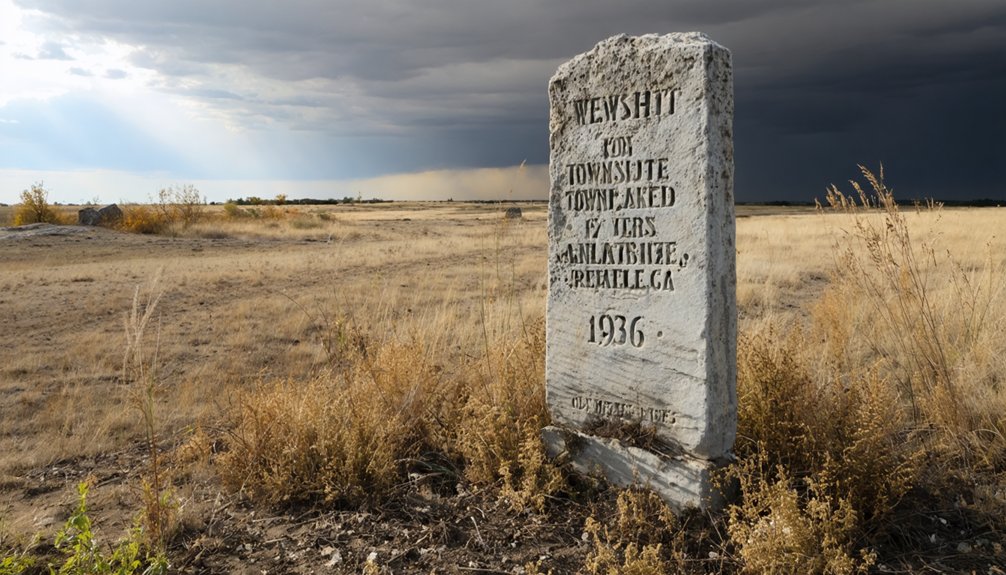
When you visit Abram’s former townsite southeast of Lincoln Center, the most tangible piece of history you’ll find is the 1936 marker bearing the inscription: *”Abram Townsite. Located here April 11, 1871. Vacated Feb. 24, 1872. First County Seat. Lincoln County. Erected 1936.”*
The native stone courthouse that once stood at the town’s highest point is long gone—John Ryan salvaged its stone to build a house on Beaver Creek after the town collapsed.
Today, you’re fundamentally standing on open Kansas land, where the marker itself carries the full weight of Abram’s brief, remarkable story.
Marker Text And Location
Little remains at the site of Abram today, but a stone marker erected in 1936 still stands as the most tangible evidence that a town ever existed here. Despite historical myths and preservation challenges, this marker cuts through time with startling clarity.
When you find it, you’ll read these words:
- “Abram Townsite” — a name once full of promise
- “Located here April 11, 1871” — a community’s hopeful beginning
- “Vacated Feb. 24, 1872” — barely ten months of existence
- “First County Seat, Lincoln County” — a forgotten civic legacy
You’re standing roughly three miles southeast of Lincoln Center. The land slopes quietly around you, indifferent to what once stood here. That marker is your only witness.
Stone Courthouse Remnants
Beyond that weathered marker, one more ghost haunts the Abram site — the memory of its native stone courthouse, which once crowned the town’s highest ridge. When Abram collapsed, the courthouse didn’t crumble on its own — someone dismantled it deliberately.
John Ryan purchased the stone and hauled it to Beaver Creek, where he rebuilt it into a private house. That act of salvage erased Abram’s most significant structure from the landscape entirely.
For anyone passionate about historical preservation, that loss stings. You won’t find walls to photograph or foundations to trace here. Instead, local legends carry the weight of what once stood.
Walk the ridge, imagine the courthouse above you, and let the silence remind you how quickly a county seat can vanish when ambition moves on.
What Visitors See Today
When you visit, that marker represents the ghost town preservation effort that keeps Abram’s historical significance alive. Standing there, you’ll feel:
- The weight of a county seat that rose and fell within months
- The silence where Washington Avenue once buzzed with commerce
- The ridge where a courthouse commanded the highest point
- The freedom of open Kansas land reclaiming what settlers built
You won’t find buildings — just wind, grassland, and that single stone telling the whole story.
How to Find the Abram Townsite
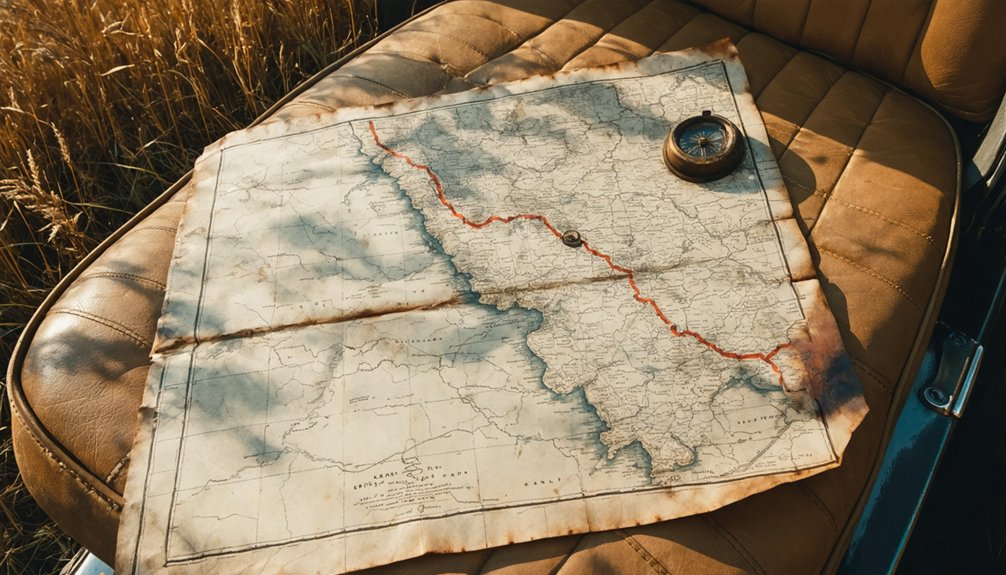
Though almost nothing remains of Abram today, you can still track down its former location in Lincoln County, Kansas, by heading roughly three miles southeast of Lincoln Center. The land sits on a ridge that slopes in every direction, which once made it a natural choice for ambitious town planning.
A historical marker erected in 1936 confirms the spot, reading: *”Abram Townsite. Located here April 11, 1871. Vacated Feb. 24, 1872. First County Seat. Lincoln County.”* That stone marker is your clearest guide.
The historical architecture is long gone — even the native stone courthouse was dismantled and hauled to Beaver Creek — but standing on that ridge, you’ll feel the quiet weight of a county seat that rose and disappeared within a single year.
When Is the Best Time to Visit the Abram Townsite?
Since Abram is an open-air historical site with no buildings or facilities, the season you visit shapes everything about the experience. Plan smart to honor this place’s historical preservation story:
- Spring (April–May): Wildflowers soften the ridge, making the landscape feel alive with community memory.
- Early Summer (June): Long daylight hours let you explore without rushing across Lincoln County’s open terrain.
- Fall (September–October): Crisp air and golden grasses create a quietly haunting atmosphere perfect for reflection.
- Winter: Avoid it — frozen ground, limited visibility, and harsh Kansas winds make meaningful exploration nearly impossible.
You’re visiting a place that existed for less than a year. Respect that fragility by arriving prepared, choosing conditions that let you truly absorb what once stood here.
Which Other Lincoln County Ghost Towns Are Worth the Drive?
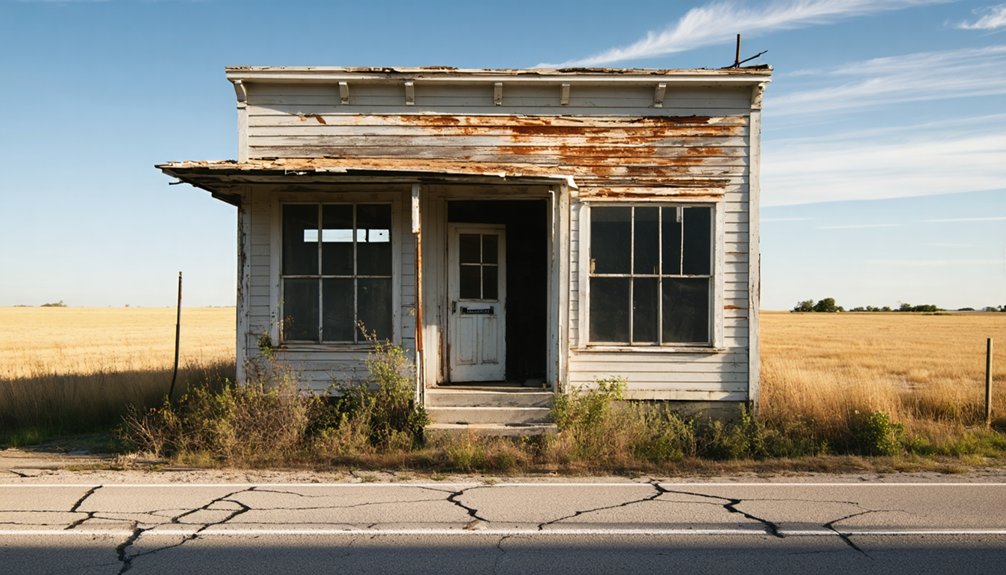
Once you’ve traced Abram’s brief life on that Lincoln County ridge, the surrounding region rewards you with more ghost town stories worth chasing down back roads. Lincoln County’s early settlement era left behind scattered communities that rose and fell alongside shifting railroad routes and county politics.
You’ll find remnants of ghost town architecture tucked across the Kansas plains — stone foundations, weathered structures, and lonely cemetery plots marking where families once built lives. Some sites benefit from modest historic preservation efforts, giving you readable context through markers and local historical society documentation.
Pair your Abram visit with a broader Lincoln County loop, consulting county historical records before you leave home. That preparation lets you navigate confidently and spend your time actually exploring rather than guessing at unmarked crossroads.
Is the Abram Townsite on Public or Private Land?
Before you make the drive out to Abram’s former townsite southeast of Lincoln Center, you’ll want to confirm the land’s current ownership status — because most rural Kansas ghost town sites sit on private agricultural land, and Abram’s location on a quarter section of railroad land originally deeded to M.D. Greene means it likely passed through multiple private hands.
Consider what’s at stake before you go:
Consider what’s at stake before you go — trespassing, landowner impact, cultural respect, and one phone call that changes everything.
- Trespassing risks erasing your freedom to explore future sites
- Landowners carry the economic impact of uninvited visitors
- Respecting boundaries honors Abram’s cultural significance
- A simple phone call to Lincoln County can clarify access
Contact the Lincoln County courthouse before visiting. That small step keeps your road trip legal, respectful, and worth every mile.
Frequently Asked Questions
Who Surveyed the Original Abram Townsite Plat?
Imagine you’re uncovering ghost town revival secrets — O.P. Hamilton of Salina, Kansas surveyed Abram’s original plat. His historic preservation efforts shaped 36 blocks, fueling your journey into Lincoln County’s forgotten past.
How Many Blocks Did the Abram Townsite Plat Include?
You’ll discover the Abram townsite plat included 36 blocks, a fascinating detail that fuels ghost town tourism and honors historic preservation. Exploring this vanished Kansas county seat, you’re connecting with bold frontier dreamers who carved civilization from open prairie.
Which Churches Were Allocated Quarter-Blocks in Abram’s Original Plan?
Four faiths claimed their ground in Abram’s ambitious blueprint — Presbyterian, Methodist, Baptist, and Catholic each received dedicated quarter-blocks, transforming these historic church architecture plots into community gathering spots that’d have rivaled any frontier town you’ve ever explored.
What Happened to Abram’s Native Stone Courthouse After Abandonment?
After abandonment, you’ll find no haunted legends lingering here—John Ryan purchased Abram’s native stone courthouse and repurposed its stones for a house on Beaver Creek, leaving preservation efforts behind in history’s dust.
Who Originally Sold the Abram Land to Its Founder?
Like a key opening history’s door, the Union Pacific Railroad Company originally sold Abram’s land to founder M.D. Greene on January 19, 1871 — a pivotal moment in early settler stories and historical land transactions you’ll want to know.
References
- https://www.ksgenweb.org/KSLincoln/resources/stories/stories58.htm
- https://legendsofkansas.com/abram-kansas/
- https://legendsofkansas.com/lincoln-county-extinct-towns/
- https://en.wikipedia.org/wiki/List_of_ghost_towns_in_Kansas
- https://legendsofkansas.com/kansas-ghost-town-list/
- https://legendsofkansas.com/every-place-kansas-a/
- https://www.kcur.org/arts-life/2022-04-09/ghost-towns-are-all-around-kansas-city-if-you-know-where-to-look
- https://freepages.rootsweb.com/~gtusa/history/usa/ks.htm
- https://legendsofkansas.com/sumner-county-kansas-extinct-towns/
- https://www.amazon.com/Ghost-Towns-Kansas-Travelers-Guide/dp/0700603689