If you’re planning a ghost town road trip to Teepee, South Dakota, you’ll want to know upfront — there’s no official ghost town by that name. What you’ll actually find is Teepee Canyon in Custer County, a raw historic mining site just miles from Jewel Cave National Monument. It’s unpreserved, largely on private land, and requires careful planning before you visit. Stick around, and you’ll discover everything you need to explore it responsibly.
Key Takeaways
- “Teepee” is likely Teepee Canyon in Custer County, a historic mining site near Jewel Cave National Monument, not an official ghost town.
- Travel west from Custer on Highway 16 approximately 18 miles to FS Road #456, using coordinates 43°43’58″N, 103°53’18″W.
- Expect collapsed mine supports, rusted equipment, prospect pits, and tailings rather than traditional abandoned town structures.
- Most ruins sit on private land, requiring landowner permission before exploring to avoid trespassing violations.
- Enhance your itinerary by combining the site with Jewel Cave, Custer State Park, and nearby ghost towns along Route 385.
Is Teepee a Real Ghost Town in South Dakota?
When you search for Teepee, South Dakota on any official ghost town registry or state historical record, you’ll come up empty — because no confirmed documentation exists placing it among the region’s 600-plus abandoned settlements in the Black Hills.
What you’ll find is Teepee Canyon in Custer County, a historic mining area distinct from any named town. Local folklore may keep the name circulating among adventurers and road trippers, but unofficial sites like this exist outside verified historical frameworks.
You’re likely encountering a geographic mix-up, possibly confused with Tee Pee City in Texas. Before you pack your bags and hit Route 385, understanding this distinction helps you set realistic expectations and plan a smarter, more rewarding exploration of the Black Hills’ genuinely documented abandoned communities.
What’s Actually at Teepee Canyon in Custer County?
When you reach Teepee Canyon in Custer County, you’ll find active historical mining diggings rather than a traditional ghost town with abandoned buildings. The main diggings sit 1–2 miles from Jewel Cave National Monument, concentrated around West Teepee Canyon and Sawmill Spring near FS Road #456 off Highway 16.
You can use Jewel Cave’s guided tours and visitor center as a launching point for understanding the broader mining history that shaped this rugged corner of the Black Hills.
Mining Diggings And History
Though no official ghost town called “Teepee” appears in South Dakota’s records, Teepee Canyon in Custer County holds real mining history worth exploring. You’ll find the main historical diggings scattered across West Teepee Canyon, roughly one to two miles from Jewel Cave National Monument.
Miners once worked these grounds using hard-rock mining techniques to extract ore from the Black Hills terrain, leaving behind visible evidence of their labor. The historical significance of this area connects directly to the 19th-century mining boom that shaped southwestern South Dakota’s identity.
You won’t find polished trail markers or visitor centers here — just raw, unfiltered remnants of human ambition carved into canyon rock. That rawness is precisely what makes this place compelling for anyone chasing genuine frontier history.
Notable Landmarks Nearby
Beyond the diggings themselves, Teepee Canyon sits within striking distance of several landmarks that reward the effort of getting out here. Jewel Cave National Monument lies just 1–2 miles away, offering ranger-guided tours through one of the world’s longest cave systems. It’s a sharp contrast to the open-air ruins you’ve just explored.
Scenic overlooks along Highway 16 give you broad views of the Black Hills’ pine-covered ridges, and wildlife sightings are common — watch for mule deer, wild turkey, and the occasional pronghorn moving through the canyon brush.
Custer State Park sits within easy driving range, adding bison herds and Cathedral Spires to your itinerary. Stack these stops together, and one canyon visit becomes a full day of genuine Black Hills exploration.
Legal and Property Rules Before You Visit Teepee Canyon
Before you load up the car and head out to Teepee Canyon, you’ll need to understand a few critical legal realities that could save you from serious trouble. Land ownership in this remote Custer County area is largely private, meaning you can’t simply wander onto any promising-looking property. Trespassing regulations carry real legal consequences here, including fines and removal by authorities.
Most abandoned structures sit on privately held land with no public access paths or official signage guiding your way. Before exploring, check local landownership records through the Custer County Clerk’s office and secure written permission from landowners.
Beyond the legal risks, deteriorating mine structures pose genuine physical dangers — collapses and unstable ground aren’t uncommon. Respecting boundaries protects both your freedom and your safety.
How to Get to Teepee Canyon From Custer
Once you’ve sorted out permissions and feel confident you’re on the right side of the law, you’re ready to map out the actual drive. From Custer, head west on Highway 16 for roughly 18 miles. Teepee Canyon opens on the road’s north side, marked by Forest Service Road #456 near Sawmill Spring.
That trailhead puts you within one to two miles of the main historical mining diggings and the West Teepee Canyon area. Use coordinates 43° 43′ 58” N, 103° 53′ 18” W to pinpoint your destination precisely.
Ruins and Diggings Still Visible at Teepee Canyon
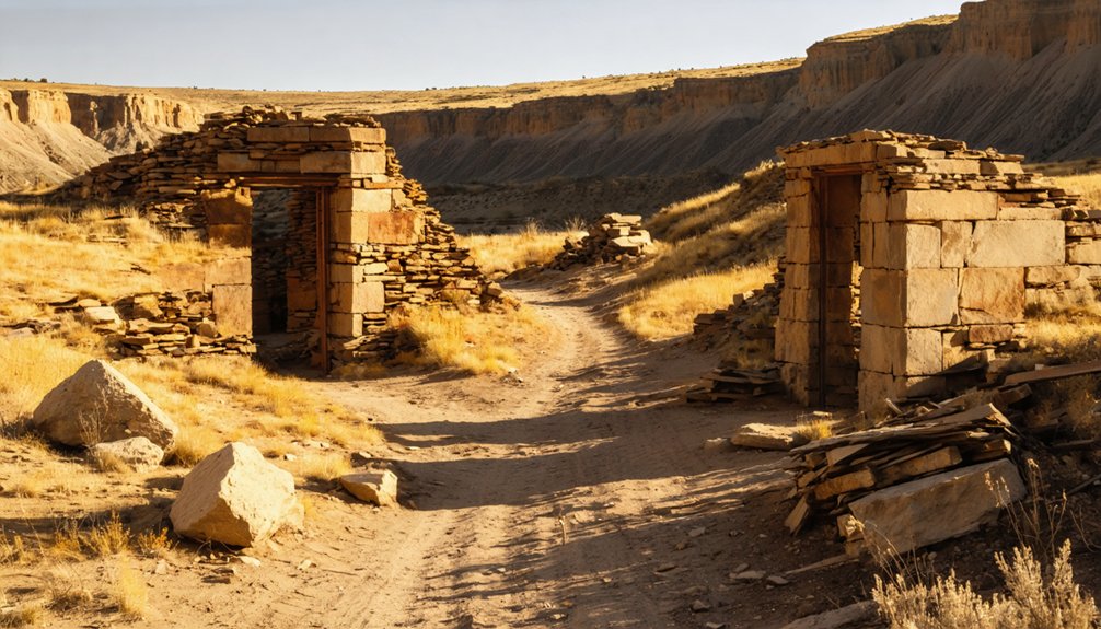
Although the canyon won’t greet you with a tourist-friendly marker, the remnants you’ll find scattered across Teepee Canyon tell a vivid story of Black Hills mining ambition. Explore 1–2 miles from Jewel Cave along FS Road #456, where historical artifacts surface throughout the West Teepee Canyon diggings near Sawmill Spring:
- Collapsed timber mine supports half-buried in hillside soil
- Rusted equipment fragments from 19th-century extraction operations
- Shallow prospect pits carved directly into canyon walls
- Stone foundations marking former work camp positions
- Ore dump tailings still visible across the canyon floor
Preservation efforts here remain minimal, meaning you’re responsible for treading carefully. Most sites sit on private land, so verify ownership before exploring. The canyon rewards curious, self-directed adventurers willing to read the landscape themselves.
Nearby Black Hills Ghost Towns Worth Adding to Your Route
Teepee Canyon sits at the heart of a region packed with ghost towns worth weaving into your itinerary. Galena, accessible via Vanocker Canyon Road off I-90 Exit 32, delivers raw frontier character through weathered structures that speak to its mining-era cultural significance. You’ll find preservation efforts here more visible than at many remote sites, giving you genuine historical context without guesswork.
Farther along Route 385, the Old West Legends corridor connects several abandoned settlements, each carrying its own backstory of boom and collapse. Keep Custer as your base camp — it sits roughly 18 miles east and offers lodging, supplies, and local knowledge.
Combining these stops transforms a single canyon visit into a full-scale Black Hills ghost town expedition worth every mile.
Who to Contact for Teepee Canyon Historical Records

Before you head out to Teepee Canyon, tracking down historical records can sharpen your understanding of what you’re actually looking at out there. Since Teepee remains an unofficial site, local folklore often fills gaps that formal records don’t.
Historical records sharpen what you see in the field — especially where folklore fills the gaps formal documents leave behind.
Reach out to these key contacts before you go:
- Custer County Historical Society – your best starting point for mining camp records and local folklore
- South Dakota State Historical Society – holds state archives that may reference informal settlements
- Black Hills National Forest Office – manages land records near FS Road #456
- Jewel Cave National Monument Staff – knowledgeable about surrounding canyon history
- Custer County Recorder’s Office – clarifies landownership before you explore private property
These contacts help you explore smarter, not just harder.
Frequently Asked Questions
What Is the Best Time of Year to Visit Teepee Canyon?
Like a phoenix rising, summer’s golden warmth breathes life into Teepee Canyon’s historical preservation. You’ll uncover local legends most vividly from June through August, when dry trails, longer daylight, and accessible paths make exploration genuinely rewarding.
Are There Guided Ghost Town Tours Available in the Black Hills Region?
You’ll find several guided tour options across the Black Hills, where operators bring ghost town history to life. They’ll take you through abandoned mines, crumbling structures, and forgotten settlements, giving you thrilling, unrestricted access to the region’s wild past.
What Photography Equipment Is Recommended for Capturing Abandoned Mining Sites?
Want stunning shots? You’ll need wide-angle camera lenses to capture crumbling structures and drone photography to reveal sweeping aerial views of abandoned mining sites, letting you document every hauntingly beautiful detail with creative freedom.
Are There Camping Facilities Near Teepee Canyon for Overnight Visitors?
You’ll find camping amenities at nearby Black Hills National Forest sites, offering a rugged basecamp for your adventure. Nearby accommodations in Custer provide comfortable alternatives, ensuring you’re rested and ready to explore Teepee Canyon’s historic diggings freely.
What Should I Pack for a Safe Ghost Town Exploration Trip?
Pack sturdy boots, a first-aid kit, flashlight, and water for your adventure. You’ll want gloves for historical preservation efforts. Follow key safety tips: wear a helmet, bring maps, and never explore unstable structures alone.
References
- https://en.wikipedia.org/wiki/List_of_ghost_towns_in_South_Dakota
- https://www.sdpb.org/rural-life-and-history/2023-08-21/some-black-hills-ghost-towns-and-their-origins
- https://www.blackhillsbadlands.com/blog/post/old-west-legends-mines-ghost-towns-route-reimagined/
- https://www.youtube.com/watch?v=_0WNYsFLSLA
- https://en.wikipedia.org/wiki/Tee_Pee_City
- https://www.mindat.org/loc-27342.html