To plan a ghost town road trip to Tonaquint, Utah, start at Crosby Family Confluence Park in St. George, where a historic marker commemorates this flood-destroyed pioneer settlement. From there, loop through Silver Reef’s preserved mining-era structures, the abandoned agricultural ghost town of Grafton, and the pioneer corridor along Santa Clara Creek. The full-day route connects Native American history, pioneer hardship, and commercial ambition across southern Utah’s rugged landscape—and there’s far more to each stop than you’d expect.
Key Takeaways
- Start at Crosby Family Confluence Park in St. George, where a historic marker commemorates Tonaquint’s Native American heritage and early irrigation practices.
- Tonaquint was a cooperative Mormon-Native American settlement destroyed by a catastrophic 1862 flood, leaving no foundations behind.
- Include Silver Reef on your loop for preserved mining-era structures and a museum showcasing the region’s 19th-century boom.
- Visit Grafton ghost town to explore pioneer agricultural history and contrast it with Tonaquint’s earlier Native American settlement story.
- St. George serves as the central hub, with additional detours to Santa Clara, Rockville, and Washington City enriching the full-day loop.
Tonaquint: Utah’s Forgotten Flood-Destroyed Pioneer Settlement
Tucked into the confluence of Santa Clara Creek and the Virgin River, Tonaquint was once Utah Territory’s southernmost pioneer settlement — a scrappy little community that didn’t survive long enough to leave much behind.
Settlers arrived around 1855, building log cabins alongside the Tonaquint band of Native Americans, whose Native American history shaped the settlement’s very name.
The settlement’s very name echoes the people who were already there — the Tonaquint band, rooted long before 1855.
Mormon missionaries worked with local residents on farming, irrigation, and dam construction, creating an early water-sharing arrangement between two very different cultures.
By 1861, roughly twelve families called this place home.
Then came the flood impact of early 1862 — a devastating surge that buried crops under mud and debris, forcing everyone out.
You won’t find foundations today, just a historic marker and a story worth knowing.
How Tonaquint Was Founded: And Why a 1862 Flood Ended It
When Rufus C. Allen and Hyrum Burgess built the first three log cabins around 1855–1856, they launched a pioneer settlement rooted in cooperation.
Tonaquint’s Native American history runs deep — the town’s name came directly from the Tonaquint band led by Chief Tut-se-gavits.
Their people shared irrigation water and farmed alongside Mormon settlers. Missionaries helped locals build dams and manage crops, creating an unusually collaborative community for its era.
There’s Almost Nothing Left: Here’s What You’ll Actually See
That marker carries real weight. It connects you to Native American history, honoring the Tonaquint band who shaped early irrigation practices in this valley long before log cabins appeared.
Stand at that confluence, read the marker, and let the landscape do the rest. The river, the desert heat, and the silence tell the story that the missing foundations can’t.
Where to Find the Historic Marker in Crosby Family Confluence Park
You’ll find Crosby Family Confluence Park in St. George, positioned near the I-15/Dixie Drive interchange where Santa Clara Creek meets the Virgin River — the exact ground Tonaquint once occupied.
The historic marker sits within the park at the confluence area, so follow the main trail toward the water and watch for interpretive signage that anchors the settlement’s story to the landscape.
Parking is available at the park’s access points, and the trail network makes it easy to pair your marker visit with a short walk along the riverbank.
Park Location And Access
Crosby Family Confluence Park sits where Santa Clara Creek meets the Virgin River in St. George, Utah, near the I-15/Dixie Drive interchange. You’ll find it easily accessible from the highway, making it a natural stop on your ghost-town road trip.
The park preserves the confluence that made Tonaquint significant — this waterway junction supported both Native American history and pioneer farming, as early settlers and the Tonaquint band once shared irrigation rights along these same banks.
Park in the lot off Tonaquint Drive and walk toward the river’s edge, where the historic marker stands.
The setting doesn’t look like a traditional ghost town, but standing at that confluence, you’re standing on ground where Utah’s southernmost pioneer settlement once struggled and ultimately disappeared beneath floodwaters.
Marker Placement Within Park
Once you’ve parked and made your way toward the river’s edge, finding the historic marker takes only a short walk. Follow the main path toward the Santa Clara Creek and Virgin River confluence, where the marker stands near the water’s meeting point.
This placement isn’t accidental — it anchors you directly at the heart of the original pioneer settlement and honors the Native American history tied to the Tonaquint band who lived here first.
The marker faces the open parkland, making it easy to spot as you approach from the main trail. Take a moment to read it carefully. It condenses centuries of Native American history and pioneer settlement into a few meaningful lines, giving you genuine historical grounding before you continue your road trip southward.
Nearby Parking And Trails
Reaching Crosby Family Confluence Park is straightforward from central St. George via Dixie Drive near the I-15 interchange. You’ll find a small parking area directly off the road, giving you easy access without a lengthy hike.
Once parked, follow the riverside trail toward the Santa Clara Creek confluence with the Virgin River. The path winds through open terrain, letting you move freely and explore at your own pace.
You’ll spot the historic marker along the trail, where Tonaquint’s historical significance gets acknowledged in a tangible, grounded way. The setting itself carries weight — standing at the water’s junction, you’re fundamentally standing where Native American heritage and pioneer settlement once intersected.
Comfortable walking shoes work fine, and the relatively flat trail suits visitors of all fitness levels.
Is Tonaquint Worth the Stop on a Southern Utah Road Trip?
Whether Tonaquint belongs on your Southern Utah road trip itinerary depends on what you’re after. If you’re drawn to Native American history and pioneer resilience, this stop delivers real substance. Here’s why it earns a place on your route:
- It marks the southernmost settlement in Utah Territory
- The Tonaquint band’s story connects deeply to early settler relations
- Crosby Family Confluence Park anchors the site with a historic marker
- Silver Reef and Grafton sit nearby, rounding out a full ghost-town day
- No crowds, no entry fees — just open history on your own terms
Tonaquint won’t wow you with preserved buildings, but it grounds your journey in something authentic. You’re standing where floods erased an entire community. That’s worth five minutes of your drive.
Nearby Ghost Towns Worth Adding: Silver Reef and Grafton
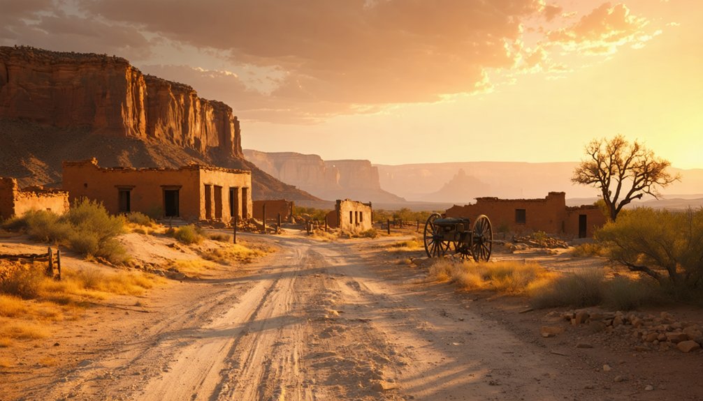
Tonaquint sets the tone, but two ghost towns nearby give your road trip real range. Silver Reef, just north of St. George, delivers a full mining-boom experience — preserved stone buildings, a working museum, and a dramatic contrast to Tonaquint‘s quiet Native American history and flood-scarred agricultural roots.
Silver Reef burns bright with mining-boom energy — a striking contrast to Tonaquint’s quieter, flood-shaped story.
You’ll feel the difference between a town that burned bright and one that simply washed away.
Grafton adds another layer entirely. This abandoned farming colony near Rockville tells a story of stubborn settlers who fought floods repeatedly before finally surrendering the land.
Sound familiar? The flood impact that erased Tonaquint echoes loudly at Grafton.
Together, these three stops create a complete southern Utah ghost-town circuit — each site distinct, each one rewarding the traveler willing to explore beyond the main highway.
How to Route Tonaquint Into a Southern Utah Ghost Town Loop
Start your loop in St. George, where you’ll swing by Crosby Family Confluence Park to catch Tonaquint’s historic marker before heading out.
From there, push northeast to Silver Reef for its preserved mining-era structures and museum.
Then curve southwest to Grafton for a look at the agricultural colony ruins near Zion.
Connecting these three stops gives you a compact but richly layered circuit through Washington County’s most compelling ghost-town history.
Starting Your Loop Route
Since St. George serves as your natural base, launching your loop from there makes sense. You’re already near Tonaquint’s historic marker at Crosby Family Confluence Park, where Native American history and pioneer agriculture shaped this forgotten settlement. From there, build your route outward:
- Tonaquint – Start with the confluence park marker in St. George
- Silver Reef – Head northeast for preserved mining-era structures and a museum
- Grafton – Continue to this photogenic agricultural colony ghost town
- Santa Clara – Explore the broader pioneer corridor along the creek
- Leeds – Connect through this quiet former settlement on your return
This loop keeps driving efficient while delivering layered stories across multiple eras. You’re not just sightseeing — you’re tracing how communities rose, adapted, and vanished across southern Utah’s rugged landscape.
Key Stops Along The Way
Each stop on this loop pulls a different thread from southern Utah’s settlement history, so sequencing them thoughtfully makes the experience richer. Begin at Tonaquint’s historic marker in Crosby Family Confluence Park, where you’ll connect with early Native American history and the cooperative irrigation techniques that shaped this flood-prone valley. The Tonaquint band farmed these banks long before Mormon settlers arrived and built their short-lived cabins here.
From St. George, push northwest to Silver Reef, where a mining boom left behind preserved stone structures and a small museum. Then route south to Grafton, an abandoned agricultural colony overlooking the Virgin River.
Together, these three sites give you pioneer hardship, commercial ambition, and Indigenous land use — a complete picture of how settlers and Native communities transformed this rugged landscape.
Connecting Nearby Ghost Towns
Routing Tonaquint into a full day loop is straightforward once you treat St. George as your anchor point. From there, you’ll connect Native American history, irrigation practices, and contrasting settlement stories across three distinct sites.
Build your loop around these stops:
- Tonaquint – Start at Crosby Family Confluence Park for the historic marker and creek junction.
- Silver Reef – Head northeast for preserved mining-era structures and an on-site museum.
- Grafton – Finish with this haunting agricultural ghost town near Rockville.
- Santa Clara – Pass through to add early missionary and irrigation context.
- Washington City – Quick detour connecting Cotton Mission settlement patterns.
Each stop layers a different chapter of southern Utah’s past, making the full loop genuinely rewarding rather than just scenic driving.
Frequently Asked Questions
What Are Tonaquint’s Other Nicknames and What Do They Mean?
Uncover ghost town legends through Tonaquint’s nicknames: Never Sweat mocks the brutal heat, Lick Skillet reveals starvation-level hardship, and Seldom Stop hints at isolation — each carrying historical significance of nicknames that’ll captivate your adventurous spirit.
Who Were the First Settlers Credited With Building Tonaquint’s Cabins?
You’ll find that Rufus C. Allen and Hyrum Burgess are the settler stories behind Tonaquint’s historical architecture — they’re credited with constructing the first three log cabins, pioneering this remote southern Utah freedom-seeking community.
Which Native American Chief Led the Band Tonaquint Was Named After?
Over 160 years ago, Chief Tut-se-gavits led the Tonaquint band, shaping Native American leadership in the region. You’ll find his Chief Tonaquint significance lives on through the settlement’s enduring name honoring his people’s legacy.
How Many Families Lived at Tonaquint Before It Was Abandoned?
You’ll find that twelve families once called Tonaquint home before its abandonment. Local folklore stories paint a vivid picture of their resilience, while historical preservation efforts help you uncover this fascinating community’s spirited, freedom-seeking legacy.
Did Any Agricultural Activity Continue at Tonaquint After Its Abandonment?
Even after 1862’s devastating flood, you’ll find that post-abandonment agriculture continued under the name “Seep Ditch,” keeping historical farming practices alive on that scarred land — proof that pioneering spirit never truly surrenders.
References
- https://usgenwebsites.org/UTWashington/towns/tonaquin.html
- https://www.facebook.com/groups/americansouthwest/posts/1590112638284871/
- https://435locals.com/ghost-town-near-zion-silver-reef/
- https://www.sgutah.com/southern-utah-ghost-towns.php
- https://jacobbarlow.com/2018/07/11/tonaquint/
- https://en.wikipedia.org/wiki/List_of_ghost_towns_in_Utah
- https://www.onlineutah.com/tonaquinthistory.shtml
- https://sceniccolorcountry.net/StGeorge/StGeorgeHistory.php