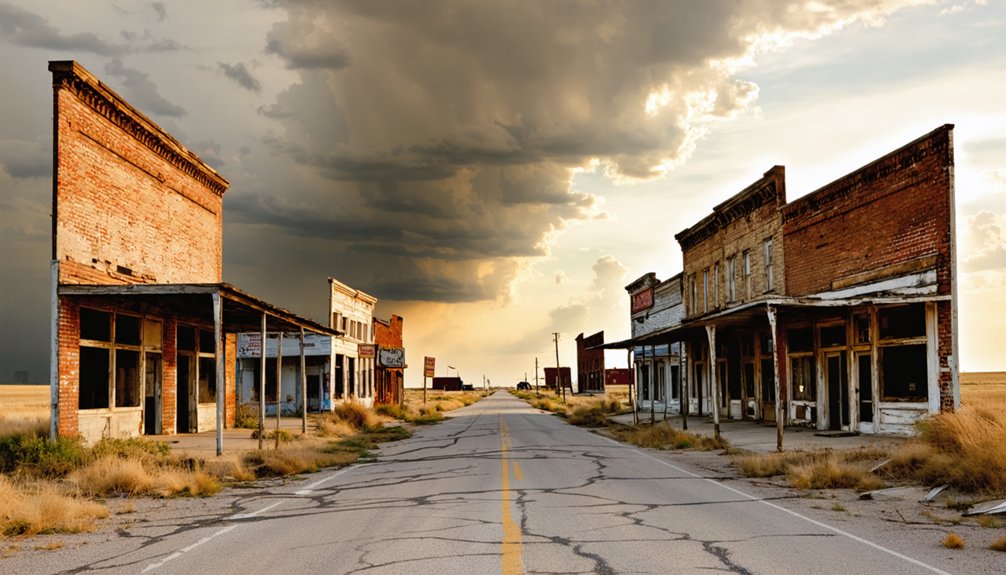
Wauneta, Kansas sits quietly in Chautauqua County near the Oklahoma border, where flat agricultural land swallowed a once-active railroad town. Platted in 1887, it peaked around 100 residents before its post office closed in 1961 and commerce faded entirely. You’ll reach it only by rural backroads, so pack supplies, charge your devices, and expect solitude. A surviving church along Kansas 166 offers your clearest connection to what once stood here — and there’s much more to uncover.
Key Takeaways
- Wauneta, Kansas, sits in southeastern Chautauqua County near the Oklahoma border, best reached by car via rural backroads with no public transportation available.
- Pack essentials including water, snacks, a full gas tank, printed county maps, sturdy shoes, sunscreen, and a portable charger before departing.
- Visit in spring or fall for mild weather and optimal photography conditions; summer heat and winter roads present significant challenges.
- A surviving church along Kansas 166 east of Cedarvale remains the most tangible landmark connecting visitors to Wauneta’s railroad-era past.
- Combine your trip with nearby ghost towns Elgin, Hewins, and Peru for a fuller exploration of southeastern Kansas’s forgotten settlements.
What Is Wauneta, Kansas and Why Do Ghost Town Visitors Go There?
Tucked into the rural landscape of southeastern Kansas near the Oklahoma border, Wauneta is an unincorporated community in Chautauqua County that once functioned as a legitimate railroad-era trade hub — and today draws ghost town enthusiasts curious about what’s left behind when a small settlement quietly fades away.
You won’t find a busy main street here, but you’ll find history worth chasing. Wauneta sits at roughly 958 feet in elevation, connected to the Missouri Pacific Railroad line that once made it a genuine shipping point for the surrounding agricultural region.
Visitors come for the local legends, the faint traces of historic architecture, and the freedom of exploring a place that most people have never heard of. That quiet obscurity is exactly the draw.
How Wauneta Went From Railroad Town to Ghost Town
When W.S. “Deak” Fisher platted Wauneta in the fall of 1887, the Missouri Pacific Railroad gave the town a genuine economic heartbeat, turning it into a busy shipping and receiving point for the surrounding agricultural region.
You can trace the town’s decline directly to the slow disappearance of its services — the post office closed in 1961, and the grocery store, gas station, and auto repair shop all eventually followed.
Once those commercial anchors vanished, Wauneta lost its reason to exist as a functioning community, leaving behind little more than historical footprints on the Kansas landscape.
Railroad Roots Drive Growth
Like many small Kansas settlements, Wauneta didn’t grow by accident—it grew because of the railroad. When the Missouri Pacific Railroad established a line through Chautauqua County, Wauneta found its purpose as a shipping and receiving point for the surrounding agricultural territory. That railroad connection drew settlers, merchants, and commerce to the area fast.
W.S. “Deak” Fisher platted the townsite in the fall of 1887, carving it into 18 blocks with Tecumseh Ave. anchoring the layout as the main street. Local legends suggest the town buzzed with activity during those early years, and historic architecture once reflected that ambition.
The Lincoln Land Co. took on some lots to push development further. The railroad didn’t just serve Wauneta—it built it.
Services Vanish, Town Fades
Railroad towns live and die by momentum, and Wauneta’s momentum didn’t last. Once a functioning trade hub, the town gradually shed its services one by one. The grocery store closed. The gas station went dark. The auto repair shop disappeared. Then, in 1961, the post office shut its doors — often the final signal that a community has crossed into urban decay.
What you’re visiting today is a place that once served a wide agricultural territory but couldn’t survive the shift away from railroad dependence. The 1910 population of 100 never grew, and the town contracted instead.
A surviving church along Kansas 166 east of Cedarvale stands as a quiet act of historical preservation. It’s one of the few anchors connecting you to what Wauneta once was.
Where Exactly Is Wauneta in Chautauqua County?
You’ll find Wauneta tucked into southeastern Kansas within Chautauqua County, sitting close to the Oklahoma border at coordinates 37°06’47″N, 96°22’50″W.
The community rests at an elevation of 958 feet (292 m), placing it in a flat, open agricultural landscape that once supported a bustling railroad trade point.
Set your device to Central Time (UTC-6) before you head out, and plan your approach through the rural backroads that define this corner of the state.
Wauneta’s Geographic Position
Tucked into the southeastern corner of Kansas, Wauneta sits within Chautauqua County just a short distance from the Oklahoma border. You’ll find it at coordinates 37°06’47″N 96°22’50″W, resting at an elevation of 958 feet above sea level. The Central Time Zone governs your schedule here, so plan accordingly.
This is rural agricultural country, where local flora like native grasses and scattered hardwoods define the landscape more than any skyline would. Don’t expect modern amenities — you’re venturing into a region where convenience stores and cell service can feel like distant luxuries.
That raw, open character is exactly what draws freedom-seeking travelers to southeastern Kansas. Wauneta rewards those willing to navigate its quiet backroads with an unfiltered glimpse into a vanished way of life.
Coordinates And Elevation Details
Pinning down Wauneta’s exact location helps you plan your approach through Chautauqua County’s winding rural roads. The coordinates sit at 37°06’47″N 96°22’50″W, placing you firmly in southeastern Kansas, close to the Oklahoma border.
You’re traveling at an elevation of 958 feet, or 292 meters, across gently rolling agricultural terrain that shaped this settlement’s local history from the start.
Central Time governs the region, so adjust your schedule accordingly. These precise coordinates let you cross-reference historic landmarks on older maps against what you’ll actually find on the ground.
When you arrive, the flat horizon and open fields tell the story of why Wauneta once thrived as a rural trade point, and why today it stands as a quiet, compelling ghost-town destination.
How to Get to Wauneta on Your Road Trip
Reaching Wauneta means heading into the rural southeastern corner of Kansas, where Chautauqua County hugs the Oklahoma border. Your best transportation options include driving south along US-166, letting the open plains guide you toward Cedarvale. No buses or trains serve this forgotten stretch anymore.
- Feel the quiet freedom of empty roads stretching endlessly toward the horizon
- Spot the surviving church along Kansas 166 east of Cedarvale, a ghost of what once thrived
- Let the landscape itself tell Wauneta’s story before you even arrive
Sample local cuisine in nearby Cedarvale or Independence before heading out, since Wauneta offers nothing commercially today. Pack your own supplies, charge your phone, and embrace the solitude.
This road trip rewards the curious, not the comfort-seeker.
What Physical Evidence of Wauneta Still Survives Today?
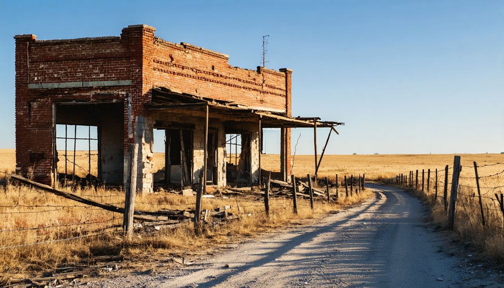
When you arrive at Wauneta today, you’ll find that physical evidence of the town’s past is sparse but meaningful. Your best landmark is a surviving church on Kansas 166 east of Cedarvale, which anchors the site historically and gives you a tangible connection to the community that once thrived here.
The original 18-block plat’s street grid may still hint at the town’s former layout, but the commercial district that once lined Tecumseh Ave. has effectively vanished, leaving only the landscape to suggest what was lost.
Surviving Church On Highway
Though little of Wauneta’s original townsite remains visible today, one tangible piece of its past still stands: a church along Kansas 166, east of Cedarvale. This surviving structure connects you directly to the community that once thrived here, offering a rare glimpse into the region’s historic architecture and local folklore.
As you pull over and take it in, let it remind you of the lives once built around this settlement:
- A congregation that gathered weekly, forming bonds in an isolated rural landscape
- Families who depended on this community as their entire world
- Voices and traditions that faded when the town’s commercial heart disappeared
You’re not just seeing an old building — you’re standing at the edge of a vanished way of life.
Remnants Of Original Plat
Beyond the surviving church, the physical evidence of Wauneta’s original plat is sparse — but knowing what once existed here sharpens what you’re looking at.
W.S. “Deak” Fisher divided this townsite into 18 blocks back in 1887, with Tecumseh Ave. anchoring the main street grid.
You won’t find much historic architecture standing today, but the land itself still reflects that original layout if you study it carefully.
Local legends hint at where the post office, grocery store, and gas station once served a community of 100 residents.
Walk the area and you’re fundamentally tracing a vanished railroad-era settlement.
That freedom to interpret the landscape on your own terms makes Wauneta a rewarding stop for anyone who prefers history unfiltered by tourist infrastructure.
Vanished Commercial District Traces
Stepping back from the plat’s ghost geometry, you’ll want to focus on what physical traces of Wauneta’s commercial district actually survive — and the honest answer is very little. The grocery store, gas station, and auto repair shop that once anchored this rural trade point have vanished entirely, leaving abandoned structures swallowed by time and prairie.
What lingers instead are:
- Local legends passed down about the railroad era’s brief prosperity
- Scattered foundations where commerce once connected farmers across a wide territory
- A surviving church along Kansas 166 east of Cedarvale, standing as the most tangible remnant
You’re fundamentally reading absence here — empty lots where transactions once happened, silence where engines idled. That rawness is precisely what draws freedom-seeking road-trippers to places like Wauneta.
What Is the Surviving Church on Kansas 166 Near Cedarvale?
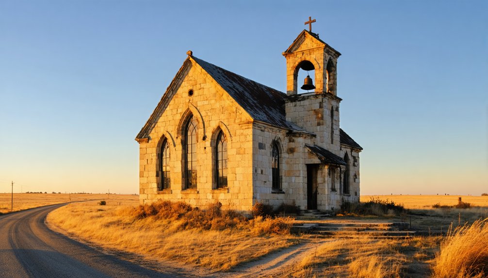
While little remains of Wauneta itself, a surviving church along Kansas 166 east of Cedarvale stands as one of the most tangible links to the community’s past. When you drive that stretch of highway, you’ll spot this quiet structure holding its ground against the surrounding rural landscape.
Its historic architecture reflects the era when Wauneta functioned as a genuine trade hub with a hundred residents depending on local institutions. Local legends likely swirl around this building, connecting it to families who once farmed and shipped goods through the Missouri Pacific Railroad stop nearby.
You don’t need a guided tour to appreciate what it represents — just pull over, take in the details, and let the structure tell its own story about southeastern Kansas’s vanished settlements.
Which Ghost Towns Near Wauneta Are Worth Combining?
That church on Kansas 166 is worth the stop, but southeastern Kansas rewards you even more when you string together several ghost-town sites into a single day trip. Chautauqua County holds layers of local legends and historic landmarks waiting for curious travelers who crave open roads and forgotten stories.
Consider adding these nearby stops to your route:
- Elgin – a quietly faded railroad town where empty storefronts still whisper about busier days
- Hewins – a crossroads community carrying local legends tied to early cattle-country commerce
- Peru – a small historic landmark settlement sitting close enough to fold into your loop without backtracking
Each site deepens your understanding of how southeastern Kansas once thrived, then slowly surrendered to time.
Best Time of Year to Visit Wauneta and Nearby Ghost Towns
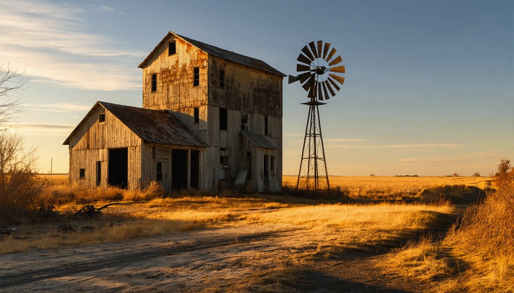
Timing your visit to Wauneta and southeastern Kansas can make the difference between a rewarding road trip and a frustrating one. Spring and fall offer the most comfortable conditions — mild temperatures, manageable roads, and clear skies that highlight the region’s open rural landscape.
Timing your visit right transforms a Kansas road trip — spring and fall deliver the mild conditions these quiet landscapes deserve.
Summer heat can be punishing, and winter roads in Chautauqua County turn unpredictable fast. Since Wauneta lacks urban development and modern amenities entirely, you’ll need to plan your supplies beforehand.
Bring water, snacks, and a full tank of gas before leaving Cedarvale or Independence.
Early mornings give you the best light for photographs of remaining structures.
Avoid holiday weekends if you want the quiet, unhurried experience these ghost-town sites genuinely deserve.
Weekday visits in October are particularly ideal.
What to Pack for a Chautauqua County Ghost Town Day Trip
Once you’ve settled on the right season, packing smart becomes your next priority. Chautauqua County’s open terrain rewards prepared explorers who respect its remoteness.
- Bring binoculars — wildlife viewing across southeastern Kansas grasslands delivers unexpected encounters with hawks, deer, and wild turkey that make the silence feel alive.
- Pack a cooler stocked with local cuisine from nearby towns, because once you’re deep in ghost-town country, convenience stops disappear fast.
- Carry a printed county map and portable charger — cell service doesn’t care about your timeline out here.
Sturdy walking shoes, sunscreen, and extra water handle the physical demands of the site.
A small notebook lets you capture details about Wauneta’s original 18-block layout as you move through what remains.
Which Kansas Records and Sources Help You Trace Wauneta’s History?
Digging into Wauneta’s past means leaning on a handful of reliable Kansas sources that actually document its short but distinct history.
Start with historical land records held through the Chautauqua County Register of Deeds, where you’ll find evidence of W.S. “Deak” Fisher’s 1887 platting and the lot transfers made to the Lincoln Land Co.
The Kansas State Historical Society holds census data, township records, and post office documentation that confirm Wauneta’s 1910 population of 100.
Railroad company archives from the Missouri Pacific line reveal how the community functioned as a local shipping and receiving point.
Ghost-town reference databases specific to Kansas round out your research by connecting surviving landmarks, like the church near Kansas 166 east of Cedarvale, to the broader settlement story.
Frequently Asked Questions
Is There Cell Phone Coverage Available Near Wauneta, Kansas?
Cell phone connectivity isn’t guaranteed near Wauneta—you’re venturing into rural southeastern Kansas, where signal strength can drop considerably. Download your maps offline, embrace the freedom of the unknown, and prepare for an unplugged ghost town adventure!
Are There Any Entrance Fees or Permits Required to Visit Wauneta?
Thankfully, no bureaucrat’s blocking your freedom here! You don’t need entrance fees or permits to visit Wauneta. Embrace historic preservation naturally, and for photography tips, just roam freely and capture this ghost town’s haunting, open beauty.
Can You Camp Overnight Near the Wauneta Ghost Town Site?
No official campgrounds exist at Wauneta, but you’ll find nearby open land perfect for historical preservation appreciation and wildlife observation. Check local county rules first, then set up camp freely under southeastern Kansas’s wide, star-filled skies.
Is the Wauneta Site Accessible for Visitors With Mobility Limitations?
You’ll find Wauneta’s rural terrain challenging if you need mobility assistance, as it lacks accessible pathways. Uneven ground and open fields define the site, so plan your visit carefully for a safe, fulfilling experience.
Are There Any Guided Ghost Town Tours Available in Chautauqua County?
No formal guided tours exist, but you’ll uncover historical preservation efforts and local legends by connecting with Chautauqua County historical societies, who actively share stories that’ll fuel your independent ghost town adventure through southeastern Kansas.
References
- https://en.wikipedia.org/wiki/Wauneta
- https://www.chasecounty.com/waunetahistory.html
- https://en.wikipedia.org/wiki/List_of_ghost_towns_in_Kansas
- https://legendsofkansas.com/kansas-ghost-town-list/
- http://www.ksgenweb.org/archives/1912/w/wauneta.html
- https://johnsoncoks.cottonhills.net/historic-records/old-towns.html
- https://esirc.emporia.edu/bitstream/handle/123456789/1577/McQuin Vol 8 Num 3.pdf?sequence=1
- https://books.google.com/books/about/Ghost_towns_of_Kansas.html?id=UwslAAAAMAAJ
- https://vi.wikipedia.org/wiki/Danh_sách_phố_ma_tại_Kansas