Planning a ghost town road trip to Black Diamond, Arizona means heading into Cochise County’s rugged desert to explore an 1880s gold and silver mining settlement frozen in time. You’ll find crumbling foundations, a weathered tramway tower, and open mine shafts scattered across National Forest land. Visit between November and February for the most comfortable conditions, pack plenty of water, and confirm land access before you go. Everything you need to know is just ahead.
Key Takeaways
- Black Diamond is an abandoned 1880s gold and silver mining settlement in Cochise County, Arizona, sitting at 3,799 feet elevation.
- Visit between November and February for mild temperatures and clear skies, avoiding dangerous summer heat from June through August.
- A four-wheel drive vehicle is essential, and you must verify land access with Coronado National Forest and Arizona State Land Department.
- Pack at least one gallon of water per person daily, a GPS device, paper maps, first-aid kit, and emergency communication tools.
- Combine your visit with nearby ghost towns like Tombstone, Gleeson, and Courtland for a rewarding multi-stop Arizona mining heritage itinerary.
What Is Black Diamond, Arizona?
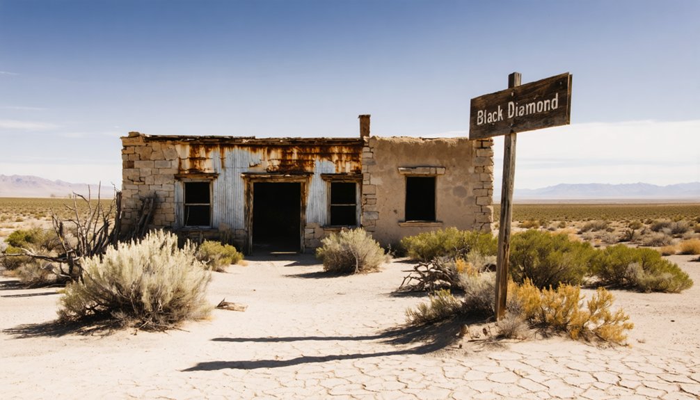
Black Diamond is an abandoned mining settlement tucked into the foothills of Cochise County, Arizona, where gold and silver prospectors once carved out a small but thriving community at an elevation of 3,799 feet.
Discovered in 1880, the town grew to roughly 100 residents and even supported its own post office from 1901 to 1908.
At its peak, Black Diamond supported roughly 100 residents and even maintained its own post office.
Its historical significance lies in what it reveals about frontier life and the underground mining techniques prospectors used to extract precious metals from the desert earth.
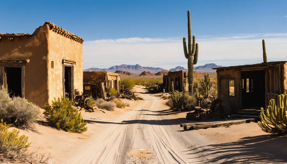
When operations ceased, Black Diamond didn’t vanish entirely — foundations, walls, a tramway tower, and scattered mine shafts still mark the landscape.
You’re stepping into a place where ambition met rugged terrain, and the remnants tell that story honestly.
What Was Black Diamond Originally Mined For?
The settlement’s name might suggest coal, but Black Diamond‘s real story runs deeper — literally. When prospectors staked their claims here in 1880, they weren’t chasing black rock — they were chasing gold and silver buried beneath Cochise County’s rugged terrain.
Black Diamond operated as a gold extraction prospect, pulling precious metals from the earth through underground mining methods. That mining history shaped everything about the settlement, from its rapid growth to its eventual abandonment once the ore ran out.
Today, the site sits on National Forest land, meaning you can explore its legacy without restrictions tying you down. The mine shafts, tailings piles, and tramway tower still stand as raw evidence of what drew ambitious prospectors to this remote Arizona landscape in the first place.
Where Exactly Is Black Diamond Located?

Tucked into Arizona’s foothills terrain, Black Diamond sits at an elevation of 3,799 feet within Santa Cruz County — a detail worth noting, since some sources mistakenly place it in neighboring Cochise County.
The legal coordinates place it within Township 18 South, Range 24 East, giving you a precise starting point for direction finding.
Township 18 South, Range 24 East marks Black Diamond’s legal position — your essential coordinates before venturing into the foothills.
Its historical significance stretches back to 1880, when miners first arrived employing gold and silver mining techniques that would shape the region’s identity for decades.
The site now falls within National Forest land, which affects access considerations.
You’ll want an off-road capable vehicle to reach it, as the foothills terrain doesn’t accommodate standard vehicles well.
Study your maps carefully before heading out — charting your way to Black Diamond rewards preparation with genuine discovery.
How Do You Actually Get There?
Getting to Black Diamond takes more than just knowing where it sits on a map — you’ll need to plan your approach carefully once you leave paved roads behind. A four-wheel drive vehicle isn’t optional here; it’s your ticket to uncovering genuine ghost town history. The foothills terrain demands respect and preparation.
Before you go, lock in these essentials:
- Avoid any road marked “Black Diamond Mine” — it leads you astray.
- Research Township 18 South, Range 24 East coordinates.
- Consult local ghost town resources for current route conditions.
- Pack supplies suited for desert climate.
Winter offers the most comfortable conditions for exploring the site’s remaining structures and learning about the gold and silver mining techniques that once defined this remote Arizona outpost.
Can You Legally Visit Black Diamond? What to Know First
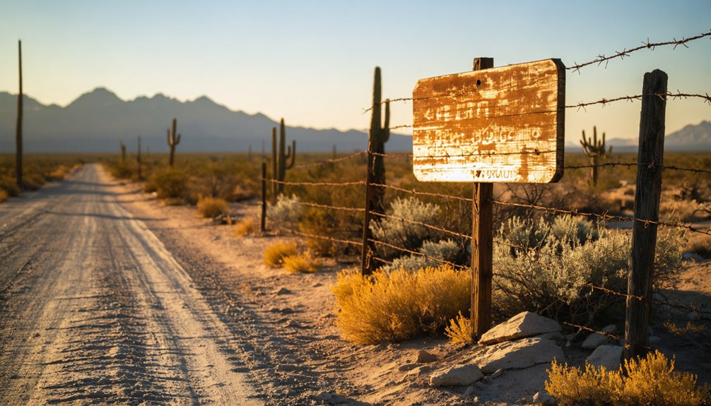
Before you pack your gear and head out, you’ll want to know that Black Diamond sits on National Forest land, which generally allows public access, but surrounding private property creates boundary lines you shouldn’t cross without permission.
Watch for posted signs marking private land, and respect any fencing or barriers you encounter along the route.
Once you reach the mine site itself, treat the shafts and tailings piles as serious hazards — unstable ground, poor air quality, and structural collapse make entering any underground opening a potentially fatal decision.
Public Vs. Private Land
Visiting Black Diamond isn’t as straightforward as pulling up to a trailhead and hiking in—much of the land surrounding the ghost town is privately owned, which means you’ll need to do your homework before making the trip.
Land ownership here is a patchwork, and understanding your access rights keeps you on the right side of the law. Before you go, confirm:
- Whether you’re crossing private or National Forest land
- Who controls access to the specific parcels you’ll travel through
- If posted signs restrict entry to certain areas
- Whether you need permission from a landowner before proceeding
Respecting these boundaries isn’t just legal common sense—it protects your freedom to explore and preserves access for future visitors.
National Forest Access Rules
Since National Forest land now encompasses the Black Diamond mining property, you’ve got a clearer legal pathway to visit than you might expect. National forest access rules generally permit recreational exploration, meaning you can legally walk the grounds, photograph the ruins, and soak in the history without special permits.
That said, access rules still carry real responsibilities. You’ll need to stay on designated routes, respect any posted closures, and leave artifacts exactly where you find them. Removing historical objects violates federal law, no exceptions.
Remember that private land parcels can border or overlap national forest boundaries in this region. Before you load up your four-wheel drive and head out, confirm current access conditions with the relevant ranger district to avoid surprises on the trail.
Mine Safety Considerations
Mine shafts scattered across Black Diamond present serious physical hazards that you’ll want to understand before stepping foot on the property.
Tailings piles and unstable ground hide real mine hazards beneath deceptively solid-looking surfaces.
Take these safety precautions seriously:
- Never enter mine shafts — structural collapse happens without warning
- Watch your footing around tailings piles, which can shift suddenly
- Travel with a partner so someone can respond during emergencies
- Carry communication devices since remote terrain limits outside contact
Private land ownership adds another layer of responsibility.
Trespassing without permission creates legal exposure you don’t want.
Research property boundaries beforehand and respect posted signage.
Your freedom to explore depends on approaching these sites responsibly and leaving the landscape exactly as you found it.
What’s Still Standing at the Black Diamond Site?
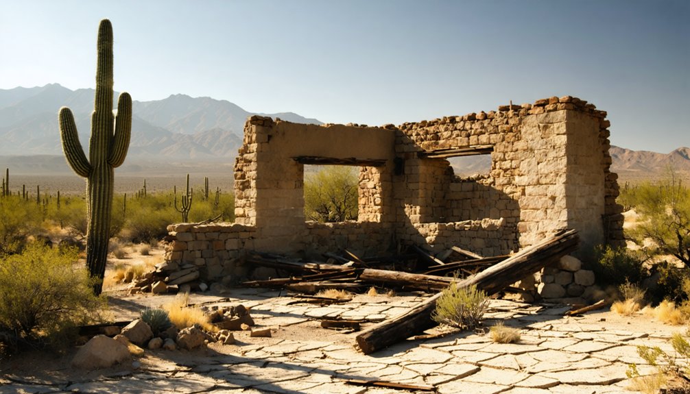
Although the years haven’t been kind to Black Diamond, you’ll still find plenty of remnants worth exploring when you arrive at the site. Foundations and walls from the settlement era remain visible, giving you a tangible connection to the miners who once called this place home.
The tramway tower still stands as one of the most striking features of your ghost town exploration, rising against the Arizona sky as a symbol of the operation’s industrial past. Mine shafts and tailings piles dot the landscape, while archaeological artifacts scattered among the abandoned structures reward curious visitors willing to look closely.
This well-preserved slice of 1880s mining history offers enough visual and historical substance to make your off-road journey genuinely worthwhile.
The Best Time of Year to Visit Black Diamond
Planning your visit around the right season makes a significant difference when exploring Black Diamond. The desert climate considerations here are real, and timing your trip around the best visiting months guarantees a more rewarding experience.
Winter reigns supreme for exploring this remote Arizona ghost town. You’ll enjoy mild temperatures, manageable terrain, and clear skies perfect for photography and exploration.
Winter is the prime season for exploring Black Diamond, offering mild temperatures and clear skies ideal for photography.
Here’s why the best visiting months matter:
- November through February delivers mild, comfortable temperatures.
- Hot summers from June through August create dangerous conditions.
- Spring months offer a secondary window with pleasant weather.
- Desert preparation remains essential regardless of season.
Pack adequate water and supplies no matter when you go. Black Diamond rewards those who plan smart and travel prepared.
What to Bring for a Remote Desert Mine Hike
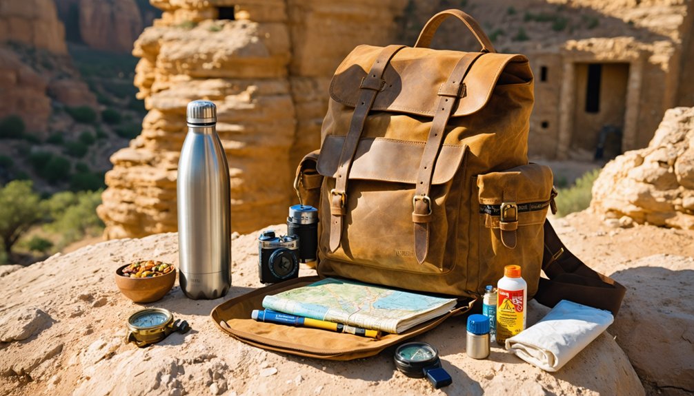
Before you head out to Black Diamond’s remote terrain, pack at least one gallon of water per person along with high-energy snacks, since you won’t find any services once you leave paved roads behind.
You’ll also want a GPS device, a paper map, a first-aid kit, and an emergency communication tool in case navigation gets tricky or conditions turn dangerous.
Top it all off with sunscreen, a wide-brimmed hat, UV-protective clothing, and layers for unexpected weather shifts at the site’s nearly 3,800-foot elevation.
Essential Water And Snacks
Heading out to a remote desert mine like Black Diamond means you’re taking on terrain that doesn’t forgive poor preparation, and water is your most critical supply.
Follow these hydration tips and snack options to stay sharp:
- Water – Carry at least one gallon per person per day; desert heat drains you faster than you’d expect.
- Electrolyte packets – Replenish minerals lost through sweat during strenuous exploration.
- High-energy snacks – Pack nuts, jerky, and dried fruit for sustained energy without bulk.
- Insulated cooler – Keep your supplies from spoiling under intense desert sun.
You’re responsible for your own safety out there, so pack smart, pack enough, and don’t rely on resupply once you’ve hit the trail.
Finding Black Diamond in the remote foothills of Cochise County isn’t a casual scroll through Google Maps—you’ll need reliable navigation tools and emergency gear that can handle real desert conditions.
Visitors frequently report navigation challenges reaching this isolated site, so pack a downloaded offline map, a physical topo map, and a compass as your core navigation strategies.
Your emergency supplies should reflect the desert’s unforgiving nature. Carry a first aid kit, emergency whistle, signal mirror, and a charged portable battery pack.
A fire starter and emergency mylar blanket add critical backup for unexpected overnights. Since the road to Black Diamond demands four-wheel drive capability, a recovery strap, tire plug kit, and jumper cables belong in your vehicle.
Preparation transforms a potentially dangerous situation into a manageable one.
Sun And Weather Protection
Desert sun at Black Diamond’s 3,799-foot elevation hits harder than most visitors expect, so you’ll want sun protection that goes well beyond a basic baseball cap. Higher elevation intensifies UV exposure greatly, and desert terrain offers zero shade while you’re exploring mine shafts and tramway ruins.
Pack smart weather gear before you head out:
- SPF 50+ sunscreen applied liberally and reapplied every two hours
- Wide-brim hat covering your neck and ears during peak afternoon hours
- Lightweight long sleeves blocking UV rays without trapping excessive heat
- Layered clothing accommodating dramatic temperature swings between morning cold and afternoon warmth
Winter visits offer milder conditions, but sun protection remains non-negotiable year-round.
Afternoon monsoon storms during summer can roll in fast, so waterproof layers belong in your pack too.
Other Ghost Towns Near Black Diamond Worth the Drive
Scattered throughout Cochise and Santa Cruz counties, several ghost towns sit within striking distance of Black Diamond and reward the extra miles with their own haunting histories.
Tombstone stands as one of Arizona’s most celebrated ghost town attractions, delivering historical significance through its preserved saloons, Boot Hill Graveyard, and legendary O.K. Corral.
Farther east, Gleeson offers crumbling adobe ruins and an old jail that’ll stop you cold.
Courtland, just a short detour away, delivers foundations and scattered remnants that spark the imagination without the crowds.
Each location carries its own character, giving you the freedom to build a multi-stop itinerary across genuinely remarkable terrain.
Combine these destinations with Black Diamond, and you’ve crafted a road trip that honors Arizona’s raw, unfiltered mining heritage.
How to Confirm Road Access and Conditions Before You Go
Before you hit the dirt roads toward Black Diamond, call the Coronado National Forest ranger station to get the latest road conditions and any access restrictions.
You’ll also want to verify whether you’re crossing private land, since ownership considerations apply to the area and you don’t want to trespass unknowingly.
Check recent visitor reports from ghost town forums or local off-road communities, as navigation challenges are common and firsthand intel can save you a frustrating dead end.
Check Road Conditions First
Planning a trip to Black Diamond means tackling rugged, off-road terrain that can shift dramatically with seasonal weather changes, so you’ll want to confirm road conditions well before you load up the four-wheel drive.
Road condition updates protect your travel safety and keep your adventure on track.
Before heading out, check these four sources:
- Coronado National Forest office for current trail and road status
- Local Arizona off-road forums where recent visitors post firsthand reports
- Weather forecasts for Cochise and Santa Cruz Counties covering your travel dates
- County road department websites for any seasonal closures or hazard warnings
Conditions change fast in desert foothills, and no ghost town photo is worth a damaged vehicle or a dangerous situation miles from help.
Contact Local Authorities
Reaching Black Diamond’s remote terrain means you’ll want more than weather apps and forum posts in your corner—local authorities carry real-time knowledge that no website reliably updates.
Contact the Coronado National Forest office for current road conditions, access permissions, and any local regulations governing the property. Rangers understand the site’s historical significance and can point you toward legitimate entry routes while flagging seasonal closures you’d never discover otherwise.
The Cochise County Sheriff’s office also tracks road hazards following storms. Call ahead rather than assuming conditions match your last online source—remote roads shift dramatically after monsoons or freeze cycles.
You’re chasing freedom out there, but informed freedom beats getting stranded on unmarked private land miles from help.
Verify Private Land Access
Three distinct land ownership categories intersect near Black Diamond—National Forest, state, and private parcels—and confusing them can turn your adventure into a trespassing incident.
Understanding land ownership and access rights before you leave home protects your freedom to explore responsibly.
Confirm your route using these steps:
- Contact the Coronado National Forest ranger district for current access rights on federal portions.
- Check Arizona State Land Department records for state parcel entry permits.
- Research county assessor maps to identify private boundaries.
- Heed posted warnings, particularly roads marked “Black Diamond Mine,” which may cross private land.
Four-wheel drive capability gets you there physically, but proper land ownership verification gets you there legally.
Don’t let an avoidable boundary mistake cut your ghost town adventure short.
Frequently Asked Questions
What Elevation Does Black Diamond Sit at Above Sea Level?
You’ll breathe the crisp air and soak in scenic vistas as Black Diamond sits at 3,799 feet above sea level. That elevation impact rewards your adventurous spirit with stunning, expansive views worth every rugged mile traveled.
When Did Black Diamond’s Post Office Operate During Its Settlement Years?
You’ll discover Black Diamond’s post office operated from 1901 to 1908, adding to its historical significance. These ghost stories of a once-thriving settlement, buzzing with nearly 100 residents,’ll fuel your adventurous spirit!
What Legal Township and Range Coordinates Identify Black Diamond’s Location?
You’ll find Black Diamond’s township boundaries at Township 18 South, with range coordinates at Range 24 East. These legal markers guide your adventurous spirit directly to this remote, untamed Arizona ghost town waiting for your exploration.
Did Coal Mining Ever Occur at the Black Diamond Site?
You won’t find coal mining history at Black Diamond — it’s a gold and silver story! Ghost town legends here celebrate precious metal extraction, making your adventurous journey into Arizona’s rugged, freedom-filled landscape even more thrillingly worthwhile.
How Many Residents Lived in Black Diamond During Its Peak Population?
Once a thriving hub, now silent ruins — you’ll find Black Diamond’s ghost town history fascinating. At its peak, approximately 100 residents lived there, leaving behind a mining legacy that’s still visible today.
References
- https://www.ghosttowns.com/states/az/blackdiamond.html
- https://www.youtube.com/watch?v=wQ1jN0dMWtE
- https://www.treasurenet.com/threads/black-diamond-mine-ghost-town.110142/
- https://www.diablogazette.com/2019/05/black-diamond-mines-forgotten-towns/
- https://www.blackdiamondmuseum.org/surrounding-towns/
- https://westernmininghistory.com/mine-detail/10234859/
- https://blackdiamondhistory.wordpress.com/2013/06/02/black-diamond/


