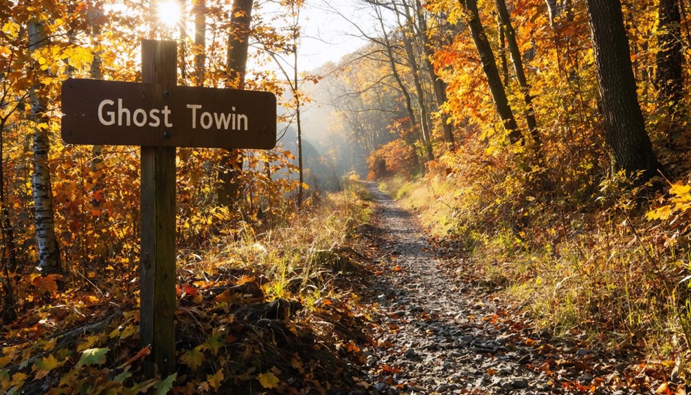
Start your ghost town road trip at Saylor Park, 1284 Old Indiana Road in Blairsville, Pennsylvania, where the Ghost Town Trail‘s western gateway opens onto 36 to 46 miles of limestone-dust path tracing Blacklick Creek. You’ll pedal past the vanished coal towns of Bracken, Wehrum, and Claghorn, where foundation stones outlasted entire communities. Pack water, layers, and a sense of history — everything ahead tells a deeper story than the silence first suggests.
Key Takeaways
- Blairsville Junction’s Saylor Park, located at 1284 Old Indiana Road, serves as the ideal western gateway to the Ghost Town Trail.
- The Ghost Town Trail spans 36 to 46 miles, featuring a hard-packed limestone-dust path along scenic Blacklick Creek toward Dilltown.
- Notable ghost towns along the trail include Bracken, Armerford, Wehrum, and Claghorn, reflecting Pennsylvania’s rich coal mining history.
- Key stops include Heshbon Access for parking and restrooms, with Dilltown offering a trail shop, B&B, and dining facilities.
- The ideal riding season runs from May through October, though the trail remains accessible year-round for various outdoor activities.
Why Blairsville Junction Is the Best Ghost Town Trail Starting Point
When you’re planning a Ghost Town Trail road trip, Blairsville Junction earns its place as the ideal western gateway.
Start at Saylor Park on Old Indiana Road, where parking, picnic facilities, and seasonal restrooms make launching your journey effortless.
From here, trail highlights unfold quickly — the limestone-dust path follows Blacklick Creek eastward, threading through a corridor where coal towns once hummed with industry before vanishing in the early 1900s.
Scenic views of the creek accompany you mile after mile, quietly narrating a forgotten Pennsylvania.
You’ll also connect directly to the Hoodlebug Trail, expanding your freedom to roam the regional network.
Blairsville Junction isn’t just a trailhead — it’s the threshold between the present and a hauntingly beautiful industrial past worth exploring.
How to Reach Saylor Park and Where to Park
You’ll find Saylor Park at 1284 Old Indiana Road, Blairsville, PA 15717, tucked along the western edge of the Ghost Town Trail where Blacklick Creek once echoed with the rumble of coal cars.
Pull into the lot and you’ve got free parking, seasonal restrooms, picnic facilities, and ballfields — everything you need before hitting the limestone-dust trail.
From there, you’re already connected to the Hoodlebug Trail, placing you at the crossroads of a regional network that threads its way through a landscape still quietly haunted by the industry that built it.
Saylor Park Location Details
Saylor Park sits at 1284 Old Indiana Road, Blairsville, PA 15717, and it’s your closest western gateway onto the Ghost Town Trail toward Blairsville Junction.
Pull in, breathe deep, and feel the quiet promise of open trail ahead. The parking amenities here give you everything you need before venturing east — seasonal restrooms, picnic facilities, a walking path, and ballfields that hum with small-town life.
Saylor Park also connects directly to the Hoodlebug Trail at Blacklick, expanding your freedom to roam beyond a single corridor.
This is where coal country’s forgotten past meets your present curiosity. Leave the noise behind, follow Blacklick Creek‘s unhurried current, and let the landscape tell its own weathered, resilient story mile by mile.
Driving Directions To Saylor Park
Getting to Saylor Park is straightforward once you’ve locked in the address — 1284 Old Indiana Road, Blairsville, PA 15717 — and let your GPS do the heavy lifting.
From Pittsburgh, you’ll follow Route 22 East, one of Pennsylvania’s most rewarding driving routes through rolling Allegheny foothills. As you approach Blairsville, the landscape opens into scenic views of Blacklick Creek valley — a quiet preview of what the trail delivers on foot or by bike.
Exit toward Blairsville and follow signs to Old Indiana Road. Saylor Park sits near Blacklick, where the Ghost Town Trail connects to the Hoodlebug Trail.
Parking is available on-site, alongside seasonal restrooms, picnic facilities, and ballfields — everything you need before heading east into Pennsylvania’s storied coal country past.
Parking And Facility Options
Once you pull off Old Indiana Road and into Saylor Park, the logistics of your trip fall quickly into place. Your parking options are straightforward — a free, accessible lot welcomes trail riders, hikers, and road-trippers without hassle.
From your car door, freedom opens immediately.
The facility amenities here are modest but purposeful. Seasonal restrooms keep you comfortable before hitting the trail. Picnic facilities invite a slow morning meal before you ride toward ghost towns that coal once built and time eventually swallowed.
A walking path loops the grounds, and ballfields stretch nearby for families arriving with restless energy.
Saylor Park also connects directly to the Hoodlebug Trail, extending your range further into Indiana County’s quiet, creek-lined corridors — terrain that rewards those who came here deliberately.
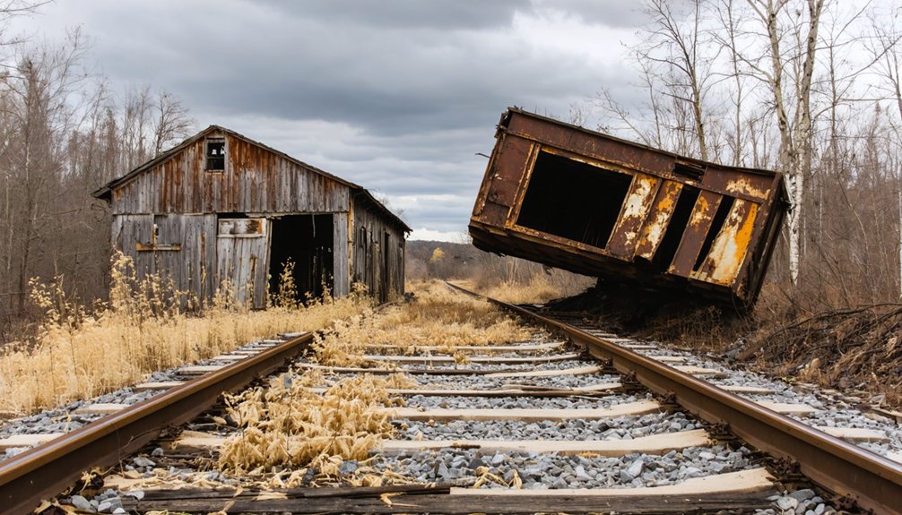
Which Ghost Towns Will You Pass on the Ghost Town Trail?
As you pedal or hike the Ghost Town Trail, you’ll pass the remnants of forgotten communities like Bracken, Armerford, Lackawanna No. 3, Scott Glenn, Webster, Beulah, and Claghorn — towns swallowed by the early 1900s collapse of the coal mining industry.
None looms larger in the trail’s history than Wehrum, once a bustling company town of 230 houses, a hotel, a store, a jail, and a bank, developed by Warren Delano and now reduced to silence.
Near Blairsville, Cokeville joins the list of lost places, reminding you that this landscape was once alive with the labor and lives of thousands.
Notable Ghost Towns Listed
Eight ghost towns haunt the Ghost Town Trail, each one a faded chapter in Pennsylvania’s coal country story. You’ll pass through Bracken, Armerford, Lackawanna No. 3, Scott Glenn, Webster, Beulah, and Claghorn — communities that thrived, then vanished when the coal ran out.
Near Blairsville, you’ll find Cokeville, another lost town swallowed by time.
Wehrum stands tallest among them. At its peak, it held 230 houses, a hotel, company store, jail, and bank — all developed by Warren Delano. Today, only silence remains.
These ghost towns aren’t just curiosities. They’re honest monuments to mining history, reminding you that entire lives unfolded here.
Walking or cycling this trail, you’re moving through real stories — not reconstructed ones — and that makes all the difference.
Towns Lost To Mining
Coal built these towns, and coal buried them. As you ride the Ghost Town Trail, you’re passing through what were once thriving communities — places where families lived, worked, and built entire lives around the mining industry.
Wehrum stood as the largest, boasting 230 houses, a hotel, a company store, even a jail and bank. Then the coal ran out, and the people left.
You’ll also pass through the remnants of Bracken, Armerford, Lackawanna No. 3, Scott Glenn, Webster, Beulah, and Claghorn — ghost towns swallowed by time and economic collapse.
Near Blairsville, Cokeville tells a similar story. Their mining history now lives quietly beneath your wheels, embedded in the landscape you’re rolling through.
Wehrum’s Historical Significance
Wehrum once stood as the crown jewel of this coal corridor, built by Warren Delano into a self-contained world of 230 houses, a hotel, a company store, a jail, and even a bank.
This wasn’t just a mining camp — it was an entire civilization carved from Pennsylvania wilderness.
Today, Wehrum Heritage lives in the silence between the trees. You’ll find the access point at 2415 Wehrum Road, Vintondale, where parking lets you step directly into that vanished world.
Nothing stands now, yet everything speaks.
Walking this stretch connects you to something rare: authentic Historical Preservation without ropes or admission fees.
You’re free to explore, imagine, and reckon with how completely a thriving community can disappear when the coal runs out.
How Far Should You Ride the Ghost Town Trail?
How far you ride depends on what you’re chasing—scenery, history, or just the simple pleasure of pedaling through a valley that time hasn’t quite finished forgetting.
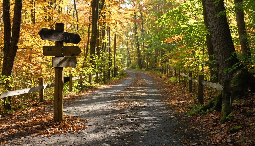
Start at Saylor Park in Blairsville and push toward Dilltown for the most rewarding stretch. Trail difficulty stays manageable—hard-packed limestone dust on a gentle former rail grade means you’re working with the landscape, not against it.
The scenic views along Blacklick Creek earn every mile. Dilltown sits roughly mid-trail and offers a B&B, snacks, and restrooms—a natural turnaround if you’re doing an out-and-back.
Ambitious riders can press further toward Vintondale and the Eliza Furnace. The full trail spans 36 to 46 miles. Ride as far as your curiosity pulls you.
What Other Trails Connect to the Ghost Town Trail Near Blairsville?
The Ghost Town Trail doesn’t dead-end at Blairsville—it reaches out. At Saylor Park in Blacklick, it connects directly to the Hoodlebug Trail, extending your freedom further into Indiana County’s quiet backroads and forgotten landscapes.
At Saylor Park in Blacklick, the Ghost Town Trail reaches out and grabs the Hoodlebug Trail—your freedom doubles instantly.
These trail connections aren’t incidental—they’re intentional threads in the Trans Allegheny Trails network, a regional system stitching western Pennsylvania together toward Pittsburgh.
You’re not just riding a single path; you’re tapping into something larger. The Blairsville Secondary segment, opened in 2005, pushes that regional link even deeper, pulling you toward nearby attractions and communities that rarely appear on tourist maps.
If you crave open miles with genuine historical weight beneath your wheels, Blairsville Junction isn’t a stopping point—it’s a launching pad.
What Are the Best Stops Between Blairsville Junction and Dilltown?
Once you leave Saylor Park and push east toward Dilltown, the Ghost Town Trail stops being abstract history and becomes something you can feel beneath your wheels.
Trail highlights emerge fast along this stretch, rewarding every mile with scenic views and quiet discovery.
Don’t miss these stops:
- Heshbon Access – A peaceful pull-off at Route 259 with parking and a portable restroom
- Blacklick Creek corridor – Watch the water trace the trail’s edge through open valley land
- Ghost town remnants – Cokeville and surrounding lost settlements ghost the landscape
- Dilltown trailhead – Parking, restrooms, a trail shop, a B&B, and water await you
Dilltown isn’t just an endpoint—it’s a reward.
You’ve earned every limestone-dusted mile getting there.
What to Know About Eliza Furnace Before You Reach Vintondale
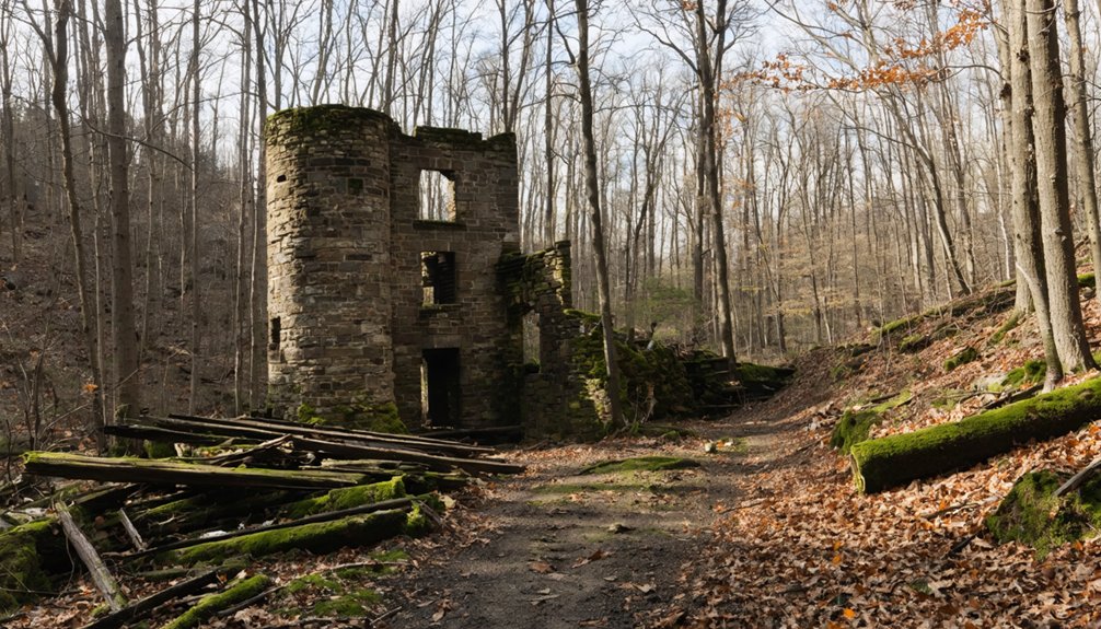
Before you reach Vintondale, you’ll want to know what’s waiting near the trail: Eliza Furnace, an 1840s hot-blast iron furnace that once pushed out over 1,000 tons of iron annually.
It’s a rare surviving artifact of western Pennsylvania’s industrial past, and its listing on the National Register of Historic Places confirms its cultural weight.
You’re not just passing a roadside relic — you’re riding past a site that once powered a region.
Eliza Furnace’s Historical Origins
Nestled near Vintondale along the Ghost Town Trail, Eliza Furnace stands as one of the region’s most quietly commanding relics of 19th-century industry.
Built in the 1840s, it carried real historical significance as a hot-blast iron production powerhouse, turning raw ore into over 1,000 tons of iron annually.
Before you arrive, here’s what makes it worth your stop:
- Iron production once fueled westward expansion and local economies here
- Architectural features reveal skilled stonework built to withstand industrial-scale heat
- Historical significance earned it a listing on the National Register of Historic Places
- Eliza Furnace operated during an era when Pennsylvania iron shaped a young nation
You’re walking into living history — not just a roadside marker.
Iron Production At Scale
When you round the bend toward Vintondale, you’re approaching a site that once churned out over 1,000 tons of iron annually — a staggering output for a mid-19th-century operation running on raw ore, limestone, and the hot-blast technology that had only recently transformed the industry.
These historical furnace innovations weren’t minor refinements — they fundamentally rewired iron manufacturing techniques, forcing superheated air into the furnace stack and dramatically increasing efficiency.
Eliza Furnace didn’t just process metal; it powered regional expansion during an era when iron meant infrastructure, movement, and independence.
Standing before its stone remnants today, you’re reading the physical record of an economy built on heat, labor, and relentless ambition — one that shaped the very landscape you’re riding through.
National Historic Register Status
What you’re pedaling toward carries a designation most historic sites never earn: a place on the National Register of Historic Places, the federal government’s official list of properties deemed worthy of preservation for their architectural, historical, or cultural significance.
Eliza Furnace’s historic significance isn’t ceremonial—it’s earned. This recognition drives ghost town preservation efforts throughout the region and gives meaning to every mile you’ve ridden.
Before you reach Vintondale, know what this designation confirms:
- Federal acknowledgment of irreplaceable cultural heritage
- Protection from unsympathetic development
- Documented architectural and industrial integrity
- A living connection to 1840s iron production methods
You’re not just passing a relic. You’re riding through federally protected American history that almost disappeared entirely.
Where to Eat, Sleep, and Recharge Along the Ghost Town Trail
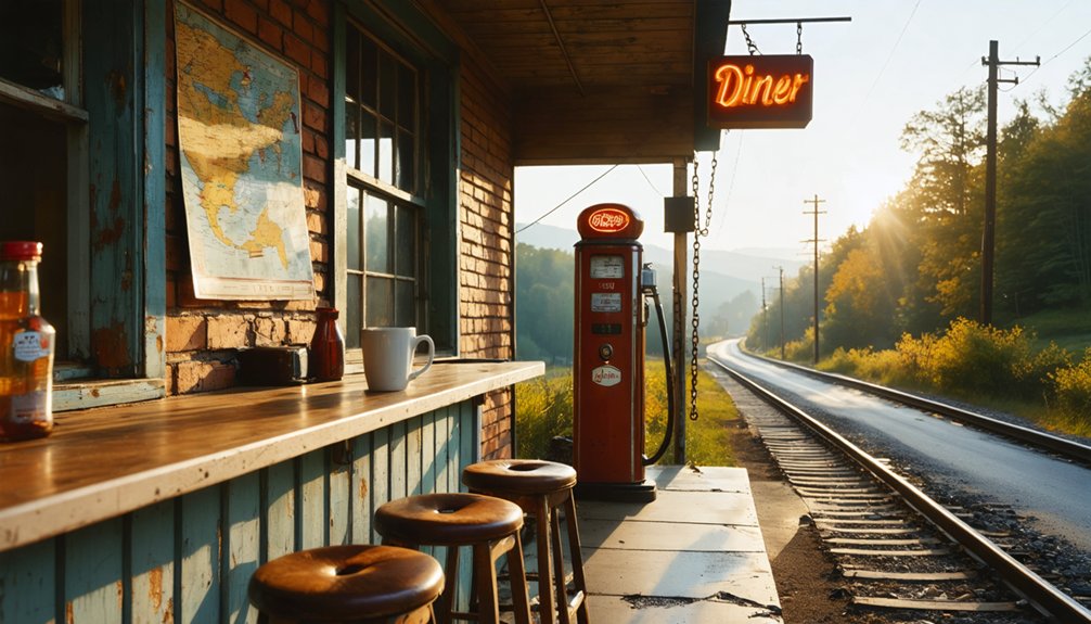
Though the Ghost Town Trail stretches across some of Pennsylvania’s most hauntingly beautiful coal country, you won’t find yourself stranded between Black Lick and Ebensburg without a meal or a warm bed.
Dilltown serves as your best resupply hub, offering a trail shop, bed and breakfast, water, and picnic facilities at 7452 Route 403. It’s the kind of stop where local dining meets scenic viewpoints overlooking Blacklick Creek’s quiet hollows.
Dilltown’s trail shop and bed and breakfast at Route 403 overlook Blacklick Creek — resupply never looked this good.
Start your ride from Saylor Park in Blairsville, push east toward Dilltown, and let the limestone trail carry you past forgotten company towns and iron furnace ruins. You’ll earn that overnight stay.
Vintondale’s Eliza Station also offers restrooms, water, and picnic access — everything a trail-hardened traveler actually needs.
What to Pack for a Ghost Town Trail Day Trip
Before you clip into your pedals at Saylor Park, pack like the trail demands it. The Ghost Town Trail’s hard-packed limestone surface rewards preparation.
These trail essentials keep your ride honest:
- Water and snacks – Dilltown’s trail shop is your mid-ride lifeline, but don’t gamble on it.
- Repair kit – a flat tire miles from Black Lick ends freedom fast.
- Layers – creek corridors trap cold air even in summer.
- Navigation – cell service ghosts out like the towns themselves.
Smart packing tips start with light and purposeful. You’re chasing 36 miles of coal-country history, not hauling your attic.
Ride lean, stay curious, and let the trail do the talking.
When Is the Best Time to Ride the Ghost Town Trail?
Timing shapes everything on the Ghost Town Trail. The best seasons fall between late spring and early fall, when limestone dust hardens firm beneath your tires and wildflowers reclaim the old coal company landscapes.
May through October delivers ideal trail conditions — dry paths, lush creek views along Blacklick Creek, and long daylight hours that let you push deeper toward Dilltown without rushing back.
Dry paths, creek views, and long daylight hours make May through October the Ghost Town Trail’s golden window.
Summer afternoons run warm, so early morning starts reward you with cooler air and golden light filtering through the tree canopy.
Fall transforms the trail dramatically, painting the hillsides above former ghost towns like Wehrum in amber and rust.
Winter keeps the trail open for cross-country skiing, but expect softer, unpredictable surfaces.
Whatever month you choose, you’ll find the trail waiting, unhurried and entirely yours.
Frequently Asked Questions
Is the Ghost Town Trail Accessible for Wheelchair Users or Adaptive Cyclists?
You’ll find it’s no coincidence the trail’s hard-packed limestone surface welcomes wheelchair accessibility and adaptive cycling — it’s built for freedom. Year-round, you can roll through history along Ghost Town Trail’s open, smooth corridor.
Are Dogs Allowed on the Ghost Town Trail Near Blairsville Junction?
The knowledge doesn’t explicitly confirm dog-friendly policies, but trail etiquette typically welcomes leashed dogs on rail trails like Ghost Town. Bring your pup, embrace the freedom, and wander where coal miners once roamed Pennsylvania’s historic wilderness.
Can You Camp Overnight Anywhere Along the Ghost Town Trail?
The knowledge doesn’t confirm official camping regulations or best campsites along Ghost Town Trail. You’ll want to contact Indiana County Parks directly to uncover where your free spirit can rest beneath the stars on this historic corridor.
Is the Ghost Town Trail Lit for Evening or Nighttime Riding?
Like riding into a forgotten world, you’ll need your own light source — the Ghost Town Trail isn’t lit. For nighttime visibility and trail safety, pack a reliable headlamp or bike light before you venture out.
Are There Guided Tours Available Along the Ghost Town Trail?
The knowledge doesn’t confirm guided tours, but you’ll uncover rich historical significance through self-guided exploration. Wander freely through local legends of abandoned coal towns, where Wehrum’s ghost stories and Eliza Furnace’s iron-forged past whisper unforgettable secrets along every mile.
References
- https://indianacountyparks.org/our-trails/ghost-town-trail/ghost-town-trailheads/
- https://en.wikipedia.org/wiki/Ghost_Town_Trail
- https://gibson-thomas.com/projects/blairsville-secondary-ghost-town-trail/
- https://www.visitindianacountypa.org/members/ghost-town-trail/
- https://indianacountyparks.org/our-trails/ghost-town-trail/
- https://www.traillink.com/trail/ghost-town-trail/
- https://www.youtube.com/watch?v=eXuTEdK79dY


