You’ll start your Boulder Basin ghost town road trip in Bonners Ferry, following roads that prospectors carved into Idaho’s mountains back in 1881. Watch for mining artifacts along pull-offs as you climb to 2,650 feet, where foundations and ruins tell stories of a radium rush that once supported an entire community. Visit in summer or fall for the best access. There’s much more to uncover about this fascinating forgotten town.
Key Takeaways
- Boulder Basin, Idaho, was a thriving mining camp established in 1908, now a ghost town with ruins, foundations, and nine interpretive sites.
- From Bonners Ferry, take US 95, turn onto Cow Creek Road, then navigate Katka Road to reach Boulder Basin at 2,650 feet.
- A 4WD vehicle is recommended due to rugged terrain; watch for mining artifacts near roadside pull-offs along the route.
- Visit during summer or fall for passable roads, dry conditions, and full access to interpretive sites and scenic overlooks.
- Pack sturdy boots, two liters of water per person, calorie-dense food, navigation tools, and weather-appropriate layers before heading out.
The Fascinating History Behind Boulder Basin’s Mining Past
Boulder Basin’s mining story stretches back to 1881, when prospectors first staked claims in this rugged corner of Idaho.
You’re walking ground where ambitious men chased fortunes using mining techniques that shaped the American West.
Then came John M. Schnatterly in 1908, transforming scattered claims into the Idaho Gold and Radium Mining Company, boldly promising a radium vein worth millions.
John M. Schnatterly arrived in 1908 with grand promises — and an entire mining company to back them up.
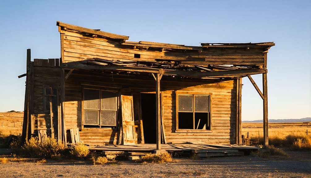
The camp grew into something resembling a real town, complete with families, a school, and daily life carved from wilderness.
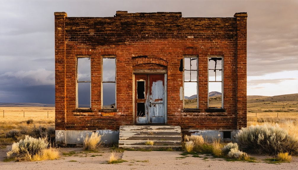
Today, historical artifacts like foundations, ruins, and partially standing structures whisper those forgotten stories.
Locals called it Ruby, Rubyville, or simply Boulder — it never carried an official name.
That raw, unnamed freedom defines the spirit you’ll feel the moment you arrive.
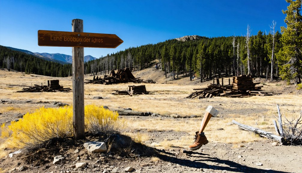
What’s Left of the Boulder Basin Mining Camp?
Time hasn’t been kind to Boulder Basin — vandals and souvenir hunters stripped away much of what once made this camp feel alive.
Still, if you look closely, the land holds secrets. Foundations break through the earth like old bones, and partially standing structures whisper stories of families who once called this place home.
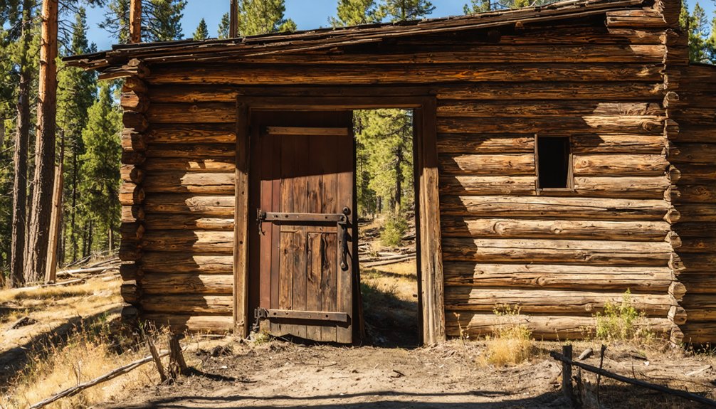
You’ll find one surviving building — the old schoolhouse — standing as a quiet symbol of site preservation.
Nine interpretive sites guide you through the historic remnants scattered across the area, connecting you to a community that never even carried an official name.
Walk about a mile past the main site, and Boulder Cemetery waits, offering its own sobering reminder that real lives unfolded here, far from anywhere most people would dare to wander.
How to Get to Boulder Basin From Bonners Ferry?
Once you’ve paid your respects to what remains, getting there becomes the adventure itself. From Bonners Ferry, take US 95 through the Bonners Ferry Ranger District, where travel routes wind through terrain rich in geological features and local wildlife.
Turn right on Ash Street, left onto Cow Creek Road for three miles, then navigate left on Crossport Road before hitting Katka Road for your final approach to Boulder Basin.
You’ll climb to 2,650 feet, where scenic views reward every mile. The road itself carries historical significance — miners, families, and dreamers once traveled similar paths hauling equipment and community stories.
Watch for mining artifacts near pull-offs. Bring a 4WD vehicle, pack for summer heat or fall chill, and prepare to walk. The best discoveries are always off-road.
When Is the Best Time to Visit Boulder Basin?
When should you make the journey to Boulder Basin? Seasonal considerations matter here.
Summer and fall are your best windows — the roads are passable, the light is golden, and the ghosts of Ruby, Rubyville, and Boulder feel almost within reach. You’ll want clear skies and dry ground beneath your boots as you explore the foundations and ruins scattered across the site.
Weather conditions can turn brutal fast. Winter buries the basin in snow, cutting off access entirely. Summer heat demands you carry water and plan accordingly. Spring can leave roads muddy and unpredictable.
Time your visit right, and Boulder Basin rewards you with nine interpretive sites, sweeping overlooks, and a raw, unfiltered connection to a community that history nearly swallowed whole.
What to Bring for a Day at Boulder Basin?
Pack sturdy hiking boots and weather-appropriate layers, since Boulder Basin’s elevation and unpredictable climate can shift quickly between summer heat and unexpected cold.
You’ll want to carry plenty of water and trail food, as the remote terrain offers no services and most remains require off-road walking to reach.
A reliable map, compass, or GPS device rounds out your kit, keeping you oriented across the nine interpretive sites and the rugged backcountry surrounding this long-forgotten mining camp.
Essential Gear and Clothing
A few essential items can make or break your day exploring Boulder Basin’s rugged terrain. Since most remains sit off-road and require walking, solid hiking essentials are non-negotiable — sturdy boots, trekking poles, and a reliable daypack will serve you well.
Weather considerations demand equal attention. Summer heat can be relentless, while unexpected mountain storms roll in fast. Layer your clothing so you’re ready for both extremes. Pack sunscreen, a wide-brimmed hat, and a lightweight rain jacket.
Bring plenty of water and high-energy snacks since there are no services at the site. A detailed map or downloaded GPS route keeps you oriented on unmarked trails.
Your camera’s essential too — the ruins, foundations, and interpretive sites deserve documentation before nature claims what little remains.
Food and Water Supplies
Boulder Basin offers zero services, so every drop of water and every calorie you’ll consume must come with you. Food availability is nonexistent here — no vendors, no vending machines, nothing.
Pack calorie-dense foods like trail mix, jerky, and energy bars that travel light but fuel hard exploration.
Your hydration options demand equal attention. Carry at least two liters of water per person, more during summer’s unforgiving heat. Temperatures climb fast at 2,650 feet, and you’ll be walking off-road across multiple interpretive sites.
Don’t count on natural water sources being safe to drink without filtration.
Think of it this way — the miners who once worked these claims hauled everything in themselves. You’re following their tradition.
Pack smart, travel light, and let nothing cut your exploration short.
Finding your way through Boulder Basin means following roads that barely qualify as that, so bring a printed topographic map and a compass — don’t rely solely on cell service that may vanish before you reach Katka Road.
Pack your mapping tools and safety precautions like armor before stepping into terrain where nine interpretive sites and scattered ruins reward the prepared explorer.
- Printed topographic map — GPS fails; paper doesn’t
- Compass — trust it when signals disappear past Cow Creek Road
- First aid kit — off-road walking through uneven foundations demands it
- Whistle and emergency contact plan — tell someone your route before you leave
Boulder Basin doesn’t forgive carelessness, but it generously rewards those who arrive ready.
How Should You Explore the Boulder Basin Site on Foot?
Once you’ve parked, lace up your boots and prepare to do some serious walking, because most of Boulder Basin’s remains lie off-road and demand exploration on foot.
Nine interpretive sites serve as your trail highlights, guiding you through the remnants of a community that once bustled with miners, families, and ambition.
Watch for interpretive signage that contextualizes the crumbling foundations and partially standing structures scattered across the landscape.
Don’t miss the overlook area, where viewing benches let you pause and absorb the silence that’s replaced the noise of industry.
If you push about a mile past the main site, Boulder Cemetery awaits — a sobering, rewarding endpoint.
Nature has reclaimed much here, so move carefully and let the ruins speak for themselves.
Frequently Asked Questions
Is There an Entrance Fee to Visit the Boulder Basin Ghost Town?
There’s no entrance fee to explore Boulder Basin’s ghost town! You’re free to roam its haunting ruins, discover nine interpretive sites, and connect with history — nature and adventure await you without costing a dime.
Are Pets Allowed When Visiting the Boulder Basin Mining Camp?
The knowledge doesn’t specify pet policies, so check with the Bonners Ferry Ranger District before heading out. If you bring pets, prioritize pet safety and stay alert to local wildlife roaming these historic, untamed grounds.
Can Visitors Camp Overnight Near the Boulder Basin Site?
The knowledge doesn’t confirm overnight camping regulations at Boulder Basin, but you’ll find nearby attractions worth exploring! Check with the Bonners Ferry Ranger District—they’ll guide your adventurous spirit toward approved camping spots near this hauntingly historic mining frontier.
Is the Boulder Cemetery Open for Public Visitation Year-Round?
Like a door left open to the past, Boulder Cemetery’s history welcomes you year-round! You’ll find it a mile past the site—just practice proper visitor etiquette and respect those who shaped this adventurous landscape.
Are Guided Tours Available at the Boulder Basin Interpretive Sites?
No guided tours are available, but you’ll discover nine interpretive sites offering rich historical insights. You’re free to explore independently, uncovering guided experiences at your own adventurous pace through Boulder Basin’s hauntingly preserved mining legacy.
References
- https://www.lib.uidaho.edu/digital/postcards/items/nwpostcards1182.html
- https://valleychamber.org/idaho-mines/
- https://history.idaho.gov/wp-content/uploads/2018/08/0064.pdf
- https://businessjournalnorthidaho.com/news/2024/apr/30/nibj-take-a-drive-through-history/
- https://miningconnection.com/surface/featured_stories/article/idahos_mining_ghost_town_is_destination_for_hardy_adventurers
- https://en.wikipedia.org/wiki/List_of_ghost_towns_in_Idaho
- https://www.fs.usda.gov/r01/idahopanhandle/recreation/idaho-gold-and-ruby-mine-boulder-city-ghost-town
- https://www.idahogeology.org/pub/Staff_Reports/1997/S-97-3.pdf
- https://books.google.com/books/about/Southern_Idaho_Ghost_Towns.html?id=Oyet3Zdhj-4C
- https://www.youtube.com/watch?v=ZhdjAf6R9fU