You’re heading to a place where a lake used to swallow the horizon and steamboats once docked at a thriving cattle empire. Cox Clark Trading Post, built in 1870 on Tulare Lake‘s western shore, now sits beneath open fields near Kettleman City in Kings County. Bring water, a paper map, and your GPS coordinates — no markers survive. Late fall’s crisp air makes the best backdrop for this vanished world, and there’s far more to uncover.
Key Takeaways
- Cox Clark Trading Post, built in 1870, sits at 35°58′08″N, 119°56′21″W in Kings County, roughly 3 miles southwest of Kettleman City.
- No structures remain at the site, so GPS navigation and a detailed paper map are essential for locating this unmarked historical location.
- Visit between late September and November or March through April for optimal weather and clear visibility during exploration.
- Pack water, sunscreen, sturdy boots, a first-aid kit, backup battery, and emergency snacks, as the site has zero on-site facilities.
- Extend your trip by exploring nearby Kings County ghost towns, Kern County remnants, or a four-day San Joaquin Valley ghost town loop route.
What Was Cox Clark Trading Post and Steamboat Landing?
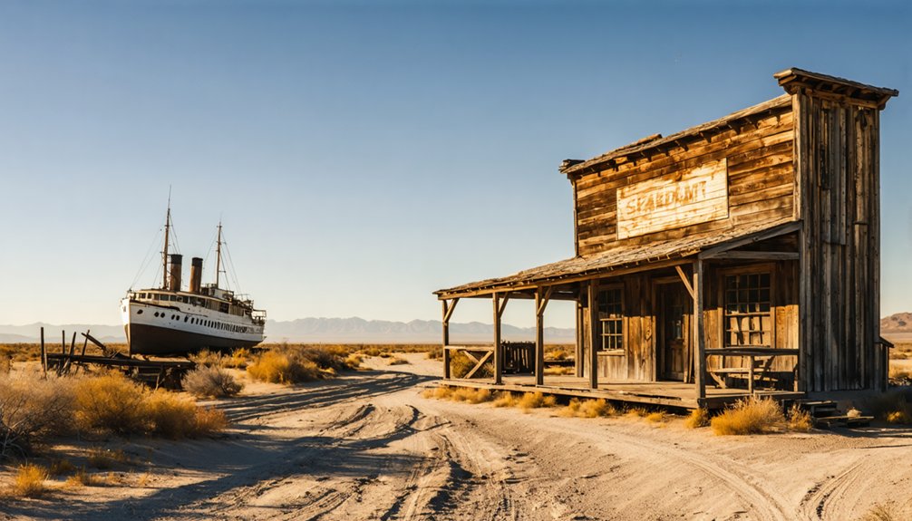
Picture a lone adobe building rising from the tule marshes on the west shore of Tulare Lake in 1870—that was Cox Clark Trading Post and Steamboat Landing, the only structure for miles in any direction.
Cox and Clark built their meat market and cattle business here, creating a hub where steamboats docked and Indians traded freely on the open frontier.
Its historical significance stretched far beyond those tule marshes. The owners held land across Tulare, Kern, San Luis Obispo, Sutter, and Yuba counties, even reaching Lake County, Oregon.
This trading post wasn’t just a remote outpost—it was a crossroads of commerce and culture in California’s vast Central Valley.
Today, nothing stands on that site, making your visit a quiet reckoning with a vanished world.
Where Exactly Is Cox Clark Located in Kings County?
You’ll find Cox Clark’s ghost town footprint at coordinates 35°58′08″N 119°56′21″W, a precise pinpoint on Kings County’s flat, sun-baked landscape where Tulare Lake’s western shore once lapped against a thriving adobe trading post.
It’s just 3 miles southwest of modern Kettleman City, making that Interstate 5 pit stop your natural launching point before you navigate out toward the barren site.
Pull up those GPS coordinates before you leave the highway, because nothing standing on the ground will guide you once you’re out there.
Kings County Coordinates Explained
Two precise coordinates — 35°58′08″N latitude and 119°56′21″W longitude — pin Cox Clark Trading Post to the western edge of what was once Tulare Lake, deep in Kings County, California.
Punch those numbers into your GPS, and you’ll understand the trading post’s historical significance immediately. You’re standing roughly three miles southwest of modern Kettleman City, on land that steamboats once navigated and Native Americans once traded across.
The tule marshes that cattlemen Cox and Clark chose back in 1870 have long since dried into flat agricultural fields — no buildings, no signage, no fanfare. Just open Central Valley earth stretching toward a vanished shoreline.
These coordinates don’t mark a destination you’ll photograph easily; they mark a freedom you’ll feel standing exactly where history quietly dissolved.
Proximity To Kettleman City
Three miles northeast of Cox Clark Trading Post, Kettleman City sits like a modern anchor along Interstate 5, its gas stations and fast-food stops worlds away from the silent lakeshore history that once defined this corner of Kings County.
You’ll use Kettleman City as your launching point, stocking up on fuel and water before heading southwest toward coordinates that mark a vanished world.
The historical significance of Cox Clark isn’t announced by signs or monuments — you’ll find only open fields where adobe walls and steamboat landings once served Indians, ranchers, and traders crossing Tulare Lake’s western shore.
That three-mile gap between modern convenience and forgotten frontier tells you everything about how completely this place has slipped from common memory, waiting for you to rediscover it.
How to Get to Cox Clark From Kettleman City
Reaching Cox Clark Trading Post from Kettleman City takes you just 3 miles southwest, a short but telling drive across the flat, sun-baked floor of what was once Tulare Lake.
Head southwest from Kettleman City using the Interstate 5 corridor as your anchor, then navigate toward coordinates 35°58′08″N, 119°56′21″W. The terrain’s unbroken flatness makes orientation straightforward, but you’ll need GPS to pinpoint the exact historical significance of this vanished settlement.
Use Interstate 5 as your anchor, then follow coordinates southwest — GPS is essential for locating this vanished settlement.
No road signs mark your destination. Ghost town exploration here demands self-reliance — load your coordinates beforehand, fuel up in Kettleman City, and carry water.
When you arrive, you’ll find open fields where steamboats once docked and cattle traders once bargained. The land remembers nothing, but you’ll feel everything.
What’s Actually Left to See at Cox Clark Today?
Once you step out of your vehicle at Cox Clark’s coordinates, the landscape delivers its answer immediately: there’s nothing left. The adobe walls, the steamboat landing, the trading post that once served Indians and cattlemen alike — all of it surrendered to drainage and time.
Flat agricultural fields now stretch where Tulare Lake’s west shore once shimmered.
Yet the historical significance of this ground remains undeniable. You’re standing where Cox and Clark built Kings County’s earliest commercial foothold in 1870, a solitary outpost amid tule marshes.
Ghost town preservation here means simply knowing the coordinates and honoring what the land remembers.
Bring your imagination. The freedom of this empty expanse invites it. No crowds, no fences — just you, open valley air, and a story the soil still holds.
Best Time of Year to Visit the Tulare Lake Bed Ghost Town
Timing your visit to Cox Clark matters more than you’d expect for a place with nothing standing. The best season runs from late September through early November, when the Central Valley sheds its brutal summer heat and the tule fog hasn’t yet swallowed the flatlands.
Ideal weather means crisp mornings, clear sightlines across the drained lake bed, and dustless dirt roads that won’t fight your tires. Spring offers a brief window too, usually March into April, before the valley bakes again.
Avoid summer entirely — triple-digit temperatures make standing on an open, shadeless plain genuinely miserable. Winter fog rolls thick and erases visibility completely.
You came to feel something on that empty shore. Give yourself the light and the air to actually do it.
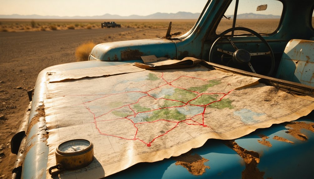
What to Pack for a Central Valley Ghost Town Road Trip
Before you head out to the barren lakeshore where Cox and Clark’s adobe once stood, you’ll want to pack smart for a site that offers no shade, no water, and no facilities.
Load your vehicle with plenty of drinking water, sunscreen, sturdy boots, and a detailed paper map alongside your GPS-loaded device set to coordinates 35°58′08″N 119°56′21″W.
You’re traversing flat Central Valley terrain, so a standard vehicle handles the roads, but a first-aid kit and a fully charged phone are non-negotiables for a ghost town that’s little more than a memory in a farmer’s field.
Essential Gear and Supplies
Packing smart for a Central Valley ghost town run means treating the land with the same respect the old traders once gave it. Your essential gear starts with water — more than you think you’ll need — because no services exist at this barren site.
Build your packing list around sun protection, sturdy boots for uneven ground, and a GPS loaded with the coordinates 35°58′08″N 119°56′21″W.
Bring physical maps as backup; digital signals fade in flat valley terrain. Pack snacks, a first aid kit, and a camera to capture what little remains.
Kettleman City sits three miles northeast, offering your last fuel stop. Visit in daylight, dress in layers for shifting valley temperatures, and leave nothing behind but footprints on ground that history nearly forgot.
Finding your way to a place that’s barely a memory demands tools that won’t let you down when the asphalt ends and the valley flattens into unmarked fields.
Load the coordinates 35°58′08″N 119°56′21″W into your GPS navigation app before leaving Kettleman City’s last signal zone. Paper maps of Kings County back you up when satellites disappear behind Central Valley haze.
Your Safety Tips checklist should include a charged backup battery, a first-aid kit, and enough water for unexpected detours across dry lake bed terrain.
Cell coverage thins fast once you leave Interstate 5’s corridor. Tell someone your route and expected return.
This ghost town won’t announce itself — it demands you arrive prepared, deliberate, and ready to read the land where Cox and Clark once stood.
Kings County Ghost Towns Within 30 Miles of Cox Clark
Once you’ve pinpointed Cox Clark’s windswept coordinates on the old Tulare Lake bed, you’ll find that Kings County quietly harbors several other ghost towns within a 30-mile radius, each carrying its own faded chapter of California’s agricultural and pioneer past.
Drive northeast toward Kettleman City, your practical base for fuel and supplies, then push outward along dusty county roads where ghost town history lingers in abandoned foundations and overgrown irrigation ditches.
Kettleman City anchors your journey — fuel up, then follow the county roads where ghost towns quietly wait.
These forgotten settlements rose quickly during California’s land boom, then collapsed just as fast when water vanished, rail lines shifted, or crops failed. You’re tracing the same restless ambition that built Cox Clark itself.
Pack your coordinates, keep your tank full, and let the open valley terrain guide you through Kings County’s quietly haunting, wide-open legacy.
The Closest Kern County Ghost Towns to Cox Clark Trading Post
Once you’ve absorbed the silence at Cox Clark, Kern County’s ghost towns pull you further south into the valley’s forgotten corridors.
You’ll find Craft’s crumbling remnants accessible via routes threading through the agricultural flatlands below Kings County’s border.
Cuttens sits nearby along a complementary route, letting you link both stops into a single unhurried drive through California’s vanished past.
Craft Ghost Town Access
Craft ghost town sits in Kern County, close enough to Cox Clark Trading Post that you can fold both into a single dusty afternoon across the San Joaquin Valley’s sun-bleached flats.
Drop south from Kettleman City along the Interstate 5 corridor, and Kern County’s forgotten settlements start materializing through your windshield.
Craft carries its own ghost town history quietly — a faded chapter of agricultural ambition that echoes the trading post significance Cox Clark once held along Tulare Lake’s vanished western shore.
Both sites reward the traveler willing to navigate by GPS across terrain that’s reverted to open fields.
You’ll want flat, dry roads and daylight hours, so time your departure early, pack water, and let the valley’s stark, unfiltered silence do the talking.
Cuttens Nearby Route
Cuttens adds another ghost town pin to your Kern County map, sitting close enough to Cox Clark Trading Post that the drive feels less like a detour and more like a natural extension of the same vanished world.
The Cuttens Route carries you south through flat Central Valley terrain, where dry grasses stretch uninterrupted toward the horizon and the silence feels earned.
Build in Scenic Stops along the way — pull over where the valley opens widest, breathe the dusty air, and let the emptiness remind you why these places disappeared quietly rather than dramatically.
You’re tracing the same economic corridors that once connected cattle ranches, trading posts, and forgotten settlements.
Cuttens rewards patience; arrive with coordinates loaded and expectations stripped down to bare discovery.
How to Link Cox Clark Into a Multi-Day San Joaquin Ghost Town Route
Because the San Joaquin Valley’s ghost towns scatter across a surprisingly navigable stretch of flatland, you can thread Cox Clark Trading Post into a multi-day loop without backtracking.
Its historical significance anchors the western leg of your route, while nearby sites fill remaining days beautifully.
Build your itinerary around these logical stops:
- Day 1: Arrive at Cox Clark via Kettleman City, prioritizing ghost town photography during golden hour light.
- Day 2: Push south toward Kern County sites like Craft and Cuttens.
- Day 3: Sweep east toward Eastern Sierra ghost towns along open highway corridors.
- Day 4: Return north through Kings County remnants, closing your loop cleanly.
Pack coordinates for each site.
The valley’s flat terrain keeps driving efficient, leaving your energy for exploration rather than navigation.
Highway 33 and the Ghost Towns Between Cox Clark and the Coast Range
Highway 33 cuts through the western San Joaquin Valley like a forgotten seam, stitching together stretches of dry grassland and Coast Range foothills that once hummed with cattle drives, trading activity, and small communities now reduced to coordinates on a map.
This highway’s history runs deep, and you’ll feel it through your windshield as the road climbs toward the ridgeline. Ghost town exploration along this corridor rewards the curious traveler willing to pull over and read the silence.
Communities that once served ranchers and drovers have vanished, leaving only faint depressions and rusted remnants. After visiting Cox Clark’s barren lakeshore site, head west on connecting routes toward Highway 33, letting the landscape itself narrate what no roadside marker can fully capture.
Frequently Asked Questions
Did Cox Clark Trading Post Ever Appear on Historic California Maps?
Cartographers carefully captured Cox Clark’s trading post on historic maps, marking its mighty mark on California’s frontier. You’ll find echoes of this storied steamboat landing etched in aged atlases, where freedom-seekers once traced their westward wanderings.
Were Any Artifacts Recovered Before the Tulare Lake Site Was Abandoned?
The records don’t confirm recovered artifacts, but you’d feel their artifact significance deeply, imagining traders and steamboats in historical context. That vanished 1870 adobe holds nostalgic whispers beneath drained fields, calling your free spirit to explore.
How Large Was the Original Cox Clark Adobe Building When Constructed?
The records don’t capture the adobe dimensions of the original construction, but you’d have stood in a lone frontier outpost on Tulare Lake’s wild western shore, where cattle traders carved freedom from untamed, marshy wilderness in 1870.
Can Visitors Legally Access the Private Farmland Surrounding the Cox Clark Site?
You shouldn’t enter without permission—farmland regulations protect these privately held fields. Always seek private access approval before wandering where Cox Clark’s ghost once breathed, honoring both the land’s freedom and its keeper’s rights.
Did the Cox Clark Owners Operate Other Trading Posts Across Their Counties?
The records don’t confirm other trading posts in their vast holdings. You’ll find owner biographies and trading post history frustratingly sparse, yet their sprawling counties hint at adventurous, freedom-chasing entrepreneurs who surely left more untold stories behind.
References
- https://en.wikipedia.org/wiki/Cox_&_Clark_Trading_Post_and_Steamboat_Landing
- https://kids.kiddle.co/List_of_ghost_towns_in_California
- https://www.businessinsider.com/bought-california-ghost-town-cerro-gordo-lonely-found-life-purpose-2024-2
- https://sunset.com/travel/california/cerro-gordo-ghost-town
- https://tredcred.com/blogs/trail/ghost-town-overlanding-off-roading-through-california-s-abandoned-history


