Planning a ghost town road trip to Graysonia, Arkansas means heading 15 miles west of Arkadelphia on Highway 8 until the forest swallows the road. You’ll need a high-clearance vehicle, sturdy boots, water, and a camera to explore concrete mill foundations, crumbling kilns, and a lone surviving shotgun house. Cell service is nearly nonexistent, so download offline maps before you go. There’s much more to know before you make the drive.
Key Takeaways
- Graysonia is located 15 miles west of Arkadelphia on Highway 8, accessible via a high-clearance vehicle along rough, forest-swallowed roads.
- Pack sturdy boots, water, snacks, layered clothing, and a GPS or offline map, as the area lacks amenities and cell service.
- Explore remnants including concrete mill foundations, kilns, a firehouse shell, a water reservoir, and an original shotgun house.
- Nearby Arkadelphia offers lodging and restaurants, making it an ideal base for your ghost town road trip.
- Highway 8 connects multiple historic sites, including Daleville and Ouachita backcountry ghost towns, enriching your overall road trip experience.
What’s Left of Graysonia, Arkansas Today?
Where Graysonia once hummed with a thousand residents, you’ll now find only concrete and silence. The forest has reclaimed nearly everything, yet powerful remnants exploration reveals the town’s bones still standing their ground.
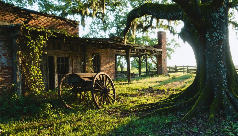
Massive poured concrete mill foundations rise from the regrown woods, commanding your attention. Two kilns, a firehouse shell, a water reservoir, and a main mill portion anchor the site’s historical significance in tangible, touchable form.
Concrete giants endure where loggers once labored — kilns, reservoir, and mill foundations defying decades of forest reclamation.
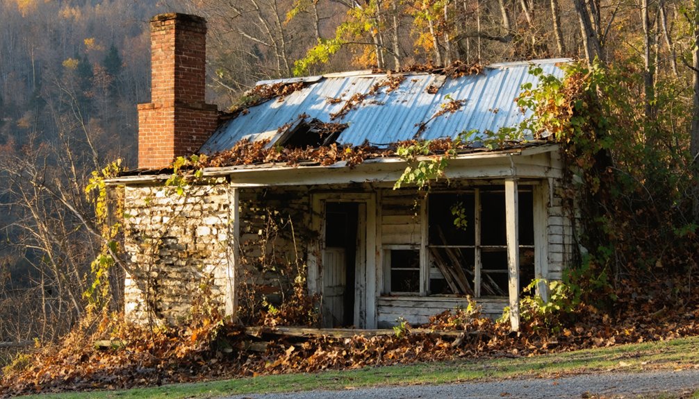
One original shotgun house still stands within what were once city limits, alongside scattered foundations disappearing into leaf litter.
Near the Antoine River, you’ll spot a possible water pump building and tower base. The forest doesn’t hide everything — it frames these ruins with an eerie beauty that rewards every explorer willing to push through the trees.
How Graysonia, Arkansas Became a Ghost Town
When the timber ran out, Graysonia’s fate was sealed. The “cut and move” mentality driving the lumber industry meant timber depletion spelled the end for the entire town.
Company relocation followed swiftly, stripping Graysonia of everything that once made it alive.
Picture what disappeared:
- Hotels emptied, their doors swinging shut as families packed wagons and chased work elsewhere.
- Houses physically relocated to Arkadelphia by Dougal McMillian, hauled away board by board for rental income.
- The forest reclaimed everything, swallowing streets, foundations, and memories beneath decades of Arkansas growth.
How To Get To Graysonia, Arkansas
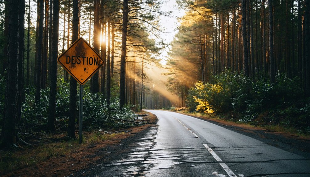
Finding Graysonia means traversing 15 miles west of Arkadelphia on Highway 8, or 10 miles east of Amity, until you spot the turnoff onto Graysonia Road — a dirt county road that winds you straight into Clark County’s forgotten past.
Graysonia access requires a high-clearance vehicle; road conditions can turn rough, especially after rain. You’ll follow the Antoine River‘s bend until the forest swallows the road entirely.
From there, hiking trails give way to informal paths through dense regrowth, so pack sturdy boots and move deliberately. Local wildlife — deer, turkey, and the occasional fox — roam freely here, making every step feel like genuine exploration.
Winter visits offer the best visibility through bare trees, letting you spot concrete ruins without fighting thick summer undergrowth. Budget roughly two hours to explore thoroughly.
What To Bring on Your Graysonia Ghost Town Visit
Packing smart for Graysonia means thinking like an explorer, not a casual day-tripper. These ghost town essentials will keep you moving confidently through the regrown forest and crumbling concrete ruins.
- Sturdy boots — Uneven foundations and root-covered ground demand ankle support and grip
- Water and snacks — You’re two hours from civilization with zero amenities nearby
- Camera with wide lens — Those massive mill foundations disappear into forest shadows beautifully
Follow these exploration tips: arrive in winter when bare trees open sightlines, bring a GPS or downloaded offline map since cell service disappears fast, and wear layers.
The Antoine River bottomland runs cold and damp. Freedom looks like being fully prepared to wander without limitations.
More Arkansas Ghost Towns and Historic Sites Near Graysonia
Graysonia doesn’t have to be a one-stop trip — Clark County and its surrounding region hold enough forgotten history to fill an entire weekend of dirt-road exploration.
Arkadelphia, just 15 miles east, anchors your base camp with lodging and restaurants while offering its own historical significance as a Civil War-era river town.
From there, you can push deeper into the Ouachita backcountry, where abandoned structures from other forgotten timber and mining communities dot the landscape.
Daleville, the very town where Graysonia’s founders first depleted their timber supply, sits nearby and deserves a stop.
Pair these destinations with a drive along Highway 8, where the Antoine River corridor reveals layer after layer of Arkansas’s raw, unfiltered past waiting for you to uncover it.
Frequently Asked Questions
Who Founded Graysonia, and What Was the Town Named After?
You’ll find Graysonia’s Ghost Town Origins tied to William Grayson and Nelson McLeod, who founded it in 1907. Its Historical Significance runs deep — they named this remarkable settlement after Grayson-McLeod Lumber Company’s visionary president, William Grayson himself.
What Was Graysonia’s Population at Its Peak?
At its peak, you’d have found Graysonia bustling with 1,000 residents! These ghost town demographics reveal fascinating historical population trends — a thriving community that’s since vanished, reclaimed entirely by Arkansas’s wild, untamed forest.
Did Graysonia Have Elected Officials Like a Real City?
Yes, Graysonia had elected officials, making it unique as Clark County’s only incorporated ghost town. You’d have witnessed real democracy thriving in the wilderness, with Nick Peters serving as its first mayor.
When Did Graysonia’s Post Office Open and Permanently Close?
Don’t underestimate Graysonia’s post office history — it reinforces this ghost town’s significance! You’ll find it opened in 1907 and permanently closed in 1950, giving you over four decades of real community life to explore.
Who Was the Last Known Resident to Leave Graysonia?
Brown Hickman was Graysonia’s last resident, leaving in 1951. You’re now tracing his footsteps through an abandoned world — his departure sealed the Graysonia legacy, surrendering this once-thriving town back to Arkansas’s reclaiming wilderness forever.
References
- https://ghost-towns.close-to-me.com/states/arkansas/graysonia-ar/
- https://en.wikipedia.org/wiki/Graysonia
- https://arkansashistory.online/2020/06/10/graysonia-clark-county-ghost-town/
- https://www.ghosttowns.com/states/ar/graysonia.html
- https://forum.expeditionportal.com/threads/an-adventure-to-find-a-ghost-town-updated.100573/
- https://encyclopediaofarkansas.net/entries/graysonia-clark-county-1209/